Loading...
Searching...
No Matches
◆ test_geohash_point_as_int()
|
static |
Definition at line 1121 of file cu_algorithm.c.
1122{
1123 unsigned int gh;
1124 POINT2D p;
1125 unsigned long long rs;
1126
1128 gh = geohash_point_as_int(&p);
1129 rs = 3440103613;
1130 CU_ASSERT_EQUAL(gh, rs);
1132 gh = geohash_point_as_int(&p);
1133 rs = 3982480893;
1134 CU_ASSERT_EQUAL(gh, rs);
1136 gh = geohash_point_as_int(&p);
1137 rs = 4166944232;
1138 CU_ASSERT_EQUAL(gh, rs);
1139}
Definition liblwgeom.h:375
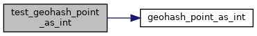
References geohash_point_as_int(), POINT2D::x, and POINT2D::y.
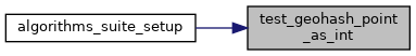
Referenced by algorithms_suite_setup().
Here is the call graph for this function:
Here is the caller graph for this function: