◆ LWGEOM2GEOS()
| GEOSGeometry * LWGEOM2GEOS | ( | const LWGEOM * | g, |
| uint8_t | autofix | ||
| ) |
Definition at line 390 of file liblwgeom/lwgeom_geos.c.
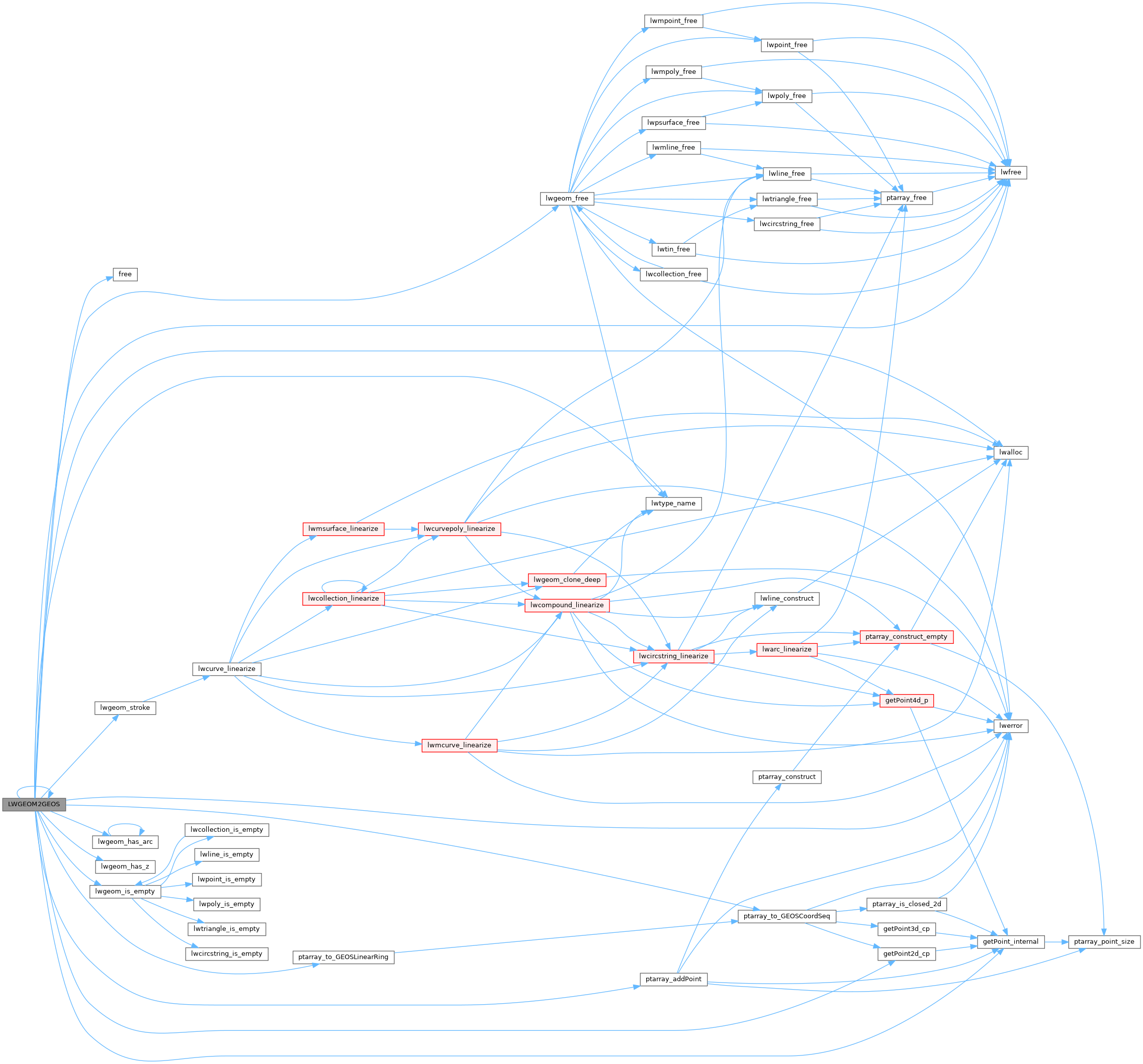
References COLLECTIONTYPE, POINTARRAY::flags, FLAGS_NDIMS, free(), LWCOLLECTION::geoms, getPoint2d_cp(), getPoint_internal(), LINETYPE, LW_FALSE, lwalloc(), LWDEBUGF, lwerror(), lwfree(), LWGEOM2GEOS(), lwgeom_free(), lwgeom_has_arc(), lwgeom_has_z(), lwgeom_is_empty(), lwgeom_stroke(), lwtype_name(), MULTILINETYPE, MULTIPOINTTYPE, MULTIPOLYGONTYPE, LWCOLLECTION::ngeoms, POINTARRAY::npoints, LWPOLY::nrings, LWPOINT::point, LWLINE::points, LWTRIANGLE::points, POINTTYPE, POLYGONTYPE, ptarray_addPoint(), ptarray_to_GEOSCoordSeq(), ptarray_to_GEOSLinearRing(), LWPOLY::rings, LWGEOM::srid, TINTYPE, TRIANGLETYPE, LWGEOM::type, POINT2D::x, and POINT2D::y.
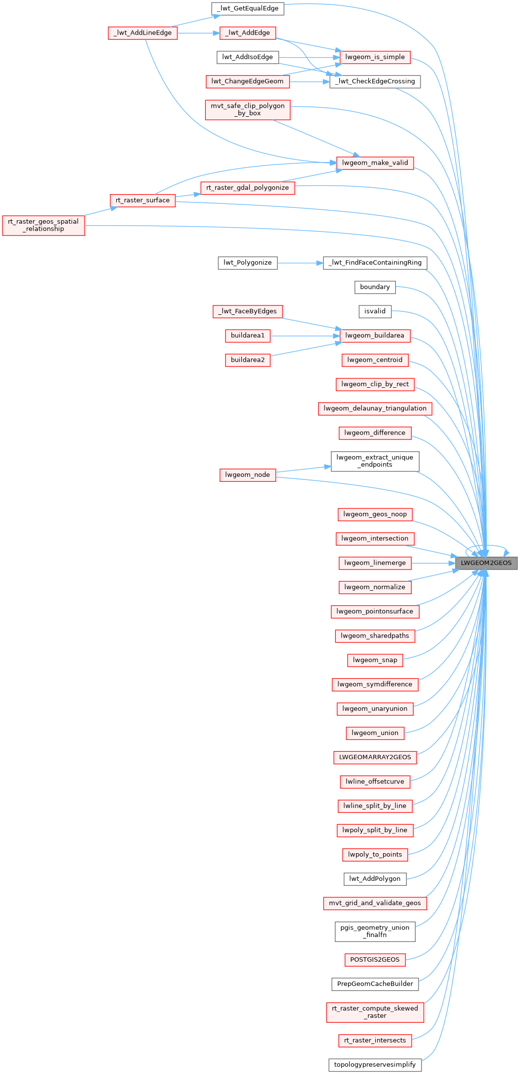
Referenced by _lwt_CheckEdgeCrossing(), _lwt_FindFaceContainingRing(), _lwt_GetEqualEdge(), boundary(), isvalid(), LWGEOM2GEOS(), lwgeom_buildarea(), lwgeom_centroid(), lwgeom_clip_by_rect(), lwgeom_delaunay_triangulation(), lwgeom_difference(), lwgeom_extract_unique_endpoints(), lwgeom_geos_noop(), lwgeom_intersection(), lwgeom_is_simple(), lwgeom_linemerge(), lwgeom_make_valid(), lwgeom_node(), lwgeom_normalize(), lwgeom_pointonsurface(), lwgeom_sharedpaths(), lwgeom_snap(), lwgeom_symdifference(), lwgeom_unaryunion(), lwgeom_union(), LWGEOMARRAY2GEOS(), lwline_offsetcurve(), lwline_split_by_line(), lwpoly_split_by_line(), lwpoly_to_points(), lwt_AddPolygon(), mvt_grid_and_validate_geos(), mvt_safe_clip_polygon_by_box(), pgis_geometry_union_finalfn(), POSTGIS2GEOS(), PrepGeomCacheBuilder(), rt_raster_compute_skewed_raster(), rt_raster_gdal_polygonize(), rt_raster_geos_spatial_relationship(), rt_raster_intersects(), rt_raster_surface(), and topologypreservesimplify().