Loading...
Searching...
No Matches
◆ lwline_split()
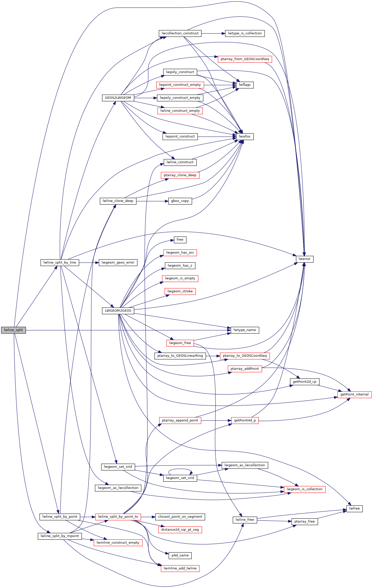
Definition at line 326 of file lwgeom_geos_split.c.
327{
329 {
334
340
341 default:
344 return NULL;
345 }
346 return NULL;
347}
const char * lwtype_name(uint8_t type)
Return the type name string associated with a type number (e.g.
Definition lwutil.c:216
static LWGEOM * lwline_split_by_mpoint(const LWLINE *lwgeom_in, const LWMPOINT *blade_in)
Definition lwgeom_geos_split.c:172
static LWGEOM * lwline_split_by_point(const LWLINE *lwgeom_in, const LWPOINT *blade_in)
Definition lwgeom_geos_split.c:153
static LWGEOM * lwline_split_by_line(const LWLINE *lwgeom_in, const LWGEOM *blade_in)
Definition lwgeom_geos_split.c:43
Definition liblwgeom.h:517
Definition liblwgeom.h:455
References LINETYPE, lwerror(), lwline_split_by_line(), lwline_split_by_mpoint(), lwline_split_by_point(), lwtype_name(), MULTILINETYPE, MULTIPOINTTYPE, MULTIPOLYGONTYPE, POINTTYPE, POLYGONTYPE, LWGEOM::type, and LWPOINT::type.
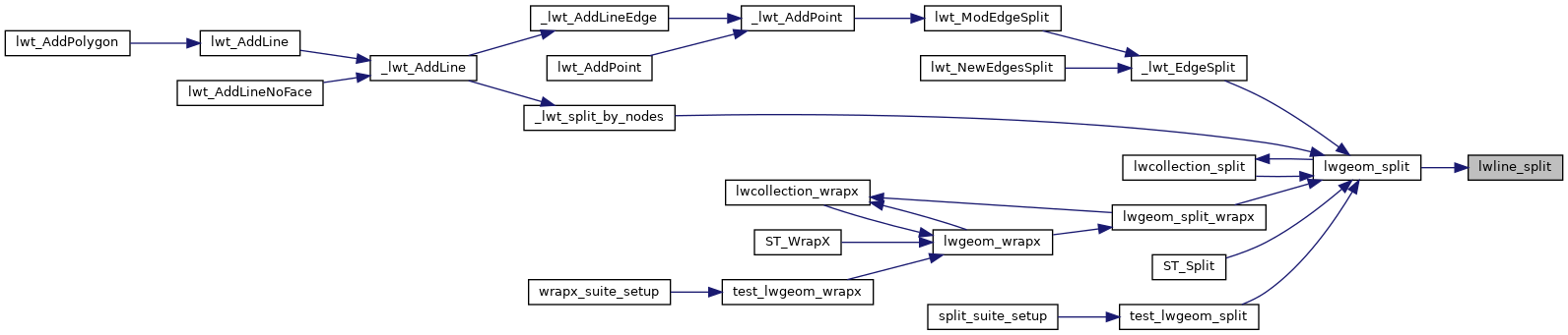
Referenced by lwgeom_split().
Here is the call graph for this function:
Here is the caller graph for this function: