◆ mvt_geom()
| LWGEOM* mvt_geom | ( | LWGEOM * | lwgeom, |
| const GBOX * | gbox, | ||
| uint32_t | extent, | ||
| uint32_t | buffer, | ||
| bool | clip_geom | ||
| ) |
Transform a geometry into vector tile coordinate space.
Makes best effort to keep validity. Might collapse geometry into lower dimension.
NOTE: modifies in place if possible (not currently possible for polygons)
Definition at line 1176 of file mvt.c.
int lwgeom_simplify_in_place(LWGEOM *igeom, double dist, int preserve_collapsed)
Definition: lwgeom.c:1715
int lwgeom_remove_repeated_points_in_place(LWGEOM *in, double tolerance)
Definition: lwgeom.c:1554
void lwgeom_grid_in_place(LWGEOM *lwgeom, const gridspec *grid)
Definition: lwgeom.c:2144
static int lwgeom_is_empty(const LWGEOM *geom)
Return true or false depending on whether a geometry is an "empty" geometry (no vertices members)
Definition: lwinline.h:193
static LWGEOM * lwgeom_to_basic_type(LWGEOM *geom, uint8 original_type)
In place process a collection to find a concrete geometry object and expose that as the actual object...
Definition: mvt.c:823
static LWGEOM * mvt_clip_and_validate(LWGEOM *lwgeom, uint8_t basic_type, uint32_t extent, uint32_t buffer, bool clip_geom)
Definition: mvt.c:1131
Definition: liblwgeom.h:317
References AFFINE::afac, buffer(), AFFINE::efac, AFFINE::ifac, LW_FALSE, lwgeom_affine(), lwgeom_get_basic_type(), lwgeom_grid_in_place(), lwgeom_is_empty(), lwgeom_remove_repeated_points_in_place(), lwgeom_simplify_in_place(), lwgeom_to_basic_type(), mvt_clip_and_validate(), window::res, GBOX::xmax, GBOX::xmin, AFFINE::xoff, GBOX::ymax, GBOX::ymin, and AFFINE::yoff.
Referenced by ST_AsMVTGeom().
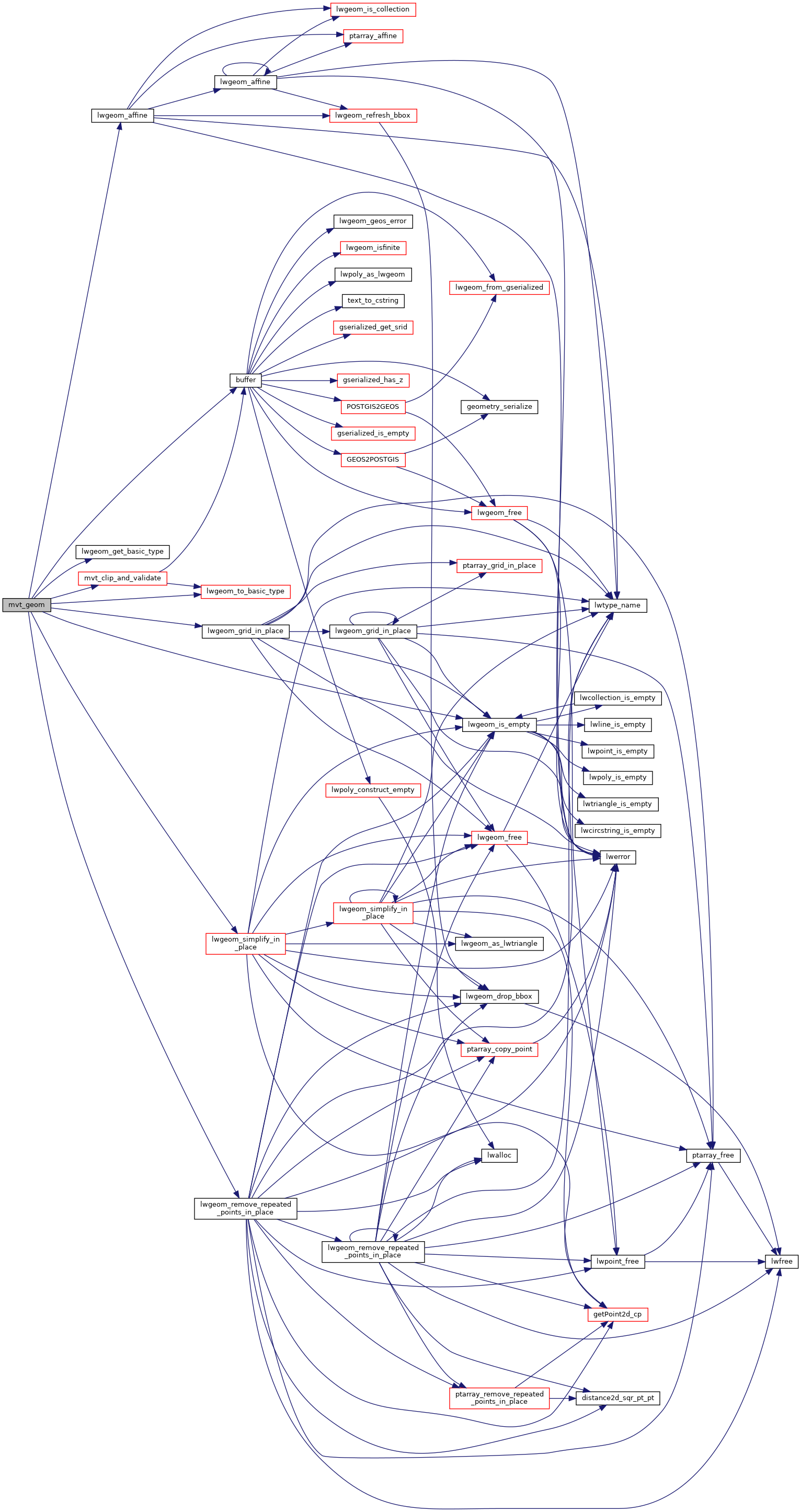
Here is the call graph for this function:

Here is the caller graph for this function:
