Loading...
Searching...
No Matches
◆ relate_full()
| Datum relate_full | ( | PG_FUNCTION_ARGS | ) |
Definition at line 2482 of file postgis/lwgeom_geos.c.
2483{
2484 GSERIALIZED *geom1;
2485 GSERIALIZED *geom2;
2486 GEOSGeometry *g1, *g2;
2487 char *relate_str;
2488 text *result;
2489 int bnr = GEOSRELATE_BNR_OGC;
2490
2491 /* TODO handle empty */
2492 geom1 = PG_GETARG_GSERIALIZED_P(0);
2493 geom2 = PG_GETARG_GSERIALIZED_P(1);
2494 gserialized_error_if_srid_mismatch(geom1, geom2, __func__);
2495
2496 if ( PG_NARGS() > 2 )
2497 bnr = PG_GETARG_INT32(2);
2498
2499 initGEOS(lwpgnotice, lwgeom_geos_error);
2500
2501 g1 = POSTGIS2GEOS(geom1 );
2502 if (!g1)
2504 g2 = POSTGIS2GEOS(geom2 );
2505 if (!g2)
2506 {
2507 GEOSGeom_destroy(g1);
2509 }
2510
2511 POSTGIS_DEBUG(3, "constructed geometries ");
2512
2513 POSTGIS_DEBUGF(3, "%s", GEOSGeomToWKT(g1));
2514 POSTGIS_DEBUGF(3, "%s", GEOSGeomToWKT(g2));
2515
2516 relate_str = GEOSRelateBoundaryNodeRule(g1, g2, bnr);
2517
2518 GEOSGeom_destroy(g1);
2519 GEOSGeom_destroy(g2);
2520
2522
2523 result = cstring_to_text(relate_str);
2524 GEOSFree(relate_str);
2525
2526 PG_FREE_IF_COPY(geom1, 0);
2527 PG_FREE_IF_COPY(geom2, 1);
2528
2529 PG_RETURN_TEXT_P(result);
2530}
void gserialized_error_if_srid_mismatch(const GSERIALIZED *g1, const GSERIALIZED *g2, const char *funcname)
Definition gserialized.c:404
Definition liblwgeom.h:429
References gserialized_error_if_srid_mismatch(), HANDLE_GEOS_ERROR, lwgeom_geos_error(), and POSTGIS2GEOS().
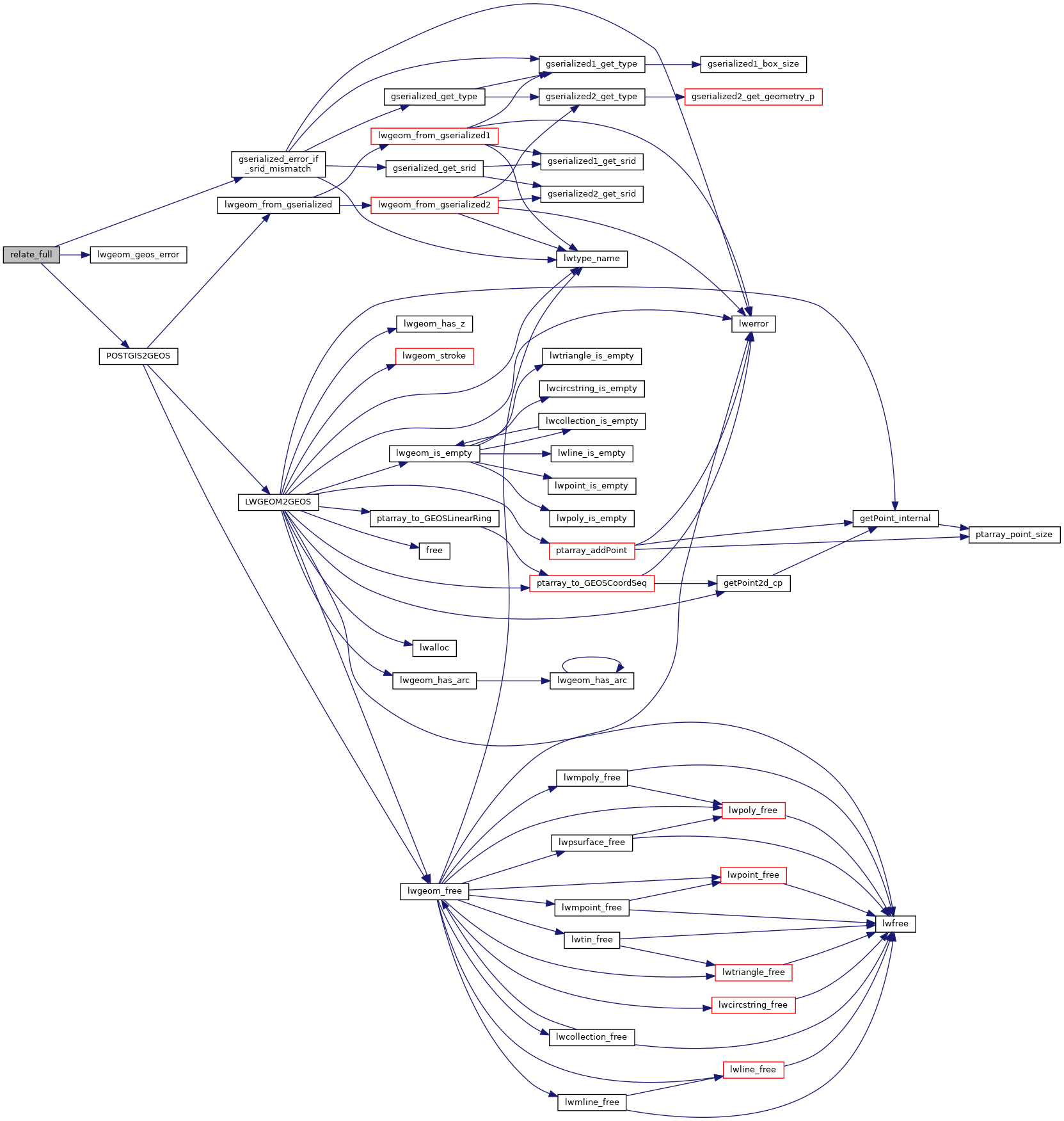
Here is the call graph for this function: