Loading...
Searching...
No Matches
◆ asgml3_circstring_buf()
|
static |
Definition at line 942 of file lwout_gml.c.
943{
944 char* ptr = output;
945 int dimension=2;
946
948 {
949 dimension = 3;
950 }
951
952 ptr += sprintf(ptr, "<%sCurve", prefix);
953 if (srs)
954 {
955 ptr += sprintf(ptr, " srsName=\"%s\"", srs);
956 }
957 if (id)
958 {
959 ptr += sprintf(ptr, " %sid=\"%s\"", prefix, id);
960 }
961 ptr += sprintf(ptr, ">");
962 ptr += sprintf(ptr, "<%ssegments>", prefix);
963 ptr += sprintf(ptr, "<%sArcString>", prefix);
964 ptr += sprintf(ptr, "<%sposList", prefix);
965
967 {
968 ptr += sprintf(ptr, " srsDimension=\"%d\"", dimension);
969 }
970 ptr += sprintf(ptr, ">");
971
973 ptr += sprintf(ptr, "</%sposList>", prefix);
974 ptr += sprintf(ptr, "</%sArcString>", prefix);
975 ptr += sprintf(ptr, "</%ssegments>", prefix);
976 ptr += sprintf(ptr, "</%sCurve>", prefix);
977 return (ptr-output);
978}
static size_t pointArray_toGML3(POINTARRAY *pa, char *buf, int precision, int opts)
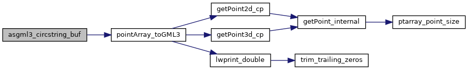
Definition lwout_gml.c:1889
References LWCIRCSTRING::flags, FLAGS_GET_Z, IS_DIMS, pointArray_toGML3(), LWCIRCSTRING::points, and precision.
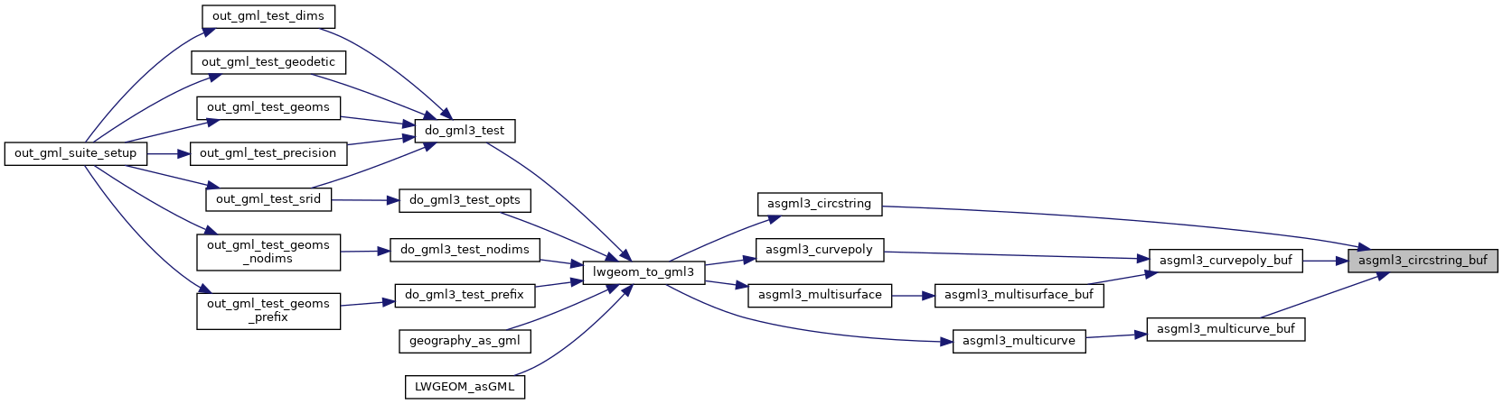
Referenced by asgml3_circstring(), asgml3_curvepoly_buf(), and asgml3_multicurve_buf().
Here is the call graph for this function:
Here is the caller graph for this function: