Loading...
Searching...
No Matches
◆ gserialized2_from_lwpoly_size()
|
static |
Definition at line 715 of file gserialized2.c.
716{
717 size_t size = 4; /* Type number. */
718 uint32_t i = 0;
719
720 assert(poly);
721
722 size += 4; /* Number of rings (zero => empty). */
724 size += 4; /* Padding to double alignment. */
725
727 {
728 size += 4; /* Number of points in ring. */
730 }
731
733
734 return size;
735}
References LWPOLY::flags, FLAGS_NDIMS, LWDEBUGF, POINTARRAY::npoints, LWPOLY::nrings, and LWPOLY::rings.
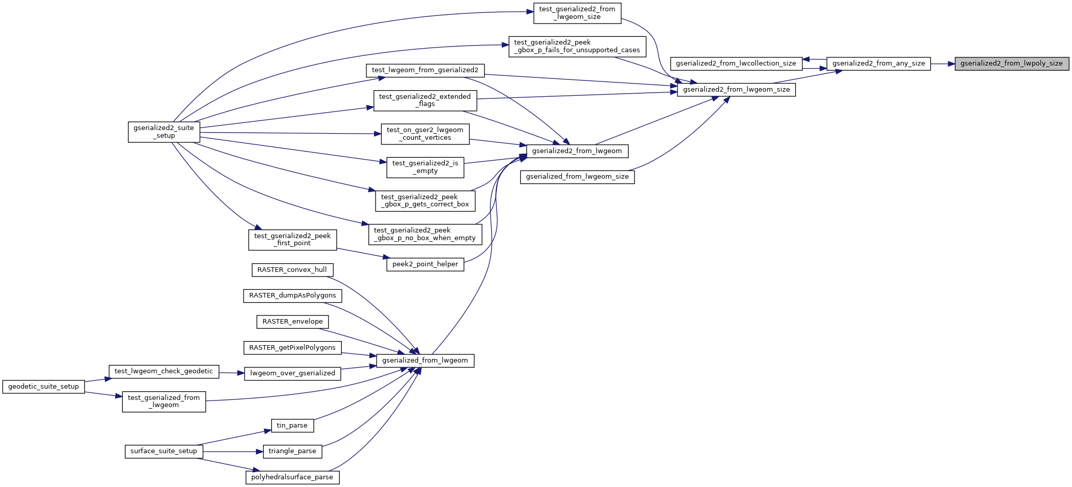
Referenced by gserialized2_from_any_size().
Here is the caller graph for this function: