Loading...
Searching...
No Matches
◆ rt_raster_geopoint_to_cell()
| rt_errorstate rt_raster_geopoint_to_cell | ( | rt_raster | raster, |
| double | xw, | ||
| double | yw, | ||
| double * | xr, | ||
| double * | yr, | ||
| double * | igt | ||
| ) |
Convert an xw,yw map point to a xr,yr raster point.
Convert an xw, yw map point to a xr, yr raster point.
- Parameters
-
raster : the raster to get info from xw : X ordinate of the geographical point yw : Y ordinate of the geographical point xr : output parameter, the pixel's column yr : output parameter, the pixel's row igt : input/output parameter, inverse geotransform matrix
- Returns
- ES_NONE if success, ES_ERROR if error
Definition at line 804 of file rt_raster.c.
809 {
810 double _igt[6] = {0};
811 double rnd = 0;
812
813 assert(NULL != raster);
814 assert(NULL != xr && NULL != yr);
815
816 if (igt != NULL)
817 memcpy(_igt, igt, sizeof(double) * 6);
818
819 /* matrix is not set */
820 if (
821 FLT_EQ(_igt[0], 0.) &&
822 FLT_EQ(_igt[1], 0.) &&
823 FLT_EQ(_igt[2], 0.) &&
824 FLT_EQ(_igt[3], 0.) &&
825 FLT_EQ(_igt[4], 0.) &&
826 FLT_EQ(_igt[5], 0.)
827 ) {
831 }
832 }
833
834 GDALApplyGeoTransform(_igt, xw, yw, xr, yr);
836 xw, yw, *xr, *yr);
837
838 rnd = ROUND(*xr, 0);
840 *xr = rnd;
841 else
842 *xr = floor(*xr);
843
844 rnd = ROUND(*yr, 0);
846 *yr = rnd;
847 else
848 *yr = floor(*yr);
849
851 xw, yw, *xr, *yr);
852
854}
void rterror(const char *fmt,...)
Wrappers used for reporting errors and info.
Definition rt_context.c:199
rt_errorstate rt_raster_get_inverse_geotransform_matrix(rt_raster raster, double *gt, double *igt)
Get 6-element array of raster inverse geotransform matrix.
Definition rt_raster.c:676
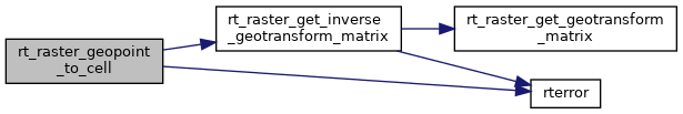
References ES_ERROR, ES_NONE, FLT_EQ, RASTER_DEBUGF, ROUND, rt_raster_get_inverse_geotransform_matrix(), and rterror().
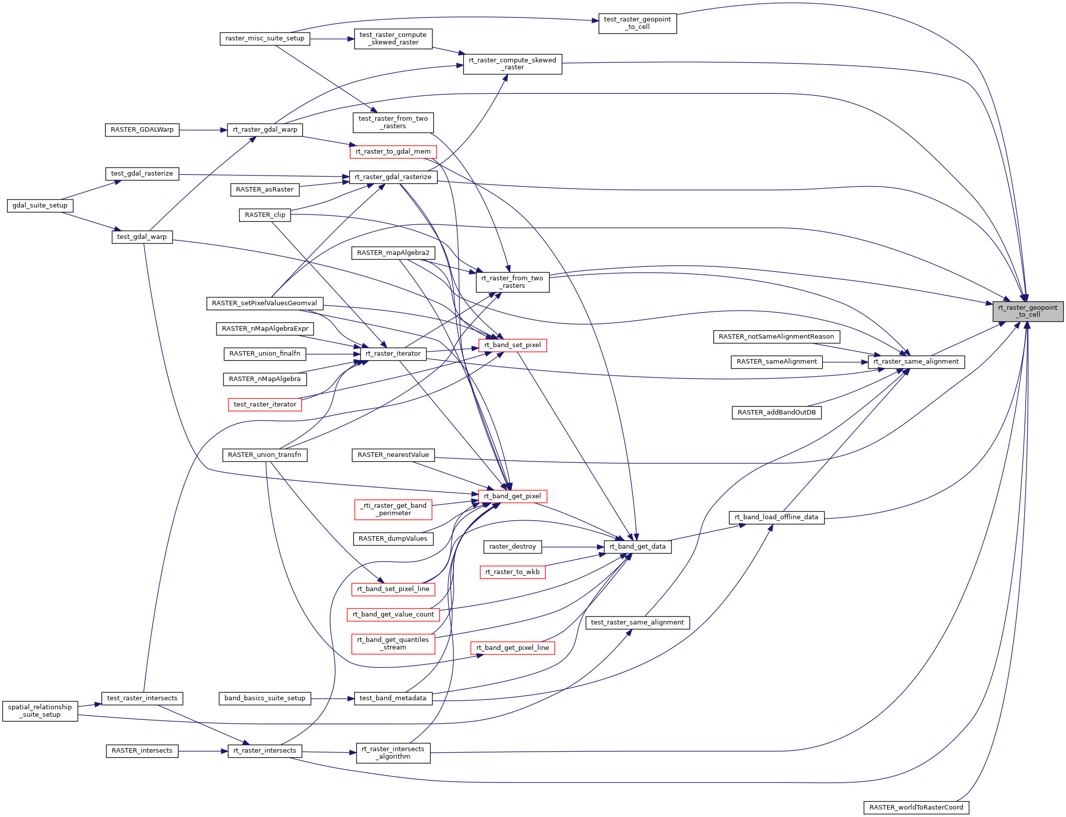
Referenced by RASTER_nearestValue(), RASTER_setPixelValuesGeomval(), RASTER_worldToRasterCoord(), rt_band_load_offline_data(), rt_raster_compute_skewed_raster(), rt_raster_from_two_rasters(), rt_raster_gdal_rasterize(), rt_raster_gdal_warp(), rt_raster_intersects(), rt_raster_intersects_algorithm(), rt_raster_same_alignment(), and test_raster_geopoint_to_cell().
Here is the call graph for this function:
Here is the caller graph for this function: