DEV (Mon 08 Apr 2024 06:07:49 PM UTC rev. 8769361 )
PostGIS 개발 그룹
PostGIS는 객체 관계형 데이터베이스 시스템인 PostgreSQL 의 확장 프로그램으로, 데이터베이스에 GIS(지리정보 시스템) 객체를 저장할 수 있게 해줍니다. PostGIS는 GiST 기반 R-Tree 공간 인덱스를 지원하며, GIS 객체의 분석 및 공간 처리를 위한 기능을 포함하고 있습니다.
![]()
![]()
이 문서는 3.3.7dev 버전의 사용자 지침서입니다.
 이 저작물은 크리에이티브 커먼즈 저작자표시-동일조건변경허락 3.0 라이선스를 따릅니다. 사용자가 원하는 대로 이 문서를 사용할 수 있지만, 우리는 사용자가 PostGIS 프로젝트의 저작권을 명시하고 가능한 위치에 http://postgis.net으로 연결되는 링크를 삽입하도록 요구합니다.
- 1. 소개
- 2. PostGIS 설치
- 3. PostGIS Administration
- 4. Data Management
- 5. Spatial Queries
- 6. 성능 향상 비법
- 7. PostGIS 도형 활용: 응용 프로그램 빌드
- 8. PostGIS Reference
- 8.1. PostgreSQL PostGIS Geometry/Geography/Box 유형
- 8.2. 관리 함수
- 8.3. 도형 작성자(constructor)
- 8.4. 도형 접근자(accessor)
- 8.5. 도형 편집자(editor)
- 8.6. Geometry Validation
- 8.7. Spatial Reference System Functions
- 8.8. Geometry Input
- 8.9. Geometry Output
- 8.10. 연산자(operator)
- 8.11. Spatial Relationships
- 8.12. Measurement Functions
- 8.13. Overlay Functions
- 8.14. 도형 공간 처리
- 8.15. Affine Transformations
- 8.16. Clustering Functions
- 8.17. Bounding Box Functions
- 8.18. 선형 참조(Linear Referencing)
- 8.19. Trajectory Functions
- 8.20. SFCGAL 함수
- 8.21. 장기 실행 트랜잭션(Long Transaction) 지원
- 8.22. Version Functions
- 8.23. PostGIS GUC(Grand Unified Custom Variable)
- 8.24. Troubleshooting Functions
- 9. PostGIS 자주 묻는 질문들
- 10. 지형(topology)
- 11. 래스터 데이터의 관리, 쿼리 및 응용
- 12. 래스트 참조문서
- 12.1. 래스터 지원 데이터형
- 12.2. 래스터 관리
- 12.3. 래스터 작성자(constructor)
- 12.4. 래스터 접근자(accessor)
- 12.5. 래스터 밴드 접근자
- 12.6. 래스터 픽셀 접근자 및 설정자(setter)
- 12.7. 래스터 편집자
- 12.8. 래스터 밴드 편집자
- 12.9. 래스터 밴드 통계 및 분석
- 12.10. Raster Inputs
- 12.11. 래스터 출력
- 12.12. 래스터 공간 처리
- 12.13. 내장 맵 대수 콜백 함수
- 12.14. 래스터 공간 처리
- 12.15. 래스터를 도형으로
- 12.16. 래스터 연산자
- 12.17. 래스터 및 래스터 밴드의 공간 관계성
- 12.18. Raster Tips
- 13. PostGIS 래스터 FAQ
- 14. PostGIS Extras
- 15. PostGIS Special Functions Index
- 15.1. PostGIS Aggregate Functions
- 15.2. PostGIS Window Functions
- 15.3. PostGIS SQL-MM Compliant Functions
- 15.4. PostGIS Geography Support Functions
- 15.5. PostGIS Raster Support Functions
- 15.6. PostGIS Geometry / Geography / Raster Dump Functions
- 15.7. PostGIS Box Functions
- 15.8. PostGIS Functions that support 3D
- 15.9. PostGIS Curved Geometry Support Functions
- 15.10. PostGIS Polyhedral Surface Support Functions
- 15.11. PostGIS Function Support Matrix
- 15.12. New, Enhanced or changed PostGIS Functions
- 15.12.1. PostGIS Functions new or enhanced in 3.3
- 15.12.2. PostGIS Functions new or enhanced in 3.2
- 15.12.3. PostGIS Functions new or enhanced in 3.1
- 15.12.4. PostGIS Functions new or enhanced in 3.0
- 15.12.5. PostGIS Functions new or enhanced in 2.5
- 15.12.6. PostGIS Functions new or enhanced in 2.4
- 15.12.7. PostGIS Functions new or enhanced in 2.3
- 15.12.8. PostGIS Functions new or enhanced in 2.2
- 15.12.9. PostGIS functions breaking changes in 2.2
- 15.12.10. PostGIS Functions new or enhanced in 2.1
- 15.12.11. PostGIS functions breaking changes in 2.1
- 15.12.12. PostGIS Functions new, behavior changed, or enhanced in 2.0
- 15.12.13. PostGIS Functions changed behavior in 2.0
- 15.12.14. PostGIS Functions new, behavior changed, or enhanced in 1.5
- 15.12.15. PostGIS Functions new, behavior changed, or enhanced in 1.4
- 15.12.16. PostGIS Functions new in 1.3
- 16. Reporting Problems
- A. Appendix
- A.1. PostGIS 3.3.6
- A.2. PostGIS 3.3.5
- A.3. PostGIS 3.3.4
- A.4. PostGIS 3.3.3
- A.5. PostGIS 3.3.2
- A.6. PostGIS 3.3.1
- A.7. PostGIS 3.3.0
- A.8. PostGIS 3.3.0rc2
- A.9. PostGIS 3.3.0rc1
- A.10. PostGIS 3.3.0beta2
- A.11. PostGIS 3.3.0beta1
- A.12. PostGIS 3.3.0alpha1
- A.13. PostGIS 3.2.0 (Olivier Courtin Edition)
- A.14. PostGIS 3.2.0beta3
- A.15. Release 3.2.0beta2
- A.16. Release 3.2.0beta1
- A.17. Release 3.2.0alpha1
- A.18. Release 3.1.0beta1
- A.19. Release 3.1.0alpha3
- A.20. Release 3.1.0alpha2
- A.21. Release 3.1.0alpha1
- A.22. Release 3.0.0
- A.23. Release 3.0.0rc2
- A.24. Release 3.0.0rc1
- A.25. Release 3.0.0beta1
- A.26. Release 3.0.0alpha4
- A.27. Release 3.0.0alpha3
- A.28. Release 3.0.0alpha2
- A.29. Release 3.0.0alpha1
- A.30. Release 2.5.0
- A.31. Release 2.4.5
- A.32. Release 2.4.4
- A.33. Release 2.4.3
- A.34. Release 2.4.2
- A.35. Release 2.4.1
- A.36. Release 2.4.0
- A.37. Release 2.3.3
- A.38. Release 2.3.2
- A.39. Release 2.3.1
- A.40. Release 2.3.0
- A.41. Release 2.2.2
- A.42. Release 2.2.1
- A.43. Release 2.2.0
- A.44. Release 2.1.8
- A.45. Release 2.1.7
- A.46. Release 2.1.6
- A.47. Release 2.1.5
- A.48. Release 2.1.4
- A.49. Release 2.1.3
- A.50. Release 2.1.2
- A.51. Release 2.1.1
- A.52. Release 2.1.0
- A.53. Release 2.0.5
- A.54. Release 2.0.4
- A.55. Release 2.0.3
- A.56. Release 2.0.2
- A.57. Release 2.0.1
- A.58. Release 2.0.0
- A.59. Release 1.5.4
- A.60. Release 1.5.3
- A.61. Release 1.5.2
- A.62. Release 1.5.1
- A.63. Release 1.5.0
- A.64. Release 1.4.0
- A.65. Release 1.3.6
- A.66. Release 1.3.5
- A.67. Release 1.3.4
- A.68. Release 1.3.3
- A.69. Release 1.3.2
- A.70. Release 1.3.1
- A.71. Release 1.3.0
- A.72. Release 1.2.1
- A.73. Release 1.2.0
- A.74. Release 1.1.6
- A.75. Release 1.1.5
- A.76. Release 1.1.4
- A.77. Release 1.1.3
- A.78. Release 1.1.2
- A.79. Release 1.1.1
- A.80. Release 1.1.0
- A.81. Release 1.0.6
- A.82. Release 1.0.5
- A.83. Release 1.0.4
- A.84. Release 1.0.3
- A.85. Release 1.0.2
- A.86. Release 1.0.1
- A.87. Release 1.0.0
- A.88. Release 1.0.0RC6
- A.89. Release 1.0.0RC5
- A.90. Release 1.0.0RC4
- A.91. Release 1.0.0RC3
- A.92. Release 1.0.0RC2
- A.93. Release 1.0.0RC1
PostGIS is a spatial extension for the PostgreSQL relational database that was created by Refractions Research Inc, as a spatial database technology research project. Refractions is a GIS and database consulting company in Victoria, British Columbia, Canada, specializing in data integration and custom software development.
PostGIS is now a project of the OSGeo Foundation and is developed and funded by many FOSS4G developers and organizations all over the world that gain great benefit from its functionality and versatility.
The PostGIS project development group plans on supporting and enhancing PostGIS to better support a range of important GIS functionality in the areas of OGC and SQL/MM spatial standards, advanced topological constructs (coverages, surfaces, networks), data source for desktop user interface tools for viewing and editing GIS data, and web-based access tools.
PostGIS 프로젝트 운영 위원회(Project Steering Committee; PSC)는 PostGIS 프로젝트의 대략적인 방향, 발표 주기, 문서화 및 원조 활동을 조정합니다. PSC는 또한 일반 사용자 지원을 제공하고, PostGIS 커뮤니티 전반에서 개발하는 소프트웨어 패치를 받아들여 승인하며, 개발자 커밋 접근, PSC 신입회원 결정 또는 중요한 API 변경 등 PostGIS에 관한 여러 가지 사안에 대해 투표를 실시합니다.
- Raúl Marín Rodríguez
MVT support, Bug fixing, Performance and stability improvements, GitHub curation, alignment of PostGIS with PostgreSQL releases
- 레지나 오베(Regina Obe)
Buildbot Maintenance, Windows production and experimental builds, documentation, alignment of PostGIS with PostgreSQL releases, X3D support, TIGER geocoder support, management functions.
- Darafei Praliaskouski
Index improvements, bug fixing and geometry/geography function improvements, SFCGAL, raster, GitHub curation, and bot maintenance.
- 폴 램지(Paul Ramsey) (의장)
Co-founder of PostGIS project. General bug fixing, geography support, geography and geometry index support (2D, 3D, nD index and anything spatial index), underlying geometry internal structures, GEOS functionality integration and alignment with GEOS releases, alignment of PostGIS with PostgreSQL releases, loader/dumper, and Shapefile GUI loader.
- 산드로 산틸리(Sandro Santilli)
Bug fixes and maintenance, buildbot maintenance, git mirror management, management functions, integration of new GEOS functionality and alignment with GEOS releases, topology support, and raster framework and low level API functions.
- 니클라스 아벤(Nicklas Avén)
거리 함수 개선(3D 거리와 관계 함수 포함) 및 추가 작업, TWKB(Tiny WKB) 출력 포맷(개발중), 개괄적인 사용자 지원을 담당
- Loïc Bartoletti
SFCGAL enhancements and maintenance and ci support
- 댄 배스턴(Dan Baston)
Geometry clustering function additions, other geometry algorithm enhancements, GEOS enhancements and general user support
- Martin Davis
GEOS enhancements and documentation
- Björn Harrtell
MapBox Vector Tile and GeoBuf functions. Gogs testing and GitLab experimentation.
- Aliaksandr Kalenik
Geometry Processing, PostgreSQL gist, general bug fixing
- 박 뽀리(Bborie Park)
Prior PSC Member. Raster development, integration with GDAL, raster loader, user support, general bug fixing, testing on various OS (Slackware, Mac, Windows, and more)
- 마크 케이브-에일런드(Mark Cave-Ayland)
Prior PSC Member. Coordinated bug fixing and maintenance effort, spatial index selectivity and binding, loader/dumper, and Shapefile GUI Loader, integration of new and new function enhancements.
- 호르헤 아레발로(Jorge Arévalo)
래스터 개발, GDAL 드라이버 지원, 로더를 담당
- 올리비에 쿠르텡(Olivier Courtin)
XML(KML, GML)/GeoJSON 입출력 기능, 3D 지원 및 버그 수정을 담당
- 크리스 호지슨(Chris Hodgson)
전 PSC 회원. 개괄적인 개발, 사이트 및 빌드봇 유지보수, OSGeo 육성 프로젝트 관리를 담당
- 마테우스 로스코트(Mateusz Loskot)
PostGIS 용 CMake 지원, 파이썬 래스터 로더 원본 개발, 저레벨 래스터 API 함수 개발을 담당
- 케빈 뉴펠드(Kevin Neufeld)
전 PSC 회원. 문서화 및 문서화 지원 도구, 빌드봇 유지보수, PostGIS 뉴스그룹에서 고급 사용자 지원, PostGIS 유지보수 기능 개선을 담당
- 데이브 블래스비(Dave Blasby)
PostGIS의 원 개발자이자 공동 창립자. 서버측 객체, 인덱스 바인딩 및 서버측의 여러 분석 기능들을 작업
- 제프 라운스버리(Jeff Lounsbury)
shapefile 로더/덤퍼 원본을 개발. 현재 PostGIS 프로젝트 소유자 대표
- 마크 레슬리(Mark Leslie)
진행중인 유지보수 및 핵심 기능 개발. 곡선 지원 개선, shapefile GUI 로더를 담당
- 피에르 라신(Pierre Racine)
Architect of PostGIS raster implementation. Raster overall architecture, prototyping, programming support
- 다피트 츠바르크(David Zwarg)
래스터 개발(대부분 맵 대수학 분석 기능들)을 담당
- 개인 공헌자
Alex Bodnaru Greg Troxel Matt Bretl Alex Mayrhofer Guillaume Lelarge Matthias Bay Andrea Peri Giuseppe Broccolo Maxime Guillaud Andreas Forø Tollefsen Han Wang Maxime van Noppen Andreas Neumann Haribabu Kommi Michael Fuhr Andrew Gierth Havard Tveite Mike Toews Anne Ghisla IIDA Tetsushi Nathan Wagner Antoine Bajolet Ingvild Nystuen Nathaniel Clay Arthur Lesuisse Jackie Leng Nikita Shulga Artur Zakirov James Marca Norman Vine Barbara Phillipot Jan Katins Patricia Tozer Ben Jubb Jason Smith Rafal Magda Bernhard Reiter Jeff Adams Ralph Mason Björn Esser Jelte Fennema Rémi Cura Brian Hamlin Jim Jones Richard Greenwood Bruce Rindahl Joe Conway Roger Crew Bruno Wolff III Jonne Savolainen Ron Mayer Bryce L. Nordgren Jose Carlos Martinez Llari Sebastiaan Couwenberg Carl Anderson Jörg Habenicht Sergei Shoulbakov Charlie Savage Julien Rouhaud Sergey Fedoseev Christoph Berg Kashif Rasul Shinichi Sugiyama Christoph Moench-Tegeder Klaus Foerster Shoaib Burq Dane Springmeyer Kris Jurka Silvio Grosso Dave Fuhry Laurenz Albe Stefan Corneliu Petrea 다피트 츠바르크(David Zwarg) Lars Roessiger Steffen Macke 다피트 츠바르크(David Zwarg) Leo Hsu Stepan Kuzmin 다피트 츠바르크(David Zwarg) Loic Dachary Stephen Frost Dmitry Vasilyev Luca S. Percich Steven Ottens Eduin Carrillo Lucas C. Villa Real Talha Rizwan Eugene Antimirov Maria Arias de Reyna Tom Glancy Even Rouault Marc Ducobu Tom van Tilburg Frank Warmerdam Mark Sondheim Vincent Mora George Silva Markus Schaber Vincent Picavet Gerald Fenoy Markus Wanner Volf Tomáš Gino Lucrezi Matt Amos - 후원 기업
PostGIS 프로젝트에 직접적으로 금전을 후원하거나, 개발자 시간 및 호스팅에 기여를 한 기업들입니다.
- Aiven
- Arrival 3D
- Associazione Italiana per l'Informazione Geografica Libera (GFOSS.it)
- AusVet
- Avencia
- Azavea
- Boundless
- Cadcorp
- Camptocamp
- Carto
- Crunchy Data
- City of Boston (DND)
- City of Helsinki
- Clever Elephant Solutions
- Cooperativa Alveo
- Deimos Space
- Faunalia
- Geographic Data BC
- Hunter Systems Group
- ISciences, LLC
- Kontur
- Lidwala Consulting Engineers
- LISAsoft
- Logical Tracking & Tracing International AG
- Maponics
- Michigan Tech Research Institute
- Natural Resources Canada
- Norwegian Forest and Landscape Institue
- Norwegian Institute of Bioeconomy Research (NIBIO)
- OSGeo
- Oslandia
- Palantir Technologies
- Paragon Corporation
- R3 GIS
- Refractions Research
- Regione Toscana - SITA
- Safe Software
- Sirius Corporation plc
- Stadt Uster
- UC Davis Center for Vectorborne Diseases
- Université Laval
- U.S. Department of State (HIU)
- Zonar Systems
- 크라우드 펀딩 캠페인
크라우드 펀딩 캠페인이란 수많은 사람들에게 서비스할 수 있는, 우리가 간절히 원하는 기능들을 후원받기 위해 진행하는 캠페인입니다. 각 캠페인은 특정 기능 또는 일련의 기능에 특화되어 있습니다. 각 후원자는 필요한 펀딩의 작은 일부분을 담당하며, 충분한 공헌자 또는 조직이 모일 경우 많은 사용자를 도울 수 있는 작업을 위한 비용을 충당할 수 있습니다. 여러분이 생각하기에 다른 사람들이 기꺼이 공동 펀딩에 참여할 만한 아이디어가 있다면, PostGIS 뉴스그룹 에 여러분의 생각을 포스팅해서 우리 모두가 함께 실현할 수 있습니다.
PostGIS 2.0.0은 이런 전략 아래 탄생한 첫 번째 출시작입니다. 우리는 PledgBank 를 이용했으며 이를 통해 캠페인을 두 번 성공적으로 진행했습니다.
postgistopology - 10명 이상의 후원자들이 2.0.0 버전에서 toTopGeometry 함수 빌드와 지형 지원 강화를 위해 250달러씩 후원했습니다.
postgis64windows - 후원자 20여 명이 윈도우 용 64비트 PostGIS의 문제점을 해결하기 위한 작업에 100달러씩 지원했고, 성공했습니다. 이제 PostgreSQL 스택 빌더에서 PostGIS 2.0.1 64비트 버전을 다운로드할 수 있습니다.
- 주요 지원 라이브러리
The GEOS geometry operations library
The GDAL Geospatial Data Abstraction Library used to power much of the raster functionality introduced in PostGIS 2. In kind, improvements needed in GDAL to support PostGIS are contributed back to the GDAL project.
The PROJ cartographic projection library
Last but not least, PostgreSQL, the giant that PostGIS stands on. Much of the speed and flexibility of PostGIS would not be possible without the extensibility, great query planner, GIST index, and plethora of SQL features provided by PostgreSQL.
이 장에서는 PostGIS 설치에 요구되는 모든 과정을 설명합니다.
사용자의 검색 경로에 모든 의존성이 설정되어 있을 깨 컴파일하려면:
tar xvfz postgis-3.3.7dev.tar.gz
cd postgis-3.3.7dev
./configure
make
make install
PostGIS가 설치되면, PostGIS를 사용하고자 하는 모든 데이터베이스 각각에서 활성화해야 합니다.
![[Note]](images/note.png) | |
현재 많은 OS 시스템들이 PostgreSQL/PostGIS용 사전 구축된 패키지를 포함하고 있습니다. 많은 경우, 최첨단 버전이 필요하거나 패키지 관리자인 경우가 아니라면 컴파일할 필요가 없습니다. 이 단원에서는 일반적인 컴파일에 대해 설명하고 있으므로, 더 상세한 설명을 원할 경우 PostGIS User contributed compile guides 와 PostGIS Dev Wiki 를 참조하십시오. PostGIS Pre-built Packages 에서 다양한 OS를 지원하는 사전 빌드된 패키지들을 확인할 수 있습니다. 만약 윈도우 사용자라면 Stackbuilder 또는 PostGIS Windows download site 를 통해 안정적인 버전을 받을 수 있습니다. 또 1~2주에 한 번 혹은 뭔가 특이한 일이 일어날 경우 빌드를 하는 very bleeding-edge windows experimental builds 가 있습니다. 사용자는 이를 통해 진행중인 PostGIS 배포본을 실행해볼 수 있습니다. |
The PostGIS module is an extension to the PostgreSQL backend server. As such, PostGIS 3.3.7dev requires full PostgreSQL server headers access in order to compile. It can be built against PostgreSQL versions 11 - 16. Earlier versions of PostgreSQL are not supported.
아직 PostgreSQL을 설치하지 않았다면 PostgreSQL 설치 지침서를 참조하십시오. http://www.postgresql.org .
| |
GEOS 기능성을 위해 PostgreSQL설치 시 표준 C++ 라이브러리를 명확하게 링크해야 할 수도 있습니다. LDFLAGS=-lstdc++ ./configure [YOUR OPTIONS HERE] 이것은 구 버전 개발 도구 이용시 거짓 C++ 예외 상호작용을 피하기 위한 방법입니다. 만약 사용자가 이상한 문제(백엔드가 갑자기 끊어진다거나 또는 비슷한 증상)를 겪는다면 PostgreSQL을 다시 컴파일해야 할 수도 있습니다. |
다음은 PostGIS 소스를 설정하고 취합하는 단계를 설명합니다. 리눅스 사용자를 위한 설명이므로 윈도우 또는 맥 사용자에겐 해당되지 않습니다.
PostGIS 소스 압축파일을 다운로드 웹사이트 http://postgis.net/stuff/postgis-3.3.7dev.tar.gz 에서 다운로드하십시오.
wget http://postgis.net/stuff/postgis-3.3.7dev.tar.gz
tar -xvzf postgis-3.3.7dev.tar.gz
cd postgis-3.3.7dev
이 명령어를 실행하면 현재 작업 디렉토리에 postgis-3.3.7dev (이)라는 명칭의 디렉터리가 생길 것입니다.
다른 방법으로는, svn 저장소 http://svn.osgeo.org/postgis/trunk/ 에서 소스를 체크아웃(checkout)할 수 있습니다.
git clone https://git.osgeo.org/gitea/postgis/postgis.git postgis
cd postgis
sh autogen.sh
설치를 계속하려면 새로 만든 postgis-3.3.7dev 디렉터리로 이동합니다.
./configure
PostGIS를 빌드하고 사용하기 위해서는 다음과 같은 요구사항들을 만족해야 합니다.
필수 사항
PostgreSQL 11 - 16. A complete installation of PostgreSQL (including server headers) is required. PostgreSQL is available from http://www.postgresql.org .
전체 PostgreSQL/PostGIS 지원 매트릭스 및 PostGIS/GEOS 지원 매트릭스는 http://trac.osgeo.org/postgis/wiki/UsersWikiPostgreSQLPostGIS 를 참조하십시오.
GNU C 컴파일러(
gcc). PostGIS를 컴파일하기 위해 그 밖에 다른 ANSI C 컴파일러들을 사용할 수 있으나gcc로 컴파일했을 경우 오류가 훨씬 적게 발생합니다.GNU Make(
gmake또는make). 많은 시스템들에서 GNUmake는 make의 기본 버전입니다.make -v를 통해 버전을 확인하십시오. 다른 버전의 make는 PostGISMakefile을 제대로 처리하지 못 할 수도 있습니다.Proj reprojection library. Proj 4.9 or above is required. The Proj library is used to provide coordinate reprojection support within PostGIS. Proj is available for download from https://proj.org/ .
GEOS geometry library, version 3.6 or greater, but GEOS 3.11+ is required to take full advantage of all the new functions and features. GEOS is available for download from https://libgeos.org/ .
LibXML2, version 2.5.x or higher. LibXML2 is currently used in some imports functions (ST_GeomFromGML and ST_GeomFromKML). LibXML2 is available for download from https://gitlab.gnome.org/GNOME/libxml2/-/releases.
JSON-C 0.9 또는 이후 버전. JSON-C는 현재 ST_GeomFromGeoJson 함수를 통해 GeoJSON을 임포트하는 데 사용되고 있습니다. JSON-C는 https://github.com/json-c/json-c/releases/ 에서 다운로드할 수 있습니다.
GDAL, version 2+ is required 3+ is preferred. This is required for raster support. https://gdal.org/download.html.
이 파라미터는 현재 작동되지 않습니다. 패키지가 PostgreSQL 설치 경로에만 설치될 것이기 때문입니다. 해당 버그를 추적하려면 http://trac.osgeo.org/postgis/ticket/635 를 참조하십시오.
선택 사항
또 Section 2.1, “짧은 설명” 에 설명된 대로 사용자가 사용하길 원하는 드라이버를 활성화하는 작업도 잊지 마십시오.
shapefile 로더 shp2pgsql-gui 를 컴파일하기 위한 GTK(GTK+2.0, 2.8+ 필요). http://www.gtk.org/.
SFCGAL, version 1.3.1 (or higher), 1.4.1 or higher is recommended. SFCGAL can be used to provide additional 2D and 3D advanced analysis functions to PostGIS cf Section 8.20, “SFCGAL 함수”. And also allow to use SFCGAL rather than GEOS for some 2D functions provided by both backends (like ST_Intersection or ST_Area, for instance). A PostgreSQL configuration variable
postgis.backendallow end user to control which backend he want to use if SFCGAL is installed (GEOS by default). Nota: SFCGAL 1.2 require at least CGAL 4.3 and Boost 1.54 (cf: https://sfcgal.org) https://gitlab.com/sfcgal/SFCGAL/.Section 14.1, “주소 표준화 도구” 를 빌드하려면 PCRE 도 필요합니다(일반적으로 유닉스 파생 시스템에 이미 설치되어 있습니다).
parseaddress-stcities.h파일에 인코딩되어 있는 데이터를 다시 빌드하려 하는 경우에만Regex::Assemble펄 CPAN 패키지가 필요합니다. Section 14.1, “주소 표준화 도구” 는 PCRE 라이브러리를 감지할 경우 자동적으로 빌드될 것입니다. 또는 설정 과정에서 유효한--with-pcre-dir=/path/to/pcre경로 변수를 입력할 수도 있습니다.To enable ST_AsMVT protobuf-c library 1.1.0 or higher (for usage) and the protoc-c compiler (for building) are required. Also, pkg-config is required to verify the correct minimum version of protobuf-c. See protobuf-c. By default, Postgis will use Wagyu to validate MVT polygons faster which requires a c++11 compiler. It will use CXXFLAGS and the same compiler as the PostgreSQL installation. To disable this and use GEOS instead use the
--without-wagyuduring the configure step.CUnit(
CUnit). 회기 검증을 하는 데 필요합니다. http://cunit.sourceforge.net/DocBook(
xsltproc)은 문서를 발행할 때 필요합니다. DocBook은 http://www.docbook.org/ 에서 다운로드할 수 있습니다.DBLatex(
dblatex)는 PDF 형식의 문서를 발행할 때 필요합니다. DBLatex는 http://dblatex.sourceforge.net/ 에서 다운로드할 수 있습니다.ImageMagick(
convert)은 문서에 사용되는 이미지를 생성하는 데 필요합니다. ImageMagick은 http://www.imagemagick.org/ 에서 다운로드할 수 있습니다.
대부분의 리눅스 설치에서 첫 번째 단계는 소스 코드를 빌드하는 데 사용할 Makefile을 생성하는 것입니다. 셸 스크립트를 실행해서 Makefile을 작성합니다.
./configure
추가 파라미터 없이 사용하면, 이 명령은 자동적으로 PostGIS 소스코드를 사용자 시스템에 빌드하는 데 필요한 필수 구성 요소들과 라이브러리의 위치를 확인하려 합니다. ./configure 명령어의 가장 흔한 사용법이긴 하지만, 이 스크립트는 비표준적인 위치에 있는 필수 라이브러리와 프로그램들에 대한 몇몇 파라미터를 받습니다.
다음은 가장 많이 사용되는 파라미터들만 나열한 목록입니다. 전체 목록은 --help 또는 --help=short 파라미터를 사용하십시오.
- --with-library-minor-version
Starting with PostGIS 3.0, the library files generated by default will no longer have the minor version as part of the file name. This means all PostGIS 3 libs will end in
postgis-3. This was done to make pg_upgrade easier, with downside that you can only install one version PostGIS 3 series in your server. To get the old behavior of file including the minor version: e.g.postgis-3.0add this switch to your configure statement.- --prefix=PREFIX
PostGIS 라이브러리와 SQL 스크립트가 설치될 경로입니다. 기본적으로 PostgreSQL가 설치된 경로와 같은 곳에 설치됩니다.
![[Caution]](images/caution.png)
이 파라미터는 현재 작동되지 않습니다. 패키지가 PostgreSQL 설치 경로에만 설치될 것이기 때문입니다. 해당 버그를 추적하려면 http://trac.osgeo.org/postgis/ticket/635 를 참조하십시오.
- --with-pgconfig=FILE
PostgreSQL은 PostGIS 같은 확장 프로그램이 PostgreSQL 설치 디렉토리의 위치를 확인하게 해주는 pg_config 라는 유틸리티를 제공합니다. PostGIS 빌드 시 대상이 될 특정 PostgreSQL 설치 디렉터리를 사용자가 직접 설정하려면 이 파라미터(--with-pgconfig=/path/to/pg_config)를 사용하십시오.
- --with-gdalconfig=FILE
GDAL은 래스터 지원을 위한 기능을 제공하는 필수 라이브러리로, GDAL 설치 디렉터리의 위치를 확인하는 소프트웨어 설치를 활성화하기 위한 gdal-config를 지원합니다. PostGIS 빌드 시 대상이 될 특정 GDAL 설치 디렉터리를 사용자가 직접 설정하려면 이 파라미터(--with-gdalconfig=/path/to/gdal-config)를 사용하십시오.
- --with-geosconfig=FILE
GEOS는 필수 도형 라이브러리로, GEOS 설치 디렉터리의 위치를 확인하는 소프트웨어 설치를 활성화하기 위한 geos-config라는 유틸리티를 제공합니다. PostGIS 빌드 시 대상이 될 특정 GEOS 설치 디렉터리를 사용자가 직접 설정하려면 이 파라미터(--with-geosconfig=/path/to/geos-config)를 사용하십시오.
- --with-xml2config=FILE
LibXML은 GeomFromKML/GML 프로세스를 진행하기 위해 필요한 라이브러리입니다. 일반적으로 libxml을 설치하면 찾을 수 있지만, 설치하지 않았거나 특정 버전을 사용하기 바랄 경우 LibXML 설치 디렉터리의 위치를 확인하는 소프트웨어 설치를 활성화하기 위해
xml2-config라는 설정 파일에 PostGIS의 위치를 지정해야 합니다. PostGIS 빌드 시 대상이 될 특정 LibXML 설치 디렉터리를 사용자가 직접 설정하려면 이 파라미터(--with-xml2config=/path/to/xml2-config)를 사용하십시오.- --with-projdir=DIR
Proj4는 PostGIS 필수 재투영 라이브러리입니다. PostGIS 빌드 시 대상이 될 특정 Proj4 설치 디렉터리를 사용자가 직접 설정하려면 이 파라미터(--with-projdir=/path/to/projdir)를 사용하십시오.
- --with-libiconv=DIR
iconv 설치 경로
- --with-jsondir=DIR
JSON-C 는 MIT-라이선스의 JSON 라이브러리로, PostGIS의 ST_GeomFromJSON 지원에 필요합니다. PostGIS 빌드 시 대상이 될 특정 JSON-C 설치 디렉터리를 사용자가 직접 설정하려면 이 파라미터(--with-jsondir=/path/to/jsondir)를 사용하십시오.
- --with-pcredir=DIR
PCRE 는 BSD-라이선스의 펄 호환 가능 정규 표현식 라이브러리로, address_standardizer 확장 프로그램이 필요합니다. PostGIS 빌드 시 대상이 될 특정 PCRE 설치 디렉터리를 사용자가 직접 설정하려면 이 파라미터(--with-pcredir=/path/to/pcredir)를 사용하십시오.
- --with-gui
데이터 임포트 GUI 컴파일(GTK+2.0 필요). shp2pgsql-gui의 shp2pgsql에 대한 그래픽 인테페이스를 생성합니다.
- --without-raster
래스터 지원 설치
- --without-topology
Disable topology support. There is no corresponding library as all logic needed for topology is in postgis-3.3.7dev library.
- --with-gettext=no
기본적으로 PostGIS는 gettext 지원을 감지해서 함께 컴파일하지만, 로더의 파손을 야기하는 비호환성 문제가 발생할 경우 이 명령어로 gettext 지원을 완전히 비활성화시킬 수 있습니다. 이런 방법으로 설정을 변경해서 문제를 해결하는 예는 버그 티켓 http://trac.osgeo.org/postgis/ticket/748 을 참조하십시오. 주의: gettext 지원을 끈다고 해서 별다른 문제는 없습니다. gettext 지원은 아직 문서화되지도 않았고 검증중에 있는 GUI 로더 용 국제 도움말/라벨 지원에 사용됩니다.
- --with-sfcgal=PATH
기본적으로 PostGIS는 이 스위치 없이는 sfcgal 지원과 함께 설치되지 않습니다.
PATH는 sfcgal-config를 가리키는 대체 경로를 지정하도록 해주는 선택적인 인자입니다.- --without-phony-revision
Disable updating postgis_revision.h to match current HEAD of the git repository.
| |
PostGIS를 SVN 저장소 에서 얻었다면, 먼저 다음 스크립트를 실행하십시오. ./autogen.sh 이 스크립트는 configure 스크립트를 생성하는데, 이 스크립트는 PostGIS의 사용자 지정 설치를 위해 이용됩니다. 만약 tar 파일 형태로 PostGIS를 얻었다면 이미 configure 가 생성되었기 때문에 ./autogen.sh 를 실행할 필요는 없습니다. |
일단 Makefile이 생성되면 PostGIS 빌드 작업은 실행만큼이나 쉽습니다.
make
산출물의 마지막 줄에 "PostGIS was built successfully. Ready to install."이란 문장이 보여야 합니다.
As of PostGIS v1.4.0, all the functions have comments generated from the documentation. If you wish to install these comments into your spatial databases later, run the command which requires docbook. The postgis_comments.sql and other package comments files raster_comments.sql, topology_comments.sql are also packaged in the tar.gz distribution in the doc folder so no need to make comments if installing from the tar ball. Comments are also included as part of the CREATE EXTENSION install.
make comments
PostGIS 2.0 버전부터 소개되었습니다. 빠른 참조 또는 학습용 유인물에 적합한 참조 자료(cheat sheet) html 파일을 생성합니다. 파일 생성에 xsltproc가 필요하며, doc 폴더 안에 다음topology_cheatsheet.html, tiger_geocoder_cheatsheet.html, raster_cheatsheet.html, postgis_cheatsheet.html 4개의 파일을 생성할 것입니다.
html 및 pdf 형식으로 미리 만들어진 파일들을 PostGIS / PostgreSQL Study Guides 에서 다운로드받을 수 있습니다.
make cheatsheets
PostgreSQL 9.1 이상을 사용 중이라면 PostGIS extentions은 자동적으로 빌드 및 설치됩니다.
소스 저장소로부터 생성할 경우에는, 먼저 function descriptions 부터 빌드해야 합니다. docbook을 설치하셨다면 빌드할 수 있고, 다음 명령을 통해 수동으로 생성할 수도 있습니다:
make comments
만약 사용자가 tar 파일 배포본을 이용해 빌드한다면 미리 빌드된 것이 tar 파일과 함께 배포됨으로 comments를 따로 빌드할 필요가 없습니다.
만약 PostgreSQL 9.1을 기반으로 빌드 중이라면 extensions은 설치 과정의 일환으로 자동 빌드될 것입니다. 만약 필요하다면 extensions 폴더로부터의 빌드하거나 또는 다른 서버에서 필요한 파일을 복사할 수 있습니다.
cd extensions
cd postgis
make clean
make
export PGUSER=postgres #overwrite psql variables
make check #to test before install
make install
# to test extensions
make check RUNTESTFLAGS=--extension
| |
|
extension 파일은 OS에 상관없이 PostGIS버전만 같으면 적용에 문제가 없습니다. 그러므로 PostGIS binaries가 설치된 서버에 확장 파일만 복사해도 문제가 없습니다.
만약 extension을 수동으로 또는 다른 서버에 설치하고 싶으면 다음 파일들을 사용자의 PostgreSQL 설치경로의 PostgreSQL / share / extension 폴더에 있는 extensions 폴더에서 복사하여 PostGIS가 설치되지 않은 서버에 필요한 바이너리 파일들을 넣어 주십시오.
이것들이 지정되지 않은 경우 설치할 수 있는 extension 의 버전 등의 정보를 나타내는 제어 파일입니다.
postgis.control, postgis_topology.control.각 extension의 /sql 폴더에 모든 파일들이 있습니다. 다음 파일들은 postgreSQL의 share/extension 폴더의 루트에 복사 되어야 함에 주의하십시오.
extensions/postgis/sql/*.sql,extensions/postgis_topology/sql/*.sql
이렇게 한 다음, 사용자는 사용 가능한 extensions으로 postgis, postgis_topology 을 PgAdmin -> extensions에서 볼 수 있을 것입니다.
만약 psql을 이용 중이라면 다음의 쿼리를 실행함으로써 확인할 수 있습니다.
SELECT name, default_version,installed_version
FROM pg_available_extensions WHERE name LIKE 'postgis%' or name LIKE 'address%';

             name             | default_version | installed_version
------------------------------+-----------------+-------------------
 address_standardizer         | 3.3.7dev         | 3.3.7dev
 address_standardizer_data_us | 3.3.7dev         | 3.3.7dev
 postgis                      | 3.3.7dev         | 3.3.7dev
 postgis_sfcgal               | 3.3.7dev         |
 postgis_tiger_geocoder       | 3.3.7dev         | 3.3.7dev
 postgis_topology             | 3.3.7dev         |
(6 rows)
만약 사용자가 쿼리하는 데이터베이스에 extension이 설치되어 있다면, 사용자는 installed_version 컬럼에서 이름을 볼 수 있습니다. 만약 아무 레코드도 없다면 서버에 postgis extension이 전혀 설치되어 있지 않음을 뜻합니다. PgAdmin III 1.14이상 버전에서는 데이터베이스 탐색 트리의 extensions에서 마우스 오른쪽 버튼 클릭을 통해 업그레이드 또는 삭제를 허용합니다.
extension이 이용 가능한 상태라면 pgAdmin extension 인터페이스 또는 다음의 sql 명령을 실행함으로써 선택한 데이터베이스 안에 postgis extension을 설치할 수 있습니다:
CREATE EXTENSION postgis;
CREATE EXTENSION postgis_sfcgal;
CREATE EXTENSION fuzzystrmatch; --needed for postgis_tiger_geocoder
--optional used by postgis_tiger_geocoder, or can be used standalone
CREATE EXTENSION address_standardizer;
CREATE EXTENSION address_standardizer_data_us;
CREATE EXTENSION postgis_tiger_geocoder;
CREATE EXTENSION postgis_topology;
PSQL에서 다음 명령어를 사용하면 어떤 버전을 설치했는지, 어떤 스키마로 설치했는지 알 수 있습니다.
\connect mygisdb
\x
\dx postgis*
List of installed extensions
-[ RECORD 1 ]-------------------------------------------------
-
Name        | postgis
Version     | 3.3.7dev
Schema      | public
Description | PostGIS geometry, geography, and raster spat..
-[ RECORD 2 ]-------------------------------------------------
-
Name        | postgis_tiger_geocoder
Version     | 3.3.7dev
Schema      | tiger
Description | PostGIS tiger geocoder and reverse geocoder
-[ RECORD 3 ]-------------------------------------------------
-
Name        | postgis_topology
Version     | 3.3.7dev
Schema      | topology
Description | PostGIS topology spatial types and functions
![[Warning]](images/warning.png) | |
|
우리의 멋진 확장 프로그램 시스템 없이 3.3.7dev 을 설치했다면, 먼저 다음 업그레이드 스크립트를 실행해서 확장 프로그램 기반 최신 버전으로 변경할 수 있습니다: postgis_upgrade_22_minor.sql,raster_upgrade_22_minor.sql,topology_upgrade_22_minor.sql.
CREATE EXTENSION postgis FROM unpackaged;
CREATE EXTENSION postgis_topology FROM unpackaged;
CREATE EXTENSION postgis_tiger_geocoder FROM unpackaged;
만약 PostGIS 빌드를 테스트하고 싶다면, 실행하십시오.
make check
위 명령어는 활성 PostgreSQL 데이터베이스 바탕으로 생성된 라이브러리를 이용하여 다양한 확인과 회귀 테스트를 실행할 것입니다.
| |
PostgreSQL, GEOS, 또는 Proj4를 표준이 아닌 경로에 설치한 경우, LD_LIBRARY_PATH 환경 변수에 해당 라이브러리 경로를 설정해주어야 합니다. |
| |
현재, make check 검사들을 실시할 때에는 |
If successful, make check will produce the output of almost 500 tests. The results will look similar to the following (numerous lines omitted below):
CUnit - A unit testing framework for C - Version 2.1-3
     http://cunit.sourceforge.net/

        .
        .
        .

Run Summary:    Type  Total    Ran Passed Failed Inactive
              suites     44     44    n/a      0        0
               tests    300    300    300      0        0
             asserts   4215   4215   4215      0      n/a
Elapsed time =    0.229 seconds

        .
        .
        .

Running tests

        .
        .
        .

Run tests: 134
Failed: 0


-- if you build with SFCGAL

        .
        .
        .

Running tests

        .
        .
        .

Run tests: 13
Failed: 0

-- if you built with raster support

        .
        .
        .

Run Summary:    Type  Total    Ran Passed Failed Inactive
              suites     12     12    n/a      0        0
               tests     65     65     65      0        0
             asserts  45896  45896  45896      0      n/a


        .
        .
        .

Running tests

        .
        .
        .

Run tests: 101
Failed: 0

-- topology regress

.
.
.

Running tests

        .
        .
        .

Run tests: 51
Failed: 0

-- if you built --with-gui, you should see this too

     CUnit - A unit testing framework for C - Version 2.1-2
     http://cunit.sourceforge.net/

        .
        .
        .

Run Summary:    Type  Total    Ran Passed Failed Inactive
              suites      2      2    n/a      0        0
               tests      4      4      4      0        0
             asserts      4      4      4      0      n/a
postgis_tiger_geocoder 와 address_standardizer 확장 프로그램은 현재 표준 PostgreSQL 설치검사(installcheck)만을 지원합니다. 이 확장 프로그램들을 테스트하려면 다음을 실행하십시오. 주의: 이미 PostGIS 코드 폴더의 루트에서 make install을 실행했다면 다시 실행할 필요는 없습니다.
address_standardizer의 경우:
cd extensions/address_standardizer
make install
make installcheck
다음과 같은 결과가 나와야 합니다:
============== dropping database "contrib_regression" ==============
DROP DATABASE
============== creating database "contrib_regression" ==============
CREATE DATABASE
ALTER DATABASE
============== running regression test queries        ==============
test test-init-extensions     ... ok
test test-parseaddress        ... ok
test test-standardize_address_1 ... ok
test test-standardize_address_2 ... ok

=====================
 All 4 tests passed.
=====================
TIGER 지오코딩 도구의 경우, 사용자의 PostgreSQL 인스턴스 안에서 PostGIS 및 fuzzystrmatch 확장 프로그램을 이용할 수 있는지 확인하십시오. address_standardizer 지원이 되도록 PostGIS를 빌드했다면 address_standardizer 테스트도 함께 실행될 것입니다.
cd extensions/postgis_tiger_geocoder
make install
make installcheck
다음과 같은 결과가 나와야 합니다:
============== dropping database "contrib_regression" ==============
DROP DATABASE
============== creating database "contrib_regression" ==============
CREATE DATABASE
ALTER DATABASE
============== installing fuzzystrmatch               ==============
CREATE EXTENSION
============== installing postgis                     ==============
CREATE EXTENSION
============== installing postgis_tiger_geocoder      ==============
CREATE EXTENSION
============== installing address_standardizer        ==============
CREATE EXTENSION
============== running regression test queries        ==============
test test-normalize_address   ... ok
test test-pagc_normalize_address ... ok

=====================
All 2 tests passed.
=====================
PostGIS 설치를 위해서 다음을 입력하십시오.
make install
이것은 --prefix 설정 파라미터에 정의된 하위 경로에 PostGIS 설치 파일을 복사할 것입니다.
로더(loader)와 덤퍼 바이너리 들은
[prefix]/bin에 설치됩니다.postgis.sql와 같은 SQL 파일들은[prefix]/share/contrib에 설치됩니다.PostGIS 라이브러리들은
[prefix]/lib에 설치됩니다.
만약 기존에 postgis_comments.sql, raster_comments.sql 파일을 생성하기 위해 make comments 명령어를 실행한 적이 있으시다면, 다음을 실행해 sql 파일을 설치하십시오.
make comments-install
| |
xsltproc의 적용 이후 일반적인 설치로부터 |
address_standardizer 확장 프로그램은 별도로 다운로드해야 하는 별도의 패키지였습니다. PostGIS 2.2 버전부터는 내장되어 있습니다. 이 확장 프로그램이 무슨 일을 하고 사용자의 필요에 따라 어떻게 설정하는지에 대한 자세한 정보는 Section 14.1, “주소 표준화 도구” 를 참조하십시오.
이 표준화 도구는 Normalize_Address 대신 PostGIS 용으로 패키징된 TIGER 지오코딩 도구(geocoder)와 함께 쓰일 수 있습니다. 이렇게 대신 사용하는 방법은 Section 2.4.3, “주소 표준화 도구를 TIGER 지오코딩 도구와 함께 사용” 을 참조하십시오. 주소 표준화 도구를 사용자의 다른 지오코딩 도구를 위한 구성 요소(building block)로 사용하거나, 주소를 더 쉽게 비교하기 위해 사용자 주소를 표준화하는 데 사용할 수도 있습니다.
주소 표준화 도구는 PCRE에 의존성을 갖습니다. PCRE는 많은 유닉스 파생 시스템에 일반적으로 이미 설치되어 있지만, http://www.pcre.org 에서 최신 버전을 다운로드할 수 있습니다. Section 2.2.3, “설정” 과정에서 PCRE를 찾았다면, 주소 표준화 도구 확장 프로그램을 자동적으로 빌드할 것입니다. 사용자가 사용하고자 하는 PCRE를 따로 설치한 경우, 설정 파라미터 --with-pcredir=/path/to/pcre 의 /path/to/pcre 부분에 사용자의 PCRE include 및 lib 디렉터리의 루트 폴더를 입력하십시오.
윈도우 사용자의 경우 PostGIS 2.1 이상 버전 번들은 이미address_standardizer와 함께 패키징되어 있으므로 컴파일할 필요없이 바로 CREATE EXTENSION 단계로 건너뛸 수 있습니다.
설치를 완료했다면 사용자 데이터베이스에 연결해서 SQL을 실행할 수 있습니다:
CREATE EXTENSION address_standardizer;
다음 테스트에는 어떤 rules, gaz, 또는 lex 테이블도 필요없습니다.
SELECT num, street, city, state, zip
 FROM parse_address('1 Devonshire Place PH301, Boston, MA 02109');
다음과 같은 결과가 나와야 합니다:
num |         street         |  city  | state |  zip
-----+------------------------+--------+-------+-------
 1   | Devonshire Place PH301 | Boston | MA    | 02109
address_standardizer 확장 프로그램을 컴파일하는 데 펄 Regex:Assemble은 더 이상 필요없습니다. 펄 Regex:Assemble이 생성하는 파일들이 소스 트리의 일부로 통합되었기 때문입니다. 하지만 usps-st-city-orig.txt 또는 usps-st-city-orig.txt usps-st-city-adds.tx 파일을 편집해야 할 경우, parseaddress-stcities.h 를 다시 빌드해야 하는데 이때 Regex:Assemble이 필요합니다.
cpan Regexp::Assemble
또는 우분투/데비안 시스템의 경우 다음 작업을 해야 할 수도 있습니다.
sudo perl -MCPAN -e "install Regexp::Assemble"
Extras like Tiger geocoder may not be packaged in your PostGIS distribution. If you are missing the tiger geocoder extension or want a newer version than what your install comes with, then use the share/extension/postgis_tiger_geocoder.* files from the packages in Windows Unreleased Versions section for your version of PostgreSQL. Although these packages are for windows, the postgis_tiger_geocoder extension files will work on any OS since the extension is an SQL/plpgsql only extension.
PostgreSQL 9.1 이상 버전과 PostGIS 2.1 이상 버전을 사용중이라면, TIGER 지오코딩 도구를 설치하는 데 새로운 확장 프로그램 모델을 활용할 수 있습니다. 그 방법은 다음과 같습니다.
먼저 PostGIS 2.1 이상 버전의 바이너리를 다운로드하거나 컴파일해서 일반적인 방법으로 설치하십시오. TIGER 지오코딩 도구는 물론 필수 확장 프로그램도 함께 설치될 것입니다.
PSQL, pgAdmin 또는 다른 도구를 통해 사용자 데이터베이스에 연결해서 다음 SQL 명령어를 실행하십시오. 이미 PostGIS가 설치된 데이터베이스에 설치하는 경우, 첫 번째 단계를 수행할 필요는 없다는 사실을 주의하십시오. 이미
fuzzystrmatch확장 프로그램이 설치되어 있다면 이 두 번째 단계도 수행할 필요가 없습니다.CREATE EXTENSION postgis; CREATE EXTENSION fuzzystrmatch; CREATE EXTENSION postgis_tiger_geocoder; --this one is optional if you want to use the rules based standardizer (pagc_normalize_address) CREATE EXTENSION address_standardizer;
이미 postgis_tiger_geocoder 확장 프로그램을 설치했고 최신 버전으로 업데이트만 하고자 할 경우:
ALTER EXTENSION postgis UPDATE;
ALTER EXTENSION postgis_tiger_geocoder UPDATE;
tiger.loader_platform과tiger.loader_variables에 사용자 지정 항목을 만들었거나 변경한 경우 이 테이블들도 업데이트해야 할 수도 있습니다.제대로 설치되었는지 확인하려면 사용자 데이터베이스에 다음 SQL을 실행하십시오:
SELECT na.address, na.streetname,na.streettypeabbrev, na.zip
        FROM normalize_address('1 Devonshire Place, Boston, MA 02109') AS na;
다음과 같은 결과가 나와야 합니다:
address | streetname | streettypeabbrev | zip ---------+------------+------------------+------- 1 | Devonshire | Pl | 02109tiger.loader_platform테이블에 사용자의 실행 파일과 서버의 경로를 새 레코드로 생성하십시오.예를 들어
sh규약(convention)을 따르는 debbie라는 프로파일을 생성하려면 다음과 같이 해야 합니다.INSERT INTO tiger.loader_platform(os, declare_sect, pgbin, wget, unzip_command, psql, path_sep, loader, environ_set_command, county_process_command) SELECT 'debbie', declare_sect, pgbin, wget, unzip_command, psql, path_sep, loader, environ_set_command, county_process_command FROM tiger.loader_platform WHERE os = 'sh';그 다음 debbie의 pg, unzip,shp2pgsql, PSQL 등의 경로 위치에 맞도록 declare_sect 열의 경로를 편집하십시오.
이
loader_platform테이블을 편집하지 않을 경우, 각 항목의 흔히 있는(common case) 위치만을 담게 되며 스크립트가 생생된 후 생성된 스크립트를 직접 편집해야 할 것입니다.As of PostGIS 2.4.1 the Zip code-5 digit tabulation area
zcta5load step was revised to load current zcta5 data and is part of the Loader_Generate_Nation_Script when enabled. It is turned off by default because it takes quite a bit of time to load (20 to 60 minutes), takes up quite a bit of disk space, and is not used that often.To enable it, do the following:
UPDATE tiger.loader_lookuptables SET load = true WHERE table_name = 'zcta520';
If present the Geocode function can use it if a boundary filter is added to limit to just zips in that boundary. The Reverse_Geocode function uses it if the returned address is missing a zip, which often happens with highway reverse geocoding.
서버의 루트, 또는 서버에 충분히 빠른 네트워크로 연결된 경우 사용자 PC의 루트에
gisdata라는 폴더를 생성하십시오. 이 폴더로 TIGER 파일을 다운로드해서 처리할 것입니다. 서버의 루트에 폴더를 만드는 게 마음에 안 들거나, 또는 단순히 다른 폴더로 변경하고 싶다면,tiger.loader_variables테이블의staging_fold항목을 편집하십시오.gisdata폴더 또는 사용자가staging_fold에 지정한 폴더 안에 temp라는 폴더를 생성하십시오. 다운로드한 TIGER 데이터를 로더가 이 temp 폴더에 압축해제할 것입니다.Then run the Loader_Generate_Nation_Script SQL function make sure to use the name of your custom profile and copy the script to a .sh or .bat file. So for example to build the nation load:
psql -c "SELECT Loader_Generate_Nation_Script('debbie')" -d geocoder -tA > /gisdata/nation_script_load.shRun the generated nation load commandline scripts.
cd /gisdata
sh nation_script_load.sh
After you are done running the nation script, you should have three tables in your
tiger_dataschema and they should be filled with data. Confirm you do by doing the following queries from psql or pgAdminSELECT count(*) FROM tiger_data.county_all;
count
-------
  3233
(1 row)
SELECT count(*) FROM tiger_data.state_all;
count
-------
    56
(1 row)
By default the tables corresponding to
bg,tract,tabblockare not loaded. These tables are not used by the geocoder but are used by folks for population statistics. If you wish to load them as part of your state loads, run the following statement to enable them.UPDATE tiger.loader_lookuptables SET load = true WHERE load = false AND lookup_name IN('tract', 'bg', 'tabblock');Alternatively you can load just these tables after loading state data using the Loader_Generate_Census_Script
For each state you want to load data for, generate a state script Loader_Generate_Script.
DO NOT Generate the state script until you have already loaded the nation data, because the state script utilizes county list loaded by nation script.
psql -c "SELECT Loader_Generate_Script(ARRAY['MA'], 'debbie')" -d geocoder -tA > /gisdata/ma_load.sh
생성된 명령어 스크립트를 실행하십시오.
cd /gisdata
sh ma_load.sh
모든 데이터를 로딩한 다음 또는 어떤 정지 지점에서 모든 TIGER 테이블을 분석해서 (상속된 통계를 포함한) 통계(stat)를 업데이트하는 것이 좋습니다.
SELECT install_missing_indexes();
vacuum (analyze, verbose) tiger.addr;
vacuum (analyze, verbose) tiger.edges;
vacuum (analyze, verbose) tiger.faces;
vacuum (analyze, verbose) tiger.featnames;
vacuum (analyze, verbose) tiger.place;
vacuum (analyze, verbose) tiger.cousub;
vacuum (analyze, verbose) tiger.county;
vacuum (analyze, verbose) tiger.state;
vacuum (analyze, verbose) tiger.zip_lookup_base;
vacuum (analyze, verbose) tiger.zip_state;
vacuum (analyze, verbose) tiger.zip_state_loc;
확장 프로그램 모델을 사용하지 않고 TIGER 지오코딩 도구를 설치했다면, 다음과 같이 확장 프로그램 모델로 변환시킬 수 있습니다:
확장 프로그램 제외(non-extension) 모델을 업그레이드하려면 Section 2.4.5, “Tiger Geocoder 업그레이드” 의 지침을 따라해보십시오.
PSQL 또는 pgAdmin을 통해 사용자 데이터베이스에 연결하고 다음 명령어를 실행하십시오:
CREATE EXTENSION postgis_tiger_geocoder FROM unpackaged;
우선 앞의 설명에 따라 PostGIS를 설치하십시오.
extras 폴더가 없을 경우, http://postgis.net/stuff/postgis-3.3.7dev.tar.gz 에서 다운로드하십시오.
tar xvfz postgis-3.3.7dev.tar.gz
cd postgis-3.3.7dev/extras/tiger_geocoder
tiger_loader_2015.sql (또는 다른 년도를 로드하고자 할 경우, 사용자가 찾을 수 있는 최신 로더)를 사용자의 실행 가능한 서버 등의 경로로 편집하거나, 그 대신 설치 완료 후 loader_platform 테이블을 업데이트할 수도 있습니다. 이 파일 또는 loader_platform 테이블을 편집지 않는다면, 각 항목의 흔히 쓰이는(common case) 위치만 담게 되어 Loader_Generate_Nation_Script 및 Loader_Generate_Script SQL 함수를 실행해서 생성된 스크립트를 직접 편집해야 할 것입니다.
TIGER 지오코딩 도구를 처음 설치하는 경우, 윈도우 시스템이라면 create_geocode.bat 스크립트를, Linux/Unix/Mac OSX 시스템이라면 create_geocode.sh 를 사용자의 PostgreSQL에 특화된 설정으로 편집한 다음 명령 프롬프트에서 각각 상응하는 스크립트를 실행하십시오.
tiger 스키마가 데이터베이스에 있는 지와 사용제 데이터베이스 search_path에 해당되는 지를 확인하십시오. 안되어 있다면 아래 명령을 함께 추가하십시오.
ALTER DATABASE geocoder SET search_path=public, tiger;
표준화 주소 기능은 까다로운 주소를 제외하고는 동작합니다. 아래와 비슷하게 나오는지 테스트 해보십시오.
SELECT pprint_addy(normalize_address('202 East Fremont Street, Las Vegas, Nevada 89101')) As pretty_address;
pretty_address
---------------------------------------
202 E Fremont St, Las Vegas, NV 89101
사용자들의 많은 불평 가운데 하나는 주소 정규화 도구 Normalize_Address 함수가 지오코딩 작업 전 준비 과정에서 주소를 정규화한다는 것입니다. 정규화 도구는 완벽하지 않아 그 불완전함을 수정하려면 막대한 노력이 필요합니다. 그래서 우리는 훨씬 나은 주소 표준화 도구 엔진을 가진 또다른 프로젝트와 통합시켰습니다. 이 새로운 address_standardizer를 이용하려면, Section 2.3, “주소 표준화 도구 설치 및 활용” 에 설명된 대로 확장 프로그램을 컴파일해서 사용자 데이터베이스에 확장 프로그램으로 설치하십시오.
postgis_tiger_geocoder 를 설치했던 데이터베이스에 이 확장 프로그램을 설치했다면, Normalize_Address 대신 Pagc_Normalize_Address 를 이용할 수 있습니다. 이 확장 프로그램은 TIGER 유무와 상관없이 동작하므로, 국제 주소와 같은 다른 데이터 소스와 함께 사용할 수 있습니다. 실제로 TIGER 지오코딩 도구 확장 프로그램은 규칙 테이블 ( tiger.pagc_rules) , 지명 색인 테이블 (tiger.pagc_gaz), 그리고 어휘 목록 테이블 (tiger.pagc_lex) 자체 수정 버전과 함께 패키징되어 있습니다. 사용자 자신의 필요에 따라 이들을 추가하고 업데이트해서 표준화 작업 과정을 향상시킬 수 있습니다.
Tiger 데이터를 로딩하기 위한 보다 자세한 설명은 extras/tiger_geocoder/tiger_2011/README에서 이용 가능합니다. 여기서는 일반적인 과정만 안내해 드립니다.
인구조사 웹사이트에서 필요한 주의 데이터를 다운로드 받습니다. 압축을 풀면 주 단위로 별개의 세트로 이뤄져 있습니다. 각 주 테이블은 tiger스키마 정의에 따라 접속 및 쿼리 할 수 있고, Drop_State_Tables_Generate_Script를 다시 불러오거나 삭제하는 등의 작업을 실시할 수 있습니다.
데이터를 로딩하기 위해서는 다음과 같은 도구들이 필요합니다:
인구조사 웹사이트에서 받은 압축 파일을 풀기 위한 툴
Unix 계열 시스템에서는 대부분
unzip으로 해제할 수 있습니다.윈도우의 경우, 무료 압축/압축해제 툴인 7-zip이 http://www.7-zip.org/에서 다운로드 가능합니다.
PostGIS 기본 설치시 설치되는
shp2pgsql명령웹 다운로드 툴인
wget은 대부분의Unix/Linux 시스템에 설치되어 있습니다.윈도우를 사용 중이면 http://gnuwin32.sourceforge.net/packages/wget.htm에서 다운로드 가능합니다.
tiger_2010을 업그레이드하는 경우, 먼저 Drop_Nation_Tables_Generate_Script 를 생성한 다음 실행해야 합니다. 행정구역 데이터를 로드하기 전에 로더 스크립트를 생성하는 Loader_Generate_Nation_Script 를 통해 전국 데이터를 로드해야 합니다. Loader_Generate_Nation_Script 를 사용하면 (2010년에서) 업그레이드는 물론 새로운 설치까지 한번에 끝날 것입니다.
사용자의 플랫폼에서 사용자가 지정한 행정구역 데이터를 로드하는 스크립트를 생성하려면 Loader_Generate_Script 를 참조하십시오. 이 데이터들을 개별적으로 로드할 수 있다는 점을 기억하십시오. 사용자가 지정한 모든 행정구역을 한번에 로드하지 않아도 됩니다. 필요할 때마다 로드할 수 있습니다.
원하는 데이터가 로딩이 된 후 Install_Missing_Indexes에서 설명된 대로 다음을 실행하십시오:
SELECT install_missing_indexes();
실행이 잘되는지 확인하려면 Geocode를 이용하여 해당 주의 주소를 변환시켜 보십시오.
PostGIS 2.0 이상 버전과 함께 패키징된 TIGER 지오코딩 도구를 이미 설치했다면, 그리고 사용자가 간절히 바라는 수정 사항이 있다면, 언제라도, 심지어 tar 파일 내부에서도 함수를 업그레이드할 수 있습니다. 이 작업은 확장 프로그램과 함께 설치되지 않은 TIGER 지오코딩 도구라야만 가능합니다.
extras 폴더가 없을 경우, http://postgis.net/stuff/postgis-3.3.7dev.tar.gz 에서 다운로드하십시오.
tar xvfz postgis-3.3.7dev.tar.gz
cd postgis-3.3.7dev/extras/tiger_geocoder/tiger_2011
윈도우 시스템이라면 upgrade_geocoder.bat 스크립트를, Linux/Unix/Mac OSX 시스템이라면 upgrade_geocoder.sh 스크립트를 찾으십시오. 사용자의 PostGIS 데이터베이스 사양에 맞춰 파일을 편집하십시오.
2010이나 2011을 업그레이드하는 경우, 로더 스크립트의 해당 라인을 주석 처리(unremark out)해야 2012 데이터를 로드하기 위한 최신 스크립트를 얻을 수 있다는 점을 기억하십시오.
명령 프롬프트에서 각 플랫폼에 상응하는 스크립트를 실행하십시오.
다음으로 모든 nation 테이블을 drop 하고 새로 불러옵니다. 이 SQL 문장으로 drop 스크립트를 만듭니다. 자세한 내용은 다음을 참고하십시오. Drop_Nation_Tables_Generate_Script
SELECT drop_nation_tables_generate_script();
생성된 drop SQL 문장을 실행하십시오.
이 SELECT 구문으로 nation load 스크립트를 생성합니다. 자세한 내용을 다음을 참고하십시오. Loader_Generate_Nation_Script
윈도우용
SELECT loader_generate_nation_script('windows'); unix/linux 용
SELECT loader_generate_nation_script('sh');생성된 스크립트를 어떻게 실행하는지 배우시려면 Section 2.4.4, “Tiger Data 불러오기”을 참고하십시오. 이것은 단지 한번만 하면 됩니다.
| |
사용자는 2010/2011 state 테이블을 합칠 수도 있고 각 state 별로 업그레이드 할 수도 있습니다. state를 2011로 업데이트 하기 전에, Drop_State_Tables_Generate_Script을 이용해 2010 테이블들을 drop 해야 합니다. |
인스톨이나 업그레이드 시 잘 되지 않을 경우 확인해야 할 몇 가지 사항은 아래와 같습니다.
PostgreSQL 11 또는 그 보다 최신 버전을 설치하셨는지 체크하십시오. 현재 작동하고 계시는 PostgreSQL의 버전과 동일한 PostgreSQL 소스 버전을 바탕으로 컴파일하였는지 확인해주십시오. (Linux) 배포본이 이미 PostgreSQL이 설치된 경우 중복 설치가 될 수 있고, 또는 이전에 설치한 사실을 잊어버렸을 수도 있습니다. PostGIS는 PostgreSQL 11 또는 그 이상 버전에서 작동되므로 구 버전을 이용 시 예상하지 못한 에러들이 발생할 수 있습니다. 어떤 PostgreSQL 버전이 작동하고 있는지 확인하기 위해서는 psql을 통하여 데이터베이스에 접속해 다음의 쿼리를 실행하십시오:
SELECT version();
RPM 방식이라면 다음과 같은 rpm 커맨드로 이전 설치 패키지의 존재를 확인할 수 있습니다: rpm -qa | grep postgresql
만약 업그레이드가 실패하면 기존 PostGIS설치 버전으로 복원하셔야 합니다.
SELECT postgis_full_version();
또한 PostreSQL, Proj4 라이브러리 및 GEOS 라이브러리에 대한 버전과 경로에 대한 설정이 올바른지 확인하십시오.
설정은
postgis_config.hh 파일을 생성하기 위해 사용됩니다.POSTGIS_PGSQL_VERSION,POSTGIS_PROJ_VERSIONandPOSTGIS_GEOS_VERSION변수가 정확한지 확인하십시오.
Tuning for PostGIS performance is much like tuning for any PostgreSQL workload. The only additional consideration is that geometries and rasters are usually large, so memory-related optimizations generally have more of an impact on PostGIS than other types of PostgreSQL queries.
For general details about optimizing PostgreSQL, refer to Tuning your PostgreSQL Server.
For PostgreSQL 9.4+ configuration can be set at the server level without touching postgresql.conf or postgresql.auto.conf by using the ALTER SYSTEM command.
ALTER SYSTEM SET work_mem = '256MB';
-- this forces non-startup configs to take effect for new connections
SELECT pg_reload_conf();
-- show current setting value
-- use SHOW ALL to see all settings
SHOW work_mem;
In addition to the Postgres settings, PostGIS has some custom settings which are listed in Section 8.23, “PostGIS GUC(Grand Unified Custom Variable)”.
These settings are configured in postgresql.conf:
Default: partition
This is generally used for table partitioning. The default for this is set to "partition" which is ideal for PostgreSQL 8.4 and above since it will force the planner to only analyze tables for constraint consideration if they are in an inherited hierarchy and not pay the planner penalty otherwise.
Default: ~128MB in PostgreSQL 9.6
Set to about 25% to 40% of available RAM. On windows you may not be able to set as high.
max_worker_processes This setting is only available for PostgreSQL 9.4+. For PostgreSQL 9.6+ this setting has additional importance in that it controls the max number of processes you can have for parallel queries.
Default: 8
Sets the maximum number of background processes that the system can support. This parameter can only be set at server start.
work_mem - sets the size of memory used for sort operations and complex queries
Default: 1-4MB
Adjust up for large dbs, complex queries, lots of RAM
Adjust down for many concurrent users or low RAM.
If you have lots of RAM and few developers:
SET work_mem TO '256MB';
maintenance_work_mem - the memory size used for VACUUM, CREATE INDEX, etc.
Default: 16-64MB
Generally too low - ties up I/O, locks objects while swapping memory
Recommend 32MB to 1GB on production servers w/lots of RAM, but depends on the # of concurrent users. If you have lots of RAM and few developers:
SET maintenance_work_mem TO '1GB';
max_parallel_workers_per_gather
This setting is only available for PostgreSQL 9.6+ and will only affect PostGIS 2.3+, since only PostGIS 2.3+ supports parallel queries. If set to higher than 0, then some queries such as those involving relation functions like ST_Intersects can use multiple processes and can run more than twice as fast when doing so. If you have a lot of processors to spare, you should change the value of this to as many processors as you have. Also make sure to bump up max_worker_processes to at least as high as this number.
Default: 0
Sets the maximum number of workers that can be started by a single
Gathernode. Parallel workers are taken from the pool of processes established bymax_worker_processes. Note that the requested number of workers may not actually be available at run time. If this occurs, the plan will run with fewer workers than expected, which may be inefficient. Setting this value to 0, which is the default, disables parallel query execution.
If you enabled raster support you may want to read below how to properly configure it.
As of PostGIS 2.1.3, out-of-db rasters and all raster drivers are disabled by default. In order to re-enable these, you need to set the following environment variables POSTGIS_GDAL_ENABLED_DRIVERS and POSTGIS_ENABLE_OUTDB_RASTERS in the server environment. For PostGIS 2.2, you can use the more cross-platform approach of setting the corresponding Section 8.23, “PostGIS GUC(Grand Unified Custom Variable)”.
If you want to enable offline raster:
POSTGIS_ENABLE_OUTDB_RASTERS=1
Any other setting or no setting at all will disable out of db rasters.
In order to enable all GDAL drivers available in your GDAL install, set this environment variable as follows
POSTGIS_GDAL_ENABLED_DRIVERS=ENABLE_ALL
If you want to only enable specific drivers, set your environment variable as follows:
POSTGIS_GDAL_ENABLED_DRIVERS="GTiff PNG JPEG GIF XYZ"
| |
If you are on windows, do not quote the driver list |
Setting environment variables varies depending on OS. For PostgreSQL installed on Ubuntu or Debian via apt-postgresql, the preferred way is to edit /etc/postgresql/ where 10 refers to version of PostgreSQL and main refers to the cluster.10/main/environment
On windows, if you are running as a service, you can set via System variables which for Windows 7 you can get to by right-clicking on Computer->Properties Advanced System Settings or in explorer navigating to Control Panel\All Control Panel Items\System. Then clicking Advanced System Settings ->Advanced->Environment Variables and adding new system variables.
After you set the environment variables, you'll need to restart your PostgreSQL service for the changes to take effect.
If you are using PostgreSQL 9.1+ and have compiled and installed the extensions/postgis modules, you can turn a database into a spatial one using the EXTENSION mechanism.
Core postgis extension includes geometry, geography, spatial_ref_sys and all the functions and comments. Raster and topology are packaged as a separate extension.
Run the following SQL snippet in the database you want to enable spatially:
CREATE EXTENSION IF NOT EXISTS plpgsql;
      CREATE EXTENSION postgis;
      CREATE EXTENSION postgis_raster; -- OPTIONAL
      CREATE EXTENSION postgis_topology; -- OPTIONAL
| |
This is generally only needed if you cannot or don't want to get PostGIS installed in the PostgreSQL extension directory (for example during testing, development or in a restricted environment). |
Adding PostGIS objects and function definitions into your database is done by loading the various sql files located in [prefix]/share/contrib as specified during the build phase.
The core PostGIS objects (geometry and geography types, and their support functions) are in the postgis.sql script. Raster objects are in the rtpostgis.sql script. Topology objects are in the topology.sql script.
For a complete set of EPSG coordinate system definition identifiers, you can also load the spatial_ref_sys.sql definitions file and populate the spatial_ref_sys table. This will permit you to perform ST_Transform() operations on geometries.
If you wish to add comments to the PostGIS functions, you can find them in the postgis_comments.sql script. Comments can be viewed by simply typing \dd [function_name] from a psql terminal window.
Run the following Shell commands in your terminal:
DB=[yourdatabase]
    SCRIPTSDIR=`pg_config --sharedir`/contrib/postgis-3.2/

    # Core objects
    psql -d ${DB} -f ${SCRIPTSDIR}/postgis.sql
    psql -d ${DB} -f ${SCRIPTSDIR}/spatial_ref_sys.sql
    psql -d ${DB} -f ${SCRIPTSDIR}/postgis_comments.sql # OPTIONAL

    # Raster support (OPTIONAL)
    psql -d ${DB} -f ${SCRIPTSDIR}/rtpostgis.sql
    psql -d ${DB} -f ${SCRIPTSDIR}/raster_comments.sql # OPTIONAL

    # Topology support (OPTIONAL)
    psql -d ${DB} -f ${SCRIPTSDIR}/topology.sql
    psql -d ${DB} -f ${SCRIPTSDIR}/topology_comments.sql # OPTIONAL
Some packaged distributions of PostGIS (in particular the Win32 installers for PostGIS >= 1.1.5) load the PostGIS functions into a template database called template_postgis. If the template_postgis database exists in your PostgreSQL installation then it is possible for users and/or applications to create spatially-enabled databases using a single command. Note that in both cases, the database user must have been granted the privilege to create new databases.
From the shell:
# createdb -T template_postgis my_spatial_db
From SQL:
postgres=# CREATE DATABASE my_spatial_db TEMPLATE=template_postgis
Upgrading existing spatial databases can be tricky as it requires replacement or introduction of new PostGIS object definitions.
Unfortunately not all definitions can be easily replaced in a live database, so sometimes your best bet is a dump/reload process.
PostGIS provides a SOFT UPGRADE procedure for minor or bugfix releases, and a HARD UPGRADE procedure for major releases.
Before attempting to upgrade PostGIS, it is always worth to backup your data. If you use the -Fc flag to pg_dump you will always be able to restore the dump with a HARD UPGRADE.
If you installed your database using extensions, you'll need to upgrade using the extension model as well. If you installed using the old sql script way, you are advised to switch your install to extensions because the script way is no longer supported.
If you originally installed PostGIS with extensions, then you need to upgrade using extensions as well. Doing a minor upgrade with extensions, is fairly painless.
If you are running PostGIS 3 or above, then you should use the PostGIS_Extensions_Upgrade function to upgrade to the latest version you have installed.
SELECT postgis_extensions_upgrade();
If you are running PostGIS 2.5 or lower, then do the following:
ALTER EXTENSION postgis UPDATE;
SELECT postgis_extensions_upgrade();
-- This second call is needed to rebundle postgis_raster extension
SELECT postgis_extensions_upgrade();
If you have multiple versions of PostGIS installed, and you don't want to upgrade to the latest, you can explicitly specify the version as follows:
ALTER EXTENSION postgis UPDATE TO "3.3.7dev";
ALTER EXTENSION postgis_topology UPDATE TO "3.3.7dev";
If you get an error notice something like:
No migration path defined for … to 3.3.7dev
Then you'll need to backup your database, create a fresh one as described in Section 3.3.1, “Spatially enable database using EXTENSION” and then restore your backup on top of this new database.
If you get a notice message like:
Version "3.3.7dev" of extension "postgis" is already installed
Then everything is already up to date and you can safely ignore it. UNLESS you're attempting to upgrade from an development version to the next (which doesn't get a new version number); in that case you can append "next" to the version string, and next time you'll need to drop the "next" suffix again:
ALTER EXTENSION postgis UPDATE TO "3.3.7devnext";
ALTER EXTENSION postgis_topology UPDATE TO "3.3.7devnext";
| |
If you installed PostGIS originally without a version specified, you can often skip the reinstallation of postgis extension before restoring since the backup just has |
| |
If you are upgrading PostGIS extension from a version prior to 3.0.0, you will have a new extension postgis_raster which you can safely drop, if you don't need raster support. You can drop as follows: DROP EXTENSION postgis_raster; |
This section applies only to those who installed PostGIS not using extensions. If you have extensions and try to upgrade with this approach you'll get messages like:
can't drop … because postgis extension depends on it
NOTE: if you are moving from PostGIS 1.* to PostGIS 2.* or from PostGIS 2.* prior to r7409, you cannot use this procedure but would rather need to do a HARD UPGRADE.
After compiling and installing (make install) you should find a set of *_upgrade.sql files in the installation folders. You can list them all with:
ls `pg_config --sharedir`/contrib/postgis-3.3.7dev/*_upgrade.sql
Load them all in turn, starting from postgis_upgrade.sql.
psql -f postgis_upgrade.sql -d your_spatial_database
The same procedure applies to raster, topology and sfcgal extensions, with upgrade files named rtpostgis_upgrade.sql, topology_upgrade.sql and sfcgal_upgrade.sql respectively. If you need them:
psql -f rtpostgis_upgrade.sql -d your_spatial_database
psql -f topology_upgrade.sql -d your_spatial_database
psql -f sfcgal_upgrade.sql -d your_spatial_database
You are advised to switch to an extension based install by running
psql -c "SELECT postgis_extensions_upgrade();"
| |
If you can't find the |
The PostGIS_Full_Version function should inform you about the need to run this kind of upgrade using a "procs need upgrade" message.
By HARD UPGRADE we mean full dump/reload of postgis-enabled databases. You need a HARD UPGRADE when PostGIS objects' internal storage changes or when SOFT UPGRADE is not possible. The Release Notes appendix reports for each version whether you need a dump/reload (HARD UPGRADE) to upgrade.
The dump/reload process is assisted by the postgis_restore.pl script which takes care of skipping from the dump all definitions which belong to PostGIS (including old ones), allowing you to restore your schemas and data into a database with PostGIS installed without getting duplicate symbol errors or bringing forward deprecated objects.
Supplementary instructions for windows users are available at Windows Hard upgrade.
The Procedure is as follows:
Create a "custom-format" dump of the database you want to upgrade (let's call it
olddb) include binary blobs (-b) and verbose (-v) output. The user can be the owner of the db, need not be postgres super account.pg_dump -h localhost -p 5432 -U postgres -Fc -b -v -f "/somepath/olddb.backup" olddb
Do a fresh install of PostGIS in a new database -- we'll refer to this database as
newdb. Please refer to Section 3.3.2, “Spatially enable database without using EXTENSION (discouraged)” and Section 3.3.1, “Spatially enable database using EXTENSION” for instructions on how to do this.The spatial_ref_sys entries found in your dump will be restored, but they will not override existing ones in spatial_ref_sys. This is to ensure that fixes in the official set will be properly propagated to restored databases. If for any reason you really want your own overrides of standard entries just don't load the spatial_ref_sys.sql file when creating the new db.
If your database is really old or you know you've been using long deprecated functions in your views and functions, you might need to load
legacy.sqlfor all your functions and views etc. to properly come back. Only do this if _really_ needed. Consider upgrading your views and functions before dumping instead, if possible. The deprecated functions can be later removed by loadinguninstall_legacy.sql.Restore your backup into your fresh
newdbdatabase using postgis_restore.pl. Unexpected errors, if any, will be printed to the standard error stream by psql. Keep a log of those.perl utils/postgis_restore.pl "/somepath/olddb.backup" | psql -h localhost -p 5432 -U postgres newdb 2> errors.txt
Errors may arise in the following cases:
Some of your views or functions make use of deprecated PostGIS objects. In order to fix this you may try loading
legacy.sqlscript prior to restore or you'll have to restore to a version of PostGIS which still contains those objects and try a migration again after porting your code. If thelegacy.sqlway works for you, don't forget to fix your code to stop using deprecated functions and drop them loadinguninstall_legacy.sql.Some custom records of spatial_ref_sys in dump file have an invalid SRID value. Valid SRID values are bigger than 0 and smaller than 999000. Values in the 999000.999999 range are reserved for internal use while values > 999999 can't be used at all. All your custom records with invalid SRIDs will be retained, with those > 999999 moved into the reserved range, but the spatial_ref_sys table would lose a check constraint guarding for that invariant to hold and possibly also its primary key ( when multiple invalid SRIDS get converted to the same reserved SRID value ).
In order to fix this you should copy your custom SRS to a SRID with a valid value (maybe in the 910000..910999 range), convert all your tables to the new srid (see UpdateGeometrySRID), delete the invalid entry from spatial_ref_sys and re-construct the check(s) with:
ALTER TABLE spatial_ref_sys ADD CONSTRAINT spatial_ref_sys_srid_check check (srid > 0 AND srid < 999000 );
ALTER TABLE spatial_ref_sys ADD PRIMARY KEY(srid));
If you are upgrading an old database containing french IGN cartography, you will have probably SRIDs out of range and you will see, when importing your database, issues like this :
WARNING: SRID 310642222 converted to 999175 (in reserved zone)
In this case, you can try following steps : first throw out completely the IGN from the sql which is resulting from postgis_restore.pl. So, after having run :
perl utils/postgis_restore.pl "/somepath/olddb.backup" > olddb.sql
run this command :
grep -v IGNF olddb.sql > olddb-without-IGN.sql
Create then your newdb, activate the required Postgis extensions, and insert properly the french system IGN with : this script After these operations, import your data :
psql -h localhost -p 5432 -U postgres -d newdb -f olddb-without-IGN.sql 2> errors.txt
The Open Geospatial Consortium (OGC) developed the Simple Features Access standard (SFA) to provide a model for geospatial data. It defines the fundamental spatial type of Geometry, along with operations which manipulate and transform geometry values to perform spatial analysis tasks. PostGIS implements the OGC Geometry model as the PostgreSQL data types geometry and geography.
Geometry is an abstract type. Geometry values belong to one of its concrete subtypes which represent various kinds and dimensions of geometric shapes. These include the atomic types Point, LineString, LinearRing and Polygon, and the collection types MultiPoint, MultiLineString, MultiPolygon and GeometryCollection. The Simple Features Access - Part 1: Common architecture v1.2.1 adds subtypes for the structures PolyhedralSurface, Triangle and TIN.
Geometry models shapes in the 2-dimensional Cartesian plane. The PolyhedralSurface, Triangle, and TIN types can also represent shapes in 3-dimensional space. The size and location of shapes are specified by their coordinates. Each coordinate has a X and Y ordinate value determining its location in the plane. Shapes are constructed from points or line segments, with points specified by a single coordinate, and line segments by two coordinates.
Coordinates may contain optional Z and M ordinate values. The Z ordinate is often used to represent elevation. The M ordinate contains a measure value, which may represent time or distance. If Z or M values are present in a geometry value, they must be defined for each point in the geometry. If a geometry has Z or M ordinates the coordinate dimension is 3D; if it has both Z and M the coordinate dimension is 4D.
Geometry values are associated with a spatial reference system indicating the coordinate system in which it is embedded. The spatial reference system is identified by the geometry SRID number. The units of the X and Y axes are determined by the spatial reference system. In planar reference systems the X and Y coordinates typically represent easting and northing, while in geodetic systems they represent longitude and latitude. SRID 0 represents an infinite Cartesian plane with no units assigned to its axes. See Section 4.5, “SPATIAL_REF_SYS 테이블과 공간 참조 시스템”.
The geometry dimension is a property of geometry types. Point types have dimension 0, linear types have dimension 1, and polygonal types have dimension 2. Collections have the dimension of the maximum element dimension.
A geometry value may be empty. Empty values contain no vertices (for atomic geometry types) or no elements (for collections).
An important property of geometry values is their spatial extent or bounding box, which the OGC model calls envelope. This is the 2 or 3-dimensional box which encloses the coordinates of a geometry. It is an efficient way to represent a geometry's extent in coordinate space and to check whether two geometries interact.
The geometry model allows evaluating topological spatial relationships as described in Section 5.1.1, “Dimensionally Extended 9-Intersection Model”. To support this the concepts of interior, boundary and exterior are defined for each geometry type. Geometries are topologically closed, so they always contain their boundary. The boundary is a geometry of dimension one less than that of the geometry itself.
The OGC geometry model defines validity rules for each geometry type. These rules ensure that geometry values represents realistic situations (e.g. it is possible to specify a polygon with a hole lying outside the shell, but this makes no sense geometrically and is thus invalid). PostGIS also allows storing and manipulating invalid geometry values. This allows detecting and fixing them if needed. See Section 4.4, “Geometry Validation”
A Point is a 0-dimensional geometry that represents a single location in coordinate space.
POINT (1 2)
POINT Z (1 2 3)
POINT ZM (1 2 3 4)
A LineString is a 1-dimensional line formed by a contiguous sequence of line segments. Each line segment is defined by two points, with the end point of one segment forming the start point of the next segment. An OGC-valid LineString has either zero or two or more points, but PostGIS also allows single-point LineStrings. LineStrings may cross themselves (self-intersect). A LineString is closed if the start and end points are the same. A LineString is simple if it does not self-intersect.
LINESTRING(0 0,1 1,1 2)
A LinearRing is a LineString which is both closed and simple. The first and last points must be equal, and the line must not self-intersect.
CIRCULARSTRING(0 0, 4 0, 4 4, 0 4, 0 0)
A Polygon is a 2-dimensional planar region, delimited by an exterior boundary (the shell) and zero or more interior boundaries (holes). Each boundary is a LinearRing.
POLYGON((0 0 0,4 0 0,4 4 0,0 4 0,0 0 0),(1 1 0,2 1 0,2 2 0,1 2 0,1 1 0))
A MultiLineString is a collection of LineStrings. A MultiLineString is closed if each of its elements is closed.
MULTILINESTRING((0 0,1 1,1 2),(2 3,3 2,5 4))
A MultiPolygon is a collection of non-overlapping, non-adjacent Polygons. Polygons in the collection may touch only at a finite number of points.
MULTIPOLYGON(((0 0,4 0,4 4,0 4,0 0),(1 1,2 1,2 2,1 2,1 1)), ((-1 -1,-1 -2,-2 -2,-2 -1,-1 -1)))
A GeometryCollection is a heterogeneous (mixed) collection of geometries.
GEOMETRYCOLLECTION(POINT(2 3),LINESTRING(2 3,3 4))
A PolyhedralSurface is a contiguous collection of patches or facets which share some edges. Each patch is a planar Polygon. If the Polygon coordinates have Z ordinates then the surface is 3-dimensional.
POLYHEDRALSURFACE( ((0 0 0, 0 0 1, 0 1 1, 0 1 0, 0 0 0)), ((0 0 0, 0 1 0, 1 1 0, 1 0 0, 0 0 0)), ((0 0 0, 1 0 0, 1 0 1, 0 0 1, 0 0 0)), ((1 1 0, 1 1 1, 1 0 1, 1 0 0, 1 1 0)), ((0 1 0, 0 1 1, 1 1 1, 1 1 0, 0 1 0)), ((0 0 1, 1 0 1, 1 1 1, 0 1 1, 0 0 1)) )
A Triangle is a polygon defined by three distinct non-collinear vertices. Because a Triangle is a polygon it is specified by four coordinates, with the first and fourth being equal.
TRIANGLE ((0 0, 0 9, 9 0, 0 0))
A TIN is a collection of non-overlapping Triangles representing a Triangulated Irregular Network.
TIN( ((0 0 0, 0 0 1, 0 1 0, 0 0 0)), ((0 0 0, 0 1 0, 1 1 0, 0 0 0)) )
The ISO/IEC 13249-3 SQL Multimedia - Spatial standard (SQL/MM) extends the OGC SFA to define Geometry subtypes containing curves with circular arcs. The SQL/MM types support 3DM, 3DZ and 4D coordinates.
| |
SQL-MM 실행 과정에서 지정된 허용 오차를 기준으로 부동소수점을 비교합니다. 현재 허용 오차는 1E-8입니다. |
CIRCULARSTRING은 기본 곡선 유형으로, 선형계의 LINESTRING과 비슷합니다. 단일 분절에는 시작점과 종단점(첫 번째 및 세 번째) 그리고 곡선 위의 다른 한 점 이렇게 포인트 세 개가 필요합니다. 예외는 닫힌 원으로, 이 경우 시작점과 종단점이 동일합니다. 이 경우 두 번째 포인트는 원호의 중심, 즉 원의 반대편이 되어야만 합니다. 원호를 함께 묶으려면, LINESTRING과 마찬가지로 한 원호의 마지막 포인트가 다음 원호의 첫 번째 포인트가 되어야 합니다. 즉 유효한 원형 스트링은 1을 초과하는 홀수 개수의 포인트들을 가져야만 한다는 뜻입니다.
CIRCULARSTRING(0 0, 4 0, 4 4, 0 4, 0 0)
복심곡선(compound curve)이란 곡선(원호) 분절과 선형 분절이 함께 있는 연속적인 단일 곡선을 말합니다. 즉 구성 요소들이 잘 형성되어야 함은 물론, (마지막을 제외한) 모든 구성 요소의 종단점이 다음 구성 요소의 시작점과 일치해야한 한다는 뜻입니다.
COMPOUNDCURVE(CIRCULARSTRING(0 0, 1 1, 1 0),(1 0, 0 1))
CURVEPOLYGON은 일반 폴리곤입니다. 외곽선과 함께 0개 이상의 내곽선을 가지고 있을 뿐입니다. 차이라면 내외곽선이 원형 스트링, 선형 스트링, 또는 복합 스트링 형태를 할 수 있다는 점입니다.
PostGIS는 1.4버전부터 만곡 폴리곤에 대해 복심곡선을 지원합니다.
CURVEPOLYGON(CIRCULARSTRING(0 0, 4 0, 4 4, 0 4, 0 0),(1 1, 3 3, 3 1, 1 1))
Example: A CurvePolygon with the shell defined by a CompoundCurve containing a CircularString and a LineString, and a hole defined by a CircularString
만곡 폴리곤 내부의 복심곡선의 예: CURVEPOLYGON(COMPOUNDCURVE(CIRCULARSTRING(0 0,2 0, 2 1, 2 3, 4 3),(4 3, 4 5, 1 4, 0 0)), CIRCULARSTRING(1.7 1, 1.4 0.4, 1.6 0.4, 1.6 0.5, 1.7 1) )
MULTICURVE는 원형 스트링, 선형 스트링, 복합 스트링을 포함할 수 있는 곡선 집합입니다.
MULTICURVE( (0 0, 5 5), CIRCULARSTRING(4 0, 4 4, 8 4) )
OpenGIS사양서에는 공간 오브젝트들을 나타내는 두 가지 표준 방법이 정의되어 있습니다: Well-Known Text (WKT) 형태와 Well-Known Binary (WKB) 형태. WKT와 WKB 모두 오브젝트 타입과 오브젝트를 구성하는 좌표들에 대한 정보를 포함하고 있습니다.
공간 참조 시스템의 WKT(Well-Known Text) 표현식입니다. 다음은 WKT SRS 표현식의 예입니다:
POINT(0 0)
POINT(0 0)
POINT(0 0)
POINT EMPTY
LINESTRING(0 0,1 1,1 2)
LINESTRING
POLYGON((0 0,4 0,4 4,0 4,0 0),(1 1, 2 1, 2 2, 1 2,1 1))
MULTIPOINT((0 0),(1 2))
MULTIPOINT((0 0),(1 2))
MULTIPOINT
MULTILINESTRING((0 0,1 1,1 2),(2 3,3 2,5 4))
MULTIPOLYGON(((0 0,4 0,4 4,0 4,0 0),(1 1,2 1,2 2,1 2,1 1)), ((-1 -1,-1 -2,-2 -2,-2 -1,-1 -1)))
GEOMETRYCOLLECTION(POINT(2 3),LINESTRING(2 3,3 4))
GEOMETRYCOLLECTION
Input and output of WKT is provided by the functions ST_AsText and ST_GeomFromText:
bytea WKB = ST_AsBinary(geometry);
text WKT = ST_AsText(geometry);
geometry = ST_GeomFromWKB(bytea WKB, SRID);
geometry = ST_GeometryFromText(text WKT, SRID);
예를 들어 OGC 공간 객체를 생성하고 삽입하기 위한 유효한 삽입 구문은 다음과 같을 것입니다:
INSERT INTO geotable ( the_geom, the_name )
VALUES ( ST_GeomFromText('POINT(-126.4 45.32)', 312), 'A Place');
Well-Known Binary (WKB) provides a portable, full-precision representation of spatial data as binary data (arrays of bytes). Examples of the WKB representations of spatial objects are:
POINT(0 0)
WKB: 0101000000000000000000F03F000000000000F03
LINESTRING(0 0,1 1,1 2)
WKB: 0102000000020000000000000000000040000000000000004000000000000022400000000000002240
Input and output of WKB is provided by the functions ST_AsBinary and ST_GeomFromWKB:
bytea WKB = ST_AsBinary(geometry);
text WKT = ST_AsText(geometry);
geometry = ST_GeomFromWKB(bytea WKB, SRID);
geometry = ST_GeometryFromText(text WKT, SRID);
예를 들어 OGC 공간 객체를 생성하고 삽입하기 위한 유효한 삽입 구문은 다음과 같을 것입니다:
INSERT INTO geotable ( the_geom, the_name )
VALUES ( ST_GeomFromText('POINT(-126.4 45.32)', 312), 'A Place');PostGIS implements the OGC Simple Features model by defining a PostgreSQL data type called geometry. It represents all of the geometry subtypes by using an internal type code (see 도형 유형 and ST_GeometryType). This allows modelling spatial features as rows of tables defined with a column of type geometry.
The geometry data type is opaque, which means that all access is done via invoking functions on geometry values. Functions allow creating geometry objects, accessing or updating all internal fields, and compute new geometry values. PostGIS supports all the functions specified in the OGC Simple feature access - Part 2: SQL option (SFS) specification, as well many others. See Chapter 8, PostGIS Reference for the full list of functions.
| |
PostGIS follows the SFA standard by prefixing spatial functions with "ST_". This was intended to stand for "Spatial and Temporal", but the temporal part of the standard was never developed. Instead it can be interpreted as "Spatial Type". |
OpenGIS 사양서는 공간 객체의 내부 저장 형식이 공간 참조 시스템 식별자(SRID)를 포함하도록 요구합니다. 데이터베이스에 삽입될 공간 객체 생성시 SRID가 필요합니다.
To make querying geometry efficient PostGIS defines various kinds of spatial indexes, and spatial operators to use them. See Section 4.9, “인덱스 빌드 작업” and Section 5.2, “Using Spatial Indexes” for details.
OGC SFA specifications initially supported only 2D geometries, and the geometry SRID is not included in the input/output representations. The OGC SFA specification 1.2.1 (which aligns with the ISO 19125 standard) adds support for 3D (ZYZ) and measured (XYM and XYZM) coordinates, but still does not include the SRID value.
Because of these limitations PostGIS defined extended EWKB and EWKT formats. They provide 3D (XYZ and XYM) and 4D (XYZM) coordinate support and include SRID information. Including all geometry information allows PostGIS to use EWKB as the format of record (e.g. in DUMP files).
EWKB and EWKT are used for the "canonical forms" of PostGIS data objects. For input, the canonical form for binary data is EWKB, and for text data either EWKB or EWKT is accepted. This allows geometry values to be created by casting a text value in either HEXEWKB or EWKT to a geometry value using ::geometry. For output, the canonical form for binary is EWKB, and for text it is HEXEWKB (hex-encoded EWKB).
For example this statement creates a geometry by casting from an EWKT text value, and outputs it using the canonical form of HEXEWKB:
=# SELECT 'SRID=4;POINT(0 0)'::geometry;

geometry
----------------------------------------------------
01010000200400000000000000000000000000000000000000
(1 row)
PostGIS EWKT output has a few differences to OGC WKT:
For 3DZ geometries the Z qualifier is omitted:
POINT(0 0)
POINT(0 0)
For 3DM geometries the M qualifier is included:
POINT(0 0)
POINT(0 0)
For 4D geometries the ZM qualifier is omitted:
POINT(0 0)
POINT(0 0)
EWKT avoids over-specifying dimensionality and the inconsistencies that can occur with the OGC/ISO format, such as:
POINT(0 0)
POINT(0 0)
POINT(0 0)
| |
PostGIS는 현재 OGC 형식의 상위 집합인 형식을 확장합니다(유효한 모든 WKB/WKT는 유효한 EWKB/EWKT가 됩니다). 하지만 향후 달라질 수도 있습니다. 특히 OGC가 PostGIS 확장 프로그램과 상충하는 새 형식을 들고 나온다면 말입니다. 그러므로 이 피처에 의존해서는 안 됩니다! |
피쳐들의 공간 오브젝트들의 텍스트 문자열표현들(WKT) 의 예들로는 다음과 같은 것들이 있습니다:
POINT(0 0 0) -- XYZ
SRID=32632;POINT(0 0) -- SRID 추가 XY
POINTM(0 0 0) -- XYM
POINT(0 0 0 0) -- XYZM
SRID=4326;MULTIPOINTM(0 0 0,1 2 1) -- SRID 추가 XYM
MULTILINESTRING((0 0 0,1 1 0,1 2 1),(2 3 1,3 2 1,5 4 1))
POLYGON((0 0 0,4 0 0,4 4 0,0 4 0,0 0 0),(1 1 0,2 1 0,2 2 0,1 2 0,1 1 0))
MULTIPOLYGON(((0 0 0,4 0 0,4 4 0,0 4 0,0 0 0),(1 1 0,2 1 0,2 2 0,1 2 0,1 1 0)),((-1 -1 0,-1 -2 0,-2 -2 0,-2 -1 0,-1 -1 0)))
GEOMETRYCOLLECTIONM( POINTM(2 3 9), LINESTRINGM(2 3 4, 3 4 5) )
MULTICURVE( (0 0, 5 5), CIRCULARSTRING(4 0, 4 4, 8 4) )
POLYHEDRALSURFACE( ((0 0 0, 0 0 1, 0 1 1, 0 1 0, 0 0 0)), ((0 0 0, 0 1 0, 1 1 0, 1 0 0, 0 0 0)), ((0 0 0, 1 0 0, 1 0 1, 0 0 1, 0 0 0)), ((1 1 0, 1 1 1, 1 0 1, 1 0 0, 1 1 0)), ((0 1 0, 0 1 1, 1 1 1, 1 1 0, 0 1 0)), ((0 0 1, 1 0 1, 1 1 1, 0 1 1, 0 0 1)) )
TRIANGLE ((0 0, 0 9, 9 0, 0 0))
TIN( ((0 0 0, 0 0 1, 0 1 0, 0 0 0)), ((0 0 0, 0 1 0, 1 1 0, 0 0 0)) )
다음과 같은 인터페이스를 이용해서 이 형식을 입력/출력할 수 있습니다.
bytea EWKB = ST_AsEWKB(geometry);
text EWKT = ST_AsEWKT(geometry);
geometry = ST_GeomFromEWKB(bytea EWKB);
geometry = ST_GeomFromEWKT(text EWKT);
예를 들어 PostGIS 공간 객체를 생성하고 삽입하기 위한 유효한 삽입 구문은 다음과 같을 것입니다:
INSERT INTO geotable ( the_geom, the_name )
VALUES ( ST_GeomFromEWKT('SRID=312;POINTM(-126.4 45.32 15)'), 'A Place' )지리형 유형은 (종종 "측지" 좌표, 또는 "위도/경도"나 "경도/위도"라고 불리는) "지리" 좌표로 표현되는 공간 피처를 자체적으로 지원합니다. 지리 좌표는 각도 단위(도)를 사용하는 구면(球面) 좌표입니다.
PostGIS 도형 유형은 평면을 기반으로 합니다. 평면상에서 두 포인트 사이의 가장 짧은 경로는 직선입니다. 즉 데카르트 수학과 직선 벡터를 이용해서 도형에 대해 계산(면적, 거리, 길이, 교차점 등)한다는 뜻입니다.
PostGIS 지리형 유형은 구면을 기반으로 합니다. 구면상에서 두 포인트 사이의 가장 짧은 경로는 대권(大圈; great circle arc)입니다. 즉 지리형에 대한 계산(면적, 거리, 길이, 교차점 등)은 더 복잡한 수학을 이용해서 구면상에서 이루어져야 한다는 뜻입니다. 더 정확하게 측정하려면 지구의 실제 회전타원체(spheroidal shape)를 고려해서 계산해야 하는데, 수학이 아주 복잡해질 수밖에 없습니다.
기저 수학이 훨씬 더 복잡하기 때문에, 지리형 유형을 위해 정의된 함수는 도형 유형의 함수보다 더 적습니다. 시간이 지날수록 새 알고리즘이 추가되어 지리형 유형의 역량은 확장될 것입니다.
Like the geometry data type, geography data is associated with a spatial reference system via a spatial reference system identifier (SRID). Any geodetic (long/lat based) spatial reference system defined in the spatial_ref_sys table can be used. (Prior to PostGIS 2.2, the geography type supported only WGS 84 geodetic (SRID:4326)). You can add your own custom geodetic spatial reference system as described in Section 4.5.2, “SPATIAL_REF_SYS 테이블과 공간 참조 시스템”.
For all spatial reference systems the units returned by measurement functions (e.g. ST_Distance, ST_Length, ST_Perimeter, ST_Area) and for the distance argument of ST_DWithin are in meters.
You can create a table to store geography data using the CREATE TABLE SQL statement with a column of type geography. The following example creates a table with a geography column storing 2D LineStrings in the WGS84 geodetic coordinate system (SRID 4326):
CREATE TABLE global_points (
    id SERIAL PRIMARY KEY,
    name VARCHAR(64),
    location GEOGRAPHY(POINT,4326)
  );
The geography type supports two optional type modifiers:
유형 변경자가 허용하는 값은 다음과 같습니다. POINT, LINESTRING, POLYGON, MULTIPOINT, MULTILINESTRING, MULTIPOLYGON. 또 이 변경자는 Z, M 및 ZM이라는 접미사를 통해 차원수 제약도 지원합니다. 따라서, 예를 들자면 'LINESTRINGM'의 변경자는 3차원 이하의 라인 스트링만을 허용할 것이며, 세 번째 차원을 기준으로 취급할 것입니다. 마찬가지로 'POINTZM'은 네 가지 차원의 데이터를 입력해야 할 것입니다.
the SRID modifier restricts the spatial reference system SRID to a particular number. If omitted, the SRID defaults to 4326 (WGS84 geodetic), and all calculations are performed using WGS84.
Examples of creating tables with geography columns:
POINT: 2D 포인트 도형을 담은 테이블 생성:
CREATE TABLE testgeog(gid serial PRIMARY KEY, the_geog geography(POINT,4326) );
POINT: 2D 포인트 도형을 담은 테이블 생성:
CREATE TABLE testgeog(gid serial PRIMARY KEY, the_geog geography(POINT,4326) );
Create a table with 3D (XYZ) POINTs and an explicit SRID of 4326:
CREATE TABLE testgeog(gid serial PRIMARY KEY, the_geog geography(POINTZ,4326) );
Create a table with 2D LINESTRING geography with the default SRID 4326:
CREATE TABLE testgeog(gid serial PRIMARY KEY, the_geog geography(POINT,4326) );
POINT: 2D 포인트 도형을 담은 테이블 생성:
CREATE TABLE testgeog(gid serial PRIMARY KEY, the_geog geography(POINT,4326) );
Geography fields are registered in the geography_columns system view. You can query the geography_columns view and see that the table is listed:
-- 메타데이터 뷰의 내용을 살펴봅시다
SELECT * FROM geography_columns;
도형과 동일한 방법으로 인덱스를 생성합니다. PostGIS가 열 유형이 지리형인 것을 감지하고 일반적인 도형 용 평면 인덱스 대신 적절한 구면 기반 인덱스를 생성할 것입니다.
-- 테스트 테이블에 구면 인덱스 생성
  CREATE INDEX global_points_gix ON global_points USING GIST ( location );
You can insert data into geography tables in the same way as geometry. Geometry data will autocast to the geography type if it has SRID 4326. The EWKT and EWKB formats can also be used to specify geography values.
-- 테스트용 테이블에 데이터를 추가해봅시다
INSERT INTO global_points (name, location) VALUES ('Town', ST_GeographyFromText('SRID=4326;POINT(-110 30)') );
INSERT INTO global_points (name, location) VALUES ('Forest', ST_GeographyFromText('SRID=4326;POINT(-109 29)') );
INSERT INTO global_points (name, location) VALUES ('London', ST_GeographyFromText('SRID=4326;POINT(0 49)') );
Any geodetic (long/lat) spatial reference system listed in spatial_ref_sys table may be specified as a geography SRID. Non-geodetic coordinate systems raise an error if used.
=# SELECT 'SRID=4;POINT(0 0)'::geometry;

geometry
----------------------------------------------------
01010000200400000000000000000000000000000000000000
(1 row)
=# SELECT 'SRID=4;POINT(0 0)'::geometry;

geometry
----------------------------------------------------
01010000200400000000000000000000000000000000000000
(1 row)
-- NAD83 UTM zone meters - gives an error since it is a meter-based planar projection
SELECT 'SRID=26910;POINT(-123 34)'::geography;

ERROR:  Only lon/lat coordinate systems are supported in geography.
쿼리 및 측정 함수는 미터 단위를 사용합니다. 따라서 거리 파라미터는 미터로 표현되어야 하고, 반환값도 미터(또는 면적의 경우 평방미터) 단위가 될 것입니다.
-- 다음은 거리 쿼리입니다. 주의: 런던이 허용 범위 1000km 밖에 있습니다
  SELECT name FROM global_points WHERE ST_DWithin(location, ST_GeographyFromText('SRID=4326;POINT(-110 29)'), 1000000);
시애틀에서 런던으로 가는 비행기가(LINESTRING(-122.33 47.606, 0.0 51.5)) 레이캬비크에(POINT(-21.96 64.15)) 얼마나 접근하는지 계산해보면, 실제 계산시 지리형이 얼마나 강력한지 알 수 있습니다.
지리형 유형이 시애틀과 런던을 잇는 대권항로와 레이캬비크 사이의 구면 상 가장 짧은 거리를 실제로 계산할 수 있습니다.
-- 지리형을 이용한 거리 계산(122.2km)
  SELECT ST_Distance('LINESTRING(-122.33 47.606, 0.0 51.5)'::geography, 'POINT(-21.96 64.15)':: geography);
대권 매퍼(Great Circle mapper) 도형 유형은 평면 세계지도 상에서 시애틀과 런던을 직선으로 잇는 경로와 레이캬비크 사이의 아무 의미도 없는 데카르트 거리를 계산합니다. 결과값의 명목상 단위를 "도(degree)"라고 할 수도 있겠지만, 결과값은 세 포인트 사이의 어떤 실제 각도 차이도 반영하지 않기 때문에 "도"라고 하는 것조차 부정확한 일이 됩니다.
-- 도형을 이용한 거리 계산(13.3"도")
  SELECT ST_Distance('LINESTRING(-122.33 47.606, 0.0 51.5)'::geometry, 'POINT(-21.96 64.15)':: geometry);
새로운 지리형 유형은 데이터를 경도/위도 좌표로 저장할 수 있도록 해주지만, 단점도 있습니다. 도형을 대상으로 정의된 함수보다 지리형 대상 함수가 더 적고, 그 정의된 함수도 실행하는 데 CPU 시간을 더 많이 잡아먹습니다.
사용자가 선택한 유형은 사용자가 빌드하는 응용 프로그램 영역에서 기대한대로 동작하도록 적합한 조건을 갖춰야 합니다. 사용자 데이터가 전세계 또는 광대한 대륙 지역을 포괄할 예정입니까 아니면 시, 도, 군 또는 그 이하의 지자체에 국한될 예정입니까?
사용자 데이터가 좁은 지역에 국한된다면, 사용 가능한 실행성 및 기능성 관점에서, 적합한 투영을 선택하고 도형을 이용하는 것이 최선의 해결책이 될 수도 있습니다.
사용자 데이터가 전세계 또는 대륙에 걸쳐 있을 경우, 지리형을 이용하면 일일이 어떤 투영법을 이용할지 고민하지 않고 시스템을 빌드할 수도 있습니다. 사용자 데이터를 경도/위도로 저장하고, 지리형을 대상으로 정의된 함수를 이용하십시오.
투영에 대한 이해가 부족하고, 따로 공부하고 싶지도 않으며, 지리형 사용시 기능성이 제한된다는 사실을 받아들일 준비가 되어 있다면, 도형보다 지리형을 사용하는 편이 더 쉬울 수 있습니다. 그냥 사용자 데이터를 경도/위도로 로드한 다음 작업을 시작하십시오.
지리형과 도형을 각각 지원하는 함수를 비교해보려면 Section 15.11, “PostGIS Function Support Matrix” 를 참조하십시오. 지리형 함수의 목록 및 설명을 간단하게 살펴보려면 Section 15.4, “PostGIS Geography Support Functions” 를 참조하십시오.
- 4.3.4.1. 계산 작업시 구체 상에서 계산하게 됩니까 회전타원체 상에서 하게 됩니까?
- 4.3.4.2. 날짜변경선과 남극/북극은 어떻습니까?
- 4.3.4.3. 공간 처리할 수 있는 가장 긴 원호가 무엇인가요?
- 4.3.4.4. 유럽이나 러시아의 면적을 계산하거나 또는 광대한 지역을 삽입하는 작업이 이렇게 느린 이유가 뭐지요?
PostGIS is compliant with the Open Geospatial Consortium’s (OGC) Simple Features specification. That standard defines the concepts of geometry being simple and valid. These definitions allow the Simple Features geometry model to represent spatial objects in a consistent and unambiguous way that supports efficient computation. (Note: the OGC SF and SQL/MM have the same definitions for simple and valid.)
A simple geometry is one that has no anomalous geometric points, such as self intersection or self tangency.
POINT 란 0차원 도형 객체로서 상속적으로 단순형 입니다.
MULTIPOINT 는 어떤 두 좌표(POINT)도 동일하지 않은 (동일한 좌표를 공유하지 않는) 단순형 입니다.
A LINESTRING is simple if it does not pass through the same point twice, except for the endpoints. If the endpoints of a simple LineString are identical it is called closed and referred to as a Linear Ring.
(a) and (c) are simple |
 (a) |  (b) |
 (c) |  (d) |
A MULTILINESTRING is simple only if all of its elements are simple and the only intersection between any two elements occurs at points that are on the boundaries of both elements.
(e) and (f) are simple |
 (e) |  (f) |  (g) |
POLYGONs are formed from linear rings, so valid polygonal geometry is always simple.
To test if a geometry is simple use the ST_IsSimple function:
SELECT
   ST_IsSimple('LINESTRING(0 0, 100 100)') AS straight,
   ST_IsSimple('LINESTRING(0 0, 100 100, 100 0, 0 100)') AS crossing;

 straight | crossing
----------+----------
 t        | f
Generally, PostGIS functions do not require geometric arguments to be simple. Simplicity is primarily used as a basis for defining geometric validity. It is also a requirement for some kinds of spatial data models (for example, linear networks often disallow lines that cross). Multipoint and linear geometry can be made simple using ST_UnaryUnion.
Geometry validity primarily applies to 2-dimensional geometries (POLYGONs and MULTIPOLYGONs) . Validity is defined by rules that allow polygonal geometry to model planar areas unambiguously.
A POLYGON is valid if:
the polygon boundary rings (the exterior shell ring and interior hole rings) are simple (do not cross or self-touch). Because of this a polygon cannnot have cut lines, spikes or loops. This implies that polygon holes must be represented as interior rings, rather than by the exterior ring self-touching (a so-called "inverted hole").
boundary rings do not cross
boundary rings may touch at points but only as a tangent (i.e. not in a line)
interior rings are contained in the exterior ring
the polygon interior is simply connected (i.e. the rings must not touch in a way that splits the polygon into more than one part)
(h) and (i) are valid |
 (h) |  (i) |  (j) |
 (k) |  (l) |  (m) |
A MULTIPOLYGON is valid if:
its element
POLYGONs are validelements do not overlap (i.e. their interiors must not intersect)
elements touch only at points (i.e. not along a line)
(n) is a valid |
 (n) |  (o) |  (p) |
These rules mean that valid polygonal geometry is also simple.
For linear geometry the only validity rule is that LINESTRINGs must have at least two points and have non-zero length (or equivalently, have at least two distinct points.) Note that non-simple (self-intersecting) lines are valid.
SELECT
   ST_IsValid('LINESTRING(0 0, 1 1)') AS len_nonzero,
   ST_IsValid('LINESTRING(0 0, 0 0, 0 0)') AS len_zero,
   ST_IsValid('LINESTRING(10 10, 150 150, 180 50, 20 130)') AS self_int;

 len_nonzero | len_zero | self_int
-------------+----------+----------
 t           | f        | t
POINT and MULTIPOINT geometries have no validity rules.
PostGIS allows creating and storing both valid and invalid Geometry. This allows invalid geometry to be detected and flagged or fixed. There are also situations where the OGC validity rules are stricter than desired (examples of this are zero-length linestrings and polygons with inverted holes.)
Many of the functions provided by PostGIS rely on the assumption that geometry arguments are valid. For example, it does not make sense to calculate the area of a polygon that has a hole defined outside of the polygon, or to construct a polygon from a non-simple boundary line. Assuming valid geometric inputs allows functions to operate more efficiently, since they do not need to check for topological correctness. (Notable exceptions are that zero-length lines and polygons with inversions are generally handled correctly.) Also, most PostGIS functions produce valid geometry output if the inputs are valid. This allows PostGIS functions to be chained together safely.
If you encounter unexpected error messages when calling PostGIS functions (such as "GEOS Intersection() threw an error!"), you should first confirm that the function arguments are valid. If they are not, then consider using one of the techniques below to ensure the data you are processing is valid.
| |
If a function reports an error with valid inputs, then you may have found an error in either PostGIS or one of the libraries it uses, and you should report this to the PostGIS project. The same is true if a PostGIS function returns an invalid geometry for valid input. |
To test if a geometry is valid use the ST_IsValid function:
SELECT ST_IsValid('POLYGON ((20 180, 180 180, 180 20, 20 20, 20 180))');
-----------------
 t
Information about the nature and location of an geometry invalidity are provided by the ST_IsValidDetail function:
SELECT valid, reason, ST_AsText(location) AS location
    FROM ST_IsValidDetail('POLYGON ((20 20, 120 190, 50 190, 170 50, 20 20))') AS t;

 valid |      reason       |                  location
-------+-------------------+---------------------------------------------
 f     | Self-intersection | POINT(91.51162790697674 141.56976744186045)
In some situations it is desirable to correct invalid geometry automatically. Use the ST_MakeValid function to do this. (ST_MakeValid is a case of a spatial function that does allow invalid input!)
By default, PostGIS does not check for validity when loading geometry, because validity testing can take a lot of CPU time for complex geometries. If you do not trust your data sources, you can enforce a validity check on your tables by adding a check constraint:
ALTER TABLE mytable
  ADD CONSTRAINT geometry_valid_check
CHECK (ST_IsValid(the_geom));A Spatial Reference System (SRS) (also called a Coordinate Reference System (CRS)) defines how geometry is referenced to locations on the Earth's surface. There are three types of SRS:
A geodetic SRS uses angular coordinates (longitude and latitude) which map directly to the surface of the earth.
A projected SRS uses a mathematical projection transformation to "flatten" the surface of the spheroidal earth onto a plane. It assigns location coordinates in a way that allows direct measurement of quantities such as distance, area, and angle. The coordinate system is Cartesian, which means it has a defined origin point and two perpendicular axes (usually oriented North and East). Each projected SRS uses a stated length unit (usually metres or feet). A projected SRS may be limited in its area of applicability to avoid distortion and fit within the defined coordinate bounds.
A local SRS is a Cartesian coordinate system which is not referenced to the earth's surface. In PostGIS this is specified by a SRID value of 0.
There are many different spatial reference systems in use. Common SRSes are standardized in the European Petroleum Survey Group EPSG database. For convenience PostGIS (and many other spatial systems) refers to SRS definitions using an integer identifier called a SRID.
A geometry is associated with a Spatial Reference System by its SRID value, which is accessed by ST_SRID. The SRID for a geometry can be assigned using ST_SetSRID. Some geometry constructor functions allow supplying a SRID (such as ST_Point and ST_MakeEnvelope). The EWKT format supports SRIDs with the SRID=n; prefix.
Spatial functions processing pairs of geometries (such as overlay and relationship functions) require that the input geometries are in the same spatial reference system (have the same SRID). Geometry data can be transformed into a different spatial reference system using ST_Transform. Geometry returned from functions has the same SRS as the input geometries.
The SPATIAL_REF_SYS table used by PostGIS is an OGC-compliant database table that defines the available spatial reference systems. It holds the numeric SRIDs and textual descriptions of the coordinate systems.
SPATIAL_REF_SYS 테이블 정의는 다음과 같습니다:
CREATE TABLE spatial_ref_sys (
  srid       INTEGER NOT NULL PRIMARY KEY,
  auth_name  VARCHAR(256),
  auth_srid  INTEGER,
  srtext     VARCHAR(2048),
  proj4text  VARCHAR(2048)
)
다음과 같은 명령행 옵션이 있습니다:
- srid
데이터베이스 내부에서 공간 참조 시스템(SRS)을 고유하게 식별하는 정수값입니다.
- auth_name
해당 참조 시스템을 위해 인용되는 표준 또는 표준들 본체의 명칭입니다. 예를 들어 "EPSG"는 유효한
AUTH_NAME이라고 할 수 있습니다.- auth_srid
The ID of the Spatial Reference System as defined by the Authority cited in the
auth_name. In the case of EPSG, this is the EPSG code.- srtext
공간 참조 시스템의 WKT(Well-Known Text) 표현식입니다. 다음은 WKT SRS 표현식의 예입니다:
PROJCS["NAD83 / UTM Zone 10N",
  GEOGCS["NAD83",
        DATUM["North_American_Datum_1983",
          SPHEROID["GRS 1980",6378137,298.257222101]
        ],
        PRIMEM["Greenwich",0],
        UNIT["degree",0.0174532925199433]
  ],
  PROJECTION["Transverse_Mercator"],
  PARAMETER["latitude_of_origin",0],
  PARAMETER["central_meridian",-123],
  PARAMETER["scale_factor",0.9996],
  PARAMETER["false_easting",500000],
  PARAMETER["false_northing",0],
  UNIT["metre",1]
]
For a discussion of SRS WKT, see the OGC standard Well-known text representation of coordinate reference systems.
- proj4text
PostGIS는 좌표 변환 기능을 제공하기 위해 proj4 라이브러리를 이용합니다.
PROJ4TEXT열이 특정 SRID에 대응하는 proj4 좌펴 정의 스트링을 담고 있습니다. 다음은 그 예입니다:+proj=utm +zone=10 +ellps=clrk66 +datum=NAD27 +units=m
이에 대한 자세한 정보는 http://trac.osgeo.org/proj/ 주소의 proj4 웹사이트를 참조하십시오.
spatial_ref_sys.sql파일이 모든 EPSG 투영에 대한SRTEXT및PROJ4TEXT정의를 담고 있습니다.
When retrieving spatial reference system definitions for use in transformations, PostGIS uses fhe following strategy:
If
auth_nameandauth_sridare present (non-NULL) use the PROJ SRS based on those entries (if one exists).If
srtextis present create a SRS using it, if possible.If
proj4textis present create a SRS using it, if possible.
PostGIS의 SPATIAL_REF_SYS 테이블이 proj 라이브러리가 처리할 수 있는, 좀 더 널리 사용되는 공간 참조 시스템 3000여 개를 담고 있긴 하지만 현재까지 알려진 모든 공간 참조 시스템을 다 담고 있지는 않으며, 사용자가 proj4의 구조를 잘 알고 있다면 자기만의 사용자 지정 투영을 정의할 수도 있습니다. 공간 참조 시스템 대부분은 특정 지역에 특화되어 있으며, 특화된 지역 범위 바깥에서 사용할 경우 어떤 의미도 없다는 점을 명심하십시오.
핵심 SPATIAL_REF_SYS 테이블에 정의되지 않은 공간 참조 시스템은 http://spatialreference.org/ 에 훌륭하게 정리되어 있습니다.
좀 더 널리 사용되는 공간 참조 시스템에는 4326 - WGS 84 Long Lat, 4269 - NAD 83 Long Lat, 3395 - WGS 84 World Mercator, 2163 - US National Atlas Equal Area, 그리고 NAD 83 및 WGS 84 UTM 대(帶; zone)의 공간 참조 시스템이 있습니다. 각 UTM 대는 측정에 가장 이상적인 공간 참조 시스템이지만, 6도 범위의 지역에만 특화되어 있습니다.
미국 여러 주의 평면 공간 참조 시스템(미터 또는 피트 기반)은 각 주마다 보통 한 개 또는 두 개가 존재합니다. 미터 기반 공간 참조 시스템 대부분은 SPATIAL_REF_SYS 테이블에 들어 있지만, 피트 기반 또는 ESRI가 생성한 공간 참조 시스템 중 상당수는 사용자가 spatialreference.org 에서 찾아와야 합니다.
You can even define non-Earth-based coordinate systems, such as Mars 2000 This Mars coordinate system is non-planar (it's in degrees spheroidal), but you can use it with the geography type to obtain length and proximity measurements in meters instead of degrees.
Here is an example of loading a custom coordinate system using an unassigned SRID and the PROJ definition for a US-centric Lambert Conformal projection:
INSERT INTO spatial_ref_sys (srid, proj4text)
VALUES ( 990000,
  '+proj=lcc  +lon_0=-95 +lat_0=25 +lat_1=25 +lat_2=25 +x_0=0 +y_0=0 +datum=WGS84 +units=m +no_defs'
);
You can create a table to store geometry data using the CREATE TABLE SQL statement with a column of type geometry. The following example creates a table with a geometry column storing 2D (XY) LineStrings in the BC-Albers coordinate system (SRID 3005):
CREATE TABLE global_points (
    id SERIAL PRIMARY KEY,
    name VARCHAR(64),
    location GEOGRAPHY(POINT,4326)
  );
The geometry type supports two optional type modifiers:
유형 변경자가 허용하는 값은 다음과 같습니다. POINT, LINESTRING, POLYGON, MULTIPOINT, MULTILINESTRING, MULTIPOLYGON. 또 이 변경자는 Z, M 및 ZM이라는 접미사를 통해 차원수 제약도 지원합니다. 따라서, 예를 들자면 'LINESTRINGM'의 변경자는 3차원 이하의 라인 스트링만을 허용할 것이며, 세 번째 차원을 기준으로 취급할 것입니다. 마찬가지로 'POINTZM'은 네 가지 차원의 데이터를 입력해야 할 것입니다.
the SRID modifier restricts the spatial reference system SRID to a particular number. If omitted, the SRID defaults to 0.
Examples of creating tables with geometry columns:
Create a table holding any kind of geometry with the default SRID:
CREATE TABLE testgeog(gid serial PRIMARY KEY, the_geog geography(POINT,4326) );
Create a table with 2D POINT geometry with the default SRID:
CREATE TABLE testgeog(gid serial PRIMARY KEY, the_geog geography(POINT,4326) );
Create a table with 3D (XYZ) POINTs and an explicit SRID of 3005:
CREATE TABLE testgeog(gid serial PRIMARY KEY, the_geog geography(POINT,4326) );
Create a table with 4D (XYZM) LINESTRING geometry with the default SRID:
CREATE TABLE testgeog(gid serial PRIMARY KEY, the_geog geography(POINT,4326) );
Create a table with 2D POLYGON geometry with the SRID 4267 (NAD 1927 long lat):
CREATE TABLE testgeog(gid serial PRIMARY KEY, the_geog geography(POINTZ,4326) );
It is possible to have more than one geometry column in a table. This can be specified when the table is created, or a column can be added using the ALTER TABLE SQL statement. This example adds a column that can hold 3D LineStrings:
ALTER TABLE roads ADD COLUMN geom2 geometry(LINESTRINGZ,4326);
OpenGIS의 "SQL 용 단순 피처 사양서(Simple Features Specification for SQL)"는 표준 GIS 객체 유형, 그 유형들을 다루기 위해 필요한 함수, 그리고 메타데이터 테이블의 집합을 정의합니다. 메타데이터의 일관성을 유지하기 위해 공간 열 생성 및 삭제와 같은 작업은 OpenGIS가 정의한 특별한 과정을 거쳐 이루어집니다.
\d geometry_columns
View "public.geometry_columns"
      Column       |          Type          | Modifiers
-------------------+------------------------+-----------
 f_table_catalog   | character varying(256) |
 f_table_schema    | character varying(256) |
 f_table_name      | character varying(256) |
 f_geometry_column | character varying(256) |
 coord_dimension   | integer                |
 srid              | integer                |
 type              | character varying(30)  |
다음과 같은 명령행 옵션이 있습니다:
- f_table_catalog, f_table_schema, f_table_name
도형 열을 담고 있는 피처 테이블의 조건을 완전히 만족하는 명칭입니다. "카탈로그"와 "스키마"가 오라클 용어라는 점을 주목하십시오. "카탈로그"를 대체하는 PostgreSQL 용어가 없기 때문에 해당 열은 공백으로 남게 됩니다. "스키마"의 경우 PostgreSQL 스키마 명칭이 사용됩니다(기본값은
public입니다).- \d geometry_columns
피처 테이블이 담고 있는 도형 열의 명칭입니다.
- coord_dimension
열의 공간 차원(2, 3, 또는 4차원)입니다.
- srid
해당 테이블이 담고 있는 도형의 좌표가 사용하는 공간 좌표 시스템의 ID로,
SPATIAL_REF_SYS를 참조하는 외래 키(foreign key)입니다.- type
공간 객체의 유형입니다. 공간 열을 단일 유형으로 제약하려면 다음 유형 가운데 하나를 이용하십시오. POINT, LINESTRING, POLYGON, MULTIPOINT, MULTILINESTRING, MULTIPOLYGON, GEOMETRYCOLLECTION 또는 이에 상응하는 XYM 버전의 POINTM, LINESTRINGM, POLYGONM, MULTIPOINTM, MULTILINESTRINGM, MULTIPOLYGONM, GEOMETRYCOLLECTIONM. 혼합 유형 집합을 이용하려면 유형으로 "GEOMETRY"를 이용할 수 있습니다.
AddGeometryColumn() 함수를 쓸 수 없을 때 이런 일이 발생할 수 있는 두 가지 경우가 있는데, SQL 뷰 그리고 대규모 삽입(bulk insert)의 경우입니다. 이런 경우, 해당 열에 제약 조건을 걸어서 geometry_columns 테이블 등록을 바로잡을 수 있습니다. PostGIS 2.0 이상 버전에서는, 사용자 열이 typmod 기반이라면 생성 과정 중에 정확하게 등록할 것이기 때문에 아무것도 할 필요가 없다는 점을 기억하십시오.
-- 이렇게 생성된 뷰가 있다고 합시다.
CREATE VIEW  public.vwmytablemercator AS
        SELECT gid, ST_Transform(geom,3395) As geom, f_name
        FROM public.mytable;

-- PostGIS 2.0 이상 버전에 정확하게 등록하려면
-- 도형을 형변환해야 합니다.
--
DROP VIEW public.vwmytablemercator;
CREATE VIEW  public.vwmytablemercator AS
        SELECT gid, ST_Transform(geom,3395)::geometry(Geometry, 3395) As geom, f_name
        FROM public.mytable;

-- 도형 유형이 2D 폴리곤이란 사실을 확실히 알고 있을 경우 다음과 같이 할 수 있습니다.
DROP VIEW public.vwmytablemercator;
CREATE VIEW  public.vwmytablemercator AS
        SELECT gid, ST_Transform(geom,3395)::geometry(Polygon, 3395) As geom, f_name
        FROM public.mytable;
-- 대규모 삽입 작업을 통해 파생 테이블을 생성했다고 합시다.
SELECT poi.gid, poi.geom, citybounds.city_name
INTO myschema.my_special_pois
FROM poi INNER JOIN citybounds ON ST_Intersects(citybounds.geom, poi.geom);
-- 새 테이블에 2D 인덱스를 생성합니다.
CREATE INDEX idx_myschema_myspecialpois_geom_gist
ON myschema.my_special_pois USING gist(geom);
-- 사용자 포인트가 3D 또는 3M 포인트일 경우,
-- 2D 인덱스가 아니라 nD 인덱스를 생성하는 편이 좋을 수도 있습니다.
-- 다음처럼 말이죠.
CREATE INDEX my_special_pois_geom_gist_nd
ON my_special_pois USING gist(geom gist_geometry_ops_nd);
-- 이 새 테이블의 도형 열을 geometry_columns 테이블에 직접 등록하는
-- 다음 방법은 PostGIS 2.0 이후 버전 및 1.4 이후 버전 모두에서 동작합니다.
-- PostGIS 2.0 버전의 경우 열을 typmod 기반으로 만들기 위해
-- 테이블의 기저 구조를 변경할 것입니다.
-- PostGIS 2.0 이전 버전의 경우, 동일한 방법으로 뷰를 등록할 수도 있습니다.
SELECT populate_geometry_columns('myschema.my_special_pois'::regclass);
-- PostGIS 2.0 버전을 사용중이고 어떤 이유에서든
-- 구식 제약조건 기반 정의 동작이 필요한 경우
-- (모든 자식 객체가 동일한 유형과 SRID가 아닌 상속 테이블의 경우 등)
-- 선택적인 새 use_typmod argument 파라미터를 거짓으로 설정하십시오.
SELECT populate_geometry_columns('myschema.my_special_pois'::regclass, false); 구식 제약조건 기반 방법을 여전히 지원하긴 하지만, 뷰에서 직접적으로 사용되는 제약조건 기반 도형 열은 typmod 기반 열과는 달리 geometry_columns 테이블에 정확하게 등록되지 않을 겁니다. 다음은 typmod를 이용하는 열과 제약조건을 이용하는 또다른 열을 정의하는 예시입니다.
CREATE TABLE pois_ny(gid SERIAL PRIMARY KEY
   , poi_name text, cat varchar(20)
   , geom geometry(POINT,4326) );
SELECT AddGeometryColumn('pois_ny', 'geom_2160', 2160, 'POINT', 2, false);
PSQL에서 실행할 경우
\d pois_ny;
두 열이 서로 다르게 정의되었다는 사실을 알 수 있습니다. 하나는 typmod, 다른 하나는 제약조건으로 정의되었습니다.
Table "public.pois_ny"
  Column   |         Type          |                       Modifiers

-----------+-----------------------+------------------------------------------------------
 gid       | integer               | not null default nextval('pois_ny_gid_seq'::regclass)
 poi_name  | text                  |
 cat       | character varying(20) |
 geom      | geometry(Point,4326)  |
 geom_2160 | geometry              |
Indexes:
    "pois_ny_pkey" PRIMARY KEY, btree (gid)
Check constraints:
    "enforce_dims_geom_2160" CHECK (st_ndims(geom_2160) = 2)
    "enforce_geotype_geom_2160" CHECK (geometrytype(geom_2160) = 'POINT'::text
        OR geom_2160 IS NULL)
    "enforce_srid_geom_2160" CHECK (st_srid(geom_2160) = 2160)
둘 다 geometry_columns 테이블에 정확하게 등록됩니다.
SELECT f_table_name, f_geometry_column, srid, type
        FROM geometry_columns
        WHERE f_table_name = 'pois_ny';
f_table_name | f_geometry_column | srid | type -------------+-------------------+------+------- pois_ny | geom | 4326 | POINT pois_ny | geom_2160 | 2160 | POINT
하지만 -- 다음과 같은 뷰를 생성하려 한다면
CREATE VIEW vw_pois_ny_parks AS
SELECT *
  FROM pois_ny
  WHERE cat='park';

SELECT f_table_name, f_geometry_column, srid, type
        FROM geometry_columns
        WHERE f_table_name = 'vw_pois_ny_parks';
typmod 기반 도형 열은 정확하게 등록되지만, 제약조건 기반 도형 열은 정확하게 등록되지 않습니다.
f_table_name   | f_geometry_column | srid |   type
------------------+-------------------+------+----------
 vw_pois_ny_parks | geom              | 4326 | POINT
 vw_pois_ny_parks | geom_2160         |    0 | GEOMETRY
PostGIS 향후 버전에서는 변경될 수도 있지만, 현재 버전에서 제약조건 기반 뷰 열을 정확하게 등록하려면 다음과 같이 해야 합니다:
DROP VIEW vw_pois_ny_parks;
CREATE VIEW vw_pois_ny_parks AS
SELECT gid, poi_name, cat
  , geom
  , geom_2160::geometry(POINT,2160) As geom_2160
  FROM pois_ny
  WHERE cat='park';
SELECT f_table_name, f_geometry_column, srid, type
        FROM geometry_columns
        WHERE f_table_name = 'vw_pois_ny_parks';
f_table_name | f_geometry_column | srid | type ------------------+-------------------+------+------- vw_pois_ny_parks | geom | 4326 | POINT vw_pois_ny_parks | geom_2160 | 2160 | POINT
공간 테이블 생성을 끝냈다면, 사용자가 데이터베이스에 GIS 데이터를 업로드할 준비가 된 것입니다. 현재, 형식화된 SQL 구문을 사용하거나 shapefile 로더/덤퍼를 사용하는 두 가지 방법으로 PostGIS/PostgreSQL 데이터베이스에 데이터를 입력할 수 있습니다.
사용자 데이터를 텍스트 표현식으로 변환할 수 있다면, PostGIS에 사용자 데이터를 입력하는 가장 쉬운 방법은 형식화된(formatted) SQL을 이용하는 것입니다. Oracle이나 다른 SQL 데이터베이스와 마찬가지로, SQL 터미널 모니터에 SQL "INSERT" 선언문으로 가득 찬 대용량 텍스트 파일을 송신하는(piping) 방법으로 데이터를 일괄 로드시킬 수 있습니다.
데이터 업로드 파일(예를 들어 roads.sql)은 다음처럼 보일 것입니다:
BEGIN;
INSERT INTO roads (road_id, roads_geom, road_name)
  VALUES (1,ST_GeomFromText('LINESTRING(191232 243118,191108 243242)',-1),'Jeff Rd');
INSERT INTO roads (road_id, roads_geom, road_name)
  VALUES (2,ST_GeomFromText('LINESTRING(189141 244158,189265 244817)',-1),'Geordie Rd');
INSERT INTO roads (road_id, roads_geom, road_name)
  VALUES (3,ST_GeomFromText('LINESTRING(192783 228138,192612 229814)',-1),'Paul St');
INSERT INTO roads (road_id, roads_geom, road_name)
  VALUES (4,ST_GeomFromText('LINESTRING(189412 252431,189631 259122)',-1),'Graeme Ave');
INSERT INTO roads (road_id, roads_geom, road_name)
  VALUES (5,ST_GeomFromText('LINESTRING(190131 224148,190871 228134)',-1),'Phil Tce');
INSERT INTO roads (road_id, roads_geom, road_name)
  VALUES (6,ST_GeomFromText('LINESTRING(198231 263418,198213 268322)',-1),'Dave Cres');
COMMIT;
"psql" SQL 터미널 모니터를 이용해서 PostgreSQL로 데이터 파일을 매우 쉽게 송신할 수 있습니다.
psql -d [database] -f roads.sql
shp2pgsql 데이터 로더는 ESRI shapefile을, 도형 형식이든 지리형 형식이든, PostGIS/PostgreSQL 데이터베이스로 삽입하기에 적합한 SQL로 변환합니다. 이 로더에는 명령행(command line) 플래그로 구별되는 몇 가지 실행 모드가 존재합니다.
shp2pgsql 명령행 로더 외에, 사용자가 PostGIS를 처음 접하는 경우 스크립트를 사용하지 않고 단 한 번 로드하는 데 더 쉽게 사용할 수 있을 뿐만 아니라 명령행 로더가 가진 대부분의 옵션도 가지고 있는 shp2pgsql-gui 그래픽 인터페이스도 있습니다. shp2pgsql-gui를 pgAdmin III의 플러그인으로 설정할 수도 있습니다.
- c|a|d|p -- 이들은 상호배타적인 옵션들입니다:
- -c
새 테이블을 생성한 다음 shapefile의 데이터로 해당 테이블을 채웁니다. 이것이 기본 모드입니다.
- -a
기존 데이터베이스 테이블에 shapefile의 데이터를 추가합니다. 이 옵션을 이용해서 복수의 파일을 로드하려면, 파일들이 동일한 속성 및 동일한 데이터 유형을 담고 있어야 한다는 점을 주의하십시오.
- -d
기존 데이터베이스 테이블을 삭제(drop)한 다음 shapefile의 데이터를 가진 새 테이블을 생성합니다.
- -p
테이블을 생성하는 SQL 코드만 생성하고, 어떤 실제 데이터도 추가하지 않습니다. 테이블 생성과 데이터 로드 단계를 완전히 분리해야 할 경우 사용할 수 있습니다.
- -?
도움말 화면을 표출합니다.
- -D
산출물 데이터의 형식으로 PostgreSQL "덤프(dump)" 형식을 사용합니다. 이 옵션은 -a, -c 및 -d와 함께 사용할 수 있습니다. 이 덤프 형식은 기본 "삽입" SQL 형식보다 훨씬 빨리 로드할 수 있습니다. 대용량 데이터셋의 경우 이 옵션을 사용하십시오.
- -s [<FROM_SRID%gt;:]<SRID>
도형 테이블을 생성하고 지정된 SRID로 채웁니다. 입력 shapefile이 주어진 FROM_SRID를 쓰도록 설정하는 옵션도 있습니다. 이런 경우 도형이 목표 SRID로 재투영될 것입니다. FROM_SRID는 -D 옵션과 함께 사용될 수 없습니다.
- -k
식별자의 대소문자(열, 스키마 및 속성)를 유지합니다. shapefile 안의 속성은 모두 대문자라는 점을 주의하십시오.
- -i
DBF 헤더 서명이 64비트 bigint 형식을 보장하더라도, 모든 정수를 표준 32비트 정수로 강제 변환하고 64비트 bigint 형식을 생성하지 않습니다.
- -I
도형 열에 GiST 인덱스를 생성합니다.
- -m
"-m
파일명" 형식으로 (긴) 열 명칭과 10문자 DBF 열 명칭을 매핑하는 목록을 담은 파일을 지정합니다. 이 파일의 내용은 공백으로 구분된 두 명칭으로 이루어진 하나 이상의 행으로, 행 맨 앞과 맨 뒤에는 공백이 없어야 합니다. 다음은 그 예시입니다:COLUMNNAME DBFFIELD1 AVERYLONGCOLUMNNAME DBFFIELD2
- -S
다중(multi) 도형 대신 단순 도형을 생성합니다. 이 옵션은 모든 도형이 실제로 단일형(예: 단일 외곽선을 가진 다중 폴리곤 또는 단일 꼭짓점을 가진 다중 포인트)일 경우에만 작동합니다.
- -t <dimensionality>
산출 도형이 지정된 차원수를 가지도록 강제합니다. 차원수를 지시하는 데 다음 스트링을 사용하십시오: 2D, 3DZ, 3DM, 4D
입력물이 지정된 차원수보다 낮은 차원일 경우, 출력물의 해당 차원은 0으로 채워질 것입니다. 입력물이 지정된 차원수보다 높은 차원일 경우, 필요 없는 차원은 제거될 것입니다.
- -w
WKB 대신 WKT 형식으로 출력합니다. 정확도가 부족하기 때문에 좌표가 이동될 가능성이 있다는 점을 주의하십시오.
- -e
각 선언문을 상호처리를 이용하지 않고 자체적으로 실행합니다. 오류를 생성하는 몇몇 망가진 도형이 있을 경우 이 옵션을 사용하면 괜찮은 데이터 대다수를 로드할 수 있습니다. "덤프" 형식은 항상 상호처리를 이용하기 때문에 -D 플래그와 함께 사용할 수 없다는 점을 주의하십시오.
- -W <encoding>
입력 데이터(DBF 파일)의 인코딩을 지정합니다. 이 옵션을 사용하면, DBF의 모든 속성을 지정된 인코딩에서 UTF8로 변환합니다. 그 결과로 생성되는 SQL 출력물은
SET CLIENT_ENCODING to UTF8명령어를 담게 되어, 백엔드에서 UTF8을 데이터베이스 내부에서 이용하도록 설정된 어떤 인코딩으로든 재변환할 수 있습니다.- -N <policy>
NULL 도형 처리 방침 -- insert*(상관없이 삽입), skip(건너뛰기), abort(중단)
- -n
DBF 파일만 임포트합니다. 사용자 데이터에 대응하는 shapefile이 없다면, 자동적으로 이 모드로 전환하여 DBF만 로드할 것입니다. 따라서 전체 shapefile 집합을 가지고 있지만 도형을 빼고 속성 데이터만 필요한 경우에만 이 플래그를 설정해야 합니다.
- -G
(경도/위도가 필요한) 도형 대신 WGS84 경위도(SRID=4326)를 쓰는 지리형을 이용합니다.
- -T <tablespace>
새 테이블을 위한 테이블스페이스를 지정합니다. -X 파라미터가 함께 쓰인 경우가 아니라면 여전히 인덱스가 기본 테이블스페이스를 이용할 것입니다. PostgreSQL 문서는 사용자 지정 테이블스페이스가 필요한 경우를 잘 설명하고 있습니다.
- -X <tablespace>
새 테이블의 인덱스를 위한 테이블스페이스를 지정합니다. 이 옵션은 기본 키(primary key) 인덱스에 적용되며, -I 플래그를 함께 사용하는 경우 GiST 공간 인덱스에도 적용됩니다.
- -c
When used, this flag will prevent the generation of
ANALYZEstatements. Without the -Z flag (default behavior), theANALYZEstatements will be generated.
다음은 로더를 이용해서 입력 파일을 생성하고 업로드하는 세션의 예시입니다:
# shp2pgsql -c -D -s 4269 -i -I shaperoads.shp myschema.roadstable > roads.sql
# psql -d roadsdb -f roads.sql
UNIX 파이프(pipe)를 이용하면 모든 변환 및 업로드 작업을 한 번에 끝낼 수 있습니다:
# shp2pgsql shaperoads.shp myschema.roadstable | psql -d roadsdb
SQL이나 shapefile 로더/덤퍼를 이용해서 데이터베이스로부터 데이터를 추출할 수 있습니다. SQL 단원에서 공간 테이블에 대한 비교 및 쿼리를 할 수 있는 몇몇 연산자에 대해 논의할 것입니다.
데이터베이스로부터 데이터를 추출하는 가장 간단한 방법은 SQL 선별(select) 쿼리로 반환될 레코드 및 열의 개수를 줄인 다음 해당 결과 열을 파싱 가능한 텍스트 파일로 덤프받는 것입니다:
db=# SELECT road_id, ST_AsText(road_geom) AS geom, road_name FROM roads;

road_id | geom                                    | road_name
--------+-----------------------------------------+-----------
          1 | LINESTRING(191232 243118,191108 243242) | Jeff Rd
          2 | LINESTRING(189141 244158,189265 244817) | Geordie Rd
          3 | LINESTRING(192783 228138,192612 229814) | Paul St
          4 | LINESTRING(189412 252431,189631 259122) | Graeme Ave
          5 | LINESTRING(190131 224148,190871 228134) | Phil Tce
          6 | LINESTRING(198231 263418,198213 268322) | Dave Cres
          7 | LINESTRING(218421 284121,224123 241231) | Chris Way
(6 rows)
하지만, 반환되는 필드의 개수를 줄이기 위해 어떤 종류의 제약이 필요할 때가 있을 것입니다. 속성 기반 제약의 경우, 일반적인 비공간 테이블의 경우와 동일한 SQL 문법을 쓰면 됩니다. 공간 제약의 경우, 다음 유용한 연산자들을 쓸 수 있습니다.
- ST_Intersects
This function tells whether two geometries share any space.
- =
이 연산자는 두 도형이 기하학적으로 동일한지를 테스트합니다.예를 들어, 'POLYGON((0 0,1 1,1 0,0 0))'과 'POLYGON((0 0,1 1,1 0,0 0))'이 동일한지를 말입니다(동일합니다).
다음으로, 이 연산자들을 쿼리에 쓸 수 있습니다. SQL 명령행에 도형과 경계 상자를 지정할 때, "ST_GeomFromText()" 함수를 이용해서 스트링 표현식을 도형으로 정확하게 변환시켜야 합니다. 해당 데이터와 일치하는 가공의 공간 참조 시스템은 312입니다. 다음은 그 예시입니다:
SELECT road_id, road_name
  FROM roads
  WHERE ST_OrderingEquals(roads_geom , ST_GeomFromText('LINESTRING(191232 243118,191108 243242)',312) ) ;
이 쿼리는 해당 값과 동일한 도형을 담고 있는 "ROADS_GEOM" 테이블로부터 단일 레코드를 반환할 것입니다.
To check whether some of the roads passes in the area defined by a polygon:
SELECT road_id, road_name
FROM roads
WHERE roads_geom && ST_GeomFromText('POLYGON((...))',312);
가장 흔한 공간 쿼리는 아마도 데이터 브라우저 또는 웹 매퍼 같은 클라이언트 소프트웨어가 화면 표출을 위해 "맵 프레임(map frame)" 용량에 해당하는 데이터를 가져오기 위해 사용하는 "프레임 기반(frame-based)" 쿼리일 것입니다.
"&&" 연산자 사용시, 비교 피처로 BOX3D 또는 도형을 지정할 수 있습니다. 하지만 도형을 지정했을 경우, 비교 작업에 해당 경계 상자가 사용될 것입니다.
Using a "BOX3D" object for the frame, such a query looks like this:
SELECT ST_AsText(roads_geom) AS geom
FROM roads
WHERE
  roads_geom && ST_MakeEnvelope(191232, 243117,191232, 243119,312);
화면에 해당하는 데이터의 투영체를 지정하는 데 SRID 312를 썼다는 사실에 주의하십시오.
pgsql2shp 테이블 덤퍼는 데이터베이스에 직접 연결되어 (아마도 쿼리가 정의했을) 테이블을 shapefile로 변환합니다. 기본 문법은 다음과 같습니다:
pgsql2shp [<options>] <database> [<schema>.]<table>
pgsql2shp [<options>] <database> <query>
다음과 같은 명령행 옵션이 있습니다:
- -f <filename>
특정 파일명으로 출력물을 작성합니다.
- -h <host>
연결할 데이터베이스 호스트를 설정합니다.
- -p <port>
데이터베이스 호스트 연결시 사용할 포트를 설정합니다.
- -P <password>
데이터베이스 연결에 사용할 비밀번호를 설정합니다.
- -u <user>
데이터베이스 연결에 사용할 사용자명을 설정합니다.
- -g <geometry column>
복수의 도형 열을 가진 테이블일 경우, shapefile 작성에 이용될 도형 열을 설정합니다.
- -b
바이너리 커서를 사용하도록 설정합니다. 이 옵션을 쓰면 실행 속도가 빨라지지만, 테이블 안에 있는 비(非) 도형 속성 가운데 하나라도 텍스트로 작성할 캐스트(cast)가 부족할 경우 실행되지 않을 것입니다.
- -r
로(raw) 모드입니다.
gid필드를 삭제하거나, 열 명칭을 제외하지 않습니다.- -m
filename 식별자를 10문자 명칭으로 다시 매핑(remap)합니다. 해당 파일의 내용은 공백으로 구분된 두 심볼로 이루어진 복수의 행으로, 행 맨 앞과 맨 뒤에는 공백이 없어야 합니다. VERYLONGSYMBOL SHORTONE ANOTHERVERYLONGSYMBOL SHORTER 등과 같은 예가 있습니다.
인덱스 덕분에 공간 데이터베이스가 대용량 데이터셋을 사용할 수 있습니다. 인덱스 작업을 하지 않으면, 어떤 피처를 검색하든 데이터베이스 안의 모든 레코드를 "순차 스캔"해야 할 것입니다. 인덱스 작업은 데이터를 특정 레코드를 찾기 위해 빠르게 훑어갈 수 있는 검색 트리로 조직해서 검색 속도를 향상시킵니다. PostgreSQL는 기본적으로 B-Tree, R-Tree, GiST 세 종류의 인덱스를 지원합니다.
The B-tree index method commonly used for attribute data is not very useful for spatial data, since it only supports storing and querying data in a single dimension. Data such as geometry (which has 2 or more dimensions) requires an index method that supports range query across all the data dimensions. One of the key advantages of PostgreSQL for spatial data handling is that it offers several kinds of index methods which work well for multi-dimensional data: GiST, BRIN and SP-GiST indexes.
GiST(Generalized Search Tree) 인덱스는 데이터를 "한 쪽에 있는 것", "겹치는 것", "내부에 있는 것"으로 분해하며 GIS 데이터를 포함한 광범위한 데이터 유형에 쓰일 수 있습니다. PostGIS는 GiST를 써서 GIS 데이터에 인덱스 작업을 한 다음, 해당 데이터에 다시 작업된 R-Tree 인덱스를 이용합니다.
BRIN (Block Range Index) indexes operate by summarizing the spatial extent of ranges of table records. Search is done via a scan of the ranges. BRIN is only appropriate for use for some kinds of data (spatially sorted, with infrequent or no update). But it provides much faster index create time, and much smaller index size.
SP-GiST (Space-Partitioned Generalized Search Tree) is a generic index method that supports partitioned search trees such as quad-trees, k-d trees, and radix trees (tries).
Spatial indexes store only the bounding box of geometries. Spatial queries use the index as a primary filter to quickly determine a set of geometries potentially matching the query condition. Most spatial queries require a secondary filter that uses a spatial predicate function to test a more specific spatial condition. For more information on queying with spatial predicates see Section 5.2, “Using Spatial Indexes”.
See also the PostGIS Workshop section on spatial indexes, and the PostgreSQL manual.
GiST는 "일반화된 검색 트리"의 줄임말로, 인덱스 작업의 포괄적인 형태입니다. GIS 인덱스 작업 외에도, 일반 B-Tree 인덱스 작업으로는 쓸 수 없는 온갖 종류의 비정규 데이터 구조(정수 배열, 분광 데이터 등등)에 대한 검색 속도를 향상시키는 데 GiST를 이용합니다.
GIS 데이터 테이블이 수천 행을 넘게 되면, 데이터 공간 검색의 속도를 향상시키기 위해 인덱스를 빌드하고 싶게 될 것입니다(사용자의 모든 검색이 속성에 기반하는 경우가 아니라면 말입니다. 그런 경우, 속성 필드에 대해 일반 인덱스를 빌드하면 됩니다).
"도형" 열에 대해 GiST 인덱스를 빌드하는 데 필요한 문법은 다음과 같습니다:
CREATE INDEX [indexname] ON [tablename] USING GIST ( [geometryfield] );
이 문법은 항상 2D 인덱스를 빌드할 것입니다. 해당 도형 유형에 PostGIS 2.0 이상 버전이 지원하는 n차원 인덱스를 얻으려면, 다음 문법으로 생성할 수 있습니다:
CREATE INDEX [indexname] ON [tablename] USING GIST ([geometryfield] gist_geometry_ops_nd);
Building a spatial index is a computationally intensive exercise. It also blocks write access to your table for the time it creates, so on a production system you may want to do in in a slower CONCURRENTLY-aware way:
CREATE INDEX [indexname] ON [tablename] USING GIST ( [geometryfield] );
After building an index, it is sometimes helpful to force PostgreSQL to collect table statistics, which are used to optimize query plans:
VACUUM ANALYZE [table_name] [(column_name)];
BRIN stands for "Block Range Index". It is a general-purpose index method introduced in PostgreSQL 9.5. BRIN is a lossy index method, meaning that a secondary check is required to confirm that a record matches a given search condition (which is the case for all provided spatial indexes). It provides much faster index creation and much smaller index size, with reasonable read performance. Its primary purpose is to support indexing very large tables on columns which have a correlation with their physical location within the table. In addition to spatial indexing, BRIN can speed up searches on various kinds of attribute data structures (integer, arrays etc). For more information see the PostgreSQL manual.
GIS 데이터 테이블이 수천 행을 넘게 되면, 데이터 공간 검색의 속도를 향상시키기 위해 인덱스를 빌드하고 싶게 될 것입니다(사용자의 모든 검색이 속성에 기반하는 경우가 아니라면 말입니다. 그런 경우, 속성 필드에 대해 일반 인덱스를 빌드하면 됩니다).
A BRIN index stores the bounding box enclosing all the geometries contained in the rows in a contiguous set of table blocks, called a block range. When executing a query using the index the block ranges are scanned to find the ones that intersect the query extent. This is efficient only if the data is physically ordered so that the bounding boxes for block ranges have minimal overlap (and ideally are mutually exclusive). The resulting index is very small in size, but is typically less performant for read than a GiST index over the same data.
Building a BRIN index is much less CPU-intensive than building a GiST index. It's common to find that a BRIN index is ten times faster to build than a GiST index over the same data. And because a BRIN index stores only one bounding box for each range of table blocks, it's common to use up to a thousand times less disk space than a GiST index.
You can choose the number of blocks to summarize in a range. If you decrease this number, the index will be bigger but will probably provide better performance.
For BRIN to be effective, the table data should be stored in a physical order which minimizes the amount of block extent overlap. It may be that the data is already sorted appropriately (for instance, if it is loaded from another dataset that is already sorted in spatial order). Otherwise, this can be accomplished by sorting the data by a one-dimensional spatial key. One way to do this is to create a new table sorted by the geometry values (which in recent PostGIS versions uses an efficient Hilbert curve ordering):
CREATE TABLE table_sorted AS
   SELECT * FROM table  ORDER BY geom;
Alternatively, data can be sorted in-place by using a GeoHash as a (temporary) index, and clustering on that index:
CREATE INDEX idx_temp_geohash ON table
    USING btree (ST_GeoHash( ST_Transform( geom, 4326 ), 20));
CLUSTER table USING idx_temp_geohash;
"도형" 열에 대해 GiST 인덱스를 빌드하는 데 필요한 문법은 다음과 같습니다:
CREATE INDEX [indexname] ON [tablename] USING GIST ( [geometryfield] );
이 문법은 항상 2D 인덱스를 빌드할 것입니다. 해당 도형 유형에 PostGIS 2.0 이상 버전이 지원하는 n차원 인덱스를 얻으려면, 다음 문법으로 생성할 수 있습니다:
CREATE INDEX [indexname] ON [tablename] USING GIST ([geometryfield] gist_geometry_ops_nd);
You can also get a 4D-dimensional index using the 4D operator class:
CREATE INDEX [indexname] ON [tablename] USING GIST ([geometryfield] gist_geometry_ops_nd);
The above commands use the default number of blocks in a range, which is 128. To specify the number of blocks to summarise in a range, use this syntax
CREATE INDEX [indexname] ON [tablename] USING GIST ( [geometryfield] );
Keep in mind that a BRIN index only stores one index entry for a large number of rows. If your table stores geometries with a mixed number of dimensions, it's likely that the resulting index will have poor performance. You can avoid this performance penalty by choosing the operator class with the least number of dimensions of the stored geometries
"도형" 열에 대해 GiST 인덱스를 빌드하는 데 필요한 문법은 다음과 같습니다:
CREATE INDEX [indexname] ON [tablename] USING GIST ( [geometryfield] );
이 문법은 항상 2D 인덱스를 빌드할 것입니다. 해당 도형 유형에 PostGIS 2.0 이상 버전이 지원하는 n차원 인덱스를 얻으려면, 다음 문법으로 생성할 수 있습니다:
Currently, only "inclusion support" is provided, meaning that just the &&, ~ and @ operators can be used for the 2D cases (for both geometry and geography), and just the &&& operator for 3D geometries. There is currently no support for kNN searches.
An important difference between BRIN and other index types is that the database does not maintain the index dynamically. Changes to spatial data in the table are simply appended to the end of the index. This will cause index search performance to degrade over time. The index can be updated by performing a VACUUM, or by using a special function brin_summarize_new_values(regclass). For this reason BRIN may be most appropriate for use with data that is read-only, or only rarely changing. For more information refer to the manual.
To summarize using BRIN for spatial data:
Index build time is very fast, and index size is very small.
Index query time is slower than GiST, but can still be very acceptable.
Requires table data to be sorted in a spatial ordering.
Requires manual index maintenance.
Most appropriate for very large tables, with low or no overlap (e.g. points), which are static or change infrequently.
More effective for queries which return relatively large numbers of data records.
SP-GiST stands for "Space-Partitioned Generalized Search Tree" and is a generic form of indexing for multi-dimensional data types that supports partitioned search trees, such as quad-trees, k-d trees, and radix trees (tries). The common feature of these data structures is that they repeatedly divide the search space into partitions that need not be of equal size. In addition to spatial indexing, SP-GiST is used to speed up searches on many kinds of data, such as phone routing, ip routing, substring search, etc. For more information see the PostgreSQL manual.
As it is the case for GiST indexes, SP-GiST indexes are lossy, in the sense that they store the bounding box enclosing spatial objects. SP-GiST indexes can be considered as an alternative to GiST indexes.
GIS 데이터 테이블이 수천 행을 넘게 되면, 데이터 공간 검색의 속도를 향상시키기 위해 인덱스를 빌드하고 싶게 될 것입니다(사용자의 모든 검색이 속성에 기반하는 경우가 아니라면 말입니다. 그런 경우, 속성 필드에 대해 일반 인덱스를 빌드하면 됩니다).
CREATE INDEX [indexname] ON [tablename] USING GIST ( [geometryfield] );
이 문법은 항상 2D 인덱스를 빌드할 것입니다. 해당 도형 유형에 PostGIS 2.0 이상 버전이 지원하는 n차원 인덱스를 얻으려면, 다음 문법으로 생성할 수 있습니다:
CREATE INDEX [indexname] ON [tablename] USING GIST ([geometryfield] gist_geometry_ops_nd);
Building a spatial index is a computationally intensive operation. It also blocks write access to your table for the time it creates, so on a production system you may want to do in in a slower CONCURRENTLY-aware way:
CREATE INDEX [indexname] ON [tablename] USING GIST ( [geometryfield] );
After building an index, it is sometimes helpful to force PostgreSQL to collect table statistics, which are used to optimize query plans:
VACUUM ANALYZE [table_name] [(column_name)];
An SP-GiST index can accelerate queries involving the following operators:
<<, &<, &>, >>, <<|, &<|, |&>, |>>, &&, @>, <@, and ~=, for 2-dimensional indexes,
&/&, ~==, @>>, and <<@, for 3-dimensional indexes.
There is no support for kNN searches at the moment.
일반적인 경우라면 인덱스는 눈에 보이지 않게 데이터 접속 속도를 향상시킵니다. 인덱스가 빌드된 후, 쿼리 설계자는 쿼리 설계의 속도를 향상기키는 데 언제 인덱스 정보를 사용할 것인지 투명하게 결정합니다. 안타깝게도 PostgreSQL 쿼리 설계자가 GiST 인덱스의 사용을 제대로 최적화시키지 못 하기 때문에, 종종 공간 인덱스를 활용해야 할 검색이 대신 기본값인 전체 데이터의 순차 스캔을 이용할 때가 있습니다.
사용자의 공간 인덱스가 (또는 사용자의 속성 인덱스가) 활용되지 않고 있다는 사실을 알게 되었다면, 몇 가지 해결 방법이 있습니다:
Examine the query plan and check your query actually computes the thing you need. An erroneous JOIN, either forgotten or to the wrong table, can unexpectedly retrieve table records multiple times. To get the query plan, execute with
EXPLAINin front of the query.Make sure statistics are gathered about the number and distributions of values in a table, to provide the query planner with better information to make decisions around index usage. VACUUM ANALYZE will compute both.
You should regularly vacuum your databases anyways. Many PostgreSQL DBAs run VACUUM as an off-peak cron job on a regular basis.
두 번째, 빈공간 분석으로 해결이 안 될 경우 SET ENABLE_SEQSCAN=OFF 명령어를 통해 강제로 쿼리 설계자가 인덱스 정보를 이용하도록 할 수 있습니다. 이 명령어는 공간 인덱스 쿼리일 경우에 한해 드물게 이용해야 합니다. 일반적으로, 쿼리 설계자는 언제 일반 B-Tree 인덱스를 활용해야 하는지 사용자보다 더 잘 알고 있습니다. 사용자 쿼리 실행 후, 다른 쿼리가 평소처럼 쿼리 설계자를 활용하도록
ENABLE_SEQSCAN을 다시 켤지 고려해봐야 합니다.쿼리 설계자가 순차 및 인덱스 스캔의 경중(cost)을 잘못 판단하고 있다면, postgresql.conf 파일의 random_page_cost의 값을 줄여보거나 "SET random_page_cost=#"로 써보십시오. 해당 파라미터의 기본값은 4이지만, 1또는 2로 설정해보십시오. 값을 감소시킬수록 점점 더 쿼리 설계자가 인덱스 스캔을 활용하게 될 것입니다.
If SET ENABLE_SEQSCAN TO OFF; does not help your query, the query may be using a SQL construct that the Postgres planner is not yet able to optimize. It may be possible to rewrite the query in a way that the planner is able to handle. For example, a subquery with an inline SELECT may not produce an efficient plan, but could possibly be rewritten using a LATERAL JOIN.
For more information see the Postgres manual section on Query Planning.
The raison d'etre of spatial databases is to perform queries inside the database which would ordinarily require desktop GIS functionality. Using PostGIS effectively requires knowing what spatial functions are available, how to use them in queries, and ensuring that appropriate indexes are in place to provide good performance.
Spatial relationships indicate how two geometries interact with one another. They are a fundamental capability for querying geometry.
According to the OpenGIS Simple Features Implementation Specification for SQL, "the basic approach to comparing two geometries is to make pair-wise tests of the intersections between the Interiors, Boundaries and Exteriors of the two geometries and to classify the relationship between the two geometries based on the entries in the resulting 'intersection' matrix."
In the theory of point-set topology, the points in a geometry embedded in 2-dimensional space are categorized into three sets:
- Boundary
The boundary of a geometry is the set of geometries of the next lower dimension. For
POINTs, which have a dimension of 0, the boundary is the empty set. The boundary of aLINESTRINGis the two endpoints. ForPOLYGONs, the boundary is the linework of the exterior and interior rings.- Interior
The interior of a geometry are those points of a geometry that are not in the boundary. For
POINTs, the interior is the point itself. The interior of aLINESTRINGis the set of points between the endpoints. ForPOLYGONs, the interior is the areal surface inside the polygon.- Exterior
The exterior of a geometry is the rest of the space in which the geometry is embedded; in other words, all points not in the interior or on the boundary of the geometry. It is a 2-dimensional non-closed surface.
The Dimensionally Extended 9-Intersection Model (DE-9IM) describes the spatial relationship between two geometries by specifying the dimensions of the 9 intersections between the above sets for each geometry. The intersection dimensions can be formally represented in a 3x3 intersection matrix.
For a geometry g the Interior, Boundary, and Exterior are denoted using the notation I(g), B(g), and E(g). Also, dim(s) denotes the dimension of a set s with the domain of {0,1,2,F}:
0=> point1=> line2=> areaF=> empty set
Using this notation, the intersection matrix for two geometries a and b is:
| Interior | Boundary | Exterior | |
|---|---|---|---|
| Interior | dim( I(a) ∩ I(b) ) | dim( I(a) ∩ B(b) ) | dim( I(a) ∩ E(b) ) |
| Boundary | dim( B(a) ∩ I(b) ) | dim( B(a) ∩ B(b) ) | dim( B(a) ∩ E(b) ) |
| Exterior | dim( E(a) ∩ I(b) ) | dim( E(a) ∩ B(b) ) | dim( E(a) ∩ E(b) ) |
Visually, for two overlapping polygonal geometries, this looks like:
| ||||||||||||||||||
|
|
Reading from left to right and top to bottom, the intersection matrix is represented as the text string '212101212'.
For more information, refer to:
To make it easy to determine common spatial relationships, the OGC SFS defines a set of named spatial relationship predicates. PostGIS provides these as the functions ST_Contains, ST_Crosses, ST_Disjoint, ST_Equals, ST_Intersects, ST_Overlaps, ST_Touches, ST_Within. It also defines the non-standard relationship predicates ST_Covers, ST_CoveredBy, and ST_ContainsProperly.
Spatial predicates are usually used as conditions in SQL WHERE or JOIN clauses. The named spatial predicates automatically use a spatial index if one is available, so there is no need to use the bounding box operator && as well. For example:
SELECT city.name, state.name, city.geom
FROM city JOIN state ON ST_Intersects(city.geom, state.geom);
For more details and illustrations, see the PostGIS Workshop.
In some cases the named spatial relationships are insufficient to provide a desired spatial filter condition.
 For example, consider a linear dataset representing a road network. It may be required to identify all road segments that cross each other, not at a point, but in a line (perhaps to validate some business rule). In this case ST_Crosses does not provide the necessary spatial filter, since for linear features it returns A two-step solution would be to first compute the actual intersection (ST_Intersection) of pairs of road lines that spatially intersect (ST_Intersects), and then check if the intersection's ST_GeometryType is ' Clearly, a simpler and faster solution is desirable. |
 A second example is locating wharves that intersect a lake's boundary on a line and where one end of the wharf is up on shore. In other words, where a wharf is within but not completely contained by a lake, intersects the boundary of a lake on a line, and where exactly one of the wharf's endpoints is within or on the boundary of the lake. It is possible to use a combination of spatial predicates to find the required features:
|
These requirements can be met by computing the full DE-9IM intersection matrix. PostGIS provides the ST_Relate function to do this:
SELECT ST_Relate( 'LINESTRING (1 1, 5 5)',
                  'POLYGON ((3 3, 3 7, 7 7, 7 3, 3 3))' );
st_relate
-----------
1010F0212
To test a particular spatial relationship, an intersection matrix pattern is used. This is the matrix representation augmented with the additional symbols {T,*}:
T=> intersection dimension is non-empty; i.e. is in{0,1,2}*=> don't care
Using intersection matrix patterns, specific spatial relationships can be evaluated in a more succinct way. The ST_Relate and the ST_RelateMatch functions can be used to test intersection matrix patterns. For the first example above, the intersection matrix pattern specifying two lines intersecting in a line is '1*1***1**':
-- Find road segments that intersect in a line
SELECT a.id
FROM roads a, roads b
WHERE a.id != b.id
      AND a.geom && b.geom
      AND ST_Relate(a.geom, b.geom, '1*1***1**');
For the second example, the intersection matrix pattern specifying a line partly inside and partly outside a polygon is '102101FF2':
-- Find wharves partly on a lake's shoreline
SELECT a.lake_id, b.wharf_id
FROM lakes a, wharfs b
WHERE a.geom && b.geom
AND ST_Relate(a.geom, b.geom, '102101FF2');When constructing queries using spatial conditions, for best performance it is important to ensure that a spatial index is used, if one exists (see Section 4.9, “인덱스 빌드 작업”). To do this, a spatial operator or index-aware function must be used in a WHERE or ON clause of the query.
Spatial operators include the bounding box operators (of which the most commonly used is &&; see Section 8.10.1, “Bounding Box Operators” for the full list) and the distance operators used in nearest-neighbor queries (the most common being <->; see Section 8.10.2, “연산자(operator)” for the full list.)
Index-aware functions automatically add a bounding box operator to the spatial condition. Index-aware functions include the named spatial relationship predicates ST_Contains, ST_ContainsProperly, ST_CoveredBy, ST_Covers, ST_Crosses, ST_Intersects, ST_Overlaps, ST_Touches, ST_Within, ST_Within, and ST_3DIntersects, and the distance predicates ST_DWithin, ST_DFullyWithin, ST_3DDFullyWithin, and ST_3DDWithin .)
Functions such as ST_Distance do not use indexes to optimize their operation. For example, the following query would be quite slow on a large table:
SELECT geom
FROM geom_table
WHERE ST_Distance( geom, 'SRID=312;POINT(100000 200000)' ) < 100
This query selects all the geometries in geom_table which are within 100 units of the point (100000, 200000). It will be slow because it is calculating the distance between each point in the table and the specified point, ie. one ST_Distance() calculation is computed for every row in the table.
The number of rows processed can be reduced substantially by using the index-aware function ST_DWithin:
SELECT geom
FROM geom_table
WHERE ST_DWithin( geom, 'SRID=312;POINT(100000 200000)', 100 )
This query selects the same geometries, but it does it in a more efficient way. This is enabled by ST_DWithin() using the && operator internally on an expanded bounding box of the query geometry. If there is a spatial index on geom, the query planner will recognize that it can use the index to reduce the number of rows scanned before calculating the distance. The spatial index allows retrieving only records with geometries whose bounding boxes overlap the expanded extent and hence which might be within the required distance. The actual distance is then computed to confirm whether to include the record in the result set.
For more information and examples see the PostGIS Workshop.
The examples in this section make use of a table of linear roads, and a table of polygonal municipality boundaries. The definition of the bc_roads table is:
Column    | Type              | Description
----------+-------------------+-------------------
gid       | integer           | Unique ID
name      | character varying | Road Name
geom      | geometry          | Location Geometry (Linestring)
The definition of the bc_municipality table is:
Column   | Type              | Description
---------+-------------------+-------------------
gid      | integer           | Unique ID
code     | integer           | Unique ID
name     | character varying | City / Town Name
geom     | geometry          | Location Geometry (Polygon)
- 5.3.1. What is the total length of all roads, expressed in kilometers?
- 5.3.2. How large is the city of Prince George, in hectares?
- 5.3.3. What is the largest municipality in the province, by area?
- 5.3.4. What is the length of roads fully contained within each municipality?
- 5.3.5. Create a new table with all the roads within the city of Prince George.
- 5.3.6. What is the length in kilometers of "Douglas St" in Victoria?
- 5.3.7. What is the largest municipality polygon that has a hole?
현재 PostgreSQL (8.0 포함) 버전들의 쿼리 최적화기(optimizer)에는 TOAST 테이블과 관련된 약점이 있습니다. TOAST 테이블은 일반 데이터 페이지에 적합하지 않은 (긴 텍스트, 큰 이미지 또는 수많은 꼭짓점을 가진 복잡 도형 같은) 대용량(데이터 크기 관점에서) 값을 저장하는 데 쓰이는 일종의 "확장 공간(extension room)"입니다. 자세한 정보는 the PostgreSQL Documentation for TOAST 를 참고하십시오.
상당히 대용량의 도형을 가진 테이블이지만, (전체 유럽 국가들의 고해상도 국경을 담고 있는 테이블처럼) 도형 행이 그렇게 많지 않을 경우 문제가 드러납니다. 이때 테이블 자체는 저용량이지만, 많은 TOAST 공간을 차지합니다. 이번 예제의 경우, 테이블 자체는 약 80행을 담고 있고 데이터 페이지 3장만 사용하지만, TOAST 테이블은 8,225페이지를 차지합니다.
이 테이블의 행 가운데 몇 행과만 일치하는 경계 상자를 검색하기 위한 도형 연산자 &&를 이용하는 쿼리를 전송해봅시다. 이때 쿼리 최적화기는 해당 테이블이 데이터 페이지 3장과 80행만 가지고 있다고 판단합니다. 이런 저용량 테이블에는 인덱스보다 순차 스캔이 훨씬 빠를 거라고 추정할 것입니다. 따라서 GiST 인덱스를 무시하기로 합니다. 일반적인 경우라면 이 추정이 맞습니다. 그러나 이번 예제의 경우, && 연산자가 경계 상자를 비교하기 위해 디스크에서 모든 도형을 불러와야 하기 때문에, 결국 모든 TOAST 페이지도 읽어야 합니다.
사용자 시스템에 이 버그가 있는지 확인하려면, "EXPLAIN ANALYZE" PostgreSQL 명령어를 실행하십시오. 자세한 정보 및 기술적인 세부 사항을 알고 싶다면, PostgreSQL 성능 메일링 리스트에 있는 다음 스레드를 읽어볼 수 있습니다: http://archives.postgresql.org/pgsql-performance/2005-02/msg00030.php
and newer thread on PostGIS https://lists.osgeo.org/pipermail/postgis-devel/2017-June/026209.html
PostgreSQL 개발자들은 쿼리 추정이 TOAST를 인식하도록 만들어 이 문제를 해결하려 하고 있습니다. 현 시점에서는, 다음 두 가지 해결 방법이 있습니다:
첫 번째 해결책은 쿼리 설계자가 인덱스를 사용하도록 강제하는 방법입니다. 쿼리를 전송하기 전에 서버로 "SET enable_seqscan TO off;"를 전송하십시오. 이렇게 하면 기본적으로 쿼리 설계자가 순차 스캔을 사용할 수 있는 경우에도 사용하지 않도록 강제합니다. 따라서 평상시처럼 GiST 인덱스를 이용할 것입니다. 그러나 이 플래그를 매번 연결할 때마다 설정해야 하고 다른 상황에서 쿼리 설계자가 잘못 추정하도록 하기 때문에, 쿼리가 끝난 후에 "SET enable_seqscan TO on;"을 전송해야 합니다.
두 번째 해결책은 쿼리 설계자가 추정하는 만큼 순차 스캔 속도를 높이는 방법입니다. 경계 상자를 "캐시"하는 추가 열을 생성한 다음, 이 추가 열을 대상으로 일치 여부를 쿼리하면 됩니다. 이번 예제의 경우, 해당 명령어는 다음과 같습니다:
SELECT AddGeometryColumn('myschema','mytable','bbox','4326','GEOMETRY','2');
UPDATE mytable SET bbox = ST_Envelope(ST_Force2D(the_geom));
이제 geom_column 대신 bbox 에 대해 && 연산자를 이용하도록 다음과 같이 사용자 쿼리를 변경하십시오:
SELECT geom_column
FROM mytable
WHERE bbox && ST_SetSRID('BOX3D(0 0,1 1)'::box3d,4326);
물론, mytable의 열을 변경하거나 추가할 경우, bbox의 "일관성"을 유지해야 합니다. 일관성을 유지시키는 가장 명료한 방법은 트리거(trigger)일 것입니다. 물론 사용자 응용 프로그램을 수정해서 bbox 열의 정보를 항상 최신 상태로 유지하도록 하거나, 모든 수정 작업 후 매번 앞에서 나온 UPDATE 쿼리를 실행할 수도 있습니다.
레코드 대부분이 읽기 전용이고, 쿼리의 대다수가 단일 인덱스를 이용하는 테이블의 경우, PostgreSQL은 CLUSTER 명령어를 제공합니다. 이 명령어는 모든 데이터 행을 인덱스 기준과 동일한 순서로 물리적으로 재정렬합니다. 이렇게 하면 성능 향상 관련 두 가지 장점이 나타납니다. 첫째, 인덱스 범위 스캔을 하는 경우 데이터 테이블에 대한 요청 횟수가 극단적으로 줄어듭니다. 둘째, 사용자가 작업중인 집합이 인덱스 상의 조금 작은 간격에 집중하고 있을 경우 데이터 행이 더 적은 데이터 페이지를 따라 퍼져 있기 때문에 더 효율적인 캐시 작업이 가능합니다. (이 시점에서 PostgreSQL 지침서에 있는 CLUSTER 명령어 문서를 읽어보는 편이 좋습니다.)
하지만, 현재 PostgreSQL은 PostGIS GiST 인덱스에 대한 클러스터 작업을 허용하지 않습니다. 왜냐하면 GiST 인덱스가 NULL 값을 단순히 무시하기 때문에, 다음과 같은 오류 메시지를 보게 될 것입니다:
lwgeom=# CLUSTER my_geom_index ON my_table;
ERROR: cannot cluster when index access method does not handle null values
HINT: You may be able to work around this by marking column "the_geom" NOT NULL.
HINT 메시지의 내용대로, 테이블에 "not null" 제약조건을 추가하면 이 결점을 피해 갈 수 있습니다:
lwgeom=# ALTER TABLE my_table ALTER COLUMN the_geom SET not null;
ALTER TABLE
물론, 사용자 도형 열 안에 실제로 NULL 값이 필요한 경우 이 방법을 쓸 수는 없습니다. 또한 제약조건을 추가하려면 앞의 메소드를 이용해야 합니다. "ALTER TABLE blubb ADD CHECK (geometry is not null);"처럼 CHECK 제약조건을 사용하는 방법은 먹히지 않을 겁니다.
때때로 사용자 테이블에 3D 또는 4D 데이터가 있지만, 항상 2D 도형만을 출력하는 OpenGIS 준수 ST_AsText() 또는 ST_AsBinary() 함수를 통해서만 접근하는 경우가 있을 수 있습니다. 이런 경우 내부적으로 ST_Force2D() 함수를 호출하는데, 대용량 도형의 경우 이 함수는 시스템의 자원을 상당히 잡아먹습니다. 이런 자원 낭비를 피하려면, 미리 그 추가적인 차원을 완전히 삭제하는 편이 효율적일 수 있습니다.
UPDATE mytable SET the_geom = ST_Force2D(the_geom);
VACUUM FULL ANALYZE mytable;
AddGeometryColumn() 함수를 통해 사용자 도형 열을 추가했을 경우 도형 차원에 제약조건이 걸려 있다는 사실을 주의하십시오. 이를 우회하려면 제약조건을 삭제해야 합니다. geometry_columns 테이블 내부 항목을 업데이트한 다음 제약조건을 다시 생성하는 걸 잊지 마십시오.
대용량 테이블의 경우, 사용자의 기본 키 또는 또다른 사용 가능한 기준과 함께 WHERE 절을 이용해서 테이블의 일부분만 업데이트하도록 제한한 다음 업데이트마다 간단히 "VACUUM;"을 실행하는 방식으로 이 업데이트를 작은 부분으로 나누는 편이 좋을 수 있습니다. 이렇게 하면 필요한 임시 디스크 공간이 급격히 줄어듭니다. 또한 몇 종류의 차원이 섞인 도형들을 가지고 있을 경우, "WHERE dimension(the_geom)>2"로 업데이트를 제한하면 이미 2D인 도형을 다시 작성하는 일을 건너뛸 수 있습니다.
미네소타 맵서버(Minnesota MapServer)는 OpenGIS 웹 매핑 서버 사양서를 준수하는 인터넷 웹 매핑 서버입니다.
MapServer 홈페이지는 http://mapserver.org 입니다.
http://www.opengeospatial.org/standards/wms 에서 OpenGIS 웹 맵 사양서를 찾아볼 수 있습니다.
MapServer와 함께 PostGIS를 사용하려면 MapServer 설정법을 알아야 하는데, MapServer 설정은 이 문서의 범위를 벗어납니다. 이 단원에서는 특정 PostGIS 문제점 및 설정 상세 정보를 다룰 것입니다.
MapServer와 함께 PostGIS를 사용하려면 다음 프로그램이 필요합니다:
PostGIS 0.6 이상 버전
MapServer 3.5 이상 버전
MapServer는 다른 어떤 PostgreSQL 클라이언트와도 동일한 방식으로 -- libpq 인터페이스를 이용해서 PostGIS/PostgreSQL 데이터에 접근합니다. 즉 PostGIS 서버에 네트워크 연결된 어떤 컴퓨터에라도 MapServer를 설치할 수 있고, PostGIS를 데이터 소스로 이용할 수 있다는 뜻입니다. 두 시스템 간의 연결이 빠를수록 좋습니다.
"--with-postgis" 설정 옵션을 포함하는, 사용자가 원하는 옵션으로 MapServer를 컴파일하고 설치하십시오.
사용자 MapServer의 맵 파일 안에 PostGIS 레이어를 추가하십시오. 다음은 그 예시입니다.
LAYER
  CONNECTIONTYPE postgis
  NAME "widehighways"
  # 원격 공간 데이터베이스에 연결
  CONNECTION "user=dbuser dbname=gisdatabase host=bigserver"
  PROCESSING "CLOSE_CONNECTION=DEFER"
  # 'roads' 테이블의 'geom' 열에서 라인을 획득
  DATA "geom from roads using srid=4326 using unique gid"
  STATUS ON
  TYPE LINE
  # 범위 내부의 라인 가운데 넓은 고속도로만 렌더링
  FILTER "type = 'highway' and numlanes >= 4"
  CLASS
    # 초고속도로를 2픽셀 너비의 밝은 색으로
    EXPRESSION ([numlanes] >= 6)
    STYLE
      COLOR 255 22 22
      WIDTH 2
    END
  END
  CLASS
    # 다른 모든 도로를 1픽셀 너비의 어두운 색으로
    EXPRESSION ([numlanes] < 6)
    STYLE
      COLOR 205 92 82
    END
  END
END
이 예시에서, PostGIS에 특화된 지시자(directive)는 다음과 같습니다:
- CONNECTIONTYPE
PostGIS 레이어의 경우, 언제나 "postgis"입니다.
- CONNECTION
다음과 같은 표준 키 및 값의 집합인 '연결 스트링(connection string)'이 데이터베이스 연결을 관장합니다(기본값은 <>로 감싸여 있습니다).
user=<username> password=<password> dbname=<username> hostname=<server> port=<5432>
비어 있는 연결 스트링도 여전히 유효하며, 어떤 키/값 쌍이라도 생략할 수 있습니다. 최소한, 연결에 필요한 데이터베이스 명 및 사용자명은 보통 제공하기 바랍니다.
- DATA
이 파라미터의 서식은 유일한 <primary key>"를 이용한 "<geocolumn> from <tablename> using srid=<srid>입니다. 이때 열은 맵에 렌더링될 공간 열을 말하고, SRID는 열이 사용하는 SRID이며 기본 키는 테이블 기본 키(또는 다른 어떤 유일값을 담은, 인덱스를 가진 열)입니다.
"using srid" 및 "using unique" 절(clause)을 생략할 수 있으며, 이런 경우 가능하다면 MapServer가 자동적으로 정확한 값을 알아낼 것입니다. 그러나 각 맵을 그리기 위해 서버 상에서 어느 정도의 추가 쿼리를 실행하는 일을 감당해야 할 것입니다.
- PROCESSING
기존 연결을 끊지 않고 재사용하는 복수의 레이어가 있을 경우 CLOSE_CONNECTION=DEFER 절을 삽입하면 속도가 향상됩니다. 더 자세한 설명이 필요한 경우 MapServer PostGIS Performance Tips 를 참조하십시오.
- FILTER
필터란 일반적으로 SQL 쿼리 안에 있는 "WHERE" 키워드를 따르는 논리에 상응하는 유효한 SQL 스트링이어야 합니다. 따라서, 예를 들어 6개 이상 차선을 가진 도로만을 렌더링하려면 "num_lanes >= 6"라는 필터를 사용하십시오.
사용자 공간 데이터베이스 안에 사용자가 그리게 될 모든 레이어에 대해 공간(GiST) 인덱스가 빌드되어 있는지 확인하십시오.
CREATE INDEX [indexname] ON [tablename] USING GIST ( [geometrycolumn] );
MapServer를 이용해서 사용자 레이어를 쿼리하게 될 경우, 사용자의 DATA 구문에 "using unique" 절을 삽입해야 할 것입니다.
쿼리 실행시 MapServer는 각 공간 레코드에 대해 유일한 식별자를 요구하며, MapServer의 PostGIS 모듈은 이 유일한 식별자를 제공하기 위해 사용자가 설정한 유일값을 이용합니다. 가장 좋은 방법은 테이블 기본 키를 쓰는 것입니다.
- 7.1.2.1. 제 맵 파일 안에 EXPRESSION 을 사용할 때, 제 테이블에 해당 값이 분명히 있는 데도 불구하고, 조건문이 항상 거짓을 반환합니다.
- 7.1.2.2. 제 shapefile에 사용하는 필터가 동일한 데이터를 가진 제 PostGIS 테이블에 대해서는 동작하지 않습니다.
- 7.1.2.3. 제 PostGIS 레이어를 그리는 속도가 제 shapefile 레이어보다 훨씬 느린데, 정상인가요?
- 7.1.2.4. 제 PostGIS 레이어는 잘 그려지는데, 쿼리 속도가 너무 느립니다. 뭐가 문제죠?
- 7.1.2.5. MapServer 레이어를 위한 소스로 (PostGIS 1.5부터 지원되는) "지리형" 열을 사용할 수 있을까요?
MapServer가 좀 더 복잡한 쿼리의 결과를 이해하도록 돕기 위한 정보를 추가하는 데 USING 허위(pseudo) SQL 절을 이용합니다. 더 정확하게는, 뷰 또는 하위집합(subselect)을 (DATA 정의에서 "FROM" 오른쪽에 오는) 소스 테이블로 사용할 때, MapServer가 각 행에 대한 유일한 식별자는 물론 테이블의 SRID를 자동적으로 파악하기 어려워집니다. USING 절이 MapServer에 이 두 가지 정보를 다음과 같이 제공할 수 있습니다:
DATA "geom FROM (
  SELECT
    table1.geom AS geom,
    table1.gid AS gid,
    table2.data AS data
  FROM table1
  LEFT JOIN table2
  ON table1.id = table2.id
) AS new_table USING UNIQUE gid USING SRID=4326"- USING UNIQUE <uniqueid>
맵 쿼리 실행시 어떤 행인지 식별하기 위해 MapServer가 각 행에 대한 유일 ID를 요구합니다. 일반적으로는 시스템 테이블에서 기본 키를 인식합니다. 하지만, 뷰 및 하위집합은 알려진 유일값 열을 자동적으로 갖추지 않습니다. MapServer의 쿼리 기능성을 활용하고자 한다면, 사용자의 뷰 또는 하위집합이 유일값 열을 포함하는지 확인하고,
USING UNIQUE절을 통해 그 사실을 선언하십시오. 예를 들어, 이런 목적을 위해 명쾌하게 테이블의 기본 키를 선택할 수 있고, 또는 결과 출력물에서 유일할 것이 보장되는 다른 어떤 열이라도 선택할 수 있습니다."맵 쿼리하기"란 해당 위치의 정보를 구하기 위해 맵을 클릭하는 행위입니다.
DATA정의에 있는 SQL 쿼리를 통한 "맵 쿼리"와 착각하지 마십시오.- USING SRID=<srid>
PostGIS는, MapServer에 정확한 데이터를 반환하기 위해, 도형이 어떤 공간 참조 시스템을 사용하는지 알아야 합니다. 일반적으로 PostGIS 데이터베이스에 있는 "geometry_columns" 테이블에서 이 정보를 찾을 수 있지만, 뷰 및 하위집합과 같이 실시간으로(on the fly) 생성된 테이블에서는 불가능합니다. 따라서
USING SRID=옵션을 이용하면DATA정의 안에 정확한 SRID를 설정할 수 있습니다.
간단한 예제로 시작해서 단계를 높여 가보도록 합시다. 다음 MapServer 레이어 정의를 살펴보십시오:
LAYER
  CONNECTIONTYPE postgis
  NAME "roads"
  CONNECTION "user=theuser password=thepass dbname=thedb host=theserver"
  DATA "geom from roads"
  STATUS ON
  TYPE LINE
  CLASS
    STYLE
      COLOR 0 0 0
    END
  END
END
이 레이어는 도로 테이블의 모든 도로 도형을 검정색 라인으로 표출할 것입니다.
이제 최소한 1:100,000 축척으로 확대하기 전까지는 고속도로만 보이도록 하려 한다고 해봅시다. 다음 두 레이어가 이런 효과를 낼 것입니다:
LAYER
  CONNECTIONTYPE postgis
  CONNECTION "user=theuser password=thepass dbname=thedb host=theserver"
  PROCESSING "CLOSE_CONNECTION=DEFER"
  DATA "geom from roads"
  MINSCALE 100000
  STATUS ON
  TYPE LINE
  FILTER "road_type = 'highway'"
  CLASS
    COLOR 0 0 0
  END
END
LAYER
  CONNECTIONTYPE postgis
  CONNECTION "user=theuser password=thepass dbname=thedb host=theserver"
  PROCESSING "CLOSE_CONNECTION=DEFER"
  DATA "geom from roads"
  MAXSCALE 100000
  STATUS ON
  TYPE LINE
  CLASSITEM road_type
  CLASS
    EXPRESSION "highway"
    STYLE
      WIDTH 2
      COLOR 255 0 0
    END
  END
  CLASS
    STYLE
      COLOR 0 0 0
    END
  END
END
축척이 1:100,000을 초과할 경우 첫 번째 레이어를 사용해서 "highway" 유형의 도로만 검정색 라인으로 표출합니다. FILTER 옵션이 "highway" 유형의 도로만 표출되도록 합니다.
축척이 1:100,000 미만일 경우 두 번째 레이어를 사용해서 고속도로를 두 배 너비의 빨강색 라인으로, 다른 도로들을 일반적인 검정색 라인으로 표출 할 것입니다.
따라서, MapServer의 기능성만을 이용해서 재미있는 작업을 두어 개 해보았습니다만, DATA SQL 선언문은 단순한 형식을 유지하고 있습니다. 도로의 명칭이 (어떤 이유로든) 또다른 테이블에 저장되어 있다고 가정하면, 도로명을 읽어 와 도로 라벨을 표출하려면 두 테이블을 연결해야 합니다.
LAYER
  CONNECTIONTYPE postgis
  CONNECTION "user=theuser password=thepass dbname=thedb host=theserver"
  DATA "geom FROM (SELECT roads.gid AS gid, roads.geom AS geom,
        road_names.name as name FROM roads LEFT JOIN road_names ON
        roads.road_name_id = road_names.road_name_id)
        AS named_roads USING UNIQUE gid USING SRID=4326"
  MAXSCALE 20000
  STATUS ON
  TYPE ANNOTATION
  LABELITEM name
  CLASS
    LABEL
      ANGLE auto
      SIZE 8
      COLOR 0 192 0
      TYPE truetype
      FONT arial
    END
  END
END
이 주석(annotation) 레이어는 축척이 1:20,000 이하일 경우 모든 도로에 초록색 라벨을 추가합니다. DATA 정의에 어떻게 SQL 연결(join)을 이용하는지도 보여주고 있습니다.
Java 클라이언트는 텍스트 표현식을 통해 직접 또는 PostGIS 번들에 포함되어 있는 JDBC 확장 프로그램을 이용해 PostgreSQL 데이터베이스 안에 있는 PostGIS "도형" 객체에 접근할 수 있습니다. 확장 프로그램 객체를 이용하려면, 사용자의 CLASSPATH에 "postgresql.jar" JDBC 드라이버 패키지와 함께 "postgis.jar" 파일이 존재해야 합니다.
import java.sql.*;
import java.util.*;
import java.lang.*;
import org.postgis.*;

public class JavaGIS {

public static void main(String[] args) {

  java.sql.Connection conn;

  try {
    /*
    * JDBC 드라이버를 로드하고 연결을 확립합니다.
    */
    Class.forName("org.postgresql.Driver");
    String url = "jdbc:postgresql://localhost:5432/database";
    conn = DriverManager.getConnection(url, "postgres", "");
    /*
    * 도형 유형을 연결에 추가합니다. addDataType() 메소드를
    * 호출하기 전에 연결을 pgSQL에 특화된 연결 실행에
    * 지정해야 한다는 점에 주의합니다.
    */
    ((org.postgresql.PGConnection)conn).addDataType("geometry",Class.forName("org.postgis.PGgeometry"));
    ((org.postgresql.PGConnection)conn).addDataType("box3d",Class.forName("org.postgis.PGbox3d"));
    /*
    * 선언문을 생성해서 선별 쿼리를 실행합니다.
    */
    Statement s = conn.createStatement();
    ResultSet r = s.executeQuery("select geom,id from geomtable");
    while( r.next() ) {
      /*
      * 도형을 객체로 얻어온 다음 해당 객체를 도형 유형에 지정합니다.
      * 도형을 출력합니다.
      */
      PGgeometry geom = (PGgeometry)r.getObject(1);
      int id = r.getInt(2);
      System.out.println("Row " + id + ":");
      System.out.println(geom.toString());
    }
    s.close();
    conn.close();
  }
catch( Exception e ) {
  e.printStackTrace();
  }
}
}
"PGgeometry" 객체는 포인트, 라인스트링, 폴리곤, 멀티폴리곤, 멀티라인스트링, 멀티폴리곤 등의 유형에 의존하는 특정 지형 도형 객체(추출 클래스 "도형"의 하위 클래스)를 담고 있는 래퍼(wrapper) 객체입니다.
PGgeometry geom = (PGgeometry)r.getObject(1);
if( geom.getType() == Geometry.POLYGON ) {
  Polygon pl = (Polygon)geom.getGeometry();
  for( int r = 0; r < pl.numRings(); r++) {
    LinearRing rng = pl.getRing(r);
    System.out.println("Ring: " + r);
    for( int p = 0; p < rng.numPoints(); p++ ) {
      Point pt = rng.getPoint(p);
      System.out.println("Point: " + p);
      System.out.println(pt.toString());
    }
  }
}
확장 프로그램 객체를 위한 JavaDoc은 기하학적 객체의 다양한 데이터 접근자(accessor) 함수에 대한 참조를 제공합니다.
- 8.1. PostgreSQL PostGIS Geometry/Geography/Box 유형
- 8.2. 관리 함수
- 8.3. 도형 작성자(constructor)
- 8.4. 도형 접근자(accessor)
- 8.5. 도형 편집자(editor)
- 8.6. Geometry Validation
- 8.7. Spatial Reference System Functions
- 8.8. Geometry Input
- 8.9. Geometry Output
- 8.10. 연산자(operator)
- 8.11. Spatial Relationships
- 8.12. Measurement Functions
- 8.13. Overlay Functions
- 8.14. 도형 공간 처리
- 8.15. Affine Transformations
- 8.16. Clustering Functions
- 8.17. Bounding Box Functions
- 8.18. 선형 참조(Linear Referencing)
- 8.19. Trajectory Functions
- 8.20. SFCGAL 함수
- 8.21. 장기 실행 트랜잭션(Long Transaction) 지원
- 8.22. Version Functions
- 8.23. PostGIS GUC(Grand Unified Custom Variable)
- 8.24. Troubleshooting Functions
아래의 함수들은 PostGIS 사용자가 필요로 하는 함수들이며, 일반 사용자가 쓰지 않는 PostGIS 객체에 필요한 다른 지원 함수들도 있습니다.
| |
PostGIS는 기존 명명 규칙에서 SQL-MM-중심 명명 규칙으로 전환하기 시작했습니다. 그 결과로, 여러분이 알고 있고 좋아하는 대부분의 함수 이름이 표준 Spatial Type (ST) 접두어를 사용한 이름으로 변경되었습니다. 갱신된 함수들이 이전 함수들과 같은 기능을 제공하며, 비록 이 문서에는 나열되어 있지는 않지만 이전 함수도 사용할 수 있습니다. 다음 버전 출시에는 이 문서에 없는 비 ST_ 함수들이 더 이상 사용되지 않을 것이며 제외될 예정이므로 이들 함수의 사용을 중단해 주십시오. |
이 섹션에서는 PostGIS에 의해 설치된 PostgreSQL의 데이터 유형을 나열합니다. 다음은 우리가 자신의 함수를 설계할 때 특히 중요한 이들의 캐스팅 동작을 설명합니다.
Each data type describes its type casting behavior. A type cast converts values of one data type into another type. PostgreSQL allows defining casting behavior for custom types, along with the functions used to convert type values. Casts can have automatic behavior, which allows automatic conversion of a function argument to a type supported by the function.
Some casts have explicit behavior, which means the cast must be specified using the syntax CAST(myval As sometype) or myval::sometype. Explicit casting avoids the issue of ambiguous casts, which can occur when using an overloaded function which does not support a given type. For example, a function may accept a box2d or a box3d, but not a geometry. Since geometry has an automatic cast to both box types, this produces an "ambiguous function" error. To prevent the error use an explicit cast to the desired box type.
All data types can be cast to text, so this does not need to be specified explicitly.
- box2d — The type representing a 2-dimensional bounding box.
- box3d — The type representing a 3-dimensional bounding box.
- geometry — geography는 지구곡면 좌표계에서 피처를 표현하는데 사용되는 공간 데이터 타입입니다.
- geometry_dump — A composite type used to describe the parts of complex geometry.
- geography — The type representing spatial features with geodetic (ellipsoidal) coordinate systems.
Name
box2d — The type representing a 2-dimensional bounding box.
Name
box3d — The type representing a 3-dimensional bounding box.
설명
box3d 지오메트리 또는 지오메트리 셋의 범위를 표현하는데 사용되는 postgis 공간 데이터 타입입니다. ST_3DExtent는 box3d 객체를 반환합니다.
The representation contains the values xmin, ymin, zmin, xmax, ymax, zmax. These are the minimum and maxium values of the X, Y and Z extents.
box3d objects have a text representation which looks like BOX3D(1 2 3,5 6 5).
Name
geometry — geography는 지구곡면 좌표계에서 피처를 표현하는데 사용되는 공간 데이터 타입입니다.
설명
geography는 지구곡면 좌표계에서 피처를 표현하는데 사용되는 공간 데이터 타입입니다.
All spatial operations on geometry use the units of the Spatial Reference System the geometry is in.
Name
geometry_dump — A composite type used to describe the parts of complex geometry.
설명
geometry_dump is a composite data type containing the fields:
geom- a geometry representing a component of the dumped geometry. The geometry type depends on the originating function.path[]- an integer array that defines the navigation path within the dumped geometry to thegeomcomponent. The path array is 1-based (i.e.path[1]is the first element.)
It is used by the ST_Dump* family of functions as an output type to explode a complex geometry into its constituent parts.
- AddGeometryColumn — 공간 테이블에서 지오메트리 컬럼을 제거합니다.
- DropGeometryColumn — 공간 테이블에서 지오메트리 컬럼을 제거합니다.
- DropGeometryTable — 테이블 및 geometry_columns의 모든 참조를 삭제합니다.
- Find_SRID — Returns the SRID defined for a geometry column.
- Populate_Geometry_Columns — Ensures geometry columns are defined with type modifiers or have appropriate spatial constraints.
- UpdateGeometrySRID — Updates the SRID of all features in a geometry column, and the table metadata.
Name
AddGeometryColumn — 공간 테이블에서 지오메트리 컬럼을 제거합니다.
Synopsis
text AddGeometryColumn(varchar table_name, varchar column_name, integer srid, varchar type, integer dimension, boolean use_typmod=true);
text AddGeometryColumn(varchar schema_name, varchar table_name, varchar column_name, integer srid, varchar type, integer dimension, boolean use_typmod=true);
text AddGeometryColumn(varchar catalog_name, varchar schema_name, varchar table_name, varchar column_name, integer srid, varchar type, integer dimension, boolean use_typmod=true);
설명
기존 테이블의 속성으로 지오메트리 컬럼을 추가합니다. schema_name은 테이블 스키마의 이름입니다. srid은 정수값 이어야 하며 SPATIAL_REF_SYS 테이블의 요소를 참조합니다. type은 지오메트리 타입과 일티하는 문자열, 예를 들어 'POLYGON' 이나 'MULTILINESTRING' 이어야 합니다. 스키마 이름이 없거나 (혹은 현재 search_path에 안버이거나) 지정된 SRID, 지오메트리 타입, 차원 등이 잘못된 경우 오류가 발생됩니다.
| |
변경사항: 2.0.0 이 함수는 geometry_columns이 시스템 카테고리에서 읽히는 뷰인 동안 더 이상 geometry_columns을 업데이트 하지 않습니다. 이것은 기본적으로 컨스트레인트를 만들지 않지만, 대신에 PostgreSQL의 내장된 타입 변경 동작이 대신합니다. 그래서 예를 들어 WGS84 POINT 컬럼을 이 함수로 만든다면 이 함수는 다음과 동등합니다: 변경 사항: 2.0.0 버전. 제약조건의 구식 습성이 필요할 경우, 기본값인 |
| |
변경 사항: 2.0.0 버전. 더 이상 뷰를 직접 geometry_columns에 등록시킬 수는 없지만, 도형 typmod 테이블 도형을 기반으로 빌드된 , 그리고 래퍼 함수 없이 사용되는 뷰는 자신의 페어런트 테이블 열의 typmod 습성을 상속하기 때문에 스스로를 정확히 등록시킵니다. 이런 뷰 도형 열을 geometry_columns에 정확히 등록시키려면, 다른 도형을 출력하는 도형 함수를 이용하는 뷰를 typmod 도형으로 형변환시켜야 할 것입니다. Section 4.6.3, “geometry_columns에 도형 열을 직접 등록하기” 을 참조하십시오. |
 This method implements the OGC Simple Features
Implementation Specification for SQL 1.1.
This method implements the OGC Simple Features
Implementation Specification for SQL 1.1.
This function supports 3d and will not drop the z-index.
This method supports Circular Strings and Curves
개선 사항: 2.0.0 버전. use_typmod 인자가 추가됐습니다. 제약조건 기반 도형 열 대신 기본적으로 typmod 도형 열을 생성합니다.
예제
-- 데이터를 담기 위한 스키마를 생성
CREATE SCHEMA my_schema;
-- 새로운 단순 PostgreSQL 테이블 생성
CREATE TABLE my_schema.my_spatial_table (id serial);

-- 단일 "id" 열을 가진 단순 테이블을 보여주는 테이블을 설명하기
postgis=# \d my_schema.my_spatial_table
                                                         Table "my_schema.my_spatial_table"
 Column |  Type   |                                Modifiers
--------+---------+-------------------------------------------------------------------------
 id     | integer | not null default nextval('my_schema.my_spatial_table_id_seq'::regclass)

-- 테이블에 공간 열을 추가
SELECT AddGeometryColumn ('my_schema','my_spatial_table','geom',4326,'POINT',2);

-- 예전 제약조건 기반 습성을 이용해서 포인트를 추가
SELECT AddGeometryColumn ('my_schema','my_spatial_table','geom_c',4326,'POINT',2, false);

-- 예전 제약조건 습성을 이용해서 만곡 폴리곤을 추가
SELECT AddGeometryColumn ('my_schema','my_spatial_table','geomcp_c',4326,'CURVEPOLYGON',2, false);

-- 새 도형을 추가했음을 보여주도록 테이블을 다시 설명하기
\d my_schema.my_spatial_table
                            addgeometrycolumn
-------------------------------------------------------------------------
 my_schema.my_spatial_table.geomcp_c SRID:4326 TYPE:CURVEPOLYGON DIMS:2
(1 row)

                                    Table "my_schema.my_spatial_table"
  Column  |         Type         |                                Modifiers
----------+----------------------+-------------------------------------------------------------------------
 id       | integer              | not null default nextval('my_schema.my_spatial_table_id_seq'::regclass)
 geom     | geometry(Point,4326) |
 geom_c   | geometry             |
 geomcp_c | geometry             |
Check constraints:
    "enforce_dims_geom_c" CHECK (st_ndims(geom_c) = 2)
    "enforce_dims_geomcp_c" CHECK (st_ndims(geomcp_c) = 2)
    "enforce_geotype_geom_c" CHECK (geometrytype(geom_c) = 'POINT'::text OR geom_c IS NULL)
    "enforce_geotype_geomcp_c" CHECK (geometrytype(geomcp_c) = 'CURVEPOLYGON'::text OR geomcp_c IS NULL)
    "enforce_srid_geom_c" CHECK (st_srid(geom_c) = 4326)
    "enforce_srid_geomcp_c" CHECK (st_srid(geomcp_c) = 4326)

-- geometry_columns 뷰도 새 열들을 등록합니다. --
SELECT f_geometry_column As col_name, type, srid, coord_dimension As ndims
    FROM geometry_columns
    WHERE f_table_name = 'my_spatial_table' AND f_table_schema = 'my_schema';

 col_name |     type     | srid | ndims
----------+--------------+------+-------
 geom     | Point        | 4326 |     2
 geom_c   | Point        | 4326 |     2
 geomcp_c | CurvePolygon | 4326 |     2
Name
DropGeometryColumn — 공간 테이블에서 지오메트리 컬럼을 제거합니다.
Synopsis
text DropGeometryColumn(varchar table_name, varchar column_name);
text DropGeometryColumn(varchar schema_name, varchar table_name, varchar column_name);
text DropGeometryColumn(varchar catalog_name, varchar schema_name, varchar table_name, varchar column_name);
설명
공간 테이블에서 도형 열을 제거합니다. schema_name이 geometry_columns 테이블에 있는 테이블 행의 f_table_schema 항목과 일치해야 한다는 점에 주의하십시오.
This method implements the OGC Simple Features
Implementation Specification for SQL 1.1.
This function supports 3d and will not drop the z-index.
This method supports Circular Strings and Curves
| |
변경 사항: 2.0.0 버전. 하위 호환성을 위해 이 함수를 제공합니다. 이제는 geometry_columns이 시스템 카탈로그를 기반으로 하는 뷰이기 때문에, 다른 어떤 테이블 열과도 마찬가지로 도형 열도 |
예제
SELECT DropGeometryColumn ('my_schema','my_spatial_table','geom');
                        -- 결과 출력물 --
                                          dropgeometrycolumn
------------------------------------------------------
 my_schema.my_spatial_table.geom effectively removed.

-- PostGIS 2.0 이상 버전에서 위 쿼리는 표준 대체 테이블과도 동등합니다.
-- 양쪽 모두 geometry_columns로부터 등록 해제될 것입니다.
ALTER TABLE my_schema.my_spatial_table DROP column geom;
Name
DropGeometryTable — 테이블 및 geometry_columns의 모든 참조를 삭제합니다.
Synopsis
boolean DropGeometryTable(varchar table_name);
boolean DropGeometryTable(varchar schema_name, varchar table_name);
boolean DropGeometryTable(varchar catalog_name, varchar schema_name, varchar table_name);
설명
테이블 및 geometry_columns에 있는 테이블의 모든 참조를 삭제합니다. 주의: 스키마를 제공하지 않는다면 스키마를 인식하는(schema-aware) pgSQL 설치 상에서 current_schema()를 사용해보십시오.
| |
변경 사항: 2.0.0 버전. 하위 호환성을 위해 이 함수를 제공합니다. 이제는 geometry_columns이 시스템 카탈로그를 기반으로 하는 뷰이기 때문에, 다른 어떤 테이블과도 마찬가지로 도형 열을 가진 테이블도 |
Name
Find_SRID — Returns the SRID defined for a geometry column.
Synopsis
integer Find_SRID(varchar a_schema_name, varchar a_table_name, varchar a_geomfield_name);
설명
Returns the integer SRID of the specified geometry column by searching through the GEOMETRY_COLUMNS table. If the geometry column has not been properly added (e.g. with the AddGeometryColumn function), this function will not work.
Name
Populate_Geometry_Columns — Ensures geometry columns are defined with type modifiers or have appropriate spatial constraints.
Synopsis
text Populate_Geometry_Columns(boolean use_typmod=true);
int Populate_Geometry_Columns(oid relation_oid, boolean use_typmod=true);
설명
지오메트리 컬럼이 타입 변경자로 정의되거나 적절한 공간 제약을 가지고 있는지 확인합니다. 이 함수는 공간 관련 테이블들이 geometry_columns 뷰에 올바르게 등록되도록 합니다. 기본적으로 유형 변경자를 가지지 않는 모든 지오메트리 컬럼들을 유형 변경자를 가진 지오메트리 컬럼들로 변환시킵니다. 엣날식 동작을 원하면 use_typmod=false으로 설정
하위 호환성 및 각 차일드 테이블이 서로 다른 도형 유형을 가질 수도 있는 테이블 상속 같은 공간 필요성을 위해, 구 버전 확인 제약조건 습성을 계속 지원합니다. 구 버전 습성이 필요하다면, use_typmod=false 처럼 새 선택적 인자를 거짓으로 패스해야 합니다. 이렇게 하면 유형 변경자는 없지만 제약조건 3개가 정의된 도형 열을 생성할 것입니다. 다시 말해, 모든 도형 열이 적어도 3개의 제약조건을 가진 테이블에 종속된다는 뜻입니다:
oid 테이블이 제공될 경우, 이 함수는 테이블에 있는 모든 도형 열의 SRID, 차원, 그리고 도형 유형을 결정하려 하며, 필요한 경우 제약조건을 추가하기도 합니다. 함수가 제대로 작동했다면, 올바른 행이 geometry_columns 테이블에 삽입됩니다. 아닐 경우, 예외가 잡혀 문제점을 설명하는 오류 메시지가 뜹니다.
oid 테이블과 함께 oid 뷰가 제공될 경우, 이 함수는 geometry_columns 테이블에 올바른 항목을 삽입하며 뷰에 있는 모든 도형의 SRID, 차원, 유형을 결정하려 하지만, 제약조건을 강제하지는 않습니다.
이 함수의 파라미터가 없는 변종은, 공간 제약조건을 테이블의 적절한 곳에 추가하며 먼저 데이터베이스 내부의 모든 공간 테이블 및 뷰에 대해 geometry_columns 테이블의 용량을 줄이고(truncate) 다시 채우는 파라미터가 있는 변종을 위한 단순 래퍼입니다. 파라미터가 없는 변종은 데이터베이스 내부에서 감지된 도형 열의 개수 및 geometry_columns 테이블로 삽입된 개수를 요약해서 반환합니다. 파라미터가 있는 버전은 단순히 geometry_columns 테이블로 삽입된 행의 개수를 반환합니다.
유효버전: 1.4.0
변경 사항: 2.0.0 버전. 이제 도형 유형을 제한하기 위해 확인 제약조건 대신 유형 변경자를 이용합니다. 새 use_typmod 를 거짓으로 설정하면, 확인 제약조건 습성을 계속 쓸 수 있습니다.
개선 사항: 2.0.0 버전. 열 생성시 유형 변경자와 함께, 또는 확인 제약조건과 함께 생성할지 통제할 수 있는 use_typmod 의 선택적 인자가 추가됐습니다.
예제
CREATE TABLE public.myspatial_table(gid serial, geom geometry);
INSERT INTO myspatial_table(geom) VALUES(ST_GeomFromText('LINESTRING(1 2, 3 4)',4326) );
-- 이제 유형 수정자(typ modifier)를 이용할 것입니다. 이 쿼리가 작동하려면, 데이터가 존재해야만 합니다.
SELECT Populate_Geometry_Columns('public.myspatial_table'::regclass);

populate_geometry_columns
--------------------------
                        1


\d myspatial_table

                                   Table "public.myspatial_table"
 Column |           Type            |                           Modifiers
--------+---------------------------+---------------------------------------------------------------
 gid    | integer                   | not null default nextval('myspatial_table_gid_seq'::regclass)
 geom   | geometry(LineString,4326) |
-- 도형 열이 typmod가 아니거나 이미 제약조건을 가지고 있지 않을 경우, 제약조건을 이용하도록 도형 열을 변경할 것입니다.
-- 이 쿼리가 작동하려면, 데이터가 존재해야만 합니다.
CREATE TABLE public.myspatial_table_cs(gid serial, geom geometry);
INSERT INTO myspatial_table_cs(geom) VALUES(ST_GeomFromText('LINESTRING(1 2, 3 4)',4326) );
SELECT Populate_Geometry_Columns('public.myspatial_table_cs'::regclass, false);
populate_geometry_columns
--------------------------
                        1
\d myspatial_table_cs

                          Table "public.myspatial_table_cs"
 Column |   Type   |                            Modifiers
--------+----------+------------------------------------------------------------------
 gid    | integer  | not null default nextval('myspatial_table_cs_gid_seq'::regclass)
 geom   | geometry |
Check constraints:
    "enforce_dims_geom" CHECK (st_ndims(geom) = 2)
    "enforce_geotype_geom" CHECK (geometrytype(geom) = 'LINESTRING'::text OR geom IS NULL)
    "enforce_srid_geom" CHECK (st_srid(geom) = 4326)
Name
UpdateGeometrySRID — Updates the SRID of all features in a geometry column, and the table metadata.
Synopsis
text UpdateGeometrySRID(varchar table_name, varchar column_name, integer srid);
text UpdateGeometrySRID(varchar schema_name, varchar table_name, varchar column_name, integer srid);
text UpdateGeometrySRID(varchar catalog_name, varchar schema_name, varchar table_name, varchar column_name, integer srid);
설명
지오메트리 컬럼, geometry_columns 메타데이터 및 srid를 대상으로 모든 피처들의 SRID를 갱신합니다. 주의: 만약 스키마가 지원되지 않으면 schema-aware pgsql installations 설치본에서 current_schema() 사용
This function supports 3d and will not drop the z-index.
This method supports Circular Strings and Curves
예제
Insert geometries into roads table with a SRID set already using EWKT format:
COPY roads (geom) FROM STDIN;
SRID=4326;LINESTRING(0 0, 10 10)
SRID=4326;LINESTRING(10 10, 15 0)
\.
다음은 도로 테이블의 이전 SRID와 상관없이 SRID를 4326으로 변경할 것입니다:
SELECT UpdateGeometrySRID('roads','geom',4326);앞의 예시는 다음 DDL 선언문과 동일합니다:
ALTER TABLE roads
  ALTER COLUMN geom TYPE geometry(MULTILINESTRING, 4326)
    USING ST_SetSRID(geom,4326);
로드 작업 중 투영체를 잘못 (또는 'unknown'으로) 적용했는데 모든 데이터를 한번에 웹 메르카토르로 변환하고 싶다면, DDL을 통해 가능합니다. 하지만 PostGIS 관리 함수 가운데 한번에 이런 작업을 할 수 있는 동일한 함수는 없습니다.
ALTER TABLE roads
 ALTER COLUMN geom TYPE geometry(MULTILINESTRING, 3857) USING ST_Transform(ST_SetSRID(geom,4326),3857) ;
- ST_GeomCollFromText — Creates a GeometryCollection or Multi* geometry from a set of geometries.
- ST_LineFromMultiPoint — 멀티포인트 도형으로부터 라인스트링을 생성합니다.
- ST_MakeEnvelope — 주어진 최소값과 최대값으로 형성된 직사각형 폴리곤을 생성합니다. 입력값이 SRID로 지정된 SRS를 가지고 있어야 합니다.
- ST_MakeLine — 포인트, 멀티포인트 또는 라인 도형으로부터 라인스트링을 생성합니다.
- ST_MakePoint — Creates a 2D, 3DZ or 4D Point.
- ST_MakePointM — x, y 좌표 및 단위를 가진 포인트를 생성합니다.
- ST_MakePolygon — Creates a Polygon from a shell and optional list of holes.
- ST_Point — Creates a Point with X, Y and SRID values.
- ST_Point — Creates a Point with X, Y, Z and SRID values.
- ST_Point — Creates a Point with X, Y, M and SRID values.
- ST_Point — Creates a Point with X, Y, Z, M and SRID values.
- ST_Polygon — Creates a Polygon from a LineString with a specified SRID.
- ST_MakeEnvelope — Creates a rectangular Polygon in Web Mercator (SRID:3857) using the XYZ tile system.
- ST_HexagonGrid — Returns a set of hexagons and cell indices that completely cover the bounds of the geometry argument.
- ST_Hexagon — Returns a single hexagon, using the provided edge size and cell coordinate within the hexagon grid space.
- ST_SquareGrid — Returns a set of grid squares and cell indices that completely cover the bounds of the geometry argument.
- ST_Square — Returns a single square, using the provided edge size and cell coordinate within the square grid space.
- ST_Letters — Returns the input letters rendered as geometry with a default start position at the origin and default text height of 100.
Name
ST_GeomCollFromText — Creates a GeometryCollection or Multi* geometry from a set of geometries.
Synopsis
geometry ST_MakeLine(geometry set geoms);
geometry ST_MakeLine(geometry geom1, geometry geom2);
geometry ST_MakeLine(geometry[] geoms_array);
설명
Collects geometries into a geometry collection. The result is either a Multi* or a GeometryCollection, depending on whether the input geometries have the same or different types (homogeneous or heterogeneous). The input geometries are left unchanged within the collection.
Variant 1: accepts two input geometries
Variant 2: accepts an array of geometries
Variant 3: aggregate function accepting a rowset of geometries.
| |
If any of the input geometries are collections (Multi* or GeometryCollection) ST_Collect returns a GeometryCollection (since that is the only type which can contain nested collections). To prevent this, use ST_Dump in a subquery to expand the input collections to their atomic elements (see example below). |
| |
ST_Collect and ST_Union appear similar, but in fact operate quite differently. ST_Collect aggregates geometries into a collection without changing them in any way. ST_Union geometrically merges geometries where they overlap, and splits linestrings at intersections. It may return single geometries when it dissolves boundaries. |
1.4.0 버전부터 사용할 수 있습니다. 이 버전부터 ST_MakeLine가 도형 배열을 입력받을 수 있습니다. 더 많은 포인트를 더 빨리 처리하기 위해 ST_MakeLine 합산 함수를 개선했습니다.
This function supports 3d and will not drop the z-index.
This method supports Circular Strings and Curves
예시: XLink 사용
Collect 2D points.
SELECT ST_AsText( ST_Collect( ST_GeomFromText('POINT(1 2)'),
        ST_GeomFromText('POINT(-2 3)') ));

st_astext
----------
MULTIPOINT((1 2),(-2 3))
Collect 3D points.
SELECT ST_AsEWKT( ST_Collect( ST_GeomFromEWKT('POINT(1 2 3)'),
                ST_GeomFromEWKT('POINT(1 2 4)') ) );

                st_asewkt
-------------------------
 MULTIPOINT(1 2 3,1 2 4)
Collect curves.
SELECT ST_AsText( ST_Collect( 'CIRCULARSTRING(220268 150415,220227 150505,220227 150406)',
                'CIRCULARSTRING(220227 150406,2220227 150407,220227 150406)'));

                st_astext
------------------------------------------------------------------------------------
MULTICURVE(CIRCULARSTRING(220268 150415,220227 150505,220227 150406),
 CIRCULARSTRING(220227 150406,2220227 150407,220227 150406))
예시: 배열 버전 사용하기
Using an array constructor for a subquery.
SELECT ST_Collect( ARRAY( SELECT geom FROM sometable ) );
Using an array constructor for values.
SELECT ST_AsText(  ST_Collect(
                ARRAY[ ST_GeomFromText('LINESTRING(1 2, 3 4)'),
                        ST_GeomFromText('LINESTRING(3 4, 4 5)') ] )) As wktcollect;

--wkt collect --
MULTILINESTRING((1 2,3 4),(3 4,4 5))
Name
ST_LineFromMultiPoint — 멀티포인트 도형으로부터 라인스트링을 생성합니다.
Synopsis
geometry ST_LineFromMultiPoint(geometry aMultiPoint);
설명
멀티포인트 도형으로부터 라인스트링을 생성합니다.
Use ST_MakeLine to create lines from Point or LineString inputs.
This function supports 3d and will not drop the z-index.
Name
ST_MakeEnvelope — 주어진 최소값과 최대값으로 형성된 직사각형 폴리곤을 생성합니다. 입력값이 SRID로 지정된 SRS를 가지고 있어야 합니다.
Synopsis
geometry ST_MakeEnvelope(double precision xmin, double precision ymin, double precision xmax, double precision ymax, integer srid=unknown);
설명
최소값과 최대값으로 형성된 직사각형 폴리곤을 생성합니다. 입력값이 SRID로 지정된 SRS를 가지고 있어야 합니다. 지정된 SRID가 없을 경우 알려지지 않은 공간 참조 시스템을 쓴다고 가정합니다.
1.5 버전부터 사용할 수 있습니다.
개선 사항: 2.0 버전부터 SRID를 지정하지 않고도 직사각형(envelope)을 설정할 수 있는 기능이 추가됐습니다.
Name
ST_MakeLine — 포인트, 멀티포인트 또는 라인 도형으로부터 라인스트링을 생성합니다.
Synopsis
geometry ST_MakeLine(geometry set geoms);
geometry ST_MakeLine(geometry geom1, geometry geom2);
geometry ST_MakeLine(geometry[] geoms_array);
설명
Creates a LineString containing the points of Point, MultiPoint, or LineString geometries. Other geometry types cause an error.
Variant 1: accepts two input geometries
Variant 2: accepts an array of geometries
Variant 3: aggregate function accepting a rowset of geometries. To ensure the order of the input geometries use ORDER BY in the function call, or a subquery with an ORDER BY clause.
Repeated nodes at the beginning of input LineStrings are collapsed to a single point. Repeated points in Point and MultiPoint inputs are not collapsed. ST_RemoveRepeatedPoints can be used to collapse repeated points from the output LineString.
This function supports 3d and will not drop the z-index.
2.0.0 버전부터 라인스트링 구성 요소 입력을 지원하기 시작했습니다.
2.0.0 버전부터 라인스트링 구성 요소 입력을 지원하기 시작했습니다.
1.4.0 버전부터 사용할 수 있습니다. 이 버전부터 ST_MakeLine가 도형 배열을 입력받을 수 있습니다. 더 많은 포인트를 더 빨리 처리하기 위해 ST_MakeLine 합산 함수를 개선했습니다.
예시: 배열 버전 사용하기
Create a line composed of two points.
SELECT ST_MakeLine(ARRAY(SELECT ST_Centroid(the_geom) FROM visit_locations ORDER BY visit_time));

-- 3D 포인트 3개로 3D 라인 만들기
SELECT ST_AsEWKT(ST_MakeLine(ARRAY[ST_MakePoint(1,2,3),
                                ST_MakePoint(3,4,5), ST_MakePoint(6,6,6)]));
                st_asewkt
-------------------------
LINESTRING(1 2 3,3 4 5,6 6 6)
주어진 3D 포인트 도형 2개로 정의되는 BOX3D를 생성합니다.
SELECT ST_AsEWKT( ST_MakeLine(ST_MakePoint(1,2,3), ST_MakePoint(3,4,5) ));

                st_asewkt
-------------------------
 LINESTRING(1 2 3,3 4 5)
포인트, 멀티포인트 또는 라인 도형으로부터 라인스트링을 생성합니다.
select ST_AsText( ST_MakeLine( 'LINESTRING(0 0, 1 1)', 'LINESTRING(2 2, 3 3)' ) );

          st_astext
-----------------------------
 LINESTRING(0 0,1 1,2 2,3 3)
예시: 배열 버전 사용하기
Create a line from an array formed by a subquery with ordering.
SELECT ST_MakeLine( ARRAY( SELECT ST_Centroid(geom) FROM visit_locations ORDER BY visit_time) );
Create a 3D line from an array of 3D points
SELECT ST_MakeLine(ARRAY(SELECT ST_Centroid(the_geom) FROM visit_locations ORDER BY visit_time));

-- 3D 포인트 3개로 3D 라인 만들기
SELECT ST_AsEWKT(ST_MakeLine(ARRAY[ST_MakePoint(1,2,3),
                                ST_MakePoint(3,4,5), ST_MakePoint(6,6,6)]));
                st_asewkt
-------------------------
LINESTRING(1 2 3,3 4 5,6 6 6)
예시: 공간 합산 버전
이 예시는 GPS 포인트 배열을 입력받아, 도형 항목이 이동 순서대로의 GPS 포인트들로 이루어진 라인스트링인 GPS 이동 하나당 한 개의 레코드를 생성합니다.
Using aggregate ORDER BY provides a correctly-ordered LineString.
SELECT gps.track_id, ST_MakeLine(gps.geom ORDER BY gps_time) As geom
        FROM gps_points As gps
        GROUP BY track_id;
Prior to PostgreSQL 9, ordering in a subquery can be used. However, sometimes the query plan may not respect the order of the subquery.
SELECT gps.track_id, ST_MakeLine(gps.geom) As geom
        FROM ( SELECT track_id, gps_time, geom
                        FROM gps_points ORDER BY track_id, gps_time ) As gps
GROUP BY track_id;Name
ST_MakePoint — Creates a 2D, 3DZ or 4D Point.
Synopsis
geometry ST_Point(float x_lon, float y_lat);
geometry ST_MakePointM(float x, float y, float m);
geometry ST_MakePoint(double precision x, double precision y, double precision z, double precision m);
설명
주어진 포인트 도형들로 정의되는 BOX2D를 생성합니다.
Use ST_MakePointM to make points with XYM coordinates.
While not OGC-compliant, ST_MakePoint is faster and more precise than ST_GeomFromText and ST_PointFromText. It is also easier to use for numeric coordinate values.
| |
For geodetic coordinates, |
This function supports 3d and will not drop the z-index.
예시
-- 알려지지 않은 SRID를 가진 포인트를 반환
SELECT ST_MakePoint(-71.1043443253471, 42.3150676015829);

-- WGS84 경위도로 표시된 포인트를 반환
SELECT ST_SetSRID(ST_MakePoint(-71.1043443253471, 42.3150676015829),4326);

-- 3D (예를 들자면 고도를 가진) 포인트를 반환
SELECT ST_MakePoint(1, 2,1.5);

-- 포인트의 z를 얻어오기
SELECT ST_Z(ST_MakePoint(1, 2,1.5));
result
-------
1.5
Name
ST_MakePointM — x, y 좌표 및 단위를 가진 포인트를 생성합니다.
Synopsis
geometry ST_MakePointM(float x, float y, float m);
설명
x, y 좌표 및 단위를 가진 포인트를 생성합니다.
Use ST_MakePoint to make points with XY, XYZ, or XYZM coordinates.
| |
For geodetic coordinates, |
예시
Create point with unknown SRID.
SELECT ST_AsEWKT(  ST_MakePointM(-71.1043443253471, 42.3150676015829, 10)  );

                                   st_asewkt
-----------------------------------------------
 POINTM(-71.1043443253471 42.3150676015829 10)
x, y 좌표 및 단위를 가진 포인트를 생성합니다.
SELECT ST_AsEWKT( ST_SetSRID(  ST_MakePointM(-71.104, 42.315, 10),  4326));

                                                st_asewkt
---------------------------------------------------------
SRID=4326;POINTM(-71.104 42.315 10)
Get measure of created point.
SELECT ST_M(  ST_MakePointM(-71.104, 42.315, 10)  );

result
-------
10
Name
ST_MakePolygon — Creates a Polygon from a shell and optional list of holes.
Synopsis
geometry ST_MakePolygon(geometry linestring);
geometry ST_MakePolygon(geometry outerlinestring, geometry[] interiorlinestrings);
설명
주어진 외부 구조(shell)로 형성된 폴리곤을 생성합니다. 입력 도형이 닫힌 라인스트링이어야 합니다.
Variant 1: Accepts one shell LineString.
Variant 2: Accepts a shell LineString and an array of inner (hole) LineStrings. A geometry array can be constructed using the PostgreSQL array_agg(), ARRAY[] or ARRAY() constructs.
| |
이 함수에 멀티라인스트링을 입력할 수는 없습니다. 라인스트링을 생성하려면 ST_LineMerge 또는 ST_Dump 를 이용하십시오. |
This function supports 3d and will not drop the z-index.
예시: 배열 버전 사용하기
인코딩된 폴리라인 스트링으로부터 라인스트링을 생성합니다.
SELECT ST_MLineFromText('MULTILINESTRING((1 2, 3 4), (4 5, 6 7))');
Create a Polygon from an open LineString, using ST_StartPoint and ST_AddPoint to close it.
SELECT ST_MakePolygon( ST_AddPoint(foo.open_line, ST_StartPoint(foo.open_line)) )
FROM (
  SELECT ST_GeomFromText('LINESTRING(75 29,77 29,77 29, 75 29)') As open_line) As foo;
인코딩된 폴리라인 스트링으로부터 라인스트링을 생성합니다.
SELECT ST_AsEWKT( ST_MakePolygon( 'LINESTRING(75.15 29.53 1,77 29 1,77.6 29.5 1, 75.15 29.53 1)'));

st_asewkt
-----------
POLYGON((75.15 29.53 1,77 29 1,77.6 29.5 1,75.15 29.53 1))
Create a Polygon from a LineString with measures
SELECT ST_AsEWKT( ST_MakePolygon( 'LINESTRINGM(75.15 29.53 1,77 29 1,77.6 29.5 2, 75.15 29.53 2)' ));

st_asewkt
----------
POLYGONM((75.15 29.53 1,77 29 1,77.6 29.5 2,75.15 29.53 2))
예시: 내곽 구조를 가진 외곽 구조
개미 구멍을 가진 도넛을 빌드해봅시다.
SELECT ST_MakePolygon(
                ST_ExteriorRing(ST_Buffer(foo.line,10)),
        ARRAY[ST_Translate(foo.line,1,1),
                ST_ExteriorRing(ST_Buffer(ST_MakePoint(20,20),1)) ]
        )
FROM
        (SELECT ST_ExteriorRing(ST_Buffer(ST_MakePoint(10,10),10,10))
                As line )
                As foo;
Create a set of province boundaries with holes representing lakes. The input is a table of province Polygons/MultiPolygons and a table of water linestrings. Lines forming lakes are determined by using ST_IsClosed. The province linework is extracted by using ST_Boundary. As required by ST_MakePolygon, the boundary is forced to be a single LineString by using ST_LineMerge. (However, note that if a province has more than one region or has islands this will produce an invalid polygon.) Using a LEFT JOIN ensures all provinces are included even if they have no lakes.
| |
NULL 배열을 ST_MakePolygon에 입력하면 NULL을 반환하기 때문에 CASE 구조를 활용합니다. |
SELECT p.gid, p.province_name,
        CASE WHEN array_agg(w.geom) IS NULL
        THEN p.geom
        ELSE  ST_MakePolygon( ST_LineMerge(ST_Boundary(p.geom)),
                        array_agg(w.geom)) END
FROM
        provinces p LEFT JOIN waterlines w
                ON (ST_Within(w.geom, p.geom) AND ST_IsClosed(w.geom))
GROUP BY p.gid, p.province_name, p.geom;
Another technique is to utilize a correlated subquery and the ARRAY() constructor that converts a row set to an array.
SELECT p.gid, p.province_name,
                CASE WHEN
                        ST_Accum(w.the_geom) IS NULL THEN p.the_geom
                ELSE  ST_MakePolygon(ST_LineMerge(ST_Boundary(p.the_geom)), ST_Accum(w.the_geom)) END
        FROM
                provinces p LEFT JOIN waterlines w
                        ON (ST_Within(w.the_geom, p.the_geom) AND ST_IsClosed(w.the_geom))
        GROUP BY p.gid, p.province_name, p.the_geom;

-- 앞과 동일한 예시이지만, 상관 하위 쿼리와
-- 행의 집합을 배열로 변환하는 PostgreSQL 내장 ARRAY() 함수를 활용합니다.

        SELECT p.gid,  p.province_name, CASE WHEN
                EXISTS(SELECT w.the_geom
                        FROM waterlines w
                        WHERE ST_Within(w.the_geom, p.the_geom)
                        AND ST_IsClosed(w.the_geom))
                THEN
                ST_MakePolygon(ST_LineMerge(ST_Boundary(p.the_geom)),
                        ARRAY(SELECT w.the_geom
                                FROM waterlines w
                                WHERE ST_Within(w.the_geom, p.the_geom)
                                AND ST_IsClosed(w.the_geom)))
                ELSE p.the_geom END As the_geom
        FROM
                provinces p;
Name
ST_Point — Creates a Point with X, Y and SRID values.
Synopsis
geometry ST_Point(float x_lon, float y_lat);
geometry ST_MakePointM(float x, float y, float m);
설명
Returns a Point with the given X and Y coordinate values. This is the SQL-MM equivalent for ST_MakePoint that takes just X and Y.
| |
For geodetic coordinates, |
Enhanced: 3.2.0 srid as an extra optional argument was added. Older installs require combining with ST_SetSRID to mark the srid on the geometry.
This method implements the SQL/MM specification. SQL-MM 3: 6.1.2
예시: 도형
SELECT ST_Point( -71.104, 42.315);
SELECT ST_SetSRID(ST_Point( -71.104, 42.315),4326);
New in 3.2.0: With SRID specified
SELECT ST_Point( -71.104, 42.315, 4326);
예시: 지리형
Pre-PostGIS 3.2 syntax
SELECT CAST( ST_SetSRID(ST_Point( -71.104, 42.315), 4326) AS geography);
3.2 and on you can include the srid
SELECT CAST( ST_Point( -71.104, 42.315, 4326) AS geography);
PostgreSQL also provides the :: short-hand for casting
SELECT ST_Point( -71.104, 42.315, 4326)::geography;
If the point coordinates are not in a geodetic coordinate system (such as WGS84), then they must be reprojected before casting to a geography. In this example a point in Pennsylvania State Plane feet (SRID 2273) is projected to WGS84 (SRID 4326).
SELECT CAST(ST_SetSRID(ST_Point(-71.1043443253471, 42.3150676015829),4326) As geography);
Name
ST_Point — Creates a Point with X, Y, Z and SRID values.
Synopsis
geometry ST_MakePoint(double precision x, double precision y, double precision z, double precision m);
설명
주어진 좌표값을 가진 ST_Point를 반환합니다. ST_MakePoint와 동일한 OGC 함수입니다.
Enhanced: 3.2.0 srid as an extra optional argument was added. Older installs require combining with ST_SetSRID to mark the srid on the geometry.
Name
ST_Point — Creates a Point with X, Y, M and SRID values.
Synopsis
geometry ST_PointM(float x, float y, float m, integer srid=unknown);
설명
주어진 좌표값을 가진 ST_Point를 반환합니다. ST_MakePoint와 동일한 OGC 함수입니다.
Enhanced: 3.2.0 srid as an extra optional argument was added. Older installs require combining with ST_SetSRID to mark the srid on the geometry.
Name
ST_Point — Creates a Point with X, Y, Z, M and SRID values.
Synopsis
geometry ST_MakeEnvelope(double precision xmin, double precision ymin, double precision xmax, double precision ymax, integer srid=unknown);
설명
주어진 좌표값을 가진 ST_Point를 반환합니다. ST_MakePoint와 동일한 OGC 함수입니다.
Enhanced: 3.2.0 srid as an extra optional argument was added. Older installs require combining with ST_SetSRID to mark the srid on the geometry.
Name
ST_Polygon — Creates a Polygon from a LineString with a specified SRID.
Synopsis
geometry ST_Polygon(geometry aLineString, integer srid);
설명
Returns a polygon built from the given LineString and sets the spatial reference system from the srid.
ST_Polygon is similar to ST_MakePolygon Variant 1 with the addition of setting the SRID.
| |
이 함수에 멀티라인스트링을 입력할 수는 없습니다. 라인스트링을 생성하려면 ST_LineMerge 또는 ST_Dump 를 이용하십시오. |
This method implements the OGC Simple Features
Implementation Specification for SQL 1.1.
This method implements the SQL/MM specification. SQL-MM 3: 8.3.2
This function supports 3d and will not drop the z-index.
예시
Create a 2D polygon.
SELECT ST_AsText( ST_Polygon('LINESTRING(75 29, 77 29, 77 29, 75 29)'::geometry, 4326) );

-- result --
POLYGON((75 29, 77 29, 77 29, 75 29))
Create a 3D polygon.
SELECT ST_AsEWKT( ST_Polygon( ST_GeomFromEWKT('LINESTRING(75 29 1, 77 29 2, 77 29 3, 75 29 1)'), 4326) );

-- result --
SRID=4326;POLYGON((75 29 1, 77 29 2, 77 29 3, 75 29 1))
Name
ST_MakeEnvelope — Creates a rectangular Polygon in Web Mercator (SRID:3857) using the XYZ tile system.
Synopsis
geometry ST_MakePoint(double precision x, double precision y, double precision z, double precision m);
설명
Creates a rectangular Polygon giving the extent of a tile in the XYZ tile system. The tile is specifed by the zoom level Z and the XY index of the tile in the grid at that level. Can be used to define the tile bounds required by ST_AsMVTGeom to convert geometry into the MVT tile coordinate space.
By default, the tile envelope is in the Web Mercator coordinate system (SRID:3857) using the standard range of the Web Mercator system (-20037508.342789, 20037508.342789). This is the most common coordinate system used for MVT tiles. The optional bounds parameter can be used to generate tiles in any coordinate system. It is a geometry that has the SRID and extent of the "Zoom Level zero" square within which the XYZ tile system is inscribed.
The optional margin parameter can be used to expand a tile by the given percentage. E.g. margin=0.125 expands the tile by 12.5%, which is equivalent to buffer=512 when the tile extent size is 4096, as used in ST_AsMVTGeom. This is useful to create a tile buffer to include data lying outside of the tile's visible area, but whose existence affects the tile rendering. For example, a city name (a point) could be near an edge of a tile, so its label should be rendered on two tiles, even though the point is located in the visible area of just one tile. Using expanded tiles in a query will include the city point in both tiles. Use a negative value to shrink the tile instead. Values less than -0.5 are prohibited because that would eliminate the tile completely. Do not specify a margin when using with ST_AsMVTGeom. See the example for ST_AsMVT.
개선 사항: 2.0.0 버전에서 선택적인 기본 SRID 파라미터가 추가됐습니다.
2.1.0 버전부터 사용할 수 있습니다.
예시: 경계 상자 폴리곤을 빌드하기
SELECT ST_AsText( ST_TileEnvelope(2, 1, 1) );

 st_astext
------------------------------
 POLYGON((-10018754.1713945 0,-10018754.1713945 10018754.1713945,0 10018754.1713945,0 0,-10018754.1713945 0))

SELECT ST_AsText( ST_TileEnvelope(3, 1, 1, ST_MakeEnvelope(-180, -90, 180, 90, 4326) ) );

                      st_astext
------------------------------------------------------
 POLYGON((-135 45,-135 67.5,-90 67.5,-90 45,-135 45))
Name
ST_HexagonGrid — Returns a set of hexagons and cell indices that completely cover the bounds of the geometry argument.
Synopsis
geometry ST_Point(float x_lon, float y_lat);
설명
Starts with the concept of a hexagon tiling of the plane. (Not a hexagon tiling of the globe, this is not the H3 tiling scheme.) For a given planar SRS, and a given edge size, starting at the origin of the SRS, there is one unique hexagonal tiling of the plane, Tiling(SRS, Size). This function answers the question: what hexagons in a given Tiling(SRS, Size) overlap with a given bounds.
The SRS for the output hexagons is the SRS provided by the bounds geometry.
Doubling or tripling the edge size of the hexagon generates a new parent tiling that fits with the origin tiling. Unfortunately, it is not possible to generate parent hexagon tilings that the child tiles perfectly fit inside.
2.1.0 버전부터 사용할 수 있습니다.
예시: 배열 버전 사용하기
To do a point summary against a hexagonal tiling, generate a hexagon grid using the extent of the points as the bounds, then spatially join to that grid.
SELECT COUNT(*), hexes.geom
FROM
    ST_HexagonGrid(
        10000,
        ST_SetSRID(ST_EstimatedExtent('pointtable', 'geom'), 3857)
    ) AS hexes
    INNER JOIN
    pointtable AS pts
    ON ST_Intersects(pts.geom, hexes.geom)
GROUP BY hexes.geom;
예시: 경계 상자 폴리곤을 빌드하기
If we generate a set of hexagons for each polygon boundary and filter out those that do not intersect their hexagons, we end up with a tiling for each polygon.
Tiling states results in a hexagon coverage of each state, and multiple hexagons overlapping at the borders between states.
| |
The LATERAL keyword is implied for set-returning functions when referring to a prior table in the FROM list. So CROSS JOIN LATERAL, CROSS JOIN, or just plain , are equivalent constructs for this example. |
SELECT admin1.gid, hex.geom
FROM
    admin1
    CROSS JOIN
    ST_HexagonGrid(100000, admin1.geom) AS hex
WHERE
    adm0_a3 = 'USA'
    AND
ST_Intersects(admin1.geom, hex.geom)Name
ST_Hexagon — Returns a single hexagon, using the provided edge size and cell coordinate within the hexagon grid space.
Synopsis
geometry ST_MakePoint(double precision x, double precision y, double precision z, double precision m);
설명
Uses the same hexagon tiling concept as ST_HexagonGrid, but generates just one hexagon at the desired cell coordinate. Optionally, can adjust origin coordinate of the tiling, the default origin is at 0,0.
Hexagons are generated with no SRID set, so use ST_SetSRID to set the SRID to the one you expect.
2.1.0 버전부터 사용할 수 있습니다.
Name
ST_SquareGrid — Returns a set of grid squares and cell indices that completely cover the bounds of the geometry argument.
Synopsis
geometry ST_Point(float x_lon, float y_lat);
설명
Starts with the concept of a square tiling of the plane. For a given planar SRS, and a given edge size, starting at the origin of the SRS, there is one unique square tiling of the plane, Tiling(SRS, Size). This function answers the question: what grids in a given Tiling(SRS, Size) overlap with a given bounds.
The SRS for the output squares is the SRS provided by the bounds geometry.
Doubling or edge size of the square generates a new parent tiling that perfectly fits with the original tiling. Standard web map tilings in mercator are just powers-of-two square grids in the mercator plane.
2.1.0 버전부터 사용할 수 있습니다.
예시: 경계 상자 폴리곤을 빌드하기
The grid will fill the whole bounds of the country, so if you want just squares that touch the country you will have to filter afterwards with ST_Intersects.
WITH grid AS (
SELECT (ST_SquareGrid(1, ST_Transform(geom,4326))).*
FROM admin0 WHERE name = 'Canada'
)
  SELEcT ST_AsText(geom)
  FROM grid
예시: 배열 버전 사용하기
To do a point summary against a square tiling, generate a square grid using the extent of the points as the bounds, then spatially join to that grid. Note the estimated extent might be off from actual extent, so be cautious and at very least make sure you've analyzed your table.
SELECT COUNT(*), squares.geom
    FROM
    pointtable AS pts
    INNER JOIN
    ST_SquareGrid(
        1000,
        ST_SetSRID(ST_EstimatedExtent('pointtable', 'geom'), 3857)
    ) AS squares
    ON ST_Intersects(pts.geom, squares.geom)
GROUP BY squares.geomName
ST_Square — Returns a single square, using the provided edge size and cell coordinate within the square grid space.
Synopsis
geometry ST_MakePoint(double precision x, double precision y, double precision z, double precision m);
설명
Uses the same square tiling concept as ST_SquareGrid, but generates just one square at the desired cell coordinate. Optionally, can adjust origin coordinate of the tiling, the default origin is at 0,0.
Squares are generated with no SRID set, so use ST_SetSRID to set the SRID to the one you expect.
2.1.0 버전부터 사용할 수 있습니다.
Name
ST_Letters — Returns the input letters rendered as geometry with a default start position at the origin and default text height of 100.
Synopsis
geometry ST_Letters(text letters, json font);
설명
Uses a built-in font to render out a string as a multipolygon geometry. The default text height is 100.0, the distance from the bottom of a descender to the top of a capital. The default start position places the start of the baseline at the origin. Over-riding the font involves passing in a json map, with a character as the key, and base64 encoded TWKB for the font shape, with the fonts having a height of 1000 units from the bottom of the descenders to the tops of the capitals.
The text is generated at the origin by default, so to reposition and resize the text, first apply the ST_Scale function and then apply the ST_Translate function.
2.1.0 버전부터 사용할 수 있습니다.

- 도형 유형 — ST_Geometry 값의 도형 유형을 반환합니다.
- ST_Boundary — 해당 도형의 결합된 범위의 닫힘 여부를 반환합니다.
- ST_BoundingDiagonal — 주어진 도형의 경계 상자의 대각선을 반환합니다.
- ST_CoordDim — ST_Geometry 값의 좌표 차원을 반환합니다.
- ST_Dimension — ST_Geometry 값의 좌표 차원을 반환합니다.
- ST_Dump — Returns a set of
geometry_dumprows for the components of a geometry. - ST_NumPoints — 도형의 내용을 요약한 텍스트를 반환합니다.
- ST_NumPoints — 도형의 내용을 요약한 텍스트를 반환합니다.
- ST_NRings — Returns a set of
geometry_dumprows for the exterior and interior rings of a Polygon. - ST_EndPoint — ST_LineString 또는 ST_CircularString 값에 있는 포인트의 개수를 반환합니다.
- ST_Envelope — 주어진 도형의 이중 정밀도(double precision; float8) 경계 상자를 표현하는 도형을 반환합니다.
- ST_ExteriorRing — 폴리곤 도형의 내곽 고리의 개수를 반환합니다.
- ST_GeometryN — ST_Geometry 값의 도형 유형을 반환합니다.
- ST_GeometryType — ST_Geometry 값의 도형 유형을 반환합니다.
- ST_HasArc — Tests if a geometry contains a circular arc
- ST_InteriorRingN — 폴리곤 도형의 내곽 고리의 개수를 반환합니다.
- ST_IsClosed —
LINESTRING의 시작점과 종단점이 일치하는 경우TRUE를 반환합니다. 다면체 표면이 닫혀 (부피를 가지고) 있는 경우TRUE를 반환합니다. - ST_IsCollection — 해당 도형이 텅 빈 도형 집합, 폴리곤, 포인트 등인 경우
TRUE를 반환합니다. - ST_IsEmpty — Tests if a geometry is empty.
- ST_IsPolygonCCW — Tests if Polygons have exterior rings oriented counter-clockwise and interior rings oriented clockwise.
- ST_IsPolygonCW — Tests if Polygons have exterior rings oriented clockwise and interior rings oriented counter-clockwise.
- ST_IsRing — Tests if a LineString is closed and simple.
- ST_IsSimple — 해당 도형이 자체 교차하거나 자체 접촉하는 이례적인 도형 포인트를 가지고 있지 않을 경우
TRUE를 반환합니다. - ST_M — Returns the M coordinate of a Point.
- ST_MemSize — ST_Geometry 값의 도형 유형을 반환합니다.
- ST_NDims — ST_Geometry 값의 좌표 차원을 반환합니다.
- ST_NPoints — 도형이 가지고 있는 포인트(꼭짓점)의 개수를 반환합니다.
- ST_NRings — 폴리곤 도형의 내곽 고리의 개수를 반환합니다.
- ST_NumGeometries — 도형이 가지고 있는 포인트의 개수를 반환합니다. 모든 도형을 입력받을 수 있습니다.
- ST_NumInteriorRings — 폴리곤 도형의 내곽 고리의 개수를 반환합니다.
- ST_NumInteriorRing — 도형 안에 있는 폴리곤의 내곽 고리의 개수를 반환합니다. ST_NumInteriorRings 함수와 동일합니다.
- ST_NumPatches — 다면체 표면 상에 있는 면의 개수를 반환합니다. 다면체 도형이 아닌 경우 NULL을 반환할 것입니다.
- ST_NumPoints — ST_LineString 또는 ST_CircularString 값에 있는 포인트의 개수를 반환합니다.
- ST_PatchN — ST_Geometry 값의 도형 유형을 반환합니다.
- ST_PointN — ST_LineString 또는 ST_CircularString 값에 있는 포인트의 개수를 반환합니다.
- ST_Points — 도형의 모든 좌표들을 담고 있는 멀티포인트를 반환합니다.
- ST_StartPoint — Returns the first point of a LineString.
- ST_Summary — 도형의 내용을 요약한 텍스트를 반환합니다.
- ST_X — Returns the X coordinate of a Point.
- ST_Y — Returns the Y coordinate of a Point.
- ST_Z — Returns the Z coordinate of a Point.
- ST_Zmflag — ST_Geometry 값의 좌표 차원을 반환합니다.
Name
도형 유형 — ST_Geometry 값의 도형 유형을 반환합니다.
Synopsis
text GeometryType(geometry geomA);
설명
도형의 유형을 스트링으로 반환합니다. 예: 'LINESTRING', 'POLYGON', 'MULTIPOINT' 등등.
OGC 사양 s2.1.1.1 - 해당 도형 인스턴스가 속해 있는, 인스턴스화할 수 있는 도형 하위 유형의 명칭을 스트링으로 반환합니다.
| |
이 함수는 'POINTM' 형식의 스트링을 반환해서 도형에 단위가 적용되었는지 여부도 보여줍니다. |
개선 사항: 2.0.0 버전부터 다면체 표면, 삼각형 및 TIN을 지원하기 시작했습니다.
This method implements the OGC Simple Features
Implementation Specification for SQL 1.1.
This method supports Circular Strings and Curves
This function supports 3d and will not drop the z-index.
This function supports Polyhedral surfaces.
This function supports Triangles and Triangulated Irregular Network Surfaces (TIN).
예시
SELECT GeometryType(ST_GeomFromText('LINESTRING(77.29 29.07,77.42 29.26,77.27 29.31,77.29 29.07)'));
 geometrytype
--------------
 LINESTRING
SELECT ST_GeometryType(ST_GeomFromEWKT('POLYHEDRALSURFACE( ((0 0 0, 0 0 1, 0 1 1, 0 1 0, 0 0 0)),
                ((0 0 0, 0 1 0, 1 1 0, 1 0 0, 0 0 0)), ((0 0 0, 1 0 0, 1 0 1, 0 0 1, 0 0 0)),
                ((1 1 0, 1 1 1, 1 0 1, 1 0 0, 1 1 0)),
                ((0 1 0, 0 1 1, 1 1 1, 1 1 0, 0 1 0)), ((0 0 1, 1 0 1, 1 1 1, 0 1 1, 0 0 1)) )'));
                        -- 결과
                        POLYHEDRALSURFACE
SELECT GeometryType(geom) as result
  FROM
    (SELECT
       ST_GeomFromEWKT('TIN (((
                0 0 0,
                0 0 1,
                0 1 0,
                0 0 0
            )), ((
                0 0 0,
                0 1 0,
                1 1 0,
                0 0 0
            ))
            )')  AS geom
    ) AS g;
 result
--------
TIN Name
ST_Boundary — 해당 도형의 결합된 범위의 닫힘 여부를 반환합니다.
Synopsis
geometry ST_Boundary(geometry geomA);
설명
해당 도형의 결합된 범위의 닫힘(closure) 여부를 반환합니다. 결합 범위(combinatorial boundary)는 OGC 사양서의 3.12.3.2 단원이 설명하는대로 정의됩니다. 이 함수의 결과가 닫힘이기 때문에, 즉 위상적(位相的)으로 폐쇄됐기 때문에, OGC 사양서 3.12.2 단원에서 설명한대로 표현적인 도형 원형(primitive)을 이용해서 결과 범위를 표현할 수 있습니다.
GEOS 모듈로 실행
| |
2.0.0 미만 버전에서 이 함수를 |
This method implements the OGC Simple Features
Implementation Specification for SQL 1.1. OGC SPEC s2.1.1.1
This method implements the SQL/MM specification. SQL-MM IEC 13249-3: 5.1.17
This function supports 3d and will not drop the z-index.
개선 사항: 2.1.0 버전부터 삼각형을 지원하기 시작했습니다.
Changed: 3.2.0 support for TIN, does not use geos, does not linearize curves
예시
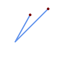 범위 포인트들이 겹치는 라인스트링
SELECT ST_Boundary(geom)
FROM (SELECT 'LINESTRING(100 150,50 60, 70 80, 160 170)'::geometry As geom) As f;
-- ST_AsText output
MULTIPOINT((100 150),(160 170))
| 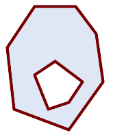 범위 멀티라인스트링을 가진 폴리곤 구멍
SELECT ST_Boundary(geom)
FROM (SELECT
'POLYGON (( 10 130, 50 190, 110 190, 140 150, 150 80, 100 10, 20 40, 10 130 ),
        ( 70 40, 100 50, 120 80, 80 110, 50 90, 70 40 ))'::geometry As geom) As f;
-- ST_AsText 출력
MULTILINESTRING((10 130,50 190,110 190,140 150,150 80,100 10,20 40,10 130),
        (70 40,100 50,120 80,80 110,50 90,70 40))
|
SELECT ST_AsText(ST_Boundary(ST_GeomFromText('LINESTRING(1 1,0 0, -1 1)')));
st_astext
-----------
MULTIPOINT((1 1),(-1 1))

SELECT ST_AsText(ST_Boundary(ST_GeomFromText('POLYGON((1 1,0 0, -1 1, 1 1))')));
st_astext
----------
LINESTRING(1 1,0 0,-1 1,1 1)

--Using a 3d polygon
SELECT ST_AsEWKT(ST_Boundary(ST_GeomFromEWKT('POLYGON((1 1 1,0 0 1, -1 1 1, 1 1 1))')));

st_asewkt
-----------------------------------
LINESTRING(1 1 1,0 0 1,-1 1 1,1 1 1)

--Using a 3d multilinestring
SELECT ST_AsEWKT(ST_Boundary(ST_GeomFromEWKT('MULTILINESTRING((1 1 1,0 0 0.5, -1 1 1),(1 1 0.5,0 0 0.5, -1 1 0.5, 1 1 0.5) )')));

st_asewkt
----------
MULTIPOINT((-1 1 1),(1 1 0.75))
Name
ST_BoundingDiagonal — 주어진 도형의 경계 상자의 대각선을 반환합니다.
Synopsis
geometry ST_BoundingDiagonal(geometry geom, boolean fits=false);
설명
주어진 도형의 경계 상자의 대각선을 라인스트링으로 반환합니다. 빈 도형을 입력받은 경우 빈 대각선을 반환하게 됩니다. 빈 도형이 아니라면 포인트 2개 중 시작점이 각 차원의 최소값들을, 종단점이 각 차원의 최대값들을 가진 라인스트링을 반환합니다.
fits 파라미터는 딱 맞는(best fit) 경계 상자가 필요한지 여부를 설정합니다. 거짓으로 설정한다면 조금 넉넉한 경계 상자도 용납할 수 있습니다(수많은 꼭짓점을 가진 도형의 경우 더 빨리 처리할 수 있습니다). 어떤 경우든 반환된 대각선의 경계 상자는 항상 입력 도형을 둘러쌉니다.
반환된 라인스트링 도형은 언제나 입력 도형의 SRID 및 차원수를 유지합니다.
| |
차원이 낮은 (입력 도형이 단일 꼭짓점) 경우 반환되는 라인스트링이 위상적으로 유효하지 않을 (내부가 없을) 것입니다. 그렇다고 해서 반환된 도형이 의미론적으로 유효하지 않다는 뜻은 아닙니다. |
2.2.0 버전부터 사용할 수 있습니다.
This function supports 3d and will not drop the z-index.
This function supports M coordinates.
Name
ST_CoordDim — ST_Geometry 값의 좌표 차원을 반환합니다.
Synopsis
integer ST_CoordDim(geometry geomA);
설명
ST_Geometry 값의 좌표 차원을 반환합니다.
이 함수는 MM을 준수하는, ST_NDims 와 동일한 함수합니다.
This method implements the OGC Simple Features
Implementation Specification for SQL 1.1.
This method implements the SQL/MM specification. SQL-MM 3: 5.1.3
This method supports Circular Strings and Curves
This function supports 3d and will not drop the z-index.
This function supports Polyhedral surfaces.
This function supports Triangles and Triangulated Irregular Network Surfaces (TIN).
Name
ST_Dimension — ST_Geometry 값의 좌표 차원을 반환합니다.
Synopsis
integer ST_Dimension(geometry g);
설명
좌표 차원과 동등하거나 낮아야 하는, 해당 도형 객체의 내재된 차원을 반환합니다. OGC 사양서 s2.1.1.1 단원을 보면 POINT 는 0, LINESTRING 은 1, POLYGON 은 2, 그리고 GEOMETRYCOLLECTION 의 경우 구성 요소 가운데 가장 높은 차원입니다. 알려지지 않은 (텅 빈) 도형인 경우 null을 반환합니다.
This method implements the SQL/MM specification. SQL-MM 3: 5.1.2
개선 사항: 2.0.0 버전부터 다면체 표면(polyhedral surface) 및 TIN을 지원합니다. 빈 도형이 주어져도 더 이상 예외가 발생하지 않습니다.
| |
2.0.0 미만 버전에서는 빈 도형에 대해 예외를 발생시켰습니다. |
This function supports Polyhedral surfaces.
This function supports Triangles and Triangulated Irregular Network Surfaces (TIN).
Name
ST_Dump — Returns a set of geometry_dump rows for the components of a geometry.
Synopsis
geometry ST_Envelope(geometry g1);
설명
A set-returning function (SRF) that extracts the components of a geometry. It returns a set of geometry_dump rows, each containing a geometry (geom field) and an array of integers (path field).
For an atomic geometry type (POINT,LINESTRING,POLYGON) a single record is returned with an empty path array and the input geometry as geom. For a collection or multi-geometry a record is returned for each of the collection components, and the path denotes the position of the component inside the collection.
ST_Dump is useful for expanding geometries. It is the inverse of a ST_GeomCollFromText / GROUP BY, in that it creates new rows. For example it can be use to expand MULTIPOLYGONS into POLYGONS.
개선 사항: 2.0.0 버전부터 다면체 표면, 삼각형 및 TIN을 지원하기 시작했습니다.
Availability: PostGIS 1.0.0RC1. Requires PostgreSQL 7.3 or higher.
| |
1.3.4 미만 버전에서 이 함수에 만곡 도형(curve)을 담고 있는 도형을 입력하면 충돌이 일어났습니다. 1.3.4 버전부터 이 버그가 해결됐습니다. |
This method supports Circular Strings and Curves
This function supports Polyhedral surfaces.
This function supports Triangles and Triangulated Irregular Network Surfaces (TIN).
This function supports 3d and will not drop the z-index.
표준 예시
SELECT sometable.field1, sometable.field1,
      (ST_Dump(sometable.geom)).geom AS geom
FROM sometable;

-- Break a compound curve into its constituent linestrings and circularstrings
SELECT ST_AsEWKT(a.geom), ST_HasArc(a.geom)
  FROM ( SELECT (ST_Dump(p_geom)).geom AS geom
         FROM (SELECT ST_GeomFromEWKT('COMPOUNDCURVE(CIRCULARSTRING(0 0, 1 1, 1 0),(1 0, 0 1))') AS p_geom) AS b
        ) AS a;
          st_asewkt          | st_hasarc
-----------------------------+----------
 CIRCULARSTRING(0 0,1 1,1 0) | t
 LINESTRING(1 0,0 1)         | f
(2 rows)
다면체 표면, TIN 및 삼각형 예시
-- 다면체 표면 예시
-- 다면체 표면을 각 면으로 분해하기
SELECT ST_AsEWKT(ST_GeometryN(p_geom,3)) As geom_ewkt
  FROM (SELECT ST_GeomFromEWKT('POLYHEDRALSURFACE(
((0 0 0, 0 0 1, 0 1 1, 0 1 0, 0 0 0)),
((0 0 0, 0 1 0, 1 1 0, 1 0 0, 0 0 0)),
((0 0 0, 1 0 0, 1 0 1, 0 0 1, 0 0 0)),
((1 1 0, 1 1 1, 1 0 1, 1 0 0, 1 1 0)),
((0 1 0, 0 1 1, 1 1 1, 1 1 0, 0 1 0)),
((0 0 1, 1 0 1, 1 1 1, 0 1 1, 0 0 1))
)')  AS p_geom )  AS a;

                geom_ewkt
------------------------------------------
 POLYGON((0 0 0,1 0 0,1 0 1,0 0 1,0 0 0))
-- TIN --
SELECT ST_AsEWKT(ST_GeometryN(geom,2)) as wkt
FROM
(SELECT
ST_GeomFromEWKT('TIN (((
0 0 0,
0 0 1,
0 1 0,
0 0 0
)), ((
0 0 0,
0 1 0,
1 1 0,
0 0 0
))
)') AS geom
) AS g;
-- 결과 --
wkt
-------------------------------------
TRIANGLE((0 0 0,0 1 0,1 1 0,0 0 0))
Name
ST_NumPoints — 도형의 내용을 요약한 텍스트를 반환합니다.
Synopsis
geometry ST_Points( geometry geom );
설명
A set-returning function (SRF) that extracts the coordinates (vertices) of a geometry. It returns a set of geometry_dump rows, each containing a geometry (geom field) and an array of integers (path field).
the
geomfieldPOINTs represent the coordinates of the supplied geometry.the
pathfield (aninteger[]) is an index enumerating the coordinate positions in the elements of the supplied geometry. The indices are 1-based. For example, for aLINESTRINGthe paths are{i}whereiis thenthcoordinate in theLINESTRING. For aPOLYGONthe paths are{i,j}whereiis the ring number (1 is outer; inner rings follow) andjis the coordinate position in the ring.
To obtain a single geometry containing the coordinates use ST_Points.
Enhanced: 2.1.0 Faster speed. Reimplemented as native-C.
개선 사항: 2.0.0 버전부터 다면체 표면, 삼각형 및 TIN을 지원하기 시작했습니다.
1.2.2 버전부터 사용할 수 있습니다.
This method supports Circular Strings and Curves
This function supports Polyhedral surfaces.
This function supports Triangles and Triangulated Irregular Network Surfaces (TIN).
This function supports 3d and will not drop the z-index.
Classic Explode a Table of LineStrings into nodes
SELECT edge_id, (dp).path[1] As index, ST_AsText((dp).geom) As wktnode
FROM (SELECT 1 As edge_id
, ST_DumpPoints(ST_GeomFromText('LINESTRING(1 2, 3 4, 10 10)')) AS dp
UNION ALL
SELECT 2 As edge_id
, ST_DumpPoints(ST_GeomFromText('LINESTRING(3 5, 5 6, 9 10)')) AS dp
) As foo;
edge_id | index | wktnode
---------+-------+--------------
1 | 1 | POINT(1 2)
1 | 2 | POINT(3 4)
1 | 3 | POINT(10 10)
2 | 1 | POINT(3 5)
2 | 2 | POINT(5 6)
2 | 3 | POINT(9 10)표준 예시
SELECT path, ST_AsText(geom)
FROM (
SELECT (ST_DumpPoints(g.geom)).*
FROM
(SELECT
'GEOMETRYCOLLECTION(
POINT ( 0 1 ),
LINESTRING ( 0 3, 3 4 ),
POLYGON (( 2 0, 2 3, 0 2, 2 0 )),
POLYGON (( 3 0, 3 3, 6 3, 6 0, 3 0 ),
( 5 1, 4 2, 5 2, 5 1 )),
MULTIPOLYGON (
(( 0 5, 0 8, 4 8, 4 5, 0 5 ),
( 1 6, 3 6, 2 7, 1 6 )),
(( 5 4, 5 8, 6 7, 5 4 ))
)
)'::geometry AS geom
) AS g
) j;
path | st_astext
-----------+------------
{1,1} | POINT(0 1)
{2,1} | POINT(0 3)
{2,2} | POINT(3 4)
{3,1,1} | POINT(2 0)
{3,1,2} | POINT(2 3)
{3,1,3} | POINT(0 2)
{3,1,4} | POINT(2 0)
{4,1,1} | POINT(3 0)
{4,1,2} | POINT(3 3)
{4,1,3} | POINT(6 3)
{4,1,4} | POINT(6 0)
{4,1,5} | POINT(3 0)
{4,2,1} | POINT(5 1)
{4,2,2} | POINT(4 2)
{4,2,3} | POINT(5 2)
{4,2,4} | POINT(5 1)
{5,1,1,1} | POINT(0 5)
{5,1,1,2} | POINT(0 8)
{5,1,1,3} | POINT(4 8)
{5,1,1,4} | POINT(4 5)
{5,1,1,5} | POINT(0 5)
{5,1,2,1} | POINT(1 6)
{5,1,2,2} | POINT(3 6)
{5,1,2,3} | POINT(2 7)
{5,1,2,4} | POINT(1 6)
{5,2,1,1} | POINT(5 4)
{5,2,1,2} | POINT(5 8)
{5,2,1,3} | POINT(6 7)
{5,2,1,4} | POINT(5 4)
(29 rows)다면체 표면, TIN 및 삼각형 예시
-- Polyhedral surface cube --
SELECT (g.gdump).path, ST_AsEWKT((g.gdump).geom) as wkt
FROM
(SELECT
ST_DumpPoints(ST_GeomFromEWKT('POLYHEDRALSURFACE( ((0 0 0, 0 0 1, 0 1 1, 0 1 0, 0 0 0)),
((0 0 0, 0 1 0, 1 1 0, 1 0 0, 0 0 0)), ((0 0 0, 1 0 0, 1 0 1, 0 0 1, 0 0 0)),
((1 1 0, 1 1 1, 1 0 1, 1 0 0, 1 1 0)),
((0 1 0, 0 1 1, 1 1 1, 1 1 0, 0 1 0)), ((0 0 1, 1 0 1, 1 1 1, 0 1 1, 0 0 1)) )') ) AS gdump
) AS g;
-- result --
path | wkt
---------+--------------
{1,1,1} | POINT(0 0 0)
{1,1,2} | POINT(0 0 1)
{1,1,3} | POINT(0 1 1)
{1,1,4} | POINT(0 1 0)
{1,1,5} | POINT(0 0 0)
{2,1,1} | POINT(0 0 0)
{2,1,2} | POINT(0 1 0)
{2,1,3} | POINT(1 1 0)
{2,1,4} | POINT(1 0 0)
{2,1,5} | POINT(0 0 0)
{3,1,1} | POINT(0 0 0)
{3,1,2} | POINT(1 0 0)
{3,1,3} | POINT(1 0 1)
{3,1,4} | POINT(0 0 1)
{3,1,5} | POINT(0 0 0)
{4,1,1} | POINT(1 1 0)
{4,1,2} | POINT(1 1 1)
{4,1,3} | POINT(1 0 1)
{4,1,4} | POINT(1 0 0)
{4,1,5} | POINT(1 1 0)
{5,1,1} | POINT(0 1 0)
{5,1,2} | POINT(0 1 1)
{5,1,3} | POINT(1 1 1)
{5,1,4} | POINT(1 1 0)
{5,1,5} | POINT(0 1 0)
{6,1,1} | POINT(0 0 1)
{6,1,2} | POINT(1 0 1)
{6,1,3} | POINT(1 1 1)
{6,1,4} | POINT(0 1 1)
{6,1,5} | POINT(0 0 1)
(30 rows)-- TIN --
SELECT ST_AsEWKT(ST_GeometryN(geom,2)) as wkt
FROM
(SELECT
ST_GeomFromEWKT('TIN (((
0 0 0,
0 0 1,
0 1 0,
0 0 0
)), ((
0 0 0,
0 1 0,
1 1 0,
0 0 0
))
)') AS geom
) AS g;
-- 결과 --
wkt
-------------------------------------
TRIANGLE((0 0 0,0 1 0,1 1 0,0 0 0))
-- TIN --
SELECT ST_AsEWKT(ST_GeometryN(geom,2)) as wkt
  FROM
    (SELECT
       ST_GeomFromEWKT('TIN (((
                0 0 0,
                0 0 1,
                0 1 0,
                0 0 0
            )), ((
                0 0 0,
                0 1 0,
                1 1 0,
                0 0 0
            ))
            )')  AS geom
    ) AS g;
-- 결과 --
                 wkt
-------------------------------------
 TRIANGLE((0 0 0,0 1 0,1 1 0,0 0 0))
Name
ST_NumPoints — 도형의 내용을 요약한 텍스트를 반환합니다.
Synopsis
geometry ST_Points( geometry geom );
설명
A set-returning function (SRF) that extracts the segments of a geometry. It returns a set of geometry_dump rows, each containing a geometry (geom field) and an array of integers (path field).
LINESTRING이 닫혀 있는 단순 도형인 경우TRUE를 반환합니다.the
pathfield (aninteger[]) is an index enumerating the segment start point positions in the elements of the supplied geometry. The indices are 1-based. For example, for aLINESTRINGthe paths are{i}whereiis thenthsegment start point in theLINESTRING. For aPOLYGONthe paths are{i,j}whereiis the ring number (1 is outer; inner rings follow) andjis the segment start point position in the ring.
2.2.0 버전부터 사용할 수 있습니다.
This function supports Triangles and Triangulated Irregular Network Surfaces (TIN).
This function supports 3d and will not drop the z-index.
표준 예시
SELECT path, ST_AsText(geom)
FROM (
SELECT (ST_DumpSegments(g.geom)).*
FROM (SELECT 'GEOMETRYCOLLECTION(
LINESTRING(1 1, 3 3, 4 4),
POLYGON((5 5, 6 6, 7 7, 5 5))
)'::geometry AS geom
) AS g
) j;
path │ st_astext
---------------------------------
{1,1} │ LINESTRING(1 1,3 3)
{1,2} │ LINESTRING(3 3,4 4)
{2,1,1} │ LINESTRING(5 5,6 6)
{2,1,2} │ LINESTRING(6 6,7 7)
{2,1,3} │ LINESTRING(7 7,5 5)
(5 rows)다면체 표면, TIN 및 삼각형 예시
-- TIN --
SELECT ST_AsEWKT(ST_GeometryN(geom,2)) as wkt
  FROM
    (SELECT
       ST_GeomFromEWKT('TIN (((
                0 0 0,
                0 0 1,
                0 1 0,
                0 0 0
            )), ((
                0 0 0,
                0 1 0,
                1 1 0,
                0 0 0
            ))
            )')  AS geom
    ) AS g;
-- 결과 --
                 wkt
-------------------------------------
 TRIANGLE((0 0 0,0 1 0,1 1 0,0 0 0))
Name
ST_NRings — Returns a set of geometry_dump rows for the exterior and interior rings of a Polygon.
Synopsis
geometry ST_ExteriorRing(geometry a_polygon);
설명
A set-returning function (SRF) that extracts the rings of a polygon. It returns a set of geometry_dump rows, each containing a geometry (geom field) and an array of integers (path field).
The geom field contains each ring as a POLYGON. The path field is an integer array of length 1 containing the polygon ring index. The exterior ring (shell) has index 0. The interior rings (holes) have indices of 1 and higher.
| |
이 함수는 멀티폴리곤을 입력받지 못 합니다. 멀티폴리곤의 경우 ST_Dump 함수와 결합해서 이용하십시오. |
Availability: PostGIS 1.1.3. Requires PostgreSQL 7.3 or higher.
This function supports 3d and will not drop the z-index.
예시
General form of query.
SELECT polyTable.field1, polyTable.field1,
          (ST_DumpRings(polyTable.geom)).geom As geom
FROM polyTable;
A polygon with a single hole.
SELECT path, ST_AsEWKT(geom) As geom
        FROM ST_DumpRings(
                ST_GeomFromEWKT('POLYGON((-8149064 5133092 1,-8149064 5132986 1,-8148996 5132839 1,-8148972 5132767 1,-8148958 5132508 1,-8148941 5132466 1,-8148924 5132394 1,
                -8148903 5132210 1,-8148930 5131967 1,-8148992 5131978 1,-8149237 5132093 1,-8149404 5132211 1,-8149647 5132310 1,-8149757 5132394 1,
                -8150305 5132788 1,-8149064 5133092 1),
                (-8149362 5132394 1,-8149446 5132501 1,-8149548 5132597 1,-8149695 5132675 1,-8149362 5132394 1))')
                )  as foo;
 path |                                            geom
----------------------------------------------------------------------------------------------------------------
  {0} | POLYGON((-8149064 5133092 1,-8149064 5132986 1,-8148996 5132839 1,-8148972 5132767 1,-8148958 5132508 1,
          |          -8148941 5132466 1,-8148924 5132394 1,
          |          -8148903 5132210 1,-8148930 5131967 1,
          |          -8148992 5131978 1,-8149237 5132093 1,
          |          -8149404 5132211 1,-8149647 5132310 1,-8149757 5132394 1,-8150305 5132788 1,-8149064 5133092 1))
  {1} | POLYGON((-8149362 5132394 1,-8149446 5132501 1,
| -8149548 5132597 1,-8149695 5132675 1,-8149362 5132394 1))Name
ST_EndPoint — ST_LineString 또는 ST_CircularString 값에 있는 포인트의 개수를 반환합니다.
Synopsis
geometry ST_Points( geometry geom );
설명
LINESTRING 또는 CIRCULARLINESTRING 도형의 첫 번째 포인트를 POINT로 반환합니다. 입력 파라미터가 LINESTRING 또는 CIRCULARLINESTRING 이 아닐 경우 NULL 을 반환합니다.
This method implements the SQL/MM specification. SQL-MM 3: 7.1.4
This function supports 3d and will not drop the z-index.
This method supports Circular Strings and Curves
| |
변경 사항: 2.0.0 버전부터 단일 도형 멀티라인스트링을 지원하지 않습니다. PostGIS 예전 버전이라면 단일 라인 멀티라인스트링을 입력받는 경우 시작점을 반환했을 겁니다. 2.0.0 버전은 다른 모든 멀티라인스트링처럼 NULL을 반환할 뿐입니다. 구식 습성은 문서화되지 않은 기능이지만, 사용자 데이터를 라인스트링으로 저장했다고 가정한 사용자의 경우 현재 2.0 버전에서 NULL이 반환될 수도 있습니다. |
예시
End point of a LineString
postgis=# SELECT ST_AsText(ST_EndPoint('LINESTRING(1 1, 2 2, 3 3)'::geometry));
 st_astext
------------
 POINT(3 3)
End point of a non-LineString is NULL
SELECT ST_EndPoint('POINT(1 1)'::geometry) IS NULL AS is_null;
  is_null
----------
 t
End point of a 3D LineString
--3d endpoint
SELECT ST_AsEWKT(ST_EndPoint('LINESTRING(1 1 2, 1 2 3, 0 0 5)'));
  st_asewkt
--------------
 POINT(0 0 5)
ST_LineString 또는 ST_CircularString 값에 있는 포인트의 개수를 반환합니다.
SELECT ST_AsText(ST_EndPoint('CIRCULARSTRING(5 2,-3 1.999999, -2 1, -4 2, 6 3)'::geometry));
 st_astext
------------
 POINT(6 3)
Name
ST_Envelope — 주어진 도형의 이중 정밀도(double precision; float8) 경계 상자를 표현하는 도형을 반환합니다.
Synopsis
geometry ST_Envelope(geometry g1);
설명
주어진 도형에 대해 float8 형 최소치 경계 상자를 도형으로 반환합니다. 해당 폴리곤은 경계 상자의 꼭짓점 포인트들로 정의됩니다((MINX, MINY), (MINX, MAXY), (MAXX, MAXY), (MAXX, MINY), (MINX, MINY)). (PostGIS는 ZMIN/ZMAX 좌표도 추가할 것입니다.)
차원이 낮은 (수직 라인, 포인트) 경우 POLYGON 보다 낮은 차원의, 예를 들어 POINT 또는 LINESTRING 도형을 반환할 것입니다.
1.5.0 버전부터 사용할 수 있으며, float4 형 대신 이중 정밀도 형으로 출력하도록 변경되었습니다.
This method implements the OGC Simple Features
Implementation Specification for SQL 1.1. s2.1.1.1
This method implements the SQL/MM specification. SQL-MM 3: 5.1.19
예시
SELECT ST_AsText(ST_Envelope('POINT(1 3)'::geometry));
 st_astext
------------
 POINT(1 3)
(1 row)


SELECT ST_AsText(ST_Envelope('LINESTRING(0 0, 1 3)'::geometry));
                   st_astext
--------------------------------
 POLYGON((0 0,0 3,1 3,1 0,0 0))
(1 row)


SELECT ST_AsText(ST_Envelope('POLYGON((0 0, 0 1, 1.0000001 1, 1.0000001 0, 0 0))'::geometry));
                                                  st_astext
--------------------------------------------------------------
 POLYGON((0 0,0 1,1.00000011920929 1,1.00000011920929 0,0 0))
(1 row)
SELECT ST_AsText(ST_Envelope('POLYGON((0 0, 0 1, 1.0000000001 1, 1.0000000001 0, 0 0))'::geometry));
                                                  st_astext
--------------------------------------------------------------
 POLYGON((0 0,0 1,1.00000011920929 1,1.00000011920929 0,0 0))
(1 row)

SELECT Box3D(geom), Box2D(geom), ST_AsText(ST_Envelope(geom)) As envelopewkt
        FROM (SELECT 'POLYGON((0 0, 0 1000012333334.34545678, 1.0000001 1, 1.0000001 0, 0 0))'::geometry As geom) As foo;
Envelope of a point and linestring.
SELECT ST_AsText(ST_Envelope(
                ST_Collect(
                        ST_GeomFromText('LINESTRING(55 75,125 150)'),
                                ST_Point(20, 80))
                                )) As wktenv;
wktenv
-----------
POLYGON((20 75,20 150,125 150,125 75,20 75))Name
ST_ExteriorRing — 폴리곤 도형의 내곽 고리의 개수를 반환합니다.
Synopsis
geometry ST_ExteriorRing(geometry a_polygon);
설명
POLYGON 도형의 외곽 고리(exterior ring)를 표현하는 라인스트링을 반환합니다. 도형이 폴리곤이 아닌 경우 NULL을 반환합니다.
| |
이 함수는 멀티폴리곤을 입력받지 못 합니다. 멀티폴리곤의 경우 ST_Dump 함수와 결합해서 이용하십시오. |
This method implements the OGC Simple Features
Implementation Specification for SQL 1.1. 2.1.5.1
This method implements the SQL/MM specification. SQL-MM 3: 8.2.3, 8.3.3
This function supports 3d and will not drop the z-index.
예시
-- 폴리곤 테이블이 있을 경우
SELECT gid, ST_ExteriorRing(the_geom) AS ering
FROM sometable;

-- 멀티폴리곤 테이블이며 각 폴리곤의
-- 외곽 고리들로 이루어진 멀티라인스트링을 반환하고자 할 경우
SELECT gid, ST_Collect(ST_ExteriorRing(the_geom)) AS erings
        FROM (SELECT gid, (ST_Dump(the_geom)).geom As the_geom
                        FROM sometable) As foo
GROUP BY gid;

--3d Example
SELECT ST_AsEWKT(
        ST_ExteriorRing(
        ST_GeomFromEWKT('POLYGON((0 0 1, 1 1 1, 1 2 1, 1 1 1, 0 0 1))')
        )
);

st_asewkt
---------
LINESTRING(0 0 1,1 1 1,1 2 1,1 1 1,0 0 1)
Name
ST_GeometryN — ST_Geometry 값의 도형 유형을 반환합니다.
Synopsis
geometry ST_GeometryN(geometry geomA, integer n);
설명
입력 도형이 도형 집합, (멀티)포인트, (멀티)라인스트링, 멀티커브(multicurve) 또는 (멀티)폴리곤이나 다면체 표면일 경우 1-기반 N번째 도형을 반환하며, 그 외의 경우 NULL을 반환합니다.
| |
0.8.0 버전부터 인덱스는 OGC 사양을 따라 1-기반입니다. 예전 버전은 대신 0-기반 인덱스를 시행했습니다. |
| |
모든 도형들을 추출하고자 한다면 ST_Dump 함수가 더 효율적이며, 단일 도형에 대해서도 작동할 것입니다. |
개선 사항: 2.0.0 버전부터 다면체 표면, 삼각형 및 TIN을 지원하기 시작했습니다.
변경 사항: 2.0.0 미만 버전은 단일 도형에 대해 NULL을 반환했을 겁니다. 2.0.0 버전부터 ST_GeometryN(..,1) 경우에 대한 도형을 반환하도록 변경됐습니다.
This method implements the OGC Simple Features
Implementation Specification for SQL 1.1.
This method implements the SQL/MM specification. SQL-MM 3: 9.1.5
This function supports 3d and will not drop the z-index.
This method supports Circular Strings and Curves
This function supports Polyhedral surfaces.
This function supports Triangles and Triangulated Irregular Network Surfaces (TIN).
표준 예시
--Extracting a subset of points from a 3d multipoint
SELECT n, ST_AsEWKT(ST_GeometryN(geom, n)) As geomewkt
FROM (
VALUES (ST_GeomFromEWKT('MULTIPOINT((1 2 7), (3 4 7), (5 6 7), (8 9 10))') ),
( ST_GeomFromEWKT('MULTICURVE(CIRCULARSTRING(2.5 2.5,4.5 2.5, 3.5 3.5), (10 11, 12 11))') )
        )As foo(geom)
        CROSS JOIN generate_series(1,100) n
WHERE n <= ST_NumGeometries(geom);

 n |               geomewkt
---+-----------------------------------------
 1 | POINT(1 2 7)
 2 | POINT(3 4 7)
 3 | POINT(5 6 7)
 4 | POINT(8 9 10)
 1 | CIRCULARSTRING(2.5 2.5,4.5 2.5,3.5 3.5)
 2 | LINESTRING(10 11,12 11)


--Extracting all geometries (useful when you want to assign an id)
SELECT gid, n, ST_GeometryN(geom, n)
FROM sometable CROSS JOIN generate_series(1,100) n
WHERE n <= ST_NumGeometries(geom);
다면체 표면, TIN 및 삼각형 예시
-- 다면체 표면 예시
-- 다면체 표면을 각 면으로 분해하기
SELECT ST_AsEWKT(ST_GeometryN(p_geom,3)) As geom_ewkt
  FROM (SELECT ST_GeomFromEWKT('POLYHEDRALSURFACE(
((0 0 0, 0 0 1, 0 1 1, 0 1 0, 0 0 0)),
((0 0 0, 0 1 0, 1 1 0, 1 0 0, 0 0 0)),
((0 0 0, 1 0 0, 1 0 1, 0 0 1, 0 0 0)),
((1 1 0, 1 1 1, 1 0 1, 1 0 0, 1 1 0)),
((0 1 0, 0 1 1, 1 1 1, 1 1 0, 0 1 0)),
((0 0 1, 1 0 1, 1 1 1, 0 1 1, 0 0 1))
)')  AS p_geom )  AS a;

                geom_ewkt
------------------------------------------
 POLYGON((0 0 0,1 0 0,1 0 1,0 0 1,0 0 0))
-- TIN --
SELECT ST_AsEWKT(ST_GeometryN(geom,2)) as wkt
FROM
(SELECT
ST_GeomFromEWKT('TIN (((
0 0 0,
0 0 1,
0 1 0,
0 0 0
)), ((
0 0 0,
0 1 0,
1 1 0,
0 0 0
))
)') AS geom
) AS g;
-- 결과 --
wkt
-------------------------------------
TRIANGLE((0 0 0,0 1 0,1 1 0,0 0 0))Name
ST_GeometryType — ST_Geometry 값의 도형 유형을 반환합니다.
Synopsis
text ST_GeometryType(geometry g1);
설명
도형의 유형을 'ST_LineString', 'ST_Polygon', 'ST_MultiPolygon' 등과 같은 스트링으로 반환합니다. 이 함수는 도형의 단위가 설정돼 있는지 알려주지 않는 것은 물론, 반환된 결과물이 스트링이며 접두사 ST가 달린다는 점에서도 GeometryType(geometry) 함수와는 다릅니다.
개선 사항: 2.0.0 버전부터 다면체 표면(polyhedral surface)을 지원합니다.
This method implements the SQL/MM specification. SQL-MM 3: 5.1.4
This function supports 3d and will not drop the z-index.
This function supports Polyhedral surfaces.
예시
SELECT ST_GeometryType(ST_GeomFromText('LINESTRING(77.29 29.07,77.42 29.26,77.27 29.31,77.29 29.07)'));
-- 결과
ST_LineString
SELECT ST_GeometryType(ST_GeomFromEWKT('POLYHEDRALSURFACE( ((0 0 0, 0 0 1, 0 1 1, 0 1 0, 0 0 0)),
((0 0 0, 0 1 0, 1 1 0, 1 0 0, 0 0 0)), ((0 0 0, 1 0 0, 1 0 1, 0 0 1, 0 0 0)),
((1 1 0, 1 1 1, 1 0 1, 1 0 0, 1 1 0)),
((0 1 0, 0 1 1, 1 1 1, 1 1 0, 0 1 0)), ((0 0 1, 1 0 1, 1 1 1, 0 1 1, 0 0 1)) )'));
-- 결과
ST_PolyhedralSurfaceSELECT ST_GeometryType(ST_GeomFromEWKT('POLYHEDRALSURFACE( ((0 0 0, 0 0 1, 0 1 1, 0 1 0, 0 0 0)),
((0 0 0, 0 1 0, 1 1 0, 1 0 0, 0 0 0)), ((0 0 0, 1 0 0, 1 0 1, 0 0 1, 0 0 0)),
((1 1 0, 1 1 1, 1 0 1, 1 0 0, 1 1 0)),
((0 1 0, 0 1 1, 1 1 1, 1 1 0, 0 1 0)), ((0 0 1, 1 0 1, 1 1 1, 0 1 1, 0 0 1)) )'));
-- 결과
ST_PolyhedralSurfaceSELECT ST_GeometryType(geom) as result
FROM
(SELECT
ST_GeomFromEWKT('TIN (((
0 0 0,
0 0 1,
0 1 0,
0 0 0
)), ((
0 0 0,
0 1 0,
1 1 0,
0 0 0
))
)') AS geom
) AS g;
result
--------
ST_Tin Name
ST_HasArc — Tests if a geometry contains a circular arc
Synopsis
boolean ST_IsEmpty(geometry geomA);
설명
해당 도형이 텅 빈 도형 집합, 폴리곤, 포인트 등인 경우 TRUE 를 반환합니다.
1.2.2 버전부터 사용할 수 있습니다.
This function supports 3d and will not drop the z-index.
This method supports Circular Strings and Curves
Name
ST_InteriorRingN — 폴리곤 도형의 내곽 고리의 개수를 반환합니다.
Synopsis
geometry ST_InteriorRingN(geometry a_polygon, integer n);
설명
폴리곤 도형의 N번째 내곽 라인스트링 고리를 반환합니다. 도형이 폴리곤이 아니거나 주어진 N이 범위(range)를 벗어난 경우 NULL을 반환합니다.
| |
이 함수는 멀티폴리곤을 입력받지 못 합니다. 멀티폴리곤의 경우 ST_Dump 함수와 결합해서 이용하십시오. |
This method implements the OGC Simple Features
Implementation Specification for SQL 1.1.
This method implements the SQL/MM specification. SQL-MM 3: 8.2.6, 8.3.5
This function supports 3d and will not drop the z-index.
Name
ST_IsClosed — LINESTRING 의 시작점과 종단점이 일치하는 경우 TRUE 를 반환합니다. 다면체 표면이 닫혀 (부피를 가지고) 있는 경우 TRUE 를 반환합니다.
Synopsis
boolean ST_IsClosed(geometry g);
설명
LINESTRING 의 시작점과 종단점이 일치하는 경우 TRUE 를 반환합니다. 다면체 표면의 경우, 다면체 표면이 면적(열림)을 가지고 있는지 부피(닫힘)를 가지고 있는지 알려줍니다.
This method implements the OGC Simple Features
Implementation Specification for SQL 1.1.
This method implements the SQL/MM specification. SQL-MM 3: 7.1.5, 9.3.3
| |
SQL-MM은 |
This function supports 3d and will not drop the z-index.
This method supports Circular Strings and Curves
개선 사항: 2.0.0 버전부터 다면체 표면(polyhedral surface)을 지원합니다.
This function supports Polyhedral surfaces.
라인스트링 및 포인트 예시
postgis=# SELECT ST_IsClosed('LINESTRING(0 0, 1 1)'::geometry);
 st_isclosed
-------------
 f
(1 row)

postgis=# SELECT ST_IsClosed('LINESTRING(0 0, 0 1, 1 1, 0 0)'::geometry);
 st_isclosed
-------------
 t
(1 row)

postgis=# SELECT ST_IsClosed('MULTILINESTRING((0 0, 0 1, 1 1, 0 0),(0 0, 1 1))'::geometry);
 st_isclosed
-------------
 f
(1 row)

postgis=# SELECT ST_IsClosed('POINT(0 0)'::geometry);
 st_isclosed
-------------
 t
(1 row)

postgis=# SELECT ST_IsClosed('MULTIPOINT((0 0), (1 1))'::geometry);
 st_isclosed
-------------
 t
(1 row)
다면체 표면 예시
-- 입방체 --
                SELECT ST_IsClosed(ST_GeomFromEWKT('POLYHEDRALSURFACE( ((0 0 0, 0 0 1, 0 1 1, 0 1 0, 0 0 0)),
                ((0 0 0, 0 1 0, 1 1 0, 1 0 0, 0 0 0)), ((0 0 0, 1 0 0, 1 0 1, 0 0 1, 0 0 0)),
                ((1 1 0, 1 1 1, 1 0 1, 1 0 0, 1 1 0)),
                ((0 1 0, 0 1 1, 1 1 1, 1 1 0, 0 1 0)), ((0 0 1, 1 0 1, 1 1 1, 0 1 1, 0 0 1)) )'));

 st_isclosed
-------------
 t


 -- 입방체이지만 한 면이 없는 경우 --
 SELECT ST_IsClosed(ST_GeomFromEWKT('POLYHEDRALSURFACE( ((0 0 0, 0 0 1, 0 1 1, 0 1 0, 0 0 0)),
                ((0 0 0, 0 1 0, 1 1 0, 1 0 0, 0 0 0)), ((0 0 0, 1 0 0, 1 0 1, 0 0 1, 0 0 0)),
                ((1 1 0, 1 1 1, 1 0 1, 1 0 0, 1 1 0)),
                ((0 1 0, 0 1 1, 1 1 1, 1 1 0, 0 1 0)) )'));

 st_isclosed
-------------
 f
Name
ST_IsCollection — 해당 도형이 텅 빈 도형 집합, 폴리곤, 포인트 등인 경우 TRUE 를 반환합니다.
Synopsis
boolean ST_IsCollection(geometry g);
설명
인수의 도형 유형이 다음 가운데 하나일 경우 TRUE 를 반환합니다:
GEOMETRYCOLLECTION
MULTI{POINT,POLYGON,LINESTRING,CURVE,SURFACE}
COMPOUNDCURVE
| |
이 함수는 도형의 유형을 분석합니다. 즉 비어 있거나 단일 요소를 담고 있는 집합일 경우에도 |
This function supports 3d and will not drop the z-index.
This method supports Circular Strings and Curves
예시
postgis=# SELECT ST_IsCollection('LINESTRING(0 0, 1 1)'::geometry);
 st_iscollection
-------------
 f
(1 row)

postgis=# SELECT ST_IsCollection('MULTIPOINT EMPTY'::geometry);
 st_iscollection
-------------
 t
(1 row)

postgis=# SELECT ST_IsCollection('MULTIPOINT((0 0))'::geometry);
 st_iscollection
-------------
 t
(1 row)

postgis=# SELECT ST_IsCollection('MULTIPOINT((0 0), (42 42))'::geometry);
 st_iscollection
-------------
 t
(1 row)

postgis=# SELECT ST_IsCollection('GEOMETRYCOLLECTION(POINT(0 0))'::geometry);
 st_iscollection
-------------
 t
(1 row)Name
ST_IsEmpty — Tests if a geometry is empty.
Synopsis
boolean ST_IsEmpty(geometry geomA);
설명
해당 도형이 텅 빈 도형인 경우 TRUE 를 반환합니다. TRUE 인 경우, 해당 도형이 텅 빈 도형 집합, 폴리곤, 포인트 등을 표현한다는 뜻입니다.
| |
SQL-MM은 |
This method implements the OGC Simple Features
Implementation Specification for SQL 1.1. s2.1.1.1
This method implements the SQL/MM specification. SQL-MM 3: 5.1.7
This method supports Circular Strings and Curves
| |
변경 사항: PostGIS 2.0.0 미만 버전에서는 ST_GeomFromText('GEOMETRYCOLLECTION(EMPTY)') 를 사용할 수 있었습니다. PostGIS 2.0.0 버전부터, SQL/MM 표준을 더 잘 준수하기 위해 이런 사용법은 금지됐습니다. |
예시
SELECT ST_IsEmpty(ST_GeomFromText('GEOMETRYCOLLECTION EMPTY'));
 st_isempty
------------
 t
(1 row)

 SELECT ST_IsEmpty(ST_GeomFromText('POLYGON EMPTY'));
 st_isempty
------------
 t
(1 row)

SELECT ST_IsEmpty(ST_GeomFromText('POLYGON((1 2, 3 4, 5 6, 1 2))'));

 st_isempty
------------
 f
(1 row)

 SELECT ST_IsEmpty(ST_GeomFromText('POLYGON((1 2, 3 4, 5 6, 1 2))')) = false;
 ?column?
----------
 t
(1 row)

 SELECT ST_IsEmpty(ST_GeomFromText('CIRCULARSTRING EMPTY'));
  st_isempty
------------
 t
(1 row)
Name
ST_IsPolygonCCW — Tests if Polygons have exterior rings oriented counter-clockwise and interior rings oriented clockwise.
Synopsis
boolean ST_IsPolygonCCW ( geometry geom );
설명
Returns true if all polygonal components of the input geometry use a counter-clockwise orientation for their exterior ring, and a clockwise direction for all interior rings.
Returns true if the geometry has no polygonal components.
| |
Closed linestrings are not considered polygonal components, so you would still get a true return by passing a single closed linestring no matter its orientation. |
| |
If a polygonal geometry does not use reversed orientation for interior rings (i.e., if one or more interior rings are oriented in the same direction as an exterior ring) then both ST_IsPolygonCW and ST_IsPolygonCCW will return false. |
2.2.0 버전부터 사용할 수 있습니다.
This function supports 3d and will not drop the z-index.
This function supports M coordinates.
Name
ST_IsPolygonCW — Tests if Polygons have exterior rings oriented clockwise and interior rings oriented counter-clockwise.
Synopsis
boolean ST_IsPolygonCW ( geometry geom );
설명
Returns true if all polygonal components of the input geometry use a clockwise orientation for their exterior ring, and a counter-clockwise direction for all interior rings.
Returns true if the geometry has no polygonal components.
| |
Closed linestrings are not considered polygonal components, so you would still get a true return by passing a single closed linestring no matter its orientation. |
| |
If a polygonal geometry does not use reversed orientation for interior rings (i.e., if one or more interior rings are oriented in the same direction as an exterior ring) then both ST_IsPolygonCW and ST_IsPolygonCCW will return false. |
2.2.0 버전부터 사용할 수 있습니다.
This function supports 3d and will not drop the z-index.
This function supports M coordinates.
Name
ST_IsRing — Tests if a LineString is closed and simple.
Synopsis
boolean ST_IsRing(geometry g);
설명
해당 LINESTRING 이 ST_IsClosed (ST_StartPoint( g)~= ST_Endpoint() 인 동시에 ST_IsSimple 인 (자체 교차하지 않는) 경우 g)TRUE 를 반환합니다.
This method implements the OGC Simple Features
Implementation Specification for SQL 1.1. 2.1.5.1
This method implements the SQL/MM specification. SQL-MM 3: 7.1.6
| |
SQL-MM은 |
예시
SELECT ST_IsRing(the_geom), ST_IsClosed(the_geom), ST_IsSimple(the_geom)
FROM (SELECT 'LINESTRING(0 0, 0 1, 1 1, 1 0, 0 0)'::geometry AS the_geom) AS foo;
 st_isring | st_isclosed | st_issimple
-----------+-------------+-------------
 t         | t           | t
(1 row)

SELECT ST_IsRing(the_geom), ST_IsClosed(the_geom), ST_IsSimple(the_geom)
FROM (SELECT 'LINESTRING(0 0, 0 1, 1 0, 1 1, 0 0)'::geometry AS the_geom) AS foo;
 st_isring | st_isclosed | st_issimple
-----------+-------------+-------------
 f         | t           | f
(1 row)
Name
ST_IsSimple — 해당 도형이 자체 교차하거나 자체 접촉하는 이례적인 도형 포인트를 가지고 있지 않을 경우 TRUE 를 반환합니다.
Synopsis
boolean ST_IsSimple(geometry geomA);
설명
해당 도형이 자체 교차하거나 자체 접촉하는 이례적인 도형 포인트를 가지고 있지 않을 경우 TRUE 를 반환합니다. 도형 단순성 및 유효성에 대한 OGC의 정의를 더 자세히 알고 싶다면, "OpenGIS의 도형 준수성 확인(Ensuring OpenGIS compliancy of geometries)" 을 참조하십시오.
| |
SQL-MM은 |
This method implements the OGC Simple Features
Implementation Specification for SQL 1.1. s2.1.1.1
This method implements the SQL/MM specification. SQL-MM 3: 5.1.8
This function supports 3d and will not drop the z-index.
Name
ST_M — Returns the M coordinate of a Point.
Synopsis
float ST_M(geometry a_point);
설명
포인트의 M 좌표를 반환합니다. M 좌표가 없는 경우 NULL을 반환합니다. 포인트만 입력받을 수 있습니다.
| |
이 함수는 (아직) OGC 사양에 들어가지 않지만, 포인트 좌표 추출자(extractor) 함수 목록을 완성하기 위해 이 문서에 작성됐습니다. |
This method implements the OGC Simple Features
Implementation Specification for SQL 1.1.
This method implements the SQL/MM specification.
This function supports 3d and will not drop the z-index.
Name
ST_MemSize — ST_Geometry 값의 도형 유형을 반환합니다.
Synopsis
integer ST_NRings(geometry geomA);
설명
ST_Geometry 값의 도형 유형을 반환합니다.
This complements the PostgreSQL built-in database object functions pg_column_size, pg_size_pretty, pg_relation_size, pg_total_relation_size.
| |
pg_relation_size which gives the byte size of a table may return byte size lower than ST_MemSize. This is because pg_relation_size does not add toasted table contribution and large geometries are stored in TOAST tables. pg_total_relation_size - includes, the table, the toasted tables, and the indexes. pg_column_size returns how much space a geometry would take in a column considering compression, so may be lower than ST_MemSize |
This function supports 3d and will not drop the z-index.
This method supports Circular Strings and Curves
This function supports Polyhedral surfaces.
This function supports Triangles and Triangulated Irregular Network Surfaces (TIN).
Changed: 2.2.0 name changed to ST_MemSize to follow naming convention.
예시
--Return how much byte space Boston takes up  in our Mass data set
SELECT pg_size_pretty(SUM(ST_MemSize(geom))) as totgeomsum,
pg_size_pretty(SUM(CASE WHEN town = 'BOSTON' THEN ST_MemSize(geom) ELSE 0 END)) As bossum,
CAST(SUM(CASE WHEN town = 'BOSTON' THEN ST_MemSize(geom) ELSE 0 END)*1.00 /
                SUM(ST_MemSize(geom))*100 As numeric(10,2)) As perbos
FROM towns;

totgeomsum        bossum        perbos
----------        ------        ------
1522 kB                30 kB        1.99


SELECT ST_MemSize(ST_GeomFromText('CIRCULARSTRING(220268 150415,220227 150505,220227 150406)'));

---
73

--What percentage of our table is taken up by just the geometry
SELECT pg_total_relation_size('public.neighborhoods') As fulltable_size, sum(ST_MemSize(geom)) As geomsize,
sum(ST_MemSize(geom))*1.00/pg_total_relation_size('public.neighborhoods')*100 As pergeom
FROM neighborhoods;
fulltable_size geomsize  pergeom
------------------------------------------------
262144         96238         36.71188354492187500000
Name
ST_NDims — ST_Geometry 값의 좌표 차원을 반환합니다.
Synopsis
integer ST_NDims(geometry g1);
설명
도형의 좌표 차원을 반환합니다. PostGIS는 2 - 2차원 (x,y), 3 - 3차원 (x,y,z), 3 - 단위를 가진 2차원 (x,y,m), 그리고 4 - 단위를 가진 3차원 공간 (x,y,z,m)을 지원합니다.
This function supports 3d and will not drop the z-index.
Name
ST_NPoints — 도형이 가지고 있는 포인트(꼭짓점)의 개수를 반환합니다.
Synopsis
integer ST_NPoints(geometry g1);
설명
도형이 가지고 있는 포인트의 개수를 반환합니다. 모든 도형을 입력받을 수 있습니다.
개선 사항: 2.0.0 버전부터 다면체 표면(polyhedral surface)을 지원합니다.
| |
1.3.4 미만 버전에서 이 함수에 만곡 도형(curve)을 담고 있는 도형을 입력하면 충돌이 일어났습니다. 1.3.4 버전부터 이 버그가 해결됐습니다. |
This function supports 3d and will not drop the z-index.
This method supports Circular Strings and Curves
This function supports Polyhedral surfaces.
Name
ST_NRings — 폴리곤 도형의 내곽 고리의 개수를 반환합니다.
Synopsis
integer ST_NRings(geometry geomA);
설명
도형이 폴리곤 또는 멀티폴리곤인 경우 고리의 개수를 반환합니다. NumInteriorRings 함수와는 달리, 외곽 고리도 개수에 포함시킵니다.
This function supports 3d and will not drop the z-index.
This method supports Circular Strings and Curves
Name
ST_NumGeometries — 도형이 가지고 있는 포인트의 개수를 반환합니다. 모든 도형을 입력받을 수 있습니다.
Synopsis
integer ST_NumGeometries(geometry geom);
설명
도형의 개수를 반환합니다. 도형 집합 또는 멀티 도형인 경우 도형의 개수를, 단일 도형인 경우 1을 반환하고, 도형 집합도 멀티 도형도 단일 도형도 아닌 경우 NULL을 반환합니다.
개선 사항: 2.0.0 버전부터 다면체 표면, 삼각형 및 TIN을 지원하기 시작했습니다.
변경 사항: 2.0.0 미만 버전에서 도형이 집합이나 멀티 유형이 아닐 경우 NULL을 반환했습니다. 2.0.0 버전부터 폴리곤, 라인스트링, 포인트 같은 단일 도형에 대해 1을 반환합니다.
This method implements the SQL/MM specification. SQL-MM 3: 9.1.4
This function supports 3d and will not drop the z-index.
This function supports Polyhedral surfaces.
This function supports Triangles and Triangulated Irregular Network Surfaces (TIN).
예시
--Prior versions would have returned NULL for this -- in 2.0.0 this returns 1
SELECT ST_NumGeometries(ST_GeomFromText('LINESTRING(77.29 29.07,77.42 29.26,77.27 29.31,77.29 29.07)'));
--result
1
--Geometry Collection Example - multis count as one geom in a collection
SELECT ST_NumGeometries(ST_GeomFromEWKT('GEOMETRYCOLLECTION(MULTIPOINT((-2 3),(-2 2)),
LINESTRING(5 5 ,10 10),
POLYGON((-7 4.2,-7.1 5,-7.1 4.3,-7 4.2)))'));
--result
3
Name
ST_NumInteriorRings — 폴리곤 도형의 내곽 고리의 개수를 반환합니다.
Synopsis
integer ST_NumInteriorRings(geometry a_polygon);
설명
폴리곤 도형의 내곽 고리의 개수를 반환합니다. 도형이 폴리곤이 아닐 경우 NULL을 반환합니다.
This method implements the SQL/MM specification. SQL-MM 3: 8.2.5
변경 사항: 2.0.0 미만 버전에서는 멀티폴리곤을 입력하면 첫 번째 폴리곤의 내곽 고리의 개수를 반환받을 수 있었습니다.
예시
-- 정규 폴리곤인 경우
SELECT gid, field1, field2, ST_NumInteriorRings(the_geom) AS numholes
FROM sometable;
-- 멀티폴리곤인 경우
-- 그리고 멀티폴리곤 내부에 있는 모든 내곽 고리의 개수를 알고자 하는 경우
SELECT gid, field1, field2, SUM(ST_NumInteriorRings(the_geom)) AS numholes
FROM (SELECT gid, field1, field2, (ST_Dump(the_geom)).geom As the_geom
FROM sometable) As foo
GROUP BY gid, field1,field2;
Name
ST_NumInteriorRing — 도형 안에 있는 폴리곤의 내곽 고리의 개수를 반환합니다. ST_NumInteriorRings 함수와 동일합니다.
Synopsis
integer ST_NumInteriorRing(geometry a_polygon);
Name
ST_NumPatches — 다면체 표면 상에 있는 면의 개수를 반환합니다. 다면체 도형이 아닌 경우 NULL을 반환할 것입니다.
Synopsis
integer ST_NumPatches(geometry g1);
설명
다면체 표면 상에 있는 면의 개수를 반환합니다. 다면체 도형이 아닌 경우 NULL을 반환할 것입니다. 이 함수는 ST_NumGeometries와 동일하지만 MM 명명법을 지원합니다. MM 규약을 신경 쓰지 않는다면 ST_NumGeometries가 더 빠릅니다.
2.0.0 버전부터 사용할 수 있습니다.
This function supports 3d and will not drop the z-index.
This method implements the OGC Simple Features
Implementation Specification for SQL 1.1.
This method implements the SQL/MM specification. SQL-MM ISO/IEC 13249-3: 8.5
This function supports Polyhedral surfaces.
예시
SELECT ST_NumPatches(ST_GeomFromEWKT('POLYHEDRALSURFACE( ((0 0 0, 0 0 1, 0 1 1, 0 1 0, 0 0 0)),
((0 0 0, 0 1 0, 1 1 0, 1 0 0, 0 0 0)), ((0 0 0, 1 0 0, 1 0 1, 0 0 1, 0 0 0)),
((1 1 0, 1 1 1, 1 0 1, 1 0 0, 1 1 0)),
((0 1 0, 0 1 1, 1 1 1, 1 1 0, 0 1 0)), ((0 0 1, 1 0 1, 1 1 1, 0 1 1, 0 0 1)) )'));
-- 결과
6
Name
ST_NumPoints — ST_LineString 또는 ST_CircularString 값에 있는 포인트의 개수를 반환합니다.
Synopsis
integer ST_NumPoints(geometry g1);
설명
ST_LineString 또는 ST_CircularString 값에 있는 포인트의 개수를 반환합니다. 1.4 미만 버전에서는 사양서대로 라인스트링만 입력받았습니다. 1.4 버전부터 이 함수는 단순히 라인스트링만이 아닌, 도형의 꼭짓점의 개수를 반환하는 ST_NPoints 함수와 비슷해졌습니다. 쿼리 목적이 다양하고 많은 도형 유형을 사용할 수 있는 ST_NPoints 함수를 대신 사용하는 편이 좋습니다.
This method implements the OGC Simple Features
Implementation Specification for SQL 1.1.
This method implements the SQL/MM specification. SQL-MM 3: 7.2.4
Name
ST_PatchN — ST_Geometry 값의 도형 유형을 반환합니다.
Synopsis
geometry ST_PatchN(geometry geomA, integer n);
설명
도형이 POLYHEDRALSURFACE, POLYHEDRALSURFACEM 인 경우 1-기반 N번째 도형 (면)을 반환합니다. 그 외의 경우 NULL을 반환합니다. 이 함수는 다면체 표면에 대해 ST_GeometryN과 동일한 답을 반환합니다. ST_GeometryN을 이용하는 편이 더 빠릅니다.
| |
인덱스는 1-기반입니다. |
| |
모든 도형들을 추출하고자 한다면 ST_Dump 함수가 더 효율적입니다. |
2.0.0 버전부터 사용할 수 있습니다.
This method implements the SQL/MM specification. SQL-MM ISO/IEC 13249-3: 8.5
This function supports 3d and will not drop the z-index.
This function supports Polyhedral surfaces.
예시
-- 다면체 표면의 두 번째 면을 추출합니다.
SELECT ST_AsEWKT(ST_PatchN(geom, 2)) As geomewkt
FROM (
VALUES (ST_GeomFromEWKT('POLYHEDRALSURFACE( ((0 0 0, 0 0 1, 0 1 1, 0 1 0, 0 0 0)),
((0 0 0, 0 1 0, 1 1 0, 1 0 0, 0 0 0)), ((0 0 0, 1 0 0, 1 0 1, 0 0 1, 0 0 0)),
((1 1 0, 1 1 1, 1 0 1, 1 0 0, 1 1 0)),
((0 1 0, 0 1 1, 1 1 1, 1 1 0, 0 1 0)), ((0 0 1, 1 0 1, 1 1 1, 0 1 1, 0 0 1)) )')) ) As foo(geom);
geomewkt
---+-----------------------------------------
POLYGON((0 0 0,0 1 0,1 1 0,1 0 0,0 0 0))
Name
ST_PointN — ST_LineString 또는 ST_CircularString 값에 있는 포인트의 개수를 반환합니다.
Synopsis
geometry ST_PointN(geometry a_linestring, integer n);
설명
도형 안에 있는 단일 라인스트링 또는 원형 라인스트링의 N번째 포인트를 반환합니다. 음수 값은 라인스트링의 종단점으로부터 반대로 집계되므로, -1이 마지막 포인트입니다. 도형 안에 라인스트링이 없는 경우 NULL을 반환합니다.
| |
0.8.0 버전부터 인덱스는 OGC 사양을 따라 1-기반입니다. OGC는 반대 방향 인덱스(음수 인덱스)를 지원하지 않습니다. 예전 버전은 대신 0-기반 인덱스를 도입했습니다. |
| |
멀티라인스트링 안에 있는 각 라인스트링의 N번째 포인트를 얻고자 할 경우, 이 함수를 ST_Dump 함수와 연결해서 이용하십시오. |
This method implements the OGC Simple Features
Implementation Specification for SQL 1.1.
This method implements the SQL/MM specification. SQL-MM 3: 7.2.5, 7.3.5
This function supports 3d and will not drop the z-index.
This method supports Circular Strings and Curves
| |
변경 사항: 2.0.0 버전부터 단일 도형 멀티라인스트링을 지원하지 않습니다. PostGIS 예전 버전이라면 단일 라인 멀티라인스트링을 입력받는 경우 시작점을 반환했을 겁니다. 2.0.0 버전은 다른 모든 멀티라인스트링처럼 NULL을 반환할 뿐입니다. 변경 사항: 2.3.0 버전부터 음수 인덱스(-1이 마지막 포인트)를 이용할 수 있습니다. |
예시
-- 라인스트링으로부터 모든 포인트를 추출합니다.
SELECT ST_AsText(
ST_PointN(
column1,
generate_series(1, ST_NPoints(column1))
))
FROM ( VALUES ('LINESTRING(0 0, 1 1, 2 2)'::geometry) ) AS foo;
st_astext
------------
POINT(0 0)
POINT(1 1)
POINT(2 2)
(3 rows)
-- 원형 라인스트링 예시
SELECT ST_AsText(ST_PointN(ST_GeomFromText('CIRCULARSTRING(1 2, 3 2, 1 2)'),2));
st_astext
----------
POINT(3 2)
SELECT st_astext(f)
FROM ST_GeometryFromtext('LINESTRING(0 0 0, 1 1 1, 2 2 2)') as g
,ST_PointN(g, -2) AS f -- 1 based index
st_astext
----------
"POINT Z (1 1 1)"
Name
ST_Points — 도형의 모든 좌표들을 담고 있는 멀티포인트를 반환합니다.
Synopsis
geometry ST_Points( geometry geom );
설명
Returns a MultiPoint containing all the coordinates of a geometry. Duplicate points are preserved, including the start and end points of ring geometries. (If desired, duplicate points can be removed by calling ST_RemoveRepeatedPoints on the result).
To obtain information about the position of each coordinate in the parent geometry use ST_NumPoints.
M and Z coordinates are preserved if present.
This method supports Circular Strings and Curves
This function supports 3d and will not drop the z-index.
2.3.0 버전부터 사용할 수 있습니다.
Name
ST_StartPoint — Returns the first point of a LineString.
Synopsis
geometry ST_StartPoint(geometry geomA);
설명
LINESTRING 또는 CIRCULARLINESTRING 도형의 첫 번째 포인트를 POINT로 반환합니다. 입력 파라미터가 LINESTRING 또는 CIRCULARLINESTRING 이 아닐 경우 NULL 을 반환합니다.
This method implements the SQL/MM specification. SQL-MM 3: 7.1.3
This function supports 3d and will not drop the z-index.
This method supports Circular Strings and Curves
| |
Enhanced: 3.2.0 returns a point for all geometries. Prior behavior returns NULLs if input was not a LineString. 변경 사항: 2.0.0 버전부터 단일 도형 멀티라인스트링을 지원하지 않습니다. PostGIS 예전 버전이라면 단일 라인 멀티라인스트링을 입력받는 경우 시작점을 반환했을 겁니다. 2.0.0 버전은 다른 모든 멀티라인스트링처럼 NULL을 반환할 뿐입니다. 구식 습성은 문서화되지 않은 기능이지만, 사용자 데이터를 라인스트링으로 저장했다고 가정한 사용자의 경우 현재 2.0 버전에서 NULL이 반환될 수도 있습니다. |
예시
Start point of a LineString
SELECT ST_AsText(ST_StartPoint('LINESTRING(0 1, 0 2)'::geometry));
st_astext
------------
POINT(0 1)
Start point of a non-LineString is NULL
SELECT ST_StartPoint('POINT(0 1)'::geometry) IS NULL AS is_null;
is_null
----------
t
Start point of a 3D LineString
SELECT ST_AsEWKT(ST_StartPoint('LINESTRING(0 1 1, 0 2 2)'::geometry));
st_asewkt
------------
POINT(0 1 1)
ST_LineString 또는 ST_CircularString 값에 있는 포인트의 개수를 반환합니다.
SELECT ST_AsText(ST_StartPoint('CIRCULARSTRING(5 2,-3 1.999999, -2 1, -4 2, 6 3)'::geometry));
st_astext
------------
POINT(5 2)
Name
ST_Summary — 도형의 내용을 요약한 텍스트를 반환합니다.
Synopsis
text ST_Summary(geometry g);
text ST_Summary(geography g);
설명
도형의 내용을 요약한 텍스트를 반환합니다.
도형 유형 뒤에 대괄호로 표기된 플래그는 다음과 같은 뜻입니다:
M: M 좌표가 존재합니다.
Z: Z 좌표가 존재합니다.
B: 캐쉬된 경계 상자를 가지고 있습니다.
G: 측지형(지리형)입니다.
S: 공간 참조 시스템을 가지고 있습니다.
This method supports Circular Strings and Curves
This function supports Polyhedral surfaces.
This function supports Triangles and Triangulated Irregular Network Surfaces (TIN).
1.2.2 버전부터 사용할 수 있습니다.
개선 사항: 2.0.0 버전부터 지리형을 지원하기 시작했습니다.
개선 사항: 2.1.0 버전. 알려진 공간 참조 시스템을 가진 경우를 나타내는 S 플래그가 추가됐습니다.
개선 사항: 2.2.0 버전부터 TIN 및 만곡 도형(curve)을 지원하기 시작했습니다.
예시
=# SELECT ST_Summary(ST_GeomFromText('LINESTRING(0 0, 1 1)')) as geom,
ST_Summary(ST_GeogFromText('POLYGON((0 0, 1 1, 1 2, 1 1, 0 0))')) geog;
geom | geog
-----------------------------+--------------------------
LineString[B] with 2 points | Polygon[BGS] with 1 rings
| ring 0 has 5 points
:
(1 row)
=# SELECT ST_Summary(ST_GeogFromText('LINESTRING(0 0 1, 1 1 1)')) As geog_line,
ST_Summary(ST_GeomFromText('SRID=4326;POLYGON((0 0 1, 1 1 2, 1 2 3, 1 1 1, 0 0 1))')) As geom_poly;
;
geog_line | geom_poly
-------------------------------- +--------------------------
LineString[ZBGS] with 2 points | Polygon[ZBS] with 1 rings
: ring 0 has 5 points
:
(1 row)
Name
ST_X — Returns the X coordinate of a Point.
Synopsis
float ST_X(geometry a_point);
설명
포인트의 X 좌표를 반환합니다. X 좌표가 없는 경우 NULL을 반환합니다. 포인트만 입력받을 수 있습니다.
| |
To get the minimum and maximum X value of geometry coordinates use the functions ST_XMin and ST_XMax. |
This method implements the SQL/MM specification. SQL-MM 3: 6.1.3
This function supports 3d and will not drop the z-index.
Name
ST_Y — Returns the Y coordinate of a Point.
Synopsis
float ST_Y(geometry a_point);
설명
포인트의 Y 좌표를 반환합니다. Y 좌표가 없는 경우 NULL을 반환합니다. 포인트만 입력받을 수 있습니다.
| |
To get the minimum and maximum Y value of geometry coordinates use the functions ST_YMin and ST_YMax. |
This method implements the OGC Simple Features
Implementation Specification for SQL 1.1.
This method implements the SQL/MM specification. SQL-MM 3: 6.1.4
This function supports 3d and will not drop the z-index.
Name
ST_Z — Returns the Z coordinate of a Point.
Synopsis
float ST_Z(geometry a_point);
Name
ST_Zmflag — ST_Geometry 값의 좌표 차원을 반환합니다.
Synopsis
smallint ST_Zmflag(geometry geomA);
설명
ST_Geometry 값의 좌표 차원을 반환합니다.
Values are: 0 = 2D, 1 = 3D-M, 2 = 3D-Z, 3 = 4D.
This function supports 3d and will not drop the z-index.
This method supports Circular Strings and Curves
예시
SELECT ST_Zmflag(ST_GeomFromEWKT('LINESTRING(1 2, 3 4)'));
st_zmflag
-----------
0
SELECT ST_Zmflag(ST_GeomFromEWKT('LINESTRINGM(1 2 3, 3 4 3)'));
st_zmflag
-----------
1
SELECT ST_Zmflag(ST_GeomFromEWKT('CIRCULARSTRING(1 2 3, 3 4 3, 5 6 3)'));
st_zmflag
-----------
2
SELECT ST_Zmflag(ST_GeomFromEWKT('POINT(1 2 3 4)'));
st_zmflag
-----------
3
- ST_AddPoint — 라인스트링에 포인트를 추가합니다.
- ST_CollectionExtract — Given a geometry collection, returns a multi-geometry containing only elements of a specified type.
- ST_CollectionHomogenize — Returns the simplest representation of a geometry collection.
- ST_CurveToLine — Converts a geometry containing curves to a linear geometry.
- ST_Scroll — Change start point of a closed LineString.
- ST_FlipCoordinates — Returns a version of a geometry with X and Y axis flipped.
- ST_Force2D — 도형을 "2차원 모드"로 강제합니다.
- ST_Force3D — 도형을 XYZ 모드로 강제합니다. ST_Force3DZ라고도 합니다.
- ST_Force3DZ — 도형을 XYZ 모드로 강제합니다.
- ST_Force3DM — 도형을 XYM 모드로 강제합니다.
- ST_Force4D — 도형을 XYZM 모드로 강제합니다.
- ST_ForcePolygonCCW — Orients all exterior rings counter-clockwise and all interior rings clockwise.
- ST_ForceCollection — 도형을 도형 집합으로 변환합니다.
- ST_ForcePolygonCW — Orients all exterior rings clockwise and all interior rings counter-clockwise.
- ST_ForceSFS — 도형이 SFS 1.1 도형 유형만을 쓰도록 강제합니다.
- ST_ForceRHR — 폴리곤 안에 있는 꼭짓점들의 방향(orientation)이 오른손 법칙(Right-Hand Rule)을 따르도록 강제합니다.
- ST_ForceCurve — 적용이 가능한 경우, 도형을 해당 도형의 만곡 유형으로 상위 형변환(upcast)합니다.
- ST_LineToCurve — Converts a linear geometry to a curved geometry.
- ST_Multi — 도형을 멀티 유형 도형으로 반환합니다.
- ST_Normalize — 도형을 해당 도형의 기본형으로 반환합니다.
- ST_QuantizeCoordinates — Sets least significant bits of coordinates to zero
- ST_RemovePoint — Remove a point from a linestring.
- ST_RemoveRepeatedPoints — Returns a version of a geometry with duplicate points removed.
- ST_Reverse — 꼭짓점들의 순서가 반대인 도형을 반환합니다.
- ST_Segmentize — 주어진 거리보다 더 긴 구간이 없도록 수정된 도형/지리형을 반환합니다.
- ST_SetPoint — 라인스트링의 포인트를 주어진 포인트로 대체합니다.
- ST_ShiftLongitude — Shifts the longitude coordinates of a geometry between -180..180 and 0..360.
- ST_WrapX — X값 근처에서 도형을 래핑합니다.
- ST_SnapToGrid — 입력 도형의 모든 포인트를 정규 그리드로 스냅(snap)시킵니다.
- ST_Snap — 입력 도형의 분절 구간과 꼭짓점을 참조 도형의 꼭짓점으로 스냅시킵니다.
- ST_SwapOrdinates — 입력 도형을 좌표값을 뒤바꾼 상태로 반환합니다.
Name
ST_AddPoint — 라인스트링에 포인트를 추가합니다.
Synopsis
geometry ST_AddPoint(geometry linestring, geometry point);
geometry ST_AddPoint(geometry linestring, geometry point, integer position = -1);
설명
Adds a point to a LineString before the index position (using a 0-based index). If the position parameter is omitted or is -1 the point is appended to the end of the LineString.
1.1.0 버전부터 사용할 수 있습니다.
This function supports 3d and will not drop the z-index.
예시
Add a point to the end of a 3D line
SELECT ST_AsEWKT(ST_AddPoint('LINESTRING(0 0 1, 1 1 1)', ST_MakePoint(1, 2, 3)));
st_asewkt
----------
LINESTRING(0 0 1,1 1 1,1 2 3)
Guarantee all lines in a table are closed by adding the start point of each line to the end of the line only for those that are not closed.
UPDATE sometable SET geom = ST_AddPoint(geom, ST_StartPoint(geom)) FROM sometable WHERE ST_IsClosed(geom) = false;
Name
ST_CollectionExtract — Given a geometry collection, returns a multi-geometry containing only elements of a specified type.
Synopsis
geometry ST_CollectionExtract(geometry collection);
geometry ST_CollectionExtract(geometry collection, integer type);
설명
Given a geometry collection, returns a homogeneous multi-geometry.
If the type is not specified, returns a multi-geometry containing only geometries of the highest dimension. So polygons are preferred over lines, which are preferred over points.
If the type is specified, returns a multi-geometry containing only that type. If there are no sub-geometries of the right type, an EMPTY geometry is returned. Only points, lines and polygons are supported. The type numbers are:
1 == POINT
2 == LINESTRING
3 == POLYGON
For atomic geometry inputs, the geometry is retured unchanged if the input type matches the requested type. Otherwise, the result is an EMPTY geometry of the specified type. If required, these can be converted to multi-geometries using ST_Multi.
| |
MultiPolygon results are not checked for validity. If the polygon components are adjacent or overlapping the result will be invalid. (For example, this can occur when applying this function to an ST_Split result.) This situation can be checked with ST_IsValid and repaired with ST_MakeValid. |
1.5.0 버전부터 사용할 수 있습니다.
| |
Prior to 1.5.3 this function returned atomic inputs unchanged, no matter type. In 1.5.3 non-matching single geometries returned a NULL result. In 2.0.0 non-matching single geometries return an EMPTY result of the requested type. |
예시
Extract highest-dimension type:
SELECT ST_AsText(ST_CollectionExtract(
'GEOMETRYCOLLECTION( POINT(0 0), LINESTRING(1 1, 2 2) )'));
st_astext
---------------
MULTILINESTRING((1 1, 2 2))
Extract points (type 1 == POINT):
SELECT ST_AsText(ST_CollectionExtract(
'GEOMETRYCOLLECTION(GEOMETRYCOLLECTION(POINT(0 0)))',
1 ));
st_astext
---------------
MULTIPOINT((0 0))
Extract lines (type 2 == LINESTRING):
SELECT ST_AsText(ST_CollectionExtract(
'GEOMETRYCOLLECTION(GEOMETRYCOLLECTION(LINESTRING(0 0, 1 1)),LINESTRING(2 2, 3 3))',
2 ));
st_astext
---------------
MULTILINESTRING((0 0, 1 1), (2 2, 3 3))
Name
ST_CollectionHomogenize — Returns the simplest representation of a geometry collection.
Synopsis
geometry ST_CollectionHomogenize(geometry collection);
설명
도형 집합을 입력받아 해당 내용의 "가장 단순한" 표현식을 반환합니다.
Homogeneous (uniform) collections are returned as the appropriate multi-geometry.
Heterogeneous (mixed) collections are flattened into a single GeometryCollection.
Collections containing a single atomic element are returned as that element.
Atomic geometries are returned unchanged. If required, these can be converted to a multi-geometry using ST_Multi.
| |
This function does not ensure that the result is valid. In particular, a collection containing adjacent or overlapping Polygons will create an invalid MultiPolygon. This situation can be checked with ST_IsValid and repaired with ST_MakeValid. |
2.0.0 버전부터 사용할 수 있습니다.
예시
Single-element collection converted to an atomic geometry
SELECT ST_AsText(ST_CollectionHomogenize('GEOMETRYCOLLECTION(POINT(0 0))'));
st_astext
------------
POINT(0 0)
Nested single-element collection converted to an atomic geometry:
SELECT ST_AsText(ST_CollectionHomogenize('GEOMETRYCOLLECTION(MULTIPOINT((0 0)))'));
st_astext
------------
POINT(0 0)
Collection converted to a multi-geometry:
SELECT ST_AsText(ST_CollectionHomogenize('GEOMETRYCOLLECTION(POINT(0 0),POINT(1 1))'));
st_astext
---------------------
MULTIPOINT((0 0),(1 1))
Nested heterogeneous collection flattened to a GeometryCollection:
SELECT ST_AsText(ST_CollectionHomogenize('GEOMETRYCOLLECTION(POINT(0 0), GEOMETRYCOLLECTION( LINESTRING(1 1, 2 2)))'));
st_astext
---------------------
GEOMETRYCOLLECTION(POINT(0 0),LINESTRING(1 1,2 2))
Collection of Polygons converted to an (invalid) MultiPolygon:
SELECT ST_AsText(ST_CollectionHomogenize('GEOMETRYCOLLECTION (POLYGON ((10 50, 50 50, 50 10, 10 10, 10 50)), POLYGON ((90 50, 90 10, 50 10, 50 50, 90 50)))'));
st_astext
---------------------
MULTIPOLYGON(((10 50,50 50,50 10,10 10,10 50)),((90 50,90 10,50 10,50 50,90 50)))
Name
ST_CurveToLine — Converts a geometry containing curves to a linear geometry.
Synopsis
geometry ST_CurveToLine(geometry curveGeom, float tolerance, integer tolerance_type, integer flags);
설명
Converts a CIRCULAR STRING to regular LINESTRING or CURVEPOLYGON to POLYGON or MULTISURFACE to MULTIPOLYGON. Useful for outputting to devices that can't support CIRCULARSTRING geometry types
Converts a given geometry to a linear geometry. Each curved geometry or segment is converted into a linear approximation using the given `tolerance` and options (32 segments per quadrant and no options by default).
The 'tolerance_type' argument determines interpretation of the `tolerance` argument. It can take the following values:
0 (default): Tolerance is max segments per quadrant.
1: Tolerance is max-deviation of line from curve, in source units.
2: Tolerance is max-angle, in radians, between generating radii.
The 'flags' argument is a bitfield. 0 by default. Supported bits are:
1: Symmetric (orientation idependent) output.
2: Retain angle, avoids reducing angles (segment lengths) when producing symmetric output. Has no effect when Symmetric flag is off.
Availability: 1.3.0
Enhanced: 2.4.0 added support for max-deviation and max-angle tolerance, and for symmetric output.
Enhanced: 3.0.0 implemented a minimum number of segments per linearized arc to prevent topological collapse.
This method implements the OGC Simple Features
Implementation Specification for SQL 1.1.
This method implements the SQL/MM specification. SQL-MM 3: 7.1.7
This function supports 3d and will not drop the z-index.
This method supports Circular Strings and Curves
예시
SELECT ST_AsText(ST_CurveToLine(ST_GeomFromText('CIRCULARSTRING(220268 150415,220227 150505,220227 150406)')));
--Result --
LINESTRING(220268 150415,220269.95064912 150416.539364228,220271.823415575 150418.17258804,220273.613787707 150419.895736857,
220275.317452352 150421.704659462,220276.930305234 150423.594998003,220278.448460847 150425.562198489,
220279.868261823 150427.60152176,220281.186287736 150429.708054909,220282.399363347 150431.876723113,
220283.50456625 150434.10230186,220284.499233914 150436.379429536,220285.380970099 150438.702620341,220286.147650624 150441.066277505,
220286.797428488 150443.464706771,220287.328738321 150445.892130112,220287.740300149 150448.342699654,
220288.031122486 150450.810511759,220288.200504713 150453.289621251,220288.248038775 150455.77405574,
220288.173610157 150458.257830005,220287.977398166 150460.734960415,220287.659875492 150463.199479347,
220287.221807076 150465.64544956,220286.664248262 150468.066978495,220285.988542259 150470.458232479,220285.196316903 150472.81345077,
220284.289480732 150475.126959442,220283.270218395 150477.39318505,220282.140985384 150479.606668057,
220280.90450212 150481.762075989,220279.5637474 150483.85421628,220278.12195122 150485.87804878,
220276.582586992 150487.828697901,220274.949363179 150489.701464356,220273.226214362 150491.491836488,
220271.417291757 150493.195501133,220269.526953216 150494.808354014,220267.559752731 150496.326509628,
220265.520429459 150497.746310603,220263.41389631 150499.064336517,220261.245228106 150500.277412127,
220259.019649359 150501.38261503,220256.742521683 150502.377282695,220254.419330878 150503.259018879,
220252.055673714 150504.025699404,220249.657244448 150504.675477269,220247.229821107 150505.206787101,
220244.779251566 150505.61834893,220242.311439461 150505.909171266,220239.832329968 150506.078553494,
220237.347895479 150506.126087555,220234.864121215 150506.051658938,220232.386990804 150505.855446946,
220229.922471872 150505.537924272,220227.47650166 150505.099855856,220225.054972724 150504.542297043,
220222.663718741 150503.86659104,220220.308500449 150503.074365683,
220217.994991777 150502.167529512,220215.72876617 150501.148267175,
220213.515283163 150500.019034164,220211.35987523 150498.7825509,
220209.267734939 150497.441796181,220207.243902439 150496,
220205.293253319 150494.460635772,220203.420486864 150492.82741196,220201.630114732 150491.104263143,
220199.926450087 150489.295340538,220198.313597205 150487.405001997,220196.795441592 150485.437801511,
220195.375640616 150483.39847824,220194.057614703 150481.291945091,220192.844539092 150479.123276887,220191.739336189 150476.89769814,
220190.744668525 150474.620570464,220189.86293234 150472.297379659,220189.096251815 150469.933722495,
220188.446473951 150467.535293229,220187.915164118 150465.107869888,220187.50360229 150462.657300346,
220187.212779953 150460.189488241,220187.043397726 150457.710378749,220186.995863664 150455.22594426,
220187.070292282 150452.742169995,220187.266504273 150450.265039585,220187.584026947 150447.800520653,
220188.022095363 150445.35455044,220188.579654177 150442.933021505,220189.25536018 150440.541767521,
220190.047585536 150438.18654923,220190.954421707 150435.873040558,220191.973684044 150433.60681495,
220193.102917055 150431.393331943,220194.339400319 150429.237924011,220195.680155039 150427.14578372,220197.12195122 150425.12195122,
220198.661315447 150423.171302099,220200.29453926 150421.298535644,220202.017688077 150419.508163512,220203.826610682 150417.804498867,
220205.716949223 150416.191645986,220207.684149708 150414.673490372,220209.72347298 150413.253689397,220211.830006129 150411.935663483,
220213.998674333 150410.722587873,220216.22425308 150409.61738497,220218.501380756 150408.622717305,220220.824571561 150407.740981121,
220223.188228725 150406.974300596,220225.586657991 150406.324522731,220227 150406)
--3d example
SELECT ST_AsEWKT(ST_CurveToLine(ST_GeomFromEWKT('CIRCULARSTRING(220268 150415 1,220227 150505 2,220227 150406 3)')));
Output
------
LINESTRING(220268 150415 1,220269.95064912 150416.539364228 1.0181172856673,
220271.823415575 150418.17258804 1.03623457133459,220273.613787707 150419.895736857 1.05435185700189,....AD INFINITUM ....
220225.586657991 150406.324522731 1.32611114201132,220227 150406 3)
--use only 2 segments to approximate quarter circle
SELECT ST_AsText(ST_CurveToLine(ST_GeomFromText('CIRCULARSTRING(220268 150415,220227 150505,220227 150406)'),2));
st_astext
------------------------------
LINESTRING(220268 150415,220287.740300149 150448.342699654,220278.12195122 150485.87804878,
220244.779251566 150505.61834893,220207.243902439 150496,220187.50360229 150462.657300346,
220197.12195122 150425.12195122,220227 150406)
-- Ensure approximated line is no further than 20 units away from
-- original curve, and make the result direction-neutral
SELECT ST_AsText(ST_CurveToLine(
'CIRCULARSTRING(0 0,100 -100,200 0)'::geometry,
20, -- Tolerance
1, -- Above is max distance between curve and line
1 -- Symmetric flag
));
st_astext
-------------------------------------------------------------------------------------------
LINESTRING(0 0,50 -86.6025403784438,150 -86.6025403784439,200 -1.1331077795296e-13,200 0)
Name
ST_Scroll — Change start point of a closed LineString.
Synopsis
geometry ST_Scroll(geometry linestring, geometry point);
설명
Changes the start/end point of a closed LineString to the given vertex point.
Availability: 3.2.0
This function supports 3d and will not drop the z-index.
This function supports M coordinates.
Name
ST_FlipCoordinates — Returns a version of a geometry with X and Y axis flipped.
Synopsis
geometry ST_FlipCoordinates(geometry geom);
설명
Returns a version of the given geometry with X and Y axis flipped. Useful for fixing geometries which contain coordinates expressed as latitude/longitude (Y,X).
2.0.0 버전부터 사용할 수 있습니다.
This method supports Circular Strings and Curves
This function supports 3d and will not drop the z-index.
This function supports M coordinates.
This function supports Polyhedral surfaces.
This function supports Triangles and Triangulated Irregular Network Surfaces (TIN).
Name
ST_Force2D — 도형을 "2차원 모드"로 강제합니다.
Synopsis
geometry ST_Force2D(geometry geomA);
설명
도형을 "2차원 모드"로 강제해서 출력 표현식이 X 및 Y 좌표만을 가지도록 합니다. 이 함수는 (OGC가 사양에 2차원 도형만 있기 때문에) OGC 준수 출력물을 강제하는 데 유용합니다.
개선 사항: 2.0.0 버전부터 다면체 표면(polyhedral surface)을 지원합니다.
변경 사항: 2.1.0 미만 버전, 즉 2.0.x 버전까지 이 함수의 명칭은 ST_Force_2D였습니다.
This method supports Circular Strings and Curves
This function supports Polyhedral surfaces.
This function supports 3d and will not drop the z-index.
예시
SELECT ST_AsEWKT(ST_Force2D(ST_GeomFromEWKT('CIRCULARSTRING(1 1 2, 2 3 2, 4 5 2, 6 7 2, 5 6 2)')));
st_asewkt
-------------------------------------
CIRCULARSTRING(1 1,2 3,4 5,6 7,5 6)
SELECT ST_AsEWKT(ST_Force2D('POLYGON((0 0 2,0 5 2,5 0 2,0 0 2),(1 1 2,3 1 2,1 3 2,1 1 2))'));
st_asewkt
----------------------------------------------
POLYGON((0 0,0 5,5 0,0 0),(1 1,3 1,1 3,1 1))
Name
ST_Force3D — 도형을 XYZ 모드로 강제합니다. ST_Force3DZ라고도 합니다.
Synopsis
geometry ST_Force3D(geometry geomA, float Zvalue = 0.0);
설명
Forces the geometries into XYZ mode. This is an alias for ST_Force3DZ. If a geometry has no Z component, then a Zvalue Z coordinate is tacked on.
개선 사항: 2.0.0 버전부터 다면체 표면(polyhedral surface)을 지원합니다.
변경 사항: 2.1.0 미만 버전, 즉 2.0.x 버전까지 이 함수의 명칭은 ST_Force_3D였습니다.
Changed: 3.1.0. Added support for supplying a non-zero Z value.
This function supports Polyhedral surfaces.
This method supports Circular Strings and Curves
This function supports 3d and will not drop the z-index.
예시
-- 기존 3D 도형은 변경되지 않습니다.
SELECT ST_AsEWKT(ST_Force3D(ST_GeomFromEWKT('CIRCULARSTRING(1 1 2, 2 3 2, 4 5 2, 6 7 2, 5 6 2)')));
st_asewkt
-----------------------------------------------
CIRCULARSTRING(1 1 2,2 3 2,4 5 2,6 7 2,5 6 2)
SELECT ST_AsEWKT(ST_Force3D('POLYGON((0 0,0 5,5 0,0 0),(1 1,3 1,1 3,1 1))'));
st_asewkt
--------------------------------------------------------------
POLYGON((0 0 0,0 5 0,5 0 0,0 0 0),(1 1 0,3 1 0,1 3 0,1 1 0))
Name
ST_Force3DZ — 도형을 XYZ 모드로 강제합니다.
Synopsis
geometry ST_Force3DZ(geometry geomA, float Zvalue = 0.0);
설명
Forces the geometries into XYZ mode. If a geometry has no Z component, then a Zvalue Z coordinate is tacked on.
개선 사항: 2.0.0 버전부터 다면체 표면(polyhedral surface)을 지원합니다.
변경 사항: 2.1.0 미만 버전, 즉 2.0.x 버전까지 이 함수의 명칭은 ST_Force_3DZ였습니다.
Changed: 3.1.0. Added support for supplying a non-zero Z value.
This function supports Polyhedral surfaces.
This function supports 3d and will not drop the z-index.
This method supports Circular Strings and Curves
예시
-- 기존 3D 도형은 변경되지 않습니다.
SELECT ST_AsEWKT(ST_Force3DZ(ST_GeomFromEWKT('CIRCULARSTRING(1 1 2, 2 3 2, 4 5 2, 6 7 2, 5 6 2)')));
st_asewkt
-----------------------------------------------
CIRCULARSTRING(1 1 2,2 3 2,4 5 2,6 7 2,5 6 2)
SELECT ST_AsEWKT(ST_Force3DZ('POLYGON((0 0,0 5,5 0,0 0),(1 1,3 1,1 3,1 1))'));
st_asewkt
--------------------------------------------------------------
POLYGON((0 0 0,0 5 0,5 0 0,0 0 0),(1 1 0,3 1 0,1 3 0,1 1 0))
Name
ST_Force3DM — 도형을 XYM 모드로 강제합니다.
Synopsis
geometry ST_Force3DM(geometry geomA, float Mvalue = 0.0);
설명
Forces the geometries into XYM mode. If a geometry has no M component, then a Mvalue M coordinate is tacked on. If it has a Z component, then Z is removed
변경 사항: 2.1.0 미만 버전, 즉 2.0.x 버전까지 이 함수의 명칭은 ST_Force_3DM이었습니다.
Changed: 3.1.0. Added support for supplying a non-zero M value.
This method supports Circular Strings and Curves
예시
-- 기존 3D 도형은 변경되지 않습니다.
SELECT ST_AsEWKT(ST_Force3DM(ST_GeomFromEWKT('CIRCULARSTRING(1 1 2, 2 3 2, 4 5 2, 6 7 2, 5 6 2)')));
st_asewkt
------------------------------------------------
CIRCULARSTRINGM(1 1 0,2 3 0,4 5 0,6 7 0,5 6 0)
SELECT ST_AsEWKT(ST_Force3DM('POLYGON((0 0 1,0 5 1,5 0 1,0 0 1),(1 1 1,3 1 1,1 3 1,1 1 1))'));
st_asewkt
---------------------------------------------------------------
POLYGONM((0 0 0,0 5 0,5 0 0,0 0 0),(1 1 0,3 1 0,1 3 0,1 1 0))
Name
ST_Force4D — 도형을 XYZM 모드로 강제합니다.
Synopsis
geometry ST_Force4D(geometry geomA, float Zvalue = 0.0, float Mvalue = 0.0);
설명
Forces the geometries into XYZM mode. Zvalue and Mvalue is tacked on for missing Z and M dimensions, respectively.
변경 사항: 2.1.0 미만 버전, 즉 2.0.x 버전까지 이 함수의 명칭은 ST_Force_4D였습니다.
Changed: 3.1.0. Added support for supplying non-zero Z and M values.
This function supports 3d and will not drop the z-index.
This method supports Circular Strings and Curves
예시
-- 기존 3D 도형은 변경되지 않습니다.
SELECT ST_AsEWKT(ST_Force4D(ST_GeomFromEWKT('CIRCULARSTRING(1 1 2, 2 3 2, 4 5 2, 6 7 2, 5 6 2)')));
st_asewkt
---------------------------------------------------------
CIRCULARSTRING(1 1 2 0,2 3 2 0,4 5 2 0,6 7 2 0,5 6 2 0)
SELECT ST_AsEWKT(ST_Force4D('MULTILINESTRINGM((0 0 1,0 5 2,5 0 3,0 0 4),(1 1 1,3 1 1,1 3 1,1 1 1))'));
st_asewkt
--------------------------------------------------------------------------------------
MULTILINESTRING((0 0 0 1,0 5 0 2,5 0 0 3,0 0 0 4),(1 1 0 1,3 1 0 1,1 3 0 1,1 1 0 1))
Name
ST_ForcePolygonCCW — Orients all exterior rings counter-clockwise and all interior rings clockwise.
Synopsis
geometry ST_ForcePolygonCCW ( geometry geom );
설명
Forces (Multi)Polygons to use a counter-clockwise orientation for their exterior ring, and a clockwise orientation for their interior rings. Non-polygonal geometries are returned unchanged.
Availability: 2.4.0
This function supports 3d and will not drop the z-index.
This function supports M coordinates.
Name
ST_ForceCollection — 도형을 도형 집합으로 변환합니다.
Synopsis
geometry ST_ForceCollection(geometry geomA);
설명
도형을 도형 집합으로 변환합니다. 이 함수는 WKB 표현식을 단순화하는 데 유용합니다.
개선 사항: 2.0.0 버전부터 다면체 표면(polyhedral surface)을 지원합니다.
1.2.2 버전부터 사용할 수 있습니다. 1.3.4 미만 버전에서 이 함수에 만곡 도형(curve)을 담고 있는 도형을 입력하면 충돌이 일어났습니다. 1.3.4 버전부터 이 버그가 해결됐습니다.
변경 사항: 2.1.0 미만 버전, 즉 2.0.x 버전까지 이 함수의 명칭은 ST_Force_Collection이었습니다.
This function supports Polyhedral surfaces.
This function supports 3d and will not drop the z-index.
This method supports Circular Strings and Curves
예시
SELECT ST_AsEWKT(ST_ForceCollection('POLYGON((0 0 1,0 5 1,5 0 1,0 0 1),(1 1 1,3 1 1,1 3 1,1 1 1))'));
st_asewkt
----------------------------------------------------------------------------------
GEOMETRYCOLLECTION(POLYGON((0 0 1,0 5 1,5 0 1,0 0 1),(1 1 1,3 1 1,1 3 1,1 1 1)))
SELECT ST_AsText(ST_ForceCollection('CIRCULARSTRING(220227 150406,2220227 150407,220227 150406)'));
st_astext
--------------------------------------------------------------------------------
GEOMETRYCOLLECTION(CIRCULARSTRING(220227 150406,2220227 150407,220227 150406))
(1 row)
-- 다면체 예시 --
SELECT ST_AsEWKT(ST_ForceCollection('POLYHEDRALSURFACE(((0 0 0,0 0 1,0 1 1,0 1 0,0 0 0)),
((0 0 0,0 1 0,1 1 0,1 0 0,0 0 0)),
((0 0 0,1 0 0,1 0 1,0 0 1,0 0 0)),
((1 1 0,1 1 1,1 0 1,1 0 0,1 1 0)),
((0 1 0,0 1 1,1 1 1,1 1 0,0 1 0)),
((0 0 1,1 0 1,1 1 1,0 1 1,0 0 1)))'))
st_asewkt
----------------------------------------------------------------------------------
GEOMETRYCOLLECTION(
POLYGON((0 0 0,0 0 1,0 1 1,0 1 0,0 0 0)),
POLYGON((0 0 0,0 1 0,1 1 0,1 0 0,0 0 0)),
POLYGON((0 0 0,1 0 0,1 0 1,0 0 1,0 0 0)),
POLYGON((1 1 0,1 1 1,1 0 1,1 0 0,1 1 0)),
POLYGON((0 1 0,0 1 1,1 1 1,1 1 0,0 1 0)),
POLYGON((0 0 1,1 0 1,1 1 1,0 1 1,0 0 1))
)
Name
ST_ForcePolygonCW — Orients all exterior rings clockwise and all interior rings counter-clockwise.
Synopsis
geometry ST_ForcePolygonCW ( geometry geom );
설명
Forces (Multi)Polygons to use a clockwise orientation for their exterior ring, and a counter-clockwise orientation for their interior rings. Non-polygonal geometries are returned unchanged.
Availability: 2.4.0
This function supports 3d and will not drop the z-index.
This function supports M coordinates.
Name
ST_ForceSFS — 도형이 SFS 1.1 도형 유형만을 쓰도록 강제합니다.
Synopsis
geometry ST_ForceSFS(geometry geomA);
geometry ST_ForceSFS(geometry geomA, text version);
Name
ST_ForceRHR — 폴리곤 안에 있는 꼭짓점들의 방향(orientation)이 오른손 법칙(Right-Hand Rule)을 따르도록 강제합니다.
Synopsis
geometry ST_ForceRHR(geometry g);
설명
Forces the orientation of the vertices in a polygon to follow a Right-Hand-Rule, in which the area that is bounded by the polygon is to the right of the boundary. In particular, the exterior ring is orientated in a clockwise direction and the interior rings in a counter-clockwise direction. This function is a synonym for ST_ForcePolygonCW
| |
The above definition of the Right-Hand-Rule conflicts with definitions used in other contexts. To avoid confusion, it is recommended to use ST_ForcePolygonCW. |
개선 사항: 2.0.0 버전부터 다면체 표면(polyhedral surface)을 지원합니다.
This function supports 3d and will not drop the z-index.
This function supports Polyhedral surfaces.
Name
ST_ForceCurve — 적용이 가능한 경우, 도형을 해당 도형의 만곡 유형으로 상위 형변환(upcast)합니다.
Synopsis
geometry ST_ForceCurve(geometry g);
설명
적용이 가능한 경우, 도형을 해당 도형의 만곡 표현식으로 바꿉니다. 라인을 복합 곡선(compoundcurve)으로, 멀티라인을 멀티커브로, 폴리곤을 커브폴리곤으로, 멀티폴리곤을 멀티서페이스(multisurface)로 변환합니다. 입력 폴리곤이 이미 만곡된 표현식인 경우 입력 표현식을 그대로 반환합니다.
2.2.0 버전부터 사용할 수 있습니다.
This function supports 3d and will not drop the z-index.
This method supports Circular Strings and Curves
Name
ST_LineToCurve — Converts a linear geometry to a curved geometry.
Synopsis
geometry ST_LineToCurve(geometry geomANoncircular);
설명
Converts plain LINESTRING/POLYGON to CIRCULAR STRINGs and Curved Polygons. Note much fewer points are needed to describe the curved equivalent.
| |
If the input LINESTRING/POLYGON is not curved enough to clearly represent a curve, the function will return the same input geometry. |
Availability: 1.3.0
This function supports 3d and will not drop the z-index.
This method supports Circular Strings and Curves
예시
-- 2D Example
SELECT ST_AsText(ST_LineToCurve(foo.geom)) As curvedastext,ST_AsText(foo.geom) As non_curvedastext
FROM (SELECT ST_Buffer('POINT(1 3)'::geometry, 3) As geom) As foo;
curvedatext non_curvedastext
--------------------------------------------------------------------|-----------------------------------------------------------------
CURVEPOLYGON(CIRCULARSTRING(4 3,3.12132034355964 0.878679656440359, | POLYGON((4 3,3.94235584120969 2.41472903395162,3.77163859753386 1.85194970290473,
1 0,-1.12132034355965 5.12132034355963,4 3)) | 3.49440883690764 1.33328930094119,3.12132034355964 0.878679656440359,
| 2.66671069905881 0.505591163092366,2.14805029709527 0.228361402466141,
| 1.58527096604839 0.0576441587903094,1 0,
| 0.414729033951621 0.0576441587903077,-0.148050297095264 0.228361402466137,
| -0.666710699058802 0.505591163092361,-1.12132034355964 0.878679656440353,
| -1.49440883690763 1.33328930094119,-1.77163859753386 1.85194970290472
| --ETC-- ,3.94235584120969 3.58527096604839,4 3))
--3D example
SELECT ST_AsText(ST_LineToCurve(geom)) As curved, ST_AsText(geom) AS not_curved
FROM (SELECT ST_Translate(ST_Force3D(ST_Boundary(ST_Buffer(ST_Point(1,3), 2,2))),0,0,3) AS geom) AS foo;
curved | not_curved
------------------------------------------------------+---------------------------------------------------------------------
CIRCULARSTRING Z (3 3 3,-1 2.99999999999999 3,3 3 3) | LINESTRING Z (3 3 3,2.4142135623731 1.58578643762691 3,1 1 3,
| -0.414213562373092 1.5857864376269 3,-1 2.99999999999999 3,
| -0.414213562373101 4.41421356237309 3,
| 0.999999999999991 5 3,2.41421356237309 4.4142135623731 3,3 3 3)
(1 row)
Name
ST_Multi — 도형을 멀티 유형 도형으로 반환합니다.
Synopsis
geometry ST_Multi(geometry geom);
설명
Returns the geometry as a MULTI* geometry collection. If the geometry is already a collection, it is returned unchanged.
Name
ST_Normalize — 도형을 해당 도형의 기본형으로 반환합니다.
Synopsis
geometry ST_Normalize(geometry geom);
설명
도형을 해당 도형의 정규화된/기본 형태로 반환합니다. 폴리곤 고리, 폴리곤 내부 고리에 있는 꼭짓점, 멀티 유형 도형 집합체의 요소를 재정렬할 수도 있습니다.
대부분의 경우, 테스트 작업 목적으로만 쓸모가 있습니다(기대한 결과물과 반환된 결과물의 비교 등).
2.3.0 버전부터 사용할 수 있습니다.
예시
SELECT ST_AsText(ST_Normalize(ST_GeomFromText(
'GEOMETRYCOLLECTION(
POINT(2 3),
MULTILINESTRING((0 0, 1 1),(2 2, 3 3)),
POLYGON(
(0 10,0 0,10 0,10 10,0 10),
(4 2,2 2,2 4,4 4,4 2),
(6 8,8 8,8 6,6 6,6 8)
)
)'
)));
st_astext
----------------------------------------------------------------------------------------------------------------------------------------------------
GEOMETRYCOLLECTION(POLYGON((0 0,0 10,10 10,10 0,0 0),(6 6,8 6,8 8,6 8,6 6),(2 2,4 2,4 4,2 4,2 2)),MULTILINESTRING((2 2,3 3),(0 0,1 1)),POINT(2 3))
(1 row)
Name
ST_QuantizeCoordinates — Sets least significant bits of coordinates to zero
Synopsis
geometry ST_QuantizeCoordinates ( geometry g , int prec_x , int prec_y , int prec_z , int prec_m );
설명
ST_QuantizeCoordinates determines the number of bits (N) required to represent a coordinate value with a specified number of digits after the decimal point, and then sets all but the N most significant bits to zero. The resulting coordinate value will still round to the original value, but will have improved compressiblity. This can result in a significant disk usage reduction provided that the geometry column is using a compressible storage type. The function allows specification of a different number of digits after the decimal point in each dimension; unspecified dimensions are assumed to have the precision of the x dimension. Negative digits are interpreted to refer digits to the left of the decimal point, (i.e., prec_x=-2 will preserve coordinate values to the nearest 100.
The coordinates produced by ST_QuantizeCoordinates are independent of the geometry that contains those coordinates and the relative position of those coordinates within the geometry. As a result, existing topological relationships between geometries are unaffected by use of this function. The function may produce invalid geometry when it is called with a number of digits lower than the intrinsic precision of the geometry.
Availability: 2.5.0
Technical Background
PostGIS stores all coordinate values as double-precision floating point integers, which can reliably represent 15 significant digits. However, PostGIS may be used to manage data that intrinsically has fewer than 15 significant digits. An example is TIGER data, which is provided as geographic coordinates with six digits of precision after the decimal point (thus requiring only nine significant digits of longitude and eight significant digits of latitude.)
When 15 significant digits are available, there are many possible representations of a number with 9 significant digits. A double precision floating point number uses 52 explicit bits to represent the significand (mantissa) of the coordinate. Only 30 bits are needed to represent a mantissa with 9 significant digits, leaving 22 insignificant bits; we can set their value to anything we like and still end up with a number that rounds to our input value. For example, the value 100.123456 can be represented by the floating point numbers closest to 100.123456000000, 100.123456000001, and 100.123456432199. All are equally valid, in that ST_AsText(geom, 6) will return the same result with any of these inputs. As we can set these bits to any value, ST_QuantizeCoordinates sets the 22 insignificant bits to zero. For a long coordinate sequence this creates a pattern of blocks of consecutive zeros that is compressed by PostgreSQL more effeciently.
| |
Only the on-disk size of the geometry is potentially affected by |
예시
SELECT ST_AsText(ST_QuantizeCoordinates('POINT (100.123456 0)'::geometry, 4));
st_astext
-------------------------
POINT(100.123455047607 0)
WITH test AS (SELECT 'POINT (123.456789123456 123.456789123456)'::geometry AS geom) SELECT digits, encode(ST_QuantizeCoordinates(geom, digits), 'hex'), ST_AsText(ST_QuantizeCoordinates(geom, digits)) FROM test, generate_series(15, -15, -1) AS digits; digits | encode | st_astext --------+--------------------------------------------+------------------------------------------ 15 | 01010000005f9a72083cdd5e405f9a72083cdd5e40 | POINT(123.456789123456 123.456789123456) 14 | 01010000005f9a72083cdd5e405f9a72083cdd5e40 | POINT(123.456789123456 123.456789123456) 13 | 01010000005f9a72083cdd5e405f9a72083cdd5e40 | POINT(123.456789123456 123.456789123456) 12 | 01010000005c9a72083cdd5e405c9a72083cdd5e40 | POINT(123.456789123456 123.456789123456) 11 | 0101000000409a72083cdd5e40409a72083cdd5e40 | POINT(123.456789123456 123.456789123456) 10 | 0101000000009a72083cdd5e40009a72083cdd5e40 | POINT(123.456789123455 123.456789123455) 9 | 0101000000009072083cdd5e40009072083cdd5e40 | POINT(123.456789123418 123.456789123418) 8 | 0101000000008072083cdd5e40008072083cdd5e40 | POINT(123.45678912336 123.45678912336) 7 | 0101000000000070083cdd5e40000070083cdd5e40 | POINT(123.456789121032 123.456789121032) 6 | 0101000000000040083cdd5e40000040083cdd5e40 | POINT(123.456789076328 123.456789076328) 5 | 0101000000000000083cdd5e40000000083cdd5e40 | POINT(123.456789016724 123.456789016724) 4 | 0101000000000000003cdd5e40000000003cdd5e40 | POINT(123.456787109375 123.456787109375) 3 | 0101000000000000003cdd5e40000000003cdd5e40 | POINT(123.456787109375 123.456787109375) 2 | 01010000000000000038dd5e400000000038dd5e40 | POINT(123.45654296875 123.45654296875) 1 | 01010000000000000000dd5e400000000000dd5e40 | POINT(123.453125 123.453125) 0 | 01010000000000000000dc5e400000000000dc5e40 | POINT(123.4375 123.4375) -1 | 01010000000000000000c05e400000000000c05e40 | POINT(123 123) -2 | 01010000000000000000005e400000000000005e40 | POINT(120 120) -3 | 010100000000000000000058400000000000005840 | POINT(96 96) -4 | 010100000000000000000058400000000000005840 | POINT(96 96) -5 | 010100000000000000000058400000000000005840 | POINT(96 96) -6 | 010100000000000000000058400000000000005840 | POINT(96 96) -7 | 010100000000000000000058400000000000005840 | POINT(96 96) -8 | 010100000000000000000058400000000000005840 | POINT(96 96) -9 | 010100000000000000000058400000000000005840 | POINT(96 96) -10 | 010100000000000000000058400000000000005840 | POINT(96 96) -11 | 010100000000000000000058400000000000005840 | POINT(96 96) -12 | 010100000000000000000058400000000000005840 | POINT(96 96) -13 | 010100000000000000000058400000000000005840 | POINT(96 96) -14 | 010100000000000000000058400000000000005840 | POINT(96 96) -15 | 010100000000000000000058400000000000005840 | POINT(96 96)
Name
ST_RemovePoint — Remove a point from a linestring.
Synopsis
geometry ST_RemovePoint(geometry linestring, integer offset);
설명
Removes a point from a LineString, given its index (0-based). Useful for turning a closed line (ring) into an open linestring.
Enhanced: 3.2.0
1.1.0 버전부터 사용할 수 있습니다.
This function supports 3d and will not drop the z-index.
Name
ST_RemoveRepeatedPoints — Returns a version of a geometry with duplicate points removed.
Synopsis
geometry ST_RemoveRepeatedPoints(geometry geom, float8 tolerance);
설명
Returns a version of the given geometry with duplicate consecutive points removed. The function processes only (Multi)LineStrings, (Multi)Polygons and MultiPoints but it can be called with any kind of geometry. Elements of GeometryCollections are processed individually. The endpoints of LineStrings are preserved.
If the tolerance parameter is provided, vertices within the tolerance distance of one another are considered to be duplicates.
Enhanced: 3.2.0
2.2.0 버전부터 사용할 수 있습니다.
This function supports Polyhedral surfaces.
This function supports 3d and will not drop the z-index.
예시
SELECT ST_AsText( ST_RemoveRepeatedPoints( 'MULTIPOINT ((1 1), (2 2), (3 3), (2 2))')); ------------------------- MULTIPOINT(1 1,2 2,3 3)
SELECT ST_AsText( ST_RemoveRepeatedPoints( 'LINESTRING (0 0, 0 0, 1 1, 0 0, 1 1, 2 2)')); --------------------------------- LINESTRING(0 0,1 1,0 0,1 1,2 2)
Example: Collection elements are processed individually.
SELECT ST_AsText( ST_RemoveRepeatedPoints( 'GEOMETRYCOLLECTION (LINESTRING (1 1, 2 2, 2 2, 3 3), POINT (4 4), POINT (4 4), POINT (5 5))')); ------------------------------------------------------------------------------ GEOMETRYCOLLECTION(LINESTRING(1 1,2 2,3 3),POINT(4 4),POINT(4 4),POINT(5 5))
Example: Repeated point removal with a distance tolerance.
SELECT ST_AsText( ST_RemoveRepeatedPoints( 'LINESTRING (0 0, 0 0, 1 1, 5 5, 1 1, 2 2)', 2)); ------------------------- LINESTRING(0 0,5 5,2 2)
Name
ST_Reverse — 꼭짓점들의 순서가 반대인 도형을 반환합니다.
Synopsis
geometry ST_Reverse(geometry g1);
Name
ST_Segmentize — 주어진 거리보다 더 긴 구간이 없도록 수정된 도형/지리형을 반환합니다.
Synopsis
geometry ST_Segmentize(geometry geom, float max_segment_length);
geography ST_Segmentize(geography geog, float max_segment_length);
설명
주어진 max_segment_length보다 긴 구간이 없도록 수정된 도형을 반환합니다. 거리 계산은 2D로만 수행됩니다. 도형의 경우, 길이 단위는 공간 참조의 단위입니다. 지리형의 경우, 미터 단위를 씁니다.
1.2.2 버전부터 사용할 수 있습니다.
Enhanced: 3.0.0 Segmentize geometry now uses equal length segments
Enhanced: 2.3.0 Segmentize geography now uses equal length segments
개선 사항: 2.1.0 버전부터 지리형을 지원하기 시작했습니다.
변경 사항: 2.1.0 버전에서 지리형을 지원하기 시작한 결과로, SELECT ST_Segmentize('LINESTRING(1 2, 3 4)',0.5); 구조는 분명하지 않은 함수 오류를 발생시킵니다. ST_GeomFromText, ST_GeogFromText 또는 SELECT ST_Segmentize('LINESTRING(1 2, 3 4)'::geometry,0.5);를 통해 도형/지리형 같은 객체의 유형을 적절히 지정해야 합니다.
| |
이 함수는 분절 구간(segment)의 개수를 늘리기만 할 뿐입니다. 최대 길이보다 짧은 분절 구간의 길이가 늘어나지는 않습니다. |
예시
SELECT ST_AsText(ST_Segmentize(
ST_GeomFromText('MULTILINESTRING((-29 -27,-30 -29.7,-36 -31,-45 -33),(-45 -33,-46 -32))')
,5)
);
st_astext
--------------------------------------------------------------------------------------------------
MULTILINESTRING((-29 -27,-30 -29.7,-34.886615700134 -30.758766735029,-36 -31,
-40.8809353009198 -32.0846522890933,-45 -33),
(-45 -33,-46 -32))
(1 row)
SELECT ST_AsText(ST_Segmentize(ST_GeomFromText('POLYGON((-29 28, -30 40, -29 28))'),10));
st_astext
-----------------------
POLYGON((-29 28,-29.8304547985374 37.9654575824488,-30 40,-29.1695452014626 30.0345424175512,-29 28))
(1 row)
Name
ST_SetPoint — 라인스트링의 포인트를 주어진 포인트로 대체합니다.
Synopsis
geometry ST_SetPoint(geometry linestring, integer zerobasedposition, geometry point);
설명
라인스트링의 N번째 포인트를 주어진 포인트로 대체합니다. 인덱스는 0-기반입니다. 음수 인덱스는 반대로 세기 때문에, -1이 마지막 포인트가 됩니다. 꼭짓점 하나가 움직였을 때 연결 관계를 유지하려는 경우 이 함수가 트리거 역할로 특히 유용합니다.
1.1.0 버전부터 사용할 수 있습니다.
업데이트 사항: 2.3.0 버전에서 음수 인덱스를 지원하기 시작했습니다.
This function supports 3d and will not drop the z-index.
예시
--Change first point in line string from -1 3 to -1 1
SELECT ST_AsText(ST_SetPoint('LINESTRING(-1 2,-1 3)', 0, 'POINT(-1 1)'));
st_astext
-----------------------
LINESTRING(-1 1,-1 3)
---Change last point in a line string (lets play with 3d linestring this time)
SELECT ST_AsEWKT(ST_SetPoint(foo.geom, ST_NumPoints(foo.geom) - 1, ST_GeomFromEWKT('POINT(-1 1 3)')))
FROM (SELECT ST_GeomFromEWKT('LINESTRING(-1 2 3,-1 3 4, 5 6 7)') As geom) As foo;
st_asewkt
-----------------------
LINESTRING(-1 2 3,-1 3 4,-1 1 3)
SELECT ST_AsText(ST_SetPoint(g, -3, p))
FROM ST_GEomFromText('LINESTRING(0 0, 1 1, 2 2, 3 3, 4 4)') AS g
, ST_PointN(g,1) as p;
st_astext
-----------------------
LINESTRING(0 0,1 1,0 0,3 3,4 4)
Name
ST_ShiftLongitude — Shifts the longitude coordinates of a geometry between -180..180 and 0..360.
Synopsis
geometry ST_ShiftLongitude(geometry geom);
설명
Reads every point/vertex in a geometry, and shifts its longitude coordinate from -180..0 to 180..360 and vice versa if between these ranges. This function is symmetrical so the result is a 0..360 representation of a -180..180 data and a -180..180 representation of a 0..360 data.
| |
This is only useful for data with coordinates in longitude/latitude; e.g. SRID 4326 (WGS 84 geographic) |
| |
1.3.4 미만 버전에서는 버그 때문에 멀티포인트를 입력받지 못 했습니다. 1.3.4 버전부터 멀티포인트도 입력할 수 있습니다. |
This function supports 3d and will not drop the z-index.
개선 사항: 2.0.0 버전부터 다면체 표면(polyhedral surface) 및 TIN을 지원합니다.
주의: 2.2.0 미만 버전에서, 이 함수의 명칭은 "ST_Shift_Longitude"였습니다.
This function supports Polyhedral surfaces.
This function supports Triangles and Triangulated Irregular Network Surfaces (TIN).
예시
--single point forward transformation
SELECT ST_AsText(ST_ShiftLongitude('SRID=4326;POINT(270 0)'::geometry))
st_astext
----------
POINT(-90 0)
--single point reverse transformation
SELECT ST_AsText(ST_ShiftLongitude('SRID=4326;POINT(-90 0)'::geometry))
st_astext
----------
POINT(270 0)
--for linestrings the functions affects only to the sufficient coordinates
SELECT ST_AsText(ST_ShiftLongitude('SRID=4326;LINESTRING(174 12, 182 13)'::geometry))
st_astext
----------
LINESTRING(174 12,-178 13)
Name
ST_WrapX — X값 근처에서 도형을 래핑합니다.
Synopsis
geometry ST_WrapX(geometry geom, float8 wrap, float8 move);
설명
This function splits the input geometries and then moves every resulting component falling on the right (for negative 'move') or on the left (for positive 'move') of given 'wrap' line in the direction specified by the 'move' parameter, finally re-unioning the pieces together.
| |
이 함수는 경위도 입력물이 한 편에서 다른 편으로 걸쳐 있지 않은 관심 피처를 갖도록 하는 데 유용합니다. |
Availability: 2.3.0 requires GEOS
This function supports 3d and will not drop the z-index.
Name
ST_SnapToGrid — 입력 도형의 모든 포인트를 정규 그리드로 스냅(snap)시킵니다.
Synopsis
geometry ST_SnapToGrid(geometry geomA, float originX, float originY, float sizeX, float sizeY);
geometry ST_SnapToGrid(geometry geomA, float sizeX, float sizeY);
geometry ST_SnapToGrid(geometry geomA, float size);
geometry ST_SnapToGrid(geometry geomA, geometry pointOrigin, float sizeX, float sizeY, float sizeZ, float sizeM);
설명
변종 1, 2, 3: 입력 도형의 모든 포인트를 원점과 셀(cell) 크기로 정의된 그리드로 스냅(snap)시킵니다. 동일한 셀에 떨어지는 연속된 포인트들을 제거하며, 출력 포인트들이 주어진 유형의 도형을 정의하기에 부족할 경우 결국 NULL을 반환합니다. 도형 집합 안에서 이렇게 붕괴된 도형은 집합에서 제외됩니다. 정확도를 낮추는 데 유용합니다.
변종 4: 1.1.0 버전에서 추가되었습니다. 입력 도형의 모든 포인트를 원점(두 번째 인수, 포인트여야 합니다) 및 셀 크기로 정의된 그리드로 스냅시킵니다. 사용자가 그리드로 스냅시키고 싶지 않은 차원의 경우, 셀 크기를 0으로 설정하십시오.
| |
반환되는 도형이 단순성을 잃을 수도 있습니다(ST_IsSimple 참조). |
| |
1.1.0 버전 배포 전에는 이 함수가 항상 2차원 도형을 반환했습니다. 1.1.0 버전부터 반환되는 도형이, 더 높은 차원값은 건드리지 않은 채, 입력 도형과 동일한 차원수를 가지게 됐습니다. 모든 그리드 차원을 정의하려면 두 번째 도형 인자를 입력받는 버전을 이용하십시오. |
1.0.0RC1 버전부터 사용할 수 있습니다.
1.1.0 버전부터 Z 및 M을 지원합니다.
This function supports 3d and will not drop the z-index.
예시
--Snap your geometries to a precision grid of 10^-3
UPDATE mytable
SET geom = ST_SnapToGrid(geom, 0.001);
SELECT ST_AsText(ST_SnapToGrid(
ST_GeomFromText('LINESTRING(1.1115678 2.123, 4.111111 3.2374897, 4.11112 3.23748667)'),
0.001)
);
st_astext
-------------------------------------
LINESTRING(1.112 2.123,4.111 3.237)
--Snap a 4d geometry
SELECT ST_AsEWKT(ST_SnapToGrid(
ST_GeomFromEWKT('LINESTRING(-1.1115678 2.123 2.3456 1.11111,
4.111111 3.2374897 3.1234 1.1111, -1.11111112 2.123 2.3456 1.1111112)'),
ST_GeomFromEWKT('POINT(1.12 2.22 3.2 4.4444)'),
0.1, 0.1, 0.1, 0.01) );
st_asewkt
------------------------------------------------------------------------------
LINESTRING(-1.08 2.12 2.3 1.1144,4.12 3.22 3.1 1.1144,-1.08 2.12 2.3 1.1144)
--With a 4d geometry - the ST_SnapToGrid(geom,size) only touches x and y coords but keeps m and z the same
SELECT ST_AsEWKT(ST_SnapToGrid(ST_GeomFromEWKT('LINESTRING(-1.1115678 2.123 3 2.3456,
4.111111 3.2374897 3.1234 1.1111)'),
0.01) );
st_asewkt
---------------------------------------------------------
LINESTRING(-1.11 2.12 3 2.3456,4.11 3.24 3.1234 1.1111)
Name
ST_Snap — 입력 도형의 분절 구간과 꼭짓점을 참조 도형의 꼭짓점으로 스냅시킵니다.
Synopsis
geometry ST_Snap(geometry input, geometry reference, float tolerance);
설명
Snaps the vertices and segments of a geometry to another Geometry's vertices. A snap distance tolerance is used to control where snapping is performed. The result geometry is the input geometry with the vertices snapped. If no snapping occurs then the input geometry is returned unchanged.
한 도형을 또다른 도형으로 스냅시키면, (노드 및 교차점 계산 과정에서 문제를 일으킬 수 있는) 거의 일치하는 경계선을 제거함으로써 오버레이 연산을 강력하게 향상시킬 수 있습니다.
스냅을 너무 많이 하면 유효하지 않은 지형을 생성하는 결과를 가져올 수 있기 때문에, 경험식(heuristics)을 통해 어떤 경우 안전하게 스냅시킬 수 있는지 알아내서 스냅시킬 꼭짓점의 개수 및 위치를 결정합니다. 하지만 이런 방식은 몇몇 가능할 수도 있는 스냅 작업을 제외하게 될 수도 있습니다.
| |
반환되는 도형이 단순성(ST_IsSimple 참조) 및 유효성(ST_IsValid 참조)을 잃을 수도 있습니다. |
GEOS 모듈로 실행
2.0.0 버전부터 사용할 수 있습니다.
예시
 라인스트링과 함께 표출된 멀티폴리곤(스냅 작업 전) | |
 허용 거리 1.01을 기준으로 라인스트링에 스냅된 멀티폴리곤. 새로운 멀티폴리곤은 참조 라인스트링과 함께 표출됩니다.
SELECT ST_AsText(ST_Snap(poly,line, ST_Distance(poly,line)*1.01)) AS polysnapped
FROM (SELECT
ST_GeomFromText('MULTIPOLYGON(
((26 125, 26 200, 126 200, 126 125, 26 125 ),
( 51 150, 101 150, 76 175, 51 150 )),
(( 151 100, 151 200, 176 175, 151 100 )))') As poly,
ST_GeomFromText('LINESTRING (5 107, 54 84, 101 100)') As line
) As foo;
polysnapped
---------------------------------------------------------------------
MULTIPOLYGON(((26 125,26 200,126 200,126 125,101 100,26 125),
(51 150,101 150,76 175,51 150)),((151 100,151 200,176 175,151 100)))
|  허용 거리 1.25를 기준으로 라인스트링에 스냅된 멀티폴리곤. 새로운 멀티폴리곤은 참조 라인스트링과 함께 표출됩니다.
SELECT ST_AsText(
ST_Snap(poly,line, ST_Distance(poly,line)*1.25)
) AS polysnapped
FROM (SELECT
ST_GeomFromText('MULTIPOLYGON(
(( 26 125, 26 200, 126 200, 126 125, 26 125 ),
( 51 150, 101 150, 76 175, 51 150 )),
(( 151 100, 151 200, 176 175, 151 100 )))') As poly,
ST_GeomFromText('LINESTRING (5 107, 54 84, 101 100)') As line
) As foo;
polysnapped
---------------------------------------------------------------------
MULTIPOLYGON(((5 107,26 200,126 200,126 125,101 100,54 84,5 107),
(51 150,101 150,76 175,51 150)),((151 100,151 200,176 175,151 100)))
|
 허용 거리 1.01을 기준으로 원래 멀티폴리곤에 스냅된 라인스트링. 새로운 라인스트링은 참조 멀티폴리곤과 함께 표출됩니다.
SELECT ST_AsText(
ST_Snap(line, poly, ST_Distance(poly,line)*1.01)
) AS linesnapped
FROM (SELECT
ST_GeomFromText('MULTIPOLYGON(
((26 125, 26 200, 126 200, 126 125, 26 125),
(51 150, 101 150, 76 175, 51 150 )),
((151 100, 151 200, 176 175, 151 100)))') As poly,
ST_GeomFromText('LINESTRING (5 107, 54 84, 101 100)') As line
) As foo;
linesnapped
----------------------------------------
LINESTRING(5 107,26 125,54 84,101 100)
|  허용 거리 1.25를 기준으로 원래 멀티폴리곤에 스냅된 라인스트링. 새로운 라인스트링은 참조 멀티폴리곤과 함께 표출됩니다.
SELECT ST_AsText(
ST_Snap(line, poly, ST_Distance(poly,line)*1.25)
) AS linesnapped
FROM (SELECT
ST_GeomFromText('MULTIPOLYGON(
(( 26 125, 26 200, 126 200, 126 125, 26 125 ),
(51 150, 101 150, 76 175, 51 150 )),
((151 100, 151 200, 176 175, 151 100 )))') As poly,
ST_GeomFromText('LINESTRING (5 107, 54 84, 101 100)') As line
) As foo;
linesnapped
---------------------------------------
LINESTRING(26 125,54 84,101 100)
|
Name
ST_SwapOrdinates — 입력 도형을 좌표값을 뒤바꾼 상태로 반환합니다.
Synopsis
geometry ST_SwapOrdinates(geometry geom, cstring ords);
설명
입력 도형을 좌표값을 뒤바꾼 상태로 반환합니다.
ords 파라미터는 뒤바꿀 좌표를 명명하는 문자 2개 길이의 스트링입니다. 유효한 명칭은 x, y, z, 그리고 m입니다.
2.2.0 버전부터 사용할 수 있습니다.
This method supports Circular Strings and Curves
This function supports 3d and will not drop the z-index.
This function supports M coordinates.
This function supports Polyhedral surfaces.
This function supports Triangles and Triangulated Irregular Network Surfaces (TIN).
- ST_IsValid — Tests if a geometry is well-formed in 2D.
- ST_IsValidDetail — Returns a
valid_detailrow stating if a geometry is valid or if not a reason and a location. - ST_IsValidReason — Returns text stating if a geometry is valid, or a reason for invalidity.
- ST_MakeValid — Attempts to make an invalid geometry valid without losing vertices.
Name
ST_IsValid — Tests if a geometry is well-formed in 2D.
Synopsis
boolean ST_IsValid(geometry g);
boolean ST_IsValid(geometry g, integer flags);
Description
Tests if an ST_Geometry value is well-formed and valid in 2D according to the OGC rules. For geometries with 3 and 4 dimensions, the validity is still only tested in 2 dimensions. For geometries that are invalid, a PostgreSQL NOTICE is emitted providing details of why it is not valid.
For the version with the flags parameter, supported values are documented in ST_IsValidDetail This version does not print a NOTICE explaining invalidity.
For more information on the definition of geometry validity, refer to Section 4.4, “Geometry Validation”
| |
SQL-MM defines the result of ST_IsValid(NULL) to be 0, while PostGIS returns NULL. |
Performed by the GEOS module.
The version accepting flags is available starting with 2.0.0.
This method implements the OGC Simple Features
Implementation Specification for SQL 1.1.
This method implements the SQL/MM specification. SQL-MM 3: 5.1.9
| |
Neither OGC-SFS nor SQL-MM specifications include a flag argument for ST_IsValid. The flag is a PostGIS extension. |
Name
ST_IsValidDetail — Returns a valid_detail row stating if a geometry is valid or if not a reason and a location.
Synopsis
valid_detail ST_IsValidDetail(geometry geom, integer flags);
Description
Returns a valid_detail row, containing a boolean (valid) stating if a geometry is valid, a varchar (reason) stating a reason why it is invalid and a geometry (location) pointing out where it is invalid.
Useful to improve on the combination of ST_IsValid and ST_IsValidReason to generate a detailed report of invalid geometries.
The optional flags parameter is a bitfield. It can have the following values:
0: Use usual OGC SFS validity semantics.
1: Consider certain kinds of self-touching rings (inverted shells and exverted holes) as valid. This is also known as "the ESRI flag", since this is the validity model used by those tools. Note that this is invalid under the OGC model.
Performed by the GEOS module.
Availability: 2.0.0
Examples
--First 3 Rejects from a successful quintuplet experiment
SELECT gid, reason(ST_IsValidDetail(geom)), ST_AsText(location(ST_IsValidDetail(geom))) as location
FROM
(SELECT ST_MakePolygon(ST_ExteriorRing(e.buff), array_agg(f.line)) As geom, gid
FROM (SELECT ST_Buffer(ST_Point(x1*10,y1), z1) As buff, x1*10 + y1*100 + z1*1000 As gid
FROM generate_series(-4,6) x1
CROSS JOIN generate_series(2,5) y1
CROSS JOIN generate_series(1,8) z1
WHERE x1 > y1*0.5 AND z1 < x1*y1) As e
INNER JOIN (SELECT ST_Translate(ST_ExteriorRing(ST_Buffer(ST_Point(x1*10,y1), z1)),y1*1, z1*2) As line
FROM generate_series(-3,6) x1
CROSS JOIN generate_series(2,5) y1
CROSS JOIN generate_series(1,10) z1
WHERE x1 > y1*0.75 AND z1 < x1*y1) As f
ON (ST_Area(e.buff) > 78 AND ST_Contains(e.buff, f.line))
GROUP BY gid, e.buff) As quintuplet_experiment
WHERE ST_IsValid(geom) = false
ORDER BY gid
LIMIT 3;
gid | reason | location
------+-------------------+-------------
5330 | Self-intersection | POINT(32 5)
5340 | Self-intersection | POINT(42 5)
5350 | Self-intersection | POINT(52 5)
--simple example
SELECT * FROM ST_IsValidDetail('LINESTRING(220227 150406,2220227 150407,222020 150410)');
valid | reason | location
-------+--------+----------
t | |
Name
ST_IsValidReason — Returns text stating if a geometry is valid, or a reason for invalidity.
Synopsis
text ST_IsValidReason(geometry geomA);
text ST_IsValidReason(geometry geomA, integer flags);
Description
Returns text stating if a geometry is valid, or if invalid a reason why.
Useful in combination with ST_IsValid to generate a detailed report of invalid geometries and reasons.
Allowed flags are documented in ST_IsValidDetail.
Performed by the GEOS module.
Availability: 1.4
Availability: 2.0 version taking flags.
Examples
-- invalid bow-tie polygon
SELECT ST_IsValidReason(
'POLYGON ((100 200, 100 100, 200 200,
200 100, 100 200))'::geometry) as validity_info;
validity_info
--------------------------
Self-intersection[150 150]
--First 3 Rejects from a successful quintuplet experiment
SELECT gid, ST_IsValidReason(geom) as validity_info
FROM
(SELECT ST_MakePolygon(ST_ExteriorRing(e.buff), array_agg(f.line)) As geom, gid
FROM (SELECT ST_Buffer(ST_Point(x1*10,y1), z1) As buff, x1*10 + y1*100 + z1*1000 As gid
FROM generate_series(-4,6) x1
CROSS JOIN generate_series(2,5) y1
CROSS JOIN generate_series(1,8) z1
WHERE x1 > y1*0.5 AND z1 < x1*y1) As e
INNER JOIN (SELECT ST_Translate(ST_ExteriorRing(ST_Buffer(ST_Point(x1*10,y1), z1)),y1*1, z1*2) As line
FROM generate_series(-3,6) x1
CROSS JOIN generate_series(2,5) y1
CROSS JOIN generate_series(1,10) z1
WHERE x1 > y1*0.75 AND z1 < x1*y1) As f
ON (ST_Area(e.buff) > 78 AND ST_Contains(e.buff, f.line))
GROUP BY gid, e.buff) As quintuplet_experiment
WHERE ST_IsValid(geom) = false
ORDER BY gid
LIMIT 3;
gid | validity_info
------+--------------------------
5330 | Self-intersection [32 5]
5340 | Self-intersection [42 5]
5350 | Self-intersection [52 5]
--simple example
SELECT ST_IsValidReason('LINESTRING(220227 150406,2220227 150407,222020 150410)');
st_isvalidreason
------------------
Valid Geometry
Name
ST_MakeValid — Attempts to make an invalid geometry valid without losing vertices.
Synopsis
geometry ST_MakeValid(geometry input);
geometry ST_MakeValid(geometry input, text params);
Description
The function attempts to create a valid representation of a given invalid geometry without losing any of the input vertices. Valid geometries are returned unchanged.
Supported inputs are: POINTS, MULTIPOINTS, LINESTRINGS, MULTILINESTRINGS, POLYGONS, MULTIPOLYGONS and GEOMETRYCOLLECTIONS containing any mix of them.
In case of full or partial dimensional collapses, the output geometry may be a collection of lower-to-equal dimension geometries, or a geometry of lower dimension.
Single polygons may become multi-geometries in case of self-intersections.
The params argument can be used to supply an options string to select the method to use for building valid geometry. The options string is in the format "method=linework|structure keepcollapsed=true|false".
The "method" key has two values.
"linework" is the original algorithm, and builds valid geometries by first extracting all lines, noding that linework together, then building a value output from the linework.
"structure" is an algorithm that distinguishes between interior and exterior rings, building new geometry by unioning exterior rings, and then differencing all interior rings.
The "keepcollapsed" key is only valid for the "structure" algorithm, and takes a value of "true" or "false". When set to "false", geometry components that collapse to a lower dimensionality, for example a one-point linestring would be dropped.
Performed by the GEOS module.
Availability: 2.0.0
Enhanced: 2.0.1, speed improvements
Enhanced: 2.1.0, added support for GEOMETRYCOLLECTION and MULTIPOINT.
Enhanced: 3.1.0, added removal of Coordinates with NaN values.
Enhanced: 3.2.0, added algorithm options, 'linework' and 'structure' which requires GEOS >= 3.10.0.
This function supports 3d and will not drop the z-index.
Examples
 before_geom: MULTIPOLYGON of 2 overlapping polygons
 after_geom: MULTIPOLYGON of 4 non-overlapping polygons
 after_geom_structure: MULTIPOLYGON of 1 non-overlapping polygon
SELECT f.geom AS before_geom, ST_MakeValid(f.geom) AS after_geom, ST_MakeValid(f.geom, 'method=structure') AS after_geom_structure FROM (SELECT 'MULTIPOLYGON(((186 194,187 194,188 195,189 195,190 195, 191 195,192 195,193 194,194 194,194 193,195 192,195 191, 195 190,195 189,195 188,194 187,194 186,14 6,13 6,12 5,11 5, 10 5,9 5,8 5,7 6,6 6,6 7,5 8,5 9,5 10,5 11,5 12,6 13,6 14,186 194)), ((150 90,149 80,146 71,142 62,135 55,128 48,119 44,110 41,100 40, 90 41,81 44,72 48,65 55,58 62,54 71,51 80,50 90,51 100, 54 109,58 118,65 125,72 132,81 136,90 139,100 140,110 139, 119 136,128 132,135 125,142 118,146 109,149 100,150 90)))'::geometry AS geom) AS f;
|
 before_geom: MULTIPOLYGON of 6 overlapping polygons
 after_geom: MULTIPOLYGON of 14 Non-overlapping polygons
 after_geom_structure: MULTIPOLYGON of 1 Non-overlapping polygon
SELECT c.geom AS before_geom,
ST_MakeValid(c.geom) AS after_geom,
ST_MakeValid(c.geom, 'method=structure') AS after_geom_structure
FROM (SELECT 'MULTIPOLYGON(((91 50,79 22,51 10,23 22,11 50,23 78,51 90,79 78,91 50)),
((91 100,79 72,51 60,23 72,11 100,23 128,51 140,79 128,91 100)),
((91 150,79 122,51 110,23 122,11 150,23 178,51 190,79 178,91 150)),
((141 50,129 22,101 10,73 22,61 50,73 78,101 90,129 78,141 50)),
((141 100,129 72,101 60,73 72,61 100,73 128,101 140,129 128,141 100)),
((141 150,129 122,101 110,73 122,61 150,73 178,101 190,129 178,141 150)))'::geometry AS geom) AS c;
|
- ST_SetSRID — Set the SRID on a geometry.
- ST_SRID — Returns the spatial reference identifier for a geometry.
- ST_Transform — Return a new geometry with coordinates transformed to a different spatial reference system.
Name
ST_SetSRID — Set the SRID on a geometry.
Synopsis
geometry ST_SetSRID(geometry geom, integer srid);
Description
Sets the SRID on a geometry to a particular integer value. Useful in constructing bounding boxes for queries.
| |
This function does not transform the geometry coordinates in any way - it simply sets the meta data defining the spatial reference system the geometry is assumed to be in. Use ST_Transform if you want to transform the geometry into a new projection. |
This method implements the OGC Simple Features
Implementation Specification for SQL 1.1.
This method supports Circular Strings and Curves
Examples
-- Mark a point as WGS 84 long lat --
SELECT ST_SetSRID(ST_Point(-123.365556, 48.428611),4326) As wgs84long_lat;
-- the ewkt representation (wrap with ST_AsEWKT) -
SRID=4326;POINT(-123.365556 48.428611)
-- Mark a point as WGS 84 long lat and then transform to web mercator (Spherical Mercator) --
SELECT ST_Transform(ST_SetSRID(ST_Point(-123.365556, 48.428611),4326),3785) As spere_merc;
-- the ewkt representation (wrap with ST_AsEWKT) -
SRID=3785;POINT(-13732990.8753491 6178458.96425423)
Name
ST_SRID — Returns the spatial reference identifier for a geometry.
Synopsis
integer ST_SRID(geometry g1);
Description
Returns the spatial reference identifier for the ST_Geometry as defined in spatial_ref_sys table. Section 4.5, “SPATIAL_REF_SYS 테이블과 공간 참조 시스템”
| |
spatial_ref_sys table is a table that catalogs all spatial reference systems known to PostGIS and is used for transformations from one spatial reference system to another. So verifying you have the right spatial reference system identifier is important if you plan to ever transform your geometries. |
This method implements the OGC Simple Features
Implementation Specification for SQL 1.1. s2.1.1.1
This method implements the SQL/MM specification. SQL-MM 3: 5.1.5
This method supports Circular Strings and Curves
Name
ST_Transform — Return a new geometry with coordinates transformed to a different spatial reference system.
Synopsis
geometry ST_Transform(geometry g1, integer srid);
geometry ST_Transform(geometry geom, text to_proj);
geometry ST_Transform(geometry geom, text from_proj, text to_proj);
geometry ST_Transform(geometry geom, text from_proj, integer to_srid);
Description
Returns a new geometry with its coordinates transformed to a different spatial reference system. The destination spatial reference to_srid may be identified by a valid SRID integer parameter (i.e. it must exist in the spatial_ref_sys table). Alternatively, a spatial reference defined as a PROJ.4 string can be used for to_proj and/or from_proj, however these methods are not optimized. If the destination spatial reference system is expressed with a PROJ.4 string instead of an SRID, the SRID of the output geometry will be set to zero. With the exception of functions with from_proj, input geometries must have a defined SRID.
ST_Transform is often confused with ST_SetSRID. ST_Transform actually changes the coordinates of a geometry from one spatial reference system to another, while ST_SetSRID() simply changes the SRID identifier of the geometry.
| |
Requires PostGIS be compiled with PROJ support. Use PostGIS_Full_Version to confirm you have PROJ support compiled in. |
| |
If using more than one transformation, it is useful to have a functional index on the commonly used transformations to take advantage of index usage. |
| |
Prior to 1.3.4, this function crashes if used with geometries that contain CURVES. This is fixed in 1.3.4+ |
Enhanced: 2.0.0 support for Polyhedral surfaces was introduced.
Enhanced: 2.3.0 support for direct PROJ.4 text was introduced.
This method implements the SQL/MM specification. SQL-MM 3: 5.1.6
This method supports Circular Strings and Curves
This function supports Polyhedral surfaces.
Examples
Change Massachusetts state plane US feet geometry to WGS 84 long lat
SELECT ST_AsText(ST_Transform(ST_GeomFromText('POLYGON((743238 2967416,743238 2967450,
743265 2967450,743265.625 2967416,743238 2967416))',2249),4326)) As wgs_geom;
wgs_geom
---------------------------
POLYGON((-71.1776848522251 42.3902896512902,-71.1776843766326 42.3903829478009,
-71.1775844305465 42.3903826677917,-71.1775825927231 42.3902893647987,-71.177684
8522251 42.3902896512902));
(1 row)
--3D Circular String example
SELECT ST_AsEWKT(ST_Transform(ST_GeomFromEWKT('SRID=2249;CIRCULARSTRING(743238 2967416 1,743238 2967450 2,743265 2967450 3,743265.625 2967416 3,743238 2967416 4)'),4326));
st_asewkt
--------------------------------------------------------------------------------------
SRID=4326;CIRCULARSTRING(-71.1776848522251 42.3902896512902 1,-71.1776843766326 42.3903829478009 2,
-71.1775844305465 42.3903826677917 3,
-71.1775825927231 42.3902893647987 3,-71.1776848522251 42.3902896512902 4)
Example of creating a partial functional index. For tables where you are not sure all the geometries will be filled in, its best to use a partial index that leaves out null geometries which will both conserve space and make your index smaller and more efficient.
CREATE INDEX idx_geom_26986_parcels
ON parcels
USING gist
(ST_Transform(geom, 26986))
WHERE geom IS NOT NULL;
Examples of using PROJ.4 text to transform with custom spatial references.
-- Find intersection of two polygons near the North pole, using a custom Gnomic projection
-- See http://boundlessgeo.com/2012/02/flattening-the-peel/
WITH data AS (
SELECT
ST_GeomFromText('POLYGON((170 50,170 72,-130 72,-130 50,170 50))', 4326) AS p1,
ST_GeomFromText('POLYGON((-170 68,-170 90,-141 90,-141 68,-170 68))', 4326) AS p2,
'+proj=gnom +ellps=WGS84 +lat_0=70 +lon_0=-160 +no_defs'::text AS gnom
)
SELECT ST_AsText(
ST_Transform(
ST_Intersection(ST_Transform(p1, gnom), ST_Transform(p2, gnom)),
gnom, 4326))
FROM data;
st_astext
--------------------------------------------------------------------------------
POLYGON((-170 74.053793645338,-141 73.4268621378904,-141 68,-170 68,-170 74.053793645338))
Configuring transformation behavior
Sometimes coordinate transformation involving a grid-shift can fail, for example if PROJ.4 has not been built with grid-shift files or the coordinate does not lie within the range for which the grid shift is defined. By default, PostGIS will throw an error if a grid shift file is not present, but this behavior can be configured on a per-SRID basis either by testing different to_proj values of PROJ.4 text, or altering the proj4text value within the spatial_ref_sys table.
For example, the proj4text parameter +datum=NAD87 is a shorthand form for the following +nadgrids parameter:
+nadgrids=@conus,@alaska,@ntv2_0.gsb,@ntv1_can.dat
The @ prefix means no error is reported if the files are not present, but if the end of the list is reached with no file having been appropriate (ie. found and overlapping) then an error is issued.
If, conversely, you wanted to ensure that at least the standard files were present, but that if all files were scanned without a hit a null transformation is applied you could use:
+nadgrids=@conus,@alaska,@ntv2_0.gsb,@ntv1_can.dat,null
The null grid shift file is a valid grid shift file covering the whole world and applying no shift. So for a complete example, if you wanted to alter PostGIS so that transformations to SRID 4267 that didn't lie within the correct range did not throw an ERROR, you would use the following:
UPDATE spatial_ref_sys SET proj4text = '+proj=longlat +ellps=clrk66 +nadgrids=@conus,@alaska,@ntv2_0.gsb,@ntv1_can.dat,null +no_defs' WHERE srid = 4267;
- ST_BdPolyFromText — 멀티라인스트링 WKT 텍스트 표현식으로 주어진 임의의 폐쇄형 라인스트링 집합으로 폴리곤을 작성합니다.
- ST_BdMPolyFromText — 멀티라인스트링 WKT 텍스트 표현식으로 주어진 임의의 폐쇄형 라인스트링 집합으로 멀티폴리곤을 작성합니다.
- ST_GeogFromText — WKT (확장) 표현식으로부터 지정된 지리형 값을 반환합니다.
- ST_GeographyFromText — WKT (확장) 표현식으로부터 지정된 지리형 값을 반환합니다.
- ST_GeomCollFromText — Makes a collection Geometry from collection WKT with the given SRID. If SRID is not given, it defaults to 0.
- ST_GeomFromEWKT — EWKT(Extended Well-Known Text)로부터 지정된 ST_Geometry 값을 반환합니다.
- ST_GeomFromMARC21 — Takes MARC21/XML geographic data as input and returns a PostGIS geometry object.
- ST_GeometryFromText — WKT(Well-Known Text)로부터 지정된 ST_Geometry 값을 반환합니다. 이 함수는 ST_GeomFromText 함수와 동일합니다.
- ST_GeomFromText — WKT 표현식으로부터 지정된 ST_Geometry 값을 반환합니다.
- ST_LineFromText — 주어진 SRID와 함께 WKT 표현식으로부터 도형을 만듭니다. SRID가 주어지지 않은 경우, 기본값인 0을 씁니다.
- ST_MLineFromText — WKT 표현식으로부터 지정된 ST_MultiLineString 값을 반환합니다.
- ST_MPointFromText — Makes a Geometry from WKT with the given SRID. If SRID is not given, it defaults to 0.
- ST_MPolyFromText — Makes a MultiPolygon Geometry from WKT with the given SRID. If SRID is not given, it defaults to 0.
- ST_PointFromText — 주어진 SRID와 함께 WKT 표현식으로부터 포인트 도형을 만듭니다. SRID가 주어지지 않은 경우, 기본값인 0을 씁니다.
- ST_PolygonFromText — Makes a Geometry from WKT with the given SRID. If SRID is not given, it defaults to 0.
- ST_WKTToSQL — WKT(Well-Known Text)로부터 지정된 ST_Geometry 값을 반환합니다. 이 함수는 ST_GeomFromText 함수와 동일합니다.
Name
ST_BdPolyFromText — 멀티라인스트링 WKT 텍스트 표현식으로 주어진 임의의 폐쇄형 라인스트링 집합으로 폴리곤을 작성합니다.
Synopsis
geometry ST_BdPolyFromText(text WKT, integer srid);
설명
멀티라인스트링 WKT 텍스트 표현식으로 주어진 임의의 폐쇄형 라인스트링 집합으로 폴리곤을 작성합니다.
| |
WKT가 멀티라인스트링이 아닐 경우 오류가 발생합니다. 출력물이 멀티폴리곤일 경우 오류가 발생하는데 이런 경우 ST_BdMPolyFromText를 사용하거나, 또는 PostGIS 특화 접근법을 사용하려면 ST_BuildArea()를 참조하십시오. |
This method implements the OGC Simple Features
Implementation Specification for SQL 1.1. s3.2.6.2
GEOS 모듈로 실행
1.1.0 버전부터 사용할 수 있습니다.
Name
ST_BdMPolyFromText — 멀티라인스트링 WKT 텍스트 표현식으로 주어진 임의의 폐쇄형 라인스트링 집합으로 멀티폴리곤을 작성합니다.
Synopsis
geometry ST_BdMPolyFromText(text WKT, integer srid);
설명
멀티라인스트링 WKT 텍스트 표현식으로 주어진 임의의 폐쇄형 라인스트링 집합으로 멀티폴리곤을 작성합니다.
| |
WKT가 멀티라인스트링이 아닐 경우 오류가 발생합니다. 출력물이 단일 폴리곤으로 이루어졌을 경우에도 멀티폴리곤으로 강제합니다. 해당 연산시 단일 폴리곤을 출력할 것이라고 확신한다면 ST_BdPolyFromText 를 사용하거나, 또는 PostGIS 특화 접근법을 사용하려 할 경우 ST_BuildArea() 를 참조하십시오. |
This method implements the OGC Simple Features
Implementation Specification for SQL 1.1. s3.2.6.2
GEOS 모듈로 실행
1.1.0 버전부터 사용할 수 있습니다.
Name
ST_GeogFromText — WKT (확장) 표현식으로부터 지정된 지리형 값을 반환합니다.
Synopsis
geography ST_GeogFromText(text EWKT);
설명
WKT 표현식 또는 확장 WKT 표현식으로부터 지리형 객체를 반환합니다. 투영체를 따로 설정하지 않은 경우 SRID 4326으로 가정합니다. 이 함수는 ST_GeographyFromText와 동일합니다. 포인트는 항상 경위도 형식으로 표현됩니다.
Name
ST_GeographyFromText — WKT (확장) 표현식으로부터 지정된 지리형 값을 반환합니다.
Synopsis
geography ST_GeographyFromText(text EWKT);
Name
ST_GeomCollFromText — Makes a collection Geometry from collection WKT with the given SRID. If SRID is not given, it defaults to 0.
Synopsis
geometry ST_GeomCollFromText(text WKT, integer srid);
geometry ST_GeomCollFromText(text WKT);
설명
Makes a collection Geometry from the Well-Known-Text (WKT) representation with the given SRID. If SRID is not given, it defaults to 0.
OGC 사양 3.2.6.2 - 선택적인 SRID를 적합성 스위트(conformance suite)로부터 가져오십시오.
WKT가 도형 집합(GEOMETRYCOLLECTION)이 아닌 경우 null을 반환합니다.
| |
사용자 WKT 도형이 모두 집합이라고 확신한다면, 이 함수를 사용하지 마십시오. 이 함수는 추가적인 유효성 검사 단계를 거치므로 ST_GeomFromText보다 느립니다. |
This method implements the OGC Simple Features
Implementation Specification for SQL 1.1. s3.2.6.2
This method implements the SQL/MM specification.
Name
ST_GeomFromEWKT — EWKT(Extended Well-Known Text)로부터 지정된 ST_Geometry 값을 반환합니다.
Synopsis
geometry ST_GeomFromEWKT(text EWKT);
설명
OGC EWKT(Extended Well-Known Text) 표현식으로부터 PostGIS ST_Geometry 객체를 작성합니다.
| |
EWKT 형식이 OGC 표준은 아니지만, SRID(공간 참조 시스템 식별자)를 포함하는 PostGIS 특화 형식입니다. |
개선 사항: 2.0.0 버전부터 다면체 표면(polyhedral surface) 및 TIN을 지원합니다.
This function supports 3d and will not drop the z-index.
This method supports Circular Strings and Curves
This function supports Polyhedral surfaces.
This function supports Triangles and Triangulated Irregular Network Surfaces (TIN).
예시
SELECT ST_GeomFromEWKT('SRID=4269;LINESTRING(-71.160281 42.258729,-71.160837 42.259113,-71.161144 42.25932)');
SELECT ST_GeomFromEWKT('SRID=4269;MULTILINESTRING((-71.160281 42.258729,-71.160837 42.259113,-71.161144 42.25932))');
SELECT ST_GeomFromEWKT('SRID=4269;POINT(-71.064544 42.28787)');
SELECT ST_GeomFromEWKT('SRID=4269;POLYGON((-71.1776585052917 42.3902909739571,-71.1776820268866 42.3903701743239,
-71.1776063012595 42.3903825660754,-71.1775826583081 42.3903033653531,-71.1776585052917 42.3902909739571))');
SELECT ST_GeomFromEWKT('SRID=4269;MULTIPOLYGON(((-71.1031880899493 42.3152774590236,
-71.1031627617667 42.3152960829043,-71.102923838298 42.3149156848307,
-71.1023097974109 42.3151969047397,-71.1019285062273 42.3147384934248,
-71.102505233663 42.3144722937587,-71.10277487471 42.3141658254797,
-71.103113945163 42.3142739188902,-71.10324876416 42.31402489987,
-71.1033002961013 42.3140393340215,-71.1033488797549 42.3139495090772,
-71.103396240451 42.3138632439557,-71.1041521907712 42.3141153348029,
-71.1041411411543 42.3141545014533,-71.1041287795912 42.3142114839058,
-71.1041188134329 42.3142693656241,-71.1041112482575 42.3143272556118,
-71.1041072845732 42.3143851580048,-71.1041057218871 42.3144430686681,
-71.1041065602059 42.3145009876017,-71.1041097995362 42.3145589148055,
-71.1041166403905 42.3146168544148,-71.1041258822717 42.3146748022936,
-71.1041375307579 42.3147318674446,-71.1041492906949 42.3147711126569,
-71.1041598612795 42.314808571739,-71.1042515013869 42.3151287620809,
-71.1041173835118 42.3150739481917,-71.1040809891419 42.3151344119048,
-71.1040438678912 42.3151191367447,-71.1040194562988 42.3151832057859,
-71.1038734225584 42.3151140942995,-71.1038446938243 42.3151006300338,
-71.1038315271889 42.315094347535,-71.1037393329282 42.315054824985,
-71.1035447555574 42.3152608696313,-71.1033436658644 42.3151648370544,
-71.1032580383161 42.3152269126061,-71.103223066939 42.3152517403219,
-71.1031880899493 42.3152774590236)),
((-71.1043632495873 42.315113108546,-71.1043583974082 42.3151211109857,
-71.1043443253471 42.3150676015829,-71.1043850704575 42.3150793250568,-71.1043632495873 42.315113108546)))');
-- 3D 원형 스트링
SELECT ST_GeomFromEWKT('CIRCULARSTRING(220268 150415 1,220227 150505 2,220227 150406 3)');
-- 다면체 표면 예시
SELECT ST_GeomFromEWKT('POLYHEDRALSURFACE(
((0 0 0, 0 0 1, 0 1 1, 0 1 0, 0 0 0)),
((0 0 0, 0 1 0, 1 1 0, 1 0 0, 0 0 0)),
((0 0 0, 1 0 0, 1 0 1, 0 0 1, 0 0 0)),
((1 1 0, 1 1 1, 1 0 1, 1 0 0, 1 1 0)),
((0 1 0, 0 1 1, 1 1 1, 1 1 0, 0 1 0)),
((0 0 1, 1 0 1, 1 1 1, 0 1 1, 0 0 1))
)');
Name
ST_GeomFromMARC21 — Takes MARC21/XML geographic data as input and returns a PostGIS geometry object.
Synopsis
geometry ST_GeomFromMARC21 ( text marcxml );
설명
This function creates a PostGIS geometry from a MARC21/XML record, which can contain a POINT or a POLYGON. In case of multiple geographic data entries in the same MARC21/XML record, a MULTIPOINT or MULTIPOLYGON will be returned. If the record contains mixed geometry types, a GEOMETRYCOLLECTION will be returned. It returns NULL if the MARC21/XML record does not contain any geographic data (datafield:034).
LOC MARC21/XML versions supported:
Availability: 3.3.0, requires libxml2 2.6+
| |
The MARC21/XML Coded Cartographic Mathematical Data currently does not provide any means to describe the Spatial Reference System of the encoded coordinates, so this function will always return a geometry with |
| |
Returned |
예시
Converting MARC21/XML geographic data containing a single POINT encoded as hddd.dddddd
SELECT
ST_AsText(
ST_GeomFromMARC21('
<record xmlns="http://www.loc.gov/MARC21/slim">
<leader>00000nz a2200000nc 4500</leader>
<controlfield tag="001">040277569</controlfield>
<datafield tag="034" ind1=" " ind2=" ">
<subfield code="d">W004.500000</subfield>
<subfield code="e">W004.500000</subfield>
<subfield code="f">N054.250000</subfield>
<subfield code="g">N054.250000</subfield>
</datafield>
</record>'));
st_astext
-------------------
POINT(-4.5 54.25)
(1 row)
Converting MARC21/XML geographic data containing a single POLYGON encoded as hdddmmss
SELECT
ST_AsText(
ST_GeomFromMARC21('
<record xmlns="http://www.loc.gov/MARC21/slim">
<leader>01062cem a2200241 a 4500</leader>
<controlfield tag="001"> 84696781 </controlfield>
<datafield tag="034" ind1="1" ind2=" ">
<subfield code="a">a</subfield>
<subfield code="b">50000</subfield>
<subfield code="d">E0130600</subfield>
<subfield code="e">E0133100</subfield>
<subfield code="f">N0523900</subfield>
<subfield code="g">N0522300</subfield>
</datafield>
</record>'));
st_astext
-----------------------------------------------------------------------------------------------------------------------
POLYGON((13.1 52.65,13.516666666666667 52.65,13.516666666666667 52.38333333333333,13.1 52.38333333333333,13.1 52.65))
(1 row)
Converting MARC21/XML geographic data containing a POLYGON and a POINT:
SELECT
ST_AsText(
ST_GeomFromMARC21('
<record xmlns="http://www.loc.gov/MARC21/slim">
<datafield tag="034" ind1="1" ind2=" ">
<subfield code="a">a</subfield>
<subfield code="b">50000</subfield>
<subfield code="d">E0130600</subfield>
<subfield code="e">E0133100</subfield>
<subfield code="f">N0523900</subfield>
<subfield code="g">N0522300</subfield>
</datafield>
<datafield tag="034" ind1=" " ind2=" ">
<subfield code="d">W004.500000</subfield>
<subfield code="e">W004.500000</subfield>
<subfield code="f">N054.250000</subfield>
<subfield code="g">N054.250000</subfield>
</datafield>
</record>'));
st_astext
-------------------------------------------------------------------------------------------------------------------------------------------------------------
GEOMETRYCOLLECTION(POLYGON((13.1 52.65,13.516666666666667 52.65,13.516666666666667 52.38333333333333,13.1 52.38333333333333,13.1 52.65)),POINT(-4.5 54.25))
(1 row)
Name
ST_GeometryFromText — WKT(Well-Known Text)로부터 지정된 ST_Geometry 값을 반환합니다. 이 함수는 ST_GeomFromText 함수와 동일합니다.
Synopsis
geometry ST_GeometryFromText(text WKT);
geometry ST_GeometryFromText(text WKT, integer srid);
설명
This method implements the OGC Simple Features
Implementation Specification for SQL 1.1.
This method implements the SQL/MM specification. SQL-MM 3: 5.1.40
Name
ST_GeomFromText — WKT 표현식으로부터 지정된 ST_Geometry 값을 반환합니다.
Synopsis
geometry ST_GeomFromText(text WKT);
geometry ST_GeomFromText(text WKT, integer srid);
설명
OGC WKT(Well-Known Text) 표현식으로부터 PostGIS ST_Geometry 객체를 작성합니다.
| |
ST_GeomFromText 함수의 변종이 2개 있는데, 첫 번째는 SRID를 입력받지 않고 공간 참조 시스템이 정의되지 않은(SRID=0) 도형을 반환합니다. 두 번째는 SRID를 두 번째 인수로 입력받아 해당 SRID를 자체 메타데이터의 일부로 포함하는 도형을 반환합니다. |
This method implements the OGC Simple Features
Implementation Specification for SQL 1.1. 사양 3.2.6.2 - 선택적인 SRID를 적합성 스위트(conformance suite)로부터 가져오십시오.
This method implements the SQL/MM specification. SQL-MM 3: 5.1.40
This method supports Circular Strings and Curves
| |
While not OGC-compliant, ST_MakePoint is faster than ST_GeomFromText and ST_PointFromText. It is also easier to use for numeric coordinate values. ST_Point is another option similar in speed to ST_MakePoint and is OGC-compliant, but doesn't support anything but 2D points. |
| |
변경 사항: PostGIS 2.0.0 미만 버전에서는 ST_GeomFromText('GEOMETRYCOLLECTION(EMPTY)') 를 사용할 수 있었습니다. PostGIS 2.0.0 버전부터, SQL/MM 표준을 더 잘 준수하기 위해 이런 사용법은 금지됐습니다. 이제는 ST_GeomFromText('GEOMETRYCOLLECTION EMPTY') 라고 작성해야 합니다. |
예시
SELECT ST_GeomFromText('LINESTRING(-71.160281 42.258729,-71.160837 42.259113,-71.161144 42.25932)');
SELECT ST_GeomFromText('LINESTRING(-71.160281 42.258729,-71.160837 42.259113,-71.161144 42.25932)',4269);
SELECT ST_GeomFromText('MULTILINESTRING((-71.160281 42.258729,-71.160837 42.259113,-71.161144 42.25932))');
SELECT ST_GeomFromText('POINT(-71.064544 42.28787)');
SELECT ST_GeomFromText('POLYGON((-71.1776585052917 42.3902909739571,-71.1776820268866 42.3903701743239,
-71.1776063012595 42.3903825660754,-71.1775826583081 42.3903033653531,-71.1776585052917 42.3902909739571))');
SELECT ST_GeomFromText('MULTIPOLYGON(((-71.1031880899493 42.3152774590236,
-71.1031627617667 42.3152960829043,-71.102923838298 42.3149156848307,
-71.1023097974109 42.3151969047397,-71.1019285062273 42.3147384934248,
-71.102505233663 42.3144722937587,-71.10277487471 42.3141658254797,
-71.103113945163 42.3142739188902,-71.10324876416 42.31402489987,
-71.1033002961013 42.3140393340215,-71.1033488797549 42.3139495090772,
-71.103396240451 42.3138632439557,-71.1041521907712 42.3141153348029,
-71.1041411411543 42.3141545014533,-71.1041287795912 42.3142114839058,
-71.1041188134329 42.3142693656241,-71.1041112482575 42.3143272556118,
-71.1041072845732 42.3143851580048,-71.1041057218871 42.3144430686681,
-71.1041065602059 42.3145009876017,-71.1041097995362 42.3145589148055,
-71.1041166403905 42.3146168544148,-71.1041258822717 42.3146748022936,
-71.1041375307579 42.3147318674446,-71.1041492906949 42.3147711126569,
-71.1041598612795 42.314808571739,-71.1042515013869 42.3151287620809,
-71.1041173835118 42.3150739481917,-71.1040809891419 42.3151344119048,
-71.1040438678912 42.3151191367447,-71.1040194562988 42.3151832057859,
-71.1038734225584 42.3151140942995,-71.1038446938243 42.3151006300338,
-71.1038315271889 42.315094347535,-71.1037393329282 42.315054824985,
-71.1035447555574 42.3152608696313,-71.1033436658644 42.3151648370544,
-71.1032580383161 42.3152269126061,-71.103223066939 42.3152517403219,
-71.1031880899493 42.3152774590236)),
((-71.1043632495873 42.315113108546,-71.1043583974082 42.3151211109857,
-71.1043443253471 42.3150676015829,-71.1043850704575 42.3150793250568,-71.1043632495873 42.315113108546)))',4326);
SELECT ST_GeomFromText('CIRCULARSTRING(220268 150415,220227 150505,220227 150406)');
Name
ST_LineFromText — 주어진 SRID와 함께 WKT 표현식으로부터 도형을 만듭니다. SRID가 주어지지 않은 경우, 기본값인 0을 씁니다.
Synopsis
geometry ST_LineFromText(text WKT);
geometry ST_LineFromText(text WKT, integer srid);
설명
Makes a Geometry from WKT with the given SRID. If SRID is not given, it defaults to 0. If WKT passed in is not a LINESTRING, then null is returned.
| |
OGC 사양 3.2.6.2 - 선택적인 SRID를 적합성 스위트(conformance suite)로부터 가져오십시오. |
| |
사용자 도형이 모두 라인스트링이란 걸 알고 있다면, 그냥 ST_GeomFromText 함수를 쓰는 편이 더 효율적입니다. 이 함수는 ST_GeomFromText만 호출하고, 라인스트링을 반환한다는 유효성 검사를 추가합니다. |
This method implements the OGC Simple Features
Implementation Specification for SQL 1.1. s3.2.6.2
This method implements the SQL/MM specification. SQL-MM 3: 7.2.8
Name
ST_MLineFromText — WKT 표현식으로부터 지정된 ST_MultiLineString 값을 반환합니다.
Synopsis
geometry ST_MLineFromText(text WKT, integer srid);
geometry ST_MLineFromText(text WKT);
설명
Makes a Geometry from Well-Known-Text (WKT) with the given SRID. If SRID is not given, it defaults to 0.
OGC 사양 3.2.6.2 - 선택적인 SRID를 적합성 스위트(conformance suite)로부터 가져오십시오.
WKT가 멀티라인스트링이 아닌 경우 null을 반환합니다.
| |
사용자 WKT 도형이 모두 포인트라고 확신한다면, 이 함수를 사용하지 마십시오. 이 함수는 추가적인 유효성 검사 단계를 거치므로 ST_GeomFromText보다 느립니다. |
This method implements the OGC Simple Features
Implementation Specification for SQL 1.1. s3.2.6.2
This method implements the SQL/MM specification.SQL-MM 3: 9.4.4
Name
ST_MPointFromText — Makes a Geometry from WKT with the given SRID. If SRID is not given, it defaults to 0.
Synopsis
geometry ST_MPointFromText(text WKT, integer srid);
geometry ST_MPointFromText(text WKT);
설명
Makes a Geometry from WKT with the given SRID. If SRID is not given, it defaults to 0.
OGC 사양 3.2.6.2 - 선택적인 SRID를 적합성 스위트(conformance suite)로부터 가져오십시오.
WKT가 멀티포인트가 아닌 경우 null을 반환합니다.
| |
사용자 WKT 도형이 모두 포인트라고 확신한다면, 이 함수를 사용하지 마십시오. 이 함수는 추가적인 유효성 검사 단계를 거치므로 ST_GeomFromText보다 느립니다. |
This method implements the OGC Simple Features
Implementation Specification for SQL 1.1. 3.2.6.2
This method implements the SQL/MM specification. SQL-MM 3: 9.2.4
Name
ST_MPolyFromText — Makes a MultiPolygon Geometry from WKT with the given SRID. If SRID is not given, it defaults to 0.
Synopsis
geometry ST_MPolyFromText(text WKT, integer srid);
geometry ST_MPolyFromText(text WKT);
설명
Makes a MultiPolygon from WKT with the given SRID. If SRID is not given, it defaults to 0.
OGC 사양 3.2.6.2 - 선택적인 SRID를 적합성 스위트(conformance suite)로부터 가져오십시오.
WKT가 멀티폴리곤이 아닌 경우 오류가 발생합니다.
| |
사용자 WKT 도형이 모두 멀티폴리곤이라고 확신한다면, 이 함수를 사용하지 마십시오. 이 함수는 추가적인 유효성 검사 단계를 거치므로 ST_GeomFromText보다 느립니다. |
This method implements the OGC Simple Features
Implementation Specification for SQL 1.1. s3.2.6.2
This method implements the SQL/MM specification. SQL-MM 3: 9.6.4
예시
SELECT ST_MPolyFromText('MULTIPOLYGON(((0 0 1,20 0 1,20 20 1,0 20 1,0 0 1),(5 5 3,5 7 3,7 7 3,7 5 3,5 5 3)))');
SELECt ST_MPolyFromText('MULTIPOLYGON(((-70.916 42.1002,-70.9468 42.0946,-70.9765 42.0872,-70.9754 42.0875,-70.9749 42.0879,-70.9752 42.0881,-70.9754 42.0891,-70.9758 42.0894,-70.9759 42.0897,-70.9759 42.0899,-70.9754 42.0902,-70.9756 42.0906,-70.9753 42.0907,-70.9753 42.0917,-70.9757 42.0924,-70.9755 42.0928,-70.9755 42.0942,-70.9751 42.0948,-70.9755 42.0953,-70.9751 42.0958,-70.9751 42.0962,-70.9759 42.0983,-70.9767 42.0987,-70.9768 42.0991,-70.9771 42.0997,-70.9771 42.1003,-70.9768 42.1005,-70.977 42.1011,-70.9766 42.1019,-70.9768 42.1026,-70.9769 42.1033,-70.9775 42.1042,-70.9773 42.1043,-70.9776 42.1043,-70.9778 42.1048,-70.9773 42.1058,-70.9774 42.1061,-70.9779 42.1065,-70.9782 42.1078,-70.9788 42.1085,-70.9798 42.1087,-70.9806 42.109,-70.9807 42.1093,-70.9806 42.1099,-70.9809 42.1109,-70.9808 42.1112,-70.9798 42.1116,-70.9792 42.1127,-70.979 42.1129,-70.9787 42.1134,-70.979 42.1139,-70.9791 42.1141,-70.9987 42.1116,-71.0022 42.1273,
-70.9408 42.1513,-70.9315 42.1165,-70.916 42.1002)))',4326);
Name
ST_PointFromText — 주어진 SRID와 함께 WKT 표현식으로부터 포인트 도형을 만듭니다. SRID가 주어지지 않은 경우, 기본값인 0을 씁니다.
Synopsis
geometry ST_PointFromText(text WKT);
geometry ST_PointFromText(text WKT, integer srid);
설명
Constructs a PostGIS ST_Geometry point object from the OGC Well-Known text representation. If SRID is not given, it defaults to unknown (currently 0). If geometry is not a WKT point representation, returns null. If completely invalid WKT, then throws an error.
| |
ST_PointFromText 함수의 변종이 2개 있는데, 첫 번째는 SRID를 입력받지 않고 공간 참조 시스템이 정의되지 않은 도형을 반환합니다. 두 번째는 SRID를 두 번째 인수로 입력받아 자체 메타데이터의 일부로 해당 SRID를 포함하는 ST_Geometry를 반환합니다. spatial_ref_sys 테이블에 정의되어 있는 SRID여야 합니다. |
| |
사용자 WKT 도형이 모두 포인트라고 확신한다면, 이 함수를 사용하지 마십시오. 이 함수는 추가적인 유효성 검사 단계를 거치므로 ST_GeomFromText보다 느립니다. 사용자가 경위도 좌표로부터 포인트를 빌드하고 OGC 준수 여부보다 성능 및 정확도에 더 관심이 있다면, ST_MakePoint 또는 OGC를 준수하는 동일한 ST_Point 함수를 이용하십시오. |
This method implements the OGC Simple Features
Implementation Specification for SQL 1.1. 사양 3.2.6.2 - 선택적인 SRID를 적합성 스위트(conformance suite)로부터 가져오십시오.
This method implements the SQL/MM specification. SQL-MM 3: 6.1.8
Name
ST_PolygonFromText — Makes a Geometry from WKT with the given SRID. If SRID is not given, it defaults to 0.
Synopsis
geometry ST_PolygonFromText(text WKT);
geometry ST_PolygonFromText(text WKT, integer srid);
설명
Makes a Geometry from WKT with the given SRID. If SRID is not given, it defaults to 0. Returns null if WKT is not a polygon.
OGC 사양 3.2.6.2 - 선택적인 SRID를 적합성 스위트(conformance suite)로부터 가져오십시오.
| |
사용자 WKT 도형이 모두 폴리곤이라고 확신한다면, 이 함수를 사용하지 마십시오. 이 함수는 추가적인 유효성 검사 단계를 거치므로 ST_GeomFromText보다 느립니다. |
This method implements the OGC Simple Features
Implementation Specification for SQL 1.1. s3.2.6.2
This method implements the SQL/MM specification. SQL-MM 3: 8.3.6
예시
SELECT ST_PolygonFromText('POLYGON((-71.1776585052917 42.3902909739571,-71.1776820268866 42.3903701743239,
-71.1776063012595 42.3903825660754,-71.1775826583081 42.3903033653531,-71.1776585052917 42.3902909739571))');
st_polygonfromtext
------------------
010300000001000000050000006...
SELECT ST_PolygonFromText('POINT(1 2)') IS NULL as point_is_notpoly;
point_is_not_poly
----------
t
- ST_GeogFromWKB — WKB 도형 표현식 또는 EWKB(확장 WKB)로부터 지리형 인스턴스를 생성합니다.
- ST_GeomFromEWKB — EWKB(Extended Well-Known Binary)로부터 지정된 ST_Geometry 값을 반환합니다.
- ST_GeomFromWKB — WKB(Well-Known Binary) 도형 표현식과 선택적인 SRID로부터 도형 인스턴스를 생성합니다.
- ST_LineFromWKB — 주어진 SRID와 함께 WKB로부터
LINESTRING을 만듭니다. - ST_LinestringFromWKB — 주어진 SRID와 함께 WKB로부터 도형을 만듭니다.
- ST_PointFromWKB — 주어진 SRID와 함께 WKB로부터 도형을 만듭니다.
- ST_WKBToSQL — WKB(Well-Known Binary) 표현식으로부터 지정된 ST_Geometry 값을 반환합니다. 이 함수는 SRID를 입력받지 않는 ST_GeomFromWKB 함수와 동일합니다.
Name
ST_GeogFromWKB — WKB 도형 표현식 또는 EWKB(확장 WKB)로부터 지리형 인스턴스를 생성합니다.
Synopsis
geography ST_GeogFromWKB(bytea wkb);
설명
ST_GeogFromWKB 함수는 도형의 WKB 표현식 또는 PostGIS 확장 WKB를 받아 적절한 지리형 유형의 인스턴스를 생성합니다. 이 함수는 SQL에서 도형 공장(Geometry Factory) 역할을 합니다.
SRID를 설정하지 않은 경우, 기본값으로 4326(WGS84 경위도)을 씁니다.
This method supports Circular Strings and Curves
예시
-- bytea 표현식이 단일한 역슬래시(\)를 포함하긴 해도, 테이블 삽입시에는 빼놓아야 합니다.
SELECT ST_AsText(
ST_GeogFromWKB(E'\\001\\002\\000\\000\\000\\002\\000\\000\\000\\037\\205\\353Q\\270~\\\\\\300\\323Mb\\020X\\231C@\\020X9\\264\\310~\\\\\\300)\\\\\\217\\302\\365\\230C@')
);
st_astext
------------------------------------------------------
LINESTRING(-113.98 39.198,-113.981 39.195)
(1 row)
Name
ST_GeomFromEWKB — EWKB(Extended Well-Known Binary)로부터 지정된 ST_Geometry 값을 반환합니다.
Synopsis
geometry ST_GeomFromEWKB(bytea EWKB);
설명
OGC EWKB(Extended Well-Known Binary) 표현식으로부터 PostGIS ST_Geometry 객체를 작성합니다.
| |
EWKB 형식이 OGC 표준은 아니지만, SRID(공간 참조 시스템 식별자)를 포함하는 PostGIS 특화 형식입니다. |
개선 사항: 2.0.0 버전부터 다면체 표면(polyhedral surface) 및 TIN을 지원합니다.
This function supports 3d and will not drop the z-index.
This method supports Circular Strings and Curves
This function supports Polyhedral surfaces.
This function supports Triangles and Triangulated Irregular Network Surfaces (TIN).
예시
NAD83 경위도(SRID 4269)로 투영된 LINESTRING(-71.160281 42.258729,-71.160837 42.259113,-71.161144 42.25932)의 라인스트링 바이너리 표현식
| |
주의: 바이트 배열이 역슬래시(\)로 구분되고 작은따옴표(')를 가지고 있을 수도 있지만, standard_conforming_strings가 비활성화돼 있을 경우 \ 및 " 둘 다 빼놓아야 합니다. 그래야만 AsEWKB 표현식과 똑같이 보이지 않기 때문입니다. |
SELECT ST_GeomFromEWKB(E'\\001\\002\\000\\000 \\255\\020\\000\\000\\003\\000\\000\\000\\344J=
\\013B\\312Q\\300n\\303(\\010\\036!E@''\\277E''K
\\312Q\\300\\366{b\\235*!E@\\225|\\354.P\\312Q
\\300p\\231\\323e1!E@'); | |
In PostgreSQL 9.1+ - standard_conforming_strings is set to on by default, where as in past versions it was set to off. You can change defaults as needed for a single query or at the database or server level. Below is how you would do it with standard_conforming_strings = on. In this case we escape the ' with standard ansi ', but slashes are not escaped |
set standard_conforming_strings = on;
SELECT ST_GeomFromEWKB('\001\002\000\000 \255\020\000\000\003\000\000\000\344J=\012\013B
\312Q\300n\303(\010\036!E@''\277E''K\012\312Q\300\366{b\235*!E@\225|\354.P\312Q\012\300p\231\323e1')Name
ST_GeomFromWKB — WKB(Well-Known Binary) 도형 표현식과 선택적인 SRID로부터 도형 인스턴스를 생성합니다.
Synopsis
geometry ST_GeomFromWKB(bytea geom);
geometry ST_GeomFromWKB(bytea geom, integer srid);
설명
ST_GeogFromWKB 함수는 도형의 WKB 표현식과 SRID(공간 참조 시스템 ID)를 받아 적절한 도형 유형의 인스턴스를 생성합니다. 이 함수는 SQL에서 도형 공장(Geometry Factory) 역할을 합니다. 이 함수는 ST_WKBToSQL 함수를 대체할 수 있습니다.
SRID를 설정하지 않은 경우, 기본값으로 0(unkown)을 씁니다.
This method implements the OGC Simple Features
Implementation Specification for SQL 1.1. s3.2.7.2 - 선택적인 SRID를 적합성 스위트(conformance suite)로부터 가져오십시오.
This method implements the SQL/MM specification. SQL-MM 3: 5.1.41
This method supports Circular Strings and Curves
예시
-- standard_conforming_strings이 활성화돼 있지 않은 경우
-- bytea 표현식이 단일한 역슬래시(\)를 포함하긴 해도, 테이블 삽입시에는 빼놓아야 합니다.
SELECT ST_AsEWKT(
ST_GeomFromWKB(E'\\001\\002\\000\\000\\000\\002\\000\\000\\000\\037\\205\\353Q\\270~\\\\\\300\\323Mb\\020X\\231C@\\020X9\\264\\310~\\\\\\300)\\\\\\217\\302\\365\\230C@',4326)
);
st_asewkt
------------------------------------------------------
SRID=4326;LINESTRING(-113.98 39.198,-113.981 39.195)
(1 row)
SELECT
ST_AsText(
ST_GeomFromWKB(
ST_AsEWKB('POINT(2 5)'::geometry)
)
);
st_astext
------------
POINT(2 5)
(1 row)Name
ST_LineFromWKB — 주어진 SRID와 함께 WKB로부터 LINESTRING 을 만듭니다.
Synopsis
geometry ST_LineFromWKB(bytea WKB);
geometry ST_LineFromWKB(bytea WKB, integer srid);
설명
ST_LineFromWKB 함수는 도형의 WKB 표현식과 SRID(공간 참조 시스템 ID)를 받아 적절한 도형 유형의 인스턴스 - 이 경우, LINESTRING 도형 - 를 생성합니다. 이 함수는 SQL에서 도형 공장(Geometry Factory) 역할을 합니다.
SRID를 설정하지 않은 경우, 기본값인 0을 씁니다. 입력된 bytea가 라인스트링이 아닌 경우, NULL을 반환합니다.
| |
OGC 사양 3.2.6.2 - 선택적인 SRID를 적합성 스위트(conformance suite)로부터 가져오십시오. |
| |
사용자 도형이 모두 |
This method implements the OGC Simple Features
Implementation Specification for SQL 1.1. s3.2.6.2
This method implements the SQL/MM specification. SQL-MM 3: 7.2.9
Name
ST_LinestringFromWKB — 주어진 SRID와 함께 WKB로부터 도형을 만듭니다.
Synopsis
geometry ST_LinestringFromWKB(bytea WKB);
geometry ST_LinestringFromWKB(bytea WKB, integer srid);
설명
ST_LinestringFromWKB 함수는 도형의 WKB 표현식과 SRID(공간 참조 시스템 ID)를 받아 적절한 도형 유형의 인스턴스 - 이 경우, LINESTRING 도형 - 를 생성합니다. 이 함수는 SQL에서 도형 공장(Geometry Factory) 역할을 합니다.
SRID를 설정하지 않은 경우, 기본값인 0을 씁니다. 입력된 bytea가 LINESTRING 도형이 아닌 경우, NULL을 반환합니다.
| |
OGC 사양 3.2.6.2 - 선택적인 SRID를 적합성 스위트(conformance suite)로부터 가져오십시오. |
| |
사용자 도형이 모두 |
This method implements the OGC Simple Features
Implementation Specification for SQL 1.1. s3.2.6.2
This method implements the SQL/MM specification. SQL-MM 3: 7.2.9
Name
ST_PointFromWKB — 주어진 SRID와 함께 WKB로부터 도형을 만듭니다.
Synopsis
geometry ST_GeomFromWKB(bytea geom);
geometry ST_GeomFromWKB(bytea geom, integer srid);
설명
ST_PointFromWKB 함수는 도형의 WKB 표현식과 SRID(공간 참조 시스템 ID)를 받아 적절한 도형 유형의 인스턴스 - 이 경우, POINT 도형 - 를 생성합니다. 이 함수는 SQL에서 도형 공장(Geometry Factory) 역할을 합니다.
SRID를 설정하지 않은 경우, 기본값인 0을 씁니다. 입력된 bytea가 포인트가 아닌 경우, NULL을 반환합니다.
This method implements the OGC Simple Features
Implementation Specification for SQL 1.1. s3.2.7.2
This method implements the SQL/MM specification. SQL-MM 3: 6.1.9
This function supports 3d and will not drop the z-index.
This method supports Circular Strings and Curves
- ST_Box2dFromGeoHash — GeoHash 스트링으로부터 BOX2D를 반환합니다.
- ST_GeomFromGeoHash — GeoHash 스트링으로부터 도형을 반환합니다.
- ST_GeomFromGML — 도형의 GML 표현식을 입력받아 PostGIS 도형 객체를 출력합니다.
- ST_GeomFromGeoJSON — GeoJSON 표현식을 입력받아 PostGIS 도형 객체를 출력합니다.
- ST_GeomFromKML — 도형의 KML 표현식을 입력받아 PostGIS 도형 객체를 출력합니다.
- ST_GeomFromTWKB — TWKB("Tiny Well-Known Binary") 도형 표현식으로부터 도형 인스턴스를 생성합니다.
- ST_GMLToSQL — GML로부터 지정된 ST_Geometry 값을 반환합니다. 이 함수는 ST_GeomFromGML 함수와 동일합니다.
- ST_LineFromEncodedPolyline — 인코딩된 폴리라인(polyline)으로부터 라인스트링을 생성합니다.
- ST_PointFromGeoHash — GeoHash 스트링으로부터 포인트를 반환합니다.
- ST_FromFlatGeobufToTable — Creates a table based on the structure of FlatGeobuf data.
- ST_FromFlatGeobuf — Reads FlatGeobuf data.
Name
ST_Box2dFromGeoHash — GeoHash 스트링으로부터 BOX2D를 반환합니다.
Synopsis
box2d ST_Box2dFromGeoHash(text geohash, integer precision=full_precision_of_geohash);
설명
GeoHash 스트링으로부터 BOX2D를 반환합니다.
If no precision is specified ST_Box2dFromGeoHash returns a BOX2D based on full precision of the input GeoHash string.
precision 을 설정한 경우, ST_Box2dFromGeoHash가 GeoHash에서 나온 그만큼의 문자를 이용해서 BOX2D를 생성합니다. 정확도 값이 낮을수록 BOX2D의 용량이 커지고 값이 높을수록 정확도가 올라갑니다.
2.1.0 버전부터 사용할 수 있습니다.
예시
SELECT ST_Box2dFromGeoHash('9qqj7nmxncgyy4d0dbxqz0');
st_geomfromgeohash
--------------------------------------------------
BOX(-115.172816 36.114646,-115.172816 36.114646)
SELECT ST_Box2dFromGeoHash('9qqj7nmxncgyy4d0dbxqz0', 0);
st_box2dfromgeohash
----------------------
BOX(-180 -90,180 90)
SELECT ST_Box2dFromGeoHash('9qqj7nmxncgyy4d0dbxqz0', 10);
st_box2dfromgeohash
---------------------------------------------------------------------------
BOX(-115.17282128334 36.1146408319473,-115.172810554504 36.1146461963654)
Name
ST_GeomFromGeoHash — GeoHash 스트링으로부터 도형을 반환합니다.
Synopsis
geometry ST_GeomFromGeoHash(text geohash, integer precision=full_precision_of_geohash);
설명
GeoHash 스트링으로부터 도형을 반환합니다. 해당 도형은 GeoHash 범위를 표현하는 폴리곤이 될 것입니다.
precision 을 설정하지 않은 경우, ST_GeomFromGeoHash가 입력 GeoHash 스트링의 전체 정확도를 기반으로 폴리곤을 반환합니다.
precision 을 설정한 경우, ST_GeomFromGeoHash가 GeoHash에서 나온 그만큼의 문자를 이용해서 폴리곤을 생성합니다.
2.1.0 버전부터 사용할 수 있습니다.
예시
SELECT ST_AsText(ST_GeomFromGeoHash('9qqj7nmxncgyy4d0dbxqz0'));
st_astext
--------------------------------------------------------------------------------------------------------------------------
POLYGON((-115.172816 36.114646,-115.172816 36.114646,-115.172816 36.114646,-115.172816 36.114646,-115.172816 36.114646))
SELECT ST_AsText(ST_GeomFromGeoHash('9qqj7nmxncgyy4d0dbxqz0', 4));
st_astext
------------------------------------------------------------------------------------------------------------------------------
POLYGON((-115.3125 36.03515625,-115.3125 36.2109375,-114.9609375 36.2109375,-114.9609375 36.03515625,-115.3125 36.03515625))
SELECT ST_AsText(ST_GeomFromGeoHash('9qqj7nmxncgyy4d0dbxqz0', 10));
st_astext
----------------------------------------------------------------------------------------------------------------------------------------------------------------------------------------
POLYGON((-115.17282128334 36.1146408319473,-115.17282128334 36.1146461963654,-115.172810554504 36.1146461963654,-115.172810554504 36.1146408319473,-115.17282128334 36.1146408319473))
Name
ST_GeomFromGML — 도형의 GML 표현식을 입력받아 PostGIS 도형 객체를 출력합니다.
Synopsis
geometry ST_GeomFromGML(text geomgml);
geometry ST_GeomFromGML(text geomgml, integer srid);
설명
OGC GML 표현식으로부터 PostGIS ST_Geometry 객체를 작성합니다.
ST_GeomFromGML은 GML 도형 조각(geometry fragment)에 대해서만 작동합니다. 완전한 GML 문서를 사용하려 할 경우 오류가 발생합니다.
지원하는 OGC GML 버전은 다음과 같습니다:
GML 3.2.1 네임스페이스
GML 3.1.1 단순 피처 프로파일 SF-2 (GML 3.1.0 및 3.0.0 하위 호환)
GML 2.1.2
OGC GML 표준: http://www.opengeospatial.org/standards/gml
1.5 버전부터 사용할 수 있습니다. LibXML2 1.6 이상 버전이 필요합니다.
개선 사항: 2.0.0 버전부터 다면체 표면(polyhedral surface) 및 TIN을 지원합니다.
개선 사항: 2.0.0 버전에서 선택적인 기본 SRID 파라미터가 추가됐습니다.
This function supports 3d and will not drop the z-index.
This function supports Polyhedral surfaces.
This function supports Triangles and Triangulated Irregular Network Surfaces (TIN).
GML은 혼합 차원을 (예를 들어 동일한 멀티 도형(MultiGeometry) 안에서 2D와 3D를 함께) 쓸 수 있습니다. PostGIS 도형은 그렇지 않기 때문에, 사라진 Z 차원을 찾은 경우 ST_GeomFromGML이 전체 도형을 2D로 변환합니다.
GML은 동일한 멀티 도형 안에서 혼합 SRS를 지원합니다. PostGIS 도형은 그렇지 않기 때문에, 이 경우 ST_GeomFromGML이 모든 하위 도형들을 SRS 루트 노드로 재투영합니다. GML 루트 노드로 쓸 수 있는 srsName 속성이 없을 경우, 오류가 발생합니다.
ST_GeomFromGML은 분명한 GML 네임스페이스를 꼼꼼히 따지지 않습니다. 일반적인 사용시에는 네임스페이스를 명시적으로 언급하지 않아도 됩니다. 하지만 GML 내부에 XLink 피처를 사용하고 싶다면 그래야 합니다.
| |
ST_GeomFromGML 함수는 SQL/MM 만곡 도형을 지원하지 않습니다. |
예시: srsName을 가진 단일 도형
SELECT ST_GeomFromGML('
<gml:LineString srsName="EPSG:4269">
<gml:coordinates>
-71.16028,42.258729 -71.160837,42.259112 -71.161143,42.25932
</gml:coordinates>
</gml:LineString
>');
예시: XLink 사용
SELECT ST_GeomFromGML('
<gml:LineString xmlns:gml="http://www.opengis.net/gml"
xmlns:xlink="http://www.w3.org/1999/xlink"
srsName="urn:ogc:def:crs:EPSG::4269">
<gml:pointProperty>
<gml:Point gml:id="p1"
><gml:pos
>42.258729 -71.16028</gml:pos
></gml:Point>
</gml:pointProperty>
<gml:pos
>42.259112 -71.160837</gml:pos>
<gml:pointProperty>
<gml:Point xlink:type="simple" xlink:href="#p1"/>
</gml:pointProperty>
</gml:LineString
>'););
예시: 다면체 표면
SELECT ST_AsEWKT(ST_GeomFromGML('
<gml:PolyhedralSurface>
<gml:polygonPatches>
<gml:PolygonPatch>
<gml:exterior>
<gml:LinearRing
><gml:posList srsDimension="3"
>0 0 0 0 0 1 0 1 1 0 1 0 0 0 0</gml:posList
></gml:LinearRing>
</gml:exterior>
</gml:PolygonPatch>
<gml:PolygonPatch>
<gml:exterior>
<gml:LinearRing
><gml:posList srsDimension="3"
>0 0 0 0 1 0 1 1 0 1 0 0 0 0 0</gml:posList
></gml:LinearRing>
</gml:exterior>
</gml:PolygonPatch>
<gml:PolygonPatch>
<gml:exterior>
<gml:LinearRing
><gml:posList srsDimension="3"
>0 0 0 1 0 0 1 0 1 0 0 1 0 0 0</gml:posList
></gml:LinearRing>
</gml:exterior>
</gml:PolygonPatch>
<gml:PolygonPatch>
<gml:exterior>
<gml:LinearRing
><gml:posList srsDimension="3"
>1 1 0 1 1 1 1 0 1 1 0 0 1 1 0</gml:posList
></gml:LinearRing>
</gml:exterior>
</gml:PolygonPatch>
<gml:PolygonPatch>
<gml:exterior>
<gml:LinearRing
><gml:posList srsDimension="3"
>0 1 0 0 1 1 1 1 1 1 1 0 0 1 0</gml:posList
></gml:LinearRing>
</gml:exterior>
</gml:PolygonPatch>
<gml:PolygonPatch>
<gml:exterior>
<gml:LinearRing
><gml:posList srsDimension="3"
>0 0 1 1 0 1 1 1 1 0 1 1 0 0 1</gml:posList
></gml:LinearRing>
</gml:exterior>
</gml:PolygonPatch>
</gml:polygonPatches>
</gml:PolyhedralSurface
>'));
-- 결과 --
POLYHEDRALSURFACE(((0 0 0,0 0 1,0 1 1,0 1 0,0 0 0)),
((0 0 0,0 1 0,1 1 0,1 0 0,0 0 0)),
((0 0 0,1 0 0,1 0 1,0 0 1,0 0 0)),
((1 1 0,1 1 1,1 0 1,1 0 0,1 1 0)),
((0 1 0,0 1 1,1 1 1,1 1 0,0 1 0)),
((0 0 1,1 0 1,1 1 1,0 1 1,0 0 1)))
Name
ST_GeomFromGeoJSON — GeoJSON 표현식을 입력받아 PostGIS 도형 객체를 출력합니다.
Synopsis
geometry ST_GeomFromGeoJSON(text geomjson);
geometry ST_GeomFromGeoJSON(json geomjson);
geometry ST_GeomFromGeoJSON(jsonb geomjson);
설명
GeoJSON 표현식으로부터 PostGIS 도형 객체를 작성합니다.
ST_GeomFromGML은 JSON 도형 조각(geometry fragment)에 대해서만 작동합니다. 완전한 JSON 문서를 사용하려 할 경우 오류가 발생합니다.
Enhanced: 3.0.0 parsed geometry defaults to SRID=4326 if not specified otherwise.
Enhanced: 2.5.0 can now accept json and jsonb as inputs.
2.0.0 버전부터 사용할 수 있습니다. JSON-C 0.9 이상 버전이 필요합니다.
| |
JSON-C 지원을 활성화시키지 않았다면, 출력물 대신 오류 메시지를 보게 될 것입니다. JSON-C를 활성화하려면, "--with-jsondir=/path/to/json-c" 인자와 함께 설정하십시오. 자세한 내용은 Section 2.2.3, “설정” 을 참조하십시오. |
This function supports 3d and will not drop the z-index.
예시
SELECT ST_AsText(ST_GeomFromGeoJSON('{"type":"Point","coordinates":[-48.23456,20.12345]}')) As wkt;
wkt
------
POINT(-48.23456 20.12345)
-- a 3D linestring
SELECT ST_AsText(ST_GeomFromGeoJSON('{"type":"LineString","coordinates":[[1,2,3],[4,5,6],[7,8,9]]}')) As wkt;
wkt
-------------------
LINESTRING(1 2,4 5,7 8)
Name
ST_GeomFromKML — 도형의 KML 표현식을 입력받아 PostGIS 도형 객체를 출력합니다.
Synopsis
geometry ST_GeomFromKML(text geomkml);
설명
OGC KML 표현식으로부터 PostGIS ST_Geometry 객체를 작성합니다.
ST_GeomFromKML은 KML 도형 조각(geometry fragment)에 대해서만 작동합니다. 완전한 KML 문서를 사용하려 할 경우 오류가 발생합니다.
지원하는 OGC KML 버전은 다음과 같습니다:
KML 2.2.0 네임스페이스
OGC KML 표준: http://www.opengeospatial.org/standards/kml
Availability: 1.5, requires libxml2 2.6+
This function supports 3d and will not drop the z-index.
| |
ST_GeomFromKML 함수는 SQL/MM 만곡 도형을 지원하지 않습니다. |
Name
ST_GeomFromTWKB — TWKB("Tiny Well-Known Binary") 도형 표현식으로부터 도형 인스턴스를 생성합니다.
Synopsis
geometry ST_GeomFromTWKB(bytea twkb);
예시
SELECT ST_AsText(ST_GeomFromTWKB(ST_AsTWKB('LINESTRING(126 34, 127 35)'::geometry)));
st_astext
-----------------------------
LINESTRING(126 34, 127 35)
(1 row)
SELECT ST_AsEWKT(
ST_GeomFromTWKB(E'\\x620002f7f40dbce4040105')
);
st_asewkt
------------------------------------------------------
LINESTRING(-113.98 39.198,-113.981 39.195)
(1 row)
Name
ST_GMLToSQL — GML로부터 지정된 ST_Geometry 값을 반환합니다. 이 함수는 ST_GeomFromGML 함수와 동일합니다.
Synopsis
geometry ST_GMLToSQL(text geomgml);
geometry ST_GMLToSQL(text geomgml, integer srid);
Name
ST_LineFromEncodedPolyline — 인코딩된 폴리라인(polyline)으로부터 라인스트링을 생성합니다.
Synopsis
geometry ST_LineFromEncodedPolyline(text polyline, integer precision=5);
설명
인코딩된 폴리라인 스트링으로부터 라인스트링을 생성합니다.
Optional precision specifies how many decimal places will be preserved in Encoded Polyline. Value should be the same on encoding and decoding, or coordinates will be incorrect.
참조: http://developers.google.com/maps/documentation/utilities/polylinealgorithm
2.2.0 버전부터 사용할 수 있습니다.
예시
-- Create a line string from a polyline
SELECT ST_AsEWKT(ST_LineFromEncodedPolyline('_p~iF~ps|U_ulLnnqC_mqNvxq`@'));
-- result --
SRID=4326;LINESTRING(-120.2 38.5,-120.95 40.7,-126.453 43.252)
-- Select different precision that was used for polyline encoding
SELECT ST_AsEWKT(ST_LineFromEncodedPolyline('_p~iF~ps|U_ulLnnqC_mqNvxq`@',6));
-- result --
SRID=4326;LINESTRING(-12.02 3.85,-12.095 4.07,-12.6453 4.3252)
Name
ST_PointFromGeoHash — GeoHash 스트링으로부터 포인트를 반환합니다.
Synopsis
point ST_PointFromGeoHash(text geohash, integer precision=full_precision_of_geohash);
설명
GeoHash 스트링으로부터 포인트를 반환합니다. 해당 포인트는 GeoHash의 중심점입니다.
precision 을 설정하지 않은 경우, ST_PointFromGeoHash가 입력 GeoHash 스트링의 전체 정확도를 기반으로 포인트를 반환합니다.
precision 을 설정한 경우, ST_PointFromGeoHash가 GeoHash에서 나온 그만큼의 문자를 이용해서 포인트를 생성합니다.
2.1.0 버전부터 사용할 수 있습니다.
예시
SELECT ST_AsText(ST_PointFromGeoHash('9qqj7nmxncgyy4d0dbxqz0'));
st_astext
------------------------------
POINT(-115.172816 36.114646)
SELECT ST_AsText(ST_PointFromGeoHash('9qqj7nmxncgyy4d0dbxqz0', 4));
st_astext
-----------------------------------
POINT(-115.13671875 36.123046875)
SELECT ST_AsText(ST_PointFromGeoHash('9qqj7nmxncgyy4d0dbxqz0', 10));
st_astext
-------------------------------------------
POINT(-115.172815918922 36.1146435141563)
Name
ST_FromFlatGeobufToTable — Creates a table based on the structure of FlatGeobuf data.
Synopsis
geometry ST_BdPolyFromText(text WKT, integer srid);
설명
Creates a table based on the structure of FlatGeobuf data. (http://flatgeobuf.org).
schema Schema name.
table Table name.
data Input FlatGeobuf data.
Availability: 3.2.0
Name
ST_FromFlatGeobuf — Reads FlatGeobuf data.
Synopsis
setof anyelement ST_FromFlatGeobuf(anyelement Table reference, bytea FlatGeobuf input data);
설명
Reads FlatGeobuf data (http://flatgeobuf.org). NOTE: PostgreSQL bytea cannot exceed 1GB.
tabletype reference to a table type.
data input FlatGeobuf data.
Availability: 3.2.0
Name
ST_AsEWKT — 도형의 WKT(Well-Known Text) 표현식을 SRID 메타데이터와 함께 반환합니다.
Synopsis
text ST_AsEWKT(geometry g1);
text ST_AsEWKT(geometry g1, integer maxdecimaldigits=15);
text ST_AsEWKT(geography g1);
text ST_AsEWKT(geography g1, integer maxdecimaldigits=15);
설명
Returns the Well-Known Text representation of the geometry prefixed with the SRID. The optional maxdecimaldigits argument may be used to reduce the maximum number of decimal digits after floating point used in output (defaults to 15).
To perform the inverse conversion of EWKT representation to PostGIS geometry use ST_GeomFromEWKT.
| |
Using the |
| |
The WKT spec does not include the SRID. To get the OGC WKT format use ST_AsText. |
| |
WKT format does not maintain precision so to prevent floating truncation, use ST_AsBinary or ST_AsEWKB format for transport. |
Enhanced: 3.1.0 support for optional precision parameter.
개선 사항: 2.0.0 버전부터 지리형, 다면체 표면, 삼각형 및 TIN을 지원하기 시작했습니다.
This function supports 3d and will not drop the z-index.
This method supports Circular Strings and Curves
This function supports Polyhedral surfaces.
This function supports Triangles and Triangulated Irregular Network Surfaces (TIN).
예시
SELECT ST_AsEWKT('0103000020E61000000100000005000000000000
000000000000000000000000000000000000000000000000000000
F03F000000000000F03F000000000000F03F000000000000F03
F000000000000000000000000000000000000000000000000'::geometry);
st_asewkt
--------------------------------
SRID=4326;POLYGON((0 0,0 1,1 1,1 0,0 0))
(1 row)
SELECT ST_AsEWKT('0108000080030000000000000060E30A4100000000785C0241000000000000F03F0000000018
E20A4100000000485F024100000000000000400000000018
E20A4100000000305C02410000000000000840')
--st_asewkt---
CIRCULARSTRING(220268 150415 1,220227 150505 2,220227 150406 3)
Name
ST_AsText — 도형/지리형의 WKT(Well-Known Text) 표현식을 SRID 메타데이터 없이 반환합니다.
Synopsis
text ST_AsText(geometry g1);
text ST_AsText(geometry g1, integer maxdecimaldigits = 15);
text ST_AsText(geography g1);
text ST_AsText(geography g1, integer maxdecimaldigits = 15);
설명
Returns the OGC Well-Known Text (WKT) representation of the geometry/geography. The optional maxdecimaldigits argument may be used to limit the number of digits after the decimal point in output ordinates (defaults to 15).
To perform the inverse conversion of WKT representation to PostGIS geometry use ST_GeomFromText.
| |
The standard OGC WKT representation does not include the SRID. To include the SRID as part of the output representation, use the non-standard PostGIS function ST_AsEWKT |
| |
The textual representation of numbers in WKT may not maintain full floating-point precision. To ensure full accuracy for data storage or transport it is best to use Well-Known Binary (WKB) format (see ST_AsBinary and |
| |
Using the |
1.5.0 버전부터 지리형을 지원합니다.
Enhanced: 2.5 - optional parameter precision introduced.
This method implements the OGC Simple Features
Implementation Specification for SQL 1.1. s2.1.1.1
This method implements the SQL/MM specification. SQL-MM 3: 5.1.25
This method supports Circular Strings and Curves
예시
SELECT ST_AsText('01030000000100000005000000000000000000
000000000000000000000000000000000000000000000000
F03F000000000000F03F000000000000F03F000000000000F03
F000000000000000000000000000000000000000000000000');
st_astext
--------------------------------
POLYGON((0 0,0 1,1 1,1 0,0 0))
Full precision output is the default.
SELECT ST_AsText('POINT(111.1111111 1.1111111)'));
st_astext
------------------------------
POINT(111.1111111 1.1111111)
The maxdecimaldigits argument can be used to limit output precision.
SELECT ST_AsText('POINT(111.1111111 1.1111111)'), 2);
st_astext
--------------------
POINT(111.11 1.11)
- ST_AsBinary — Return the OGC/ISO Well-Known Binary (WKB) representation of the geometry/geography without SRID meta data.
- ST_AsEWKB — Return the Extended Well-Known Binary (EWKB) representation of the geometry with SRID meta data.
- ST_AsHEXEWKB — 도형을 소 엔디안(NDR) 또는 대 엔디안(XDR) 인코딩을 통해 HEXEWKB (텍스트) 형식으로 반환합니다.
Name
ST_AsBinary — Return the OGC/ISO Well-Known Binary (WKB) representation of the geometry/geography without SRID meta data.
Synopsis
bytea ST_AsBinary(geometry g1);
bytea ST_AsBinary(geometry g1, text NDR_or_XDR);
bytea ST_AsBinary(geography g1);
bytea ST_AsBinary(geography g1, text NDR_or_XDR);
설명
Returns the OGC/ISO Well-Known Binary (WKB) representation of the geometry. The first function variant defaults to encoding using server machine endian. The second function variant takes a text argument specifying the endian encoding, either little-endian ('NDR') or big-endian ('XDR').
WKB format is useful to read geometry data from the database and maintaining full numeric precision. This avoids the precision rounding that can happen with text formats such as WKT.
To perform the inverse conversion of WKB to PostGIS geometry use ST_GeomFromWKB.
| |
The OGC/ISO WKB format does not include the SRID. To get the EWKB format which does include the SRID use ST_AsEWKB |
| |
The default behavior in PostgreSQL 9.0 has been changed to output bytea in hex encoding. If your GUI tools require the old behavior, then SET bytea_output='escape' in your database. |
개선 사항: 2.0.0 버전부터 다면체 표면, 삼각형 및 TIN을 지원하기 시작했습니다.
개선 사항: 2.0.0 버전부터 더 높은 좌표 차원을 지원합니다.
개선 사항: 2.0.0 버전부터 지리형과 함께 엔디안을 설정하는 방식을 지원합니다.
1.5.0 버전부터 지리형을 지원합니다.
변경 사항: 2.0.0버전부터 이 함수에 알려지지 않은 유형을 입력할 수 없게 됐습니다. 반드시 도형을 입력해야 합니다. ST_AsBinary('POINT(1 2)') 같은 구조는 더 이상 유효하지 않아, n st_asbinary(unknown) is not unique error 오류가 발생합니다. 이런 코드는 ST_AsBinary('POINT(1 2)'::geometry); 로 변경돼야 합니다. 이렇게 변경할 수 없는 경우, legacy.sql 을 설치하십시오.
This method implements the OGC Simple Features
Implementation Specification for SQL 1.1. s2.1.1.1
This method implements the SQL/MM specification. SQL-MM 3: 5.1.37
This method supports Circular Strings and Curves
This function supports Polyhedral surfaces.
This function supports Triangles and Triangulated Irregular Network Surfaces (TIN).
This function supports 3d and will not drop the z-index.
예시
SELECT ST_AsBinary(ST_GeomFromText('POLYGON((0 0,0 1,1 1,1 0,0 0))',4326));
st_asbinary
--------------------------------
\x01030000000100000005000000000000000000000000000000000000000000000000000000000000
000000f03f000000000000f03f000000000000f03f000000000000f03f0000000000000000000000
00000000000000000000000000
SELECT ST_AsBinary(ST_GeomFromText('POLYGON((0 0,0 1,1 1,1 0,0 0))',4326), 'XDR');
st_asbinary
--------------------------------
\x000000000300000001000000050000000000000000000000000000000000000000000000003ff000
00000000003ff00000000000003ff00000000000003ff00000000000000000000000000000000000
00000000000000000000000000
Name
ST_AsEWKB — Return the Extended Well-Known Binary (EWKB) representation of the geometry with SRID meta data.
Synopsis
bytea ST_AsEWKB(geometry g1);
bytea ST_AsEWKB(geometry g1, text NDR_or_XDR);
설명
Returns the Extended Well-Known Binary (EWKB) representation of the geometry with SRID metadata. The first function variant defaults to encoding using server machine endian. The second function variant takes a text argument specifying the endian encoding, either little-endian ('NDR') or big-endian ('XDR').
WKB format is useful to read geometry data from the database and maintaining full numeric precision. This avoids the precision rounding that can happen with text formats such as WKT.
To perform the inverse conversion of EWKB to PostGIS geometry use ST_GeomFromEWKB.
| |
To get the OGC/ISO WKB format use ST_AsBinary. Note that OGC/ISO WKB format does not include the SRID. |
개선 사항: 2.0.0 버전부터 다면체 표면, 삼각형 및 TIN을 지원하기 시작했습니다.
This function supports 3d and will not drop the z-index.
This method supports Circular Strings and Curves
This function supports Polyhedral surfaces.
This function supports Triangles and Triangulated Irregular Network Surfaces (TIN).
예시
SELECT ST_AsEWKB(ST_GeomFromText('POLYGON((0 0,0 1,1 1,1 0,0 0))',4326));
st_asewkb
--------------------------------
\x0103000020e610000001000000050000000000000000000000000000000000000000000000000000
00000000000000f03f000000000000f03f000000000000f03f000000000000f03f00000000000000
0000000000000000000000000000000000
SELECT ST_AsEWKB(ST_GeomFromText('POLYGON((0 0,0 1,1 1,1 0,0 0))',4326), 'XDR');
st_asewkb
--------------------------------
\x0020000003000010e600000001000000050000000000000000000000000000000000000000000000
003ff00000000000003ff00000000000003ff00000000000003ff000000000000000000000000000
0000000000000000000000000000000000
Name
ST_AsHEXEWKB — 도형을 소 엔디안(NDR) 또는 대 엔디안(XDR) 인코딩을 통해 HEXEWKB (텍스트) 형식으로 반환합니다.
Synopsis
text ST_AsHEXEWKB(geometry g1, text NDRorXDR);
text ST_AsHEXEWKB(geometry g1);
설명
도형을 소 엔디안(NDR) 또는 대 엔디안(XDR) 인코딩을 통해 HEXEWKB (텍스트) 형식으로 반환합니다. 인코딩을 설정하지 않으면 NDR을 씁니다.
| |
1.2.2 버전부터 사용할 수 있습니다. |
This function supports 3d and will not drop the z-index.
This method supports Circular Strings and Curves
예시
SELECT ST_AsHEXEWKB(ST_GeomFromText('POLYGON((0 0,0 1,1 1,1 0,0 0))',4326));
-- 이 함수는 다음 함수와 동일한 답을 출력합니다.
SELECT ST_GeomFromText('POLYGON((0 0,0 1,1 1,1 0,0 0))',4326)::text;
st_ashexewkb
--------
0103000020E6100000010000000500
00000000000000000000000000000000
00000000000000000000000000000000F03F
000000000000F03F000000000000F03F000000000000F03
F000000000000000000000000000000000000000000000000- ST_AsEncodedPolyline — 라인스트링 도형으로부터 인코딩된 폴리라인을 반환합니다.
- ST_AsFlatGeobuf — Return a FlatGeobuf representation of a set of rows.
- ST_AsGeobuf — Return a Geobuf representation of a set of rows.
- ST_AsGeoJSON — Return a geometry as a GeoJSON element.
- ST_AsGML — 도형을 GML 2 또는 GML 3 버전 요소로 반환합니다.
- ST_AsKML — 도형을 GML 2 또는 GML 3 버전 요소로 반환합니다.
- ST_AsLatLonText — 주어진 포인트의 도, 분, 초 표현식을 반환합니다.
- ST_AsMARC21 — Returns geometry as a MARC21/XML record with a geographic datafield (034).
- ST_AsMVTGeom — Transforms a geometry into the coordinate space of a MVT tile.
- ST_AsMVT — Aggregate function returning a MVT representation of a set of rows.
- ST_AsSVG — Returns SVG path data for a geometry.
- ST_AsTWKB — 도형을 TWKB(Tiny Well-Known Binary)로 반환합니다.
- ST_AsX3D — 도형을 X3D XML 노드 요소 형식: ISO-IEC-19776-1.2-X3DEncodings-XML로 반환합니다.
- ST_GeoHash — 도형의 GeoHash 표현식을 반환합니다.
Name
ST_AsEncodedPolyline — 라인스트링 도형으로부터 인코딩된 폴리라인을 반환합니다.
Synopsis
text ST_AsEncodedPolyline(geometry geom, integer precision=5);
설명
Returns the geometry as an Encoded Polyline. This format is used by Google Maps with precision=5 and by Open Source Routing Machine with precision=5 and 6.
Optional precision specifies how many decimal places will be preserved in Encoded Polyline. Value should be the same on encoding and decoding, or coordinates will be incorrect.
2.2.0 버전부터 사용할 수 있습니다.
예시
기본
SELECT ST_AsEncodedPolyline(GeomFromEWKT('SRID=4326;LINESTRING(-120.2 38.5,-120.95 40.7,-126.453 43.252)'));
-- 결과 --
|_p~iF~ps|U_ulLnnqC_mqNvxq`@
지리형 라인스트링 및 지리형 분절화(segmentize)와 결합해서 사용하고, 구글 지도에 올립니다.
-- 보스턴에서 샌프란시스코까지 100km마다 분절하는 SQL 구문
SELECT ST_AsEncodedPolyline(
ST_Segmentize(
ST_GeogFromText('LINESTRING(-71.0519 42.4935,-122.4483 37.64)'),
100000)::geometry) As encodedFlightPath;사용자가 $ 변수를 쿼리 결과로 대체한 자바스크립트는 다음과 같이 보일 것입니다.
<script type="text/javascript" src="http://maps.googleapis.com/maps/api/js?libraries=geometry"
></script>
<script type="text/javascript">
flightPath = new google.maps.Polyline({
path: google.maps.geometry.encoding.decodePath("$encodedFlightPath"),
map: map,
strokeColor: '#0000CC',
strokeOpacity: 1.0,
strokeWeight: 4
});
</script>
Name
ST_AsFlatGeobuf — Return a FlatGeobuf representation of a set of rows.
Synopsis
bytea ST_AsFlatGeobuf(anyelement set row);
bytea ST_AsFlatGeobuf(anyelement row, bool index);
bytea ST_AsFlatGeobuf(anyelement row, bool index, text geom_name);
설명
Return a FlatGeobuf representation (http://flatgeobuf.org) of a set of rows corresponding to a FeatureCollection. NOTE: PostgreSQL bytea cannot exceed 1GB.
row row data with at least a geometry column.
index toggle spatial index creation. Default is false.
geom_name is the name of the geometry column in the row data. If NULL it will default to the first found geometry column.
Availability: 3.2.0
Name
ST_AsGeobuf — Return a Geobuf representation of a set of rows.
Synopsis
bytea ST_AsGeobuf(anyelement set row);
bytea ST_AsGeobuf(anyelement row, text geom_name);
설명
Return a Geobuf representation (https://github.com/mapbox/geobuf) of a set of rows corresponding to a FeatureCollection. Every input geometry is analyzed to determine maximum precision for optimal storage. Note that Geobuf in its current form cannot be streamed so the full output will be assembled in memory.
row row data with at least a geometry column.
geom_name is the name of the geometry column in the row data. If NULL it will default to the first found geometry column.
Availability: 2.4.0
Name
ST_AsGeoJSON — Return a geometry as a GeoJSON element.
Synopsis
text ST_AsGeoJSON(record feature, text geomcolumnname, integer maxdecimaldigits=9, boolean pretty_bool=false);
text ST_AsGeoJSON(geometry geom, integer maxdecimaldigits=9, integer options=8);
text ST_AsGeoJSON(geography geog, integer maxdecimaldigits=9, integer options=0);
설명
Returns a geometry as a GeoJSON "geometry", or a row as a GeoJSON "feature". (See the GeoJSON specifications RFC 7946). 2D and 3D Geometries are both supported. GeoJSON only support SFS 1.1 geometry types (no curve support for example).
The maxdecimaldigits argument may be used to reduce the maximum number of decimal places used in output (defaults to 9). If you are using EPSG:4326 and are outputting the geometry only for display, maxdecimaldigits=6 can be a good choice for many maps.
| |
Using the |
The options argument can be used to add BBOX or CRS in GeoJSON output:
0: means no option
1: GeoJSON BBOX
2: GeoJSON Short CRS (예: EPSG:4326)
4: GeoJSON Long CRS (예: urn:ogc:def:crs:EPSG::4326)
8: GeoJSON Short CRS if not EPSG:4326 (default)
The GeoJSON specification states that polygons are oriented using the Right-Hand Rule, and some clients require this orientation. This can be ensured by using ST_ForcePolygonCCW . The specification also requires that geometry be in the WGS84 coordinate system (SRID = 4326). If necessary geometry can be projected into WGS84 using ST_Transform: ST_Transform( geom, 4326 ).
GeoJSON can be tested and viewed online at geojson.io and geojsonlint.com. It is widely supported by web mapping frameworks:
1.3.4 버전부터 사용할 수 있습니다.
1.5.0 버전부터 지리형을 지원합니다.
변경 사항: 2.0.0 버전부터 기본 독립 변수(default arg) 및 명명된 독립 변수(named arg)를 지원합니다.
Changed: 3.0.0 support records as input
Changed: 3.0.0 output SRID if not EPSG:4326.
This function supports 3d and will not drop the z-index.
예시
Generate a FeatureCollection:
SELECT json_build_object(
'type', 'FeatureCollection',
'features', json_agg(ST_AsGeoJSON(t.*)::json)
)
FROM ( VALUES (1, 'one', 'POINT(1 1)'::geometry),
(2, 'two', 'POINT(2 2)'),
(3, 'three', 'POINT(3 3)')
) as t(id, name, geom);{"type" : "FeatureCollection", "features" : [{"type": "Feature", "geometry": {"type":"Point","coordinates":[1,1]}, "properties": {"id": 1, "name": "one"}}, {"type": "Feature", "geometry": {"type":"Point","coordinates":[2,2]}, "properties": {"id": 2, "name": "two"}}, {"type": "Feature", "geometry": {"type":"Point","coordinates":[3,3]}, "properties": {"id": 3, "name": "three"}}]}Generate a Feature:
SELECT ST_AsGeoJSON(t.*) FROM (VALUES (1, 'one', 'POINT(1 1)'::geometry)) AS t(id, name, geom);
st_asgeojson
-----------------------------------------------------------------------------------------------------------------
{"type": "Feature", "geometry": {"type":"Point","coordinates":[1,1]}, "properties": {"id": 1, "name": "one"}}
An alternate way to generate Features with an id property is to use JSONB functions and operators:
SELECT jsonb_build_object(
'type', 'Feature',
'id', id,
'geometry', ST_AsGeoJSON(geom)::jsonb,
'properties', to_jsonb( t.* ) - 'id' - 'geom'
) AS json
FROM (VALUES (1, 'one', 'POINT(1 1)'::geometry)) AS t(id, name, geom);json
-----------------------------------------------------------------------------------------------------------------
{"id": 1, "type": "Feature", "geometry": {"type": "Point", "coordinates": [1, 1]}, "properties": {"name": "one"}}
Don't forget to transform your data to WGS84 longitude, latitude to conform with the GeoJSON specification:
SELECT ST_AsGeoJSON(ST_Transform(geom,4326)) from fe_edges limit 1;
st_asgeojson
-----------------------------------------------------------------------------------------------------------
{"type":"MultiLineString","coordinates":[[[-89.734634999999997,31.492072000000000],
[-89.734955999999997,31.492237999999997]]]}
3D geometries are supported:
SELECT ST_AsGeoJSON('LINESTRING(1 2 3, 4 5 6)');{"type":"LineString","coordinates":[[1,2,3],[4,5,6]]}Name
ST_AsGML — 도형을 GML 2 또는 GML 3 버전 요소로 반환합니다.
Synopsis
text ST_AsGML(geometry geom, integer maxdecimaldigits=15, integer options=0);
text ST_AsGML(geography geog, integer maxdecimaldigits=15, integer options=0, text nprefix=null, text id=null);
text ST_AsGML(integer version, geometry geom, integer maxdecimaldigits=15, integer options=0, text nprefix=null, text id=null);
text ST_AsGML(integer version, geography geog, integer maxdecimaldigits=15, integer options=0, text nprefix=null, text id=null);
설명
Return the geometry as a Geography Markup Language (GML) element. The version parameter, if specified, may be either 2 or 3. If no version parameter is specified then the default is assumed to be 2. The maxdecimaldigits argument may be used to reduce the maximum number of decimal places used in output (defaults to 15).
| |
Using the |
GML 2는 2.1.2 버전을, GML 3은 3.1.1 버전을 가리킵니다.
'옵션' 인수는 비트필드(bitfield) 구조체입니다. CRS 출력 유형을 GML 출력으로 정의하고, 데이터를 위도/경도로 선언하는 데 쓸 수 있습니다.
0: GML Short CRS (예: EPSG:4326), 기본값
1: GML Long CRS (예: urn:ogc:def:crs:EPSG::4326)
2: GML 3에 한해, 출력물에서 srsDimension 속성을 제거합니다.
4: GML 3에 한해, 라인을 위해 <Curve> 보다 <LineString> 태그를 사용합니다.
16: 데이터가 위도/경도(예: srid=4326)라고 선언합니다. 기본적으로는 데이터가 평면 좌표라고 가정합니다. 이 옵션은 축의 순서(axis order)와 관련돼 있어, GML 3.1.1 출력물에 대해서만 쓸모가 있습니다. 따라서 이 옵션을 설정하면, 데이터베이스의 경도 위도 대신 위도 경도로 좌표의 순서를 바꿀 것입니다.
32: 도형을 둘러싼 상자(envelope)를 출력합니다.
사용자 지정 네임스페이스 접두사를 설정하거나 접두사를 사용하지 않도록 설정(비어 있는 경우)하는 데 '네임스페이스 접두사' 인수를 사용할 수도 있습니다. 이 인수가 NULL이거나 생략된 경우 'gml' 접두사를 씁니다.
1.3.2 버전부터 사용할 수 있습니다.
1.5.0 버전부터 지리형을 지원합니다.
개선 사항: 2.0.0 버전부터 접두사를 지원합니다. 라인에 대해 커브 대신 라인스트링 태그를 이용할 수 있도록 GML 3용 옵션 '4'가 등장했습니다. GML 3가 다면체 표면 및 TIN을 지원하기 시작했습니다. 상자를 출력하는 옵션 '32'도 새롭게 등장했습니다.
변경 사항: 2.0.0 버전부터 명명된 독립변수(named arg)를 기본값으로 씁니다.
개선 사항: 2.1.0 버전부터 GML 3를 위해 ID를 지원하기 시작했습니다.
| |
ST_AsGML 함수의 3 이상 버전만이 다면체 표면 및 TIN을 지원합니다. |
This method implements the SQL/MM specification. SQL-MM IEC 13249-3: 17.2
This function supports 3d and will not drop the z-index.
This function supports Polyhedral surfaces.
This function supports Triangles and Triangulated Irregular Network Surfaces (TIN).
예시: 버전 2
SELECT ST_AsGML(ST_GeomFromText('POLYGON((0 0,0 1,1 1,1 0,0 0))',4326));
st_asgml
--------
<gml:Polygon srsName="EPSG:4326"
><gml:outerBoundaryIs
><gml:LinearRing
><gml:coordinates
>0,0 0,1 1,1 1,0 0,0</gml:coordinates
></gml:LinearRing
></gml:outerBoundaryIs
></gml:Polygon
>
예시: 버전 3
-- 좌표의 순서를 뒤집고 확장 EPSG를 출력합니다. (16 | 1) --
SELECT ST_AsGML(3, ST_GeomFromText('POINT(5.234234233242 6.34534534534)',4326), 5, 17);
st_asgml
--------
<gml:Point srsName="urn:ogc:def:crs:EPSG::4326"
><gml:pos
>6.34535 5.23423</gml:pos
></gml:Point
>
-- 상자(envelope)를 출력합니다. (32) --
SELECT ST_AsGML(3, ST_GeomFromText('LINESTRING(1 2, 3 4, 10 20)',4326), 5, 32);
st_asgml
--------
<gml:Envelope srsName="EPSG:4326">
<gml:lowerCorner
>1 2</gml:lowerCorner>
<gml:upperCorner
>10 20</gml:upperCorner>
</gml:Envelope
>
-- 상자(envelope)를 출력하고 (32), 좌표를 뒤집고(경도 위도 대신 위도 경도) (16), long SRS를 사용 (1) = 32 | 16 | 1 = 49 --
SELECT ST_AsGML(3, ST_GeomFromText('LINESTRING(1 2, 3 4, 10 20)',4326), 5, 49);
st_asgml
--------
<gml:Envelope srsName="urn:ogc:def:crs:EPSG::4326">
<gml:lowerCorner
>2 1</gml:lowerCorner>
<gml:upperCorner
>20 10</gml:upperCorner>
</gml:Envelope
>
-- 다면체 예시 --
SELECT ST_AsGML(3, ST_GeomFromEWKT('POLYHEDRALSURFACE( ((0 0 0, 0 0 1, 0 1 1, 0 1 0, 0 0 0)),
((0 0 0, 0 1 0, 1 1 0, 1 0 0, 0 0 0)), ((0 0 0, 1 0 0, 1 0 1, 0 0 1, 0 0 0)),
((1 1 0, 1 1 1, 1 0 1, 1 0 0, 1 1 0)),
((0 1 0, 0 1 1, 1 1 1, 1 1 0, 0 1 0)), ((0 0 1, 1 0 1, 1 1 1, 0 1 1, 0 0 1)) )'));
st_asgml
--------
<gml:PolyhedralSurface>
<gml:polygonPatches>
<gml:PolygonPatch>
<gml:exterior>
<gml:LinearRing>
<gml:posList srsDimension="3"
>0 0 0 0 0 1 0 1 1 0 1 0 0 0 0</gml:posList>
</gml:LinearRing>
</gml:exterior>
</gml:PolygonPatch>
<gml:PolygonPatch>
<gml:exterior>
<gml:LinearRing>
<gml:posList srsDimension="3"
>0 0 0 0 1 0 1 1 0 1 0 0 0 0 0</gml:posList>
</gml:LinearRing>
</gml:exterior>
</gml:PolygonPatch>
<gml:PolygonPatch>
<gml:exterior>
<gml:LinearRing>
<gml:posList srsDimension="3"
>0 0 0 1 0 0 1 0 1 0 0 1 0 0 0</gml:posList>
</gml:LinearRing>
</gml:exterior>
</gml:PolygonPatch>
<gml:PolygonPatch>
<gml:exterior>
<gml:LinearRing>
<gml:posList srsDimension="3"
>1 1 0 1 1 1 1 0 1 1 0 0 1 1 0</gml:posList>
</gml:LinearRing>
</gml:exterior>
</gml:PolygonPatch>
<gml:PolygonPatch>
<gml:exterior>
<gml:LinearRing>
<gml:posList srsDimension="3"
>0 1 0 0 1 1 1 1 1 1 1 0 0 1 0</gml:posList>
</gml:LinearRing>
</gml:exterior>
</gml:PolygonPatch>
<gml:PolygonPatch>
<gml:exterior>
<gml:LinearRing>
<gml:posList srsDimension="3"
>0 0 1 1 0 1 1 1 1 0 1 1 0 0 1</gml:posList>
</gml:LinearRing>
</gml:exterior>
</gml:PolygonPatch>
</gml:polygonPatches>
</gml:PolyhedralSurface
>
Name
ST_AsKML — 도형을 GML 2 또는 GML 3 버전 요소로 반환합니다.
Synopsis
text ST_AsKML(geometry geom, integer maxdecimaldigits=15, text nprefix=NULL);
text ST_AsKML(geography geog, integer maxdecimaldigits=15, text nprefix=NULL);
설명
도형을 KML(Keyhole Markup Language) 요소로 반환합니다. 이 함수에는 몇 가지 변종이 있습니다. 출력물에 쓰이는 소수점 이하 자릿수의 최대값(기본값은 15), 버전의 기본값은 2이며 기본 네임스페이스는 접두사를 쓰지 않습니다.
| |
Using the |
| |
PostGIS를 Proj 지원과 함께 컴파일해야 합니다. Proj 지원과 함께 컴파일됐는지 여부를 확인하려면 PostGIS_Full_Version 을 이용하십시오. |
| |
1.2.2 버전부터 사용할 수 있습니다. 버전 파라미터를 포함하는 최신 변종은 1.3.2 버전부터 등장했습니다. |
| |
개선 사항: 2.0.0 버전부터 네임스페이스에 접두사를 추가할 수 있습니다. 기본값은 접두사를 쓰지 않는 것입니다. |
| |
Changed: 3.0.0 - Removed the "versioned" variant signature |
| |
ST_AsKML 출력물은 SRID가 없는 도형과는 동작하지 않을 것입니다. |
This function supports 3d and will not drop the z-index.
예시
SELECT ST_AsKML(ST_GeomFromText('POLYGON((0 0,0 1,1 1,1 0,0 0))',4326));
st_askml
--------
<Polygon
><outerBoundaryIs
><LinearRing
><coordinates
>0,0 0,1 1,1 1,0 0,0</coordinates
></LinearRing
></outerBoundaryIs
></Polygon>
-- 3D 라인스트링
SELECT ST_AsKML('SRID=4326;LINESTRING(1 2 3, 4 5 6)');
<LineString
><coordinates
>1,2,3 4,5,6</coordinates
></LineString>
Name
ST_AsLatLonText — 주어진 포인트의 도, 분, 초 표현식을 반환합니다.
Synopsis
text ST_AsLatLonText(geometry pt, text format='');
설명
포인트의 도, 분, 초 표현식을 반환합니다.
| |
이 함수는 포인트가 위도/경도 투영체 안에 있다고 가정합니다. 출력물에서 X(경도) 및 Y(위도) 좌표는 "정규" 범위(경도는 -180도에서 180도, 위도는 -90도에서 90도)로 정규화됩니다. |
텍스트 파라미터는 결과물의 텍스트를 위한 형식을 담고 있는 형식 스트링으로, 날짜 형식 스트링과 비슷합니다. 유효한 토큰은 도를 나타내는 "D", 분을 나타내는 "M", 초를 나타내는 "S", 그리고 기본방향(북남동서, cardinal direction)을 나타내는 "C"입니다. D, M, S 토큰들은 원하는 폭 및 정밀도를 표시하기 위해 반복될 수도 있습니다("SSS.SSSS"는 "1.0023"처럼 표기하라는 뜻입니다).
M, S, C는 선택적입니다. "C"가 생략된 경우, 도는 남쪽 또는 서쪽일 경우 "-" 부호와 함께 표시됩니다. "S"가 생략된 경우, 사용자가 설정한 대로의 소수점 이하 자릿수 정밀도로 분이 표시될 것입니다. "M"도 생략된 경우, 사용자가 설정한 대로의 소수점 이하 자릿수 정밀도로 도가 표시될 것입니다.
형식 스트링이 빠진 (또는 길이가 0인) 경우 기본 형식을 쓸 것입니다.
2.0 버전부터 사용할 수 있습니다.
예시
기본 형식
SELECT (ST_AsLatLonText('POINT (-3.2342342 -2.32498)'));
st_aslatlontext
----------------------------
2°19'29.928"S 3°14'3.243"W
(기본값과 동일한) 형식을 제공합니다.
SELECT (ST_AsLatLonText('POINT (-3.2342342 -2.32498)', 'D°M''S.SSS"C'));
st_aslatlontext
----------------------------
2°19'29.928"S 3°14'3.243"W
D, M, S, C 및 .이 아닌 다른 문자들은 그냥 무시됩니다.
SELECT (ST_AsLatLonText('POINT (-3.2342342 -2.32498)', 'D degrees, M minutes, S seconds to the C'));
st_aslatlontext
--------------------------------------------------------------------------------------
2 degrees, 19 minutes, 30 seconds to the S 3 degrees, 14 minutes, 3 seconds to the W
기본방향 대신 부호가 붙은 도를 사용합니다.
SELECT (ST_AsLatLonText('POINT (-3.2342342 -2.32498)', 'D°M''S.SSS"'));
st_aslatlontext
----------------------------
-2°19'29.928" -3°14'3.243"
소수점이 붙은 도를 사용합니다.
SELECT (ST_AsLatLonText('POINT (-3.2342342 -2.32498)', 'D.DDDD degrees C'));
st_aslatlontext
-----------------------------------
2.3250 degrees S 3.2342 degrees W
지나치게 큰 값은 정규화됩니다.
SELECT (ST_AsLatLonText('POINT (-302.2342342 -792.32498)'));
st_aslatlontext
-------------------------------
72°19'29.928"S 57°45'56.757"E
Name
ST_AsMARC21 — Returns geometry as a MARC21/XML record with a geographic datafield (034).
Synopsis
text ST_AsMARC21 ( geometry geom , text format='hdddmmss' );
설명
This function returns a MARC21/XML record with Coded Cartographic Mathematical Data representing the bounding box of a given geometry. The format parameter allows to encode the coordinates in subfields $d,$e,$f and $g in all formats supported by the MARC21/XML standard. Valid formats are:
cardinal direction, degrees, minutes and seconds (default):
hdddmmssdecimal degrees with cardinal direction:
hddd.dddddddecimal degrees without cardinal direction:
ddd.dddddddecimal minutes with cardinal direction:
hdddmm.mmmmdecimal minutes without cardinal direction:
dddmm.mmmmdecimal seconds with cardinal direction:
hdddmmss.sss
The decimal sign may be also a comma, e.g. hdddmm,mmmm.
The precision of decimal formats can be limited by the number of characters after the decimal sign, e.g. hdddmm.mm for decimal minutes with a precision of two decimals.
This function ignores the Z and M dimensions.
LOC MARC21/XML versions supported:
Availability: 3.3.0
| |
This function does not support non lon/lat geometries, as they are not supported by the MARC21/XML standard (Coded Cartographic Mathematical Data). |
| |
The MARC21/XML Standard does not provide any means to annotate the spatial reference system for Coded Cartographic Mathematical Data, which means that this information will be lost after conversion to MARC21/XML. |
예시
Converting a POINT to MARC21/XML formated as hdddmmss (default)
SELECT ST_AsMARC21('SRID=4326;POINT(-4.504289 54.253312)'::geometry);
st_asmarc21
-------------------------------------------------
<record xmlns="http://www.loc.gov/MARC21/slim">
<datafield tag="034" ind1="1" ind2=" ">
<subfield code="a">a</subfield>
<subfield code="d">W0043015</subfield>
<subfield code="e">W0043015</subfield>
<subfield code="f">N0541512</subfield>
<subfield code="g">N0541512</subfield>
</datafield>
</record>
Converting a POLYGON to MARC21/XML formated in decimal degrees
SELECT ST_AsMARC21('SRID=4326;POLYGON((-4.5792388916015625 54.18172660239091,-4.56756591796875 54.196993557130355,-4.546623229980469 54.18313300502024,-4.5792388916015625 54.18172660239091))'::geometry,'hddd.dddd');
<record xmlns="http://www.loc.gov/MARC21/slim">
<datafield tag="034" ind1="1" ind2=" ">
<subfield code="a">a</subfield>
<subfield code="d">W004.5792</subfield>
<subfield code="e">W004.5466</subfield>
<subfield code="f">N054.1970</subfield>
<subfield code="g">N054.1817</subfield>
</datafield>
</record>
Converting a GEOMETRYCOLLECTION to MARC21/XML formated in decimal minutes. The geometries order in the MARC21/XML output correspond to their order in the collection.
SELECT ST_AsMARC21('SRID=4326;GEOMETRYCOLLECTION(POLYGON((13.1 52.65,13.516666666666667 52.65,13.516666666666667 52.38333333333333,13.1 52.38333333333333,13.1 52.65)),POINT(-4.5 54.25))'::geometry,'hdddmm.mmmm');
st_asmarc21
-------------------------------------------------
<record xmlns="http://www.loc.gov/MARC21/slim">
<datafield tag="034" ind1="1" ind2=" ">
<subfield code="a">a</subfield>
<subfield code="d">E01307.0000</subfield>
<subfield code="e">E01331.0000</subfield>
<subfield code="f">N05240.0000</subfield>
<subfield code="g">N05224.0000</subfield>
</datafield>
<datafield tag="034" ind1="1" ind2=" ">
<subfield code="a">a</subfield>
<subfield code="d">W00430.0000</subfield>
<subfield code="e">W00430.0000</subfield>
<subfield code="f">N05415.0000</subfield>
<subfield code="g">N05415.0000</subfield>
</datafield>
</record>
Name
ST_AsMVTGeom — Transforms a geometry into the coordinate space of a MVT tile.
Synopsis
geometry ST_AsMVTGeom(geometry geom, box2d bounds, integer extent=4096, integer buffer=256, boolean clip_geom=true);
설명
Transforms a geometry into the coordinate space of a MVT (Mapbox Vector Tile) tile, clipping it to the tile bounds if required. The geometry must be in the coordinate system of the target map (using ST_Transform if needed). Commonly this is Web Mercator (SRID:3857).
The function attempts to preserve geometry validity, and corrects it if needed. This may cause the result geometry to collapse to a lower dimension.
The rectangular bounds of the tile in the target map coordinate space must be provided, so the geometry can be transformed, and clipped if required. The bounds can be generated using ST_MakeEnvelope.
This function is used to convert geometry into the tile coordinate space required by ST_AsMVT.
geom is the geometry to transform, in the coordinate system of the target map.
bounds is the rectangular bounds of the tile in map coordinate space, with no buffer.
extent is the tile extent size in tile coordinate space as defined by the MVT specification. Defaults to 4096.
buffer is the buffer size in tile coordinate space for geometry clippig. Defaults to 256.
clip_geom is a boolean to control if geometries are clipped or encoded as-is. Defaults to true.
Availability: 2.4.0
| |
From 3.0, Wagyu can be chosen at configure time to clip and validate MVT polygons. This library is faster and produces more correct results than the GEOS default, but it might drop small polygons. |
예시
SELECT ST_AsText(ST_AsMVTGeom(
ST_GeomFromText('POLYGON ((0 0, 10 0, 10 5, 0 -5, 0 0))'),
ST_MakeBox2D(ST_Point(0, 0), ST_Point(4096, 4096)),
4096, 0, false));
st_astext
--------------------------------------------------------------------
MULTIPOLYGON(((5 4096,10 4091,10 4096,5 4096)),((5 4096,0 4101,0 4096,5 4096)))
Canonical example for a Web Mercator tile using a computed tile bounds to query and clip geometry.
SELECT ST_AsMVTGeom(
ST_Transform( geom, 3857 ),
ST_TileEnvelope(12, 513, 412), extent => 4096, buffer => 64) AS geom
FROM data
WHERE geom && ST_TileEnvelope(12, 513, 412, margin => (64.0 / 4096))
Name
ST_AsMVT — Aggregate function returning a MVT representation of a set of rows.
Synopsis
bytea ST_AsMVT(anyelement set row);
bytea ST_AsMVT(anyelement row, text name);
bytea ST_AsMVT(anyelement row, text name, integer extent);
bytea ST_AsMVT(anyelement row, text name, integer extent, text geom_name);
bytea ST_AsMVT(anyelement row, text name, integer extent, text geom_name, text feature_id_name);
설명
An aggregate function which returns a binary Mapbox Vector Tile representation of a set of rows corresponding to a tile layer. The rows must contain a geometry column which will be encoded as a feature geometry. The geometry must be in tile coordinate space and valid as per the MVT specification. ST_AsMVTGeom can be used to transform geometry into tile coordinate space. Other row columns are encoded as feature attributes.
The Mapbox Vector Tile format can store features with varying sets of attributes. To use this capability supply a JSONB column in the row data containing Json objects one level deep. The keys and values in the JSONB values will be encoded as feature attributes.
Tiles with multiple layers can be created by concatenating multiple calls to this function using || or STRING_AGG.
![[Important]](images/important.png) | |
Do not call with a |
row row data with at least a geometry column.
name is the name of the layer. Default is the string "default".
extent is the tile extent in screen space as defined by the specification. Default is 4096.
geom_name is the name of the geometry column in the row data. Default is the first geometry column. Note that PostgreSQL by default automatically folds unquoted identifiers to lower case, which means that unless the geometry column is quoted, e.g. "MyMVTGeom", this parameter must be provided as lowercase.
feature_id_name is the name of the Feature ID column in the row data. If NULL or negative the Feature ID is not set. The first column matching name and valid type (smallint, integer, bigint) will be used as Feature ID, and any subsequent column will be added as a property. JSON properties are not supported.
Enhanced: 3.0 - added support for Feature ID.
Enhanced: 2.5.0 - added support parallel query.
Availability: 2.4.0
Name
ST_AsSVG — Returns SVG path data for a geometry.
Synopsis
text ST_AsSVG(geometry geom, integer rel=0, integer maxdecimaldigits=15);
text ST_AsSVG(geography geog, integer rel=0, integer maxdecimaldigits=15);
설명
도형을 SVG(Scalar Vector Graphics) 경로 데이터로 반환합니다. 상대 이동(relative move) 관점에서 구현된 경로 데이터를 얻으려면 두 번째 인수로 1을 사용하고, 절대 이동(absolute move) 관점에서 구현된 경로 데이터를 얻으려면 기본값 0을 사용하십시오. 출력물에 쓰인 소수점 이하 자릿수의 최대값(기본값은 15)을 줄이는 데 세 번째 인수를 쓸 수도 있습니다. 'rel' 독립 변수가 0일 때 포인트 도형을 cx/cy로 렌더링하고, 'rel' 독립 변수가 1일 때 x/y로 렌더링합니다. 멀티포인트 도형들은 쉼표(",")로 구분하고, 도형 집합의 도형들은 쌍반점(";")으로 구분합니다.
| |
1.2.2 버전부터 사용할 수 있습니다. 1.4.0버전에서 http://www.w3.org/TR/SVG/paths.html#PathDataBNF 를 준수하기 위해 절대 경로에 L 명령어를 포함시켰습니다. |
변경 사항: 2.0.0 버전부터 기본 독립 변수(default arg)를 사용하고 명명된 독립 변수(named arg)를 지원합니다.
Name
ST_AsTWKB — 도형을 TWKB(Tiny Well-Known Binary)로 반환합니다.
Synopsis
bytea ST_AsTWKB(geometry g1, integer decimaldigits_xy=0, integer decimaldigits_z=0, integer decimaldigits_m=0, boolean include_sizes=false, boolean include_bounding boxes=false);
bytea ST_AsTWKB(geometry[] geometries, bigint[] unique_ids, integer decimaldigits_xy=0, integer decimaldigits_z=0, integer decimaldigits_m=0, boolean include_sizes=false, boolean include_bounding_boxes=false);
설명
도형을 TWKB(Tiny Well-Known Binary) 형식으로 반환합니다. TWKB는 출력물의 용량을 최소화하는 데 집중한 압축 바이너리 형식 입니다.
소수점 이하 자릿수 파라미터가 출력물에 어느 정도의 정밀도를 저장할지 결정합니다. 기본적으로, 모든 값은 인코딩하기 전에 가장 가까운 단위로 반올림됩니다. 더 높은 정밀도를 복사하고 싶다면, 자릿수를 올리십시오. 예를 들어, 값이 1이라면 소수점 오른쪽의 첫 번째 숫자까지 보전될 것입니다.
크기 및 경계 상자 파라미터는 객체의 인코딩된 길이 및 경계에 대한 선택적인 정보를 출력물에 포함시킬지 말지를 결정합니다. 기본적으로는 포함되지 않습니다. 사용자의 클라이언트 소프트웨어가 필요로하지 않는다면 활성화시키지 마십시오. 디스크 공간을 소비할 뿐입니다(디스크 공간을 절약하는 것이 TWKB의 목적입니다).
이 함수의 배열 입력 형식은 도형 집합 및 유일 식별자를 식별자를 보전하는 TWKB 집합으로 변환하는 데 쓰입니다. 집합의 압축을 풀어 그 안에 있는 객체들에 대한 상세 정보에 접근하는 기능을 가진 클라이언트에 유용합니다. array_agg 함수를 이용해서 배열을 생성할 수 있습니다. 다른 파라미터들은 이 함수의 단순 형태의 경우와 동일하게 실행됩니다.
| |
https://github.com/TWKB/Specification 에서 형식 사양서를 찾아볼 수 있으며, https://github.com/TWKB/twkb.js 에서 자바스크립트 클라이언트를 빌드하기 위한 코드를 찾을 수 있습니다. |
Enhanced: 2.4.0 memory and speed improvements.
2.2.0 버전부터 사용할 수 있습니다.
예시
SELECT ST_AsTWKB('LINESTRING(1 1,5 5)'::geometry);
st_astwkb
--------------------------------------------
\x02000202020808
식별자를 포함하는 종합 TWKB 객체를 생성하려면, 먼저 "array_agg()"를 통해 원하는 도형과 객체를 합친 다음 적절한 TWKB 함수를 호출하십시오.
SELECT ST_AsTWKB(array_agg(geom), array_agg(gid)) FROM mytable;
st_astwkb
--------------------------------------------
\x040402020400000202
Name
ST_AsX3D — 도형을 X3D XML 노드 요소 형식: ISO-IEC-19776-1.2-X3DEncodings-XML로 반환합니다.
Synopsis
text ST_AsX3D(geometry g1, integer maxdecimaldigits=15, integer options=0);
설명
도형을 http://www.web3d.org/standards/number/19776-1 에서 정의하는 X3D XML 형식화 노드 요소로 반환합니다. maxdecimaldigits (정밀도)를 설정하지 않을 경우 기본값인 15를 씁니다.
| |
X3D 도형 유형이 PostGIS 도형 유형을 직접 매핑하지 않기 때문에 PostGIS 도형을 X3D 도형으로 번역하는 다양한 방법이 있습니다. 또 현재 렌더링 도구 대부분이 새로운 X3D 유형을 지원하지 않기 때문에, 더 잘 매핑돼 있는 몇몇 X3D 유형을 다루지 않습니다. 이 단원에서 다루는 것이 우리가 결정한 매핑입니다. 사용자가 선호하는 매핑을 표시할 수 있게 해주는 아이디어나 방법이 떠올랐다면 부디 버그 티켓(bug ticket)을 포스팅해주십시오. 다음은 현재 PostGIS 2D/3D 유형을 X3D 유형으로 매핑하는 방법입니다. |
'옵션' 인수는 비트필드 구조체입니다. PostGIS 2.2 이상 버전의 경우, 좌표를 X3D 지리좌표 지리공간 노드로 표현할지, 그리고 또 x/y 축을 뒤집을지 말지를 표시하는 데 쓰입니다. 기본적으로 ST_AsX3D 는 데이터베이스 형식 (long,lat or X,Y)로 출력하지만, X3D의 기본값인 위도/경도, y/x를 선호할 수도 있습니다.
0: 데이터베이스 순서로 정렬된 X/Y(예를 들어 경도/위도 = X,Y가 표준 데이터베이스 순서입니다), 데이터 값, 비(非) 공간 좌표(구식 정규 좌표 태그).
1: X 및 Y를 뒤집습니다. 지리좌표(GeoCoordinate) 옵션 스위치와 연결해서 사용할 경우, 출력물이 기본값인 "latitude_first"(위도 먼저)가 될 것이고 좌표도 마찬가지로 뒤집힐 것입니다.
2: 좌표를 지리공간 지리좌표로 출력합니다. 도형이 WGS84 경위도(SRID 4326)가 아닐 경우, 이 옵션은 오류를 발생시킬 것입니다. 현재 이 지리좌표 유형만 지원합니다. 공간 참조 시스템을 정의하는 X3D 사양 을 참조하십시오. 출력물은 기본적으로
GeoCoordinate geoSystem='"GD" "WE" "longitude_first"'가 됩니다. X3D 기본값인GeoCoordinate geoSystem='"GD" "WE" "latitude_first"'를 선호한다면,(2 + 1)=3을 쓰십시오.
| PostGIS 유형 | 2D X3D 유형 | 3D X3D 유형 |
|---|---|---|
| LINESTRING | 아직 구현되지 않았습니다. 구현시 PolyLine2D가 될 것입니다. | LineSet |
| MULTILINESTRING | 아직 구현되지 않았습니다. 구현시 PolyLine2D가 될 것입니다. | IndexedLineSet |
| MULTIPOINT | Polypoint2D | PointSet |
| POINT | 공백으로 구분된 좌표를 출력합니다. | 공백으로 구분된 좌표를 출력합니다. |
| (MULTI) POLYGON, POLYHEDRALSURFACE | 유효하지 않은 X3D 마크업(markup)입니다. | IndexedFaceSet (현재 내곽 고리를 또다른 면 집합(faceset)으로 출력합니다.) |
| TIN | TriangleSet2D (아직 구현되지 않았습니다.) | IndexedTriangleSet |
| |
2차원 도형 지원이 아직 완성되지 않았습니다. 현재 내곽 고리를 그저 개별적인 폴리곤으로 그립니다. 이 부분은 현재 작업중입니다. |
Lots of advancements happening in 3D space particularly with X3D Integration with HTML5
또 렌더링된 도형을 보는 데 이용할 수 있는 멋진 오픈소스 X3D 뷰어가 있습니다. 맥, 리눅스, 윈도우 용 Free Wrl 바이너리를 http://freewrl.sourceforge.net/ 에서 다운로드할 수 있습니다. 도형을 보기 위해 패키징된 FreeWRL_Launcher를 이용하십시오.
Also check out PostGIS minimalist X3D viewer that utilizes this function and x3dDom html/js open source toolkit.
2.0.0 버전부터 ISO-IEC-19776-1.2-X3DEncodings-XML을 이용할 수 있습니다.
개선 사항: 2.2.0 버전부터 지리좌표 및 축(x/y, 경도/위도) 뒤집기를 지원합니다. 자세한 내용은 옵션을 살펴보십시오.
This function supports 3d and will not drop the z-index.
This function supports Polyhedral surfaces.
This function supports Triangles and Triangulated Irregular Network Surfaces (TIN).
예시: 완전히 기능하는 X3D 문서를 생성합니다. 다음 예시는 FreeWrl 및 다른 X3D 뷰어에서 볼 수 있는 정육면체를 생성할 것입니다.
SELECT '<?xml version="1.0" encoding="UTF-8"?>
<!DOCTYPE X3D PUBLIC "ISO//Web3D//DTD X3D 3.0//EN" "http://www.web3d.org/specifications/x3d-3.0.dtd">
<X3D>
<Scene>
<Transform>
<Shape>
<Appearance>
<Material emissiveColor=''0 0 1''/>
</Appearance
> ' ||
ST_AsX3D( ST_GeomFromEWKT('POLYHEDRALSURFACE( ((0 0 0, 0 0 1, 0 1 1, 0 1 0, 0 0 0)),
((0 0 0, 0 1 0, 1 1 0, 1 0 0, 0 0 0)), ((0 0 0, 1 0 0, 1 0 1, 0 0 1, 0 0 0)),
((1 1 0, 1 1 1, 1 0 1, 1 0 0, 1 1 0)),
((0 1 0, 0 1 1, 1 1 1, 1 1 0, 0 1 0)), ((0 0 1, 1 0 1, 1 1 1, 0 1 1, 0 0 1)) )')) ||
'</Shape>
</Transform>
</Scene>
</X3D
>' As x3ddoc;
x3ddoc
--------
<?xml version="1.0" encoding="UTF-8"?>
<!DOCTYPE X3D PUBLIC "ISO//Web3D//DTD X3D 3.0//EN" "http://www.web3d.org/specifications/x3d-3.0.dtd">
<X3D>
<Scene>
<Transform>
<Shape>
<Appearance>
<Material emissiveColor='0 0 1'/>
</Appearance>
<IndexedFaceSet coordIndex='0 1 2 3 -1 4 5 6 7 -1 8 9 10 11 -1 12 13 14 15 -1 16 17 18 19 -1 20 21 22 23'>
<Coordinate point='0 0 0 0 0 1 0 1 1 0 1 0 0 0 0 0 1 0 1 1 0 1 0 0 0 0 0 1 0 0 1 0 1 0 0 1 1 1 0 1 1 1 1 0 1 1 0 0 0 1 0 0 1 1 1 1 1 1 1 0 0 0 1 1 0 1 1 1 1 0 1 1' />
</IndexedFaceSet>
</Shape>
</Transform>
</Scene>
</X3D
>PostGIS buildings
Copy and paste the output of this query to x3d scene viewer and click Show
SELECT string_agg('<Shape>' || ST_AsX3D(ST_Extrude(geom, 0,0, i*0.5)) ||
'<Appearance>
<Material diffuseColor="' || (0.01*i)::text || ' 0.8 0.2" specularColor="' || (0.05*i)::text || ' 0 0.5"/>
</Appearance>
</Shape>', '')
FROM ST_Subdivide(ST_Letters('PostGIS'),20) WITH ORDINALITY AS f(geom,i);
Buildings formed by subdividing PostGIS and extrusion
예시: 소수점 정밀도 6이며 3단위 상승한 팔각형
SELECT ST_AsX3D(
ST_Translate(
ST_Force_3d(
ST_Buffer(ST_Point(10,10),5, 'quad_segs=2')), 0,0,
3)
,6) As x3dfrag;
x3dfrag
--------
<IndexedFaceSet coordIndex="0 1 2 3 4 5 6 7">
<Coordinate point="15 10 3 13.535534 6.464466 3 10 5 3 6.464466 6.464466 3 5 10 3 6.464466 13.535534 3 10 15 3 13.535534 13.535534 3 " />
</IndexedFaceSet
>예시: TIN
SELECT ST_AsX3D(ST_GeomFromEWKT('TIN (((
0 0 0,
0 0 1,
0 1 0,
0 0 0
)), ((
0 0 0,
0 1 0,
1 1 0,
0 0 0
))
)')) As x3dfrag;
x3dfrag
--------
<IndexedTriangleSet index='0 1 2 3 4 5'
><Coordinate point='0 0 0 0 0 1 0 1 0 0 0 0 0 1 0 1 1 0'/></IndexedTriangleSet
>예시: 닫힌 멀티라인스트링(구멍을 가진 폴리곤의 경계선)
SELECT ST_AsX3D(
ST_GeomFromEWKT('MULTILINESTRING((20 0 10,16 -12 10,0 -16 10,-12 -12 10,-20 0 10,-12 16 10,0 24 10,16 16 10,20 0 10),
(12 0 10,8 8 10,0 12 10,-8 8 10,-8 0 10,-8 -4 10,0 -8 10,8 -4 10,12 0 10))')
) As x3dfrag;
x3dfrag
--------
<IndexedLineSet coordIndex='0 1 2 3 4 5 6 7 0 -1 8 9 10 11 12 13 14 15 8'>
<Coordinate point='20 0 10 16 -12 10 0 -16 10 -12 -12 10 -20 0 10 -12 16 10 0 24 10 16 16 10 12 0 10 8 8 10 0 12 10 -8 8 10 -8 0 10 -8 -4 10 0 -8 10 8 -4 10 ' />
</IndexedLineSet
>Name
ST_GeoHash — 도형의 GeoHash 표현식을 반환합니다.
Synopsis
text ST_GeoHash(geometry geom, integer maxchars=full_precision_of_point);
설명
도형의 GeoHash 표현식(http://en.wikipedia.org/wiki/Geohash)을 반환합니다. GeoHash는 포인트를 접두사 작업에 기반해 정렬할 수 있고 검색할 수 있는 텍스트 형식으로 인코딩합니다. GeoHash가 짧을수록 포인트의 정밀도 표현이 낮아집니다. GeoHash를 실제 포인트를 담고 있는 상자로 생각할 수도 있습니다.
maxchars 를 설정하지 않은 경우 ST_GeoHash는 입력 도형의 완전한 정밀도에 기반한 GeoHash를 반환합니다. 포인트가 (입력의 완전한 이중 정밀도 데이터형을 담기에 충분한) 20글자의 정밀도를 가진 GeoHash를 반환합니다. 다른 유형들은 해당 피처의 용량에 기반한 다양한 분량의 정밀도를 가진 GeoHash를 반환합니다. 피처 용량이 클수록 정밀도는 낮아지고, 피처 용량이 작을수록 정밀도는 높아집니다. GeoHash가 상정하는 상자가 언제나 입력 피처를 담고 있을 것이라는 가정 때문입니다.
maxchars 를 설정한 경우 ST_GeoHash는 최대한 설정 글자수의 정밀도를 가진 GeoHash를 반환합니다. 따라서 입력 도형의 정밀도 표현은 낮은 편입니다. 포인트가 아닌 도형의 경우, 도형의 경계 상자의 중심점에서 계산을 시작합니다.
1.4.0 버전부터 사용할 수 있습니다.
| |
ST_GeoHash 함수는 지리 좌표(경도/위도)를 가지지 않은 도형을 입력받지 못 합니다. |
This method supports Circular Strings and Curves
- && — A의 2D 경계 상자와 B의 2D 경계 상자가 교차하는 경우
TRUE를 반환합니다. - &&(geometry,box2df) — Returns
TRUEif a geometry's (cached) 2D bounding box intersects a 2D float precision bounding box (BOX2DF). - &&(box2df,geometry) — Returns
TRUEif a 2D float precision bounding box (BOX2DF) intersects a geometry's (cached) 2D bounding box. - &&(box2df,box2df) — Returns
TRUEif two 2D float precision bounding boxes (BOX2DF) intersect each other. - &&& — A의 n차원 경계 상자와 B의 n차원 경계 상자가 교차하는 경우
TRUE를 반환합니다. - &&&(geometry,gidx) — Returns
TRUEif a geometry's (cached) n-D bounding box intersects a n-D float precision bounding box (GIDX). - &&&(gidx,geometry) — Returns
TRUEif a n-D float precision bounding box (GIDX) intersects a geometry's (cached) n-D bounding box. - &&&(gidx,gidx) — Returns
TRUEif two n-D float precision bounding boxes (GIDX) intersect each other. - &< — A의 경계 상자가 B의 경계 상자와 겹치거나 그 왼쪽에 있을 경우
TRUE를 반환합니다. - &<| — A의 경계 상자가 B의 경계 상자와 겹치거나 그 아래에 있을 경우
TRUE를 반환합니다. - &> — A의 경계 상자가 B의 경계 상자와 겹치거나 그 오른쪽에 있을 경우
TRUE를 반환합니다. - << — A의 경계 상자가 오로지 B의 경계 상자 왼쪽에 있을 경우에만
TRUE를 반환합니다. - <<| — A의 경계 상자가 오로지 B의 경계 상자 아래에 있을 경우에만
TRUE를 반환합니다. - = — Returns
TRUEif the coordinates and coordinate order geometry/geography A are the same as the coordinates and coordinate order of geometry/geography B. - >> — A의 경계 상자가 오로지 B의 경계 상자 오른쪽에 있을 경우에만
TRUE를 반환합니다. - @ — B의 경계 상자가 A의 경계 상자를 담고 있을 경우
TRUE를 반환합니다. - @(geometry,box2df) — Returns
TRUEif a geometry's 2D bounding box is contained into a 2D float precision bounding box (BOX2DF). - @(box2df,geometry) — Returns
TRUEif a 2D float precision bounding box (BOX2DF) is contained into a geometry's 2D bounding box. - @(box2df,box2df) — Returns
TRUEif a 2D float precision bounding box (BOX2DF) is contained into another 2D float precision bounding box. - |&> — A의 경계 상자가 B의 경계 상자와 겹치거나 그 위에 있을 경우
TRUE를 반환합니다. - |>> — A의 경계 상자가 오로지 B의 경계 상자 위에 있을 경우에만
TRUE를 반환합니다. - ~ — A의 경계 상자가 B의 경계 상자를 담고 있을 경우
TRUE를 반환합니다. - ~(geometry,box2df) — Returns
TRUEif a geometry's 2D bonding box contains a 2D float precision bounding box (GIDX). - ~(box2df,geometry) — Returns
TRUEif a 2D float precision bounding box (BOX2DF) contains a geometry's 2D bonding box. - ~(box2df,box2df) — Returns
TRUEif a 2D float precision bounding box (BOX2DF) contains another 2D float precision bounding box (BOX2DF). - ~= — A의 경계 상자와 B의 경계 상자가 동일할 경우
TRUE를 반환합니다.
Name
&& — A의 2D 경계 상자와 B의 2D 경계 상자가 교차하는 경우 TRUE 를 반환합니다.
Synopsis
boolean &&( geometry A , geometry B );
boolean &&( geography A , geography B );
설명
&& 연산자는 도형 A의 2D 경계 상자와 도형 B의 2D 경계 상자가 교차하는 경우 TRUE 를 반환합니다.
| |
이 피연산자(operand)는 도형에서 이용할 수도 있는 모든 인덱스를 활용할 것입니다. |
개선 사항: 2.0.0 버전부터 다면체 표면(polyhedral surface)을 지원합니다.
1.5.0 버전부터 지리형을 지원합니다.
This method supports Circular Strings and Curves
This function supports Polyhedral surfaces.
예시
SELECT tbl1.column1, tbl2.column1, tbl1.column2 && tbl2.column2 AS overlaps
FROM ( VALUES
(1, 'LINESTRING(0 0, 3 3)'::geometry),
(2, 'LINESTRING(0 1, 0 5)'::geometry)) AS tbl1,
( VALUES
(3, 'LINESTRING(1 2, 4 6)'::geometry)) AS tbl2;
column1 | column1 | overlaps
---------+---------+----------
1 | 3 | t
2 | 3 | f
(2 rows)Name
&&(geometry,box2df) — Returns TRUE if a geometry's (cached) 2D bounding box intersects a 2D float precision bounding box (BOX2DF).
Synopsis
boolean &&( geometry A , box2df B );
설명
The && operator returns TRUE if the cached 2D bounding box of geometry A intersects the 2D bounding box B, using float precision. This means that if B is a (double precision) box2d, it will be internally converted to a float precision 2D bounding box (BOX2DF)
| |
This operand is intended to be used internally by BRIN indexes, more than by users. |
Availability: 2.3.0 support for Block Range INdexes (BRIN) was introduced. Requires PostgreSQL 9.5+.
This method supports Circular Strings and Curves
This function supports Polyhedral surfaces.
Name
&&(box2df,geometry) — Returns TRUE if a 2D float precision bounding box (BOX2DF) intersects a geometry's (cached) 2D bounding box.
Synopsis
boolean &&( box2df A , geometry B );
설명
The && operator returns TRUE if the 2D bounding box A intersects the cached 2D bounding box of geometry B, using float precision. This means that if A is a (double precision) box2d, it will be internally converted to a float precision 2D bounding box (BOX2DF)
| |
This operand is intended to be used internally by BRIN indexes, more than by users. |
Availability: 2.3.0 support for Block Range INdexes (BRIN) was introduced. Requires PostgreSQL 9.5+.
This method supports Circular Strings and Curves
This function supports Polyhedral surfaces.
Name
&&(box2df,box2df) — Returns TRUE if two 2D float precision bounding boxes (BOX2DF) intersect each other.
Synopsis
boolean &&( box2df A , box2df B );
설명
The && operator returns TRUE if two 2D bounding boxes A and B intersect each other, using float precision. This means that if A (or B) is a (double precision) box2d, it will be internally converted to a float precision 2D bounding box (BOX2DF)
| |
This operator is intended to be used internally by BRIN indexes, more than by users. |
Availability: 2.3.0 support for Block Range INdexes (BRIN) was introduced. Requires PostgreSQL 9.5+.
This method supports Circular Strings and Curves
This function supports Polyhedral surfaces.
Name
&&& — A의 n차원 경계 상자와 B의 n차원 경계 상자가 교차하는 경우 TRUE 를 반환합니다.
Synopsis
boolean &&&( geometry A , geometry B );
설명
&&& 연산자는 도형 A의 n차원 경계 상자와 도형 B의 n차원 경계 상자가 교차하는 경우 TRUE 를 반환합니다.
| |
이 피연산자(operand)는 도형에서 이용할 수도 있는 모든 인덱스를 활용할 것입니다. |
2.0.0 버전부터 사용할 수 있습니다.
This method supports Circular Strings and Curves
This function supports Polyhedral surfaces.
This function supports Triangles and Triangulated Irregular Network Surfaces (TIN).
This function supports 3d and will not drop the z-index.
예시: 3차원 라인스트링
SELECT tbl1.column1, tbl2.column1, tbl1.column2 &&& tbl2.column2 AS overlaps_3d,
tbl1.column2 && tbl2.column2 AS overlaps_2d
FROM ( VALUES
(1, 'LINESTRING Z(0 0 1, 3 3 2)'::geometry),
(2, 'LINESTRING Z(1 2 0, 0 5 -1)'::geometry)) AS tbl1,
( VALUES
(3, 'LINESTRING Z(1 2 1, 4 6 1)'::geometry)) AS tbl2;
column1 | column1 | overlaps_3d | overlaps_2d
---------+---------+-------------+-------------
1 | 3 | t | t
2 | 3 | f | t
예시: 3DM 라인스트링
SELECT tbl1.column1, tbl2.column1, tbl1.column2 &&& tbl2.column2 AS overlaps_3zm,
tbl1.column2 && tbl2.column2 AS overlaps_2d
FROM ( VALUES
(1, 'LINESTRING M(0 0 1, 3 3 2)'::geometry),
(2, 'LINESTRING M(1 2 0, 0 5 -1)'::geometry)) AS tbl1,
( VALUES
(3, 'LINESTRING M(1 2 1, 4 6 1)'::geometry)) AS tbl2;
column1 | column1 | overlaps_3zm | overlaps_2d
---------+---------+-------------+-------------
1 | 3 | t | t
2 | 3 | f | t
Name
&&&(geometry,gidx) — Returns TRUE if a geometry's (cached) n-D bounding box intersects a n-D float precision bounding box (GIDX).
Synopsis
boolean &&&( geometry A , gidx B );
설명
The &&& operator returns TRUE if the cached n-D bounding box of geometry A intersects the n-D bounding box B, using float precision. This means that if B is a (double precision) box3d, it will be internally converted to a float precision 3D bounding box (GIDX)
| |
This operator is intended to be used internally by BRIN indexes, more than by users. |
Availability: 2.3.0 support for Block Range INdexes (BRIN) was introduced. Requires PostgreSQL 9.5+.
This method supports Circular Strings and Curves
This function supports Polyhedral surfaces.
This function supports Triangles and Triangulated Irregular Network Surfaces (TIN).
This function supports 3d and will not drop the z-index.
Name
&&&(gidx,geometry) — Returns TRUE if a n-D float precision bounding box (GIDX) intersects a geometry's (cached) n-D bounding box.
Synopsis
boolean &&&( gidx A , geometry B );
설명
The &&& operator returns TRUE if the n-D bounding box A intersects the cached n-D bounding box of geometry B, using float precision. This means that if A is a (double precision) box3d, it will be internally converted to a float precision 3D bounding box (GIDX)
| |
This operator is intended to be used internally by BRIN indexes, more than by users. |
Availability: 2.3.0 support for Block Range INdexes (BRIN) was introduced. Requires PostgreSQL 9.5+.
This method supports Circular Strings and Curves
This function supports Polyhedral surfaces.
This function supports Triangles and Triangulated Irregular Network Surfaces (TIN).
This function supports 3d and will not drop the z-index.
Name
&&&(gidx,gidx) — Returns TRUE if two n-D float precision bounding boxes (GIDX) intersect each other.
Synopsis
boolean &&&( gidx A , gidx B );
설명
The &&& operator returns TRUE if two n-D bounding boxes A and B intersect each other, using float precision. This means that if A (or B) is a (double precision) box3d, it will be internally converted to a float precision 3D bounding box (GIDX)
| |
This operator is intended to be used internally by BRIN indexes, more than by users. |
Availability: 2.3.0 support for Block Range INdexes (BRIN) was introduced. Requires PostgreSQL 9.5+.
This method supports Circular Strings and Curves
This function supports Polyhedral surfaces.
This function supports Triangles and Triangulated Irregular Network Surfaces (TIN).
This function supports 3d and will not drop the z-index.
Name
&< — A의 경계 상자가 B의 경계 상자와 겹치거나 그 왼쪽에 있을 경우 TRUE 를 반환합니다.
Synopsis
boolean &<( geometry A , geometry B );
설명
&< 연산자는 도형 A의 경계 상자가 도형 B의 경계 상자와 겹치거나 그 왼쪽에 있을 경우, 또는 더 정확히 말하자면 도형 B의 경계 상자와 겹치거나 그 오른쪽에 있지 않을 경우, TRUE 를 반환합니다.
| |
이 피연산자(operand)는 도형에서 이용할 수도 있는 모든 인덱스를 활용할 것입니다. |
예시
SELECT tbl1.column1, tbl2.column1, tbl1.column2 &< tbl2.column2 AS overleft
FROM
( VALUES
(1, 'LINESTRING(1 2, 4 6)'::geometry)) AS tbl1,
( VALUES
(2, 'LINESTRING(0 0, 3 3)'::geometry),
(3, 'LINESTRING(0 1, 0 5)'::geometry),
(4, 'LINESTRING(6 0, 6 1)'::geometry)) AS tbl2;
column1 | column1 | overleft
---------+---------+----------
1 | 2 | f
1 | 3 | f
1 | 4 | t
(3 rows)Name
&<| — A의 경계 상자가 B의 경계 상자와 겹치거나 그 아래에 있을 경우 TRUE 를 반환합니다.
Synopsis
boolean &<|( geometry A , geometry B );
설명
&<| 연산자는 도형 A의 경계 상자가 도형 B의 경계 상자와 겹치거나 그 아래에 있을 경우, 또는 더 정확히 말하자면 도형 B의 경계 상자와 겹치거나 위에 있지 않을 경우, TRUE 를 반환합니다.
This method supports Circular Strings and Curves
This function supports Polyhedral surfaces.
| |
이 피연산자(operand)는 도형에서 이용할 수도 있는 모든 인덱스를 활용할 것입니다. |
예시
SELECT tbl1.column1, tbl2.column1, tbl1.column2 &<| tbl2.column2 AS overbelow
FROM
( VALUES
(1, 'LINESTRING(6 0, 6 4)'::geometry)) AS tbl1,
( VALUES
(2, 'LINESTRING(0 0, 3 3)'::geometry),
(3, 'LINESTRING(0 1, 0 5)'::geometry),
(4, 'LINESTRING(1 2, 4 6)'::geometry)) AS tbl2;
column1 | column1 | overbelow
---------+---------+-----------
1 | 2 | f
1 | 3 | t
1 | 4 | t
(3 rows)Name
&> — A의 경계 상자가 B의 경계 상자와 겹치거나 그 오른쪽에 있을 경우 TRUE 를 반환합니다.
Synopsis
boolean &>( geometry A , geometry B );
설명
&> 연산자는 도형 A의 경계 상자가 도형 B의 경계 상자와 겹치거나 그 오른쪽에 있을 경우, 또는 더 정확히 말하자면 도형 B의 경계 상자와 겹치거나 그 왼쪽에 있지 않을 경우, TRUE 를 반환합니다.
| |
이 피연산자(operand)는 도형에서 이용할 수도 있는 모든 인덱스를 활용할 것입니다. |
예시
SELECT tbl1.column1, tbl2.column1, tbl1.column2 &> tbl2.column2 AS overright
FROM
( VALUES
(1, 'LINESTRING(1 2, 4 6)'::geometry)) AS tbl1,
( VALUES
(2, 'LINESTRING(0 0, 3 3)'::geometry),
(3, 'LINESTRING(0 1, 0 5)'::geometry),
(4, 'LINESTRING(6 0, 6 1)'::geometry)) AS tbl2;
column1 | column1 | overright
---------+---------+-----------
1 | 2 | t
1 | 3 | t
1 | 4 | f
(3 rows)Name
<< — A의 경계 상자가 오로지 B의 경계 상자 왼쪽에 있을 경우에만 TRUE 를 반환합니다.
Synopsis
boolean <<( geometry A , geometry B );
설명
<< 연산자는 도형 A의 경계 상자가 오로지 도형 B의 경계 상자 왼쪽에 있을 경우에만 TRUE 를 반환합니다.
| |
이 피연산자(operand)는 도형에서 이용할 수도 있는 모든 인덱스를 활용할 것입니다. |
예시
SELECT tbl1.column1, tbl2.column1, tbl1.column2 << tbl2.column2 AS left
FROM
( VALUES
(1, 'LINESTRING (1 2, 1 5)'::geometry)) AS tbl1,
( VALUES
(2, 'LINESTRING (0 0, 4 3)'::geometry),
(3, 'LINESTRING (6 0, 6 5)'::geometry),
(4, 'LINESTRING (2 2, 5 6)'::geometry)) AS tbl2;
column1 | column1 | left
---------+---------+------
1 | 2 | f
1 | 3 | t
1 | 4 | t
(3 rows)Name
<<| — A의 경계 상자가 오로지 B의 경계 상자 아래에 있을 경우에만 TRUE 를 반환합니다.
Synopsis
boolean <<|( geometry A , geometry B );
설명
<<| 연산자는 도형 A의 경계 상자가 오로지 도형 B의 경계 상자 아래에 있을 경우에만 TRUE 를 반환합니다.
| |
이 피연산자(operand)는 도형에서 이용할 수도 있는 모든 인덱스를 활용할 것입니다. |
예시
SELECT tbl1.column1, tbl2.column1, tbl1.column2 <<| tbl2.column2 AS below
FROM
( VALUES
(1, 'LINESTRING (0 0, 4 3)'::geometry)) AS tbl1,
( VALUES
(2, 'LINESTRING (1 4, 1 7)'::geometry),
(3, 'LINESTRING (6 1, 6 5)'::geometry),
(4, 'LINESTRING (2 3, 5 6)'::geometry)) AS tbl2;
column1 | column1 | below
---------+---------+-------
1 | 2 | t
1 | 3 | f
1 | 4 | f
(3 rows)Name
= — Returns TRUE if the coordinates and coordinate order geometry/geography A are the same as the coordinates and coordinate order of geometry/geography B.
Synopsis
boolean =( geometry A , geometry B );
boolean =( geography A , geography B );
설명
The = operator returns TRUE if the coordinates and coordinate order geometry/geography A are the same as the coordinates and coordinate order of geometry/geography B. PostgreSQL uses the =, <, and > operators defined for geometries to perform internal orderings and comparison of geometries (ie. in a GROUP BY or ORDER BY clause).
| |
Only geometry/geography that are exactly equal in all respects, with the same coordinates, in the same order, are considered equal by this operator. For "spatial equality", that ignores things like coordinate order, and can detect features that cover the same spatial area with different representations, use ST_OrderingEquals or ST_Equals |
| |
This operand will NOT make use of any indexes that may be available on the geometries. For an index assisted exact equality test, combine = with &&. |
Changed: 2.4.0, in prior versions this was bounding box equality not a geometric equality. If you need bounding box equality, use ~= instead.
This method supports Circular Strings and Curves
This function supports Polyhedral surfaces.
예시
SELECT 'LINESTRING(0 0, 0 1, 1 0)'::geometry = 'LINESTRING(1 1, 0 0)'::geometry;
?column?
----------
f
(1 row)
SELECT ST_AsText(column1)
FROM ( VALUES
('LINESTRING(0 0, 1 1)'::geometry),
('LINESTRING(1 1, 0 0)'::geometry)) AS foo;
st_astext
---------------------
LINESTRING(0 0,1 1)
LINESTRING(1 1,0 0)
(2 rows)
-- Note: the GROUP BY uses the "=" to compare for geometry equivalency.
SELECT ST_AsText(column1)
FROM ( VALUES
('LINESTRING(0 0, 1 1)'::geometry),
('LINESTRING(1 1, 0 0)'::geometry)) AS foo
GROUP BY column1;
st_astext
---------------------
LINESTRING(0 0,1 1)
LINESTRING(1 1,0 0)
(2 rows)
-- In versions prior to 2.0, this used to return true --
SELECT ST_GeomFromText('POINT(1707296.37 4820536.77)') =
ST_GeomFromText('POINT(1707296.27 4820536.87)') As pt_intersect;
--pt_intersect --
f
Name
>> — A의 경계 상자가 오로지 B의 경계 상자 오른쪽에 있을 경우에만 TRUE 를 반환합니다.
Synopsis
boolean >>( geometry A , geometry B );
설명
>> 연산자는 도형 A의 경계 상자가 오로지 도형 B의 경계 상자 오른쪽에 있을 경우에만 TRUE 를 반환합니다.
| |
이 피연산자(operand)는 도형에서 이용할 수도 있는 모든 인덱스를 활용할 것입니다. |
예시
SELECT tbl1.column1, tbl2.column1, tbl1.column2 >> tbl2.column2 AS right
FROM
( VALUES
(1, 'LINESTRING (2 3, 5 6)'::geometry)) AS tbl1,
( VALUES
(2, 'LINESTRING (1 4, 1 7)'::geometry),
(3, 'LINESTRING (6 1, 6 5)'::geometry),
(4, 'LINESTRING (0 0, 4 3)'::geometry)) AS tbl2;
column1 | column1 | right
---------+---------+-------
1 | 2 | t
1 | 3 | f
1 | 4 | f
(3 rows)Name
@ — B의 경계 상자가 A의 경계 상자를 담고 있을 경우 TRUE 를 반환합니다.
Synopsis
boolean @( geometry A , geometry B );
설명
@ 연산자는 도형 B의 경계 상자가 도형 A의 경계 상자를 완전히 담고 있을 경우 TRUE 를 반환합니다.
| |
이 피연산자(operand)는 도형에서 이용할 수도 있는 모든 인덱스를 활용할 것입니다. |
예시
SELECT tbl1.column1, tbl2.column1, tbl1.column2 @ tbl2.column2 AS contained
FROM
( VALUES
(1, 'LINESTRING (1 1, 3 3)'::geometry)) AS tbl1,
( VALUES
(2, 'LINESTRING (0 0, 4 4)'::geometry),
(3, 'LINESTRING (2 2, 4 4)'::geometry),
(4, 'LINESTRING (1 1, 3 3)'::geometry)) AS tbl2;
column1 | column1 | contained
---------+---------+-----------
1 | 2 | t
1 | 3 | f
1 | 4 | t
(3 rows)Name
@(geometry,box2df) — Returns TRUE if a geometry's 2D bounding box is contained into a 2D float precision bounding box (BOX2DF).
Synopsis
boolean @( geometry A , box2df B );
설명
The @ operator returns TRUE if the A geometry's 2D bounding box is contained the 2D bounding box B, using float precision. This means that if B is a (double precision) box2d, it will be internally converted to a float precision 2D bounding box (BOX2DF)
| |
This operand is intended to be used internally by BRIN indexes, more than by users. |
Availability: 2.3.0 support for Block Range INdexes (BRIN) was introduced. Requires PostgreSQL 9.5+.
This method supports Circular Strings and Curves
This function supports Polyhedral surfaces.
Name
@(box2df,geometry) — Returns TRUE if a 2D float precision bounding box (BOX2DF) is contained into a geometry's 2D bounding box.
Synopsis
boolean @( box2df A , geometry B );
설명
The @ operator returns TRUE if the 2D bounding box A is contained into the B geometry's 2D bounding box, using float precision. This means that if B is a (double precision) box2d, it will be internally converted to a float precision 2D bounding box (BOX2DF)
| |
This operand is intended to be used internally by BRIN indexes, more than by users. |
Availability: 2.3.0 support for Block Range INdexes (BRIN) was introduced. Requires PostgreSQL 9.5+.
This method supports Circular Strings and Curves
This function supports Polyhedral surfaces.
Name
@(box2df,box2df) — Returns TRUE if a 2D float precision bounding box (BOX2DF) is contained into another 2D float precision bounding box.
Synopsis
boolean @( box2df A , box2df B );
설명
The @ operator returns TRUE if the 2D bounding box A is contained into the 2D bounding box B, using float precision. This means that if A (or B) is a (double precision) box2d, it will be internally converted to a float precision 2D bounding box (BOX2DF)
| |
This operand is intended to be used internally by BRIN indexes, more than by users. |
Availability: 2.3.0 support for Block Range INdexes (BRIN) was introduced. Requires PostgreSQL 9.5+.
This method supports Circular Strings and Curves
This function supports Polyhedral surfaces.
Name
|&> — A의 경계 상자가 B의 경계 상자와 겹치거나 그 위에 있을 경우 TRUE 를 반환합니다.
Synopsis
boolean |&>( geometry A , geometry B );
설명
|&> 연산자는 도형 A의 경계 상자가 도형 B의 경계 상자와 겹치거나 그 위에 있을 경우, 또는 더 정확히 말하자면 도형 B의 경계 상자와 겹치거나 아래에 있지 않을 경우, TRUE 를 반환합니다.
| |
이 피연산자(operand)는 도형에서 이용할 수도 있는 모든 인덱스를 활용할 것입니다. |
예시
SELECT tbl1.column1, tbl2.column1, tbl1.column2 |&> tbl2.column2 AS overabove
FROM
( VALUES
(1, 'LINESTRING(6 0, 6 4)'::geometry)) AS tbl1,
( VALUES
(2, 'LINESTRING(0 0, 3 3)'::geometry),
(3, 'LINESTRING(0 1, 0 5)'::geometry),
(4, 'LINESTRING(1 2, 4 6)'::geometry)) AS tbl2;
column1 | column1 | overabove
---------+---------+-----------
1 | 2 | t
1 | 3 | f
1 | 4 | f
(3 rows)Name
|>> — A의 경계 상자가 오로지 B의 경계 상자 위에 있을 경우에만 TRUE 를 반환합니다.
Synopsis
boolean |>>( geometry A , geometry B );
설명
The |>> operator returns TRUE if the bounding box of geometry A is strictly above the bounding box of geometry B.
| |
이 피연산자(operand)는 도형에서 이용할 수도 있는 모든 인덱스를 활용할 것입니다. |
예시
SELECT tbl1.column1, tbl2.column1, tbl1.column2 |>> tbl2.column2 AS above
FROM
( VALUES
(1, 'LINESTRING (1 4, 1 7)'::geometry)) AS tbl1,
( VALUES
(2, 'LINESTRING (0 0, 4 2)'::geometry),
(3, 'LINESTRING (6 1, 6 5)'::geometry),
(4, 'LINESTRING (2 3, 5 6)'::geometry)) AS tbl2;
column1 | column1 | above
---------+---------+-------
1 | 2 | t
1 | 3 | f
1 | 4 | f
(3 rows)Name
~ — A의 경계 상자가 B의 경계 상자를 담고 있을 경우 TRUE 를 반환합니다.
Synopsis
boolean ~( geometry A , geometry B );
설명
~ 연산자는 도형 A의 경계 상자가 도형 B의 경계 상자를 완전히 담고 있을 경우 TRUE 를 반환합니다.
| |
이 피연산자(operand)는 도형에서 이용할 수도 있는 모든 인덱스를 활용할 것입니다. |
예시
SELECT tbl1.column1, tbl2.column1, tbl1.column2 ~ tbl2.column2 AS contains
FROM
( VALUES
(1, 'LINESTRING (0 0, 3 3)'::geometry)) AS tbl1,
( VALUES
(2, 'LINESTRING (0 0, 4 4)'::geometry),
(3, 'LINESTRING (1 1, 2 2)'::geometry),
(4, 'LINESTRING (0 0, 3 3)'::geometry)) AS tbl2;
column1 | column1 | contains
---------+---------+----------
1 | 2 | f
1 | 3 | t
1 | 4 | t
(3 rows)Name
~(geometry,box2df) — Returns TRUE if a geometry's 2D bonding box contains a 2D float precision bounding box (GIDX).
Synopsis
boolean ~( geometry A , box2df B );
설명
The ~ operator returns TRUE if the 2D bounding box of a geometry A contains the 2D bounding box B, using float precision. This means that if B is a (double precision) box2d, it will be internally converted to a float precision 2D bounding box (BOX2DF)
| |
This operand is intended to be used internally by BRIN indexes, more than by users. |
Availability: 2.3.0 support for Block Range INdexes (BRIN) was introduced. Requires PostgreSQL 9.5+.
This method supports Circular Strings and Curves
This function supports Polyhedral surfaces.
Name
~(box2df,geometry) — Returns TRUE if a 2D float precision bounding box (BOX2DF) contains a geometry's 2D bonding box.
Synopsis
boolean ~( box2df A , geometry B );
설명
The ~ operator returns TRUE if the 2D bounding box A contains the B geometry's bounding box, using float precision. This means that if A is a (double precision) box2d, it will be internally converted to a float precision 2D bounding box (BOX2DF)
| |
This operand is intended to be used internally by BRIN indexes, more than by users. |
Availability: 2.3.0 support for Block Range INdexes (BRIN) was introduced. Requires PostgreSQL 9.5+.
This method supports Circular Strings and Curves
This function supports Polyhedral surfaces.
Name
~(box2df,box2df) — Returns TRUE if a 2D float precision bounding box (BOX2DF) contains another 2D float precision bounding box (BOX2DF).
Synopsis
boolean ~( box2df A , box2df B );
설명
The ~ operator returns TRUE if the 2D bounding box A contains the 2D bounding box B, using float precision. This means that if A is a (double precision) box2d, it will be internally converted to a float precision 2D bounding box (BOX2DF)
| |
This operand is intended to be used internally by BRIN indexes, more than by users. |
Availability: 2.3.0 support for Block Range INdexes (BRIN) was introduced. Requires PostgreSQL 9.5+.
This method supports Circular Strings and Curves
This function supports Polyhedral surfaces.
Name
~= — A의 경계 상자와 B의 경계 상자가 동일할 경우 TRUE 를 반환합니다.
Synopsis
boolean ~=( geometry A , geometry B );
설명
~= 연산자는 도형/지리형 A의 경계 상자와 도형/지리형 B의 경계 상자가 동일할 경우 TRUE 를 반환합니다.
| |
이 피연산자(operand)는 도형에서 이용할 수도 있는 모든 인덱스를 활용할 것입니다. |
1.5.0 버전에서 습성이 변경됐습니다.
This function supports Polyhedral surfaces.
| |
This operator has changed behavior in PostGIS 1.5 from testing for actual geometric equality to only checking for bounding box equality. To complicate things it also depends on if you have done a hard or soft upgrade which behavior your database has. To find out which behavior your database has you can run the query below. To check for true equality use ST_OrderingEquals or ST_Equals. |
Name
<-> — A와 B 사이의 2차원 거리를 반환합니다.
Synopsis
double precision <->( geometry A , geometry B );
double precision <->( geography A , geography B );
설명
<-> 연산자는 두 도형 사이의 2차원 거리를 반환합니다. "ORDER BY" 절 안에서 이용하면 인덱스 지원형(index-assisted) 최근접(nearest neighbor) 결과 집합을 출력합니다. PostgreSQL 9.5 미만 버전은 경계 상자의 중심점 사이의 거리만 출력하고, 9.5 이상 버전은 도형 사이의 진정한 거리, 그리고 지리형 사이의 구면 거리(distance sphere)를 산출하는 진정한 KNN 거리 탐색을 실행합니다.
| |
이 피연산자(operand)는 도형에 대해 이용할 수 있을지도 모르는 2차원 GiST 인덱스를 활용할 것입니다. 연산자가 ORDER BY 절 안에 있을 때만 공간 인덱스를 쓴다는 점에서 공간 인덱스를 이용하는 다른 연산자들과는 다릅니다. |
| |
도형 가운데 하나가, 예를 들어 a.geom이 아니라 'SRID=3005;POINT(1011102 450541)'::geometry와 같이, (하위 쿼리/CTE(common table expression) 안에 있지 않은) 상수일 경우에만 인덱스의 효과가 나타납니다. |
실제 사용례를 살펴보려면 OpenGeo workshop: Nearest-Neighbour Searching 을 참조하십시오.
개선 사항: 2.2.0 버전 -- PostgreSQL 9.5 이상 버전에서 도형 및 지리형에 대해 진정한 KNN("K nearest neighbor") 습성을 도입했습니다. 지리형 KNN이 타원체가 아니라 구체를 기반으로 한다는 점에 주의하십시오. PostgreSQL 9.4 이하 버전에서 지리형을 쓸 수 있긴 하지만, 중심점 상자만 지원합니다.
변경 사항: 2.2.0 버전 -- PostgreSQL 9.5 버전 사용자의 경우, 예전의 하이브리드 문법(Hybrid syntax)이 느릴 수도 있기 때문에 PostGIS 2.2 이상, PostgreSQL 9.5 이상 버전에서만 사용자 코드를 실행하는 경우 이 꼼수를 제거하는 편이 좋을 수도 있습니다. 다음 예시를 참조하세요.
2.0.0 버전부터 사용할 수 있습니다. 약한 KNN이 실제 거리 대신 도형 중심점 거리에 기반한 최근접 탐색을 제공합니다. 포인트의 경우 정확한 결과를 출력하지만, 다른 모든 유형에 대해서는 부정확한 결과를 냅니다. PostgreSQL 9.1 이상 버전에서 이용할 수 있습니다.
예시
SELECT ST_Distance(geom, 'SRID=3005;POINT(1011102 450541)'::geometry) as d,edabbr, vaabbr
FROM va2005
ORDER BY d limit 10;
d | edabbr | vaabbr
------------------+--------+--------
0 | ALQ | 128
5541.57712511724 | ALQ | 129A
5579.67450712005 | ALQ | 001
6083.4207708641 | ALQ | 131
7691.2205404848 | ALQ | 003
7900.75451037313 | ALQ | 122
8694.20710669982 | ALQ | 129B
9564.24289057111 | ALQ | 130
12089.665931705 | ALQ | 127
18472.5531479404 | ALQ | 002
(10 rows)
그리고 KNN의 가공되지 않은 답은:
SELECT st_distance(geom, 'SRID=3005;POINT(1011102 450541)'::geometry) as d,edabbr, vaabbr
FROM va2005
ORDER BY geom <-> 'SRID=3005;POINT(1011102 450541)'::geometry limit 10;
d | edabbr | vaabbr
------------------+--------+--------
0 | ALQ | 128
5541.57712511724 | ALQ | 129A
5579.67450712005 | ALQ | 001
6083.4207708641 | ALQ | 131
7691.2205404848 | ALQ | 003
7900.75451037313 | ALQ | 122
8694.20710669982 | ALQ | 129B
9564.24289057111 | ALQ | 130
12089.665931705 | ALQ | 127
18472.5531479404 | ALQ | 002
(10 rows)
사용자가 이 두 쿼리에 대해 "EXPLAIN ANALYZE"를 실행하면 두 번째 쿼리의 성능이 향상되는 것을 볼 수 있을 겁니다.
PostgreSQL 9.5 미만 버전을 실행하는 사용자의 경우, 실제 최근접 거리를 찾으려면 하이브리드 쿼리를 이용하십시오. 먼저 인덱스 지원형 KNN을 이용한 CTE(common table expression) 쿼리를 실행한 다음, 올바른 정렬 순서를 얻기 위해 정확한 쿼리를 실행합니다:
WITH index_query AS (
SELECT ST_Distance(geom, 'SRID=3005;POINT(1011102 450541)'::geometry) as d,edabbr, vaabbr
FROM va2005
ORDER BY geom <-> 'SRID=3005;POINT(1011102 450541)'::geometry LIMIT 100)
SELECT *
FROM index_query
ORDER BY d limit 10;
d | edabbr | vaabbr
------------------+--------+--------
0 | ALQ | 128
5541.57712511724 | ALQ | 129A
5579.67450712005 | ALQ | 001
6083.4207708641 | ALQ | 131
7691.2205404848 | ALQ | 003
7900.75451037313 | ALQ | 122
8694.20710669982 | ALQ | 129B
9564.24289057111 | ALQ | 130
12089.665931705 | ALQ | 127
18472.5531479404 | ALQ | 002
(10 rows)
Name
|=| — A와 B 사이의 최근접점(closest point of approach)을 잇는 궤도(trajectory)의 거리를 반환합니다.
Synopsis
double precision |=|( geometry A , geometry B );
설명
|=| 연산자는 두 궤도(ST_IsValidTrajectory 참조) 사이의 3차원 거리를 반환합니다. 이 연산자는 ST_DistanceCPA 함수와 동일하지만, 연산자이기 때문에 (PostgreSQL 9.5.0 이상 버전이 필요한) N차원 인덱스를 이용하는 최근접(nearest neightbor) 탐색을 실행하는 데 사용할 수 있습니다.
| |
이 피연산자(operand)는 도형에 대해 이용할 수 있을지도 모르는 N차원 GiST 인덱스를 활용할 것입니다. 연산자가 ORDER BY 절 안에 있을 때만 공간 인덱스를 쓴다는 점에서 공간 인덱스를 이용하는 다른 연산자들과는 다릅니다. |
| |
도형 가운데 하나가, 예를 들어 a.geom이 아니라 'SRID=3005;LINESTRINGM(0 0 0,0 0 1)'::geometry와 같이, (하위 쿼리/CTE(common table expression) 안에 있지 않은) 상수일 경우에만 인덱스의 효과가 나타납니다. |
2.2.0 버전부터 사용할 수 있습니다. PostgreSQL 9.5 이상 버전에서만 인덱스 지원형(index-supported)을 사용할 수 있습니다.
예시
-- 글자 그대로의 쿼리 궤도를 psql 변수로 저장합니다...
\set qt 'ST_AddMeasure(ST_MakeLine(ST_MakePointM(-350,300,0),ST_MakePointM(-410,490,0)),10,20)'
-- 쿼리를 실행합니다!
SELECT track_id, dist FROM (
SELECT track_id, ST_DistanceCPA(tr,:qt) dist
FROM trajectories
ORDER BY tr |=| :qt
LIMIT 5
) foo;
track_id dist
----------+-------------------
395 | 0.576496831518066
380 | 5.06797130410151
390 | 7.72262293958322
385 | 9.8004461358071
405 | 10.9534397988433
(5 rows)
Name
<#> — A와 B의 경계 상자 사이의 2차원 거리를 반환합니다.
Synopsis
double precision <#>( geometry A , geometry B );
설명
<#> 연산자는 두 부동소수점(floating point) 경계 상자 사이의 거리를 반환합니다. 공간 인덱스(PostgreSQL 9.1 이상 버전 필요)로부터 경계 상자들을 읽어 올 수도 있습니다. 최근접 근사치 거리의 순서를 정렬하는 데 유용합니다.
| |
이 피연산자(operand)는 도형에 대해 이용할 수 있을지도 모르는 어떤 인덱스라도 활용할 것입니다. 연산자가 ORDER BY 절 안에 있을 때만 공간 인덱스를 쓴다는 점에서 공간 인덱스를 이용하는 다른 연산자들과는 다릅니다. |
| |
도형 가운데 하나가, 예를 들어 g1.geom <#>가 아니라 ORDER BY (ST_GeomFromText('POINT(1 2)') <#> geom)과 같이, 상수일 경우에만 인덱스의 효과가 나타납니다. |
2.0.0 버전부터 사용할 수 있습니다. PostgreSQL 9.1 이상 버전에서만 KNN을 쓸 수 있습니다.
예시
SELECT *
FROM (
SELECT b.tlid, b.mtfcc,
b.geom <#
> ST_GeomFromText('LINESTRING(746149 2948672,745954 2948576,
745787 2948499,745740 2948468,745712 2948438,
745690 2948384,745677 2948319)',2249) As b_dist,
ST_Distance(b.geom, ST_GeomFromText('LINESTRING(746149 2948672,745954 2948576,
745787 2948499,745740 2948468,745712 2948438,
745690 2948384,745677 2948319)',2249)) As act_dist
FROM bos_roads As b
ORDER BY b_dist, b.tlid
LIMIT 100) As foo
ORDER BY act_dist, tlid LIMIT 10;
tlid | mtfcc | b_dist | act_dist
-----------+-------+------------------+------------------
85732027 | S1400 | 0 | 0
85732029 | S1400 | 0 | 0
85732031 | S1400 | 0 | 0
85734335 | S1400 | 0 | 0
85736037 | S1400 | 0 | 0
624683742 | S1400 | 0 | 128.528874268666
85719343 | S1400 | 260.839270432962 | 260.839270432962
85741826 | S1400 | 164.759294123275 | 260.839270432962
85732032 | S1400 | 277.75 | 311.830282365264
85735592 | S1400 | 222.25 | 311.830282365264
(10 rows)
Name
<<->> — A 경계 상자와 B의 경계 상자의 중심점 사이의 N차원 거리를 반환합니다.
Synopsis
double precision <<->>( geometry A , geometry B );
설명
<<->> 연산자는 두 도형의 경계 상자의 중심점 사이의 N차 (유클리드) 거리를 반환합니다. 최근접 근사치 거리의 순서를 정렬하는 데 유용합니다.
| |
이 피연산자(operand)는 도형에 대해 이용할 수 있을지도 모르는 N차원 GiST 인덱스를 활용할 것입니다. 연산자가 ORDER BY 절 안에 있을 때만 공간 인덱스를 쓴다는 점에서 공간 인덱스를 이용하는 다른 연산자들과는 다릅니다. |
| |
도형 가운데 하나가, 예를 들어 a.geom이 아니라 'SRID=3005;POINT(1011102 450541)'::geometry와 같이, (하위 쿼리/CTE(common table expression) 안에 있지 않은) 상수일 경우에만 인덱스의 효과가 나타납니다. |
2.2.0 버전부터 사용할 수 있습니다. PostgreSQL 9.1 이상 버전에서만 KNN을 쓸 수 있습니다.
Name
<<#>> — A와 B의 경계 상자 사이의 N차원 거리를 반환합니다.
Synopsis
double precision <<#>>( geometry A , geometry B );
설명
<#> 연산자는 두 부동소수점(floating point) 경계 상자 사이의 거리를 반환합니다. 공간 인덱스(PostgreSQL 9.1 이상 버전 필요)로부터 경계 상자들을 읽어 올 수도 있습니다. 최근접 근사치 거리의 순서를 정렬하는 데 유용합니다.
| |
이 피연산자(operand)는 도형에 대해 이용할 수 있을지도 모르는 어떤 인덱스라도 활용할 것입니다. 연산자가 ORDER BY 절 안에 있을 때만 공간 인덱스를 쓴다는 점에서 공간 인덱스를 이용하는 다른 연산자들과는 다릅니다. |
| |
도형 가운데 하나가, 예를 들어 g1.geom <<#>>가 아니라 ORDER BY (ST_GeomFromText('POINT(1 2)') <<#>> geom)과 같이, 상수일 경우에만 인덱스의 효과가 나타납니다. |
2.2.0 버전부터 사용할 수 있습니다. PostgreSQL 9.1 이상 버전에서만 KNN을 쓸 수 있습니다.
- ST_3DIntersects — Tests if two geometries spatially intersect in 3D - only for points, linestrings, polygons, polyhedral surface (area).
- ST_Contains — Tests if no points of B lie in the exterior of A, and A and B have at least one interior point in common.
- ST_ContainsProperly — Tests if B intersects the interior of A but not the boundary or exterior.
- ST_CoveredBy — Tests if no point in A is outside B
- ST_Covers — Tests if no point in B is outside A
- ST_Crosses — Tests if two geometries have some, but not all, interior points in common.
- ST_Disjoint — Tests if two geometries are disjoint (they have no point in common).
- ST_Equals — Tests if two geometries include the same set of points.
- ST_Intersects — Tests if two geometries intersect (they have at least one point in common).
- ST_LineCrossingDirection — Returns a number indicating the crossing behavior of two LineStrings.
- ST_OrderingEquals — Tests if two geometries represent the same geometry and have points in the same directional order.
- ST_Overlaps — Tests if two geometries intersect and have the same dimension, but are not completely contained by each other.
- ST_Relate — Tests if two geometries have a topological relationship matching an Intersection Matrix pattern, or computes their Intersection Matrix
- ST_RelateMatch — Tests if a DE-9IM Intersection Matrix matches an Intersection Matrix pattern
- ST_Touches — Tests if two geometries have at least one point in common, but their interiors do not intersect.
- ST_Within — Tests if no points of A lie in the exterior of B, and A and B have at least one interior point in common.
Name
ST_3DIntersects — Tests if two geometries spatially intersect in 3D - only for points, linestrings, polygons, polyhedral surface (area).
Synopsis
boolean ST_3DIntersects( geometry geomA , geometry geomB );
Description
Overlaps, Touches, Within all imply spatial intersection. If any of the aforementioned returns true, then the geometries also spatially intersect. Disjoint implies false for spatial intersection.
| |
This function automatically includes a bounding box comparison that makes use of any spatial indexes that are available on the geometries. |
Changed: 3.0.0 SFCGAL backend removed, GEOS backend supports TINs.
Availability: 2.0.0
This function supports 3d and will not drop the z-index.
This function supports Polyhedral surfaces.
This function supports Triangles and Triangulated Irregular Network Surfaces (TIN).
This method implements the SQL/MM specification. SQL-MM IEC 13249-3: 5.1
Geometry Examples
SELECT ST_3DIntersects(pt, line), ST_Intersects(pt, line)
FROM (SELECT 'POINT(0 0 2)'::geometry As pt, 'LINESTRING (0 0 1, 0 2 3)'::geometry As line) As foo;
st_3dintersects | st_intersects
-----------------+---------------
f | t
(1 row)
Name
ST_Contains — Tests if no points of B lie in the exterior of A, and A and B have at least one interior point in common.
Synopsis
boolean ST_Contains(geometry geomA, geometry geomB);
Description
Returns TRUE if geometry B is completely inside geometry A. A contains B if and only if no points of B lie in the exterior of A, and at least one point of the interior of B lies in the interior of A.
A subtlety of the definition is that a geometry does not contain things in its boundary. Thus polygons and lines do not contain lines and points lying in their boundary. For further details see Subtleties of OGC Covers, Contains, Within. (The ST_Covers predicate provides a more inclusive relationship.) However, a geometry does contain itself. (In contrast, in the ST_ContainsProperly predicate a geometry does not properly contain itself.)
ST_Contains is the inverse of ST_Within. So, ST_Contains(A,B) = ST_Within(B,A).
| |
This function automatically includes a bounding box comparison
that makes use of any spatial indexes that are available on the geometries. To avoid index use, use the function |
Performed by the GEOS module
Enhanced: 2.3.0 Enhancement to PIP short-circuit extended to support MultiPoints with few points. Prior versions only supported point in polygon.
| |
Enhanced: 3.0.0 enabled support for |
| |
Do not use this function with invalid geometries. You will get unexpected results. |
NOTE: this is the "allowable" version that returns a boolean, not an integer.
This method implements the OGC Simple Features
Implementation Specification for SQL 1.1. s2.1.1.2 // s2.1.13.3 - same as within(geometry B, geometry A)
This method implements the SQL/MM specification. SQL-MM 3: 5.1.31
Examples
ST_Contains returns TRUE in the following situations:
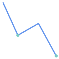
| 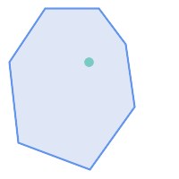
|
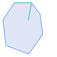
| 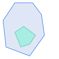
|
The ST_Contains predicate returns FALSE in the following situations:
| 
|
-- A circle within a circle
SELECT ST_Contains(smallc, bigc) As smallcontainsbig,
ST_Contains(bigc,smallc) As bigcontainssmall,
ST_Contains(bigc, ST_Union(smallc, bigc)) as bigcontainsunion,
ST_Equals(bigc, ST_Union(smallc, bigc)) as bigisunion,
ST_Covers(bigc, ST_ExteriorRing(bigc)) As bigcoversexterior,
ST_Contains(bigc, ST_ExteriorRing(bigc)) As bigcontainsexterior
FROM (SELECT ST_Buffer(ST_GeomFromText('POINT(1 2)'), 10) As smallc,
ST_Buffer(ST_GeomFromText('POINT(1 2)'), 20) As bigc) As foo;
-- Result
smallcontainsbig | bigcontainssmall | bigcontainsunion | bigisunion | bigcoversexterior | bigcontainsexterior
------------------+------------------+------------------+------------+-------------------+---------------------
f | t | t | t | t | f
-- Example demonstrating difference between contains and contains properly
SELECT ST_GeometryType(geomA) As geomtype, ST_Contains(geomA,geomA) AS acontainsa, ST_ContainsProperly(geomA, geomA) AS acontainspropa,
ST_Contains(geomA, ST_Boundary(geomA)) As acontainsba, ST_ContainsProperly(geomA, ST_Boundary(geomA)) As acontainspropba
FROM (VALUES ( ST_Buffer(ST_Point(1,1), 5,1) ),
( ST_MakeLine(ST_Point(1,1), ST_Point(-1,-1) ) ),
( ST_Point(1,1) )
) As foo(geomA);
geomtype | acontainsa | acontainspropa | acontainsba | acontainspropba
--------------+------------+----------------+-------------+-----------------
ST_Polygon | t | f | f | f
ST_LineString | t | f | f | f
ST_Point | t | t | f | f
Name
ST_ContainsProperly — Tests if B intersects the interior of A but not the boundary or exterior.
Synopsis
boolean ST_ContainsProperly(geometry geomA, geometry geomB);
Description
Returns true if B intersects the interior of A but not the boundary or exterior.
A does not properly contain itself, but does contain itself.
Every point of the other geometry is a point of this geometry's interior. The DE-9IM Intersection Matrix for the two geometries matches [T**FF*FF*] used in ST_Relate
An example use case for this predicate is computing the intersections of a set of geometries with a large polygonal geometry. Since intersection is a fairly slow operation, it can be more efficient to use containsProperly to filter out test geometries which lie wholly inside the area. In these cases the intersection is known a priori to be exactly the original test geometry.
| |
This function automatically includes a bounding box comparison
that makes use of any spatial indexes that are available on the geometries. To avoid index use, use the function |
| |
The advantage of this predicate over ST_Contains and ST_Intersects is that it can be computed more efficiently, with no need to compute topology at individual points. |
Performed by the GEOS module.
Availability: 1.4.0
| |
Enhanced: 3.0.0 enabled support for |
| |
Do not use this function with invalid geometries. You will get unexpected results. |
Examples
--a circle within a circle
SELECT ST_ContainsProperly(smallc, bigc) As smallcontainspropbig,
ST_ContainsProperly(bigc,smallc) As bigcontainspropsmall,
ST_ContainsProperly(bigc, ST_Union(smallc, bigc)) as bigcontainspropunion,
ST_Equals(bigc, ST_Union(smallc, bigc)) as bigisunion,
ST_Covers(bigc, ST_ExteriorRing(bigc)) As bigcoversexterior,
ST_ContainsProperly(bigc, ST_ExteriorRing(bigc)) As bigcontainsexterior
FROM (SELECT ST_Buffer(ST_GeomFromText('POINT(1 2)'), 10) As smallc,
ST_Buffer(ST_GeomFromText('POINT(1 2)'), 20) As bigc) As foo;
--Result
smallcontainspropbig | bigcontainspropsmall | bigcontainspropunion | bigisunion | bigcoversexterior | bigcontainsexterior
------------------+------------------+------------------+------------+-------------------+---------------------
f | t | f | t | t | f
--example demonstrating difference between contains and contains properly
SELECT ST_GeometryType(geomA) As geomtype, ST_Contains(geomA,geomA) AS acontainsa, ST_ContainsProperly(geomA, geomA) AS acontainspropa,
ST_Contains(geomA, ST_Boundary(geomA)) As acontainsba, ST_ContainsProperly(geomA, ST_Boundary(geomA)) As acontainspropba
FROM (VALUES ( ST_Buffer(ST_Point(1,1), 5,1) ),
( ST_MakeLine(ST_Point(1,1), ST_Point(-1,-1) ) ),
( ST_Point(1,1) )
) As foo(geomA);
geomtype | acontainsa | acontainspropa | acontainsba | acontainspropba
--------------+------------+----------------+-------------+-----------------
ST_Polygon | t | f | f | f
ST_LineString | t | f | f | f
ST_Point | t | t | f | f
See Also
ST_GeometryType, ST_Boundary, ST_Contains, ST_Covers, ST_CoveredBy, ST_Equals, ST_Relate, ST_Within
Name
ST_CoveredBy — Tests if no point in A is outside B
Synopsis
boolean ST_CoveredBy(geometry geomA, geometry geomB);
boolean ST_CoveredBy(geography geogA, geography geogB);
Description
Returns true if no point in Geometry/Geography A lies outside Geometry/Geography B. Equivalently, tests if every point of geometry A is inside (i.e. intersects the interior or boundary of) geometry B.
| |
This function automatically includes a bounding box comparison
that makes use of any spatial indexes that are available on the geometries. To avoid index use, use the function |
| |
Enhanced: 3.0.0 enabled support for |
| |
Do not use this function with invalid geometries. You will get unexpected results. |
Performed by the GEOS module
Availability: 1.2.2
NOTE: this is the "allowable" version that returns a boolean, not an integer.
Not an OGC standard, but Oracle has it too.
Examples
--a circle coveredby a circle
SELECT ST_CoveredBy(smallc,smallc) As smallinsmall,
ST_CoveredBy(smallc, bigc) As smallcoveredbybig,
ST_CoveredBy(ST_ExteriorRing(bigc), bigc) As exteriorcoveredbybig,
ST_Within(ST_ExteriorRing(bigc),bigc) As exeriorwithinbig
FROM (SELECT ST_Buffer(ST_GeomFromText('POINT(1 2)'), 10) As smallc,
ST_Buffer(ST_GeomFromText('POINT(1 2)'), 20) As bigc) As foo;
--Result
smallinsmall | smallcoveredbybig | exteriorcoveredbybig | exeriorwithinbig
--------------+-------------------+----------------------+------------------
t | t | t | f
(1 row) Name
ST_Covers — Tests if no point in B is outside A
Synopsis
boolean ST_Covers(geometry geomA, geometry geomB);
boolean ST_Covers(geography geogpolyA, geography geogpointB);
Description
Returns true if no point in Geometry/Geography B is outside Geometry/Geography A. Equivalently, tests if every point of geometry B is inside (i.e. intersects the interior or boundary of) geometry A.
| |
This function automatically includes a bounding box comparison
that makes use of any spatial indexes that are available on the geometries. To avoid index use, use the function |
| |
Enhanced: 3.0.0 enabled support for |
| |
Do not use this function with invalid geometries. You will get unexpected results. |
Performed by the GEOS module
Enhanced: 2.4.0 Support for polygon in polygon and line in polygon added for geography type
Enhanced: 2.3.0 Enhancement to PIP short-circuit for geometry extended to support MultiPoints with few points. Prior versions only supported point in polygon.
Availability: 1.5 - support for geography was introduced.
Availability: 1.2.2
NOTE: this is the "allowable" version that returns a boolean, not an integer.
Not an OGC standard, but Oracle has it too.
Examples
Geometry example
--a circle covering a circle
SELECT ST_Covers(smallc,smallc) As smallinsmall,
ST_Covers(smallc, bigc) As smallcoversbig,
ST_Covers(bigc, ST_ExteriorRing(bigc)) As bigcoversexterior,
ST_Contains(bigc, ST_ExteriorRing(bigc)) As bigcontainsexterior
FROM (SELECT ST_Buffer(ST_GeomFromText('POINT(1 2)'), 10) As smallc,
ST_Buffer(ST_GeomFromText('POINT(1 2)'), 20) As bigc) As foo;
--Result
smallinsmall | smallcoversbig | bigcoversexterior | bigcontainsexterior
--------------+----------------+-------------------+---------------------
t | f | t | f
(1 row) Geeography Example
-- a point with a 300 meter buffer compared to a point, a point and its 10 meter buffer
SELECT ST_Covers(geog_poly, geog_pt) As poly_covers_pt,
ST_Covers(ST_Buffer(geog_pt,10), geog_pt) As buff_10m_covers_cent
FROM (SELECT ST_Buffer(ST_GeogFromText('SRID=4326;POINT(-99.327 31.4821)'), 300) As geog_poly,
ST_GeogFromText('SRID=4326;POINT(-99.33 31.483)') As geog_pt ) As foo;
poly_covers_pt | buff_10m_covers_cent
----------------+------------------
f | t
Name
ST_Crosses — Tests if two geometries have some, but not all, interior points in common.
Synopsis
boolean ST_Crosses(geometry g1, geometry g2);
Description
Compares two geometry objects and returns true if their intersection "spatially cross", that is, the geometries have some, but not all interior points in common. The intersection of the interiors of the geometries must be non-empty and must have dimension less than the maximum dimension of the two input geometries. Additionally, the intersection of the two geometries must not equal either of the source geometries. Otherwise, it returns false.
In mathematical terms, this is:

Geometries cross if their DE-9IM Intersection Matrix matches:
T*T******for Point/Line, Point/Area, and Line/Area situationsT*****T**for Line/Point, Area/Point, and Area/Line situations0********for Line/Line situations
For Point/Point and Area/Area situations this predicate returns false.
The OpenGIS Simple Features Specification defines this predicate only for Point/Line, Point/Area, Line/Line, and Line/Area situations. JTS / GEOS extends the definition to apply to Line/Point, Area/Point and Area/Line situations as well. This makes the relation symmetric.
| |
This function automatically includes a bounding box comparison that makes use of any spatial indexes that are available on the geometries. |
| |
Enhanced: 3.0.0 enabled support for |
This method implements the OGC Simple Features
Implementation Specification for SQL 1.1. s2.1.13.3
This method implements the SQL/MM specification. SQL-MM 3: 5.1.29
Examples
The following situations all return true.
| 
|
| 
|
Consider a situation where a user has two tables: a table of roads and a table of highways.
CREATE TABLE roads ( id serial NOT NULL, geom geometry, CONSTRAINT roads_pkey PRIMARY KEY (road_id) );
|
CREATE TABLE highways ( id serial NOT NULL, the_gem geometry, CONSTRAINT roads_pkey PRIMARY KEY (road_id) );
|
To determine a list of roads that cross a highway, use a query similiar to:
SELECT roads.id FROM roads, highways WHERE ST_Crosses(roads.geom, highways.geom);
Name
ST_Disjoint — Tests if two geometries are disjoint (they have no point in common).
Synopsis
boolean ST_Disjoint( geometry A , geometry B );
Description
Overlaps, Touches, Within all imply geometries are not spatially disjoint. If any of the aforementioned returns true, then the geometries are not spatially disjoint. Disjoint implies false for spatial intersection.
| |
Enhanced: 3.0.0 enabled support for |
Performed by the GEOS module
| |
This function call does not use indexes |
| |
NOTE: this is the "allowable" version that returns a boolean, not an integer. |
This method implements the OGC Simple Features
Implementation Specification for SQL 1.1. s2.1.1.2 //s2.1.13.3 - a.Relate(b, 'FF*FF****')
This method implements the SQL/MM specification. SQL-MM 3: 5.1.26
Name
ST_Equals — Tests if two geometries include the same set of points.
Synopsis
boolean ST_Equals(geometry A, geometry B);
Description
Returns true if the given geometries are "spatially equal". Use this for a 'better' answer than '='. Note by spatially equal we mean ST_Within(A,B) = true and ST_Within(B,A) = true and also mean ordering of points can be different but represent the same geometry structure. To verify the order of points is consistent, use ST_OrderingEquals (it must be noted ST_OrderingEquals is a little more stringent than simply verifying order of points are the same).
| |
Enhanced: 3.0.0 enabled support for |
This method implements the OGC Simple Features
Implementation Specification for SQL 1.1. s2.1.1.2
This method implements the SQL/MM specification. SQL-MM 3: 5.1.24
Changed: 2.2.0 Returns true even for invalid geometries if they are binary equal
Examples
SELECT ST_Equals(ST_GeomFromText('LINESTRING(0 0, 10 10)'),
ST_GeomFromText('LINESTRING(0 0, 5 5, 10 10)'));
st_equals
-----------
t
(1 row)
SELECT ST_Equals(ST_Reverse(ST_GeomFromText('LINESTRING(0 0, 10 10)')),
ST_GeomFromText('LINESTRING(0 0, 5 5, 10 10)'));
st_equals
-----------
t
(1 row)
Name
ST_Intersects — Tests if two geometries intersect (they have at least one point in common).
Synopsis
boolean ST_Intersects( geometry geomA , geometry geomB );
boolean ST_Intersects( geography geogA , geography geogB );
Description
Compares two geometries and returns true if they intersect. Geometries intersect if they have any point in common.
For geography, a distance tolerance of 0.00001 meters is used (so points that are very close are considered to intersect).
Geometries intersect if their DE-9IM Intersection Matrix matches one of:
T*********T**********T*********T****
Spatial intersection is implied by all the other spatial relationship tests, except ST_Disjoint, which tests that geometries do NOT intersect.
| |
This function automatically includes a bounding box comparison that makes use of any spatial indexes that are available on the geometries. |
Changed: 3.0.0 SFCGAL version removed and native support for 2D TINS added.
Enhanced: 2.5.0 Supports GEOMETRYCOLLECTION.
Enhanced: 2.3.0 Enhancement to PIP short-circuit extended to support MultiPoints with few points. Prior versions only supported point in polygon.
Performed by the GEOS module (for geometry), geography is native
Availability: 1.5 support for geography was introduced.
| |
For geography, this function has a distance tolerance of about 0.00001 meters and uses the sphere rather than spheroid calculation. |
| |
NOTE: this is the "allowable" version that returns a boolean, not an integer. |
This method implements the OGC Simple Features
Implementation Specification for SQL 1.1. s2.1.1.2 //s2.1.13.3 - ST_Intersects(g1, g2 ) --> Not (ST_Disjoint(g1, g2 ))
This method implements the SQL/MM specification. SQL-MM 3: 5.1.27
This method supports Circular Strings and Curves
This function supports Triangles and Triangulated Irregular Network Surfaces (TIN).
Geometry Examples
SELECT ST_Intersects('POINT(0 0)'::geometry, 'LINESTRING ( 2 0, 0 2 )'::geometry);
st_intersects
---------------
f
(1 row)
SELECT ST_Intersects('POINT(0 0)'::geometry, 'LINESTRING ( 0 0, 0 2 )'::geometry);
st_intersects
---------------
t
(1 row)
-- Look up in table. Make sure table has a GiST index on geometry column for faster lookup.
SELECT id, name FROM cities WHERE ST_Intersects(geom, 'SRID=4326;POLYGON((28 53,27.707 52.293,27 52,26.293 52.293,26 53,26.293 53.707,27 54,27.707 53.707,28 53))');
id | name
----+-------
2 | Minsk
(1 row)
Name
ST_LineCrossingDirection — Returns a number indicating the crossing behavior of two LineStrings.
Synopsis
integer ST_LineCrossingDirection(geometry linestringA, geometry linestringB);
Description
Given two linestrings returns an integer between -3 and 3 indicating what kind of crossing behavior exists between them. 0 indicates no crossing. This is only supported for LINESTRINGs.
The crossing number has the following meaning:
0: LINE NO CROSS
-1: LINE CROSS LEFT
1: LINE CROSS RIGHT
-2: LINE MULTICROSS END LEFT
2: LINE MULTICROSS END RIGHT
-3: LINE MULTICROSS END SAME FIRST LEFT
3: LINE MULTICROSS END SAME FIRST RIGHT
Availability: 1.4
Examples
Example: LINE CROSS LEFT and LINE CROSS RIGHT
Blue: Line A; Green: Line B
SELECT ST_LineCrossingDirection(lineA, lineB) As A_cross_B,
ST_LineCrossingDirection(lineB, lineA) As B_cross_A
FROM (SELECT
ST_GeomFromText('LINESTRING(25 169,89 114,40 70,86 43)') As lineA,
ST_GeomFromText('LINESTRING (20 140, 71 74, 161 53)') As lineB
) As foo;
A_cross_B | B_cross_A
-----------+-----------
-1 | 1
Example: LINE MULTICROSS END SAME FIRST LEFT and LINE MULTICROSS END SAME FIRST RIGHT
Blue: Line A; Green: Line B
SELECT ST_LineCrossingDirection(lineA, lineB) As A_cross_B,
ST_LineCrossingDirection(lineB, lineA) As B_cross_A
FROM (SELECT
ST_GeomFromText('LINESTRING(25 169,89 114,40 70,86 43)') As lineA,
ST_GeomFromText('LINESTRING(171 154,20 140,71 74,161 53)') As lineB
) As foo;
A_cross_B | B_cross_A
-----------+-----------
3 | -3
Example: LINE MULTICROSS END LEFT and LINE MULTICROSS END RIGHT
Blue: Line A; Green: Line B
SELECT ST_LineCrossingDirection(lineA, lineB) As A_cross_B,
ST_LineCrossingDirection(lineB, lineA) As B_cross_A
FROM (SELECT
ST_GeomFromText('LINESTRING(25 169,89 114,40 70,86 43)') As lineA,
ST_GeomFromText('LINESTRING(5 90, 71 74, 20 140, 171 154)') As lineB
) As foo;
A_cross_B | B_cross_A
-----------+-----------
-2 | 2
Example: LINE MULTICROSS END LEFT and LINE MULTICROSS END RIGHT
Blue: Line A; Green: Line B
SELECT ST_LineCrossingDirection(lineA, lineB) As A_cross_B,
ST_LineCrossingDirection(lineB, lineA) As B_cross_A
FROM (SELECT
ST_GeomFromText('LINESTRING(25 169,89 114,40 70,86 43)') As lineA,
ST_GeomFromText('LINESTRING (171 154, 20 140, 71 74, 2.99 90.16)') As lineB
) As foo;
A_cross_B | B_cross_A
-----------+-----------
2 | -2
SELECT s1.gid, s2.gid, ST_LineCrossingDirection(s1.geom, s2.geom)
FROM streets s1 CROSS JOIN streets s2
ON (s1.gid != s2.gid AND s1.geom && s2.geom )
WHERE ST_LineCrossingDirection(s1.geom, s2.geom) > 0;
Name
ST_OrderingEquals — Tests if two geometries represent the same geometry and have points in the same directional order.
Synopsis
boolean ST_OrderingEquals(geometry A, geometry B);
Description
ST_OrderingEquals compares two geometries and returns t (TRUE) if the geometries are equal and the coordinates are in the same order; otherwise it returns f (FALSE).
| |
This function is implemented as per the ArcSDE SQL specification rather than SQL-MM. http://edndoc.esri.com/arcsde/9.1/sql_api/sqlapi3.htm#ST_OrderingEquals |
This method implements the SQL/MM specification. SQL-MM 3: 5.1.43
Examples
SELECT ST_OrderingEquals(ST_GeomFromText('LINESTRING(0 0, 10 10)'),
ST_GeomFromText('LINESTRING(0 0, 5 5, 10 10)'));
st_orderingequals
-----------
f
(1 row)
SELECT ST_OrderingEquals(ST_GeomFromText('LINESTRING(0 0, 10 10)'),
ST_GeomFromText('LINESTRING(0 0, 0 0, 10 10)'));
st_orderingequals
-----------
t
(1 row)
SELECT ST_OrderingEquals(ST_Reverse(ST_GeomFromText('LINESTRING(0 0, 10 10)')),
ST_GeomFromText('LINESTRING(0 0, 0 0, 10 10)'));
st_orderingequals
-----------
f
(1 row)
Name
ST_Overlaps — Tests if two geometries intersect and have the same dimension, but are not completely contained by each other.
Synopsis
boolean ST_Overlaps(geometry A, geometry B);
Description
Returns TRUE if geometry A and B "spatially overlap". Two geometries overlap if they have the same dimension, each has at least one point not shared by the other (or equivalently neither covers the other), and the intersection of their interiors has the same dimension. The overlaps relationship is symmetrical.
| |
This function automatically includes a bounding box comparison
that makes use of any spatial indexes that are available on the geometries. To avoid index use, use the function |
Performed by the GEOS module
| |
Enhanced: 3.0.0 enabled support for |
NOTE: this is the "allowable" version that returns a boolean, not an integer.
This method implements the OGC Simple Features
Implementation Specification for SQL 1.1. s2.1.1.2 // s2.1.13.3
This method implements the SQL/MM specification. SQL-MM 3: 5.1.32
Examples
ST_Overlaps returns TRUE in the following situations:
| 
| 
|
A Point on a LineString is contained, but since it has lower dimension it does not overlap or cross.
SELECT ST_Overlaps(a,b) AS overlaps, ST_Crosses(a,b) AS crosses,
ST_Intersects(a, b) AS intersects, ST_Contains(b,a) AS b_contains_a
FROM (SELECT ST_GeomFromText('POINT (100 100)') As a,
ST_GeomFromText('LINESTRING (30 50, 40 160, 160 40, 180 160)') AS b) AS t
overlaps | crosses | intersects | b_contains_a
---------+----------------------+--------------
f | f | t | t

A LineString that partly covers a Polygon intersects and crosses, but does not overlap since it has different dimension.
SELECT ST_Overlaps(a,b) AS overlaps, ST_Crosses(a,b) AS crosses,
ST_Intersects(a, b) AS intersects, ST_Contains(a,b) AS contains
FROM (SELECT ST_GeomFromText('POLYGON ((40 170, 90 30, 180 100, 40 170))') AS a,
ST_GeomFromText('LINESTRING(10 10, 190 190)') AS b) AS t;
overlap | crosses | intersects | contains
---------+---------+------------+--------------
f | t | t | f
Two Polygons that intersect but with neither contained by the other overlap, but do not cross because their intersection has the same dimension.
SELECT ST_Overlaps(a,b) AS overlaps, ST_Crosses(a,b) AS crosses,
ST_Intersects(a, b) AS intersects, ST_Contains(b, a) AS b_contains_a,
ST_Dimension(a) AS dim_a, ST_Dimension(b) AS dim_b,
ST_Dimension(ST_Intersection(a,b)) AS dim_int
FROM (SELECT ST_GeomFromText('POLYGON ((40 170, 90 30, 180 100, 40 170))') AS a,
ST_GeomFromText('POLYGON ((110 180, 20 60, 130 90, 110 180))') AS b) As t;
overlaps | crosses | intersects | b_contains_a | dim_a | dim_b | dim_int
----------+---------+------------+--------------+-------+-------+-----------
t | f | t | f | 2 | 2 | 2
Name
ST_Relate — Tests if two geometries have a topological relationship matching an Intersection Matrix pattern, or computes their Intersection Matrix
Synopsis
boolean ST_Relate(geometry geomA, geometry geomB, text intersectionMatrixPattern);
text ST_Relate(geometry geomA, geometry geomB);
text ST_Relate(geometry geomA, geometry geomB, integer boundaryNodeRule);
Description
These functions allow testing and evaluating the spatial (topological) relationship between two geometries, as defined by the Dimensionally Extended 9-Intersection Model (DE-9IM).
The DE-9IM is specified as a 9-element matrix indicating the dimension of the intersections between the Interior, Boundary and Exterior of two geometries. It is represented by a 9-character text string using the symbols 'F', '0', '1', '2' (e.g. 'FF1FF0102').
A specific kind of spatial relationships is evaluated by comparing the intersection matrix to an intersection matrix pattern. A pattern can include the additional symbols 'T' and '*'. Common spatial relationships are provided by the named functions ST_Contains, ST_ContainsProperly, ST_Covers, ST_CoveredBy, ST_Crosses, ST_Disjoint, ST_Equals, ST_Intersects, ST_Overlaps, ST_Touches, and ST_Within. Using an explicit pattern allows testing multiple conditions of intersects, crosses, etc in one step. It also allows testing spatial relationships which do not have a named spatial relationship function. For example, the relationship "Interior-Intersects" has the DE-9IM pattern T********, which is not evaluated by any named predicate.
For more information refer to Section 5.1, “Determining Spatial Relationships”.
Variant 1: Tests if two geometries are spatially related according to the given intersectionMatrixPattern.
| |
Unlike most of the named spatial relationship predicates, this does NOT automatically include an index call. The reason is that some relationships are true for geometries which do NOT intersect (e.g. Disjoint). If you are using a relationship pattern that requires intersection, then include the && index call. |
| |
It is better to use a named relationship function if available, since they automatically use a spatial index where one exists. Also, they may implement performance optimizations which are not available with full relate evalation. |
Variant 2: Returns the DE-9IM matrix string for the spatial relationship between the two input geometries. The matrix string can be tested for matching a DE-9IM pattern using ST_RelateMatch.
Variant 3: Like variant 2, but allows specifying a Boundary Node Rule. A boundary node rule allows finer control over whether geometry boundary points are considered to lie in the DE-9IM Interior or Boundary. The boundaryNodeRule code is: 1: OGC/MOD2, 2: Endpoint, 3: MultivalentEndpoint, 4: MonovalentEndpoint.
This function is not in the OGC spec, but is implied. see s2.1.13.2
This method implements the OGC Simple Features
Implementation Specification for SQL 1.1. s2.1.1.2 // s2.1.13.3
This method implements the SQL/MM specification. SQL-MM 3: 5.1.25
Performed by the GEOS module
Enhanced: 2.0.0 - added support for specifying boundary node rule.
| |
Enhanced: 3.0.0 enabled support for |
Examples
Using the boolean-valued function to test spatial relationships.
SELECT ST_Relate('POINT(1 2)', ST_Buffer( 'POINT(1 2)', 2), '0FFFFF212');
st_relate
-----------
t
SELECT ST_Relate(POINT(1 2)', ST_Buffer( 'POINT(1 2)', 2), '*FF*FF212');
st_relate
-----------
t
Testing a custom spatial relationship pattern as a query condition, with && to enable using a spatial index.
-- Find compounds that properly intersect (not just touch) a poly (Interior Intersects)
SELECT c.* , p.name As poly_name
FROM polys AS p
INNER JOIN compounds As c
ON c.geom && p.geom
AND ST_Relate(p.geom, c.geom,'T********');
Computing the intersection matrix for spatial relationships.
SELECT ST_Relate( 'POINT(1 2)',
ST_Buffer( 'POINT(1 2)', 2));
st_relate
-----------
0FFFFF212
SELECT ST_Relate( 'LINESTRING(1 2, 3 4)',
'LINESTRING(5 6, 7 8)' );
st_relate
-----------
FF1FF0102
Name
ST_RelateMatch — Tests if a DE-9IM Intersection Matrix matches an Intersection Matrix pattern
Synopsis
boolean ST_RelateMatch(text intersectionMatrix, text intersectionMatrixPattern);
Description
Tests if a Dimensionally Extended 9-Intersection Model (DE-9IM) intersectionMatrix value satisfies an intersectionMatrixPattern. Intersection matrix values can be computed by ST_Relate.
For more information refer to Section 5.1, “Determining Spatial Relationships”.
Performed by the GEOS module
Availability: 2.0.0
Examples
SELECT ST_RelateMatch('101202FFF', 'TTTTTTFFF') ;
-- result --
t
Patterns for common spatial relationships matched against intersection matrix values, for a line in various positions relative to a polygon
SELECT pat.name AS relationship, pat.val AS pattern,
mat.name AS position, mat.val AS matrix,
ST_RelateMatch(mat.val, pat.val) AS match
FROM (VALUES ( 'Equality', 'T1FF1FFF1' ),
( 'Overlaps', 'T*T***T**' ),
( 'Within', 'T*F**F***' ),
( 'Disjoint', 'FF*FF****' )) AS pat(name,val)
CROSS JOIN
(VALUES ('non-intersecting', 'FF1FF0212'),
('overlapping', '1010F0212'),
('inside', '1FF0FF212')) AS mat(name,val);
relationship | pattern | position | matrix | match
--------------+-----------+------------------+-----------+-------
Equality | T1FF1FFF1 | non-intersecting | FF1FF0212 | f
Equality | T1FF1FFF1 | overlapping | 1010F0212 | f
Equality | T1FF1FFF1 | inside | 1FF0FF212 | f
Overlaps | T*T***T** | non-intersecting | FF1FF0212 | f
Overlaps | T*T***T** | overlapping | 1010F0212 | t
Overlaps | T*T***T** | inside | 1FF0FF212 | f
Within | T*F**F*** | non-intersecting | FF1FF0212 | f
Within | T*F**F*** | overlapping | 1010F0212 | f
Within | T*F**F*** | inside | 1FF0FF212 | t
Disjoint | FF*FF**** | non-intersecting | FF1FF0212 | t
Disjoint | FF*FF**** | overlapping | 1010F0212 | f
Disjoint | FF*FF**** | inside | 1FF0FF212 | f
Name
ST_Touches — Tests if two geometries have at least one point in common, but their interiors do not intersect.
Synopsis
boolean ST_Touches(geometry A, geometry B);
Description
Returns TRUE if A and B intersect, but their interiors do not intersect. Equivalently, A and B have at least one point in common, and the common points lie in at least one boundary. For Point/Point inputs the relationship is always FALSE, since points do not have a boundary.
In mathematical terms, this relationship is:

This relationship holds if the DE-9IM Intersection Matrix for the two geometries matches one of:
FT*******
F**T*****
F***T****
| |
This function automatically includes a bounding box comparison
that makes use of any spatial indexes that are available on the geometries. To avoid using an index, use |
| |
Enhanced: 3.0.0 enabled support for |
This method implements the OGC Simple Features
Implementation Specification for SQL 1.1. s2.1.1.2 // s2.1.13.3
This method implements the SQL/MM specification. SQL-MM 3: 5.1.28
Examples
The ST_Touches predicate returns TRUE in the following examples.
| 
| 
|
| 
| 
|
SELECT ST_Touches('LINESTRING(0 0, 1 1, 0 2)'::geometry, 'POINT(1 1)'::geometry);
st_touches
------------
f
(1 row)
SELECT ST_Touches('LINESTRING(0 0, 1 1, 0 2)'::geometry, 'POINT(0 2)'::geometry);
st_touches
------------
t
(1 row)Name
ST_Within — Tests if no points of A lie in the exterior of B, and A and B have at least one interior point in common.
Synopsis
boolean ST_Within(geometry A, geometry B);
Description
Returns TRUE if geometry A is completely inside geometry B. For this function to make sense, the source geometries must both be of the same coordinate projection, having the same SRID. It is a given that if ST_Within(A,B) is true and ST_Within(B,A) is true, then the two geometries are considered spatially equal.
A subtlety of this definition is that the boundary of a geometry is not within the geometry. This means that lines and points lying in the boundary of a polygon or line are not within the geometry. For further details see Subtleties of OGC Covers, Contains, Within. (The ST_CoveredBy predicate provides a more inclusive relationship).
ST_Within is the inverse of ST_Contains. So, ST_Within(A,B) = ST_Contains(B,A).
| |
This function automatically includes a bounding box comparison
that makes use of any spatial indexes that are available on the geometries. To avoid index use, use the function |
Performed by the GEOS module
Enhanced: 2.3.0 Enhancement to PIP short-circuit for geometry extended to support MultiPoints with few points. Prior versions only supported point in polygon.
| |
Enhanced: 3.0.0 enabled support for |
| |
Do not use this function with invalid geometries. You will get unexpected results. |
NOTE: this is the "allowable" version that returns a boolean, not an integer.
This method implements the OGC Simple Features
Implementation Specification for SQL 1.1. s2.1.1.2 // s2.1.13.3 - a.Relate(b, 'T*F**F***')
This method implements the SQL/MM specification. SQL-MM 3: 5.1.30
Examples
--a circle within a circle
SELECT ST_Within(smallc,smallc) As smallinsmall,
ST_Within(smallc, bigc) As smallinbig,
ST_Within(bigc,smallc) As biginsmall,
ST_Within(ST_Union(smallc, bigc), bigc) as unioninbig,
ST_Within(bigc, ST_Union(smallc, bigc)) as biginunion,
ST_Equals(bigc, ST_Union(smallc, bigc)) as bigisunion
FROM
(
SELECT ST_Buffer(ST_GeomFromText('POINT(50 50)'), 20) As smallc,
ST_Buffer(ST_GeomFromText('POINT(50 50)'), 40) As bigc) As foo;
--Result
smallinsmall | smallinbig | biginsmall | unioninbig | biginunion | bigisunion
--------------+------------+------------+------------+------------+------------
t | t | f | t | t | t
(1 row)

- ST_3DDWithin — Tests if two 3D geometries are within a given 3D distance
- ST_3DDFullyWithin — Tests if two 3D geometries are entirely within a given 3D distance
- ST_DFullyWithin — Tests if two geometries are entirely within a given distance
- ST_DWithin — Tests if two geometries are within a given distance
- ST_PointInsideCircle — Tests if a point geometry is inside a circle defined by a center and radius.
Name
ST_3DDWithin — Tests if two 3D geometries are within a given 3D distance
Synopsis
boolean ST_3DDWithin(geometry g1, geometry g2, double precision distance_of_srid);
Description
Returns true if the 3D distance between two geometry values is no larger than distance distance_of_srid. The distance is specified in units defined by the spatial reference system of the geometries. For this function to make sense the source geometries must be in the same coordinate system (have the same SRID).
| |
This function automatically includes a bounding box comparison that makes use of any spatial indexes that are available on the geometries. |
This function supports 3d and will not drop the z-index.
This function supports Polyhedral surfaces.
This method implements the SQL/MM specification. SQL-MM ?
Availability: 2.0.0
Examples
-- Geometry example - units in meters (SRID: 2163 US National Atlas Equal area) (3D point and line compared 2D point and line)
-- Note: currently no vertical datum support so Z is not transformed and assumed to be same units as final.
SELECT ST_3DDWithin(
ST_Transform(ST_GeomFromEWKT('SRID=4326;POINT(-72.1235 42.3521 4)'),2163),
ST_Transform(ST_GeomFromEWKT('SRID=4326;LINESTRING(-72.1260 42.45 15, -72.123 42.1546 20)'),2163),
126.8
) As within_dist_3d,
ST_DWithin(
ST_Transform(ST_GeomFromEWKT('SRID=4326;POINT(-72.1235 42.3521 4)'),2163),
ST_Transform(ST_GeomFromEWKT('SRID=4326;LINESTRING(-72.1260 42.45 15, -72.123 42.1546 20)'),2163),
126.8
) As within_dist_2d;
within_dist_3d | within_dist_2d
----------------+----------------
f | t
Name
ST_3DDFullyWithin — Tests if two 3D geometries are entirely within a given 3D distance
Synopsis
boolean ST_3DDFullyWithin(geometry g1, geometry g2, double precision distance);
Description
Returns true if the 3D geometries are fully within the specified distance of one another. The distance is specified in units defined by the spatial reference system of the geometries. For this function to make sense, the source geometries must both be of the same coordinate projection, having the same SRID.
| |
This function automatically includes a bounding box comparison that makes use of any spatial indexes that are available on the geometries. |
Availability: 2.0.0
This function supports 3d and will not drop the z-index.
This function supports Polyhedral surfaces.
Examples
-- This compares the difference between fully within and distance within as well
-- as the distance fully within for the 2D footprint of the line/point vs. the 3d fully within
SELECT ST_3DDFullyWithin(geom_a, geom_b, 10) as D3DFullyWithin10, ST_3DDWithin(geom_a, geom_b, 10) as D3DWithin10,
ST_DFullyWithin(geom_a, geom_b, 20) as D2DFullyWithin20,
ST_3DDFullyWithin(geom_a, geom_b, 20) as D3DFullyWithin20 from
(select ST_GeomFromEWKT('POINT(1 1 2)') as geom_a,
ST_GeomFromEWKT('LINESTRING(1 5 2, 2 7 20, 1 9 100, 14 12 3)') as geom_b) t1;
d3dfullywithin10 | d3dwithin10 | d2dfullywithin20 | d3dfullywithin20
------------------+-------------+------------------+------------------
f | t | t | f Name
ST_DFullyWithin — Tests if two geometries are entirely within a given distance
Synopsis
boolean ST_DFullyWithin(geometry g1, geometry g2, double precision distance);
Description
Returns true if the geometries are entirely within the specified distance of one another. The distance is specified in units defined by the spatial reference system of the geometries. For this function to make sense, the source geometries must both be of the same coordinate projection, having the same SRID.
| |
This function automatically includes a bounding box comparison that makes use of any spatial indexes that are available on the geometries. |
Availability: 1.5.0
Examples
postgis=# SELECT ST_DFullyWithin(geom_a, geom_b, 10) as DFullyWithin10, ST_DWithin(geom_a, geom_b, 10) as DWithin10, ST_DFullyWithin(geom_a, geom_b, 20) as DFullyWithin20 from
(select ST_GeomFromText('POINT(1 1)') as geom_a,ST_GeomFromText('LINESTRING(1 5, 2 7, 1 9, 14 12)') as geom_b) t1;
-----------------
DFullyWithin10 | DWithin10 | DFullyWithin20 |
---------------+----------+---------------+
f | t | t | Name
ST_DWithin — Tests if two geometries are within a given distance
Synopsis
boolean ST_DWithin(geometry g1, geometry g2, double precision distance_of_srid);
boolean ST_DWithin(geography gg1, geography gg2, double precision distance_meters, boolean use_spheroid = true);
Description
Returns true if the geometries are within a given distance
For geometry: The distance is specified in units defined by the spatial reference system of the geometries. For this function to make sense, the source geometries must be in the same coordinate system (have the same SRID).
For geography: units are in meters and distance measurement defaults to use_spheroid=true. For faster evaluation use use_spheroid=false to measure on the sphere.
| |
Use ST_3DDWithin for 3D geometries. |
| |
This function call includes a bounding box comparison that makes use of any indexes that are available on the geometries. |
This method implements the OGC Simple Features
Implementation Specification for SQL 1.1.
Availability: 1.5.0 support for geography was introduced
Enhanced: 2.1.0 improved speed for geography. See Making Geography faster for details.
Enhanced: 2.1.0 support for curved geometries was introduced.
Prior to 1.3, ST_Expand was commonly used in conjunction with && and ST_Distance to test for distance, and in pre-1.3.4 this function used that logic. From 1.3.4, ST_DWithin uses a faster short-circuit distance function.
Examples
-- Find the nearest hospital to each school
-- that is within 3000 units of the school.
-- We do an ST_DWithin search to utilize indexes to limit our search list
-- that the non-indexable ST_Distance needs to process
-- If the units of the spatial reference is meters then units would be meters
SELECT DISTINCT ON (s.gid) s.gid, s.school_name, s.geom, h.hospital_name
FROM schools s
LEFT JOIN hospitals h ON ST_DWithin(s.geom, h.geom, 3000)
ORDER BY s.gid, ST_Distance(s.geom, h.geom);
-- The schools with no close hospitals
-- Find all schools with no hospital within 3000 units
-- away from the school. Units is in units of spatial ref (e.g. meters, feet, degrees)
SELECT s.gid, s.school_name
FROM schools s
LEFT JOIN hospitals h ON ST_DWithin(s.geom, h.geom, 3000)
WHERE h.gid IS NULL;
-- Find broadcasting towers that receiver with limited range can receive.
-- Data is geometry in Spherical Mercator (SRID=3857), ranges are approximate.
-- Create geometry index that will check proximity limit of user to tower
CREATE INDEX ON broadcasting_towers using gist (geom);
-- Create geometry index that will check proximity limit of tower to user
CREATE INDEX ON broadcasting_towers using gist (ST_Expand(geom, sending_range));
-- Query towers that 4-kilometer receiver in Minsk Hackerspace can get
-- Note: two conditions, because shorter LEAST(b.sending_range, 4000) will not use index.
SELECT b.tower_id, b.geom
FROM broadcasting_towers b
WHERE ST_DWithin(b.geom, 'SRID=3857;POINT(3072163.4 7159374.1)', 4000)
AND ST_DWithin(b.geom, 'SRID=3857;POINT(3072163.4 7159374.1)', b.sending_range);
Name
ST_PointInsideCircle — Tests if a point geometry is inside a circle defined by a center and radius.
Synopsis
boolean ST_PointInsideCircle(geometry a_point, float center_x, float center_y, float radius);
Description
Returns true if the geometry is a point and is inside the circle with center center_x,center_y and radius radius.
| |
Does not use spatial indexes. Use ST_DWithin instead. |
Availability: 1.2
Changed: 2.2.0 In prior versions this was called ST_Point_Inside_Circle
- ST_Area — 도형의 기하학적 중심을 반환합니다.
- ST_Azimuth — 두 도형 사이의 2차원 최단 라인을 반환합니다.
- ST_Angle — 두 도형 사이의 3차원 최장(longest) 라인을 반환합니다.
- ST_ClosestPoint — Returns the 2D point on g1 that is closest to g2. This is the first point of the shortest line from one geometry to the other.
- ST_3DClosestPoint — g2에 가장 가까운 g1 상에 있는 3차원 포인트를 반환합니다. 해당 포인트는 3D 최단 라인의 첫 번째 포인트입니다.
- ST_Distance — 두 도형 사이의 3차원 최장(longest) 라인을 반환합니다.
- ST_3DDistance — 도형 유형에 대해, 두 도형 사이의 (SRS에 기반한) 3차원 데카르트 최단 거리를 투영 단위로 반환합니다.
- ST_DistanceSphere — 특정 회전타원체가 주어진 두 경위도 도형 사이의 최단 거리를 반환합니다. PostGIS 1.5 미만 버전은 포인트만 지원했습니다.
- ST_DistanceSpheroid — 특정 회전타원체가 주어진 두 경위도 도형 사이의 최단 거리를 반환합니다. PostGIS 1.5 미만 버전은 포인트만 지원했습니다.
- ST_FrechetDistance — 두 도형 사이의 3차원 최단(shortest) 라인을 반환합니다.
- ST_HausdorffDistance — 두 도형 사이의 3차원 최단(shortest) 라인을 반환합니다.
- ST_Length — 도형의 기하학적 중심을 반환합니다.
- ST_Length2D — 도형이 라인스트링 또는 멀티라인스트링일 경우 도형의 2차원 길이를 반환합니다. 이 함수는
ST_Length와 동일합니다. - ST_3DLength — 도형의 기하학적 중심을 반환합니다.
- ST_LengthSpheroid — 도형의 기하학적 중심을 반환합니다.
- ST_LongestLine — 두 도형 사이의 3차원 최장(longest) 라인을 반환합니다.
- ST_3DLongestLine — 두 도형 사이의 3차원 최장(longest) 라인을 반환합니다.
- ST_MaxDistance — 두 도형 사이의 2차원 최장 거리를 투영 단위로 반환합니다.
- ST_3DMaxDistance — 도형 유형에 대해, 두 도형 사이의 (SRS에 기반한) 3차원 데카르트 최장 거리를 투영 단위로 반환합니다.
- ST_MinimumClearance — 도형의 튼튼함(robustness)의 척도인 도형의 최소 여유(clearance)를 반환합니다.
- ST_MinimumClearanceLine — 포인트 2개로 이루어진, 도형의 최소 여유를 나타내는 라인스트링을 반환합니다.
- ST_Perimeter — Returns the length of the boundary of a polygonal geometry or geography.
- ST_Perimeter2D — Returns the 2D perimeter of a polygonal geometry. Alias for
ST_Perimeter. - ST_3DPerimeter — 도형의 기하학적 중심을 반환합니다.
- ST_Project — 시작점으로부터 미터 단위 거리 및 라디안 단위 방향(방위각)을 이용해 투영된
POINT를 반환합니다. - ST_ShortestLine — 두 도형 사이의 2차원 최단 라인을 반환합니다.
- ST_3DShortestLine — 두 도형 사이의 3차원 최단(shortest) 라인을 반환합니다.
Name
ST_Area — 도형의 기하학적 중심을 반환합니다.
Synopsis
float ST_Area(geometry g1);
float ST_Area(geography geog, boolean use_spheroid=true);
설명
도형이 폴리곤이나 멀티폴리곤일 경우 표면의 면적을 - ST_Surface 또는 ST_MultiSurface 함수의 면적 측정값을 - 반환합니다. 도형 유형의 경우, SRID가 지정한 단위로 2차원 데카르트 면적을 구합니다. 지리형 유형의 경우, 평방미터 단위로 곡면(curved surface)의 면적을 구합니다. 구체의 면적에 대해 덜 정확하지만 더 빠르게 측정하려면, ST_Area(geog,false) 함수를 이용하십시오.
개선 사항: 2.0.0 버전부터 2차원 다면체 표면(polyhedral surface)을 지원합니다.
개선 사항: 2.2.0 버전부터 회전타원체 측정시 정확도와 강력함을 향상시키기 위해 GeographicLib을 이용합니다. 이 새 기능의 장점을 취하려면 Proj 4.9.0 이상 버전이 필요합니다.
Changed: 3.0.0 - does not depend on SFCGAL anymore.
This method implements the OGC Simple Features
Implementation Specification for SQL 1.1.
This method implements the SQL/MM specification. SQL-MM 3: 8.1.2, 9.5.3
This function supports Polyhedral surfaces.
| |
다면체 표면의 경우, (2.5차원이 아니라) 2차원 다면체 표면만 지원합니다. 2.5차원일 경우 0이 아닌(non-zero) 답을 내놓을 수도 있지만, XY 평면상에 완벽하게 놓이는 면들의 면적만 반환하는 것입니다. |
예시
매사추세츠 토지의 부지(plot)에 대해 평방피트 단위로 면적을 반환하고, 이에 환산값을 곱해서 평방미터 면적을 구합니다. EPSG:2249가 매사추세츠 주 피트 단위 평면이기 때문에 평방피트 단위의 값을 반환한다는 점에 주의하십시오.
select ST_Area(geom) sqft,
ST_Area(geom) * 0.3048 ^ 2 sqm
from (
select 'SRID=2249;POLYGON((743238 2967416,743238 2967450,
743265 2967450,743265.625 2967416,743238 2967416))' :: geometry geom
) subquery;
┌─────────┬─────────────┐
│ sqft │ sqm │
├─────────┼─────────────┤
│ 928.625 │ 86.27208552 │
└─────────┴─────────────┘
평방피트 면적을 반환하며, 평방미터 값을 구하려면 매사추세츠 주 미터 단위 평면((EPSG:26986))으로 변환해야 합니다. EPSG:2249가 매사추세츠 주 피트 단위 평면이기 때문에 평방피트 단위의 값을 반환하고 EPSG:26986이 매사추세츠 주 미터 단위 평면이기 때문에 변환된 면적이 평방미터 단위가 된다는 점에 주의하십시오.
select ST_Area(geom) sqft,
ST_Area(ST_Transform(geom, 26986)) As sqm
from (
select
'SRID=2249;POLYGON((743238 2967416,743238 2967450,
743265 2967450,743265.625 2967416,743238 2967416))' :: geometry geom
) subquery;
┌─────────┬─────────────────┐
│ sqft │ sqm │
├─────────┼─────────────────┤
│ 928.625 │ 86.272430607008 │
└─────────┴─────────────────┘
지리형 데이터 유형을 이용해서 평방피트 및 평방미터 면적을 반환합니다. 도형을 지리형으로 변환시킨다는 점에 주의하십시오(변환하기 전에 사용자 도형의 투영체가 WGS84 4326 경위도 좌표계인지 확인해야 합니다). 지리형은 항상 미터 단위로 측정됩니다. 이 예시는 그저 비교해보기 위한 보여주기에 불과합니다. 일반적으로 이미 사용자 테이블에 지리형 데이터 유형으로 저장되어 있을 겁니다.
select ST_Area(geog) / 0.3048 ^ 2 sqft_spheroid,
ST_Area(geog, false) / 0.3048 ^ 2 sqft_sphere,
ST_Area(geog) sqm_spheroid
from (
select ST_Transform(
'SRID=2249;POLYGON((743238 2967416,743238 2967450,743265 2967450,743265.625 2967416,743238 2967416))'::geometry,
4326
) :: geography geog
) as subquery;
┌──────────────────┬──────────────────┬──────────────────┐
│ sqft_spheroid │ sqft_sphere │ sqm_spheroid │
├──────────────────┼──────────────────┼──────────────────┤
│ 928.684405784452 │ 927.049336105925 │ 86.2776044979692 │
└──────────────────┴──────────────────┴──────────────────┘
If your data is in geography already:
select ST_Area(geog) / 0.3048 ^ 2 sqft,
ST_Area(the_geog) sqm
from somegeogtable;Name
ST_Azimuth — 두 도형 사이의 2차원 최단 라인을 반환합니다.
Synopsis
float ST_Azimuth(geometry origin, geometry target);
float ST_Azimuth(geography origin, geography target);
설명
Returns the azimuth in radians of the target point from the origin point, or NULL if the two points are coincident. The azimuth angle is a positive clockwise angle referenced from the positive Y axis (geometry) or the North meridian (geography): North = 0; Northeast = π/4; East = π/2; Southeast = 3π/4; South = π; Southwest 5π/4; West = 3π/2; Northwest = 7π/4.
For the geography type, the azimuth solution is known as the inverse geodesic problem.
The azimuth is a mathematical concept defined as the angle between a reference vector and a point, with angular units in radians. The result value in radians can be converted to degrees using the PostgreSQL function degrees().
객체를 해당 객체의 수직축을 따라 이동시키기 위해 ST_Translate 함수와 방위각을 함께 이용할 때 방위각이 특히 유용합니다. 이런 내용의 예시를 보려면 Plpgsqlfunctions PostGIS wiki section 의 upgis_lineshift 단원을 살펴보십시오.
1.1.0 버전부터 사용할 수 있습니다.
개선 사항: 2.0.0 버전부터 지리형을 지원합니다.
개선 사항: 2.2.0 버전부터 회전타원체 측정시 정확도와 강력함을 향상시키기 위해 GeographicLib을 이용합니다. 이 새 기능의 장점을 취하려면 Proj 4.9.0 이상 버전이 필요합니다.
예시
도 단위의 도형 방위각
SELECT degrees(ST_Azimuth( ST_Point(25, 45), ST_Point(75, 100))) AS degA_B,
degrees(ST_Azimuth( ST_Point(75, 100), ST_Point(25, 45) )) AS degB_A;
dega_b | degb_a
------------------+------------------
42.2736890060937 | 222.273689006094
 Blue: origin Point(25,45); Green: target Point(75, 100); Yellow: Y axis or North; Red: azimuth angle.
|  Blue: origin Point(75, 100); Green: target Point(25, 45); Yellow: Y axis or North; Red: azimuth angle.
|
Name
ST_Angle — 두 도형 사이의 3차원 최장(longest) 라인을 반환합니다.
Synopsis
float ST_Angle(geometry point1, geometry point2, geometry point3, geometry point4);
float ST_Angle(geometry line1, geometry line2);
설명
두 도형 사이의 3차원 최장(longest) 라인을 반환합니다.
Variant 1: computes the angle enclosed by the points P1-P2-P3. If a 4th point provided computes the angle points P1-P2 and P3-P4
Variant 2: computes the angle between two vectors S1-E1 and S2-E2, defined by the start and end points of the input lines
방위각은 참조 평면과 포인트 사이의 라디안 단위의 각도로 정의되는 수학적 개념입니다. PostgreSQL 내장 함수인 degrees()를 써서 라디안 단위를 도 단위로 변환할 수 있습니다. 예시 코드를 확인해보십시오.
Note that ST_Angle(P1,P2,P3) = ST_Angle(P2,P1,P2,P3).
Availability: 2.5.0
예시
폴리곤과 폴리곤 사이의 최장 라인
SELECT degrees( ST_Angle('POINT(0 0)', 'POINT(10 10)', 'POINT(20 0)') );
degrees
---------
270
Angle between vectors defined by four points
SELECT degrees( ST_Angle('POINT (10 10)', 'POINT (0 0)', 'POINT(90 90)', 'POINT (100 80)') );
degrees
-------------------
269.9999999999999
Angle between vectors defined by the start and end points of lines
SELECT degrees( ST_Angle('LINESTRING(0 0, 0.3 0.7, 1 1)', 'LINESTRING(0 0, 0.2 0.5, 1 0)') );
degrees
--------------
45
Name
ST_ClosestPoint — Returns the 2D point on g1 that is closest to g2. This is the first point of the shortest line from one geometry to the other.
Synopsis
geometry ST_ClosestPoint(geometry geom1, geometry geom2);
설명
Returns the 2-dimensional point on geom1 that is closest to geom2. This is the first point of the shortest line between the geometries (as computed by ST_ShortestLine).
| |
3차원 도형의 경우엔 ST_3DClosestPoint 함수를 이용하는 편이 좋습니다. |
1.5.0 버전부터 사용할 수 있습니다.
예시
The closest point for a Point and a LineString is the point itself. The closest point for a LineString and a Point is a point on the line.
SELECT ST_AsText( ST_ClosestPoint(pt,line)) AS cp_pt_line,
ST_AsText( ST_ClosestPoint(line,pt)) AS cp_line_pt
FROM (SELECT 'POINT (160 40)'::geometry AS pt,
'LINESTRING (10 30, 50 50, 30 110, 70 90, 180 140, 130 190)'::geometry AS line ) AS t;
cp_pt_line | cp_line_pt
----------------+------------------------------------------
POINT(160 40) | POINT(125.75342465753425 115.34246575342466)
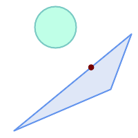
The closest point on polygon A to polygon B
SELECT ST_AsText( ST_ClosestPoint(
'POLYGON ((190 150, 20 10, 160 70, 190 150))',
ST_Buffer('POINT(80 160)', 30) )) As ptwkt;
------------------------------------------
POINT(131.59149149528952 101.89887534906197)
Name
ST_3DClosestPoint — g2에 가장 가까운 g1 상에 있는 3차원 포인트를 반환합니다. 해당 포인트는 3D 최단 라인의 첫 번째 포인트입니다.
Synopsis
geometry ST_3DClosestPoint(geometry g1, geometry g2);
설명
g2에 가장 가까운 g1 상에 있는 3차원 포인트를 반환합니다. 해당 포인트는 3D 최단 라인의 첫 번째 포인트입니다. 3D 최단 라인의 3D 길이가 3D 거리입니다.
This function supports 3d and will not drop the z-index.
This function supports Polyhedral surfaces.
2.0.0 버전부터 사용할 수 있습니다.
변경 사항: 2.2.0 버전부터 2D 도형 두 개를 입력할 경우, (존재하지 않는 Z을 0으로 가정하는 예전 습성 대신) 2D 포인트를 반환합니다. 2D 및 3D의 경우, 더 이상 Z가 없을 때 Z를 0으로 가정하지 않습니다.
예시
라인스트링과 포인트 -- 3D, 2D 모두의 최근접점(closest point) SELECT ST_AsEWKT(ST_3DClosestPoint(line,pt)) AS cp3d_line_pt,
ST_AsEWKT(ST_ClosestPoint(line,pt)) As cp2d_line_pt
FROM (SELECT 'POINT(100 100 30)'::geometry As pt,
'LINESTRING (20 80 20, 98 190 1, 110 180 3, 50 75 1000)'::geometry As line
) As foo;
cp3d_line_pt | cp2d_line_pt
-----------------------------------------------------------+------------------------------------------
POINT(54.6993798867619 128.935022917228 11.5475869506606) | POINT(73.0769230769231 115.384615384615)
|
라인스트링과 멀티포인트 -- 3D, 2D 모두의 최근접점(closest point) SELECT ST_AsEWKT(ST_3DClosestPoint(line,pt)) AS cp3d_line_pt,
ST_AsEWKT(ST_ClosestPoint(line,pt)) As cp2d_line_pt
FROM (SELECT 'MULTIPOINT(100 100 30, 50 74 1000)'::geometry As pt,
'LINESTRING (20 80 20, 98 190 1, 110 180 3, 50 75 900)'::geometry As line
) As foo;
cp3d_line_pt | cp2d_line_pt
-----------------------------------------------------------+--------------
POINT(54.6993798867619 128.935022917228 11.5475869506606) | POINT(50 75)
|
멀티라인스트링과 폴리곤 -- 3D, 2D 모두의 최근접점(closest point) SELECT ST_AsEWKT(ST_3DClosestPoint(poly, mline)) As cp3d,
ST_AsEWKT(ST_ClosestPoint(poly, mline)) As cp2d
FROM (SELECT ST_GeomFromEWKT('POLYGON((175 150 5, 20 40 5, 35 45 5, 50 60 5, 100 100 5, 175 150 5))') As poly,
ST_GeomFromEWKT('MULTILINESTRING((175 155 2, 20 40 20, 50 60 -2, 125 100 1, 175 155 1),
(1 10 2, 5 20 1))') As mline ) As foo;
cp3d | cp2d
-------------------------------------------+--------------
POINT(39.993580415989 54.1889925532825 5) | POINT(20 40)
|
Name
ST_Distance — 두 도형 사이의 3차원 최장(longest) 라인을 반환합니다.
Synopsis
float ST_HausdorffDistance(geometry g1, geometry g2);
float ST_HausdorffDistance(geometry g1, geometry g2, float densifyFrac);
설명
도형 유형에 대해, 두 도형 사이의 3차원 데카르트 최단 거리를 두 도형의 투영 단위(SRS 단위)로 반환합니다.
For geography types defaults to return the minimum geodesic distance between two geographies in meters, compute on the spheroid determined by the SRID. If use_spheroid is false, a faster spherical calculation is used.
This method implements the OGC Simple Features
Implementation Specification for SQL 1.1.
This method implements the SQL/MM specification. SQL-MM 3: 5.1.23
This method supports Circular Strings and Curves
1.5.0 버전부터 지리형을 지원합니다. 대용량 또는 수많은 꼭짓점을 가진 도형을 더 잘 처리하기 위해 평면에 대한 속도를 향상시켰습니다.
개선 사항: 2.1.0 버전부터 지리형에 대한 속도가 향상됐습니다. 자세한 내용은 Making Geography faster 를 참조하십시오.
개선 사항: 2.1.0 버전부터 만곡 도형을 지원하기 시작했습니다.
개선 사항: 2.2.0 버전부터 회전타원체 측정시 정확도와 강력함을 향상시키기 위해 GeographicLib을 이용합니다. 이 새 기능의 장점을 취하려면 Proj 4.9.0 이상 버전이 필요합니다.
Changed: 3.0.0 - does not depend on SFCGAL anymore.
도형 예시
Geometry example - units in planar degrees 4326 is WGS 84 long lat, units are degrees.
SELECT ST_Distance(
'SRID=4326;POINT(-72.1235 42.3521)'::geometry,
'SRID=4326;LINESTRING(-72.1260 42.45, -72.123 42.1546)'::geometry );
-----------------
0.00150567726382282Geometry example - units in meters (SRID: 3857, proportional to pixels on popular web maps). Although the value is off, nearby ones can be compared correctly, which makes it a good choice for algorithms like KNN or KMeans.
SELECT ST_Distance(
ST_Transform('SRID=4326;POINT(-72.1235 42.3521)'::geometry, 3857),
ST_Transform('SRID=4326;LINESTRING(-72.1260 42.45, -72.123 42.1546)'::geometry, 3857) );
-----------------
167.441410065196Geometry example - units in meters (SRID: 3857 as above, but corrected by cos(lat) to account for distortion)
SELECT ST_Distance(
ST_Transform('SRID=4326;POINT(-72.1235 42.3521)'::geometry, 3857),
ST_Transform('SRID=4326;LINESTRING(-72.1260 42.45, -72.123 42.1546)'::geometry, 3857)
) * cosd(42.3521);
-----------------
123.742351254151Geometry example - units in meters (SRID: 26986 Massachusetts state plane meters) (most accurate for Massachusetts)
SELECT ST_Distance(
ST_Transform('SRID=4326;POINT(-72.1235 42.3521)'::geometry, 26986),
ST_Transform('SRID=4326;LINESTRING(-72.1260 42.45, -72.123 42.1546)'::geometry, 26986) );
-----------------
123.797937878454Geometry example - units in meters (SRID: 2163 US National Atlas Equal area) (least accurate)
SELECT ST_Distance(
ST_Transform('SRID=4326;POINT(-72.1235 42.3521)'::geometry, 2163),
ST_Transform('SRID=4326;LINESTRING(-72.1260 42.45, -72.123 42.1546)'::geometry, 2163) );
------------------
126.664256056812지리형 예시
Same as geometry example but note units in meters - use sphere for slightly faster and less accurate computation.
SELECT ST_Distance(gg1, gg2) As spheroid_dist, ST_Distance(gg1, gg2, false) As sphere_dist
FROM (SELECT
'SRID=4326;POINT(-72.1235 42.3521)'::geography as gg1,
'SRID=4326;LINESTRING(-72.1260 42.45, -72.123 42.1546)'::geography as gg2
) As foo ;
spheroid_dist | sphere_dist
------------------+------------------
123.802076746848 | 123.475736916397Name
ST_3DDistance — 도형 유형에 대해, 두 도형 사이의 (SRS에 기반한) 3차원 데카르트 최단 거리를 투영 단위로 반환합니다.
Synopsis
float ST_3DDistance(geometry g1, geometry g2);
설명
도형 유형에 대해, 두 도형 사이의 3차원 데카르트 최단 거리를 두 도형의 투영 단위(SRS 단위)로 반환합니다.
This function supports 3d and will not drop the z-index.
This function supports Polyhedral surfaces.
This method implements the SQL/MM specification. SQL-MM ISO/IEC 13249-3
2.0.0 버전부터 사용할 수 있습니다.
변경 사항: 2.2.0 버전부터, 2D 및 3D의 경우 더 이상 Z가 없을 때 Z를 0으로 가정하지 않습니다.
Changed: 3.0.0 - SFCGAL version removed
예시
-- 도형 예시 - 미터 단위 (SRID 2163 미국 등적 전도) (2D 포인트 및 라인과 비교한 3D 포인트 및 라인)
-- 주의: 현재 수직 데이터를 지원하지 않으므로 Z를 변환하지 않고 최종 결과물과 동일한 단위로 가정합니다.
SELECT ST_3DDistance(
ST_Transform(ST_GeomFromEWKT('SRID=4326;POINT(-72.1235 42.3521 4)'),2163),
ST_Transform(ST_GeomFromEWKT('SRID=4326;LINESTRING(-72.1260 42.45 15, -72.123 42.1546 20)'),2163)
) As dist_3d,
ST_Distance(
ST_Transform(ST_GeomFromText('POINT(-72.1235 42.3521)',4326),2163),
ST_Transform(ST_GeomFromText('LINESTRING(-72.1260 42.45, -72.123 42.1546)', 4326),2163)
) As dist_2d;
dist_3d | dist_2d
------------------+-----------------
127.295059324629 | 126.66425605671
-- 멀티라인스트링과 폴리곤 모두의 3D 및 2D 거리
-- 3D 최근접점(closest point) 예시와 동일
SELECT ST_3DDistance(poly, mline) As dist3d,
ST_Distance(poly, mline) As dist2d
FROM (SELECT ST_GeomFromEWKT('POLYGON((175 150 5, 20 40 5, 35 45 5, 50 60 5, 100 100 5, 175 150 5))') As poly,
ST_GeomFromEWKT('MULTILINESTRING((175 155 2, 20 40 20, 50 60 -2, 125 100 1, 175 155 1),
(1 10 2, 5 20 1))') As mline ) As foo;
dist3d | dist2d
-------------------+--------
0.716635696066337 | 0
Name
ST_DistanceSphere — 특정 회전타원체가 주어진 두 경위도 도형 사이의 최단 거리를 반환합니다. PostGIS 1.5 미만 버전은 포인트만 지원했습니다.
Synopsis
float ST_DistanceSphere(geometry geomlonlatA, geometry geomlonlatB, float8 radius=6371008);
설명
경위도 포인트 2개 사이의 최단 거리를 미터 단위로 반환합니다. SRID가 정의하는 회전타원체에서 추출한 반경을 가진 지구 구체를 이용합니다. ST_DistanceSpheroid 보다는 처리 속도가 빠르지만, 정확도는 떨어집니다. PostGIS 1.5 미만 버전에서는 포인트에 대해서만 구현돼 있었습니다.
1.5 버전부터 포인트가 아닌 다른 도형 유형을 지원하기 시작했습니다. 1.5 미만 버전에서는 포인트에 대해서만 구현돼 있었습니다.
변경 사항: 2.2.0 미만 버전에서는 ST_Distance_Sphere라는 명칭이었습니다.
예시
SELECT round(CAST(ST_DistanceSphere(ST_Centroid(the_geom), ST_GeomFromText('POINT(-118 38)',4326)) As numeric),2) As dist_meters,
round(CAST(ST_Distance(ST_Transform(ST_Centroid(the_geom),32611),
ST_Transform(ST_GeomFromText('POINT(-118 38)', 4326),32611)) As numeric),2) As dist_utm11_meters,
round(CAST(ST_Distance(ST_Centroid(the_geom), ST_GeomFromText('POINT(-118 38)', 4326)) As numeric),5) As dist_degrees,
round(CAST(ST_Distance(ST_Transform(the_geom,32611),
ST_Transform(ST_GeomFromText('POINT(-118 38)', 4326),32611)) As numeric),2) As min_dist_line_point_meters
FROM
(SELECT ST_GeomFromText('LINESTRING(-118.584 38.374,-118.583 38.5)', 4326) As the_geom) as foo;
dist_meters | dist_utm11_meters | dist_degrees | min_dist_line_point_meters
-------------+-------------------+--------------+----------------------------
70424.47 | 70438.00 | 0.72900 | 65871.18
Name
ST_DistanceSpheroid — 특정 회전타원체가 주어진 두 경위도 도형 사이의 최단 거리를 반환합니다. PostGIS 1.5 미만 버전은 포인트만 지원했습니다.
Synopsis
float ST_DistanceSpheroid(geometry geomlonlatA, geometry geomlonlatB, spheroid measurement_spheroid=WGS84);
설명
특정 회전타원체가 주어진 두 경위도 도형 사이의 최단 거리를 반환합니다. 주어진 회전타원체에 대한 설명은 ST_LengthSpheroid 를 참조하십시오. PostGIS 1.5 미만 버전은 포인트만 지원했습니다.
| |
현재 이 함수는 도형의 SRID를 찾아보지 않고 주어진 회전타원체의 좌표로 쓰여 있다고 가정할 것입니다. 이 함수의 이전 버전은 포인트만 지원했습니다. |
1.5 버전부터 포인트가 아닌 다른 도형 유형을 지원하기 시작했습니다. 1.5 미만 버전에서는 포인트에 대해서만 구현돼 있었습니다.
변경 사항: 2.2.0 미만 버전에서는 ST_Distance_Spheroid라는 명칭이었습니다.
예시
SELECT round(CAST(
ST_DistanceSpheroid(ST_Centroid(the_geom), ST_GeomFromText('POINT(-118 38)',4326), 'SPHEROID["WGS 84",6378137,298.257223563]')
As numeric),2) As dist_meters_spheroid,
round(CAST(ST_DistanceSphere(ST_Centroid(the_geom), ST_GeomFromText('POINT(-118 38)',4326)) As numeric),2) As dist_meters_sphere,
round(CAST(ST_Distance(ST_Transform(ST_Centroid(the_geom),32611),
ST_Transform(ST_GeomFromText('POINT(-118 38)', 4326),32611)) As numeric),2) As dist_utm11_meters
FROM
(SELECT ST_GeomFromText('LINESTRING(-118.584 38.374,-118.583 38.5)', 4326) As the_geom) as foo;
dist_meters_spheroid | dist_meters_sphere | dist_utm11_meters
----------------------+--------------------+-------------------
70454.92 | 70424.47 | 70438.00
Name
ST_FrechetDistance — 두 도형 사이의 3차원 최단(shortest) 라인을 반환합니다.
Synopsis
float ST_FrechetDistance(geometry g1, geometry g2, float densifyFrac = -1);
설명
Implements algorithm for computing the Fréchet distance restricted to discrete points for both geometries, based on Computing Discrete Fréchet Distance. The Fréchet distance is a measure of similarity between curves that takes into account the location and ordering of the points along the curves. Therefore it is often better than the Hausdorff distance.
When the optional densifyFrac is specified, this function performs a segment densification before computing the discrete Fréchet distance. The densifyFrac parameter sets the fraction by which to densify each segment. Each segment will be split into a number of equal-length subsegments, whose fraction of the total length is closest to the given fraction.
Units are in the units of the spatial reference system of the geometries.
| |
현재 구현된 함수는 불연속 위치로 꼭짓점만 지원합니다. 이를 임의 밀도의 포인트들을 사용할 수 있도록 확장할 수 있습니다. |
| |
The smaller densifyFrac we specify, the more acurate Fréchet distance we get. But, the computation time and the memory usage increase with the square of the number of subsegments. |
GEOS 모듈로 실행
Availability: 2.4.0 - requires GEOS >= 3.7.0
예시
postgres=# SELECT st_frechetdistance('LINESTRING (0 0, 100 0)'::geometry, 'LINESTRING (0 0, 50 50, 100 0)'::geometry);
st_frechetdistance
--------------------
70.7106781186548
(1 row)
SELECT st_frechetdistance('LINESTRING (0 0, 100 0)'::geometry, 'LINESTRING (0 0, 50 50, 100 0)'::geometry, 0.5);
st_frechetdistance
--------------------
50
(1 row)
Name
ST_HausdorffDistance — 두 도형 사이의 3차원 최단(shortest) 라인을 반환합니다.
Synopsis
float ST_HausdorffDistance(geometry g1, geometry g2);
float ST_HausdorffDistance(geometry g1, geometry g2, float densifyFrac);
설명
Returns the Hausdorff distance between two geometries. The Hausdorff distance is a measure of how similar or dissimilar 2 geometries are.
The function actually computes the "Discrete Hausdorff Distance". This is the Hausdorff distance computed at discrete points on the geometries. The densifyFrac parameter can be specified, to provide a more accurate answer by densifying segments before computing the discrete Hausdorff distance. Each segment is split into a number of equal-length subsegments whose fraction of the segment length is closest to the given fraction.
Units are in the units of the spatial reference system of the geometries.
| |
This algorithm is NOT equivalent to the standard Hausdorff distance. However, it computes an approximation that is correct for a large subset of useful cases. One important case is Linestrings that are roughly parallel to each other, and roughly equal in length. This is a useful metric for line matching. |
1.5.0 버전부터 사용할 수 있습니다.
예시
Hausdorff distance (red) and distance (yellow) between two lines
SELECT ST_HausdorffDistance(geomA, geomB),
ST_Distance(geomA, geomB)
FROM (SELECT 'LINESTRING (20 70, 70 60, 110 70, 170 70)'::geometry AS geomA,
'LINESTRING (20 90, 130 90, 60 100, 190 100)'::geometry AS geomB) AS t;
st_hausdorffdistance | st_distance
----------------------+-------------
37.26206567625497 | 20
Example: Hausdorff distance with densification.
SELECT ST_HausdorffDistance(
'LINESTRING (130 0, 0 0, 0 150)'::geometry,
'LINESTRING (10 10, 10 150, 130 10)'::geometry,
0.5);
----------------------
70
Example: For each building, find the parcel that best represents it. First we require that the parcel intersect with the building geometry. DISTINCT ON guarantees we get each building listed only once. ORDER BY .. ST_HausdorffDistance selects the parcel that is most similar to the building.
SELECT DISTINCT ON (buildings.gid) buildings.gid, parcels.parcel_id
FROM buildings
INNER JOIN parcels
ON ST_Intersects(buildings.geom, parcels.geom)
ORDER BY buildings.gid, ST_HausdorffDistance(buildings.geom, parcels.geom);
Name
ST_Length — 도형의 기하학적 중심을 반환합니다.
Synopsis
float ST_Length(geometry a_2dlinestring);
float ST_Length(geography geog, boolean use_spheroid=true);
설명
도형의 경우: 도형이 라인스트링, 멀티라인스트링, ST_Curve, ST_MultiCurve일 경우 도형의 2차원 데카르트 길이를 반환합니다. 면 도형의 경우 0을 반환합니다. 면 도형에 대해서는 ST_Perimeter 를 이용하십시오. 도형 유형의 경우, 도형의 공간 참조 시스템이 해당 길이의 측정 단위를 설정합니다.
지리형의 경우: 측지 역 문제(geodesic inverse problem)를 이용해서 계산을 수행합니다. 이때 길이 단위는 미터입니다. PostGIS를 PROJ 4.8.0 이상 버전과 함께 컴파일한 경우, SRID가 회정타원체를 정의합니다. SRID가 없는 경우 오직 WGS84로 설정됩니다. use_spheroid=false 일 경우, 회전타원체 대신 구체 상에서 근사치를 계산할 것입니다.
도형의 경우 이 함수는 현재 ST_Length2D와 동일하지만, 향후 더 높은 차원을 지원하기 위해 변경될 수도 있습니다.
| |
변경 사항: 2.0.0 버전에서 중요한 변경이 이루어졌습니다. 2.0.0 이전 버전에서 이 함수에 폴리곤/멀티폴리곤 유형의 지리형을 입력하면 폴리곤/멀티폴리곤의 둘레를 반환했을 겁니다. 2.0.0 버전부터 도형 습성과 맞추기 위해 0을 반환하도록 변경됐습니다. 폴리곤의 둘레를 원한다면 ST_Perimeter 함수를 이용하십시오. |
| |
지리형 측정시 기본값은 회전타원체 상의 측정입니다. 더 빠르지만 덜 정확한 구체를 이용하려면 ST_Length(gg,false); 를 쓰십시오. |
This method implements the OGC Simple Features
Implementation Specification for SQL 1.1. s2.1.5.1
This method implements the SQL/MM specification. SQL-MM 3: 7.1.2, 9.3.4
1.5.0 버전부터 지리형을 지원합니다.
This method is also provided by SFCGAL backend.
도형 예시
라인스트링의 길이를 피트 단위로 반환합니다. 투영체 EPSG:2249가 매사추세츠 주 피트 단위 평면이기 때문에 피트 단위라는 사실을 주의하십시오.
SELECT ST_Length(ST_GeomFromText('LINESTRING(743238 2967416,743238 2967450,743265 2967450,
743265.625 2967416,743238 2967416)',2249));
st_length
---------
122.630744000095
-- WGS84 라인스트링을 매사추세츠 주 피트 단위 평면으로 변환
SELECT ST_Length(
ST_Transform(
ST_GeomFromEWKT('SRID=4326;LINESTRING(-72.1260 42.45, -72.1240 42.45666, -72.123 42.1546)'),
26986
)
);
st_length
---------
34309.4563576191
지리형 예시
WGS84 지리형 라인의 길이를 반환합니다.
-- 계산시 회전타원체보다는 구체를 이용합니다.
SELECT ST_Length(the_geog) As length_spheroid, ST_Length(the_geog,false) As length_sphere
FROM (SELECT ST_GeographyFromText(
'SRID=4326;LINESTRING(-72.1260 42.45, -72.1240 42.45666, -72.123 42.1546)') As the_geog)
As foo;
length_spheroid | length_sphere
------------------+------------------
34310.5703627288 | 34346.2060960742
Name
ST_Length2D — 도형이 라인스트링 또는 멀티라인스트링일 경우 도형의 2차원 길이를 반환합니다. 이 함수는 ST_Length 와 동일합니다.
Synopsis
float ST_Length2D(geometry a_2dlinestring);
Name
ST_3DLength — 도형의 기하학적 중심을 반환합니다.
Synopsis
float ST_3DLength(geometry a_3dlinestring);
설명
도형이 라인스트링 또는 멀티라인스트링일 경우 도형의 3차원 또는 2차원 길이를 반환합니다. 2차원 라인의 경우 2차원 길이만 반환할 것입니다(ST_Length 및 ST_Length2D와 동일합니다).
This function supports 3d and will not drop the z-index.
This method implements the SQL/MM specification. SQL-MM IEC 13249-3: 7.1, 10.3
변경 사항: 2.0.0 미만 버전에서는 ST_Length3D라는 명칭이었습니다.
Name
ST_LengthSpheroid — 도형의 기하학적 중심을 반환합니다.
Synopsis
float ST_LengthSpheroid(geometry a_geometry, spheroid a_spheroid);
설명
타원체 상에 있는 도형의 길이/둘레를 계산합니다. 이 함수는 도형의 좌표가 경도/위도이며 재투영하지 않고 길이를 얻고 싶을 때 유용합니다. 이 타원체는 개별적인 데이터베이스 유형으로 다음과 같이 작성할 수 있습니다:
SPHEROID[<NAME>,<SEMI-MAJOR AXIS>,<INVERSE FLATTENING>]
도형 예시
SPHEROID["GRS_1980",6378137,298.257222101]
1.2.2 버전부터 사용할 수 있습니다.
변경 사항: 2.2.0 미만 버전에서는 ST_Length_Spheroid라는 명칭이었으며, ST_3DLength_Spheroid라는 동일 함수가 있었습니다.
This function supports 3d and will not drop the z-index.
예시
SELECT ST_LengthSpheroid( geometry_column,
'SPHEROID["GRS_1980",6378137,298.257222101]' )
FROM geometry_table;
SELECT ST_LengthSpheroid( the_geom, sph_m ) As tot_len,
ST_LengthSpheroid(ST_GeometryN(the_geom,1), sph_m) As len_line1,
ST_LengthSpheroid(ST_GeometryN(the_geom,2), sph_m) As len_line2
FROM (SELECT ST_GeomFromText('MULTILINESTRING((-118.584 38.374,-118.583 38.5),
(-71.05957 42.3589 , -71.061 43))') As the_geom,
CAST('SPHEROID["GRS_1980",6378137,298.257222101]' As spheroid) As sph_m) as foo;
tot_len | len_line1 | len_line2
------------------+------------------+------------------
85204.5207562955 | 13986.8725229309 | 71217.6482333646
-- 3D
SELECT ST_LengthSpheroid( the_geom, sph_m ) As tot_len,
ST_LengthSpheroid(ST_GeometryN(the_geom,1), sph_m) As len_line1,
ST_LengthSpheroid(ST_GeometryN(the_geom,2), sph_m) As len_line2
FROM (SELECT ST_GeomFromEWKT('MULTILINESTRING((-118.584 38.374 20,-118.583 38.5 30),
(-71.05957 42.3589 75, -71.061 43 90))') As the_geom,
CAST('SPHEROID["GRS_1980",6378137,298.257222101]' As spheroid) As sph_m) as foo;
tot_len | len_line1 | len_line2
------------------+-----------------+------------------
85204.5259107402 | 13986.876097711 | 71217.6498130292
Name
ST_LongestLine — 두 도형 사이의 3차원 최장(longest) 라인을 반환합니다.
Synopsis
geometry ST_LongestLine(geometry g1, geometry g2);
설명
Returns the 2-dimensional longest line between the points of two geometries. The line returned starts on g1 and ends on g2.
The longest line always occurs between two vertices. The function returns the first longest line if more than one is found. The length of the line is equal to the distance returned by ST_MaxDistance.
If g1 and g2 are the same geometry, returns the line between the two vertices farthest apart in the geometry. This is a diameter of the circle computed by ST_MinimumBoundingCircle
1.5.0 버전부터 사용할 수 있습니다.
예시
포인트와 라인 사이의 최장 라인
SELECT ST_AsText( ST_LongestLine(
'POINT (160 40)',
'LINESTRING (10 30, 50 50, 30 110, 70 90, 180 140, 130 190)' )
) AS lline;
-----------------
LINESTRING(160 40,130 190)
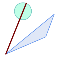
폴리곤과 폴리곤 사이의 최장 라인
SELECT ST_AsText( ST_LongestLine(
'POLYGON ((190 150, 20 10, 160 70, 190 150))',
ST_Buffer('POINT(80 160)', 30)
) ) AS llinewkt;
-----------------
LINESTRING(20 10,105.3073372946034 186.95518130045156)

Longest line across a single geometry. The length of the line is equal to the Maximum Distance. The line is a diameter of the Minimum Bounding Circle.
SELECT ST_AsText( ST_LongestLine( geom, geom)) AS llinewkt,
ST_MaxDistance( geom, geom) AS max_dist,
ST_Length( ST_LongestLine(geom, geom)) AS lenll
FROM (SELECT 'POLYGON ((40 180, 110 160, 180 180, 180 120, 140 90, 160 40, 80 10, 70 40, 20 50, 40 180),
(60 140, 99 77.5, 90 140, 60 140))'::geometry AS geom) AS t;
llinewkt | max_dist | lenll
---------------------------+--------------------+--------------------
LINESTRING(20 50,180 180) | 206.15528128088303 | 206.15528128088303
Name
ST_3DLongestLine — 두 도형 사이의 3차원 최장(longest) 라인을 반환합니다.
Synopsis
geometry ST_3DLongestLine(geometry g1, geometry g2);
설명
두 도형 사이의 3차원 최장(longest) 라인을 반환합니다. 하나 이상의 최장 라인이 있을 경우, 이 함수는 첫 번째 최장 라인만 반환할 것입니다. 반환되는 라인은 항상 g1에서 시작해서 g2에서 끝납니다. 이 함수가 반환하는 라인의 3차원 길이는 ST_3DMaxDistance 함수가 g1과 g2에 대해 반환하는 길이와 언제나 동일합니다.
2.0.0 버전부터 사용할 수 있습니다.
변경 사항: 2.2.0 버전부터 2D 도형 두 개를 입력할 경우, (존재하지 않는 Z을 0으로 가정하는 예전 습성 대신) 2D 포인트를 반환합니다. 2D 및 3D의 경우, 더 이상 Z가 없을 때 Z를 0으로 가정하지 않습니다.
This function supports 3d and will not drop the z-index.
This function supports Polyhedral surfaces.
예시
라인스트링과 포인트 -- 3D, 2D 모두의 최장 라인 SELECT ST_AsEWKT(ST_3DLongestLine(line,pt)) AS lol3d_line_pt,
ST_AsEWKT(ST_LongestLine(line,pt)) As lol2d_line_pt
FROM (SELECT 'POINT(100 100 30)'::geometry As pt,
'LINESTRING (20 80 20, 98 190 1, 110 180 3, 50 75 1000)'::geometry As line
) As foo;
lol3d_line_pt | lol2d_line_pt
-----------------------------------+----------------------------
LINESTRING(50 75 1000,100 100 30) | LINESTRING(98 190,100 100)
|
라인스트링과 멀티포인트 -- 3D, 2D 모두의 최장 라인 SELECT ST_AsEWKT(ST_3DLongestLine(line,pt)) AS lol3d_line_pt,
ST_AsEWKT(ST_LongestLine(line,pt)) As lol2d_line_pt
FROM (SELECT 'MULTIPOINT(100 100 30, 50 74 1000)'::geometry As pt,
'LINESTRING (20 80 20, 98 190 1, 110 180 3, 50 75 900)'::geometry As line
) As foo;
lol3d_line_pt | lol2d_line_pt
---------------------------------+--------------------------
LINESTRING(98 190 1,50 74 1000) | LINESTRING(98 190,50 74)
|
멀티라인스트링과 폴리곤 -- 3D, 2D 모두의 최장 라인 SELECT ST_AsEWKT(ST_3DLongestLine(poly, mline)) As lol3d,
ST_AsEWKT(ST_LongestLine(poly, mline)) As lol2d
FROM (SELECT ST_GeomFromEWKT('POLYGON((175 150 5, 20 40 5, 35 45 5, 50 60 5, 100 100 5, 175 150 5))') As poly,
ST_GeomFromEWKT('MULTILINESTRING((175 155 2, 20 40 20, 50 60 -2, 125 100 1, 175 155 1),
(1 10 2, 5 20 1))') As mline ) As foo;
lol3d | lol2d
------------------------------+--------------------------
LINESTRING(175 150 5,1 10 2) | LINESTRING(175 150,1 10)
|
Name
ST_MaxDistance — 두 도형 사이의 2차원 최장 거리를 투영 단위로 반환합니다.
Synopsis
float ST_MaxDistance(geometry g1, geometry g2);
설명
두 도형 사이의 2차원 최장 거리를 투영 단위로 반환합니다. g1과 g2가 동일한 도형일 경우 이 함수는 해당 도형 내에서 서로 가장 멀리 있는 두 꼭짓점 사이의 거리를 반환합니다.
두 도형 사이의 2차원 최장 거리를 투영 단위로 반환합니다. g1과 g2가 동일한 도형일 경우 이 함수는 해당 도형 내에서 서로 가장 멀리 있는 두 꼭짓점 사이의 거리를 반환합니다.
1.5.0 버전부터 사용할 수 있습니다.
예시
포인트와 라인 사이의 최장 라인
SELECT ST_MaxDistance('POINT(0 0)'::geometry, 'LINESTRING ( 2 0, 0 2 )'::geometry);
-----------------
2
SELECT ST_MaxDistance('POINT(0 0)'::geometry, 'LINESTRING ( 2 2, 2 2 )'::geometry);
------------------
2.82842712474619
Maximum distance between vertices of a single geometry.
SELECT ST_MaxDistance('POLYGON ((10 10, 10 0, 0 0, 10 10))'::geometry,
'POLYGON ((10 10, 10 0, 0 0, 10 10))'::geometry);
------------------
14.142135623730951
Name
ST_3DMaxDistance — 도형 유형에 대해, 두 도형 사이의 (SRS에 기반한) 3차원 데카르트 최장 거리를 투영 단위로 반환합니다.
Synopsis
float ST_3DMaxDistance(geometry g1, geometry g2);
설명
도형 유형에 대해, 두 도형 사이의 3차원 데카르트 최대 거리를 두 도형의 투영 단위(SRS 단위)로 반환합니다.
This function supports 3d and will not drop the z-index.
This function supports Polyhedral surfaces.
2.0.0 버전부터 사용할 수 있습니다.
변경 사항: 2.2.0 버전부터, 2D 및 3D의 경우 더 이상 Z가 없을 때 Z를 0으로 가정하지 않습니다.
예시
-- 도형 예시 - 미터 단위 (SRID 2163 미국 등적 전도) (2D 포인트 및 라인과 비교한 3D 포인트 및 라인)
-- 주의: 현재 수직 데이터를 지원하지 않으므로 Z를 변환하지 않고 최종 결과물과 동일한 단위로 가정합니다.
SELECT ST_3DMaxDistance(
ST_Transform(ST_GeomFromEWKT('SRID=4326;POINT(-72.1235 42.3521 10000)'),2163),
ST_Transform(ST_GeomFromEWKT('SRID=4326;LINESTRING(-72.1260 42.45 15, -72.123 42.1546 20)'),2163)
) As dist_3d,
ST_MaxDistance(
ST_Transform(ST_GeomFromEWKT('SRID=4326;POINT(-72.1235 42.3521 10000)'),2163),
ST_Transform(ST_GeomFromEWKT('SRID=4326;LINESTRING(-72.1260 42.45 15, -72.123 42.1546 20)'),2163)
) As dist_2d;
dist_3d | dist_2d
------------------+------------------
24383.7467488441 | 22247.8472107251
Name
ST_MinimumClearance — 도형의 튼튼함(robustness)의 척도인 도형의 최소 여유(clearance)를 반환합니다.
Synopsis
float ST_MinimumClearance(geometry g);
설명
(폴리곤일 경우) ST_IsValid 또는 (라인일 경우) ST_IsSimple 함수에 따라 유효성에 대한 기준을 만족시키지만, 텍스트 기반 형식(WKT, KML, GML GeoJSON 등) 또는 이중 정밀도 부동소수점 좌표를 이용하지 않는 바이너리 형식(MapInfo TAB 등)으로 변환하는 과정에서 일어날 수 있는 것처럼, 꼭짓점 가운데 하나가 살짝 이동하면 유효하지 않아지는 도형이 그렇게 희귀한 것은 아닙니다.
The minimum clearance is a quantitative measure of a geometry's robustness to change in coordinate precision. It is the largest distance by which vertices of the geometry can be moved without creating an invalid geometry. Larger values of minimum clearance indicate greater robustness.
도형이 e 라는 최소 여유를 가지고 있을 경우, 다음과 같이 말할 수 있습니다:
도형 내부의 어떤 서로 다른 꼭짓점 2개도
e보다 더 떨어져 있지 않습니다.종단점이 아닌 한 어떤 꼭짓점도 라인 선분에
e보다 가까이 있을 수는 없습니다.
도형에 대해 최소 여유가 존재하지 않을 경우 (예를 들어 단일 포인트 또는 포인트들이 서로 동일한 멀티포인트인 경우) ST_MinimumClearance 함수는 무한을 반환할 것입니다.
To avoid validity issues caused by precision loss, ST_ReducePrecision can reduce coordinate precision while ensuring that polygonal geometry remains valid.
2.3.0 버전부터 사용할 수 있습니다.
Name
ST_MinimumClearanceLine — 포인트 2개로 이루어진, 도형의 최소 여유를 나타내는 라인스트링을 반환합니다.
Synopsis
Geometry ST_MinimumClearanceLine(geometry g);
설명
Returns the two-point LineString spanning a geometry's minimum clearance. If the geometry does not have a minimum clearance, LINESTRING EMPTY is returned.
GEOS 모듈로 실행
2.3.0 버전부터 사용할 수 있습니다. GEOS 3.6.0 이상 버전이 필요합니다.
Name
ST_Perimeter — Returns the length of the boundary of a polygonal geometry or geography.
Synopsis
float ST_Perimeter(geometry g1);
float ST_Perimeter(geography geog, boolean use_spheroid=true);
설명
도형/지리형이 ST_Surface, ST_MultiSurface(폴리곤, 멀티폴리곤)일 경우 도형/지리형의 2차원 둘레를 반환합니다. 면이 없는 도형의 경우 0을 반환합니다. 선형 도형의 경우 ST_Length 를 이용하십시오. 도형 유형의 경우, 도형의 공간 참조 시스템이 해당 둘레의 측정 단위를 설정합니다.
지리형의 경우: 측지 역 문제(geodesic inverse problem)를 이용해서 계산을 수행합니다. 이때 둘레 단위는 미터입니다. PostGIS를 PROJ 4.8.0 이상 버전과 함께 컴파일한 경우, SRID가 회정타원체를 정의합니다. SRID가 없는 경우 오직 WGS84로 설정됩니다. use_spheroid=false 일 경우, 회전타원체 대신 구체 상에서 근사치를 계산할 것입니다.
이 함수는 현재 ST_Perimeter2D와 동일하지만, 향후 더 높은 차원을 지원하기 위해 변경될 수도 있습니다.
This method implements the OGC Simple Features
Implementation Specification for SQL 1.1. s2.1.5.1
This method implements the SQL/MM specification. SQL-MM 3: 8.1.3, 9.5.4
개선 사항: 2.0.0 버전부터 지리형을 지원합니다.
예시: 도형
폴리곤 및 멀티폴리곤의 둘레를 피트 단위로 반환합니다. 투영체 EPSG:2249가 매사추세츠 주 피트 단위 평면이기 때문에 피트 단위라는 사실을 주의하십시오.
SELECT ST_Perimeter(ST_GeomFromText('POLYGON((743238 2967416,743238 2967450,743265 2967450,
743265.625 2967416,743238 2967416))', 2249));
st_perimeter
---------
122.630744000095
(1 row)
SELECT ST_Perimeter(ST_GeomFromText('MULTIPOLYGON(((763104.471273676 2949418.44119003,
763104.477769673 2949418.42538203,
763104.189609677 2949418.22343004,763104.471273676 2949418.44119003)),
((763104.471273676 2949418.44119003,763095.804579742 2949436.33850239,
763086.132105649 2949451.46730207,763078.452329651 2949462.11549407,
763075.354136904 2949466.17407812,763064.362142565 2949477.64291974,
763059.953961626 2949481.28983009,762994.637609571 2949532.04103014,
762990.568508415 2949535.06640477,762986.710889563 2949539.61421415,
763117.237897679 2949709.50493431,763235.236617789 2949617.95619822,
763287.718121842 2949562.20592617,763111.553321674 2949423.91664605,
763104.471273676 2949418.44119003)))', 2249));
st_perimeter
---------
845.227713366825
(1 row)
예시: 지리형
폴리곤 및 멀티폴리곤의 둘레를 미터 단위로 반환합니다. 지리형이기 때문에 투영체가 WGS84 경위도라는 점에 주의하십시오.
SELECT ST_Perimeter(geog) As per_meters, ST_Perimeter(geog)/0.3048 As per_ft
FROM ST_GeogFromText('POLYGON((-71.1776848522251 42.3902896512902,-71.1776843766326 42.3903829478009,
-71.1775844305465 42.3903826677917,-71.1775825927231 42.3902893647987,-71.1776848522251 42.3902896512902))') As geog;
per_meters | per_ft
-----------------+------------------
37.3790462565251 | 122.634666195949
-- 멀티폴리곤 예시 --
SELECT ST_Perimeter(geog) As per_meters, ST_Perimeter(geog,false) As per_sphere_meters, ST_Perimeter(geog)/0.3048 As per_ft
FROM ST_GeogFromText('MULTIPOLYGON(((-71.1044543107478 42.340674480411,-71.1044542869917 42.3406744369506,
-71.1044553562977 42.340673886454,-71.1044543107478 42.340674480411)),
((-71.1044543107478 42.340674480411,-71.1044860600303 42.3407237015564,-71.1045215770124 42.3407653385914,
-71.1045498002983 42.3407946553165,-71.1045611902745 42.3408058316308,-71.1046016507427 42.340837442371,
-71.104617893173 42.3408475056957,-71.1048586153981 42.3409875993595,-71.1048736143677 42.3409959528211,
-71.1048878050242 42.3410084812078,-71.1044020965803 42.3414730072048,
-71.1039672113619 42.3412202916693,-71.1037740497748 42.3410666421308,
-71.1044280218456 42.3406894151355,-71.1044543107478 42.340674480411)))') As geog;
per_meters | per_sphere_meters | per_ft
------------------+-------------------+------------------
257.634283683311 | 257.412311446337 | 845.256836231335
Name
ST_Perimeter2D — Returns the 2D perimeter of a polygonal geometry. Alias for ST_Perimeter.
Synopsis
float ST_Perimeter2D(geometry geomA);
Name
ST_3DPerimeter — 도형의 기하학적 중심을 반환합니다.
Synopsis
float ST_3DPerimeter(geometry geomA);
설명
도형이 폴리곤 또는 멀티폴리곤일 경우 도형의 3차원 둘레를 반환합니다. 2차원 도형의 경우 2차원 둘레를 반환할 것입니다.
This function supports 3d and will not drop the z-index.
This method implements the SQL/MM specification. SQL-MM ISO/IEC 13249-3: 8.1, 10.5
변경 사항: 2.0.0 미만 버전에서는 ST_Perimeter3D라는 명칭이었습니다.
예시
매사추세츠 주 피트 단위 평면에서 공중에 살짝 떠 있는 폴리곤의 둘레
SELECT ST_3DPerimeter(the_geom), ST_Perimeter2d(the_geom), ST_Perimeter(the_geom) FROM
(SELECT ST_GeomFromEWKT('SRID=2249;POLYGON((743238 2967416 2,743238 2967450 1,
743265.625 2967416 1,743238 2967416 2))') As the_geom) As foo;
ST_3DPerimeter | st_perimeter2d | st_perimeter
------------------+------------------+------------------
105.465793597674 | 105.432997272188 | 105.432997272188
Name
ST_Project — 시작점으로부터 미터 단위 거리 및 라디안 단위 방향(방위각)을 이용해 투영된 POINT 를 반환합니다.
Synopsis
geography ST_Project(geography g1, float distance, float azimuth);
설명
시작점으로부터 미터 단위로 측정된 거리 및 라디안 단위로 측정된 방향(방위각)을 이용해 측지선을 따라 투영된 POINT 를 반환합니다. 이를 측지 주 문제(geodesic direct problem)라고도 합니다.
거리의 단위는 미터입니다.
운항 분야에서 때로 방위각을 기수방위(heading) 또는 방향(bearing)으로 부르기도 합니다. 방위각은 진북(방위각 0)을 기준으로 측정됩니다. 동쪽은 방위각 90(π/2), 남쪽은 방위각 180(π), 서쪽은 방위각 270(3π/2)입니다.
2.0.0 버전부터 사용할 수 있습니다.
Enhanced: 2.4.0 Allow negative distance and non-normalized azimuth.
Name
ST_ShortestLine — 두 도형 사이의 2차원 최단 라인을 반환합니다.
Synopsis
geometry ST_ShortestLine(geometry geom1, geometry geom2);
설명
Returns the 2-dimensional shortest line between two geometries. The line returned starts in geom1 and ends in geom2. If geom1 and geom2 intersect the result is a line with start and end at an intersection point. The length of the line is the same as ST_Distance returns for g1 and g2.
1.5.0 버전부터 사용할 수 있습니다.
예시
Shortest line between Point and LineString
SELECT ST_AsText( ST_ShortestLine(
'POINT (160 40)',
'LINESTRING (10 30, 50 50, 30 110, 70 90, 180 140, 130 190)')
) As sline;
---------------------------------------------------------
LINESTRING(160 40,125.75342465753425 115.34246575342466)
Shortest line between Polygons
SELECT ST_AsText( ST_ShortestLine(
'POLYGON ((190 150, 20 10, 160 70, 190 150))',
ST_Buffer('POINT(80 160)', 30)
) ) AS llinewkt;
-----------------
LINESTRING(131.59149149528952 101.89887534906197,101.21320343559644 138.78679656440357)
Name
ST_3DShortestLine — 두 도형 사이의 3차원 최단(shortest) 라인을 반환합니다.
Synopsis
geometry ST_3DShortestLine(geometry g1, geometry g2);
설명
두 도형 사이의 3차원 최단(shortest) 라인을 반환합니다. 하나 이상의 최단 라인이 있을 경우, 이 함수는 첫 번째 최단 라인만 반환할 것입니다. g1과 g2가 단 한 개의 포인트에서만 교차할 경우, 이 함수는 교차점에서 시작하고 끝나는 라인을 반환할 것입니다. g1과 g2가 한 개 이상의 포인트에서 교차할 경우, 이 함수는 동일한 포인트에서 시작하고 끝나는 라인을 반환하지만 해당 포인트는 교차하는 포인트들 가운데 어떤 포인트라도 될 수 있습니다. 반환되는 라인은 항상 g1에서 시작해서 g2에서 끝납니다. 이 함수가 반환하는 라인의 3차원 길이는 ST_3DDistance 함수가 g1과 g2에 대해 반환하는 길이와 언제나 동일합니다.
2.0.0 버전부터 사용할 수 있습니다.
변경 사항: 2.2.0 버전부터 2D 도형 두 개를 입력할 경우, (존재하지 않는 Z을 0으로 가정하는 예전 습성 대신) 2D 포인트를 반환합니다. 2D 및 3D의 경우, 더 이상 Z가 없을 때 Z를 0으로 가정하지 않습니다.
This function supports 3d and will not drop the z-index.
This function supports Polyhedral surfaces.
예시
라인스트링과 포인트 -- 3D, 2D 모두의 최단 라인 SELECT ST_AsEWKT(ST_3DShortestLine(line,pt)) AS shl3d_line_pt,
ST_AsEWKT(ST_ShortestLine(line,pt)) As shl2d_line_pt
FROM (SELECT 'POINT(100 100 30)'::geometry As pt,
'LINESTRING (20 80 20, 98 190 1, 110 180 3, 50 75 1000)'::geometry As line
) As foo;
shl3d_line_pt | shl2d_line_pt
----------------------------------------------------------------------------+------------------------------------------------------
LINESTRING(54.6993798867619 128.935022917228 11.5475869506606,100 100 30) | LINESTRING(73.0769230769231 115.384615384615,100 100)
|
라인스트링과 멀티포인트 -- 3D, 2D 모두의 최단 라인 SELECT ST_AsEWKT(ST_3DShortestLine(line,pt)) AS shl3d_line_pt,
ST_AsEWKT(ST_ShortestLine(line,pt)) As shl2d_line_pt
FROM (SELECT 'MULTIPOINT(100 100 30, 50 74 1000)'::geometry As pt,
'LINESTRING (20 80 20, 98 190 1, 110 180 3, 50 75 900)'::geometry As line
) As foo;
shl3d_line_pt | shl2d_line_pt
---------------------------------------------------------------------------+------------------------
LINESTRING(54.6993798867619 128.935022917228 11.5475869506606,100 100 30) | LINESTRING(50 75,50 74)
|
멀티라인스트링과 폴리곤 -- 3D, 2D 모두의 최단 라인 SELECT ST_AsEWKT(ST_3DShortestLine(poly, mline)) As shl3d,
ST_AsEWKT(ST_ShortestLine(poly, mline)) As shl2d
FROM (SELECT ST_GeomFromEWKT('POLYGON((175 150 5, 20 40 5, 35 45 5, 50 60 5, 100 100 5, 175 150 5))') As poly,
ST_GeomFromEWKT('MULTILINESTRING((175 155 2, 20 40 20, 50 60 -2, 125 100 1, 175 155 1),
(1 10 2, 5 20 1))') As mline ) As foo;
shl3d | shl2d
---------------------------------------------------------------------------------------------------+------------------------
LINESTRING(39.993580415989 54.1889925532825 5,40.4078575708294 53.6052383805529 5.03423778139177) | LINESTRING(20 40,20 40)
|
- ST_ClipByBox2D — Computes the portion of a geometry falling within a rectangle.
- ST_Difference — Computes a geometry representing the part of geometry A that does not intersect geometry B.
- ST_Intersection — Computes a geometry representing the shared portion of geometries A and B.
- ST_MemUnion — Aggregate function which unions geometries in a memory-efficent but slower way
- ST_Node — Nodes a collection of lines.
- ST_Split — Returns a collection of geometries created by splitting a geometry by another geometry.
- ST_Subdivide — Computes a rectilinear subdivision of a geometry.
- ST_SymDifference — Computes a geometry representing the portions of geometries A and B that do not intersect.
- ST_UnaryUnion — Computes the union of the components of a single geometry.
- ST_Union — Computes a geometry representing the point-set union of the input geometries.
Name
ST_ClipByBox2D — Computes the portion of a geometry falling within a rectangle.
Synopsis
geometry ST_ClipByBox2D(geometry geom, box2d box);
Description
Clips a geometry by a 2D box in a fast and tolerant but possibly invalid way. Topologically invalid input geometries do not result in exceptions being thrown. The output geometry is not guaranteed to be valid (in particular, self-intersections for a polygon may be introduced).
Performed by the GEOS module.
Availability: 2.2.0
Name
ST_Difference — Computes a geometry representing the part of geometry A that does not intersect geometry B.
Synopsis
geometry ST_Difference(geometry geomA, geometry geomB, float8 gridSize = -1);
Description
Returns a geometry representing the part of geometry A that does not intersect geometry B. This is equivalent to A - ST_Intersection(A,B). If A is completely contained in B then an empty atomic geometry of appropriate type is returned.
| |
This is the only overlay function where input order matters. ST_Difference(A, B) always returns a portion of A. |
If the optional gridSize argument is provided, the inputs are snapped to a grid of the given size, and the result vertices are computed on that same grid. (Requires GEOS-3.9.0 or higher)
Performed by the GEOS module
Enhanced: 3.1.0 accept a gridSize parameter - requires GEOS >= 3.9.0
This method implements the OGC Simple Features
Implementation Specification for SQL 1.1. s2.1.1.3
This method implements the SQL/MM specification. SQL-MM 3: 5.1.20
This function supports 3d and will not drop the z-index. However, the result is computed using XY only. The result Z values are copied, averaged or interpolated.
Examples
|
 The input linestrings
|
 The difference of the two linestrings
|
The difference of 2D linestrings.
SELECT ST_AsText(
ST_Difference(
'LINESTRING(50 100, 50 200)'::geometry,
'LINESTRING(50 50, 50 150)'::geometry
)
);
st_astext
---------
LINESTRING(50 150,50 200)
The difference of 3D points.
SELECT ST_AsEWKT( ST_Difference(
'MULTIPOINT(-118.58 38.38 5,-118.60 38.329 6,-118.614 38.281 7)' :: geometry,
'POINT(-118.614 38.281 5)' :: geometry
) );
st_asewkt
---------
MULTIPOINT(-118.6 38.329 6,-118.58 38.38 5)
Name
ST_Intersection — Computes a geometry representing the shared portion of geometries A and B.
Synopsis
geometry ST_Intersection( geometry geomA , geometry geomB , float8 gridSize = -1 );
geography ST_Intersection( geography geogA , geography geogB );
Description
Returns a geometry representing the point-set intersection of two geometries. In other words, that portion of geometry A and geometry B that is shared between the two geometries.
If the geometries have no points in common (i.e. are disjoint) then an empty atomic geometry of appropriate type is returned.
If the optional gridSize argument is provided, the inputs are snapped to a grid of the given size, and the result vertices are computed on that same grid. (Requires GEOS-3.9.0 or higher)
ST_Intersection in conjunction with ST_Intersects is useful for clipping geometries such as in bounding box, buffer, or region queries where you only require the portion of a geometry that is inside a country or region of interest.
| |
Geography: For geography this is really a thin wrapper around the geometry implementation. It first determines the best SRID that fits the bounding box of the 2 geography objects (if geography objects are within one half zone UTM but not same UTM will pick one of those) (favoring UTM or Lambert Azimuthal Equal Area (LAEA) north/south pole, and falling back on mercator in worst case scenario) and then intersection in that best fit planar spatial ref and retransforms back to WGS84 geography. |
| |
This function will drop the M coordinate values if present. |
| |
If working with 3D geometries, you may want to use SFGCAL based ST_3DIntersection which does a proper 3D intersection for 3D geometries. Although this function works with Z-coordinate, it does an averaging of Z-Coordinate. |
Performed by the GEOS module
Enhanced: 3.1.0 accept a gridSize parameter - requires GEOS >= 3.9.0
Changed: 3.0.0 does not depend on SFCGAL.
Availability: 1.5 support for geography data type was introduced.
This method implements the OGC Simple Features
Implementation Specification for SQL 1.1. s2.1.1.3
This method implements the SQL/MM specification. SQL-MM 3: 5.1.18
This function supports 3d and will not drop the z-index. However, the result is computed using XY only. The result Z values are copied, averaged or interpolated.
Examples
SELECT ST_AsText(ST_Intersection('POINT(0 0)'::geometry, 'LINESTRING ( 2 0, 0 2 )'::geometry));
st_astext
---------------
GEOMETRYCOLLECTION EMPTY
SELECT ST_AsText(ST_Intersection('POINT(0 0)'::geometry, 'LINESTRING ( 0 0, 0 2 )'::geometry));
st_astext
---------------
POINT(0 0)Clip all lines (trails) by country. Here we assume country geom are POLYGON or MULTIPOLYGONS. NOTE: we are only keeping intersections that result in a LINESTRING or MULTILINESTRING because we don't care about trails that just share a point. The dump is needed to expand a geometry collection into individual single MULT* parts. The below is fairly generic and will work for polys, etc. by just changing the where clause.
select clipped.gid, clipped.f_name, clipped_geom
from (
select trails.gid, trails.f_name,
(ST_Dump(ST_Intersection(country.geom, trails.geom))).geom clipped_geom
from country
inner join trails on ST_Intersects(country.geom, trails.geom)
) as clipped
where ST_Dimension(clipped.clipped_geom) = 1;For polys e.g. polygon landmarks, you can also use the sometimes faster hack that buffering anything by 0.0 except a polygon results in an empty geometry collection. (So a geometry collection containing polys, lines and points buffered by 0.0 would only leave the polygons and dissolve the collection shell.)
select poly.gid,
ST_Multi(
ST_Buffer(
ST_Intersection(country.geom, poly.geom),
0.0
)
) clipped_geom
from country
inner join poly on ST_Intersects(country.geom, poly.geom)
where not ST_IsEmpty(ST_Buffer(ST_Intersection(country.geom, poly.geom), 0.0));Examples: 2.5Dish
Note this is not a true intersection, compare to the same example using ST_3DIntersection.
select ST_AsText(ST_Intersection(linestring, polygon)) As wkt
from ST_GeomFromText('LINESTRING Z (2 2 6,1.5 1.5 7,1 1 8,0.5 0.5 8,0 0 10)') AS linestring
CROSS JOIN ST_GeomFromText('POLYGON((0 0 8, 0 1 8, 1 1 8, 1 0 8, 0 0 8))') AS polygon;
st_astext
---------------------------------------
LINESTRING Z (1 1 8,0.5 0.5 8,0 0 10)
Name
ST_MemUnion — Aggregate function which unions geometries in a memory-efficent but slower way
Synopsis
geometry ST_MemUnion(geometry set geomfield);
Description
An aggregate function that unions the input geometries, merging them to produce a result geometry with no overlaps. The output may be a single geometry, a MultiGeometry, or a Geometry Collection.
| |
Produces the same result as ST_Union, but uses less memory and more processor time. This aggregate function works by unioning the geometries incrementally, as opposed to the ST_Union aggregate which first accumulates an array and then unions the contents using a fast algorithm. |
This function supports 3d and will not drop the z-index. However, the result is computed using XY only. The result Z values are copied, averaged or interpolated.
Name
ST_Node — Nodes a collection of lines.
Synopsis
geometry ST_Node(geometry geom);
Description
Returns a (Multi)LineString representing the fully noded version of a collection of linestrings. The noding preserves all of the input nodes, and introduces the least possible number of new nodes. The resulting linework is dissolved (duplicate lines are removed).
This is a good way to create fully-noded linework suitable for use as input to ST_Polygonize.
This function supports 3d and will not drop the z-index.
Performed by the GEOS module.
Availability: 2.0.0
Changed: 2.4.0 this function uses GEOSNode internally instead of GEOSUnaryUnion. This may cause the resulting linestrings to have a different order and direction compared to PostGIS < 2.4.
Examples
Noding a 3D LineString which self-intersects
SELECT ST_AsText(
ST_Node('LINESTRINGZ(0 0 0, 10 10 10, 0 10 5, 10 0 3)'::geometry)
) As output;
output
-----------
MULTILINESTRING Z ((0 0 0,5 5 4.5),(5 5 4.5,10 10 10,0 10 5,5 5 4.5),(5 5 4.5,10 0 3))
Noding two LineStrings which share common linework. Note that the result linework is dissolved.
SELECT ST_AsText(
ST_Node('MULTILINESTRING ((2 5, 2 1, 7 1), (6 1, 4 1, 2 3, 2 5))'::geometry)
) As output;
output
-----------
MULTILINESTRING((2 5,2 3),(2 3,2 1,4 1),(4 1,2 3),(4 1,6 1),(6 1,7 1))
Name
ST_Split — Returns a collection of geometries created by splitting a geometry by another geometry.
Synopsis
geometry ST_Split(geometry input, geometry blade);
Description
The function supports splitting a LineString by a (Multi)Point, (Multi)LineString or (Multi)Polygon boundary, or a (Multi)Polygon by a LineString. When a (Multi)Polygon is used as as the blade, its linear components (the boundary) are used for splitting the input. The result geometry is always a collection.
This function is in a sense the opposite of ST_Union. Applying ST_Union to the returned collection should theoretically yield the original geometry (although due to numerical rounding this may not be exactly the case).
| |
If the the input and blade do not intersect due to numerical precision issues, the input may not be split as expected. To avoid this situation it may be necessary to snap the input to the blade first, using ST_Snap with a small tolerance. |
Availability: 2.0.0 requires GEOS
Enhanced: 2.2.0 support for splitting a line by a multiline, a multipoint or (multi)polygon boundary was introduced.
Enhanced: 2.5.0 support for splitting a polygon by a multiline was introduced.
Examples
Polygon split by a Line
|
 Before Split
|
 After split
|
SELECT ST_AsText( ST_Split(
ST_Buffer(ST_GeomFromText('POINT(100 90)'), 50), -- circle
ST_MakeLine(ST_Point(10, 10),ST_Point(190, 190)) -- line
));
-- result --
GEOMETRYCOLLECTION(
POLYGON((150 90,149.039264020162 80.2454838991936,146.193976625564 70.8658283817455,..),
POLYGON(..))
)
MultiLineString split by a Point, where the point lies exactly on both LineStrings.
|
 Before Split
|
 After split
|
SELECT ST_AsText(ST_Split(
'MULTILINESTRING((10 10, 190 191), (15 15, 30 30, 100 90))',
ST_Point(30,30))) As split;
split
------
GEOMETRYCOLLECTION(
LINESTRING(10 10,30 30),
LINESTRING(30 30,190 190),
LINESTRING(15 15,30 30),
LINESTRING(30 30,100 90)
)
LineString split by a Point, where the point does not lie exactly on the line. Shows using ST_Snap to snap the line to the point to allow it to be split.
WITH data AS (SELECT
'LINESTRING(0 0, 100 100)'::geometry AS line,
'POINT(51 50)':: geometry AS point
)
SELECT ST_AsText( ST_Split(line, point)) AS no_split,
ST_AsText( ST_Split( ST_Snap(line, point, 1), point)) AS split
FROM data;
no_split | split
---------------------------------------------+---------------------------------------------------------------------
GEOMETRYCOLLECTION(LINESTRING(0 0,100 100)) | GEOMETRYCOLLECTION(LINESTRING(0 0,51 50),LINESTRING(51 50,100 100))
Name
ST_Subdivide — Computes a rectilinear subdivision of a geometry.
Synopsis
setof geometry ST_Subdivide(geometry geom, integer max_vertices=256, float8 gridSize = -1);
Description
Returns a set of geometries that are the result of dividing geom into parts using rectilinear lines, with each part containing no more than max_vertices.
max_vertices must be 5 or more, as 5 points are needed to represent a closed box. gridSize can be specified to have clipping work in fixed-precision space (requires GEOS-3.9.0+).
Point-in-polygon and other spatial operations are normally faster for indexed subdivided datasets. Since the bounding boxes for the parts usually cover a smaller area than the original geometry bbox, index queries produce fewer "hit" cases. The "hit" cases are faster because the spatial operations executed by the index recheck process fewer points.
| |
This is a set-returning function (SRF) that return a set of rows containing single geometry values. It can be used in a SELECT list or a FROM clause to produce a result set with one record for each result geometry. |
Performed by the GEOS module.
Availability: 2.2.0
Enhanced: 2.5.0 reuses existing points on polygon split, vertex count is lowered from 8 to 5.
Enhanced: 3.1.0 accept a gridSize parameter, requires GEOS >= 3.9.0 to use this new feature.
Examples
Example: Subdivide a polygon into parts with no more than 10 vertices, and assign each part a unique id.
Subdivided to maximum 10 vertices
SELECT row_number() OVER() As rn, ST_AsText(geom) As wkt
FROM (SELECT ST_SubDivide(
'POLYGON((132 10,119 23,85 35,68 29,66 28,49 42,32 56,22 64,32 110,40 119,36 150,
57 158,75 171,92 182,114 184,132 186,146 178,176 184,179 162,184 141,190 122,
190 100,185 79,186 56,186 52,178 34,168 18,147 13,132 10))'::geometry,10)) AS f(geom);
rn │ wkt ────┼──────────────────────────────────────────────────────────────────────────────────────────────────────────────── 1 │ POLYGON((119 23,85 35,68 29,66 28,32 56,22 64,29.8260869565217 100,119 100,119 23)) 2 │ POLYGON((132 10,119 23,119 56,186 56,186 52,178 34,168 18,147 13,132 10)) 3 │ POLYGON((119 56,119 100,190 100,185 79,186 56,119 56)) 4 │ POLYGON((29.8260869565217 100,32 110,40 119,36 150,57 158,75 171,92 182,114 184,114 100,29.8260869565217 100)) 5 │ POLYGON((114 184,132 186,146 178,176 184,179 162,184 141,190 122,190 100,114 100,114 184))
Example: Densify a long geography line using ST_Segmentize(geography, distance), and use ST_Subdivide to split the resulting line into sublines of 8 vertices.
The densified and split lines.
SELECT ST_AsText( ST_Subdivide(
ST_Segmentize('LINESTRING(0 0, 85 85)'::geography,
1200000)::geometry, 8));
LINESTRING(0 0,0.487578359029357 5.57659056746196,0.984542144675897 11.1527721155093,1.50101059639722 16.7281035483571,1.94532113630331 21.25) LINESTRING(1.94532113630331 21.25,2.04869538062779 22.3020741387339,2.64204641967673 27.8740533545155,3.29994062412787 33.443216802941,4.04836719489742 39.0084282520239,4.59890468420694 42.5) LINESTRING(4.59890468420694 42.5,4.92498503922732 44.5680389206321,5.98737409390639 50.1195229244701,7.3290919767674 55.6587646879025,8.79638749938413 60.1969505994924) LINESTRING(8.79638749938413 60.1969505994924,9.11375579533779 61.1785363177625,11.6558166691368 66.6648504160202,15.642041247655 72.0867690601745,22.8716627200212 77.3609628116894,24.6991785131552 77.8939011989848) LINESTRING(24.6991785131552 77.8939011989848,39.4046096622744 82.1822848017636,44.7994523421035 82.5156766227011) LINESTRING(44.7994523421035 82.5156766227011,85 85)
Example: Subdivide the complex geometries of a table in-place. The original geometry records are deleted from the source table, and new records for each subdivided result geometry are inserted.
WITH complex_areas_to_subdivide AS (
DELETE from polygons_table
WHERE ST_NPoints(geom) > 255
RETURNING id, column1, column2, column3, geom
)
INSERT INTO polygons_table (fid, column1, column2, column3, geom)
SELECT fid, column1, column2, column3,
ST_Subdivide(geom, 255) as geom
FROM complex_areas_to_subdivide;
Example: Create a new table containing subdivided geometries, retaining the key of the original geometry so that the new table can be joined to the source table. Since ST_Subdivide is a set-returning (table) function that returns a set of single-value rows, this syntax automatically produces a table with one row for each result part.
CREATE TABLE subdivided_geoms AS
SELECT pkey, ST_Subdivide(geom) AS geom
FROM original_geoms;
Name
ST_SymDifference — Computes a geometry representing the portions of geometries A and B that do not intersect.
Synopsis
geometry ST_SymDifference(geometry geomA, geometry geomB, float8 gridSize = -1);
Description
Returns a geometry representing the portions of geonetries A and B that do not intersect. This is equivalent to ST_Union(A,B) - ST_Intersection(A,B). It is called a symmetric difference because ST_SymDifference(A,B) = ST_SymDifference(B,A).
If the optional gridSize argument is provided, the inputs are snapped to a grid of the given size, and the result vertices are computed on that same grid. (Requires GEOS-3.9.0 or higher)
Performed by the GEOS module
Enhanced: 3.1.0 accept a gridSize parameter - requires GEOS >= 3.9.0
This method implements the OGC Simple Features
Implementation Specification for SQL 1.1. s2.1.1.3
This method implements the SQL/MM specification. SQL-MM 3: 5.1.21
This function supports 3d and will not drop the z-index. However, the result is computed using XY only. The result Z values are copied, averaged or interpolated.
Examples
|
The original linestrings shown together
|
 The symmetric difference of the two linestrings
|
--Safe for 2d - symmetric difference of 2 linestrings
SELECT ST_AsText(
ST_SymDifference(
ST_GeomFromText('LINESTRING(50 100, 50 200)'),
ST_GeomFromText('LINESTRING(50 50, 50 150)')
)
);
st_astext
---------
MULTILINESTRING((50 150,50 200),(50 50,50 100))
--When used in 3d doesn't quite do the right thing
SELECT ST_AsEWKT(ST_SymDifference(ST_GeomFromEWKT('LINESTRING(1 2 1, 1 4 2)'),
ST_GeomFromEWKT('LINESTRING(1 1 3, 1 3 4)')))
st_astext
------------
MULTILINESTRING((1 3 2.75,1 4 2),(1 1 3,1 2 2.25))
Name
ST_UnaryUnion — Computes the union of the components of a single geometry.
Synopsis
geometry ST_UnaryUnion(geometry geom, float8 gridSize = -1);
Description
A single-input variant of ST_Union. The input may be a single geometry, a MultiGeometry, or a GeometryCollection. The union is applied to the individual elements of the input.
This function can be used to fix MultiPolygons which are invalid due to overlapping components. However, the input components must each be valid. An invalid input component such as a bow-tie polygon may cause an error. For this reason it may be better to use ST_MakeValid.
Another use of this function is to node and dissolve a collection of linestrings which cross or overlap to make them simple. (To add nodes but not dissolve duplicate linework use ST_Node.)
It is possible to combine ST_UnaryUnion with ST_GeomCollFromText to fine-tune how many geometries are be unioned at once. This allows trading off between memory usage and compute time, striking a balance between ST_Union and ST_MemUnion.
If the optional gridSize argument is provided, the inputs are snapped to a grid of the given size, and the result vertices are computed on that same grid. (Requires GEOS-3.9.0 or higher)
This function supports 3d and will not drop the z-index. However, the result is computed using XY only. The result Z values are copied, averaged or interpolated.
Enhanced: 3.1.0 accept a gridSize parameter - requires GEOS >= 3.9.0
Availability: 2.0.0
Name
ST_Union — Computes a geometry representing the point-set union of the input geometries.
Synopsis
geometry ST_Union(geometry g1, geometry g2);
geometry ST_Union(geometry g1, geometry g2, float8 gridSize);
geometry ST_Union(geometry[] g1_array);
geometry ST_Union(geometry set g1field);
geometry ST_Union(geometry set g1field, float8 gridSize);
Description
Unions the input geometries, merging geometry to produce a result geometry with no overlaps. The output may be an atomic geometry, a MultiGeometry, or a Geometry Collection. Comes in several variants:
Two-input variant: returns a geometry that is the union of two input geometries. If either input is NULL, then NULL is returned.
Array variant: returns a geometry that is the union of an array of geometries.
Aggregate variant: returns a geometry that is the union of a rowset of geometries. The ST_Union() function is an "aggregate" function in the terminology of PostgreSQL. That means that it operates on rows of data, in the same way the SUM() and AVG() functions do and like most aggregates, it also ignores NULL geometries.
See ST_UnaryUnion for a non-aggregate, single-input variant.
The ST_Union array and set variants use the fast Cascaded Union algorithm described in http://blog.cleverelephant.ca/2009/01/must-faster-unions-in-postgis-14.html
A gridSize can be specified to work in fixed-precision space. The inputs are snapped to a grid of the given size, and the result vertices are computed on that same grid. (Requires GEOS-3.9.0 or higher)
| |
ST_GeomCollFromText may sometimes be used in place of ST_Union, if the result is not required to be non-overlapping. ST_Collect is usually faster than ST_Union because it performs no processing on the collected geometries. |
Performed by the GEOS module.
ST_Union creates MultiLineString and does not sew LineStrings into a single LineString. Use ST_LineMerge to sew LineStrings.
NOTE: this function was formerly called GeomUnion(), which was renamed from "Union" because UNION is an SQL reserved word.
Enhanced: 3.1.0 accept a gridSize parameter - requires GEOS >= 3.9.0
Changed: 3.0.0 does not depend on SFCGAL.
Availability: 1.4.0 - ST_Union was enhanced. ST_Union(geomarray) was introduced and also faster aggregate collection in PostgreSQL.
This method implements the OGC Simple Features
Implementation Specification for SQL 1.1. s2.1.1.3
| |
Aggregate version is not explicitly defined in OGC SPEC. |
This method implements the SQL/MM specification. SQL-MM 3: 5.1.19 the z-index (elevation) when polygons are involved.
This function supports 3d and will not drop the z-index. However, the result is computed using XY only. The result Z values are copied, averaged or interpolated.
Examples
Aggregate example
SELECT id,
ST_Union(geom) as singlegeom
FROM sometable f
GROUP BY id;
Non-Aggregate example
select ST_AsText(ST_Union('POINT(1 2)' :: geometry, 'POINT(-2 3)' :: geometry))
st_astext
----------
MULTIPOINT(-2 3,1 2)
select ST_AsText(ST_Union('POINT(1 2)' :: geometry, 'POINT(1 2)' :: geometry))
st_astext
----------
POINT(1 2)3D example - sort of supports 3D (and with mixed dimensions!)
select ST_AsEWKT(ST_Union(geom))
from (
select 'POLYGON((-7 4.2,-7.1 4.2,-7.1 4.3, -7 4.2))'::geometry geom
union all
select 'POINT(5 5 5)'::geometry geom
union all
select 'POINT(-2 3 1)'::geometry geom
union all
select 'LINESTRING(5 5 5, 10 10 10)'::geometry geom
) as foo;
st_asewkt
---------
GEOMETRYCOLLECTION(POINT(-2 3 1),LINESTRING(5 5 5,10 10 10),POLYGON((-7 4.2 5,-7.1 4.2 5,-7.1 4.3 5,-7 4.2 5)));
3d example not mixing dimensions
select ST_AsEWKT(ST_Union(geom))
from (
select 'POLYGON((-7 4.2 2,-7.1 4.2 3,-7.1 4.3 2, -7 4.2 2))'::geometry geom
union all
select 'POINT(5 5 5)'::geometry geom
union all
select 'POINT(-2 3 1)'::geometry geom
union all
select 'LINESTRING(5 5 5, 10 10 10)'::geometry geom
) as foo;
st_asewkt
---------
GEOMETRYCOLLECTION(POINT(-2 3 1),LINESTRING(5 5 5,10 10 10),POLYGON((-7 4.2 2,-7.1 4.2 3,-7.1 4.3 2,-7 4.2 2)))
--Examples using new Array construct
SELECT ST_Union(ARRAY(SELECT geom FROM sometable));
SELECT ST_AsText(ST_Union(ARRAY[ST_GeomFromText('LINESTRING(1 2, 3 4)'),
ST_GeomFromText('LINESTRING(3 4, 4 5)')])) As wktunion;
--wktunion---
MULTILINESTRING((3 4,4 5),(1 2,3 4))
- ST_Buffer — Computes a geometry covering all points within a given distance from a geometry.
- ST_BuildArea — Creates a polygonal geometry formed by the linework of a geometry.
- ST_Centroid — 도형의 기하학적 중심을 반환합니다.
- ST_ChaikinSmoothing — Returns a smoothed version of a geometry, using the Chaikin algorithm
- ST_ConcaveHull — Computes a possibly concave geometry that encloses all input geometry vertices
- ST_ConvexHull — Computes the convex hull of a geometry.
- ST_DelaunayTriangles — Returns the Delaunay triangulation of the vertices of a geometry.
- ST_FilterByM — Removes vertices based on their M value
- ST_GeneratePoints — Generates random points contained in a Polygon or MultiPolygon.
- ST_GeometricMedian — 멀티 포인트의 기하학적 중심값(median)을 반환합니다.
- ST_LineMerge — Return the lines formed by sewing together a MultiLineString.
- ST_MaximumInscribedCircle — 도형의 기하학적 중심을 반환합니다.
- ST_MinimumBoundingCircle — Returns the smallest circle polygon that contains a geometry.
- ST_MinimumBoundingRadius — Returns the center point and radius of the smallest circle that contains a geometry.
- ST_OrientedEnvelope — Returns a minimum-area rectangle containing a geometry.
- ST_OffsetCurve — Returns an offset line at a given distance and side from an input line.
- ST_PointOnSurface — Computes a point guaranteed to lie in a polygon, or on a geometry.
- ST_Polygonize — Computes a collection of polygons formed from the linework of a set of geometries.
- ST_ReducePrecision — Returns a valid geometry with points rounded to a grid tolerance.
- ST_SharedPaths — 두 입력 라인스트링/멀티라인스트링이 공유하는 경로를 담고 있는 집합을 반환합니다.
- ST_Simplify — Returns a simplified version of a geometry, using the Douglas-Peucker algorithm.
- ST_SimplifyPreserveTopology — Returns a simplified and valid version of a geometry, using the Douglas-Peucker algorithm.
- ST_SimplifyPolygonHull — Computes a simplifed topology-preserving outer or inner hull of a polygonal geometry.
- ST_SimplifyVW — Returns a simplified version of a geometry, using the Visvalingam-Whyatt algorithm
- ST_SetEffectiveArea — Sets the effective area for each vertex, using the Visvalingam-Whyatt algorithm.
- ST_TriangulatePolygon — Computes the constrained Delaunay triangulation of polygons
- ST_VoronoiLines — Returns the boundaries of the Voronoi diagram of the vertices of a geometry.
- ST_VoronoiPolygons — Returns the cells of the Voronoi diagram of the vertices of a geometry.
Name
ST_Buffer — Computes a geometry covering all points within a given distance from a geometry.
Synopsis
geometry ST_Buffer(geometry g1, float radius_of_buffer, text buffer_style_parameters = '');
geometry ST_Buffer(geometry g1, float radius_of_buffer, integer num_seg_quarter_circle);
geography ST_Buffer(geography g1, float radius_of_buffer, text buffer_style_parameters);
geography ST_Buffer(geography g1, float radius_of_buffer, integer num_seg_quarter_circle);
설명
Computes a POLYGON or MULTIPOLYGON that represents all points whose distance from a geometry/geography is less than or equal to a given distance. A negative distance shrinks the geometry rather than expanding it. A negative distance may shrink a polygon completely, in which case POLYGON EMPTY is returned. For points and lines negative distances always return empty results.
For geometry, the distance is specified in the units of the Spatial Reference System of the geometry. For geography, the distance is specified in meters.
The optional third parameter controls the buffer accuracy and style. The accuracy of circular arcs in the buffer is specified as the number of line segments used to approximate a quarter circle (default is 8). The buffer style can be specifed by providing a list of blank-separated key=value pairs as follows:
'quad_segs=#' : number of line segments used to approximate a quarter circle (default is 8).
'endcap=round|flat|square' : endcap style (defaults to "round"). 'butt' is accepted as a synonym for 'flat'.
'join=round|mitre|bevel' : join style (defaults to "round"). 'miter' is accepted as a synonym for 'mitre'.
'mitre_limit=#.#' : mitre ratio limit (only affects mitered join style). 'miter_limit' is accepted as a synonym for 'mitre_limit'.
'side=both|left|right' : 'left' or 'right' performs a single-sided buffer on the geometry, with the buffered side relative to the direction of the line. This is only applicable to LINESTRING geometry and does not affect POINT or POLYGON geometries. By default end caps are square.
| |
For geography, this is a wrapper around the geometry implementation. It determines a planar spatial reference system that best fits the bounding box of the geography object (trying UTM, Lambert Azimuthal Equal Area (LAEA) North/South pole, and finally Mercator ). The buffer is computed in the planar space, and then transformed back to WGS84. This may not produce the desired behavior if the input object is much larger than a UTM zone or crosses the dateline |
| |
Buffer output is always a valid polygonal geometry. Buffer can handle invalid inputs, so buffering by distance 0 is sometimes used as a way of repairing invalid polygons. ST_MakeValid can also be used for this purpose. |
| |
Buffering is sometimes used to perform a within-distance search. For this use case it is more efficient to use ST_DWithin. |
| |
This function ignores the Z dimension. It always gives a 2D result even when used on a 3D geometry. |
Enhanced: 2.5.0 - ST_Buffer geometry support was enhanced to allow for side buffering specification side=both|left|right.
Availability: 1.5 - ST_Buffer was enhanced to support different endcaps and join types. These are useful for example to convert road linestrings into polygon roads with flat or square edges instead of rounded edges. Thin wrapper for geography was added.
GEOS 모듈로 실행
This method implements the OGC Simple Features
Implementation Specification for SQL 1.1. s2.1.1.3
This method implements the SQL/MM specification. SQL-MM IEC 13249-3: 5.1.30
예시
 quad_segs=8 (기본값)
SELECT ST_Buffer(
ST_GeomFromText('POINT(100 90)'),
50, 'quad_segs=8');
|  quad_segs=2 (저질)
SELECT ST_Buffer(
ST_GeomFromText('POINT(100 90)'),
50, 'quad_segs=2');
| |
 endcap=round join=round (기본값)
SELECT ST_Buffer(
ST_GeomFromText(
'LINESTRING(50 50,150 150,150 50)'
), 10, 'endcap=round join=round');
|  endcap=square
SELECT ST_Buffer(
ST_GeomFromText(
'LINESTRING(50 50,150 150,150 50)'
), 10, 'endcap=square join=round');
|  endcap=flat
SELECT ST_Buffer(
ST_GeomFromText(
'LINESTRING(50 50,150 150,150 50)'
), 10, 'endcap=flat join=round');
|
 join=bevel
SELECT ST_Buffer(
ST_GeomFromText(
'LINESTRING(50 50,150 150,150 50)'
), 10, 'join=bevel');
|  join=mitre mitre_limit=5.0 (마이터 제한 기본값)
SELECT ST_Buffer(
ST_GeomFromText(
'LINESTRING(50 50,150 150,150 50)'
), 10, 'join=mitre mitre_limit=5.0');
|  join=mitre mitre_limit=1
SELECT ST_Buffer(
ST_GeomFromText(
'LINESTRING(50 50,150 150,150 50)'
), 10, 'join=mitre mitre_limit=1.0');
|
 side=left
SELECT ST_Buffer(
ST_GeomFromText(
'LINESTRING(50 50,150 150,150 50)'
), 10, 'side=left');
|  side=right
SELECT ST_Buffer(
ST_GeomFromText(
'LINESTRING(50 50,150 150,150 50)'
), 10, 'side=right');
|  side=left join=mitre
SELECT ST_Buffer(
ST_GeomFromText(
'LINESTRING(50 50,150 150,150 50)'
), 10, 'side=left join=mitre');
|
 right-hand-winding, polygon boundary side=left
SELECT ST_Buffer(
ST_ForceRHR(
ST_Boundary(
ST_GeomFromText(
'POLYGON ((50 50, 50 150, 150 150, 150 50, 50 50))'))),
), 20, 'side=left');
|  right-hand-winding, polygon boundary side=right
SELECT ST_Buffer(
ST_ForceRHR(
ST_Boundary(
ST_GeomFromText(
'POLYGON ((50 50, 50 150, 150 150, 150 50, 50 50))'))
), 20,'side=right')
|
--A buffered point approximates a circle
-- A buffered point forcing approximation of (see diagram)
-- 2 points per quarter circle is poly with 8 sides (see diagram)
SELECT ST_NPoints(ST_Buffer(ST_GeomFromText('POINT(100 90)'), 50)) As promisingcircle_pcount,
ST_NPoints(ST_Buffer(ST_GeomFromText('POINT(100 90)'), 50, 2)) As lamecircle_pcount;
promisingcircle_pcount | lamecircle_pcount
------------------------+-------------------
33 | 9
--A lighter but lamer circle
-- only 2 points per quarter circle is an octagon
--Below is a 100 meter octagon
-- Note coordinates are in NAD 83 long lat which we transform
to Mass state plane meter and then buffer to get measurements in meters;
SELECT ST_AsText(ST_Buffer(
ST_Transform(
ST_SetSRID(ST_Point(-71.063526, 42.35785),4269), 26986)
,100,2)) As octagon;
----------------------
POLYGON((236057.59057465 900908.759918696,236028.301252769 900838.049240578,235
957.59057465 900808.759918696,235886.879896532 900838.049240578,235857.59057465
900908.759918696,235886.879896532 900979.470596815,235957.59057465 901008.759918
696,236028.301252769 900979.470596815,236057.59057465 900908.759918696))
Name
ST_BuildArea — Creates a polygonal geometry formed by the linework of a geometry.
Synopsis
geometry ST_BuildArea(geometry geom);
설명
Creates an areal geometry formed by the constituent linework of the input geometry. The input can be LINESTRINGS, MULTILINESTRINGS, POLYGONS, MULTIPOLYGONS, and GeometryCollections. The result is a Polygon or MultiPolygon, depending on input. If the input linework does not form polygons, NULL is returned.
This function assumes all inner geometries represent holes
| |
입력 선분의 교점(node)이 정확히 구성돼야만 이 함수가 제대로 동작합니다. |
1.1.0 버전부터 사용할 수 있습니다.
예시
 These will create a donut
--using polygons
SELECT ST_BuildArea(ST_Collect(smallc,bigc))
FROM (SELECT
ST_Buffer(
ST_GeomFromText('POINT(100 90)'), 25) As smallc,
ST_Buffer(ST_GeomFromText('POINT(100 90)'), 50) As bigc) As foo;
--using linestrings
SELECT ST_BuildArea(ST_Collect(smallc,bigc))
FROM (SELECT
ST_ExteriorRing(ST_Buffer(
ST_GeomFromText('POINT(100 90)'), 25)) As smallc,
ST_ExteriorRing(ST_Buffer(ST_GeomFromText('POINT(100 90)'), 50)) As bigc) As foo;
|
참고
ST_Node, ST_MakePolygon, ST_MakeValid, ST_BdPolyFromText, ST_BdMPolyFromText (wrappers to this function with standard OGC interface)
Name
ST_Centroid — 도형의 기하학적 중심을 반환합니다.
Synopsis
geometry ST_Centroid(geometry g1);
geography ST_Centroid(geography g1, boolean use_spheroid=true);
설명
Computes a point which is the geometric center of mass of a geometry. For [MULTI]POINTs, the centroid is the arithmetic mean of the input coordinates. For [MULTI]LINESTRINGs, the centroid is computed using the weighted length of each line segment. For [MULTI]POLYGONs, the centroid is computed in terms of area. If an empty geometry is supplied, an empty GEOMETRYCOLLECTION is returned. If NULL is supplied, NULL is returned. If CIRCULARSTRING or COMPOUNDCURVE are supplied, they are converted to linestring with CurveToLine first, then same than for LINESTRING
For mixed-dimension input, the result is equal to the centroid of the component Geometries of highest dimension (since the lower-dimension geometries contribute zero "weight" to the centroid).
Note that for polygonal geometries the centroid does not necessarily lie in the interior of the polygon. For example, see the diagram below of the centroid of a C-shaped polygon. To construct a point guaranteed to lie in the interior of a polygon use ST_PointOnSurface.
New in 2.3.0 : supports CIRCULARSTRING and COMPOUNDCURVE (using CurveToLine)
Availability: 2.4.0 support for geography was introduced.
This method implements the OGC Simple Features
Implementation Specification for SQL 1.1.
This method implements the SQL/MM specification. SQL-MM 3: 8.1.4, 9.5.5
예시
In the following illustrations the red dot is the centroid of the source geometry.
| 
|
| 
|
SELECT ST_AsText(ST_Centroid('MULTIPOINT ( -1 0, -1 2, -1 3, -1 4, -1 7, 0 1, 0 3, 1 1, 2 0, 6 0, 7 8, 9 8, 10 6 )'));
st_astext
------------------------------------------
POINT(2.30769230769231 3.30769230769231)
(1 row)
SELECT ST_AsText(ST_centroid(g))
FROM ST_GeomFromText('CIRCULARSTRING(0 2, -1 1,0 0, 0.5 0, 1 0, 2 1, 1 2, 0.5 2, 0 2)') AS g ;
------------------------------------------
POINT(0.5 1)
SELECT ST_AsText(ST_centroid(g))
FROM ST_GeomFromText('COMPOUNDCURVE(CIRCULARSTRING(0 2, -1 1,0 0),(0 0, 0.5 0, 1 0),CIRCULARSTRING( 1 0, 2 1, 1 2),(1 2, 0.5 2, 0 2))' ) AS g;
------------------------------------------
POINT(0.5 1)
Name
ST_ChaikinSmoothing — Returns a smoothed version of a geometry, using the Chaikin algorithm
Synopsis
geometry ST_ChaikinSmoothing(geometry geom, integer nIterations = 1, boolean preserveEndPoints = false);
설명
Returns a "smoothed" version of the given geometry using the Chaikin algorithm. See Chaikins-Algorithm for an explanation of the process. For each iteration the number of vertex points will double. The function puts new vertex points at 1/4 of the line before and after each point and removes the original point. To reduce the number of points use one of the simplification functions on the result. The new points gets interpolated values for all included dimensions, also z and m.
Second argument, number of iterations is limited to max 5 iterations
Note third argument is only valid for polygons, and will be ignored for linestrings
이 함수는 3차원을 처리하며, 세 번째 차원이 결과에 영향을 미칠 것입니다.
| |
Note that returned geometry will get more points than the original. To reduce the number of points again use one of the simplification functions on the result. (see ST_Simplify and ST_SimplifyVW) |
Availability: 2.5.0
예시
A triangle is smoothed
select ST_AsText(ST_ChaikinSmoothing(geom)) smoothed
FROM (SELECT 'POLYGON((0 0, 8 8, 0 16, 0 0))'::geometry geom) As foo;
┌───────────────────────────────────────────┐
│ smoothed │
├───────────────────────────────────────────┤
│ POLYGON((2 2,6 6,6 10,2 14,0 12,0 4,2 2)) │
└───────────────────────────────────────────┘
Name
ST_ConcaveHull — Computes a possibly concave geometry that encloses all input geometry vertices
Synopsis
geometry ST_ConcaveHull(geometry param_geom, float param_pctconvex, boolean param_allow_holes = false);
설명
A concave hull of a geometry is a possibly concave geometry that encloses the vertices of the input geometry. In the general case the concave hull is a Polygon. The polygon will not contain holes unless the optional param_allow_holes argument is specified as true. The concave hull of two or more collinear points is a two-point LineString. The concave hull of one or more identical points is a Point.
One can think of a concave hull as "shrink-wrapping" a set of points. This is different to the convex hull, which is more like wrapping a rubber band around the points. The concave hull generally has a smaller area and represents a more natural boundary for the input points. Like the convex hull, the vertices of a concave hull are a subset of the input points, and all other input points are contained within it.
The param_pctconvex controls the concaveness of the computed hull. A value of 1 produces the convex hull. A value of 0 produces a hull of maximum concaveness (but still a single polygon). Values between 1 and 0 produce hulls of increasing concaveness. Choosing a suitable value depends on the nature of the input data, but often values between 0.3 and 0.1 produce reasonable results.
Technically, the param_pctconvex determines a length as a fraction of the difference between the longest and shortest edges in the Delaunay Triangulation of the input points. Edges longer than this length are "eroded" from the triangulation. The triangles remaining form the concave hull.
For point and linear inputs, the hull will enclose all the points of the inputs. For polygonal inputs, the hull will enclose all the points of the input and also all the areas covered by the input. If you want a point-wise hull of a polygonal input, convert it to points first, using ST_Points.
This is not an aggregate function. To compute the concave hull of a set of geometries use ST_GeomCollFromText (e.g. ST_ConcaveHull( ST_Collect( geom ), 0.80).
2.0.0 버전부터 사용할 수 있습니다.
Enhanced: 3.3.0, GEOS native implementation enabled for GEOS 3.11+
예시

Concave Hull of a MultiPoint
SELECT ST_AsText( ST_ConcaveHull(
'MULTIPOINT ((10 72), (53 76), (56 66), (63 58), (71 51), (81 48), (91 46), (101 45), (111 46), (121 47), (131 50), (140 55), (145 64), (144 74), (135 80), (125 83), (115 85), (105 87), (95 89), (85 91), (75 93), (65 95), (55 98), (45 102), (37 107), (29 114), (22 122), (19 132), (18 142), (21 151), (27 160), (35 167), (44 172), (54 175), (64 178), (74 180), (84 181), (94 181), (104 181), (114 181), (124 181), (134 179), (144 177), (153 173), (162 168), (171 162), (177 154), (182 145), (184 135), (139 132), (136 142), (128 149), (119 153), (109 155), (99 155), (89 155), (79 153), (69 150), (61 144), (63 134), (72 128), (82 125), (92 123), (102 121), (112 119), (122 118), (132 116), (142 113), (151 110), (161 106), (170 102), (178 96), (185 88), (189 78), (190 68), (189 58), (185 49), (179 41), (171 34), (162 29), (153 25), (143 23), (133 21), (123 19), (113 19), (102 19), (92 19), (82 19), (72 21), (62 22), (52 25), (43 29), (33 34), (25 41), (19 49), (14 58), (21 73), (31 74), (42 74), (173 134), (161 134), (150 133), (97 104), (52 117), (157 156), (94 171), (112 106), (169 73), (58 165), (149 40), (70 33), (147 157), (48 153), (140 96), (47 129), (173 55), (144 86), (159 67), (150 146), (38 136), (111 170), (124 94), (26 59), (60 41), (71 162), (41 64), (88 110), (122 34), (151 97), (157 56), (39 146), (88 33), (159 45), (47 56), (138 40), (129 165), (33 48), (106 31), (169 147), (37 122), (71 109), (163 89), (37 156), (82 170), (180 72), (29 142), (46 41), (59 155), (124 106), (157 80), (175 82), (56 50), (62 116), (113 95), (144 167))',
0.1 ) );
---st_astext--
POLYGON ((18 142, 21 151, 27 160, 35 167, 44 172, 54 175, 64 178, 74 180, 84 181, 94 181, 104 181, 114 181, 124 181, 134 179, 144 177, 153 173, 162 168, 171 162, 177 154, 182 145, 184 135, 173 134, 161 134, 150 133, 139 132, 136 142, 128 149, 119 153, 109 155, 99 155, 89 155, 79 153, 69 150, 61 144, 63 134, 72 128, 82 125, 92 123, 102 121, 112 119, 122 118, 132 116, 142 113, 151 110, 161 106, 170 102, 178 96, 185 88, 189 78, 190 68, 189 58, 185 49, 179 41, 171 34, 162 29, 153 25, 143 23, 133 21, 123 19, 113 19, 102 19, 92 19, 82 19, 72 21, 62 22, 52 25, 43 29, 33 34, 25 41, 19 49, 14 58, 10 72, 21 73, 31 74, 42 74, 53 76, 56 66, 63 58, 71 51, 81 48, 91 46, 101 45, 111 46, 121 47, 131 50, 140 55, 145 64, 144 74, 135 80, 125 83, 115 85, 105 87, 95 89, 85 91, 75 93, 65 95, 55 98, 45 102, 37 107, 29 114, 22 122, 19 132, 18 142))
Concave Hull of a MultiPoint, allowing holes
SELECT ST_AsText( ST_ConcaveHull(
'MULTIPOINT ((132 64), (114 64), (99 64), (81 64), (63 64), (57 49), (52 36), (46 20), (37 20), (26 20), (32 36), (39 55), (43 69), (50 84), (57 100), (63 118), (68 133), (74 149), (81 164), (88 180), (101 180), (112 180), (119 164), (126 149), (132 131), (139 113), (143 100), (150 84), (157 69), (163 51), (168 36), (174 20), (163 20), (150 20), (143 36), (139 49), (132 64), (99 151), (92 138), (88 124), (81 109), (74 93), (70 82), (83 82), (99 82), (112 82), (126 82), (121 96), (114 109), (110 122), (103 138), (99 151), (34 27), (43 31), (48 44), (46 58), (52 73), (63 73), (61 84), (72 71), (90 69), (101 76), (123 71), (141 62), (166 27), (150 33), (159 36), (146 44), (154 53), (152 62), (146 73), (134 76), (143 82), (141 91), (130 98), (126 104), (132 113), (128 127), (117 122), (112 133), (119 144), (108 147), (119 153), (110 171), (103 164), (92 171), (86 160), (88 142), (79 140), (72 124), (83 131), (79 118), (68 113), (63 102), (68 93), (35 45))',
0.15, true ) );
---st_astext--
POLYGON ((43 69, 50 84, 57 100, 63 118, 68 133, 74 149, 81 164, 88 180, 101 180, 112 180, 119 164, 126 149, 132 131, 139 113, 143 100, 150 84, 157 69, 163 51, 168 36, 174 20, 163 20, 150 20, 143 36, 139 49, 132 64, 114 64, 99 64, 81 64, 63 64, 57 49, 52 36, 46 20, 37 20, 26 20, 32 36, 35 45, 39 55, 43 69), (88 124, 81 109, 74 93, 83 82, 99 82, 112 82, 121 96, 114 109, 110 122, 103 138, 92 138, 88 124))
Using with ST_Collect to compute the concave hull of a geometry set.
-- Compute estimate of infected area based on point observations
SELECT disease_type,
ST_ConcaveHull( ST_Collect(obs_pnt), 0.3 ) AS geom
FROM disease_obs
GROUP BY disease_type;
Name
ST_ConvexHull — Computes the convex hull of a geometry.
Synopsis
geometry ST_ConvexHull(geometry geomA);
설명
Computes the convex hull of a geometry. The convex hull is the smallest convex geometry that encloses all geometries in the input.
One can think of the convex hull as the geometry obtained by wrapping an rubber band around a set of geometries. This is different from a concave hull which is analogous to "shrink-wrapping" the geometries. A convex hull is often used to determine an affected area based on a set of point observations.
In the general case the convex hull is a Polygon. The convex hull of two or more collinear points is a two-point LineString. The convex hull of one or more identical points is a Point.
This is not an aggregate function. To compute the convex hull of a set of geometries, use ST_GeomCollFromText to aggregate them into a geometry collection (e.g. ST_ConvexHull(ST_Collect(geom)).
GEOS 모듈로 실행
This method implements the OGC Simple Features
Implementation Specification for SQL 1.1. s2.1.1.3
This method implements the SQL/MM specification. SQL-MM IEC 13249-3: 5.1.16
This function supports 3d and will not drop the z-index.
예시
Convex Hull of a MultiLinestring and a MultiPoint
SELECT ST_AsText(ST_ConvexHull(
ST_Collect(
ST_GeomFromText('MULTILINESTRING((100 190,10 8),(150 10, 20 30))'),
ST_GeomFromText('MULTIPOINT(50 5, 150 30, 50 10, 10 10)')
)) );
---st_astext--
POLYGON((50 5,10 8,10 10,100 190,150 30,150 10,50 5))
Using with ST_Collect to compute the convex hulls of geometry sets.
--Get estimate of infected area based on point observations
SELECT d.disease_type,
ST_ConvexHull(ST_Collect(d.geom)) As geom
FROM disease_obs As d
GROUP BY d.disease_type;
Name
ST_DelaunayTriangles — Returns the Delaunay triangulation of the vertices of a geometry.
Synopsis
geometry ST_DelaunayTriangles(geometry g1, float tolerance, int4 flags);
설명
Return the Delaunay triangulation of the vertices of the input geometry. Output is a COLLECTION of polygons (for flags=0) or a MULTILINESTRING (for flags=1) or TIN (for flags=2). The tolerance, if any, is used to snap input vertices together.
GEOS 모듈로 실행
2.1.0 버전부터 사용할 수 있습니다.
This function supports 3d and will not drop the z-index.
This function supports Triangles and Triangulated Irregular Network Surfaces (TIN).
2차원 예시
 원본 폴리곤 -- our original geometry --
ST_Union(ST_GeomFromText('POLYGON((175 150, 20 40,
50 60, 125 100, 175 150))'),
ST_Buffer(ST_GeomFromText('POINT(110 170)'), 20)
) |
 두 폴리곤의 ST_DelaunayTriangles: 각 삼각형이 서로 다른 색으로 칠해진 들로네 삼각형 폴리곤
-- geometries overlaid multilinestring triangles
SELECT
ST_DelaunayTriangles(
ST_Union(ST_GeomFromText('POLYGON((175 150, 20 40,
50 60, 125 100, 175 150))'),
ST_Buffer(ST_GeomFromText('POINT(110 170)'), 20)
))
As dtriag;
|
 -- 멀티라인스트링인 들로네 삼각형
SELECT
ST_DelaunayTriangles(
ST_Union(ST_GeomFromText('POLYGON((175 150, 20 40,
50 60, 125 100, 175 150))'),
ST_Buffer(ST_GeomFromText('POINT(110 170)'), 20)
),0.001,1)
As dtriag;
|
 -- 삼각형 폴리곤 55개인 포인트 45개의 들로네 삼각형
-- this produces a table of 42 points that form an L shape
SELECT (ST_DumpPoints(ST_GeomFromText(
'MULTIPOINT(14 14,34 14,54 14,74 14,94 14,114 14,134 14,
150 14,154 14,154 6,134 6,114 6,94 6,74 6,54 6,34 6,
14 6,10 6,8 6,7 7,6 8,6 10,6 30,6 50,6 70,6 90,6 110,6 130,
6 150,6 170,6 190,6 194,14 194,14 174,14 154,14 134,14 114,
14 94,14 74,14 54,14 34,14 14)'))).geom
INTO TABLE l_shape;
-- output as individual polygon triangles
SELECT ST_AsText((ST_Dump(geom)).geom) As wkt
FROM ( SELECT ST_DelaunayTriangles(ST_Collect(geom)) As geom
FROM l_shape) As foo;
---wkt ---
POLYGON((6 194,6 190,14 194,6 194))
POLYGON((14 194,6 190,14 174,14 194))
POLYGON((14 194,14 174,154 14,14 194))
POLYGON((154 14,14 174,14 154,154 14))
POLYGON((154 14,14 154,150 14,154 14))
POLYGON((154 14,150 14,154 6,154 14))
:
:
|
Name
ST_FilterByM — Removes vertices based on their M value
Synopsis
geometry ST_FilterByM(geometry geom, double precision min, double precision max = null, boolean returnM = false);
설명
Filters out vertex points based on their M-value. Returns a geometry with only vertex points that have a M-value larger or equal to the min value and smaller or equal to the max value. If max-value argument is left out only min value is considered. If fourth argument is left out the m-value will not be in the resulting geometry. If resulting geometry have too few vertex points left for its geometry type an empty geometry will be returned. In a geometry collection geometries without enough points will just be left out silently.
This function is mainly intended to be used in conjunction with ST_SetEffectiveArea. ST_EffectiveArea sets the effective area of a vertex in its m-value. With ST_FilterByM it then is possible to get a simplified version of the geometry without any calculations, just by filtering
| |
There is a difference in what ST_SimplifyVW returns when not enough points meet the criteria compared to ST_FilterByM. ST_SimplifyVW returns the geometry with enough points while ST_FilterByM returns an empty geometry |
| |
Note that the returned geometry might be invalid |
| |
This function returns all dimensions, including the Z and M values |
Availability: 2.5.0
Name
ST_GeneratePoints — Generates random points contained in a Polygon or MultiPolygon.
Synopsis
geometry ST_GeneratePoints( g geometry , npoints integer );
geometry ST_GeneratePoints( geometry g , integer npoints , integer seed );
Name
ST_GeometricMedian — 멀티 포인트의 기하학적 중심값(median)을 반환합니다.
Synopsis
geometry ST_GeometricMedian ( geometry geom, float8 tolerance = NULL, int max_iter = 10000, boolean fail_if_not_converged = false);
설명
Computes the approximate geometric median of a MultiPoint geometry using the Weiszfeld algorithm. The geometric median is the point minimizing the sum of distances to the input points. It provides a centrality measure that is less sensitive to outlier points than the centroid (center of mass).
The algorithm iterates until the distance change between successive iterations is less than the supplied tolerance parameter. If this condition has not been met after max_iterations iterations, the function produces an error and exits, unless fail_if_not_converged is set to false (the default).
If a tolerance argument is not provided, the tolerance value is calculated based on the extent of the input geometry.
If present, the input point M values are interpreted as their relative weights.
2.3.0 버전부터 사용할 수 있습니다.
Enhanced: 2.5.0 Added support for M as weight of points.
This function supports 3d and will not drop the z-index.
This function supports M coordinates.
예시
Comparison of the geometric median (red) and centroid (turquoise) of a MultiPoint.
WITH test AS (
SELECT 'MULTIPOINT((10 10), (10 40), (40 10), (190 190))'::geometry geom)
SELECT
ST_AsText(ST_Centroid(geom)) centroid,
ST_AsText(ST_GeometricMedian(geom)) median
FROM test;
centroid | median
--------------------+----------------------------------------
POINT(62.5 62.5) | POINT(25.01778421249728 25.01778421249728)
(1 row)
Name
ST_LineMerge — Return the lines formed by sewing together a MultiLineString.
Synopsis
geometry ST_LineMerge(geometry amultilinestring);
geometry ST_LineMerge(geometry amultilinestring, boolean directed);
설명
Returns a LineString or MultiLineString formed by joining together the line elements of a MultiLineString. Lines are joined at their endpoints at 2-way intersections. Lines are not joined across intersections of 3-way or greater degree.
If directed is TRUE, then ST_LineMerge will not change point order within LineStrings, so lines with opposite directions will not be merged
| |
Only use with MultiLineString/LineStrings. Other geometry types return an empty GeometryCollection |
GEOS 모듈로 실행
Enhanced: 3.3.0 accept a directed parameter - requires GEOS >= 3.11.0
1.1.0 버전부터 사용할 수 있습니다.
| |
This function strips the M dimension. |
예시
Merging lines with different orientation.
SELECT ST_AsText(ST_LineMerge(
'MULTILINESTRING((10 160, 60 120), (120 140, 60 120), (120 140, 180 120))'
));
--------------------------------------------
LINESTRING(10 160,60 120,120 140,180 120)
Lines are not merged across intersections with degree > 2.
SELECT ST_AsText(ST_LineMerge(
'MULTILINESTRING((10 160, 60 120), (120 140, 60 120), (120 140, 180 120), (100 180, 120 140))'
));
--------------------------------------------
MULTILINESTRING((10 160,60 120,120 140),(100 180,120 140),(120 140,180 120))
If merging is not possible due to non-touching lines, the original MultiLineString is returned.
SELECT ST_AsText(ST_LineMerge( 'MULTILINESTRING((-29 -27,-30 -29.7,-36 -31,-45 -33),(-45.2 -33.2,-46 -32))' )); ---------------- MULTILINESTRING((-45.2 -33.2,-46 -32),(-29 -27,-30 -29.7,-36 -31,-45 -33))
Lines with opposite directions are not merged if directed = TRUE.
SELECT ST_AsText(ST_LineMerge( 'MULTILINESTRING((60 30, 10 70), (120 50, 60 30), (120 50, 180 30))', TRUE)); ------------------------------------------------------- MULTILINESTRING((120 50,60 30,10 70),(120 50,180 30))
Example showing Z-dimension handling.
SELECT ST_AsText(ST_LineMerge(
'MULTILINESTRING((-29 -27 11,-30 -29.7 10,-36 -31 5,-45 -33 6), (-29 -27 12,-30 -29.7 5), (-45 -33 1,-46 -32 11))'
));
--------------------------------------------------------------------------------------------------
LINESTRING Z (-30 -29.7 5,-29 -27 11,-30 -29.7 10,-36 -31 5,-45 -33 1,-46 -32 11)
Name
ST_MaximumInscribedCircle — 도형의 기하학적 중심을 반환합니다.
Synopsis
(geometry, geometry, double precision) ST_MaximumInscribedCircle(geometry geom);
설명
Finds the largest circle that is contained within a (multi)polygon, or which does not overlap any lines and points. Returns a record with fields:
center- center point of the circlenearest- a point on the geometry nearest to the centerradius- radius of the circle
For polygonal inputs, the circle is inscribed within the boundary rings, using the internal rings as boundaries. For linear and point inputs, the circle is inscribed within the convex hull of the input, using the input lines and points as further boundaries.
Availability: 3.1.0 - requires GEOS >= 3.9.0.
예시
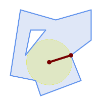
Maximum inscribed circle of a polygon. Center, nearest point, and radius are returned.
SELECT radius, ST_AsText(center) AS center, ST_AsText(nearest) AS nearest
FROM ST_MaximumInscribedCircle(
'POLYGON ((40 180, 110 160, 180 180, 180 120, 140 90, 160 40, 80 10, 70 40, 20 50, 40 180),
(60 140, 50 90, 90 140, 60 140))');
radius | center | nearest
-----------------+----------------------------+---------------
45.165845650018 | POINT(96.953125 76.328125) | POINT(140 90)
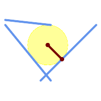
Maximum inscribed circle of a multi-linestring. Center, nearest point, and radius are returned.
Name
ST_MinimumBoundingCircle — Returns the smallest circle polygon that contains a geometry.
Synopsis
geometry ST_MinimumBoundingCircle(geometry geomA, integer num_segs_per_qt_circ=48);
설명
Returns the smallest circle polygon that contains a geometry.
| |
사분원 당 구간 48개라는 기본값으로 원에 가까운 폴리곤을 생성합니다. 이 폴리곤이 최소 경계 원(minimum bounding circle)의 근사치이기 때문에, 입력 도형 안에 있는 포인트 몇 개는 폴리곤 내부에 담기지 않을 수도 있습니다. 구간의 개수를 늘리면 성능을 거의 저하시키지 않고도 근사치를 향상시킬 수 있습니다. 폴리곤 근사치가 적당하지 않은 경우, ST_MinimumBoundingRadius 함수를 사용할 수도 있습니다. |
This function is not an aggregate. It can be used with ST_GeomCollFromText to get the minimum bounding circle of a set of geometries.
폴리곤의 면적을 최소 경계 원의 면적으로 나눈 비율을 종종 루크(Roeck) 테스트라고 부릅니다.
GEOS 모듈로 실행
유효버전: 1.4.0
예시
SELECT d.disease_type,
ST_MinimumBoundingCircle(ST_Collect(d.geom)) As geom
FROM disease_obs As d
GROUP BY d.disease_type;
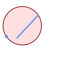
포인트 및 라인스트링의 최소 경계 원. 사분원의 근사치를 구하는 데 구간 8개를 이용합니다.
SELECT ST_AsText(ST_MinimumBoundingCircle(
ST_Collect(
ST_GeomFromText('LINESTRING(55 75,125 150)'),
ST_Point(20, 80)), 8
)) As wktmbc;
wktmbc
-----------
POLYGON((135.59714732062 115,134.384753327498 102.690357210921,130.79416296937 90.8537670908995,124.963360620072 79.9451031602111,117.116420743937 70.3835792560632,107.554896839789 62.5366393799277,96.6462329091006 56.70583703063,84.8096427890789 53.115246672502,72.5000000000001 51.9028526793802,60.1903572109213 53.1152466725019,48.3537670908996 56.7058370306299,37.4451031602112 62.5366393799276,27.8835792560632 70.383579256063,20.0366393799278 79.9451031602109,14.20583703063 90.8537670908993,10.615246672502 102.690357210921,9.40285267938019 115,10.6152466725019 127.309642789079,14.2058370306299 139.1462329091,20.0366393799275 150.054896839789,27.883579256063 159.616420743937,
37.4451031602108 167.463360620072,48.3537670908992 173.29416296937,60.190357210921 176.884753327498,
72.4999999999998 178.09714732062,84.8096427890786 176.884753327498,96.6462329091003 173.29416296937,107.554896839789 167.463360620072,
117.116420743937 159.616420743937,124.963360620072 150.054896839789,130.79416296937 139.146232909101,134.384753327498 127.309642789079,135.59714732062 115))
Name
ST_MinimumBoundingRadius — Returns the center point and radius of the smallest circle that contains a geometry.
Synopsis
(geometry, double precision) ST_MinimumBoundingRadius(geometry geom);
설명
Computes the center point and radius of the smallest circle that contains a geometry. Returns a record with fields:
center- center point of the circleradius- radius of the circle
Use in conjunction with ST_GeomCollFromText to get the minimum bounding circle of a set of geometries.
2.3.0 버전부터 사용할 수 있습니다.
Name
ST_OrientedEnvelope — Returns a minimum-area rectangle containing a geometry.
Synopsis
geometry ST_OrientedEnvelope( geometry geom );
설명
Returns the minimum-area rotated rectangle enclosing a geometry. Note that more than one such rectangle may exist. May return a Point or LineString in the case of degenerate inputs.
Availability: 2.5.0
예시
SELECT ST_AsText(ST_OrientedEnvelope('MULTIPOINT ((0 0), (-1 -1), (3 2))'));
st_astext
------------------------------------------------
POLYGON((3 2,2.88 2.16,-1.12 -0.84,-1 -1,3 2))
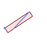
Oriented envelope of a point and linestring.
SELECT ST_AsText(ST_OrientedEnvelope(
ST_Collect(
ST_GeomFromText('LINESTRING(55 75,125 150)'),
ST_Point(20, 80))
)) As wktenv;
wktenv
-----------
POLYGON((19.9999999999997 79.9999999999999,33.0769230769229 60.3846153846152,138.076923076924 130.384615384616,125.000000000001 150.000000000001,19.9999999999997 79.9999999999999))
Name
ST_OffsetCurve — Returns an offset line at a given distance and side from an input line.
Synopsis
geometry ST_OffsetCurve(geometry line, float signed_distance, text style_parameters='');
설명
Return an offset line at a given distance and side from an input line. All points of the returned geometries are not further than the given distance from the input geometry. Useful for computing parallel lines about a center line.
For positive distance the offset is on the left side of the input line and retains the same direction. For a negative distance it is on the right side and in the opposite direction.
거리의 단위는 공간 참조 시스템의 단위로 측정됩니다.
Note that output may be a MULTILINESTRING or EMPTY for some jigsaw-shaped input geometries.
다음과 같이 연산을 조정하기 위해 선택적인 세 번째 파라미터로 공백으로 구분된 키=값 쌍의 목록을 설정할 수 있습니다:
'quad_segs=#' : 사분원(quarter circle)의 근사치를 계산하는 데 쓰이는 선분의 개수(기본값은 8)
'join=round|mitre|bevel' : 접합 스타일(기본값은 "원형(round)"). '마이터(mitre)'의 동의어로 '마이터(miter)'도 쓸 수 있습니다.
'mitre_limit=#.#' : 마이터 비율 제한(마이터 접합 스타일만 영향을 받습니다). 'mitre_limit'의 동의어로 'miter_limit'도 쓸 수 있습니다.
GEOS 모듈로 실행
2.0 버전부터 사용할 수 있습니다.
Enhanced: 2.5 - added support for GEOMETRYCOLLECTION and MULTILINESTRING
| |
This function ignores the Z dimension. It always gives a 2D result even when used on a 3D geometry. |
예시
도로 주위로 열린 버퍼를 계산합니다.
SELECT ST_Union(
ST_OffsetCurve(f.geom, f.width/2, 'quad_segs=4 join=round'),
ST_OffsetCurve(f.geom, -f.width/2, 'quad_segs=4 join=round')
) as track
FROM someroadstable;
 거리 15, 원본 라인에서 'quad_segs=4 join=round' 및 오프셋은 15단위
SELECT ST_AsText(ST_OffsetCurve(ST_GeomFromText(
'LINESTRING(164 16,144 16,124 16,104 16,84 16,64 16,
44 16,24 16,20 16,18 16,17 17,
16 18,16 20,16 40,16 60,16 80,16 100,
16 120,16 140,16 160,16 180,16 195)'),
15, 'quad_segs=4 join=round'));
--output --
LINESTRING(164 1,18 1,12.2597485145237 2.1418070123307,
7.39339828220179 5.39339828220179,
5.39339828220179 7.39339828220179,
2.14180701233067 12.2597485145237,1 18,1 195)
|  거리 -15, 원본 라인에서 'quad_segs=4 join=round' 및 오프셋은 -15단위
SELECT ST_AsText(ST_OffsetCurve(geom,
-15, 'quad_segs=4 join=round')) As notsocurvy
FROM ST_GeomFromText(
'LINESTRING(164 16,144 16,124 16,104 16,84 16,64 16,
44 16,24 16,20 16,18 16,17 17,
16 18,16 20,16 40,16 60,16 80,16 100,
16 120,16 140,16 160,16 180,16 195)') As geom;
-- notsocurvy --
LINESTRING(31 195,31 31,164 31)
|
 더 둥글게 만들기 위한 이중 오프셋, 첫 번째 쿼리가 방향을 역전시킨다는 점에 주의하십시오. 즉 -30 + 15 = -15 입니다.
SELECT ST_AsText(ST_OffsetCurve(ST_OffsetCurve(geom,
-30, 'quad_segs=4 join=round'), -15, 'quad_segs=4 join=round')) As morecurvy
FROM ST_GeomFromText(
'LINESTRING(164 16,144 16,124 16,104 16,84 16,64 16,
44 16,24 16,20 16,18 16,17 17,
16 18,16 20,16 40,16 60,16 80,16 100,
16 120,16 140,16 160,16 180,16 195)') As geom;
-- morecurvy --
LINESTRING(164 31,46 31,40.2597485145236 32.1418070123307,
35.3933982822018 35.3933982822018,
32.1418070123307 40.2597485145237,31 46,31 195)
|  평행한 라인을 얻기 위한 정규 오프셋 15와 결합된, 더 둥글게 만들기 위한 이중 오프셋. 원본과 중첩.
SELECT ST_AsText(ST_Collect(
ST_OffsetCurve(geom, 15, 'quad_segs=4 join=round'),
ST_OffsetCurve(ST_OffsetCurve(geom,
-30, 'quad_segs=4 join=round'), -15, 'quad_segs=4 join=round')
)
) As parallel_curves
FROM ST_GeomFromText(
'LINESTRING(164 16,144 16,124 16,104 16,84 16,64 16,
44 16,24 16,20 16,18 16,17 17,
16 18,16 20,16 40,16 60,16 80,16 100,
16 120,16 140,16 160,16 180,16 195)') As geom;
-- parallel curves --
MULTILINESTRING((164 1,18 1,12.2597485145237 2.1418070123307,
7.39339828220179 5.39339828220179,5.39339828220179 7.39339828220179,
2.14180701233067 12.2597485145237,1 18,1 195),
(164 31,46 31,40.2597485145236 32.1418070123307,35.3933982822018 35.3933982822018,
32.1418070123307 40.2597485145237,31 46,31 195))
|
 거리 15, 원본 라인과 함께 표출된 'quad_segs=4 join=round'
SELECT ST_AsText(ST_OffsetCurve(ST_GeomFromText(
'LINESTRING(164 16,144 16,124 16,104 16,84 16,64 16,
44 16,24 16,20 16,18 16,17 17,
16 18,16 20,16 40,16 60,16 80,16 100,
16 120,16 140,16 160,16 180,16 195)'),
15, 'quad_segs=4 join=bevel'));
-- output --
LINESTRING(164 1,18 1,7.39339828220179 5.39339828220179,
5.39339828220179 7.39339828220179,1 18,1 195)
|  수집된 15, -15. join=mitre mitre_limit=2.1
SELECT ST_AsText(ST_Collect(
ST_OffsetCurve(geom, 15, 'quad_segs=4 join=mitre mitre_limit=2.2'),
ST_OffsetCurve(geom, -15, 'quad_segs=4 join=mitre mitre_limit=2.2')
) )
FROM ST_GeomFromText(
'LINESTRING(164 16,144 16,124 16,104 16,84 16,64 16,
44 16,24 16,20 16,18 16,17 17,
16 18,16 20,16 40,16 60,16 80,16 100,
16 120,16 140,16 160,16 180,16 195)') As geom;
-- output --
MULTILINESTRING((164 1,11.7867965644036 1,1 11.7867965644036,1 195),
(31 195,31 31,164 31))
|
Name
ST_PointOnSurface — Computes a point guaranteed to lie in a polygon, or on a geometry.
Synopsis
geometry ST_PointOnSurface(geometry g1);
설명
Returns a POINT which is guaranteed to lie in the interior of a surface (POLYGON, MULTIPOLYGON, and CURVED POLYGON). In PostGIS this function also works on line and point geometries.
This method implements the OGC Simple Features
Implementation Specification for SQL 1.1. s3.2.14.2 // s3.2.18.2
This method implements the SQL/MM specification. SQL-MM 3: 8.1.5, 9.5.6. The specifications define ST_PointOnSurface for surface geometries only. PostGIS extends the function to support all common geometry types. Other databases (Oracle, DB2, ArcSDE) seem to support this function only for surfaces. SQL Server 2008 supports all common geometry types.
This function supports 3d and will not drop the z-index.
예시
 PointOnSurface of a |  PointOnSurface of a |
 PointOnSurface of a |  PointOnSurface of a |
SELECT ST_AsText(ST_PointOnSurface('POINT(0 5)'::geometry));
------------
POINT(0 5)
SELECT ST_AsText(ST_PointOnSurface('LINESTRING(0 5, 0 10)'::geometry));
------------
POINT(0 5)
SELECT ST_AsText(ST_PointOnSurface('POLYGON((0 0, 0 5, 5 5, 5 0, 0 0))'::geometry));
----------------
POINT(2.5 2.5)
SELECT ST_AsEWKT(ST_PointOnSurface(ST_GeomFromEWKT('LINESTRING(0 5 1, 0 0 1, 0 10 2)')));
----------------
POINT(0 0 1)
Example: The result of ST_PointOnSurface is guaranteed to lie within polygons, whereas the point computed by ST_Centroid may be outside.
Red: point on surface; Green: centroid
SELECT ST_AsText(ST_PointOnSurface(geom)) AS pt_on_surf,
ST_AsText(ST_Centroid(geom)) AS centroid
FROM (SELECT 'POLYGON ((130 120, 120 190, 30 140, 50 20, 190 20,
170 100, 90 60, 90 130, 130 120))'::geometry AS geom) AS t;
pt_on_surf | centroid
-----------------+---------------------------------------------
POINT(62.5 110) | POINT(100.18264840182648 85.11415525114155)
Name
ST_Polygonize — Computes a collection of polygons formed from the linework of a set of geometries.
Synopsis
geometry ST_Polygonize(geometry set geomfield);
geometry ST_Polygonize(geometry[] geom_array);
설명
Creates a GeometryCollection containing the polygons formed by the constituent linework of a set of geometries. Input linework must be correctly noded for this function to work properly.
| |
To ensure input is fully noded use ST_Node on the input geometry before polygonizing. |
| |
GeometryCollections are often difficult to deal with with third party tools. Use ST_Dump to convert the polygonize result into separate polygons. |
GEOS 모듈로 실행
유효버전: 1.0.0RC1
예시: 단일 라인스트링의 폴리곤화
SELECT ST_AsEWKT(ST_Polygonize(geom_4269)) As geomtextrep
FROM (SELECT geom_4269 FROM ma.suffolk_edges ORDER BY tlid LIMIT 45) As foo;
geomtextrep
-------------------------------------
SRID=4269;GEOMETRYCOLLECTION(POLYGON((-71.040878 42.285678,-71.040943 42.2856,-71.04096 42.285752,-71.040878 42.285678)),
POLYGON((-71.17166 42.353675,-71.172026 42.354044,-71.17239 42.354358,-71.171794 42.354971,-71.170511 42.354855,
-71.17112 42.354238,-71.17166 42.353675)))
(1 row)
--Use ST_Dump to dump out the polygonize geoms into individual polygons
SELECT ST_AsEWKT((ST_Dump(foofoo.polycoll)).geom) As geomtextrep
FROM (SELECT ST_Polygonize(geom_4269) As polycoll
FROM (SELECT geom_4269 FROM ma.suffolk_edges
ORDER BY tlid LIMIT 45) As foo) As foofoo;
geomtextrep
------------------------
SRID=4269;POLYGON((-71.040878 42.285678,-71.040943 42.2856,-71.04096 42.285752,
-71.040878 42.285678))
SRID=4269;POLYGON((-71.17166 42.353675,-71.172026 42.354044,-71.17239 42.354358
,-71.171794 42.354971,-71.170511 42.354855,-71.17112 42.354238,-71.17166 42.353675))
(2 rows)
Name
ST_ReducePrecision — Returns a valid geometry with points rounded to a grid tolerance.
Synopsis
geometry ST_ReducePrecision(geometry g, float8 gridsize);
설명
Returns a valid geometry with all points rounded to the provided grid tolerance, and features below the tolerance removed.
Unlike ST_SnapToGrid the returned geometry will be valid, with no ring self-intersections or collapsed components.
Precision reduction can be used to:
match coordinate precision to the data accuracy
reduce the number of coordinates needed to represent a geometry
ensure valid geometry output to formats which use lower precision (e.g. text formats such as WKT, GeoJSON or KML when the number of output decimal places is limited).
export valid geometry to systems which use lower or limited precision (e.g. SDE, Oracle tolerance value)
Availability: 3.1.0 - requires GEOS >= 3.9.0.
예시
SELECT ST_AsText(ST_ReducePrecision('POINT(1.412 19.323)', 0.1));
st_astext
-----------------
POINT(1.4 19.3)
SELECT ST_AsText(ST_ReducePrecision('POINT(1.412 19.323)', 1.0));
st_astext
-------------
POINT(1 19)
SELECT ST_AsText(ST_ReducePrecision('POINT(1.412 19.323)', 10));
st_astext
-------------
POINT(0 20)
Precision reduction can reduce number of vertices
SELECT ST_AsText(ST_ReducePrecision('LINESTRING (10 10, 19.6 30.1, 20 30, 20.3 30, 40 40)', 1));
st_astext
-------------
LINESTRING (10 10, 20 30, 40 40)
Precision reduction splits polygons if needed to ensure validity
SELECT ST_AsText(ST_ReducePrecision('POLYGON ((10 10, 60 60.1, 70 30, 40 40, 50 10, 10 10))', 10));
st_astext
-------------
MULTIPOLYGON (((60 60, 70 30, 40 40, 60 60)), ((40 40, 50 10, 10 10, 40 40)))
Name
ST_SharedPaths — 두 입력 라인스트링/멀티라인스트링이 공유하는 경로를 담고 있는 집합을 반환합니다.
Synopsis
geometry ST_SharedPaths(geometry lineal1, geometry lineal2);
설명
두 입력 도형이 공유하는 경로를 담고 있는 집합을 반환합니다. 동일한 방향을 향하는 경로가 이 집합의 첫 번째 요소이며, 반대 방향을 향하는 경로가 두 번째 요소입니다. 경로 그 자체는 첫 번째 도형의 방향을 따릅니다.
GEOS 모듈로 실행
2.0.0 버전부터 사용할 수 있습니다.
예시: 공유된 경로 찾기
 멀티라인스트링과 라인스트링 |
 멀티라인스트링과 라인스트링이 공유하는 경로와 원본 도형들을 중첩
SELECT ST_AsText(
ST_SharedPaths(
ST_GeomFromText('MULTILINESTRING((26 125,26 200,126 200,126 125,26 125),
(51 150,101 150,76 175,51 150))'),
ST_GeomFromText('LINESTRING(151 100,126 156.25,126 125,90 161, 76 175)')
)
) As wkt
wkt
-------------------------------------------------------------
GEOMETRYCOLLECTION(MULTILINESTRING((126 156.25,126 125),
(101 150,90 161),(90 161,76 175)),MULTILINESTRING EMPTY)
|
-- same example but linestring orientation flipped
SELECT ST_AsText(
ST_SharedPaths(
ST_GeomFromText('LINESTRING(76 175,90 161,126 125,126 156.25,151 100)'),
ST_GeomFromText('MULTILINESTRING((26 125,26 200,126 200,126 125,26 125),
(51 150,101 150,76 175,51 150))')
)
) As wkt
wkt
-------------------------------------------------------------
GEOMETRYCOLLECTION(MULTILINESTRING EMPTY,
MULTILINESTRING((76 175,90 161),(90 161,101 150),(126 125,126 156.25)))
|
Name
ST_Simplify — Returns a simplified version of a geometry, using the Douglas-Peucker algorithm.
Synopsis
geometry ST_Simplify(geometry geomA, float tolerance);
geometry ST_Simplify(geometry geomA, float tolerance, boolean preserveCollapsed);
설명
더글러스-패커(Douglas-Peucker) 알고리즘을 이용해서 입력 도형의 "단순화"된 버전을 반환합니다. 실제로는 [멀티]라인, [멀티]폴리곤과만 작동하지만, 어떤 종류의 도형도 입력할 수 있다고 해도 과언은 아닙니다. 객체별 기반으로 단순화 작업을 하기 때문에 이 함수에 도형 집합도 입력할 수 있습니다.
The "preserve collapsed" flag will retain objects that would otherwise be too small given the tolerance. For example, a 1m long line simplified with a 10m tolerance. If preserveCollapsed argument is specified as true, the line will not disappear. This flag is useful for rendering engines, to avoid having large numbers of very small objects disappear from a map leaving surprising gaps.
| |
반환되는 도형이 단순성을 잃을 수도 있다는 점에 주의하십시오(ST_IsSimple 참조). |
| |
위상(topology)이 보전되지 않아 유효하지 않은 도형이 반환될 수도 있습니다. 위상을 유지하려면 ST_SimplifyPreserveTopology 함수를 이용하십시오. |
1.2.2 버전부터 사용할 수 있습니다.
예시
원을 너무 단순화시키면 팔각형을 거쳐 삼각형이 되고 맙니다.
SELECT ST_Npoints(geom) AS np_before,
ST_NPoints(ST_Simplify(geom,0.1)) AS np01_notbadcircle,
ST_NPoints(ST_Simplify(geom,0.5)) AS np05_notquitecircle,
ST_NPoints(ST_Simplify(geom,1)) AS np1_octagon,
ST_NPoints(ST_Simplify(geom,10)) AS np10_triangle,
(ST_Simplify(geom,100) is null) AS np100_geometrygoesaway
FROM
(SELECT ST_Buffer('POINT(1 3)', 10,12) As geom) AS foo;
np_before | np01_notbadcircle | np05_notquitecircle | np1_octagon | np10_triangle | np100_geometrygoesaway
-----------+-------------------+---------------------+-------------+---------------+------------------------
49 | 33 | 17 | 9 | 4 | t
Name
ST_SimplifyPreserveTopology — Returns a simplified and valid version of a geometry, using the Douglas-Peucker algorithm.
Synopsis
geometry ST_SimplifyPreserveTopology(geometry geomA, float tolerance);
설명
더글러스-패커(Douglas-Peucker) 알고리즘을 이용해서 입력 도형의 "단순화"된 버전을 반환합니다. 유효하지 않은 파생 도형(특히 폴리곤)을 생성하지 않을 것입니다. 실제로는 [멀티]라인, [멀티]폴리곤과만 작동하지만, 어떤 종류의 도형도 입력할 수 있다고 해도 과언은 아닙니다. 객체별 기반으로 단순화 작업을 하기 때문에 이 함수에 도형 집합도 입력할 수 있습니다.
GEOS 모듈로 실행
1.3.3 버전부터 사용할 수 있습니다.
예시
ST_Simplify 함수와 동일하지만, ST_SimplifyPreserveTopology는 과단순화(oversimplification)를 막아준다는 사실을 알 수 있습니다. 원을 단순화해도 기껏해야 사각형에서 끝납니다.
SELECT ST_Npoints(geom) As np_before, ST_NPoints(ST_SimplifyPreserveTopology(geom,0.1)) As np01_notbadcircle, ST_NPoints(ST_SimplifyPreserveTopology(geom,0.5)) As np05_notquitecircle,
ST_NPoints(ST_SimplifyPreserveTopology(geom,1)) As np1_octagon, ST_NPoints(ST_SimplifyPreserveTopology(geom,10)) As np10_square,
ST_NPoints(ST_SimplifyPreserveTopology(geom,100)) As np100_stillsquare
FROM (SELECT ST_Buffer('POINT(1 3)', 10,12) As geom) As foo;
--result--
np_before | np01_notbadcircle | np05_notquitecircle | np1_octagon | np10_square | np100_stillsquare
-----------+-------------------+---------------------+-------------+---------------+-------------------
49 | 33 | 17 | 9 | 5 | 5
Name
ST_SimplifyPolygonHull — Computes a simplifed topology-preserving outer or inner hull of a polygonal geometry.
Synopsis
geometry ST_SimplifyPolygonHull(geometry param_geom, float vertex_fraction, boolean is_outer = true);
설명
Computes a simplified topology-preserving outer or inner hull of a polygonal geometry. An outer hull completely covers the input geometry. An inner hull is completely covered by the input geometry. The result is a polygonal geometry formed by a subset of the input vertices. MultiPolygons and holes are handled and produce a result with the same structure as the input.
The reduction in vertex count is controlled by the vertex_fraction parameter, which is a number in the range 0 to 1. Lower values produce simpler results, with smaller vertex count and less concaveness. For both outer and inner hulls a vertex fraction of 1.0 produces the orginal geometry. For outer hulls a value of 0.0 produces the convex hull (for a single polygon); for inner hulls it produces a triangle.
The simplification process operates by progressively removing concave corners that contain the least amount of area, until the vertex count target is reached. It prevents edges from crossing, so the result is always a valid polygonal geometry.
To get better results with geometries that contain relatively long line segments, it might be necessary to "segmentize" the input, as shown below.
GEOS 모듈로 실행
Availability: 3.3.0 - requires GEOS >= 3.11.0
예시
Outer hull of a Polygon
SELECT ST_SimplifyPolygonHull(
'POLYGON ((131 158, 136 163, 161 165, 173 156, 179 148, 169 140, 186 144, 190 137, 185 131, 174 128, 174 124, 166 119, 158 121, 158 115, 165 107, 161 97, 166 88, 166 79, 158 57, 145 57, 112 53, 111 47, 93 43, 90 48, 88 40, 80 39, 68 32, 51 33, 40 31, 39 34, 49 38, 34 38, 25 34, 28 39, 36 40, 44 46, 24 41, 17 41, 14 46, 19 50, 33 54, 21 55, 13 52, 11 57, 22 60, 34 59, 41 68, 75 72, 62 77, 56 70, 46 72, 31 69, 46 76, 52 82, 47 84, 56 90, 66 90, 64 94, 56 91, 33 97, 36 100, 23 100, 22 107, 29 106, 31 112, 46 116, 36 118, 28 131, 53 132, 59 127, 62 131, 76 130, 80 135, 89 137, 87 143, 73 145, 80 150, 88 150, 85 157, 99 162, 116 158, 115 165, 123 165, 122 170, 134 164, 131 158))',
0.3);
Inner hull of a Polygon
SELECT ST_SimplifyPolygonHull(
'POLYGON ((131 158, 136 163, 161 165, 173 156, 179 148, 169 140, 186 144, 190 137, 185 131, 174 128, 174 124, 166 119, 158 121, 158 115, 165 107, 161 97, 166 88, 166 79, 158 57, 145 57, 112 53, 111 47, 93 43, 90 48, 88 40, 80 39, 68 32, 51 33, 40 31, 39 34, 49 38, 34 38, 25 34, 28 39, 36 40, 44 46, 24 41, 17 41, 14 46, 19 50, 33 54, 21 55, 13 52, 11 57, 22 60, 34 59, 41 68, 75 72, 62 77, 56 70, 46 72, 31 69, 46 76, 52 82, 47 84, 56 90, 66 90, 64 94, 56 91, 33 97, 36 100, 23 100, 22 107, 29 106, 31 112, 46 116, 36 118, 28 131, 53 132, 59 127, 62 131, 76 130, 80 135, 89 137, 87 143, 73 145, 80 150, 88 150, 85 157, 99 162, 116 158, 115 165, 123 165, 122 170, 134 164, 131 158))',
0.3, false);
Outer hull simplification of a MultiPolygon, with segmentization
SELECT ST_SimplifyPolygonHull(
ST_Segmentize(ST_Letters('xt'), 2.0),
0.1);
Name
ST_SimplifyVW — Returns a simplified version of a geometry, using the Visvalingam-Whyatt algorithm
Synopsis
geometry ST_SimplifyVW(geometry geomA, float tolerance);
설명
비스베일링검-와이어트(Visvalingam-Whyatt) 알고리즘을 이용해서 입력 도형의 "단순화"된 버전을 반환합니다. 실제로는 [멀티]라인, [멀티]폴리곤과만 작동하지만, 어떤 종류의 도형도 입력할 수 있다고 해도 과언은 아닙니다. 객체별 기반으로 단순화 작업을 하기 때문에 이 함수에 도형 집합도 입력할 수 있습니다.
| |
반환되는 도형이 단순성을 잃을 수도 있다는 점에 주의하십시오(ST_IsSimple 참조). |
| |
위상(topology)이 보전되지 않아 유효하지 않은 도형이 반환될 수도 있습니다. 위상을 유지하려면 ST_SimplifyPreserveTopology 함수를 이용하십시오. |
| |
이 함수는 3차원을 처리하며, 세 번째 차원이 결과에 영향을 미칠 것입니다. |
2.2.0 버전부터 사용할 수 있습니다.
Name
ST_SetEffectiveArea — Sets the effective area for each vertex, using the Visvalingam-Whyatt algorithm.
Synopsis
geometry ST_SetEffectiveArea(geometry geomA, float threshold = 0, integer set_area = 1);
설명
비스베일링검-와이어트 알고리즘을 이용해서 각 꼭짓점에 대한 유효 범위를 설정합니다. 유효 범위는 꼭짓점의 M값으로 저장됩니다. 선택적인 "임계" 파라미터를 설정할 경우, 임계치 이상의 유효 범위를 가진 꼭짓점만을 담고 있는 단순화된 도형을 반환할 것입니다.
임계치를 설정할 경우 이 함수를 서버측 단순화 작업에 이용할 수 있습니다. 또다른 옵션은 임계치를 0으로 설정하는 것입니다. 이럴 경우, 유효 범위를 M값으로 가진 전체 도형을 반환하는데, 이 도형을 클라이언트측에서 매우 빨리 단순화하는 데 쓸 수 있습니다.
실제로는 [멀티]라인, [멀티]폴리곤과만 작동하지만, 어떤 종류의 도형도 입력할 수 있다고 해도 과언은 아닙니다. 객체별 기반으로 단순화 작업을 하기 때문에 이 함수에 도형 집합도 입력할 수 있습니다.
| |
반환되는 도형이 단순성을 잃을 수도 있다는 점에 주의하십시오(ST_IsSimple 참조). |
| |
위상(topology)이 보전되지 않아 유효하지 않은 도형이 반환될 수도 있습니다. 위상을 유지하려면 ST_SimplifyPreserveTopology 함수를 이용하십시오. |
| |
출력 도형은 M값으로 가지고 있던 정보를 모두 잃게 될 것입니다. |
| |
이 함수는 3차원을 처리하며, 세 번째 차원이 유효 범위에 영향을 미칠 것입니다. |
2.2.0 버전부터 사용할 수 있습니다.
예시
라인스트링의 유효 범위를 계산합니다. 임계치를 0으로 설정하기 때문에, 입력 도형 안에 있는 모든 꼭짓점을 반환합니다.
select ST_AsText(ST_SetEffectiveArea(geom)) all_pts, ST_AsText(ST_SetEffectiveArea(geom,30) ) thrshld_30
FROM (SELECT 'LINESTRING(5 2, 3 8, 6 20, 7 25, 10 10)'::geometry geom) As foo;
-- 결과 --
all_pts | thrshld_30
-----------+-------------------+
LINESTRING M (5 2 3.40282346638529e+38,3 8 29,6 20 1.5,7 25 49.5,10 10 3.40282346638529e+38) | LINESTRING M (5 2 3.40282346638529e+38,7 25 49.5,10 10 3.40282346638529e+38)
Name
ST_TriangulatePolygon — Computes the constrained Delaunay triangulation of polygons
Synopsis
geometry ST_TriangulatePolygon(geometry geom);
설명
Computes the constrained Delaunay triangulation of polygons. Holes and Multipolygons are supported.
The "constrained Delaunay triangulation" of a polygon is a set of triangles formed from the vertices of the polygon, and covering it exactly, with the maximum total interior angle over all possible triangulations. It provides the "best quality" triangulation of the polygon.
Availability: 3.3.0 - requires GEOS >= 3.11.0
Example
Triangulation of a square.
SELECT ST_AsText(
ST_TriangulatePolygon('POLYGON((0 0, 0 1, 1 1, 1 0, 0 0))'));
st_astext
---------------------------------------------------------------------------
GEOMETRYCOLLECTION(POLYGON((0 0,0 1,1 1,0 0)),POLYGON((1 1,1 0,0 0,1 1)))
Example
Triangulation of the letter P.
SELECT ST_AsText(ST_TriangulatePolygon(
'POLYGON ((26 17, 31 19, 34 21, 37 24, 38 29, 39 43, 39 161, 38 172, 36 176, 34 179, 30 181, 25 183, 10 185, 10 190, 100 190, 121 189, 139 187, 154 182, 167 177, 177 169, 184 161, 189 152, 190 141, 188 128, 186 123, 184 117, 180 113, 176 108, 170 104, 164 101, 151 96, 136 92, 119 89, 100 89, 86 89, 73 89, 73 39, 74 32, 75 27, 77 23, 79 20, 83 18, 89 17, 106 15, 106 10, 10 10, 10 15, 26 17), (152 147, 151 152, 149 157, 146 162, 142 166, 137 169, 132 172, 126 175, 118 177, 109 179, 99 180, 89 180, 80 179, 76 178, 74 176, 73 171, 73 100, 85 99, 91 99, 102 99, 112 100, 121 102, 128 104, 134 107, 139 110, 143 114, 147 118, 149 123, 151 128, 153 141, 152 147))'
));

Polygon Triangulation
Name
ST_VoronoiLines — Returns the boundaries of the Voronoi diagram of the vertices of a geometry.
Synopsis
geometry ST_VoronoiLines( g1 geometry , tolerance float8 , extend_to geometry );
설명
ST_VoronoiLines computes a two-dimensional Voronoi diagram from the vertices of the supplied geometry and returns the boundaries between cells in that diagram as a MultiLineString. Returns null if input geometry is null. Returns an empty geometry collection if the input geometry contains only one vertex. Returns an empty geometry collection if the extend_to envelope has zero area.
선택할 수 있는 파라미터:
'tolerance' : 그보다 가까운 꼭짓점들을 동일하다고 간주할 허용 오차 거리입니다. 0이 아닌 허용 오차 거리를 설정하면 알고리즘의 강력함을 향상시킬 수 있습니다. (기본값 = 0.0)
'extend_to' : If a geometry is supplied as the "extend_to" parameter, the diagram will be extended to cover the envelope of the "extend_to" geometry, unless that envelope is smaller than the default envelope (default = NULL, default envelope is boundingbox of input geometry extended by about 50% in each direction).
GEOS 모듈로 실행
2.3.0 버전부터 사용할 수 있습니다.
예시
 Voronoi lines with tolerance of 30 units
SELECT ST_VoronoiLines(geom, 30) As geom FROM (SELECT 'MULTIPOINT (50 30, 60 30, 100 100,10 150, 110 120)'::geometry As geom ) As g
-- ST_AsText 출력물 MULTILINESTRING((135.555555555556 270,36.8181818181818 92.2727272727273),(36.8181818181818 92.2727272727273,-110 43.3333333333333),(230 -45.7142857142858,36.8181818181818 92.2727272727273))
|
Name
ST_VoronoiPolygons — Returns the cells of the Voronoi diagram of the vertices of a geometry.
Synopsis
geometry ST_VoronoiPolygons( g1 geometry , tolerance float8 , extend_to geometry );
설명
ST_VoronoiPolygons computes a two-dimensional Voronoi diagram from the vertices of the supplied geometry. The result is a GeometryCollection of Polygons that covers an envelope larger than the extent of the input vertices. Returns null if input geometry is null. Returns an empty geometry collection if the input geometry contains only one vertex. Returns an empty geometry collection if the extend_to envelope has zero area.
선택할 수 있는 파라미터:
'tolerance' : 그보다 가까운 꼭짓점들을 동일하다고 간주할 허용 오차 거리입니다. 0이 아닌 허용 오차 거리를 설정하면 알고리즘의 강력함을 향상시킬 수 있습니다. (기본값 = 0.0)
'extend_to' : If a geometry is supplied as the "extend_to" parameter, the diagram will be extended to cover the envelope of the "extend_to" geometry, unless that envelope is smaller than the default envelope (default = NULL, default envelope is boundingbox of input geometry extended by about 50% in each direction).
GEOS 모듈로 실행
2.3.0 버전부터 사용할 수 있습니다.
예시
 Points overlaid on top of Voronoi diagram
SELECT
ST_VoronoiPolygons(geom) As geom
FROM (SELECT 'MULTIPOINT (50 30, 60 30, 100 100,10 150, 110 120)'::geometry As geom ) As g;
-- ST_AsText 출력물 GEOMETRYCOLLECTION(POLYGON((-110 43.3333333333333,-110 270,100.5 270,59.3478260869565 132.826086956522,36.8181818181818 92.2727272727273,-110 43.3333333333333)), POLYGON((55 -90,-110 -90,-110 43.3333333333333,36.8181818181818 92.2727272727273,55 79.2857142857143,55 -90)), POLYGON((230 47.5,230 -20.7142857142857,55 79.2857142857143,36.8181818181818 92.2727272727273,59.3478260869565 132.826086956522,230 47.5)),POLYGON((230 -20.7142857142857,230 -90,55 -90,55 79.2857142857143,230 -20.7142857142857)), POLYGON((100.5 270,230 270,230 47.5,59.3478260869565 132.826086956522,100.5 270)))
|
 허용 오차 거리가 30 단위인 보로노이 다이어그램
SELECT ST_VoronoiPolygons(geom, 30) As geom FROM (SELECT 'MULTIPOINT (50 30, 60 30, 100 100,10 150, 110 120)'::geometry As geom ) As g;
-- ST_AsText 출력물 GEOMETRYCOLLECTION(POLYGON((-110 43.3333333333333,-110 270,100.5 270,59.3478260869565 132.826086956522,36.8181818181818 92.2727272727273,-110 43.3333333333333)), POLYGON((230 47.5,230 -45.7142857142858,36.8181818181818 92.2727272727273,59.3478260869565 132.826086956522,230 47.5)),POLYGON((230 -45.7142857142858,230 -90,-110 -90,-110 43.3333333333333,36.8181818181818 92.2727272727273,230 -45.7142857142858)), POLYGON((100.5 270,230 270,230 47.5,59.3478260869565 132.826086956522,100.5 270)))
|
Voronoi with tolerance of 30 units as MultiLineString
SELECT ST_VoronoiLines(geom, 30) As geom FROM (SELECT 'MULTIPOINT (50 30, 60 30, 100 100,10 150, 110 120)'::geometry As geom ) As g
-- ST_AsText 출력물 MULTILINESTRING((135.555555555556 270,36.8181818181818 92.2727272727273),(36.8181818181818 92.2727272727273,-110 43.3333333333333),(230 -45.7142857142858,36.8181818181818 92.2727272727273))
|
These functions change the position and shape of geometries using affine transformations.
- ST_Affine — Apply a 3D affine transformation to a geometry.
- ST_Rotate — Rotates a geometry about an origin point.
- ST_RotateX — Rotates a geometry about the X axis.
- ST_RotateY — Rotates a geometry about the Y axis.
- ST_RotateZ — Rotates a geometry about the Z axis.
- ST_Scale — Scales a geometry by given factors.
- ST_Translate — Translates a geometry by given offsets.
- ST_TransScale — Translates and scales a geometry by given offsets and factors.
Name
ST_Affine — Apply a 3D affine transformation to a geometry.
Synopsis
geometry ST_Affine(geometry geomA, float a, float b, float c, float d, float e, float f, float g, float h, float i, float xoff, float yoff, float zoff);
geometry ST_Affine(geometry geomA, float a, float b, float d, float e, float xoff, float yoff);
Description
Applies a 3D affine transformation to the geometry to do things like translate, rotate, scale in one step.
Version 1: The call
ST_Affine(geom, a, b, c, d, e, f, g, h, i, xoff, yoff, zoff)
represents the transformation matrix
/ a b c xoff \ | d e f yoff | | g h i zoff | \ 0 0 0 1 /
and the vertices are transformed as follows:
x' = a*x + b*y + c*z + xoff y' = d*x + e*y + f*z + yoff z' = g*x + h*y + i*z + zoff
All of the translate / scale functions below are expressed via such an affine transformation.
Version 2: Applies a 2d affine transformation to the geometry. The call
ST_Affine(geom, a, b, d, e, xoff, yoff)
represents the transformation matrix
/ a b 0 xoff \ / a b xoff \ | d e 0 yoff | rsp. | d e yoff | | 0 0 1 0 | \ 0 0 1 / \ 0 0 0 1 /
and the vertices are transformed as follows:
x' = a*x + b*y + xoff y' = d*x + e*y + yoff z' = z
This method is a subcase of the 3D method above.
Enhanced: 2.0.0 support for Polyhedral surfaces, Triangles and TIN was introduced.
Availability: 1.1.2. Name changed from Affine to ST_Affine in 1.2.2
| |
Prior to 1.3.4, this function crashes if used with geometries that contain CURVES. This is fixed in 1.3.4+ |
This function supports Polyhedral surfaces.
This function supports Triangles and Triangulated Irregular Network Surfaces (TIN).
This function supports 3d and will not drop the z-index.
This method supports Circular Strings and Curves
Examples
--Rotate a 3d line 180 degrees about the z axis. Note this is long-hand for doing ST_Rotate();
SELECT ST_AsEWKT(ST_Affine(geom, cos(pi()), -sin(pi()), 0, sin(pi()), cos(pi()), 0, 0, 0, 1, 0, 0, 0)) As using_affine,
ST_AsEWKT(ST_Rotate(geom, pi())) As using_rotate
FROM (SELECT ST_GeomFromEWKT('LINESTRING(1 2 3, 1 4 3)') As geom) As foo;
using_affine | using_rotate
-----------------------------+-----------------------------
LINESTRING(-1 -2 3,-1 -4 3) | LINESTRING(-1 -2 3,-1 -4 3)
(1 row)
--Rotate a 3d line 180 degrees in both the x and z axis
SELECT ST_AsEWKT(ST_Affine(geom, cos(pi()), -sin(pi()), 0, sin(pi()), cos(pi()), -sin(pi()), 0, sin(pi()), cos(pi()), 0, 0, 0))
FROM (SELECT ST_GeomFromEWKT('LINESTRING(1 2 3, 1 4 3)') As geom) As foo;
st_asewkt
-------------------------------
LINESTRING(-1 -2 -3,-1 -4 -3)
(1 row)
Name
ST_Rotate — Rotates a geometry about an origin point.
Synopsis
geometry ST_Rotate(geometry geomA, float rotRadians);
geometry ST_Rotate(geometry geomA, float rotRadians, float x0, float y0);
geometry ST_Rotate(geometry geomA, float rotRadians, geometry pointOrigin);
Description
Rotates geometry rotRadians counter-clockwise about the origin point. The rotation origin can be specified either as a POINT geometry, or as x and y coordinates. If the origin is not specified, the geometry is rotated about POINT(0 0).
Enhanced: 2.0.0 support for Polyhedral surfaces, Triangles and TIN was introduced.
Enhanced: 2.0.0 additional parameters for specifying the origin of rotation were added.
Availability: 1.1.2. Name changed from Rotate to ST_Rotate in 1.2.2
This function supports 3d and will not drop the z-index.
This method supports Circular Strings and Curves
This function supports Polyhedral surfaces.
This function supports Triangles and Triangulated Irregular Network Surfaces (TIN).
Examples
--Rotate 180 degrees
SELECT ST_AsEWKT(ST_Rotate('LINESTRING (50 160, 50 50, 100 50)', pi()));
st_asewkt
---------------------------------------
LINESTRING(-50 -160,-50 -50,-100 -50)
(1 row)
--Rotate 30 degrees counter-clockwise at x=50, y=160
SELECT ST_AsEWKT(ST_Rotate('LINESTRING (50 160, 50 50, 100 50)', pi()/6, 50, 160));
st_asewkt
---------------------------------------------------------------------------
LINESTRING(50 160,105 64.7372055837117,148.301270189222 89.7372055837117)
(1 row)
--Rotate 60 degrees clockwise from centroid
SELECT ST_AsEWKT(ST_Rotate(geom, -pi()/3, ST_Centroid(geom)))
FROM (SELECT 'LINESTRING (50 160, 50 50, 100 50)'::geometry AS geom) AS foo;
st_asewkt
--------------------------------------------------------------
LINESTRING(116.4225 130.6721,21.1597 75.6721,46.1597 32.3708)
(1 row)
Name
ST_RotateX — Rotates a geometry about the X axis.
Synopsis
geometry ST_RotateX(geometry geomA, float rotRadians);
Description
Rotates a geometry geomA - rotRadians about the X axis.
| |
|
Enhanced: 2.0.0 support for Polyhedral surfaces, Triangles and TIN was introduced.
Availability: 1.1.2. Name changed from RotateX to ST_RotateX in 1.2.2
This function supports Polyhedral surfaces.
This function supports 3d and will not drop the z-index.
This function supports Triangles and Triangulated Irregular Network Surfaces (TIN).
Name
ST_RotateY — Rotates a geometry about the Y axis.
Synopsis
geometry ST_RotateY(geometry geomA, float rotRadians);
Description
Rotates a geometry geomA - rotRadians about the y axis.
| |
|
Availability: 1.1.2. Name changed from RotateY to ST_RotateY in 1.2.2
Enhanced: 2.0.0 support for Polyhedral surfaces, Triangles and TIN was introduced.
This function supports Polyhedral surfaces.
This function supports 3d and will not drop the z-index.
This function supports Triangles and Triangulated Irregular Network Surfaces (TIN).
Name
ST_RotateZ — Rotates a geometry about the Z axis.
Synopsis
geometry ST_RotateZ(geometry geomA, float rotRadians);
Description
Rotates a geometry geomA - rotRadians about the Z axis.
| |
This is a synonym for ST_Rotate |
| |
|
Enhanced: 2.0.0 support for Polyhedral surfaces, Triangles and TIN was introduced.
Availability: 1.1.2. Name changed from RotateZ to ST_RotateZ in 1.2.2
| |
Prior to 1.3.4, this function crashes if used with geometries that contain CURVES. This is fixed in 1.3.4+ |
This function supports 3d and will not drop the z-index.
This method supports Circular Strings and Curves
This function supports Polyhedral surfaces.
This function supports Triangles and Triangulated Irregular Network Surfaces (TIN).
Examples
--Rotate a line 90 degrees along z-axis
SELECT ST_AsEWKT(ST_RotateZ(ST_GeomFromEWKT('LINESTRING(1 2 3, 1 1 1)'), pi()/2));
st_asewkt
---------------------------
LINESTRING(-2 1 3,-1 1 1)
--Rotate a curved circle around z-axis
SELECT ST_AsEWKT(ST_RotateZ(geom, pi()/2))
FROM (SELECT ST_LineToCurve(ST_Buffer(ST_GeomFromText('POINT(234 567)'), 3)) As geom) As foo;
st_asewkt
----------------------------------------------------------------------------------------------------------------------------
CURVEPOLYGON(CIRCULARSTRING(-567 237,-564.87867965644 236.12132034356,-564 234,-569.12132034356 231.87867965644,-567 237))
Name
ST_Scale — Scales a geometry by given factors.
Synopsis
geometry ST_Scale(geometry geomA, float XFactor, float YFactor, float ZFactor);
geometry ST_Scale(geometry geomA, float XFactor, float YFactor);
geometry ST_Scale(geometry geom, geometry factor);
geometry ST_Scale(geometry geom, geometry factor, geometry origin);
Description
Scales the geometry to a new size by multiplying the ordinates with the corresponding factor parameters.
The version taking a geometry as the factor parameter allows passing a 2d, 3dm, 3dz or 4d point to set scaling factor for all supported dimensions. Missing dimensions in the factor point are equivalent to no scaling the corresponding dimension.
The three-geometry variant allows a "false origin" for the scaling to be passed in. This allows "scaling in place", for example using the centroid of the geometry as the false origin. Without a false origin, scaling takes place relative to the actual origin, so all coordinates are just multipled by the scale factor.
| |
Prior to 1.3.4, this function crashes if used with geometries that contain CURVES. This is fixed in 1.3.4+ |
Availability: 1.1.0.
Enhanced: 2.0.0 support for Polyhedral surfaces, Triangles and TIN was introduced.
Enhanced: 2.2.0 support for scaling all dimension (factor parameter) was introduced.
Enhanced: 2.5.0 support for scaling relative to a local origin (origin parameter) was introduced.
This function supports Polyhedral surfaces.
This function supports 3d and will not drop the z-index.
This method supports Circular Strings and Curves
This function supports Triangles and Triangulated Irregular Network Surfaces (TIN).
This function supports M coordinates.
Examples
--Version 1: scale X, Y, Z
SELECT ST_AsEWKT(ST_Scale(ST_GeomFromEWKT('LINESTRING(1 2 3, 1 1 1)'), 0.5, 0.75, 0.8));
st_asewkt
--------------------------------------
LINESTRING(0.5 1.5 2.4,0.5 0.75 0.8)
--Version 2: Scale X Y
SELECT ST_AsEWKT(ST_Scale(ST_GeomFromEWKT('LINESTRING(1 2 3, 1 1 1)'), 0.5, 0.75));
st_asewkt
----------------------------------
LINESTRING(0.5 1.5 3,0.5 0.75 1)
--Version 3: Scale X Y Z M
SELECT ST_AsEWKT(ST_Scale(ST_GeomFromEWKT('LINESTRING(1 2 3 4, 1 1 1 1)'),
ST_MakePoint(0.5, 0.75, 2, -1)));
st_asewkt
----------------------------------------
LINESTRING(0.5 1.5 6 -4,0.5 0.75 2 -1)
--Version 4: Scale X Y using false origin
SELECT ST_AsText(ST_Scale('LINESTRING(1 1, 2 2)', 'POINT(2 2)', 'POINT(1 1)'::geometry));
st_astext
---------------------
LINESTRING(1 1,3 3)
Name
ST_Translate — Translates a geometry by given offsets.
Synopsis
geometry ST_Translate(geometry g1, float deltax, float deltay);
geometry ST_Translate(geometry g1, float deltax, float deltay, float deltaz);
Description
Returns a new geometry whose coordinates are translated delta x,delta y,delta z units. Units are based on the units defined in spatial reference (SRID) for this geometry.
| |
Prior to 1.3.4, this function crashes if used with geometries that contain CURVES. This is fixed in 1.3.4+ |
Availability: 1.2.2
This function supports 3d and will not drop the z-index.
This method supports Circular Strings and Curves
Examples
Move a point 1 degree longitude
SELECT ST_AsText(ST_Translate(ST_GeomFromText('POINT(-71.01 42.37)',4326),1,0)) As wgs_transgeomtxt;
wgs_transgeomtxt
---------------------
POINT(-70.01 42.37)
Move a linestring 1 degree longitude and 1/2 degree latitude
SELECT ST_AsText(ST_Translate(ST_GeomFromText('LINESTRING(-71.01 42.37,-71.11 42.38)',4326),1,0.5)) As wgs_transgeomtxt;
wgs_transgeomtxt
---------------------------------------
LINESTRING(-70.01 42.87,-70.11 42.88)
Move a 3d point
SELECT ST_AsEWKT(ST_Translate(CAST('POINT(0 0 0)' As geometry), 5, 12,3));
st_asewkt
---------
POINT(5 12 3)
Move a curve and a point
SELECT ST_AsText(ST_Translate(ST_Collect('CURVEPOLYGON(CIRCULARSTRING(4 3,3.12 0.878,1 0,-1.121 5.1213,6 7, 8 9,4 3))','POINT(1 3)'),1,2));
st_astext
------------------------------------------------------------------------------------------------------------
GEOMETRYCOLLECTION(CURVEPOLYGON(CIRCULARSTRING(5 5,4.12 2.878,2 2,-0.121 7.1213,7 9,9 11,5 5)),POINT(2 5))
Name
ST_TransScale — Translates and scales a geometry by given offsets and factors.
Synopsis
geometry ST_TransScale(geometry geomA, float deltaX, float deltaY, float XFactor, float YFactor);
Description
Translates the geometry using the deltaX and deltaY args, then scales it using the XFactor, YFactor args, working in 2D only.
| |
|
| |
Prior to 1.3.4, this function crashes if used with geometries that contain CURVES. This is fixed in 1.3.4+ |
Availability: 1.1.0.
This function supports 3d and will not drop the z-index.
This method supports Circular Strings and Curves
Examples
SELECT ST_AsEWKT(ST_TransScale(ST_GeomFromEWKT('LINESTRING(1 2 3, 1 1 1)'), 0.5, 1, 1, 2));
st_asewkt
-----------------------------
LINESTRING(1.5 6 3,1.5 4 1)
--Buffer a point to get an approximation of a circle, convert to curve and then translate 1,2 and scale it 3,4
SELECT ST_AsText(ST_Transscale(ST_LineToCurve(ST_Buffer('POINT(234 567)', 3)),1,2,3,4));
st_astext
------------------------------------------------------------------------------------------------------------------------------
CURVEPOLYGON(CIRCULARSTRING(714 2276,711.363961030679 2267.51471862576,705 2264,698.636038969321 2284.48528137424,714 2276))
- ST_ClusterDBSCAN — Window function that returns a cluster id for each input geometry using the DBSCAN algorithm.
- ST_ClusterIntersecting — Aggregate function that clusters the input geometries into connected sets.
- ST_ClusterKMeans — Window function that returns a cluster id for each input geometry using the K-means algorithm.
- ST_ClusterWithin — Aggregate function that clusters the input geometries by separation distance.
Name
ST_ClusterDBSCAN — Window function that returns a cluster id for each input geometry using the DBSCAN algorithm.
Synopsis
integer ST_ClusterDBSCAN(geometry winset geom, float8 eps, integer minpoints);
Description
Returns cluster number for each input geometry, based on a 2D implementation of the Density-based spatial clustering of applications with noise (DBSCAN) algorithm. Unlike ST_ClusterKMeans, it does not require the number of clusters to be specified, but instead uses the desired distance (eps) and density (minpoints) parameters to construct each cluster.
An input geometry will be added to a cluster if it is either:
Note that border geometries may be within eps distance of core geometries in more than one cluster; in this case, either assignment would be correct, and the border geometry will be arbitrarily asssigned to one of the available clusters. In these cases, it is possible for a correct cluster to be generated with fewer than minpoints geometries. When assignment of a border geometry is ambiguous, repeated calls to ST_ClusterDBSCAN will produce identical results if an ORDER BY clause is included in the window definition, but cluster assignments may differ from other implementations of the same algorithm.
| |
Input geometries that do not meet the criteria to join any other cluster will be assigned a cluster number of NULL. |
Availability: 2.3.0
Examples
Assigning a cluster number to each polygon within 50 meters of each other. Require at least 2 polygons per cluster
 within 50 meters at least 2 per cluster. singletons have NULL for cid
SELECT name, ST_ClusterDBSCAN(geom, eps := 50, minpoints := 2) over () AS cid
FROM boston_polys
WHERE name > '' AND building > ''
AND ST_DWithin(geom,
ST_Transform(
ST_GeomFromText('POINT(-71.04054 42.35141)', 4326), 26986),
500);
| name | bucket -------------------------------------+-------- Manulife Tower | 0 Park Lane Seaport I | 0 Park Lane Seaport II | 0 Renaissance Boston Waterfront Hotel | 0 Seaport Boston Hotel | 0 Seaport Hotel & World Trade Center | 0 Waterside Place | 0 World Trade Center East | 0 100 Northern Avenue | 1 100 Pier 4 | 1 The Institute of Contemporary Art | 1 101 Seaport | 2 District Hall | 2 One Marina Park Drive | 2 Twenty Two Liberty | 2 Vertex | 2 Vertex | 2 Watermark Seaport | 2 Blue Hills Bank Pavilion | NULL World Trade Center West | NULL (20 rows) |
Combining parcels with the same cluster number into a single geometry. This uses named argument calling
SELECT cid, ST_Collect(geom) AS cluster_geom, array_agg(parcel_id) AS ids_in_cluster FROM (
SELECT parcel_id, ST_ClusterDBSCAN(geom, eps := 0.5, minpoints := 5) over () AS cid, geom
FROM parcels) sq
GROUP BY cid;
Name
ST_ClusterIntersecting — Aggregate function that clusters the input geometries into connected sets.
Synopsis
geometry[] ST_ClusterIntersecting(geometry set g);
Description
ST_ClusterIntersecting is an aggregate function that returns an array of GeometryCollections, where each GeometryCollection represents an interconnected set of geometries.
Availability: 2.2.0
Examples
WITH testdata AS
(SELECT unnest(ARRAY['LINESTRING (0 0, 1 1)'::geometry,
'LINESTRING (5 5, 4 4)'::geometry,
'LINESTRING (6 6, 7 7)'::geometry,
'LINESTRING (0 0, -1 -1)'::geometry,
'POLYGON ((0 0, 4 0, 4 4, 0 4, 0 0))'::geometry]) AS geom)
SELECT ST_AsText(unnest(ST_ClusterIntersecting(geom))) FROM testdata;
--result
st_astext
---------
GEOMETRYCOLLECTION(LINESTRING(0 0,1 1),LINESTRING(5 5,4 4),LINESTRING(0 0,-1 -1),POLYGON((0 0,4 0,4 4,0 4,0 0)))
GEOMETRYCOLLECTION(LINESTRING(6 6,7 7))
Name
ST_ClusterKMeans — Window function that returns a cluster id for each input geometry using the K-means algorithm.
Synopsis
integer ST_ClusterKMeans(geometry winset geom, integer number_of_clusters, float max_radius);
Description
Returns K-means cluster number for each input geometry. The distance used for clustering is the distance between the centroids for 2D geometries, and distance between bounding box centers for 3D geometries. For POINT inputs, M coordinate will be treated as weight of input and has to be larger than 0.
max_radius, if set, will cause ST_ClusterKMeans to generate more clusters than k ensuring that no cluster in output has radius larger than max_radius. This is useful in reachability analysis.
Enhanced: 3.2.0 Support for max_radius
Enhanced: 3.1.0 Support for 3D geometries and weights
Availability: 2.3.0
Examples
Generate dummy set of parcels for examples:
CREATE TABLE parcels AS
SELECT lpad((row_number() over())::text,3,'0') As parcel_id, geom,
('{residential, commercial}'::text[])[1 + mod(row_number()OVER(),2)] As type
FROM
ST_Subdivide(ST_Buffer('SRID=3857;LINESTRING(40 100, 98 100, 100 150, 60 90)'::geometry,
40, 'endcap=square'),12) As geom;
Parcels color-coded by cluster number (cid)
SELECT ST_ClusterKMeans(geom, 3) OVER() AS cid, parcel_id, geom
FROM parcels;
cid | parcel_id | geom -----+-----------+--------------- 0 | 001 | 0103000000... 0 | 002 | 0103000000... 1 | 003 | 0103000000... 0 | 004 | 0103000000... 1 | 005 | 0103000000... 2 | 006 | 0103000000... 2 | 007 | 0103000000...
Partitioning parcel clusters by type:
SELECT ST_ClusterKMeans(geom, 3) over (PARTITION BY type) AS cid, parcel_id, type
FROM parcels;cid | parcel_id | type -----+-----------+------------- 1 | 005 | commercial 1 | 003 | commercial 2 | 007 | commercial 0 | 001 | commercial 1 | 004 | residential 0 | 002 | residential 2 | 006 | residential
Example: Clustering a preaggregated planetary-scale data population dataset using 3D clusering and weighting. Identify at least 20 regions based on Kontur Population Data that do not span more than 3000 km from their center:
create table kontur_population_3000km_clusters as
select
geom,
ST_ClusterKMeans(
ST_Force4D(
ST_Transform(ST_Force3D(geom), 4978), -- cluster in 3D XYZ CRS
mvalue := population -- set clustering to be weighed by population
),
20, -- aim to generate at least 20 clusters
max_radius := 3000000 -- but generate more to make each under 3000 km radius
) over () as cid
from
kontur_population;
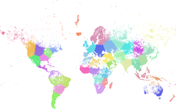
World population clustered to above specs produces 46 clusters. Clusters are centered at well-populated regions (New York, Moscow). Greenland is one cluster. There are island clusters that span across the antimeridian. Cluster edges follow Earth's curvature.
Name
ST_ClusterWithin — Aggregate function that clusters the input geometries by separation distance.
Synopsis
geometry[] ST_ClusterWithin(geometry set g, float8 distance);
Description
ST_ClusterWithin is an aggregate function that returns an array of GeometryCollections, where each GeometryCollection represents a set of geometries separated by no more than the specified distance. (Distances are Cartesian distances in the units of the SRID.)
Availability: 2.2.0
Examples
WITH testdata AS
(SELECT unnest(ARRAY['LINESTRING (0 0, 1 1)'::geometry,
'LINESTRING (5 5, 4 4)'::geometry,
'LINESTRING (6 6, 7 7)'::geometry,
'LINESTRING (0 0, -1 -1)'::geometry,
'POLYGON ((0 0, 4 0, 4 4, 0 4, 0 0))'::geometry]) AS geom)
SELECT ST_AsText(unnest(ST_ClusterWithin(geom, 1.4))) FROM testdata;
--result
st_astext
---------
GEOMETRYCOLLECTION(LINESTRING(0 0,1 1),LINESTRING(5 5,4 4),LINESTRING(0 0,-1 -1),POLYGON((0 0,4 0,4 4,0 4,0 0)))
GEOMETRYCOLLECTION(LINESTRING(6 6,7 7))
These functions produce or operate on bounding boxes. They can also provide and accept geometry values, by using automatic or explicit casts.
See also Section 15.7, “PostGIS Box Functions”.
- Box2D — Returns a BOX2D representing the 2D extent of a geometry.
- Box3D — Returns a BOX3D representing the 3D extent of a geometry.
- ST_EstimatedExtent — Returns the estimated extent of a spatial table.
- ST_Expand — Returns a bounding box expanded from another bounding box or a geometry.
- ST_Extent — Aggregate function that returns the bounding box of geometries.
- ST_3DExtent — Aggregate function that returns the 3D bounding box of geometries.
- ST_MakeBox2D — Creates a BOX2D defined by two 2D point geometries.
- ST_3DMakeBox — Creates a BOX3D defined by two 3D point geometries.
- ST_XMax — Returns the X maxima of a 2D or 3D bounding box or a geometry.
- ST_XMin — Returns the X minima of a 2D or 3D bounding box or a geometry.
- ST_YMax — Returns the Y maxima of a 2D or 3D bounding box or a geometry.
- ST_YMin — Returns the Y minima of a 2D or 3D bounding box or a geometry.
- ST_ZMax — Returns the Z maxima of a 2D or 3D bounding box or a geometry.
- ST_ZMin — Returns the Z minima of a 2D or 3D bounding box or a geometry.
Name
Box2D — Returns a BOX2D representing the 2D extent of a geometry.
Synopsis
box2d Box2D(geometry geom);
Description
Returns a box2d representing the 2D extent of the geometry.
Enhanced: 2.0.0 support for Polyhedral surfaces, Triangles and TIN was introduced.
This method supports Circular Strings and Curves
This function supports Polyhedral surfaces.
This function supports Triangles and Triangulated Irregular Network Surfaces (TIN).
Name
Box3D — Returns a BOX3D representing the 3D extent of a geometry.
Synopsis
box3d Box3D(geometry geom);
Description
Returns a box3d representing the 3D extent of the geometry.
Enhanced: 2.0.0 support for Polyhedral surfaces, Triangles and TIN was introduced.
This method supports Circular Strings and Curves
This function supports Polyhedral surfaces.
This function supports Triangles and Triangulated Irregular Network Surfaces (TIN).
This function supports 3d and will not drop the z-index.
Name
ST_EstimatedExtent — Returns the estimated extent of a spatial table.
Synopsis
box2d ST_EstimatedExtent(text schema_name, text table_name, text geocolumn_name, boolean parent_only);
box2d ST_EstimatedExtent(text schema_name, text table_name, text geocolumn_name);
box2d ST_EstimatedExtent(text table_name, text geocolumn_name);
Description
Returns the estimated extent of a spatial table as a box2d. The current schema is used if not specified. The estimated extent is taken from the geometry column's statistics. This is usually much faster than computing the exact extent of the table using ST_Extent or ST_3DExtent.
The default behavior is to also use statistics collected from child tables (tables with INHERITS) if available. If parent_only is set to TRUE, only statistics for the given table are used and child tables are ignored.
For PostgreSQL >= 8.0.0 statistics are gathered by VACUUM ANALYZE and the result extent will be about 95% of the actual one. For PostgreSQL < 8.0.0 statistics are gathered by running update_geometry_stats() and the result extent is exact.
| |
In the absence of statistics (empty table or no ANALYZE called) this function returns NULL. Prior to version 1.5.4 an exception was thrown instead. |
Availability: 1.0.0
Changed: 2.1.0. Up to 2.0.x this was called ST_Estimated_Extent.
This method supports Circular Strings and Curves
Name
ST_Expand — Returns a bounding box expanded from another bounding box or a geometry.
Synopsis
geometry ST_Expand(geometry geom, float units_to_expand);
geometry ST_Expand(geometry geom, float dx, float dy, float dz=0, float dm=0);
box2d ST_Expand(box2d box, float units_to_expand);
box2d ST_Expand(box2d box, float dx, float dy);
box3d ST_Expand(box3d box, float units_to_expand);
box3d ST_Expand(box3d box, float dx, float dy, float dz=0);
Description
Returns a bounding box expanded from the bounding box of the input, either by specifying a single distance with which the box should be expanded on both axes, or by specifying an expansion distance for each axis. Uses double-precision. Can be used for distance queries, or to add a bounding box filter to a query to take advantage of a spatial index.
In addition to the version of ST_Expand accepting and returning a geometry, variants are provided that accept and return box2d and box3d data types.
Distances are in the units of the spatial reference system of the input.
ST_Expand is similar to ST_Buffer, except while buffering expands a geometry in all directions, ST_Expand expands the bounding box along each axis.
| |
Pre version 1.3, ST_Expand was used in conjunction with ST_Distance to do indexable distance queries. For example, |
Availability: 1.5.0 behavior changed to output double precision instead of float4 coordinates.
Enhanced: 2.0.0 support for Polyhedral surfaces, Triangles and TIN was introduced.
Enhanced: 2.3.0 support was added to expand a box by different amounts in different dimensions.
This function supports Polyhedral surfaces.
This function supports Triangles and Triangulated Irregular Network Surfaces (TIN).
Examples
| |
Examples below use US National Atlas Equal Area (SRID=2163) which is a meter projection |
--10 meter expanded box around bbox of a linestring
SELECT CAST(ST_Expand(ST_GeomFromText('LINESTRING(2312980 110676,2312923 110701,2312892 110714)', 2163),10) As box2d);
st_expand
------------------------------------
BOX(2312882 110666,2312990 110724)
--10 meter expanded 3D box of a 3D box
SELECT ST_Expand(CAST('BOX3D(778783 2951741 1,794875 2970042.61545891 10)' As box3d),10)
st_expand
-----------------------------------------------------
BOX3D(778773 2951731 -9,794885 2970052.61545891 20)
--10 meter geometry astext rep of a expand box around a point geometry
SELECT ST_AsEWKT(ST_Expand(ST_GeomFromEWKT('SRID=2163;POINT(2312980 110676)'),10));
st_asewkt
-------------------------------------------------------------------------------------------------
SRID=2163;POLYGON((2312970 110666,2312970 110686,2312990 110686,2312990 110666,2312970 110666))
Name
ST_Extent — Aggregate function that returns the bounding box of geometries.
Synopsis
box2d ST_Extent(geometry set geomfield);
Description
An aggregate function that returns a box2d bounding box that bounds a set of geometries.
The bounding box coordinates are in the spatial reference system of the input geometries.
ST_Extent is similar in concept to Oracle Spatial/Locator's SDO_AGGR_MBR.
| |
ST_Extent returns boxes with only X and Y ordinates even with 3D geometries. To return XYZ ordinates use ST_3DExtent. |
| |
The returned |
Enhanced: 2.0.0 support for Polyhedral surfaces, Triangles and TIN was introduced.
This function supports Polyhedral surfaces.
This function supports Triangles and Triangulated Irregular Network Surfaces (TIN).
Examples
| |
Examples below use Massachusetts State Plane ft (SRID=2249) |
SELECT ST_Extent(geom) as bextent FROM sometable;
st_bextent
------------------------------------
BOX(739651.875 2908247.25,794875.8125 2970042.75)
--Return extent of each category of geometries
SELECT ST_Extent(geom) as bextent
FROM sometable
GROUP BY category ORDER BY category;
bextent | name
----------------------------------------------------+----------------
BOX(778783.5625 2951741.25,794875.8125 2970042.75) | A
BOX(751315.8125 2919164.75,765202.6875 2935417.25) | B
BOX(739651.875 2917394.75,756688.375 2935866) | C
--Force back into a geometry
-- and render the extended text representation of that geometry
SELECT ST_SetSRID(ST_Extent(geom),2249) as bextent FROM sometable;
bextent
--------------------------------------------------------------------------------
SRID=2249;POLYGON((739651.875 2908247.25,739651.875 2970042.75,794875.8125 2970042.75,
794875.8125 2908247.25,739651.875 2908247.25))
Name
ST_3DExtent — Aggregate function that returns the 3D bounding box of geometries.
Synopsis
box3d ST_3DExtent(geometry set geomfield);
Description
An aggregate function that returns a box3d (includes Z ordinate) bounding box that bounds a set of geometries.
The bounding box coordinates are in the spatial reference system of the input geometries.
| |
The returned |
Enhanced: 2.0.0 support for Polyhedral surfaces, Triangles and TIN was introduced.
Changed: 2.0.0 In prior versions this used to be called ST_Extent3D
This function supports 3d and will not drop the z-index.
This method supports Circular Strings and Curves
This function supports Polyhedral surfaces.
This function supports Triangles and Triangulated Irregular Network Surfaces (TIN).
Examples
SELECT ST_3DExtent(foo.geom) As b3extent
FROM (SELECT ST_MakePoint(x,y,z) As geom
FROM generate_series(1,3) As x
CROSS JOIN generate_series(1,2) As y
CROSS JOIN generate_series(0,2) As Z) As foo;
b3extent
--------------------
BOX3D(1 1 0,3 2 2)
--Get the extent of various elevated circular strings
SELECT ST_3DExtent(foo.geom) As b3extent
FROM (SELECT ST_Translate(ST_Force_3DZ(ST_LineToCurve(ST_Buffer(ST_Point(x,y),1))),0,0,z) As geom
FROM generate_series(1,3) As x
CROSS JOIN generate_series(1,2) As y
CROSS JOIN generate_series(0,2) As Z) As foo;
b3extent
--------------------
BOX3D(1 0 0,4 2 2)
Name
ST_MakeBox2D — Creates a BOX2D defined by two 2D point geometries.
Synopsis
box2d ST_MakeBox2D(geometry pointLowLeft, geometry pointUpRight);
Examples
--Return all features that fall reside or partly reside in a US national atlas coordinate bounding box
--It is assumed here that the geometries are stored with SRID = 2163 (US National atlas equal area)
SELECT feature_id, feature_name, geom
FROM features
WHERE geom && ST_SetSRID(ST_MakeBox2D(ST_Point(-989502.1875, 528439.5625),
ST_Point(-987121.375 ,529933.1875)),2163)Name
ST_3DMakeBox — Creates a BOX3D defined by two 3D point geometries.
Synopsis
box3d ST_3DMakeBox(geometry point3DLowLeftBottom, geometry point3DUpRightTop);
Description
Creates a box3d defined by two 3D Point geometries.
This function supports 3D and will not drop the z-index.
Changed: 2.0.0 In prior versions this used to be called ST_MakeBox3D
Name
ST_XMax — Returns the X maxima of a 2D or 3D bounding box or a geometry.
Synopsis
float ST_XMax(box3d aGeomorBox2DorBox3D);
Description
Returns the X maxima of a 2D or 3D bounding box or a geometry.
| |
Although this function is only defined for box3d, it also works for box2d and geometry values due to automatic casting. However, it will not accept a geometry or box2d text representation, since those do not auto-cast. |
This function supports 3d and will not drop the z-index.
This method supports Circular Strings and Curves
Examples
SELECT ST_XMax('BOX3D(1 2 3, 4 5 6)');
st_xmax
-------
4
SELECT ST_XMax(ST_GeomFromText('LINESTRING(1 3 4, 5 6 7)'));
st_xmax
-------
5
SELECT ST_XMax(CAST('BOX(-3 2, 3 4)' As box2d));
st_xmax
-------
3
--Observe THIS DOES NOT WORK because it will try to auto-cast the string representation to a BOX3D
SELECT ST_XMax('LINESTRING(1 3, 5 6)');
--ERROR: BOX3D parser - doesn't start with BOX3D(
SELECT ST_XMax(ST_GeomFromEWKT('CIRCULARSTRING(220268 150415 1,220227 150505 2,220227 150406 3)'));
st_xmax
--------
220288.248780547
Name
ST_XMin — Returns the X minima of a 2D or 3D bounding box or a geometry.
Synopsis
float ST_XMin(box3d aGeomorBox2DorBox3D);
Description
Returns the X minima of a 2D or 3D bounding box or a geometry.
| |
Although this function is only defined for box3d, it also works for box2d and geometry values due to automatic casting. However it will not accept a geometry or box2d text representation, since those do not auto-cast. |
This function supports 3d and will not drop the z-index.
This method supports Circular Strings and Curves
Examples
SELECT ST_XMin('BOX3D(1 2 3, 4 5 6)');
st_xmin
-------
1
SELECT ST_XMin(ST_GeomFromText('LINESTRING(1 3 4, 5 6 7)'));
st_xmin
-------
1
SELECT ST_XMin(CAST('BOX(-3 2, 3 4)' As box2d));
st_xmin
-------
-3
--Observe THIS DOES NOT WORK because it will try to auto-cast the string representation to a BOX3D
SELECT ST_XMin('LINESTRING(1 3, 5 6)');
--ERROR: BOX3D parser - doesn't start with BOX3D(
SELECT ST_XMin(ST_GeomFromEWKT('CIRCULARSTRING(220268 150415 1,220227 150505 2,220227 150406 3)'));
st_xmin
--------
220186.995121892
Name
ST_YMax — Returns the Y maxima of a 2D or 3D bounding box or a geometry.
Synopsis
float ST_YMax(box3d aGeomorBox2DorBox3D);
Description
Returns the Y maxima of a 2D or 3D bounding box or a geometry.
| |
Although this function is only defined for box3d, it also works for box2d and geometry values due to automatic casting. However it will not accept a geometry or box2d text representation, since those do not auto-cast. |
This function supports 3d and will not drop the z-index.
This method supports Circular Strings and Curves
Examples
SELECT ST_YMax('BOX3D(1 2 3, 4 5 6)');
st_ymax
-------
5
SELECT ST_YMax(ST_GeomFromText('LINESTRING(1 3 4, 5 6 7)'));
st_ymax
-------
6
SELECT ST_YMax(CAST('BOX(-3 2, 3 4)' As box2d));
st_ymax
-------
4
--Observe THIS DOES NOT WORK because it will try to auto-cast the string representation to a BOX3D
SELECT ST_YMax('LINESTRING(1 3, 5 6)');
--ERROR: BOX3D parser - doesn't start with BOX3D(
SELECT ST_YMax(ST_GeomFromEWKT('CIRCULARSTRING(220268 150415 1,220227 150505 2,220227 150406 3)'));
st_ymax
--------
150506.126829327
Name
ST_YMin — Returns the Y minima of a 2D or 3D bounding box or a geometry.
Synopsis
float ST_YMin(box3d aGeomorBox2DorBox3D);
Description
Returns the Y minima of a 2D or 3D bounding box or a geometry.
| |
Although this function is only defined for box3d, it also works for box2d and geometry values due to automatic casting. However it will not accept a geometry or box2d text representation, since those do not auto-cast. |
This function supports 3d and will not drop the z-index.
This method supports Circular Strings and Curves
Examples
SELECT ST_YMin('BOX3D(1 2 3, 4 5 6)');
st_ymin
-------
2
SELECT ST_YMin(ST_GeomFromText('LINESTRING(1 3 4, 5 6 7)'));
st_ymin
-------
3
SELECT ST_YMin(CAST('BOX(-3 2, 3 4)' As box2d));
st_ymin
-------
2
--Observe THIS DOES NOT WORK because it will try to auto-cast the string representation to a BOX3D
SELECT ST_YMin('LINESTRING(1 3, 5 6)');
--ERROR: BOX3D parser - doesn't start with BOX3D(
SELECT ST_YMin(ST_GeomFromEWKT('CIRCULARSTRING(220268 150415 1,220227 150505 2,220227 150406 3)'));
st_ymin
--------
150406
Name
ST_ZMax — Returns the Z maxima of a 2D or 3D bounding box or a geometry.
Synopsis
float ST_ZMax(box3d aGeomorBox2DorBox3D);
Description
Returns the Z maxima of a 2D or 3D bounding box or a geometry.
| |
Although this function is only defined for box3d, it also works for box2d and geometry values due to automatic casting. However it will not accept a geometry or box2d text representation, since those do not auto-cast. |
This function supports 3d and will not drop the z-index.
This method supports Circular Strings and Curves
Examples
SELECT ST_ZMax('BOX3D(1 2 3, 4 5 6)');
st_zmax
-------
6
SELECT ST_ZMax(ST_GeomFromEWKT('LINESTRING(1 3 4, 5 6 7)'));
st_zmax
-------
7
SELECT ST_ZMax('BOX3D(-3 2 1, 3 4 1)' );
st_zmax
-------
1
--Observe THIS DOES NOT WORK because it will try to auto-cast the string representation to a BOX3D
SELECT ST_ZMax('LINESTRING(1 3 4, 5 6 7)');
--ERROR: BOX3D parser - doesn't start with BOX3D(
SELECT ST_ZMax(ST_GeomFromEWKT('CIRCULARSTRING(220268 150415 1,220227 150505 2,220227 150406 3)'));
st_zmax
--------
3
Name
ST_ZMin — Returns the Z minima of a 2D or 3D bounding box or a geometry.
Synopsis
float ST_ZMin(box3d aGeomorBox2DorBox3D);
Description
Returns the Z minima of a 2D or 3D bounding box or a geometry.
| |
Although this function is only defined for box3d, it also works for box2d and geometry values due to automatic casting. However it will not accept a geometry or box2d text representation, since those do not auto-cast. |
This function supports 3d and will not drop the z-index.
This method supports Circular Strings and Curves
Examples
SELECT ST_ZMin('BOX3D(1 2 3, 4 5 6)');
st_zmin
-------
3
SELECT ST_ZMin(ST_GeomFromEWKT('LINESTRING(1 3 4, 5 6 7)'));
st_zmin
-------
4
SELECT ST_ZMin('BOX3D(-3 2 1, 3 4 1)' );
st_zmin
-------
1
--Observe THIS DOES NOT WORK because it will try to auto-cast the string representation to a BOX3D
SELECT ST_ZMin('LINESTRING(1 3 4, 5 6 7)');
--ERROR: BOX3D parser - doesn't start with BOX3D(
SELECT ST_ZMin(ST_GeomFromEWKT('CIRCULARSTRING(220268 150415 1,220227 150505 2,220227 150406 3)'));
st_zmin
--------
1
- ST_LineInterpolatePoint — Returns a point interpolated along a line at a fractional location.
- ST_LineInterpolatePoint — Returns a point interpolated along a 3D line at a fractional location.
- ST_LineInterpolatePoints — Returns points interpolated along a line at a fractional interval.
- ST_LineLocatePoint — Returns the fractional location of the closest point on a line to a point.
- ST_LineSubstring — Returns the part of a line between two fractional locations.
- ST_LocateAlong — Returns the point(s) on a geometry that match a measure value.
- ST_LocateBetween — Returns the portions of a geometry that match a measure range.
- ST_LocateBetweenElevations — Returns the portions of a geometry that lie in an elevation (Z) range.
- ST_InterpolatePoint — 입력 포인트에 가까운 포인트에서 도형의 척도 차원(M 차원)의 값을 반환합니다.
- ST_AddMeasure — Interpolates measures along a linear geometry.
Name
ST_LineInterpolatePoint — Returns a point interpolated along a line at a fractional location.
Synopsis
geometry ST_LineInterpolatePoint(geometry a_linestring, float8 a_fraction);
설명
라인을 따라 보간된 포인트를 반환합니다. 첫 번째 인수는 라인스트링이어야 합니다. 두 번째 인수는 0과 1 사이의 Float8 데이터형으로 라인스트링의 전체 길이에서 포인트가 위치해야 하는 비율을 의미합니다.
포인트에 가장 가까운 라인의 위치를 계산하는 방법에 대해서는 ST_LineLocatePoint 를 참조하십시오.
| |
This function computes points in 2D and then interpolates values for Z and M, while ST_LineInterpolatePoint computes points in 3D and only interpolates the M value. |
| |
1.1.1 배포판부터 이 함수는 M 및 Z값(이 있을 경우)도 보간합니다. 이전 배포판에서는 두 값을 0.0으로 고정시켰습니다. |
0.8.2 버전부터 사용할 수 있습니다. 1.1.1 버전에서 Z과 M 좌표를 지원합니다.
변경 사항: 2.1.0 미만 버전, 즉 2.0.x 버전까지 이 함수의 명칭은 ST_Line_Interpolate_Point였습니다.
This function supports 3d and will not drop the z-index.
예시
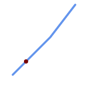
20% 위치 (0.20)에 있는 보간된 포인트를 가진 라인스트링
-- The point 20% along a line
SELECT ST_AsEWKT( ST_LineInterpolatePoint(
'LINESTRING(25 50, 100 125, 150 190)',
0.2 ));
----------------
POINT(51.5974135047432 76.5974135047432)
The mid-point of a 3D line:
SELECT ST_AsEWKT( ST_LineInterpolatePoint('
LINESTRING(1 2 3, 4 5 6, 6 7 8)',
0.5 ));
--------------------
POINT(3.5 4.5 5.5)
The closest point on a line to a point:
SELECT ST_AsText( ST_LineInterpolatePoint( line.geom,
ST_LineLocatePoint( line.geom, 'POINT(4 3)')))
FROM (SELECT ST_GeomFromText('LINESTRING(1 2, 4 5, 6 7)') As geom) AS line;
------------
POINT(3 4)
Name
ST_LineInterpolatePoint — Returns a point interpolated along a 3D line at a fractional location.
Synopsis
geometry ST_LineInterpolatePoint(geometry a_linestring, float8 a_fraction);
설명
라인을 따라 보간된 포인트를 반환합니다. 첫 번째 인수는 라인스트링이어야 합니다. 두 번째 인수는 0과 1 사이의 Float8 데이터형으로 라인스트링의 전체 길이에서 포인트가 위치해야 하는 비율을 의미합니다.
| |
ST_LineInterpolatePoint computes points in 2D and then interpolates the values for Z and M, while this function computes points in 3D and only interpolates the M value. |
2.0.0 버전부터 사용할 수 있습니다.
This function supports 3d and will not drop the z-index.
Name
ST_LineInterpolatePoints — Returns points interpolated along a line at a fractional interval.
Synopsis
geometry ST_LineInterpolatePoints(geometry a_linestring, float8 a_fraction, boolean repeat);
설명
Returns one or more points interpolated along a line at a fractional interval. The first argument must be a LINESTRING. The second argument is a float8 between 0 and 1 representing the spacing between the points as a fraction of line length. If the third argument is false, at most one point will be constructed (which is equivalent to ST_LineInterpolatePoint.)
If the result has zero or one points, it is returned as a POINT. If it has two or more points, it is returned as a MULTIPOINT.
Availability: 2.5.0
This function supports 3d and will not drop the z-index.
This function supports M coordinates.
예시
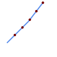
A LineString with points interpolated every 20%
--Return points each 20% along a 2D line
SELECT ST_AsText(ST_LineInterpolatePoints('LINESTRING(25 50, 100 125, 150 190)', 0.20))
----------------
MULTIPOINT((51.5974135047432 76.5974135047432),(78.1948270094864 103.194827009486),(104.132163186446 130.37181214238),(127.066081593223 160.18590607119),(150 190))
Name
ST_LineLocatePoint — Returns the fractional location of the closest point on a line to a point.
Synopsis
float8 ST_LineLocatePoint(geometry a_linestring, geometry a_point);
설명
입력 포인트에 가장 가까운 위치에 있는 라인스트링 상의 포인트를 나타내는 2차원 라인 전체 길이의 비율을 0에서 1 사이의 부동소수점 데이터형(float)으로 반환합니다.
반환된 위치를 이용해서 포인트(ST_LineInterpolatePoint) 또는 부분 스트링(ST_LineSubstring)을 추출할 수 있습니다.
이 함수는 주소의 개수의 근사치를 구하는 데 유용합니다.
1.1.0 버전부터 사용할 수 있습니다.
변경 사항: 2.1.0 미만 버전, 즉 2.0.x 버전까지 이 함수의 명칭은 ST_Line_Locate_Point였습니다.
예시
-- 거리를 따라 있는 포인트의 번지수를 대충 어림짐작하기
-- foo 전체가 집 중심점 및 거리처럼 보이는 가짜 데이터를 생성하기 위한 것이라는 점에 주의
-- ST_DWithin을 이용해서 거리에서 너무 멀리 떨어진 집들을 제외
SELECT ST_AsText(house_loc) As as_text_house_loc,
startstreet_num +
CAST( (endstreet_num - startstreet_num)
* ST_LineLocatePoint(street_line, house_loc) As integer) As street_num
FROM
(SELECT ST_GeomFromText('LINESTRING(1 2, 3 4)') As street_line,
ST_MakePoint(x*1.01,y*1.03) As house_loc, 10 As startstreet_num,
20 As endstreet_num
FROM generate_series(1,3) x CROSS JOIN generate_series(2,4) As y)
As foo
WHERE ST_DWithin(street_line, house_loc, 0.2);
as_text_house_loc | street_num
-------------------+------------
POINT(1.01 2.06) | 10
POINT(2.02 3.09) | 15
POINT(3.03 4.12) | 20
-- 포인트 또는 다른 도형에 가장 가까운 라인 상의 포인트를 찾기
SELECT ST_AsText(ST_LineInterpolatePoint(foo.the_line, ST_LineLocatePoint(foo.the_line, ST_GeomFromText('POINT(4 3)'))))
FROM (SELECT ST_GeomFromText('LINESTRING(1 2, 4 5, 6 7)') As the_line) As foo;
st_astext
----------------
POINT(3 4)
Name
ST_LineSubstring — Returns the part of a line between two fractional locations.
Synopsis
geometry ST_LineSubstring(geometry a_linestring, float8 startfraction, float8 endfraction);
설명
Computes the line which is the section of the input line starting and ending at the given fractional locations. The first argument must be a LINESTRING. The second and third arguments are values in the range [0, 1] representing the start and end locations as fractions of line length. The Z and M values are interpolated for added endpoints if present.
'시작'과 '끝'이 동일한 값일 경우 이 함수는 ST_LineInterpolatePoint 함수와 같아집니다.
| |
This only works with LINESTRINGs. To use on contiguous MULTILINESTRINGs first join them with ST_LineMerge. |
| |
1.1.1 배포판부터 이 함수는 M 및 Z값(이 있을 경우)도 보간합니다. 이전 배포판에서는 두 값을 설정하지 않았습니다. |
1.1.0 버전부터 사용할 수 있습니다. 1.1.1 버전부터 Z 및 M을 지원합니다.
변경 사항: 2.1.0 미만 버전, 즉 2.0.x 버전까지 이 함수의 명칭은 ST_Line_Substring이었습니다.
This function supports 3d and will not drop the z-index.
예시
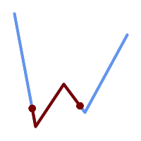
중간 1/3 범위(0.333, 0.666)를 중첩해서 출력한 라인스트링
SELECT ST_AsText(ST_LineSubstring( 'LINESTRING (20 180, 50 20, 90 80, 120 40, 180 150)', 0.333, 0.666)); ------------------------------------------------------------------------------------------------ LINESTRING (45.17311810399485 45.74337011202746, 50 20, 90 80, 112.97593050157862 49.36542599789519)
If start and end locations are the same, the result is a POINT.
SELECT ST_AsText(ST_LineSubstring( 'LINESTRING(25 50, 100 125, 150 190)', 0.333, 0.333)); ------------------------------------------ POINT(69.2846934853974 94.2846934853974)
A query to cut a LineString into sections of length 100 or shorter. It uses generate_series() with a CROSS JOIN LATERAL to produce the equivalent of a FOR loop.
WITH data(id, geom) AS (VALUES
( 'A', 'LINESTRING( 0 0, 200 0)'::geometry ),
( 'B', 'LINESTRING( 0 100, 350 100)'::geometry ),
( 'C', 'LINESTRING( 0 200, 50 200)'::geometry )
)
SELECT id, i,
ST_AsText( ST_LineSubstring( geom, startfrac, LEAST( endfrac, 1 )) ) AS geom
FROM (
SELECT id, geom, ST_Length(geom) len, 100 sublen FROM data
) AS d
CROSS JOIN LATERAL (
SELECT i, (sublen * i) / len AS startfrac,
(sublen * (i+1)) / len AS endfrac
FROM generate_series(0, floor( len / sublen )::integer ) AS t(i)
-- skip last i if line length is exact multiple of sublen
WHERE (sublen * i) / len <> 1.0
) AS d2;
id | i | geom
----+---+-----------------------------
A | 0 | LINESTRING(0 0,100 0)
A | 1 | LINESTRING(100 0,200 0)
B | 0 | LINESTRING(0 100,100 100)
B | 1 | LINESTRING(100 100,200 100)
B | 2 | LINESTRING(200 100,300 100)
B | 3 | LINESTRING(300 100,350 100)
C | 0 | LINESTRING(0 200,50 200)
Name
ST_LocateAlong — Returns the point(s) on a geometry that match a measure value.
Synopsis
geometry ST_LocateAlong(geometry ageom_with_measure, float8 a_measure, float8 offset);
설명
Returns the location(s) along a measured geometry that have the given measure values. The result is a Point or MultiPoint. Polygonal inputs are not supported.
If offset is provided, the result is offset to the left or right of the input line by the specified distance. A positive offset will be to the left, and a negative one to the right.
| |
Use this function only for linear geometries with an M component |
The semantic is specified by the ISO/IEC 13249-3 SQL/MM Spatial standard.
1.1.0 버전부터 예전 명칭인 ST_Locate_Along_Measure로 사용할 수 있습니다.
변경 사항: 2.0.0 미만 버전에서는 ST_Locate_Along_Measure라는 명칭이었습니다. 예전 명칭은 더 지원되지 않고 곧 삭제될 예정이지만, 아직은 사용할 수 있습니다.
This function supports M coordinates.
This method implements the SQL/MM specification. SQL-MM IEC 13249-3: 5.1.13
Name
ST_LocateBetween — Returns the portions of a geometry that match a measure range.
Synopsis
geometry ST_LocateBetween(geometry geomA, float8 measure_start, float8 measure_end, float8 offset);
설명
설정한 척도와 일치하는 요소들을 가진 파생 도형 집합의 값을 반환합니다. 폴리곤 구성 요소는 지원되지 않습니다.
오프셋을 설정할 경우, 그 결과 입력 라인에서 설정한 단위 개수만큼 왼쪽 또는 오른쪽에 오프셋 도형 집합을 출력할 것입니다. 양의 오프셋은 왼쪽, 음의 오프셋은 오른쪽으로 출력할 것입니다.
Clipping a non-convex POLYGON may produce invalid geometry.
The semantic is specified by the ISO/IEC 13249-3 SQL/MM Spatial standard.
1.1.0 버전부터 예전 명칭인 ST_Locate_Between_Measures로 사용할 수 있습니다.
변경 사항: 2.0.0 미만 버전에서는 ST_Locate_Along_Measure라는 명칭이었습니다. 예전 명칭은 더 지원되지 않고 곧 삭제될 예정이지만, 아직은 사용할 수 있습니다.
Enhanced: 3.0.0 - added support for POLYGON, TIN, TRIANGLE.
This function supports M coordinates.
This method implements the SQL/MM specification. SQL-MM IEC 13249-3: 5.1
예시
SELECT ST_AsText(
ST_LocateBetween(
'MULTILINESTRING M ((1 2 3, 3 4 2, 9 4 3),(1 2 3, 5 4 5))':: geometry,
1.5, 3 ));
------------------------------------------------------------------------
GEOMETRYCOLLECTION M (LINESTRING M (1 2 3,3 4 2,9 4 3),POINT M (1 2 3))
A LineString with the section between measures 2 and 8, offset to the left
SELECT ST_AsText( ST_LocateBetween(
ST_AddMeasure('LINESTRING (20 180, 50 20, 100 120, 180 20)', 0, 10),
2, 8,
20
));
------------------------------------------------------------------------
MULTILINESTRING((54.49835019899045 104.53426957938231,58.70056060327303 82.12248075654186,69.16695286779743 103.05526528559065,82.11145618000168 128.94427190999915,84.24893681714357 132.32493442618113,87.01636951231555 135.21267035596549,90.30307285299679 137.49198684843182,93.97759758337769 139.07172433557758,97.89298381958797 139.8887023914453,101.89263860095893 139.9102465862721,105.81659870902816 139.13549527600819,109.50792827749828 137.5954340631298,112.81899532549731 135.351656550512,115.6173761888606 132.49390095108848,145.31017306064817 95.37790486135405))
Name
ST_LocateBetweenElevations — Returns the portions of a geometry that lie in an elevation (Z) range.
Synopsis
geometry ST_LocateBetweenElevations(geometry geom_mline, float8 elevation_start, float8 elevation_end);
설명
Returns a geometry (collection) with the portions of a geometry that lie in an elevation (Z) range.
Clipping a non-convex POLYGON may produce invalid geometry.
1.4.0 버전부터 사용할 수 있습니다.
Enhanced: 3.0.0 - added support for POLYGON, TIN, TRIANGLE.
This function supports 3d and will not drop the z-index.
예시
SELECT ST_AsText(
ST_LocateBetweenElevations(
'LINESTRING(1 2 3, 4 5 6)'::geometry,
2, 4 ));
st_astext
-----------------------------------
MULTILINESTRING Z ((1 2 3,2 3 4))
SELECT ST_AsText(
ST_LocateBetweenElevations(
'LINESTRING(1 2 6, 4 5 -1, 7 8 9)',
6, 9)) As ewelev;
ewelev
-----------------------------------------------------------------------
GEOMETRYCOLLECTION Z (POINT Z (1 2 6),LINESTRING Z (6.1 7.1 6,7 8 9))
Name
ST_InterpolatePoint — 입력 포인트에 가까운 포인트에서 도형의 척도 차원(M 차원)의 값을 반환합니다.
Synopsis
float8 ST_InterpolatePoint(geometry linear_geom_with_measure, geometry point);
설명
Returns an interpolated measure value of a linear measured geometry at the location closest to the given point.
| |
Use this function only for linear geometries with an M component |
2.0.0 버전부터 사용할 수 있습니다.
This function supports 3d and will not drop the z-index.
Name
ST_AddMeasure — Interpolates measures along a linear geometry.
Synopsis
geometry ST_AddMeasure(geometry geom_mline, float8 measure_start, float8 measure_end);
설명
시작점과 종단점 사이의 선형적으로 보간된 척도 요소들을 가진 파생 도형을 반환합니다. 도형이 척도 차원을 가지고 있지 않을 경우, 척도 차원을 추가합니다. 도형이 척도 차원을 가지고 있을 경우, 새 값들로 덮어 씁니다. 라인스트링과 멀티라인스트링만 지원합니다.
1.5.0 버전부터 사용할 수 있습니다.
This function supports 3d and will not drop the z-index.
예시
SELECT ST_AsText(ST_AddMeasure(
ST_GeomFromEWKT('LINESTRING(1 0, 2 0, 4 0)'),1,4)) As ewelev;
ewelev
--------------------------------
LINESTRINGM(1 0 1,2 0 2,4 0 4)
SELECT ST_AsText(ST_AddMeasure(
ST_GeomFromEWKT('LINESTRING(1 0 4, 2 0 4, 4 0 4)'),10,40)) As ewelev;
ewelev
----------------------------------------
LINESTRING(1 0 4 10,2 0 4 20,4 0 4 40)
SELECT ST_AsText(ST_AddMeasure(
ST_GeomFromEWKT('LINESTRINGM(1 0 4, 2 0 4, 4 0 4)'),10,40)) As ewelev;
ewelev
----------------------------------------
LINESTRINGM(1 0 10,2 0 20,4 0 40)
SELECT ST_AsText(ST_AddMeasure(
ST_GeomFromEWKT('MULTILINESTRINGM((1 0 4, 2 0 4, 4 0 4),(1 0 4, 2 0 4, 4 0 4))'),10,70)) As ewelev;
ewelev
-----------------------------------------------------------------
MULTILINESTRINGM((1 0 10,2 0 20,4 0 40),(1 0 40,2 0 50,4 0 70))
- ST_IsValidTrajectory — Tests if the geometry is a valid trajectory.
- ST_ClosestPointOfApproach — Returns a measure at the closest point of approach of two trajectories.
- ST_DistanceCPA — Returns the distance between the closest point of approach of two trajectories.
- ST_CPAWithin — Tests if the closest point of approach of two trajectories is within the specified distance.
Name
ST_IsValidTrajectory — Tests if the geometry is a valid trajectory.
Synopsis
boolean ST_IsValidTrajectory(geometry line);
Description
Tests if a geometry encodes a valid trajectory. A valid trajectory is represented as a LINESTRING with measures (M values). The measure values must increase from each vertex to the next.
Valid trajectories are expected as input to spatio-temporal functions like ST_ClosestPointOfApproach
Availability: 2.2.0
This function supports 3d and will not drop the z-index.
Examples
-- A valid trajectory SELECT ST_IsValidTrajectory(ST_MakeLine( ST_MakePointM(0,0,1), ST_MakePointM(0,1,2)) ); t -- An invalid trajectory SELECT ST_IsValidTrajectory(ST_MakeLine(ST_MakePointM(0,0,1), ST_MakePointM(0,1,0))); NOTICE: Measure of vertex 1 (0) not bigger than measure of vertex 0 (1) st_isvalidtrajectory ---------------------- f
Name
ST_ClosestPointOfApproach — Returns a measure at the closest point of approach of two trajectories.
Synopsis
float8 ST_ClosestPointOfApproach(geometry track1, geometry track2);
Description
Returns the smallest measure at which points interpolated along the given trajectories are at the smallest distance.
Inputs must be valid trajectories as checked by ST_IsValidTrajectory. Null is returned if the trajectories do not overlap in their M ranges.
See ST_LocateAlong for getting the actual points at the given measure.
Availability: 2.2.0
This function supports 3d and will not drop the z-index.
Examples
-- Return the time in which two objects moving between 10:00 and 11:00
-- are closest to each other and their distance at that point
WITH inp AS ( SELECT
ST_AddMeasure('LINESTRING Z (0 0 0, 10 0 5)'::geometry,
extract(epoch from '2015-05-26 10:00'::timestamptz),
extract(epoch from '2015-05-26 11:00'::timestamptz)
) a,
ST_AddMeasure('LINESTRING Z (0 2 10, 12 1 2)'::geometry,
extract(epoch from '2015-05-26 10:00'::timestamptz),
extract(epoch from '2015-05-26 11:00'::timestamptz)
) b
), cpa AS (
SELECT ST_ClosestPointOfApproach(a,b) m FROM inp
), points AS (
SELECT ST_Force3DZ(ST_GeometryN(ST_LocateAlong(a,m),1)) pa,
ST_Force3DZ(ST_GeometryN(ST_LocateAlong(b,m),1)) pb
FROM inp, cpa
)
SELECT to_timestamp(m) t,
ST_Distance(pa,pb) distance
FROM points, cpa;
t | distance
-------------------------------+------------------
2015-05-26 10:45:31.034483+02 | 1.96036833151395
Name
ST_DistanceCPA — Returns the distance between the closest point of approach of two trajectories.
Synopsis
float8 ST_DistanceCPA(geometry track1, geometry track2);
Description
Returns the minimum distance two moving objects have ever been each other.
Inputs must be valid trajectories as checked by ST_IsValidTrajectory. Null is returned if the trajectories do not overlap in their M ranges.
Availability: 2.2.0
This function supports 3d and will not drop the z-index.
Examples
-- Return the minimum distance of two objects moving between 10:00 and 11:00
WITH inp AS ( SELECT
ST_AddMeasure('LINESTRING Z (0 0 0, 10 0 5)'::geometry,
extract(epoch from '2015-05-26 10:00'::timestamptz),
extract(epoch from '2015-05-26 11:00'::timestamptz)
) a,
ST_AddMeasure('LINESTRING Z (0 2 10, 12 1 2)'::geometry,
extract(epoch from '2015-05-26 10:00'::timestamptz),
extract(epoch from '2015-05-26 11:00'::timestamptz)
) b
)
SELECT ST_DistanceCPA(a,b) distance FROM inp;
distance
------------------
1.96036833151395
Name
ST_CPAWithin — Tests if the closest point of approach of two trajectories is within the specified distance.
Synopsis
boolean ST_CPAWithin(geometry track1, geometry track2, float8 dist);
Description
Tests whether two moving objects have ever been closer than the specified distance.
Inputs must be valid trajectories as checked by ST_IsValidTrajectory. False is returned if the trajectories do not overlap in their M ranges.
Availability: 2.2.0
This function supports 3d and will not drop the z-index.
Examples
WITH inp AS ( SELECT
ST_AddMeasure('LINESTRING Z (0 0 0, 10 0 5)'::geometry,
extract(epoch from '2015-05-26 10:00'::timestamptz),
extract(epoch from '2015-05-26 11:00'::timestamptz)
) a,
ST_AddMeasure('LINESTRING Z (0 2 10, 12 1 2)'::geometry,
extract(epoch from '2015-05-26 10:00'::timestamptz),
extract(epoch from '2015-05-26 11:00'::timestamptz)
) b
)
SELECT ST_CPAWithin(a,b,2), ST_DistanceCPA(a,b) distance FROM inp;
st_cpawithin | distance
--------------+------------------
t | 1.96521473776207
SFCGAL은 고급 2D 및 3D 함수를 제공하는 CGAL을 둘러싼 C++ 래퍼(wrapper) 라이브러리입니다. 강력한 기능을 위해, 도형 좌표가 정밀한 유리수 표현식을 가지고 있습니다.
SFCGAL 홈페이지 http://www.sfcgal.org 에서 이 라이브러리의 설치 지침을 찾아볼 수 있습니다. 함수들을 로드하려면 확장 프로그램 postgis_sfcgal을 생성하십시오.
- postgis_sfcgal_version — 실행중인 SFCGAL의 버전을 반환합니다.
- postgis_sfcgal_version — Returns the full version of SFCGAL in use including CGAL and Boost versions
- ST_3DArea — 3차원 표면 도형의 면적을 계산합니다. 입체일 경우 0을 반환할 것입니다.
- ST_3DConvexHull — 면 도형의 근사 중심축을 계산합니다.
- ST_3DIntersection — 3차원 교차를 수행합니다.
- ST_3DDifference — 3차원 차이를 수행합니다.
- ST_3DUnion — Perform 3D union.
- ST_AlphaShape — Computes a possible concave geometry using the CGAL Alpha Shapes algorithm.
- ST_ApproximateMedialAxis — 면 도형의 근사 중심축을 계산합니다.
- ST_ConstrainedDelaunayTriangles — Return a constrained Delaunay triangulation around the given input geometry.
- ST_Extrude — 표면을 관련 입체로 돌출시킵니다.
- ST_ForceLHR — LHR(Left Hand Reverse; 시계 방향) 방향을 강제합니다.
- ST_IsPlanar — 표면이 평면인지 아닌지 확인합니다.
- ST_IsSolid — 도형이 입체인지 테스트합니다. 어떤 유효성 검사도 수행하지 않습니다.
- ST_MakeSolid — 도형을 입체로 지정합니다. 어떤 확인 작업도 수행하지 않습니다. 유효한 입체를 얻으려면, 입력 도형이 닫힌 다면체 표면 또는 닫힌 TIN이어야만 합니다.
- ST_MinkowskiSum — 민코프스키 합계를 수행합니다.
- ST_OptimalAlphaShape — Computes a possible concave geometry using the CGAL Alpha Shapes algorithm after have computed the "optimal" alpha value.
- ST_Orientation — 표면의 방향(orientation)을 결정합니다.
- ST_StraightSkeleton — 도형으로부터 직선 골격(straight skeleton)을 계산합니다.
- ST_Tesselate — 폴리곤 또는 다면체 표면의 표면 다듬기(tesselation) 작업을 수행한 다음 TIN 또는 TIN 집합으로 반환합니다.
- ST_Volume — 3차원 입체의 부피를 계산합니다. 표면 도형을 입력하면 (닫힌 도형일지라도) 0을 반환할 것입니다.
Name
postgis_sfcgal_version — 실행중인 SFCGAL의 버전을 반환합니다.
Synopsis
text postgis_sfcgal_version(void);
Name
postgis_sfcgal_version — Returns the full version of SFCGAL in use including CGAL and Boost versions
Synopsis
text postgis_sfcgal_version(void);
설명
Returns the full version of SFCGAL in use including CGAL and Boost versions
2.1.0 버전부터 사용할 수 있습니다.
This method needs SFCGAL backend.
This function supports 3d and will not drop the z-index.
This function supports Polyhedral surfaces.
This function supports Triangles and Triangulated Irregular Network Surfaces (TIN).
Name
ST_3DArea — 3차원 표면 도형의 면적을 계산합니다. 입체일 경우 0을 반환할 것입니다.
Synopsis
floatST_3DArea(geometry geom1);
설명
2.1.0 버전부터 사용할 수 있습니다.
This method needs SFCGAL backend.
This method implements the SQL/MM specification. SQL-MM IEC 13249-3: 8.1, 10.5
This function supports 3d and will not drop the z-index.
This function supports Polyhedral surfaces.
This function supports Triangles and Triangulated Irregular Network Surfaces (TIN).
예시
주의: 기본적으로 KWT로부터 빌드된 다면체 표면은 표면 도형이지 입체가 아닙니다. 따라서 표면 면적을 구할 수 있습니다. 입체로 변환하면, 면적을 구할 수 없습니다.
SELECT ST_3DArea(geom) As cube_surface_area,
ST_3DArea(ST_MakeSolid(geom)) As solid_surface_area
FROM (SELECT 'POLYHEDRALSURFACE( ((0 0 0, 0 0 1, 0 1 1, 0 1 0, 0 0 0)),
((0 0 0, 0 1 0, 1 1 0, 1 0 0, 0 0 0)),
((0 0 0, 1 0 0, 1 0 1, 0 0 1, 0 0 0)),
((1 1 0, 1 1 1, 1 0 1, 1 0 0, 1 1 0)),
((0 1 0, 0 1 1, 1 1 1, 1 1 0, 0 1 0)),
((0 0 1, 1 0 1, 1 1 1, 0 1 1, 0 0 1)) )'::geometry) As f(geom);
cube_surface_area | solid_surface_area
-------------------+--------------------
6 | 0 Name
ST_3DConvexHull — 면 도형의 근사 중심축을 계산합니다.
Synopsis
geometry ST_3DConvexHull(geometry geom1);
설명
2.1.0 버전부터 사용할 수 있습니다.
This method needs SFCGAL backend.
This function supports 3d and will not drop the z-index.
This function supports Polyhedral surfaces.
This function supports Triangles and Triangulated Irregular Network Surfaces (TIN).
예시
SELECT ST_AsText(ST_3DConvexHull('LINESTRING Z(0 0 5, 1 5 3, 5 7 6, 9 5 3 , 5 7 5, 6 3 5)'::geometry));POLYHEDRALSURFACE Z (((1 5 3,9 5 3,0 0 5,1 5 3)),((1 5 3,0 0 5,5 7 6,1 5 3)),((5 7 6,5 7 5,1 5 3,5 7 6)),((0 0 5,6 3 5,5 7 6,0 0 5)),((6 3 5,9 5 3,5 7 6,6 3 5)),((0 0 5,9 5 3,6 3 5,0 0 5)),((9 5 3,5 7 5,5 7 6,9 5 3)),((1 5 3,5 7 5,9 5 3,1 5 3)))
WITH f AS (SELECT i, ST_Extrude(geom, 0,0, i ) AS geom
FROM ST_Subdivide(ST_Letters('CH'),5) WITH ORDINALITY AS sd(geom,i)
)
SELECT ST_3DConvexHull(ST_Collect(f.geom) )
FROM f;
Original geometry overlaid with 3D convex hull
Name
ST_3DIntersection — 3차원 교차를 수행합니다.
Synopsis
geometry ST_3DIntersection(geometry geom1, geometry geom2);
설명
geom1과 geom2가 공유하는 부분을 도형으로 반환합니다.
2.1.0 버전부터 사용할 수 있습니다.
This method needs SFCGAL backend.
This method implements the SQL/MM specification. SQL-MM IEC 13249-3: 5.1
This function supports 3d and will not drop the z-index.
This function supports Polyhedral surfaces.
This function supports Triangles and Triangulated Irregular Network Surfaces (TIN).
예시
PostGIS ST_AsX3D 를 통해 3차원 영상을 생성한 다음 X3Dom HTML 자바스크립트 렌더링 라이브러리 를 이용해서 HTML로 렌더링합니다.
SELECT ST_Extrude(ST_Buffer(ST_GeomFromText('POINT(100 90)'),
50, 'quad_segs=2'),0,0,30) AS geom1,
ST_Extrude(ST_Buffer(ST_GeomFromText('POINT(80 80)'),
50, 'quad_segs=1'),0,0,30) AS geom2;
 원본 3차원 도형들이 중첩합니다. geom2를 반투명하게 표현했습니다. |
SELECT ST_3DIntersection(geom1,geom2)
FROM ( SELECT ST_Extrude(ST_Buffer(ST_GeomFromText('POINT(100 90)'),
50, 'quad_segs=2'),0,0,30) AS geom1,
ST_Extrude(ST_Buffer(ST_GeomFromText('POINT(80 80)'),
50, 'quad_segs=1'),0,0,30) AS geom2 ) As t;
 geom1과 geom2가 교차한 부분 |
3차원 라인스트링과 폴리곤
SELECT ST_AsText(ST_3DIntersection(linestring, polygon)) As wkt
FROM ST_GeomFromText('LINESTRING Z (2 2 6,1.5 1.5 7,1 1 8,0.5 0.5 8,0 0 10)') AS linestring
CROSS JOIN ST_GeomFromText('POLYGON((0 0 8, 0 1 8, 1 1 8, 1 0 8, 0 0 8))') AS polygon;
wkt
--------------------------------
LINESTRING Z (1 1 8,0.5 0.5 8)
정육면체(닫힌 다면체 표면)과 폴리곤 Z
SELECT ST_AsText(ST_3DIntersection(
ST_GeomFromText('POLYHEDRALSURFACE Z( ((0 0 0, 0 0 1, 0 1 1, 0 1 0, 0 0 0)),
((0 0 0, 0 1 0, 1 1 0, 1 0 0, 0 0 0)), ((0 0 0, 1 0 0, 1 0 1, 0 0 1, 0 0 0)),
((1 1 0, 1 1 1, 1 0 1, 1 0 0, 1 1 0)),
((0 1 0, 0 1 1, 1 1 1, 1 1 0, 0 1 0)), ((0 0 1, 1 0 1, 1 1 1, 0 1 1, 0 0 1)) )'),
'POLYGON Z ((0 0 0, 0 0 0.5, 0 0.5 0.5, 0 0.5 0, 0 0 0))'::geometry))TIN Z (((0 0 0,0 0 0.5,0 0.5 0.5,0 0 0)),((0 0.5 0,0 0 0,0 0.5 0.5,0 0.5 0)))
두 물체의 입체 교차 또한 물체인 두 물체가 교차하는 부분(ST_Dimension 함수가 3을 반환)
SELECT ST_AsText(ST_3DIntersection( ST_Extrude(ST_Buffer('POINT(10 20)'::geometry,10,1),0,0,30),
ST_Extrude(ST_Buffer('POINT(10 20)'::geometry,10,1),2,0,10) ));POLYHEDRALSURFACE Z (((13.3333333333333 13.3333333333333 10,20 20 0,20 20 10,13.3333333333333 13.3333333333333 10)),
((20 20 10,16.6666666666667 23.3333333333333 10,13.3333333333333 13.3333333333333 10,20 20 10)),
((20 20 0,16.6666666666667 23.3333333333333 10,20 20 10,20 20 0)),
((13.3333333333333 13.3333333333333 10,10 10 0,20 20 0,13.3333333333333 13.3333333333333 10)),
((16.6666666666667 23.3333333333333 10,12 28 10,13.3333333333333 13.3333333333333 10,16.6666666666667 23.3333333333333 10)),
((20 20 0,9.99999999999995 30 0,16.6666666666667 23.3333333333333 10,20 20 0)),
((10 10 0,9.99999999999995 30 0,20 20 0,10 10 0)),((13.3333333333333 13.3333333333333 10,12 12 10,10 10 0,13.3333333333333 13.3333333333333 10)),
((12 28 10,12 12 10,13.3333333333333 13.3333333333333 10,12 28 10)),
((16.6666666666667 23.3333333333333 10,9.99999999999995 30 0,12 28 10,16.6666666666667 23.3333333333333 10)),
((10 10 0,0 20 0,9.99999999999995 30 0,10 10 0)),
((12 12 10,11 11 10,10 10 0,12 12 10)),((12 28 10,11 11 10,12 12 10,12 28 10)),
((9.99999999999995 30 0,11 29 10,12 28 10,9.99999999999995 30 0)),((0 20 0,2 20 10,9.99999999999995 30 0,0 20 0)),
((10 10 0,2 20 10,0 20 0,10 10 0)),((11 11 10,2 20 10,10 10 0,11 11 10)),((12 28 10,11 29 10,11 11 10,12 28 10)),
((9.99999999999995 30 0,2 20 10,11 29 10,9.99999999999995 30 0)),((11 11 10,11 29 10,2 20 10,11 11 10)))Name
ST_3DDifference — 3차원 차이를 수행합니다.
Synopsis
geometry ST_3DDifference(geometry geom1, geometry geom2);
설명
geom2의 일부분이 아닌 geom1의 부분을 반환합니다.
2.2.0 버전부터 사용할 수 있습니다.
This method needs SFCGAL backend.
This method implements the SQL/MM specification. SQL-MM IEC 13249-3: 5.1
This function supports 3d and will not drop the z-index.
This function supports Polyhedral surfaces.
This function supports Triangles and Triangulated Irregular Network Surfaces (TIN).
예시
PostGIS ST_AsX3D 를 통해 3차원 영상을 생성한 다음 X3Dom HTML 자바스크립트 렌더링 라이브러리 를 이용해서 HTML로 렌더링합니다.
SELECT ST_Extrude(ST_Buffer(ST_GeomFromText('POINT(100 90)'),
50, 'quad_segs=2'),0,0,30) AS geom1,
ST_Extrude(ST_Buffer(ST_GeomFromText('POINT(80 80)'),
50, 'quad_segs=1'),0,0,30) AS geom2;
원본 3차원 도형들이 중첩합니다. geom2가 제거될 부분을 나타냅니다. |
SELECT ST_3DDifference(geom1,geom2)
FROM ( SELECT ST_Extrude(ST_Buffer(ST_GeomFromText('POINT(100 90)'),
50, 'quad_segs=2'),0,0,30) AS geom1,
ST_Extrude(ST_Buffer(ST_GeomFromText('POINT(80 80)'),
50, 'quad_segs=1'),0,0,30) AS geom2 ) As t;
 geom2를 제거하고 남은 부분 |
Name
ST_3DUnion — Perform 3D union.
Synopsis
geometry ST_3DUnion(geometry geom1, geometry geom2);
geometry ST_3DUnion(geometry set g1field);
설명
2.2.0 버전부터 사용할 수 있습니다.
Availability: 3.3.0 aggregate variant was added
This method needs SFCGAL backend.
This method implements the SQL/MM specification. SQL-MM IEC 13249-3: 5.1
This function supports 3d and will not drop the z-index.
This function supports Polyhedral surfaces.
This function supports Triangles and Triangulated Irregular Network Surfaces (TIN).
Aggregate variant: returns a geometry that is the 3D union of a rowset of geometries. The ST_3DUnion() function is an "aggregate" function in the terminology of PostgreSQL. That means that it operates on rows of data, in the same way the SUM() and AVG() functions do and like most aggregates, it also ignores NULL geometries.
예시
PostGIS ST_AsX3D 를 통해 3차원 영상을 생성한 다음 X3Dom HTML 자바스크립트 렌더링 라이브러리 를 이용해서 HTML로 렌더링합니다.
SELECT ST_Extrude(ST_Buffer(ST_GeomFromText('POINT(100 90)'),
50, 'quad_segs=2'),0,0,30) AS geom1,
ST_Extrude(ST_Buffer(ST_GeomFromText('POINT(80 80)'),
50, 'quad_segs=1'),0,0,30) AS geom2;
원본 3차원 도형들이 중첩합니다. geom2를 반투명하게 표현했습니다. |
SELECT ST_3DUnion(geom1,geom2)
FROM ( SELECT ST_Extrude(ST_Buffer(ST_GeomFromText('POINT(100 90)'),
50, 'quad_segs=2'),0,0,30) AS geom1,
ST_Extrude(ST_Buffer(ST_GeomFromText('POINT(80 80)'),
50, 'quad_segs=1'),0,0,30) AS geom2 ) As t;
 geom1과 geom2의 통합 |
Name
ST_AlphaShape — Computes a possible concave geometry using the CGAL Alpha Shapes algorithm.
Synopsis
geometry ST_AlphaShape(geometry geom, float alpha, boolean allow_holes = false);
설명
Assume we are given a set S of points in 2D [...] and we would like to have something like "the shape formed by these points". This is quite a vague notion and there are probably many possible interpretations, the α-shape being one of them. Alpha shapes can be used for shape reconstruction from a dense unorganized set of data points. Indeed, an α-shape is demarcated by a frontier, which is a linear approximation of the original shape [1]. [1] F. Bernardini and C. Bajaj. Sampling and reconstructing manifolds using alpha-shapes. Technical Report CSD-TR-97-013, Dept. Comput. Sci., Purdue Univ., West Lafayette, IN, 1997. Source: CGAL ALpha Shapes This function compute the concave hull of a set of geometry, but using CGAL and a different algorithm than ST_ConcaveHull performed by the GEOS module. See : Concave Hulls in JTS
Availability: 3.3.0 - requires SFCGAL >= 1.4.1.
This method needs SFCGAL backend.
예시
Concave Hull of a MultiPoint (same example As ST_OptimalAlphaShape)
SELECT ST_AsText(ST_AlphaShape('MULTIPOINT((63 84),(76 88),(68 73),(53 18),(91 50),(81 70),
(88 29),(24 82),(32 51),(37 23),(27 54),(84 19),(75 87),(44 42),(77 67),(90 30),(36 61),(32 65),
(81 47),(88 58),(68 73),(49 95),(81 60),(87 50),
(78 16),(79 21),(30 22),(78 43),(26 85),(48 34),(35 35),(36 40),(31 79),(83 29),(27 84),(52 98),(72 95),(85 71),
(75 84),(75 77),(81 29),(77 73),(41 42),(83 72),(23 36),(89 53),(27 57),(57 97),(27 77),(39 88),(60 81),
(80 72),(54 32),(55 26),(62 22),(70 20),(76 27),(84 35),(87 42),(82 54),(83 64),(69 86),(60 90),(50 86),(43 80),(36 73),
(36 68),(40 75),(24 67),(23 60),(26 44),(28 33),(40 32),(43 19),(65 16),(73 16),(38 46),(31 59),(34 86),(45 90),(64 97))'::geometry,80.2));
POLYGON((89 53,91 50,87 42,90 30,88 29,84 19,78 16,73 16,65 16,53 18,43 19,37 23,30 22,28 33,23 36,26 44,27 54,23 60,24 67,
27 77,24 82,26 85,34 86,39 88,45 90,49 95,52 98,57 97,64 97,72 95,76 88,75 84,83 72,85 71,88 58,89 53))
Concave Hull of a MultiPoint, allowing holes (same example as ST_OptimalAlphaShape)
SELECT ST_AsText(ST_AlphaShape('MULTIPOINT((63 84),(76 88),(68 73),(53 18),(91 50),(81 70),(88 29),(24 82),(32 51),(37 23),(27 54),(84 19),(75 87),(44 42),(77 67),(90 30),(36 61),(32 65),(81 47),(88 58),(68 73),(49 95),(81 60),(87 50),
(78 16),(79 21),(30 22),(78 43),(26 85),(48 34),(35 35),(36 40),(31 79),(83 29),(27 84),(52 98),(72 95),(85 71),
(75 84),(75 77),(81 29),(77 73),(41 42),(83 72),(23 36),(89 53),(27 57),(57 97),(27 77),(39 88),(60 81),
(80 72),(54 32),(55 26),(62 22),(70 20),(76 27),(84 35),(87 42),(82 54),(83 64),(69 86),(60 90),(50 86),(43 80),(36 73),
(36 68),(40 75),(24 67),(23 60),(26 44),(28 33),(40 32),(43 19),(65 16),(73 16),(38 46),(31 59),(34 86),(45 90),(64 97))'::geometry, 100.1,true))
POLYGON((89 53,91 50,87 42,90 30,88 29,84 19,78 16,73 16,65 16,53 18,43 19,37 23,30 22,28 33,23 36,26 44,27 54,23 60,24 67,27 77,24 82,26 85,34 86,39 88,45 90,49 95,52 98,57 97,64 97,72 95,76 88,75 84,83 72,85 71,88 58,89 53),
(36 61,36 68,40 75,43 80,50 86,60 81,68 73,77 67,81 60,82 54,81 47,78 43,76 27,62 22,54 32,48 34,44 42,38 46,36 61))
Concave Hull of a MultiPoint, allowing holes (same example as ST_ConcaveHull)
SELECT ST_AlphaShape(
'MULTIPOINT ((132 64), (114 64), (99 64), (81 64), (63 64), (57 49), (52 36), (46 20), (37 20), (26 20), (32 36), (39 55), (43 69), (50 84), (57 100), (63 118), (68 133), (74 149), (81 164), (88 180), (101 180), (112 180), (119 164), (126 149), (132 131), (139 113), (143 100), (150 84), (157 69), (163 51), (168 36), (174 20), (163 20), (150 20), (143 36), (139 49), (132 64), (99 151), (92 138), (88 124), (81 109), (74 93), (70 82), (83 82), (99 82), (112 82), (126 82), (121 96), (114 109), (110 122), (103 138), (99 151), (34 27), (43 31), (48 44), (46 58), (52 73), (63 73), (61 84), (72 71), (90 69), (101 76), (123 71), (141 62), (166 27), (150 33), (159 36), (146 44), (154 53), (152 62), (146 73), (134 76), (143 82), (141 91), (130 98), (126 104), (132 113), (128 127), (117 122), (112 133), (119 144), (108 147), (119 153), (110 171), (103 164), (92 171), (86 160), (88 142), (79 140), (72 124), (83 131), (79 118), (68 113), (63 102), (68 93), (35 45))'::geometry,102.2, true);
POLYGON((134 80,136 75,130 63,135 45,132 44,126 28,117 24,110 24,98 24,80 27,82 39,72 51,60 48,56 34,52 52,42 50,
34 54,39 66,40 81,34 90,36 100,40 116,36 123,39 128,51 129,58 132,68 135,74 142,78 147,86 146,96 146,
108 142,114 132,112 126,112 116,116 110,120 108,125 108,128 106,125 96,132 87,134 80))
Name
ST_ApproximateMedialAxis — 면 도형의 근사 중심축을 계산합니다.
Synopsis
geometry ST_ApproximateMedialAxis(geometry geom);
설명
입력 면 도형의 직선 골격을 바탕으로 근사 중심축(approximate medial axis)을 반환합니다. 사용 가능한 버전(1.2.0 이상)에 대해 빌드했을 때 SFCGAL에 특화된 API를 이용합니다. 그렇지 않을 경우 이 함수는 (더 느린) ST_StraightSkeleton 함수를 둘러싼 래퍼(wrapper)에 불과합니다.
2.2.0 버전부터 사용할 수 있습니다.
This method needs SFCGAL backend.
This function supports 3d and will not drop the z-index.
This function supports Polyhedral surfaces.
This function supports Triangles and Triangulated Irregular Network Surfaces (TIN).
Name
ST_ConstrainedDelaunayTriangles — Return a constrained Delaunay triangulation around the given input geometry.
Synopsis
geometry ST_Tesselate(geometry geom);
설명
Return a Constrained Delaunay triangulation around the vertices of the input geometry. Output is a TIN.
This method needs SFCGAL backend.
2.1.0 버전부터 사용할 수 있습니다.
This function supports 3d and will not drop the z-index.
예시
 ST_ConstrainedDelaunayTriangles of 2 polygons
select ST_ConstrainedDelaunayTriangles(
ST_Union(
'POLYGON((175 150, 20 40, 50 60, 125 100, 175 150))'::geometry,
ST_Buffer('POINT(110 170)'::geometry, 20)
)
);
|  ST_DelaunayTriangles of 2 polygons. Triangle edges cross polygon boundaries.
select ST_DelaunayTriangles(
ST_Union(
'POLYGON((175 150, 20 40, 50 60, 125 100, 175 150))'::geometry,
ST_Buffer('POINT(110 170)'::geometry, 20)
)
);
|
Name
ST_Extrude — 표면을 관련 입체로 돌출시킵니다.
Synopsis
geometry ST_Extrude(geometry geom, float x, float y, float z);
설명
2.1.0 버전부터 사용할 수 있습니다.
This method needs SFCGAL backend.
This function supports 3d and will not drop the z-index.
This function supports Polyhedral surfaces.
This function supports Triangles and Triangulated Irregular Network Surfaces (TIN).
예시
PostGIS ST_AsX3D 를 통해 3차원 영상을 생성한 다음 X3Dom HTML 자바스크립트 렌더링 라이브러리 를 이용해서 HTML로 렌더링합니다.
SELECT ST_Buffer(ST_GeomFromText('POINT(100 90)'),
50, 'quad_segs=2'),0,0,30);
 버퍼를 적용한 포인트에서 생성된 원본 팔각형 |
ST_Extrude(ST_Buffer(ST_GeomFromText('POINT(100 90)'),
50, 'quad_segs=2'),0,0,30);
 Z축을 따라 30단위만큼 돌출된 육각형이 다면체 표면 Z(PolyhedralSurfaceZ)을 생성합니다. |
SELECT ST_GeomFromText('LINESTRING(50 50, 100 90, 95 150)')
 원본 라인스트링 |
SELECT ST_Extrude(
ST_GeomFromText('LINESTRING(50 50, 100 90, 95 150)'),0,0,10));
 Z축을 따라 돌출된 라인스트링이 다면체 표면 Z(PolyhedralSurfaceZ)을 생성합니다. |
Name
ST_ForceLHR — LHR(Left Hand Reverse; 시계 방향) 방향을 강제합니다.
Synopsis
geometry ST_ForceLHR(geometry geom);
Name
ST_MakeSolid — 도형을 입체로 지정합니다. 어떤 확인 작업도 수행하지 않습니다. 유효한 입체를 얻으려면, 입력 도형이 닫힌 다면체 표면 또는 닫힌 TIN이어야만 합니다.
Synopsis
geometry ST_MakeSolid(geometry geom1);
Name
ST_MinkowskiSum — 민코프스키 합계를 수행합니다.
Synopsis
geometry ST_MinkowskiSum(geometry geom1, geometry geom2);
설명
이 함수는 폴리곤과, 포인트, 라인 또는 폴리곤의 2차원 민코프스키 합계를 수행합니다.
두 도형 A와 B의 민코프스키 합계란 A와 B에 있는 모든 포인트를 합한, 모든 포인트들의 집합입니다. 민코프스키 합계는 운동 계획(motion planning) 및 CAD(computer-aided design) 분야에서 자주 사용됩니다. 자세한 내용은 Wikipedia Minkowski addition 을 참조하십시오.
첫 번째 파라미터는 어떤 2차원 도형(포인트, 라인스트링, 폴리곤)도 될 수 있습니다. 만약 3차원 도형을 입력할 경우, Z 좌표를 0으로 강제해서 2차원으로 변환하기 때문에 유효하지 않은 도형으로 변할 가능성이 있습니다. 두 번째 파라미터는 2차원 폴리곤이어야만 합니다.
구현하는 데 CGAL 2D Minkowskisum 을 활용합니다.
2.1.0 버전부터 사용할 수 있습니다.
This method needs SFCGAL backend.
예시
라인스트링이 원을 뚫고 지나가는 경우 라인스트링과 원형 폴리곤의 민코프스키 합계
|
 합계 전
|
 합계 후
|
SELECT ST_MinkowskiSum(line, circle))
FROM (SELECT
ST_MakeLine(ST_MakePoint(10, 10),ST_MakePoint(100, 100)) As line,
ST_Buffer(ST_GeomFromText('POINT(50 50)'), 30) As circle) As foo;
-- WKT --
MULTIPOLYGON(((30 59.9999999999999,30.5764415879031 54.1472903395161,32.2836140246614 48.5194970290472,35.0559116309237 43.3328930094119,38.7867965644036 38.7867965644035,43.332893009412 35.0559116309236,48.5194970290474 32.2836140246614,54.1472903395162 30.5764415879031,60.0000000000001 30,65.8527096604839 30.5764415879031,71.4805029709527 32.2836140246614,76.6671069905881 35.0559116309237,81.2132034355964 38.7867965644036,171.213203435596 128.786796564404,174.944088369076 133.332893009412,177.716385975339 138.519497029047,179.423558412097 144.147290339516,180 150,179.423558412097 155.852709660484,177.716385975339 161.480502970953,174.944088369076 166.667106990588,171.213203435596 171.213203435596,166.667106990588 174.944088369076,
161.480502970953 177.716385975339,155.852709660484 179.423558412097,150 180,144.147290339516 179.423558412097,138.519497029047 177.716385975339,133.332893009412 174.944088369076,128.786796564403 171.213203435596,38.7867965644035 81.2132034355963,35.0559116309236 76.667106990588,32.2836140246614 71.4805029709526,30.5764415879031 65.8527096604838,30 59.9999999999999)))
폴리곤과 멀티 포인트의 민코프스키 합계
|
 합계 전
|
 합계 후: 폴리곤을 복제해서 포인트의 위치로 번역합니다.
|
SELECT ST_MinkowskiSum(mp, poly)
FROM (SELECT 'MULTIPOINT(25 50,70 25)'::geometry As mp,
'POLYGON((130 150, 20 40, 50 60, 125 100, 130 150))'::geometry As poly
) As foo
-- WKT --
MULTIPOLYGON(
((70 115,100 135,175 175,225 225,70 115)),
((120 65,150 85,225 125,275 175,120 65))
)
Name
ST_OptimalAlphaShape — Computes a possible concave geometry using the CGAL Alpha Shapes algorithm after have computed the "optimal" alpha value.
Synopsis
geometryST_OptimalAlphaShape(geometry param_geom, boolean allow_holes = false, integer nb_components);
설명
Computes the "optimal" alpha-shapes of the set of geometry. CGAL can automatically find the optimal value of alpha. This version uses it to find an "optimal" alpha-shape. The result is a single polygon. It will not contain holes unless the optional param_allow_holes argument is specified as true. The result will be generated such that the number of solid component of the alpha shape is equal to or smaller than param_nb_components.
Availability: 3.3.0 - requires SFCGAL >= 1.4.1.
This method needs SFCGAL backend.
예시
Concave Hull of a MultiPoint (same example as ST_AlphaShape)
SELECT ST_AsText(ST_OptimalAlphaShape('MULTIPOINT((63 84),(76 88),(68 73),(53 18),(91 50),(81 70),
(88 29),(24 82),(32 51),(37 23),(27 54),(84 19),(75 87),(44 42),(77 67),(90 30),(36 61),(32 65),
(81 47),(88 58),(68 73),(49 95),(81 60),(87 50),
(78 16),(79 21),(30 22),(78 43),(26 85),(48 34),(35 35),(36 40),(31 79),(83 29),(27 84),(52 98),(72 95),(85 71),
(75 84),(75 77),(81 29),(77 73),(41 42),(83 72),(23 36),(89 53),(27 57),(57 97),(27 77),(39 88),(60 81),
(80 72),(54 32),(55 26),(62 22),(70 20),(76 27),(84 35),(87 42),(82 54),(83 64),(69 86),(60 90),(50 86),(43 80),(36 73),
(36 68),(40 75),(24 67),(23 60),(26 44),(28 33),(40 32),(43 19),(65 16),(73 16),(38 46),(31 59),(34 86),(45 90),(64 97))'::geometry));
POLYGON((89 53,91 50,87 42,90 30,88 29,84 19,78 16,73 16,65 16,53 18,43 19,37 23,30 22,28 33,23 36,
26 44,27 54,23 60,24 67,27 77,24 82,26 85,34 86,39 88,45 90,49 95,52 98,57 97,64 97,72 95,76 88,75 84,75 77,83 72,85 71,83 64,88 58,89 53))
Concave Hull of a MultiPoint, allowing holes (same example as ST_AlphaShape)
SELECT ST_AsText(ST_OptimalAlphaShape('MULTIPOINT((63 84),(76 88),(68 73),(53 18),(91 50),(81 70),(88 29),(24 82),(32 51),(37 23),(27 54),(84 19),(75 87),(44 42),(77 67),(90 30),(36 61),(32 65),(81 47),(88 58),(68 73),(49 95),(81 60),(87 50),
(78 16),(79 21),(30 22),(78 43),(26 85),(48 34),(35 35),(36 40),(31 79),(83 29),(27 84),(52 98),(72 95),(85 71),
(75 84),(75 77),(81 29),(77 73),(41 42),(83 72),(23 36),(89 53),(27 57),(57 97),(27 77),(39 88),(60 81),
(80 72),(54 32),(55 26),(62 22),(70 20),(76 27),(84 35),(87 42),(82 54),(83 64),(69 86),(60 90),(50 86),(43 80),(36 73),
(36 68),(40 75),(24 67),(23 60),(26 44),(28 33),(40 32),(43 19),(65 16),(73 16),(38 46),(31 59),(34 86),(45 90),(64 97))'::geometry, allow_holes => true));
POLYGON((89 53,91 50,87 42,90 30,88 29,84 19,78 16,73 16,65 16,53 18,43 19,37 23,30 22,28 33,23 36,26 44,27 54,23 60,24 67,27 77,24 82,26 85,34 86,39 88,45 90,49 95,52 98,57 97,64 97,72 95,76 88,75 84,75 77,83 72,85 71,83 64,88 58,89 53),(36 61,36 68,40 75,43 80,50 86,60 81,68 73,77 67,81 60,82 54,81 47,78 43,81 29,76 27,70 20,62 22,55 26,54 32,48 34,44 42,38 46,36 61))
Name
ST_StraightSkeleton — 도형으로부터 직선 골격(straight skeleton)을 계산합니다.
Synopsis
geometry ST_StraightSkeleton(geometry geom);

Name
ST_Tesselate — 폴리곤 또는 다면체 표면의 표면 다듬기(tesselation) 작업을 수행한 다음 TIN 또는 TIN 집합으로 반환합니다.
Synopsis
geometry ST_Tesselate(geometry geom);
설명
[멀티]폴리곤 또는 다면체 표면 같은 표면 도형을 입력받아 삼각형을 이용한 다듬기(모자이크) 과정을 거친 TIN 표현식을 반환합니다.
2.1.0 버전부터 사용할 수 있습니다.
This method needs SFCGAL backend.
This function supports 3d and will not drop the z-index.
This function supports Polyhedral surfaces.
This function supports Triangles and Triangulated Irregular Network Surfaces (TIN).
예시
SELECT ST_GeomFromText('POLYHEDRALSURFACE Z( ((0 0 0, 0 0 1, 0 1 1, 0 1 0, 0 0 0)),
((0 0 0, 0 1 0, 1 1 0, 1 0 0, 0 0 0)), ((0 0 0, 1 0 0, 1 0 1, 0 0 1, 0 0 0)),
((1 1 0, 1 1 1, 1 0 1, 1 0 0, 1 1 0)),
((0 1 0, 0 1 1, 1 1 1, 1 1 0, 0 1 0)), ((0 0 1, 1 0 1, 1 1 1, 0 1 1, 0 0 1)) )');
 원본 정육면체 |
SELECT ST_Tesselate(ST_GeomFromText('POLYHEDRALSURFACE Z( ((0 0 0, 0 0 1, 0 1 1, 0 1 0, 0 0 0)),
((0 0 0, 0 1 0, 1 1 0, 1 0 0, 0 0 0)), ((0 0 0, 1 0 0, 1 0 1, 0 0 1, 0 0 0)),
((1 1 0, 1 1 1, 1 0 1, 1 0 0, 1 1 0)),
((0 1 0, 0 1 1, 1 1 1, 1 1 0, 0 1 0)), ((0 0 1, 1 0 1, 1 1 1, 0 1 1, 0 0 1)) )'));
ST_AsText 출력물: TIN Z (((0 0 0,0 0 1,0 1 1,0 0 0)),((0 1 0,0 0 0,0 1 1,0 1 0)),
((0 0 0,0 1 0,1 1 0,0 0 0)),
((1 0 0,0 0 0,1 1 0,1 0 0)),((0 0 1,1 0 0,1 0 1,0 0 1)),
((0 0 1,0 0 0,1 0 0,0 0 1)),
((1 1 0,1 1 1,1 0 1,1 1 0)),((1 0 0,1 1 0,1 0 1,1 0 0)),
((0 1 0,0 1 1,1 1 1,0 1 0)),((1 1 0,0 1 0,1 1 1,1 1 0)),
((0 1 1,1 0 1,1 1 1,0 1 1)),((0 1 1,0 0 1,1 0 1,0 1 1)))
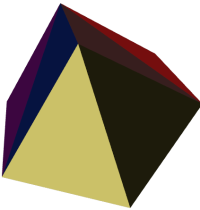 삼각형을 색으로 구분한 다듬어진 정육면체 |
SELECT 'POLYGON (( 10 190, 10 70, 80 70, 80 130, 50 160, 120 160, 120 190, 10 190 ))'::geometry;
 원본 폴리곤 |
SELECT
ST_Tesselate('POLYGON (( 10 190, 10 70, 80 70, 80 130, 50 160, 120 160, 120 190, 10 190 ))'::geometry);
ST_AsText 출력물: TIN(((80 130,50 160,80 70,80 130)),((50 160,10 190,10 70,50 160)),
((80 70,50 160,10 70,80 70)),((120 160,120 190,50 160,120 160)),
((120 190,10 190,50 160,120 190)))
 다듬어진 폴리곤 |
Name
ST_Volume — 3차원 입체의 부피를 계산합니다. 표면 도형을 입력하면 (닫힌 도형일지라도) 0을 반환할 것입니다.
Synopsis
float ST_Volume(geometry geom1);
설명
2.2.0 버전부터 사용할 수 있습니다.
This method needs SFCGAL backend.
This function supports 3d and will not drop the z-index.
This function supports Polyhedral surfaces.
This function supports Triangles and Triangulated Irregular Network Surfaces (TIN).
This method implements the SQL/MM specification. SQL-MM IEC 13249-3: 9.1 (same as ST_3DVolume)
예시
WKT로 닫힌 표면을 생성했을 때, 입체라기보다는 면으로 취급됩니다. 이 닫힌 표면을 입체로 만들려면, ST_MakeSolid 함수를 이용해야 합니다. 면 도형은 부피가 없습니다. 다음은 그 사실을 보여주는 예시입니다.
SELECT ST_Volume(geom) As cube_surface_vol,
ST_Volume(ST_MakeSolid(geom)) As solid_surface_vol
FROM (SELECT 'POLYHEDRALSURFACE( ((0 0 0, 0 0 1, 0 1 1, 0 1 0, 0 0 0)),
((0 0 0, 0 1 0, 1 1 0, 1 0 0, 0 0 0)),
((0 0 0, 1 0 0, 1 0 1, 0 0 1, 0 0 0)),
((1 1 0, 1 1 1, 1 0 1, 1 0 0, 1 1 0)),
((0 1 0, 0 1 1, 1 1 1, 1 1 0, 0 1 0)),
((0 0 1, 1 0 1, 1 1 1, 0 1 1, 0 0 1)) )'::geometry) As f(geom);
cube_surface_vol | solid_surface_vol
------------------+-------------------
0 | 1
이 모듈 및 관련 PL/pgSQL 함수들은 웹 피처 서비스(Web Feature Service) 사양서가 요구하는 장기 잠금(long locking) 을 지원하기 위해 구현됐습니다.
- AddAuth — 현재 트랜잭션에 이용될 승인 토큰을 추가합니다.
- CheckAuth — 승인 토큰을 바탕으로, 테이블에 대해 행들의 업데이트 및 삭제를 금지/허락하는 트리거를 생성합니다.
- DisableLongTransactions — DisableLongTransactions
- EnableLongTransactions — EnableLongTransactions
- LockRow — 테이블 내부의 특정 행에 대한 잠금/승인을 설정합니다.
- UnlockRows — Removes all locks held by an authorization token.
| |
사용자는 직렬 가능 트랜잭션 레벨(serializable transaction level) 을 이용해야 합니다. 그렇지 않으면 잠금 기제(locking mechanism)가 중단될 것입니다. |
Name
AddAuth — 현재 트랜잭션에 이용될 승인 토큰을 추가합니다.
Synopsis
boolean AddAuth(text auth_token);
설명
현재 트랜잭션에 이용될 승인 토큰을 추가합니다.
Adds the current transaction identifier and authorization token to a temporary table called temp_lock_have_table.
1.1.3 버전부터 사용할 수 있습니다.
Name
CheckAuth — 승인 토큰을 바탕으로, 테이블에 대해 행들의 업데이트 및 삭제를 금지/허락하는 트리거를 생성합니다.
Synopsis
integer CheckAuth(text a_schema_name, text a_table_name, text a_key_column_name);
integer CheckAuth(text a_table_name, text a_key_column_name);
Name
DisableLongTransactions — DisableLongTransactions
Synopsis
text DisableLongTransactions();
Name
EnableLongTransactions — EnableLongTransactions
Synopsis
text EnableLongTransactions();
Name
LockRow — 테이블 내부의 특정 행에 대한 잠금/승인을 설정합니다.
Synopsis
integer LockRow(text a_schema_name, text a_table_name, text a_row_key, text an_auth_token, timestamp expire_dt);
integer LockRow(text a_table_name, text a_row_key, text an_auth_token, timestamp expire_dt);
integer LockRow(text a_table_name, text a_row_key, text an_auth_token);
설명
테이블 내부의 특정 행에 대한 잠금/승인을 설정합니다. <authid>는 텍스트 값, <expires>는 기본값이 now()+1시간인 타임스탬프입니다. 잠금이 할당된 경우 1을 반환하고, 그렇지 않을 (이미 다른 승인을 받아 잠겨 있는) 경우 0을 반환합니다.
1.1.3 버전부터 사용할 수 있습니다.
- PostGIS_Extensions_Upgrade — Packages and upgrades PostGIS extensions (e.g. postgis_raster, postgis_topology, postgis_sfcgal) to latest available version.
- PostGIS_Full_Version — Reports full PostGIS version and build configuration infos.
- PostGIS_GEOS_Version — Returns the version number of the GEOS library.
- PostGIS_Liblwgeom_Version — Returns the version number of the liblwgeom library. This should match the version of PostGIS.
- PostGIS_LibXML_Version — Returns the version number of the libxml2 library.
- PostGIS_Lib_Build_Date — Returns build date of the PostGIS library.
- PostGIS_Lib_Version — Returns the version number of the PostGIS library.
- PostGIS_PROJ_Version — Returns the version number of the PROJ4 library.
- PostGIS_Wagyu_Version — Returns the version number of the internal Wagyu library.
- PostGIS_Scripts_Build_Date — Returns build date of the PostGIS scripts.
- PostGIS_Scripts_Installed — Returns version of the PostGIS scripts installed in this database.
- PostGIS_Scripts_Released — Returns the version number of the postgis.sql script released with the installed PostGIS lib.
- PostGIS_Version — Returns PostGIS version number and compile-time options.
Name
PostGIS_Extensions_Upgrade — Packages and upgrades PostGIS extensions (e.g. postgis_raster, postgis_topology, postgis_sfcgal) to latest available version.
Synopsis
text PostGIS_Extensions_Upgrade();
Description
Packages and upgrades PostGIS extensions to latest version. Only extensions you have installed in the database will be packaged and upgraded if needed. Reports full PostGIS version and build configuration infos after. This is short-hand for doing multiple CREATE EXTENSION .. FROM unpackaged and ALTER EXTENSION .. UPDATE for each PostGIS extension. Currently only tries to upgrade extensions postgis, postgis_raster, postgis_sfcgal, postgis_topology, and postgis_tiger_geocoder.
Availability: 2.5.0
| |
Changed: 3.3.0 support for upgrades from any PostGIS version. Does not work on all systems. Changed: 3.0.0 to repackage loose extensions and support postgis_raster. |
Examples
SELECT PostGIS_Extensions_Upgrade();
NOTICE: Packaging extension postgis
NOTICE: Packaging extension postgis_raster
NOTICE: Packaging extension postgis_sfcgal
NOTICE: Extension postgis_topology is not available or not packagable for some reason
NOTICE: Extension postgis_tiger_geocoder is not available or not packagable for some reason
postgis_extensions_upgrade
-------------------------------------------------------------------
Upgrade completed, run SELECT postgis_full_version(); for details
(1 row)Name
PostGIS_Full_Version — Reports full PostGIS version and build configuration infos.
Synopsis
text PostGIS_Full_Version();
Description
Reports full PostGIS version and build configuration infos. Also informs about synchronization between libraries and scripts suggesting upgrades as needed.
Examples
SELECT PostGIS_Full_Version();
postgis_full_version
----------------------------------------------------------------------------------
POSTGIS="3.0.0dev r17211" [EXTENSION] PGSQL="110" GEOS="3.8.0dev-CAPI-1.11.0 df24b6bb" SFCGAL="1.3.6" PROJ="Rel. 5.2.0, September 15th, 2018"
GDAL="GDAL 2.3.2, released 2018/09/21" LIBXML="2.9.9" LIBJSON="0.13.1" LIBPROTOBUF="1.3.1" WAGYU="0.4.3 (Internal)" TOPOLOGY RASTER
(1 row)
Name
PostGIS_GEOS_Version — Returns the version number of the GEOS library.
Synopsis
text PostGIS_GEOS_Version();
Name
PostGIS_Liblwgeom_Version — Returns the version number of the liblwgeom library. This should match the version of PostGIS.
Synopsis
text PostGIS_Liblwgeom_Version();
Name
PostGIS_LibXML_Version — Returns the version number of the libxml2 library.
Synopsis
text PostGIS_LibXML_Version();
Name
PostGIS_Lib_Build_Date — Returns build date of the PostGIS library.
Synopsis
text PostGIS_Lib_Build_Date();
Name
PostGIS_Lib_Version — Returns the version number of the PostGIS library.
Synopsis
text PostGIS_Lib_Version();
Name
PostGIS_PROJ_Version — Returns the version number of the PROJ4 library.
Synopsis
text PostGIS_PROJ_Version();
Description
Returns the version number of the PROJ4 library, or NULL if PROJ4 support is not enabled.
Name
PostGIS_Wagyu_Version — Returns the version number of the internal Wagyu library.
Synopsis
text PostGIS_Wagyu_Version();
Description
Returns the version number of the internal Wagyu library, or NULL if Wagyu support is not enabled.
Name
PostGIS_Scripts_Build_Date — Returns build date of the PostGIS scripts.
Synopsis
text PostGIS_Scripts_Build_Date();
Name
PostGIS_Scripts_Installed — Returns version of the PostGIS scripts installed in this database.
Synopsis
text PostGIS_Scripts_Installed();
Description
Returns version of the PostGIS scripts installed in this database.
| |
If the output of this function doesn't match the output of PostGIS_Scripts_Released you probably missed to properly upgrade an existing database. See the Upgrading section for more info. |
Availability: 0.9.0
Name
PostGIS_Scripts_Released — Returns the version number of the postgis.sql script released with the installed PostGIS lib.
Synopsis
text PostGIS_Scripts_Released();
Description
Returns the version number of the postgis.sql script released with the installed PostGIS lib.
| |
Starting with version 1.1.0 this function returns the same value of PostGIS_Lib_Version. Kept for backward compatibility. |
Availability: 0.9.0
- postgis.backend — GEOS와 SFCGAL 양쪽의 겹치는 함수를 서비스하는 백엔드입니다. geos 또는 sfcgal을 선택할 수 있는데, 기본값은 geos입니다.
- postgis.gdal_datapath — GDAL의 GDAL_DATA 옵션의 값을 할당하는 설정 옵션입니다. 설정하지 않을 경우, 환경적으로 설정된 GDAL_DATA 변수를 사용합니다.
- postgis.gdal_enabled_drivers — PostGIS 환경에서 사용할 수 있는 GDAL 드라이버를 설정하는 설정 옵션입니다. GDAL 설정 변수 GDAL_SKIP에 영향을 미칩니다.
- postgis.enable_outdb_rasters — DB 외부 래스터 밴드에 접근할 수 있게 해주는 불 설정 옵션입니다.
- postgis.gdal_vsi_options — DB 외부 래스터 밴드에 접근할 수 있게 해주는 불 설정 옵션입니다.
Name
postgis.backend — GEOS와 SFCGAL 양쪽의 겹치는 함수를 서비스하는 백엔드입니다. geos 또는 sfcgal을 선택할 수 있는데, 기본값은 geos입니다.
설명
PostGIS를 sfcgal 지원과 함께 컴파일했을 경우에만 GUC가 유의미해집니다. GEOS와 SFCGAL의 동일한 함수명을 가진 함수를 위해 이용되는 geos 백엔드가 기본값입니다. 이 변수를 변경하면 기본값을 무시하고 요청을 서비스하는 백엔드를 sfcgal로 바꿀 수 있습니다.
2.1.0 버전부터 사용할 수 있습니다.
Name
postgis.gdal_datapath — GDAL의 GDAL_DATA 옵션의 값을 할당하는 설정 옵션입니다. 설정하지 않을 경우, 환경적으로 설정된 GDAL_DATA 변수를 사용합니다.
설명
GDAL의 GDAL_DATA 옵션의 값을 설정하기 위한 PostgreSQL GUC 변수입니다. postgis.gdal_datapath 값은 GDAL의 데이터 파일을 가리키는 완전한 물리적 경로여야 합니다.
이 설정 옵션은 GDAL의 데이터 파일 경로가 쉽게 변경할 수 없도록 기록(hard-coded)되지 않은 윈도우 플랫폼에서 가장 쓸모가 있습니다. GDAL의 데이터 파일이 GDAL의 예상 경로에 없을 때 이 옵션을 설정해야 합니다.
| |
PostgreSQL의 설정 파일 postgresql.conf 안에서 이 옵션을 설정할 수 있습니다. 또 연결이나 상호처리 단계에서도 설정할 수 있습니다. |
2.2.0 버전부터 사용할 수 있습니다.
| |
GDAL의 설정 옵션 페이지에서 GDAL_DATA에 대한 추가 정보를 찾아볼 수 있습니다. |
Name
postgis.gdal_enabled_drivers — PostGIS 환경에서 사용할 수 있는 GDAL 드라이버를 설정하는 설정 옵션입니다. GDAL 설정 변수 GDAL_SKIP에 영향을 미칩니다.
설명
PostGIS 환경에서 사용할 수 있는 GDAL 드라이버를 설정하는 설정 옵션입니다. GDAL 설정 변수 GDAL_SKIP에 영향을 미칩니다. PostgreSQL의 설정 파일 postgresql.conf 안에서 이 옵션을 설정할 수 있습니다. 또 연결이나 상호처리 단계에서도 설정할 수 있습니다.
PostgreSQL을 구동시키는 과정에서 사용할 수 있는 드라이버 목록과 함께 환경 변수 POSTGIS_GDAL_ENABLED_DRIVERS 를 패스(pass)시켜 postgis.gdal_enabled_drivers 의 초기값을 설정할 수도 있습니다.
드라이버의 축약명 또는 코드를 통해 활성화된 GDAL 특화 드라이버를 지정할 수 있습니다. 드라이버의 축약명 또는 코드는 GDAL 래스터 형식 에서 찾을 수 있습니다. 각 드라이버 사이에 공백을 삽입하면 복수의 드라이버를 지정할 수 있습니다.
| |
|
| |
표준 PostGIS 설치시, |
| |
GDAL_SKIP에 대한 추가 정보는 GDAL의 Configuration Options 에서 찾아볼 수 있습니다. |
2.2.0 버전부터 사용할 수 있습니다.
예시
postgis.gdal_enabled_drivers 를 설정한 다음 재설정해보십시오.
데이터베이스와의 모든 새 연결에 백엔드를 설정해봅시다.
ALTER DATABASE mygisdb SET postgis.gdal_enabled_drivers TO 'GTiff PNG JPEG';
서버와의 모든 새 연결에 기본 활성화된 드라이버를 설정해봅시다. 슈퍼유저 권한 및 PostgreSQL 9.4 이상 버전이 필요합니다. 또 데이터베이스, 세션, 사용자 설정 단계에서 이 설정을 무시할 수 없습니다.
ALTER SYSTEM SET postgis.gdal_enabled_drivers TO 'GTiff PNG JPEG';
SELECT pg_reload_conf();
SET postgis.gdal_enabled_drivers TO 'GTiff PNG JPEG';
SET postgis.gdal_enabled_drivers = default;
모든 GDAL 드라이버를 활성화시키십시오.
SET postgis.gdal_enabled_drivers = 'ENABLE_ALL';
모든 GDAL 드라이버를 비활성화시키십시오.
SET postgis.gdal_enabled_drivers = 'DISABLE_ALL';
Name
postgis.enable_outdb_rasters — DB 외부 래스터 밴드에 접근할 수 있게 해주는 불 설정 옵션입니다.
설명
DB 외부 래스터 밴드에 접근할 수 있게 해주는 불 설정 옵션입니다. PostgreSQL의 설정 파일 postgresql.conf 안에서 이 옵션을 설정할 수 있습니다. 또 연결이나 상호처리 단계에서도 설정할 수 있습니다.
PostgreSQL을 구동시키는 과정에서 0이 아닌 값과 함께 환경 변수 POSTGIS_ENABLE_OUTDB_RASTERS 를 패스(pass)시켜 postgis.enable_outdb_rasters 의 초기값을 설정할 수도 있습니다.
| |
|
| |
표준 PostGIS 설치시, |
2.2.0 버전부터 사용할 수 있습니다.
예시
postgis.enable_outdb_rasters 를 설정한 다음 재설정해보십시오.
SET postgis.enable_outdb_rasters TO True;
SET postgis.enable_outdb_rasters = default;
SET postgis.enable_outdb_rasters = True;
SET postgis.enable_outdb_rasters = False;
Set for specific database
ALTER DATABASE mygisdb SET postgis.backend = sfcgal;
Setting for whole database cluster. You need to reconnect to the database for changes to take effect.
--writes to postgres.auto.conf
ALTER SYSTEM postgis.enable_outdb_rasters = true;
--Reloads postgres conf
SELECT pg_reload_conf();
Name
postgis.gdal_vsi_options — DB 외부 래스터 밴드에 접근할 수 있게 해주는 불 설정 옵션입니다.
설명
A string configuration to set options used when working with an out-db raster. Configuration options control things like how much space GDAL allocates to local data cache, whether to read overviews, and what access keys to use for remote out-db data sources.
2.2.0 버전부터 사용할 수 있습니다.
예시
postgis.enable_outdb_rasters 를 설정한 다음 재설정해보십시오.
SET postgis.gdal_vsi_options = 'AWS_ACCESS_KEY_ID=xxxxxxxxxxxxxxx AWS_SECRET_ACCESS_KEY=yyyyyyyyyyyyyyyyyyyyyyyyyy';
Set postgis.gdal_vsi_options just for the current transaction using the LOCAL keyword:
SET LOCAL postgis.gdal_vsi_options = 'AWS_ACCESS_KEY_ID=xxxxxxxxxxxxxxx AWS_SECRET_ACCESS_KEY=yyyyyyyyyyyyyyyyyyyyyyyyyy';
- PostGIS_AddBBox — Add bounding box to the geometry.
- PostGIS_DropBBox — Drop the bounding box cache from the geometry.
- PostGIS_HasBBox — Returns TRUE if the bbox of this geometry is cached, FALSE otherwise.
Name
PostGIS_AddBBox — Add bounding box to the geometry.
Synopsis
geometry PostGIS_AddBBox(geometry geomA);
Description
Add bounding box to the geometry. This would make bounding box based queries faster, but will increase the size of the geometry.
| |
Bounding boxes are automatically added to geometries so in general this is not needed unless the generated bounding box somehow becomes corrupted or you have an old install that is lacking bounding boxes. Then you need to drop the old and readd. |
This method supports Circular Strings and Curves
Name
PostGIS_DropBBox — Drop the bounding box cache from the geometry.
Synopsis
geometry PostGIS_DropBBox(geometry geomA);
Description
Drop the bounding box cache from the geometry. This reduces geometry size, but makes bounding-box based queries slower. It is also used to drop a corrupt bounding box. A tale-tell sign of a corrupt cached bounding box is when your ST_Intersects and other relation queries leave out geometries that rightfully should return true.
| |
Bounding boxes are automatically added to geometries and improve speed of queries so in general this is not needed unless the generated bounding box somehow becomes corrupted or you have an old install that is lacking bounding boxes. Then you need to drop the old and readd. This kind of corruption has been observed in 8.3-8.3.6 series whereby cached bboxes were not always recalculated when a geometry changed and upgrading to a newer version without a dump reload will not correct already corrupted boxes. So one can manually correct using below and readd the bbox or do a dump reload. |
This method supports Circular Strings and Curves
Examples
--This example drops bounding boxes where the cached box is not correct
--The force to ST_AsBinary before applying Box2D forces a recalculation of the box, and Box2D applied to the table geometry always
-- returns the cached bounding box.
UPDATE sometable
SET geom = PostGIS_DropBBox(geom)
WHERE Not (Box2D(ST_AsBinary(geom)) = Box2D(geom));
UPDATE sometable
SET geom = PostGIS_AddBBox(geom)
WHERE Not PostGIS_HasBBOX(geom);
Name
PostGIS_HasBBox — Returns TRUE if the bbox of this geometry is cached, FALSE otherwise.
Synopsis
boolean PostGIS_HasBBox(geometry geomA);
Description
Returns TRUE if the bbox of this geometry is cached, FALSE otherwise. Use PostGIS_AddBBox and PostGIS_DropBBox to control caching.
This method supports Circular Strings and Curves
- 9.1. PostGIS 활용에 대한 예제, 지침서, 워크숍 등을 어디에서 찾아볼 수 있을까요?
- 9.2. PostGIS 1.5에서 돌아가던 응용 프로그램과 데스크톱 툴들이 PostGIS 2.0에서 동작하지 않습니다. 어떻게 고칠 수 있을까요?
- 9.3. osm2pgsql을 통해 OpenStreetMap 데이터를 로드할 때 다음과 같은 오류가 발생합니다. ERROR: operator class "gist_geometry_ops" does not exist for access method "gist". PostGIS 1.5에서는 잘 됐는데 말이죠.
- 9.4. PostgreSQL 9.0을 운용 중이며 OpenJump, SafeFME와 그리고 몇 몇 다른 툴들에서 지오메트리들을 더는 읽거나 볼 수 없습니다.
- 9.5. 지오메트리 컬럼을 보기 위해 PgAdmin을 사용하려고 했으나 비어있습니다. 왜 그런지요?
- 9.6. 어떠한 종류의 지오메트리 오브젝트들을 저장할 수 있습니까?
- 9.7. 혼동되네요. 제가 지오메트리-geometry- 또는 지형-geography- 중 어떤 데이터를 사용하여 저장해야 합니까?
- 9.8. geography에 관한 geographic region이 얼마나 큰지와 같이 더 복잡하고 심오한 질문이 있습니다. geography 컬럼을 이용하여 타당한 답들을 얻을 수 있나요? 예를 들어 극지방 같은 제한사항이 있나요? 필드안의 모든 것은 반구(SQL Server 2008가 가지고 있는 것처럼), 스피드 등에 맞아 떨어져야 하나요?
- 9.9. 어떻게 GIS 객체를 데이터베이스에 삽입할 수 있나요?
- 9.10. 어떻게 공간 쿼리를 만들 수 있나요?
- 9.11. 어떻게 큰 테이블에서 공간 쿼리 속도를 높일 수 있나요?
- 9.12. 왜 PostgreSQL R-Tree indexes를 지원하지 않나요?
- 9.13. 왜 AddGeometryColumn() 함수를 사용해야 하나요? 그리고 다른 모든OpenGIS 들도 사용해야만 하나요?
- 9.14. 다른 오브젝트의 반경 이내 모든 오브젝트들을 찾을 수 있는 가장 좋은 방법은 무엇인가요?
- 9.15. 어떻게 쿼리의 일부로 좌표계 변환을 수행할 수 있습니까?
- 9.16. 제법 큰 지오메트리에 ST_AsEWKT와 ST_AsText을 하였습니다. 그랬더니 이것이 빈 필드를 반환했습니다. 왜 이런 것인가요?
- 9.17. ST_Intersects를 했는데 두 지오메트리가 교차하지 않는다는 메시지를 받았습니다. 교차하고 있음을 내가 아는데 말이죠!!! 왜 이럴까요?
- 9.18. 저는 PostIGIS를 사용하여 소프트웨어를 개발해 출시하였습니다. 제 소프트웨어도 PostGIS처럼 GPL을 라이센스로 가져야 하나요? 만약 PostGIS를 사용할 경우 제 코드를 공개해야만 하나요?
- 9.19. Why are the results of overlay operations and spatial predicates sometimes inconsistent?
9.1. | PostGIS 활용에 대한 예제, 지침서, 워크숍 등을 어디에서 찾아볼 수 있을까요? | |||
A step by step tutorial guide workshop Introduction to PostGIS. It includes packaged data as well as intro to working with OpenGeo Suite. It is probably the best tutorial on PostGIS. BostonGIS에서도 PostGIS: 멍청이도 할 수 있는 지침서 를 제공합니다. 이 지침서는 윈도우 사용자를 더 중시하고 있습니다. | ||||
9.2. | PostGIS 1.5에서 돌아가던 응용 프로그램과 데스크톱 툴들이 PostGIS 2.0에서 동작하지 않습니다. 어떻게 고칠 수 있을까요? | |||
더 이상 지원되지 않는 상당수의 함수들이 PostGIS 2.0의 코드 기반에서 제거되었습니다. 이 것은 GeoServer나 MapServer, QuantumGIS, 그리고 OpenJump와 같은 몇몇 third-party 툴들 뿐만아니라, 많은 응용 프로그램들에게도 영향을 주고 있습니다. 이것을 해결하는 두가지 방법이 있습니다. thrid-party 응용들의 경우, 당신은 이 이슈들의 많은 부분들이 수정된 최신버전으로 업그레이드 하는 방법을 시도할 수 있습니다. 당신이 직접 개발한 코드인 경우, 당신의 코드가 더이상 제거된 함수들을 사용하지 않도록 수정할 수 있습니다. 이 함수들의 대부분은 ST_Union, ST_Length의 이전 버전들로서 ST_를 사용하지 않는 것들일 것입니다. 마지막 수단으로, The | ||||
9.3. | osm2pgsql을 통해 OpenStreetMap 데이터를 로드할 때 다음과 같은 오류가 발생합니다. ERROR: operator class "gist_geometry_ops" does not exist for access method "gist". PostGIS 1.5에서는 잘 됐는데 말이죠. | |||
PostGIS 2 버전부터 기본 도형 연산자 클래스가 gist_geometry_ops에서 gist_geometry_ops_2d로 변경되었고, gist_geometry_ops는 완전히 삭제되었습니다. PostGIS 2 버전부터 3D를 지원하기 위해 N-D 공간 인덱스를 도입했는데, 구 명칭 gist_geometry_ops가 부정확하고 혼동된다고 여겨졌기 때문입니다. 테이블 및 인덱스를 생성하는 과정의 일부인 몇몇 구 버전 응용 프로그램은 연산자 클래스 명을 정확히 참조합니다. 기본 2D 인덱스를 사용하고자 하는 경우 이렇게 정확히 참조할 필요는 없습니다. 따라서 이런 경우라면 인덱스 생성 명령어를 다음과 같이 변경하십시오: 나쁜 예에서: CREATE INDEX idx_my_table_geom ON my_table USING gist(geom gist_geometry_ops); 좋은 예로: CREATE INDEX idx_my_table_geom ON my_table USING gist(geom); 사용자가 연산자 클래스를 지정해야만 하는 유일한 경우는 다음과 같이 3D 공간 인덱스를 생성하고자 할 때뿐입니다: CREATE INDEX idx_my_super3d_geom ON my_super3d USING gist(geom gist_geometry_ops_nd); 안타깝게도 사용자가 변경할 수 없는, 구 버전 gist_geometry_ops가 하드 코딩되어 있는 컴파일된 코드를 써야만 할 경우, PostGIS 2.0.2 이상 버전에 패키징된 | ||||
9.4. | PostgreSQL 9.0을 운용 중이며 OpenJump, SafeFME와 그리고 몇 몇 다른 툴들에서 지오메트리들을 더는 읽거나 볼 수 없습니다. | |||
PostgreSQL 9.0+에서, bytea 데이터를 위한 디폴트 인코딩은 hex로 바뀌었고 예전 JDBC 드라이브는 여전히 escape format을 취합니다. 이것은 예전 JDBC 드라이버를 사용한 Java 어플리케이션이나 오래된 ST_AsBinary의 작동을 요하는 예전 npgsql 드라이버를 사용하는 .NET 어플리케이션 같은 몇몇 어플리케이션에 영향을 끼칩니다. 이것을 다시 작동시키기 위한 두 가지 접근 방법이 있습니다. JDBC driver를 최신 PostgreSQL 9.0버전으로 업그레이드 시킬 수 있습니다. 최신 PosgtreSQL버전은 http://jdbc.postgresql.org/download.html에서 다운받으실 수 있습니다 만약 .NET app을 실행중이라면 Npgsql 2.0.11또는 그 이상의 버전을 사용할 수 있습니다. 이는 Francisco Figueiredo's NpgSQL 2.0.11 released blog entry에 설명되어 있는 것과 같이 http://pgfoundry.org/frs/?group_id=1000140에서 다운받으실 수 있습니다. 만약 PostgreSQL driver를 업그레이드 하는 것이 옵션사항이 아니라면 아래를 입력함으로써 이전 방식으로 디폴트 설정을 할 수 있습니다: ALTER DATABASE mypostgisdb SET bytea_output='escape'; | ||||
9.5. | 지오메트리 컬럼을 보기 위해 PgAdmin을 사용하려고 했으나 비어있습니다. 왜 그런지요? | |||
PgAdmin은 큰 지오메트리에 대해 아무것도 보여주지 않습니다. 지오메트리 컬럼에 있는 데이터를 검증하는 가장 좋은 방법은? -- 이 스크립트는 사용자의 모든 geom 항목이 차 있다면 어떤 레코드도 반환하지 않습니다. SELECT somefield FROM mytable WHERE geom IS NULL; -- 얼마나 큰 지오메트리가 쿼리되는지 알고 싶다면 -- 지오메트리 컬럼에 들어있는 어떤 도형의 점 수중 가장 큰 것을 말해 줌 SELECT MAX(ST_NPoints(geom)) FROM sometable; | ||||
9.6. | 어떠한 종류의 지오메트리 오브젝트들을 저장할 수 있습니까? | |||
포인트, 라인스트링, 폴리곤, 멀티포인트, 멀티라인스트링, 멀티폴리곤, 그리고 지오메트리컬렉션(GeometryCollection) 도형을 저장할 수 있습니다. PostGIS 2.0 이상 버전이라면 TINS 및 다면체 표면(Polyhedral Surface)도 기본 도형 유형으로 저장할 수 있습니다. Z, M, ZM 확장자를 가지는 오픈GIS WKT 형식(Open GIS Well Known Text Format)이 이런 도형들을 지정하고 있습니다. 현재 다음 세 가지 데이터 유형을 지원합니다. 그 세 가지 유형은 측정시 평면좌표계를 이용하는 표준 OGC 도형 데이터 유형, 구체 또는 편구체 상에서 계산하는 측지좌표계를 이용하는 지리 데이터 유형, 그리고 PostGIS 공간 유형 계보에 새롭게 추가된 래스터 데이터 분석 및 저장을 위한 래스터입니다. 래스터 전용 FAQ도 있습니다. 더 자세한 설명은 Chapter 13, PostGIS 래스터 FAQ 과 Chapter 12, 래스트 참조문서 를 참조하십시오. | ||||
9.7. | 혼동되네요. 제가 지오메트리-geometry- 또는 지형-geography- 중 어떤 데이터를 사용하여 저장해야 합니까? | |||
짧은 답변: 지리형(geography)은 장거리(long range distance) 범위 측정을 지원하는 새로운 데이터 유형이지만, 이 유형을 대상으로 하는 계산 대부분은 도형의 경우보다 느립니다. 지리형을 이용할 경우, 평면좌표계를 자세히 알 필요는 없습니다. 사용자가 전세계에 걸친 데이터를 가지고 있고 거리 및 길이를 측정하는 데에만 관심이 있을 경우 일반적으로 지리형이 최선입니다. 도형 데이터 유형은 훨씬 많은 함수가 지원하고, 제3자 도구의 광범위한 지원을 받으며, 도형을 대상으로 하는 연산이 더 빠릅니다 -- 대용량 도형의 경우 때로는 10배 빠르기도 합니다. 사용자가 공간 참조 시스템(Spatial Reference System)에 꽤 익숙하거나, 사용자 데이터 전부가 단일 공간 참조 시스템(SRID) 의 적용을 받는 국지적인 데이터를 처리하는 경우, 또는 상당한 양의 공간 처리 작업을 해야할 경우 도형이 최선입니다. 주의: 각 유형의 장점을 취하기 위해 1단계 작업(one-off)만으로 꽤 쉽게 두 유형을 변환시킬 수 있습니다. 현재 어떤 지원을 받는지 그리고 받지 못 하는지 알고 싶다면 Section 15.11, “PostGIS Function Support Matrix” 를 참조하십시오. 긴 답변: 보다 더 긴 답변을 원하신다면 Section 4.3.3, “도형 데이터 유형과 지리형 데이터 유형을 중첩해서 이용하는 경우” and function type matrix를 참조하십시오. | ||||
9.8. | geography에 관한 geographic region이 얼마나 큰지와 같이 더 복잡하고 심오한 질문이 있습니다. geography 컬럼을 이용하여 타당한 답들을 얻을 수 있나요? 예를 들어 극지방 같은 제한사항이 있나요? 필드안의 모든 것은 반구(SQL Server 2008가 가지고 있는 것처럼), 스피드 등에 맞아 떨어져야 하나요? | |||
이 섹션에서 답변하기에는 질문이 너무 깊고 복잡합니다. Section 4.3.4, “지리형 고급 FAQ”을 참조하십시오. | ||||
9.9. | 어떻게 GIS 객체를 데이터베이스에 삽입할 수 있나요? | |||
First, you need to create a table with a column of type "geometry" or "geography" to hold your GIS data. Storing geography type data is a little different than storing geometry. Refer to Section 4.3, “PostGIS 지리형 유형” for details on storing geography. Geometry사용을 위해: psql 로 데이터베이스에 접속하시고 다음 SQL을 실행해 보십시오. CREATE TABLE gtest (id serial primary key, name varchar(20), geom geometry(LINESTRING)); 도형 열 정의가 실패하는 경우, 아마도 PostGIS 함수와 객체를 해당 데이터베이스에 로드하지 않았거나 PostGIS 2.0 미만 버전을 사용하고 있을 겁니다. Section 2.2, “소스를 컴파일하고 설치하기: 상세 설명” 를 참조하십시오. 그러고 난 뒤, SQL insert 구문를 사용함으로서 geometry를 테이블에 삽입할 수 있습니다. GIS 객체는 표현을 위해 OpenGIS 컨소시움의 “well-knows text” 포맷을 사용합니다: INSERT INTO gtest (ID, NAME, GEOM)
VALUES (
1,
'First Geometry',
ST_GeomFromText('LINESTRING(2 3,4 5,6 5,7 8)')
);다른 GIS 객체에 대해 더 알아보시려면 object reference를 참고하십시오. 테이블의 GIS 데이터를 보시려면: SELECT id, name, ST_AsText(geom) AS geom FROM gtest; 반환값은 대략 아래처럼 나타납니다: id | name | geom ----+----------------+----------------------------- 1 | First Geometry | LINESTRING(2 3,4 5,6 5,7 8) (1 row) | ||||
9.10. | 어떻게 공간 쿼리를 만들 수 있나요? | |||
다른 데이터베이스 쿼리를 만드는 것과 동일한 방식입니다. 하나의 SQL은 반환값, 함수, 부울 연산의 조합입니다. 공간 쿼리들의 경우, 쿼리를 구축할 시 염두에 두어야 할 두 가지 중요한 사항들이 있습니다. 활용할 수 있는 공간 인덱스가 있는가? 그리고 많은 수의 지오메트리에 비용이 많이 드는 고급계산들을 하고 있지 않은가? 가 바로 그 중요한 두 가지 사항들 입니다. 일반적으로, 피쳐의 바운딩박스가 교차하는 지에 대해 테스트를 하는 “교차 연산자(&&)”를 사용하길 원할 것입니다. && 연산자 유용한 이유는 공간 인덱스가 있을 때 테스트 속도를 높일 수 있기 때문입니다. 이는 쿼리를 매우 매우 빠르게 할 것입니다. 사용자는 또한 Distance(), ST_Intersects(), ST_Contains() and ST_Within()와 같은 공간 함수들을 검색 결과를 좁히기 위해 활용하게 될 것입니다. 대부분의 공간 쿼리들은 인덱스를 이용한 테스트 및 공간 함수 테스트를 둘 다 포함합니다. 인덱스를 이용한 테스트는 조건을 충족할 수도 있는 반환 tuple의 숫자를 제한하는 역할을 합니다. 그러고는 공간 함수들은 조건을 정확히 테스트 하기 위해 사용됩니다. SELECT id, geom FROM thetable WHERE ST_Contains(geom,'POLYGON((0 0, 0 10, 10 10, 10 0, 0 0))'); | ||||
9.11. | 어떻게 큰 테이블에서 공간 쿼리 속도를 높일 수 있나요? | |||
큰 테이블에서의 빠른 쿼리는 공간 데이터베이스의 존재이유입니다(트랜잭션 지원와 함께). 그러므로 좋은 인덱스를 가지는 것이 중요합니다.
CREATE INDEX [indexname] ON [tablename] USING GIST ( [geometrycolumn] ); "USING GIST"옵션은 GiST(Generalized Search Tree) 인덱스를 사용하도록 서버를 알려줍니다.
사용자는 PosgreSQL 쿼리 플래너가 언제 이것을 사용할 지에 합당한 결정을 할 수 있도록 충분한 정보를 갖게 보장해야 합니다. 이렇게 하기 위해서는 geometry 테이블에 “통계 수집”을 반드시 실행 해야 합니다. PostgreSQL 8.0.x 그리고 그 이상 버전의 경우, VACUUM ANALYZE 명령어을 실행하십시오. PostgreSQL 7.4.x 그 이하의 버전의 경우, SELECT UPDATE_GEOMETRY_STATS() 명령어를 실행하십시오. | ||||
9.12. | 왜 PostgreSQL R-Tree indexes를 지원하지 않나요? | |||
PostGIS의 초기 버전들은 PostgreSQL R-Tree 인덱스들을 사용했습니다. 그러나 PostgreSQL R-Tree는 버전0.6 이후 완전히 폐기되었고, 공간인덱싱은 R-Tree-over-GiST scheme를 이용해 제공됩니다. 우리 테스터들이 R-Tree와 GiST의 검색 속도가 유사하다는 것을 보여주었습니다. 원래의 PostgreSQL R-Tree는 GIS 피처들에 적합하지 않은 두 가지 한계점이 있었습니다(이런 한계점은 일반적인 R-Tree의 컨셉 때문이 아닌 PostgreSQL native R-Tree 구현상의 문제임에 주의하십시오):
| ||||
9.13. | 왜 | |||
만약 OpenGIS 지원 기능들을 사용하길 원하지 않으신다면 사용할 필요는 없습니다. 단순히 구 버전의 테이블들을 생성하고 CREATE 문에서 geometry 행들을 정의하십시오. 모든 지오메트리는 -1의 SRID를 가질 것이며, OpenGIS meta-data 테이블은 적절하게 채워지지 않을 것입니다. 그러나, 이것은 PostGIS 기반의 대부분의 애플리케이션들이 실패하도록 할 것 입니다. 그렇기에 geometry 테이블들을 생성하기 위해서 일반적으로 MapServer는 geometry_columns meta-data를 활용하는 애플리케이션 중 하나입니다. 구체적으로 말하면 MapServer는 피처의 on-the-fly reprojection 시 현재 map projection에 Geometry 행의 SRID를 사용할 수 있습니다. | ||||
9.14. | 다른 오브젝트의 반경 이내 모든 오브젝트들을 찾을 수 있는 가장 좋은 방법은 무엇인가요? | |||
데이터베이스를 가장 효율적으로 사용하기 위해서는 바운딩박스 테스트와 반경 테스트를 결합하는 반경 쿼리를 하는 것이 가장 좋습니다. 바운딩박스 테스트는 공간 인덱스를 사용하며, 후에 반경 테스트를 적용할 데이터의 부분집합에 대한 빠른 엑세스를 제공합니다.
예를 들어 POINT(1000 1000)의 100 미터 이내의 모든 오브젝트들을 찾기 위해서는 다음의 쿼리를 통해 잘 수행할 수 있습니다: SELECT * FROM geotable WHERE ST_DWithin(geocolumn, 'POINT(1000 1000)', 100.0); | ||||
9.15. | 어떻게 쿼리의 일부로 좌표계 변환을 수행할 수 있습니까? | |||
To perform a reprojection, both the source and destination coordinate systems must be defined in the SPATIAL_REF_SYS table, and the geometries being reprojected must already have an SRID set on them. Once that is done, a reprojection is as simple as referring to the desired destination SRID. The below projects a geometry to NAD 83 long lat. The below will only work if the srid of geom is not -1 (not undefined spatial ref) SELECT ST_Transform(geom,4269) FROM geotable; | ||||
9.16. | 제법 큰 지오메트리에 ST_AsEWKT와 ST_AsText을 하였습니다. 그랬더니 이것이 빈 필드를 반환했습니다. 왜 이런 것인가요? | |||
아마도 큰 텍스트를 보여주지 못하는 PgAdmin이나 다른 툴을 쓰고 있기 때문일 것입니다. 만약 사용자의 지오메트리가 충분히 크다면, 이런 툴에서는 공백으로 나타날 것입니다. PSQL을 사용하시면 WKT로 보거나 출력하실 수 있습니다. --To check number of geometries are really blank
SELECT count(gid) FROM geotable WHERE geom IS NULL; | ||||
9.17. | ST_Intersects를 했는데 두 지오메트리가 교차하지 않는다는 메시지를 받았습니다. 교차하고 있음을 내가 아는데 말이죠!!! 왜 이럴까요? | |||
일반적으로 두 가지 경우에 발생합니다. 사용자의 지오메트리가 유효하지 않거나 - ST_IsValid 확인, 사용자가 ST_AsText가 잘라낸 유효숫자를 가지고 교차한다고 판단하는 경우입니다. 소숫점 이하의 많은 숫자들이 사용자에게 보이지 않습니다. | ||||
9.18. | 저는 PostIGIS를 사용하여 소프트웨어를 개발해 출시하였습니다. 제 소프트웨어도 PostGIS처럼 GPL을 라이센스로 가져야 하나요? 만약 PostGIS를 사용할 경우 제 코드를 공개해야만 하나요? | |||
Almost certainly not. As an example, consider Oracle database running on Linux. Linux is GPL, Oracle is not: does Oracle running on Linux have to be distributed using the GPL? No. Similarly your software can use a PostgreSQL/PostGIS database as much as it wants and be under any license you like. The only exception would be if you made changes to the PostGIS source code, and distributed your changed version of PostGIS. In that case you would have to share the code of your changed PostGIS (but not the code of applications running on top of it). Even in this limited case, you would still only have to distribute source code to people you distributed binaries to. The GPL does not require that you publish your source code, only that you share it with people you give binaries to. The above remains true even if you use PostGIS in conjunction with the optional CGAL-enabled functions. Portions of CGAL are GPL, but so is all of PostGIS already: using CGAL does not make PostGIS any more GPL than it was to start with. | ||||
9.19. | Why are the results of overlay operations and spatial predicates sometimes inconsistent? | |||
This is usually presented as a specific case, such as
The reason is that PostGIS represents geometry and performs operations using finite-precision floating-point numbers. This provides the illusion of computing using real numbers - but it's only an illusion. Inevitably, small inaccuracies occur, which cause results of different operations to be slightly inconsistent. Furthermore, PostGIS operations contain error-prevention code which may perturb input geometries by tiny amounts in order to prevent robustness errors from occurring. These minor alterations also may produce computed results which are not fully consistent. The discrepancy between results should always be very small. But queries should not rely on exact consistency when comparing overlay results. Instead, consider using an area or distance-based tolerance in geometric comparisons. |
PostGIS 지형 유형 및 함수는 표면(face), 가장자리(edge), 노드(node)와 같은 위상기하학적 객체를 관리했습니다.
Sandro Santilli's presentation at PostGIS Day Paris 2011 conference gives a good synopsis of PostGIS Topology and where it is headed Topology with PostGIS 2.0 slide deck.
Vincent Picavet provides a good synopsis and overview of what is Topology, how is it used, and various FOSS4G tools that support it in PostGIS Topology PGConf EU 2012 .
지형에 기반한 GIS 데이터베이스의 예로는 US Census Topologically Integrated Geographic Encoding and Referencing System (TIGER) 데이터베이스가 있습니다. PostGIS 지형 유형을 테스트해보고 싶은데 데이터가 필요하다면, Topology_Load_Tiger 를 확인해보십시오.
PostGIS 지형 모듈은 PostGIS 이전 버전에도 있었지만, 공식 PostGIS 문서에 포함된 적은 없었습니다. PostGIS 2.0.0 버전에서, 지원이 중단된 모든 함수를 제거하고, 알려진 사용성 문제들을 해결하고, 기능 및 함수들을 새로이 문서화하며, 새로운 함수들을 추가하고, SQL-MM 표준을 더 잘 준수하도록 개선하는 등 주요한 정리 작업이 이루어졌습니다.
이 프로젝트에 대한 자세한 내용을 PostGIS Topology Wiki 에서 찾아볼 수 있습니다.
이 모듈과 관련된 모든 함수 및 테이블이 topology 라는 스키마에 설치돼 있습니다.
SQL/MM 표준이 정의하는 함수들은 접두사 ST_ 가 붙은 명칭을 가지고 있으며, PostGIS에 특화된 함수들의 명칭에는 접두사가 붙지 않습니다.
Topology support is build by default starting with PostGIS 2.0, and can be disabled specifying --without-topology configure option at build time as described in Chapter 2, PostGIS 설치
- getfaceedges_returntype — A composite type that consists of a sequence number and an edge number.
- TopoGeometry — A composite type representing a topologically defined geometry.
- validatetopology_returntype — A composite type that consists of an error message and id1 and id2 to denote location of error. This is the return type for
ValidateTopology.
Name
getfaceedges_returntype — A composite type that consists of a sequence number and an edge number.
Name
TopoGeometry — A composite type representing a topologically defined geometry.
설명
특정 지형 레이어에 있는, 특정 유형 및 특정 ID를 가진 지형 도형을 참조하는 합성 유형입니다. TopoGeometry를 구성하는 요소는 topology_id, layer_id, id, type 정수형 속성입니다.
topology_id는 정수형입니다: 지형 스키마 및 SRID를 정의하는 topology.topology 테이블에 정의돼 있는 지형을 참조하십시오.layer_id는 정수형입니다: TopoGeometry가 속해 있는 레이어 테이블의 layer_id입니다. topology_id 와 layer_id를 조합하면 topology.layers 테이블에 유일한 참조(unique reference)를 제공합니다.id는 정수형입니다: 해당 지형 레이어에 지형 도형을 유일하게 정의하는, 자동 생성된 순차 번호입니다.1에서 4까지의
type정수가 도형 유형을 정의합니다. 1: [멀티]포인트, 2: [멀티]라인, 3: [멀티]폴리곤, 4: 도형 집합.
Name
validatetopology_returntype — A composite type that consists of an error message and id1 and id2 to denote location of error. This is the return type for ValidateTopology.
설명
오류 메시지 및 정수형 2개로 이루어진 합성 유형입니다. ValidateTopology 함수가 확인 오류 및 해당 오류에 연관된 지형 객체들의 ID를 표시하는 id1과 id2를 나타내는 이 집합을 반환합니다.
error는 가변 길이 문자열(varchar)입니다: 오류의 유형을 표시합니다.현재 오류 설명자(descriptor)는 다음과 같습니다: coincident nodes(일치하는 노드들), edge crosses node(노드를 가로지르는 경계선), edge not simple(단순하지 않은 경계선), edge end node geometry mis-match(경계선의 종단 노드 도형 불일치), edge start node geometry mismatch(경계선의 시작 노드 도형 불일치), face overlaps face(표면 중첩 표면), face within face(표면 내부 표면)
id1은 정수형입니다: 오류가 발생한 경계선(edge)/표면(face)/노드(node)의 식별자를 나타냅니다.id2는 정수형입니다: 객체 2개와 연관된 오류일 경우, 두 번째 경계선 또는 노드를 표시합니다.
- TopoElement — 일반적으로 TopoGeometry 구성 요소를 식별하는 데 쓰이는 정수형 2개의 배열입니다.
- TopoElementArray — An array of TopoElement objects.
Name
TopoElement — 일반적으로 TopoGeometry 구성 요소를 식별하는 데 쓰이는 정수형 2개의 배열입니다.
설명
단순 또는 계층 TopoGeometry 의 구성 요소 1개를 표현하는 데 쓰이는 정수형 2개의 배열입니다.
단순 TopoGeometry의 경우, 배열의 첫 번째 요소가 지형적 원시형(topological primitive)의 식별자를 나타내고 두 번째 요소가 그 유형(1: node, 2: edge, 3: face)을 나타냅니다. 계층 TopoGeometry의 경우 배열의 첫 번째 요소가 자식 TopoGeometry의 식별자를 나타내고 두 번째 요소가 해당 레이어 식별자를 나타냅니다.
| |
어떤 계층 TopoGeometry가 주어지더라도, 모든 자식 TopoGeometry 요소들은, 해당 TopoGeometry의 레이어에 대해 topology.layer 레코드에 지정된 동일한 자식 레이어에서 나옵니다. |
예시
SELECT te[1] AS id, te[2] AS type FROM
( SELECT ARRAY[1,2]::topology.topoelement AS te ) f;
id | type
----+------
1 | 2
SELECT ARRAY[1,2]::topology.topoelement;
te
-------
{1,2}
-- topoelement에 요소 3개를 가진 배열을 넣으면 어떻게 되는지 보여주는 예시
-- 주의: topoelement는 요소 2개를 가진 배열이어야 하므로 차원 확인에 실패합니다.
SELECT ARRAY[1,2,3]::topology.topoelement;
ERROR: value for domain topology.topoelement violates check constraint "dimensions"
Name
TopoElementArray — An array of TopoElement objects.
예시
SELECT '{{1,2},{4,3}}'::topology.topoelementarray As tea;
tea
-------
{{1,2},{4,3}}
-- 더 설명적인 동일한 쿼리 --
SELECT ARRAY[ARRAY[1,2], ARRAY[4,3]]::topology.topoelementarray As tea;
tea
-------
{{1,2},{4,3}}
-- 지형과 함께 패키징된 배열 종합 함수를 이용 --
SELECT topology.TopoElementArray_Agg(ARRAY[e,t]) As tea
FROM generate_series(1,4) As e CROSS JOIN generate_series(1,3) As t;
tea
--------------------------------------------------------------------------
{{1,1},{1,2},{1,3},{2,1},{2,2},{2,3},{3,1},{3,2},{3,3},{4,1},{4,2},{4,3}}
SELECT '{{1,2,4},{3,4,5}}'::topology.topoelementarray As tea;
ERROR: value for domain topology.topoelementarray violates check constraint "dimensions"
- AddTopoGeometryColumn — 기존 테이블에 TopoGeometry 열을 추가하고, topology.layer에 이 새 열을 레이어로 추가하며, 새 layer_id를 반환합니다.
- DropTopology — 이용에 주의하십시오: 지형 스키마를 삭제하고 topology.topology 테이블에서 해당 참조를, 그리고 geometry_columns 테이블에서 해당 스키마에 있는 테이블의 참조를 삭제합니다.
- DropTopoGeometryColumn —
schema_name스키마 안의table_name명칭의 테이블에서 Topogeometry 열을 삭제하고 topology.layer 테이블에서 해당 열을 등록 해제합니다. - Populate_Topology_Layer — Adds missing entries to topology.layer table by reading metadata from topo tables.
- TopologySummary — Takes a topology name and provides summary totals of types of objects in topology.
- ValidateTopology — Returns a set of validatetopology_returntype objects detailing issues with topology.
- ValidateTopologyRelation — Returns info about invalid topology relation records
- FindTopology — Returns a topology record by different means.
- FindLayer — Returns a topology.layer record by different means.
Name
AddTopoGeometryColumn — 기존 테이블에 TopoGeometry 열을 추가하고, topology.layer에 이 새 열을 레이어로 추가하며, 새 layer_id를 반환합니다.
Synopsis
integer AddTopoGeometryColumn(varchar topology_name, varchar schema_name, varchar table_name, varchar column_name, varchar feature_type);
integer AddTopoGeometryColumn(varchar topology_name, varchar schema_name, varchar table_name, varchar column_name, varchar feature_type, integer child_layer);
설명
각 TopoGeometry 객체는 특정 지형의 특정 레이어에 속합니다. TopoGeometry 객체를 생성하기 전에 해당 지형 레이어를 생성해야 합니다. 지형 레이어란 지형과 피처 테이블의 조합입니다. 유형 및 계층 정보도 담고 있습니다. AddTopoGeometryColumn() 함수를 이용해서 레이어를 생성해보겠습니다:
이 함수는 요청한 열을 테이블에 추가하고 topology.layer 테이블에 레코드를 주어진 모든 정보와 함께 추가할 것입니다.
[child_layer]를 따로 설정하지 않을 (또는 NULL로 설정할) 경우, 해당 레이어가 (원시형 지형 요소들로 이루어진) 기본 TopoGeometry를 담을 것입니다. 그렇지 않을 경우, 이 레이어는 (child_layer에서 나온 TopoGeometry들로 이루어진) 계층 TopoGeometry를 담을 것입니다.
레이어를 생성했다면 (AddTopoGeometryColumn 함수가 레이어의 ID를 반환합니다) 해당 레이어에 TopoGeometry 객체를 작성할 준비가 된 것입니다.
유효한 feature_type 은 POINT, LINE, POLYGON, COLLECTION입니다.
Availability: 1.1
예시
-- 이 예시를 위해 ma_topo 스키마에 새 테이블을 생성했다는 점에 주의하십시오.
-- 다른 스키마에 생성할 수 있었는데도 말입니다. 그랬더라면 topology_name과 schema_name이 달라졌을 겁니다.
CREATE SCHEMA ma;
CREATE TABLE ma.parcels(gid serial, parcel_id varchar(20) PRIMARY KEY, address text);
SELECT topology.AddTopoGeometryColumn('ma_topo', 'ma', 'parcels', 'topo', 'POLYGON');CREATE SCHEMA ri;
CREATE TABLE ri.roads(gid serial PRIMARY KEY, road_name text);
SELECT topology.AddTopoGeometryColumn('ri_topo', 'ri', 'roads', 'topo', 'LINE');
Name
DropTopology — 이용에 주의하십시오: 지형 스키마를 삭제하고 topology.topology 테이블에서 해당 참조를, 그리고 geometry_columns 테이블에서 해당 스키마에 있는 테이블의 참조를 삭제합니다.
Synopsis
integer DropTopology(varchar topology_schema_name);
설명
지형 스키마를 삭제하고 topology.topology 테이블에서 해당 참조를, 그리고 geometry_columns 테이블에서 해당 스키마에 있는 테이블의 참조를 삭제합니다. 이 함수는 사용자의 관심 데이터를 파괴할 수도 있으니 주의해서 사용해야 합니다. 스키마가 존재하지 않을 경우, 해당 스키마의 명칭으로 된 참조 항목만 제거합니다.
Availability: 1.1
Name
DropTopoGeometryColumn — schema_name 스키마 안의 table_name 명칭의 테이블에서 Topogeometry 열을 삭제하고 topology.layer 테이블에서 해당 열을 등록 해제합니다.
Synopsis
text DropTopoGeometryColumn(varchar schema_name, varchar table_name, varchar column_name);
Name
Populate_Topology_Layer — Adds missing entries to topology.layer table by reading metadata from topo tables.
Synopsis
setof record Populate_Topology_Layer();
설명
Adds missing entries to the topology.layer table by inspecting topology constraints on tables. This function is useful for fixing up entries in topology catalog after restores of schemas with topo data.
It returns the list of entries created. Returned columns are schema_name, table_name, feature_column.
2.3.0 버전부터 사용할 수 있습니다.
예시
SELECT CreateTopology('strk_topo');
CREATE SCHEMA strk;
CREATE TABLE strk.parcels(gid serial, parcel_id varchar(20) PRIMARY KEY, address text);
SELECT topology.AddTopoGeometryColumn('strk_topo', 'strk', 'parcels', 'topo', 'POLYGON');
-- this will return no records because this feature is already registered
SELECT *
FROM topology.Populate_Topology_Layer();
-- let's rebuild
TRUNCATE TABLE topology.layer;
SELECT *
FROM topology.Populate_Topology_Layer();
SELECT topology_id,layer_id, schema_name As sn, table_name As tn, feature_column As fc
FROM topology.layer;
schema_name | table_name | feature_column
-------------+------------+----------------
strk | parcels | topo
(1 row)
topology_id | layer_id | sn | tn | fc
-------------+----------+------+---------+------
2 | 2 | strk | parcels | topo
(1 row)Name
TopologySummary — Takes a topology name and provides summary totals of types of objects in topology.
Synopsis
text TopologySummary(varchar topology_schema_name);
설명
Takes a topology name and provides summary totals of types of objects in topology.
2.0.0 버전부터 사용할 수 있습니다.
예시
SELECT topology.topologysummary('city_data');
topologysummary
--------------------------------------------------------
Topology city_data (329), SRID 4326, precision: 0
22 nodes, 24 edges, 10 faces, 29 topogeoms in 5 layers
Layer 1, type Polygonal (3), 9 topogeoms
Deploy: features.land_parcels.feature
Layer 2, type Puntal (1), 8 topogeoms
Deploy: features.traffic_signs.feature
Layer 3, type Lineal (2), 8 topogeoms
Deploy: features.city_streets.feature
Layer 4, type Polygonal (3), 3 topogeoms
Hierarchy level 1, child layer 1
Deploy: features.big_parcels.feature
Layer 5, type Puntal (1), 1 topogeoms
Hierarchy level 1, child layer 2
Deploy: features.big_signs.featureName
ValidateTopology — Returns a set of validatetopology_returntype objects detailing issues with topology.
Synopsis
setof validatetopology_returntype ValidateTopology(varchar toponame, geometry bbox);
설명
Returns a set of validatetopology_returntype objects detailing issues with topology, optionally limiting the check to the area specified by the bbox parameter.
List of possible errors, what they mean and what the returned ids represent are displayed below:
| 오류 | id1 | id2 | Meaning |
|---|---|---|---|
| coincident nodes | Identifier of first node. | Identifier of second node. | Two nodes have the same geometry. |
| edge crosses node(노드를 가로지르는 경계선) | Identifier of the edge. | Identifier of the node. | An edge has a node in its interior. See ST_Relate. |
| invalid edge(유효하지 않은 경계선) | Identifier of the edge. | An edge geometry is invalid. See ST_IsValid. | |
| edge not simple(단순하지 않은 경계선) | Identifier of the edge. | An edge geometry has self-intersections. See ST_IsSimple. | |
| edge crosses edge(경계선을 가로지르는 경계선) | Identifier of first edge. | Identifier of second edge. | Two edges have an interior intersection. See ST_Relate. |
| edge start node geometry mismatch(경계선의 시작 노드 도형 불일치) | Identifier of the edge. | Identifier of the indicated start node. | The geometry of the node indicated as the starting node for an edge does not match the first point of the edge geometry. See ST_StartPoint. |
| edge end node geometry mis-match(경계선의 종단 노드 도형 불일치) | Identifier of the edge. | Identifier of the indicated end node. | The geometry of the node indicated as the ending node for an edge does not match the last point of the edge geometry. See ST_EndPoint. |
| face without edges(경계선이 없는 표면) | Identifier of the orphaned face. | No edge reports an existing face on either of its sides (left_face, right_face). | |
| face has no rings(고리가 없는 표면) | Identifier of the partially-defined face. | Edges reporting a face on their sides do not form a ring. | |
| face has wrong mbr | Identifier of the face with wrong mbr cache. | Minimum bounding rectangle of a face does not match minimum bounding box of the collection of edges reporting the face on their sides. | |
| hole not in advertised face | Signed identifier of an edge, identifying the ring. See GetRingEdges. | A ring of edges reporting a face on its exterior is contained in different face. | |
| not-isolated node has not- containing_face | Identifier of the ill-defined node. | A node which is reported as being on the boundary of one or more edges is indicating a containing face. | |
| isolated node has containing_face | Identifier of the ill-defined node. | A node which is not reported as being on the boundary of any edges is lacking the indication of a containing face. | |
| isolated node has wrong containing_face | Identifier of the misrepresented node. | A node which is not reported as being on the boundary of any edges indicates a containing face which is not the actual face containing it. See GetFaceContainingPoint. | |
| invalid next_right_edge | Identifier of the misrepresented edge. | Signed id of the edge which should be indicated as the next right edge. | The edge indicated as the next edge encountered walking on the right side of an edge is wrong. |
| invalid next_left_edge | Identifier of the misrepresented edge. | Signed id of the edge which should be indicated as the next left edge. | The edge indicated as the next edge encountered walking on the left side of an edge is wrong. |
| mixed face labeling in ring | Signed identifier of an edge, identifying the ring. See GetRingEdges. | Edges in a ring indicate conflicting faces on the walking side. This is also known as a "Side Location Conflict". | |
| non-closed ring | Signed identifier of an edge, identifying the ring. See GetRingEdges. | A ring of edges formed by following next_left_edge/next_right_edge attributes starts and ends on different nodes. | |
| face has multiple shells | Identifier of the contended face. | Signed identifier of an edge, identifying the ring. See GetRingEdges. | More than a one ring of edges indicate the same face on its interior. |
1.0.0 버전부터 사용할 수 있습니다.
개선 사항: 2.0.0 버전에서 경계선 가로지르기 탐지를 더 효율적으로 개선하고, 이전 버전에 존재했던 긍정 오류(false positive)를 해결했습니다.
변경 사항: 2.2.0 버전에서 'edge crosses node'를 오류 설명문과 일치시키기 위해 id1과 id2의 값을 서로 바꿨습니다.
Changed: 3.2.0 added optional bbox parameter, perform face labeling and edge linking checks.
Name
ValidateTopologyRelation — Returns info about invalid topology relation records
Synopsis
setof record ValidateTopologyRelation(varchar toponame);
Name
FindTopology — Returns a topology record by different means.
Synopsis
topology FindTopology(TopoGeometry topogeom);
topology FindTopology(regclass layerTable, name layerColumn);
topology FindTopology(name layerSchema, name layerTable, name layerColumn);
topology FindTopology(text topoName);
topology FindTopology(int id);
Name
FindLayer — Returns a topology.layer record by different means.
Synopsis
topology.layer FindLayer(TopoGeometry tg);
topology.layer FindLayer(regclass layer_table, name feature_column);
topology.layer FindLayer(name schema_name, name table_name, name feature_column);
topology.layer FindLayer(integer topology_id, integer layer_id);
Adding elements to a topology triggers many database queries for finding existing edges that will be split, adding nodes and updating edges that will node with the new linework. For this reason it is useful that statistics about the data in the topology tables are up-to-date.
PostGIS Topology population and editing functions do not automatically update the statistics because a updating stats after each and every change in a topology would be overkill, so it is the caller's duty to take care of that.
| |
That the statistics updated by autovacuum will NOT be visible to transactions which started before autovacuum process completed, so long-running transactions will need to run ANALYZE themselves, to use updated statistics. |
- CreateTopology — 새 지형 스키마를 생성하고 topology.topology 테이블에 이 새 스키마를 등록합니다.
- CopyTopology — 지형 구조(노드, 경계선, 표면, 레이어 및 TopoGeometry)를 복사합니다.
- ST_InitTopoGeo — 새 지형 스키마를 생성하고 topology.topology 테이블에 이 새 스키마를 등록한 다음 처리 과정의 상세한 요약문을 반환합니다.
- ST_CreateTopoGeo — 텅 빈 입력 지형에 도형들의 집합을 추가한 다음 작업 성공 여부를 상세하게 설명하는 메시지를 반환합니다.
- TopoGeo_AddPoint — 허용 오차를 이용해서 그리고 기존 경계선을 분할(split)하기도 해서 기존 지형에 포인트를 추가합니다.
- TopoGeo_AddLineString — Adds a linestring to an existing topology using a tolerance and possibly splitting existing edges/faces. Returns edge identifiers.
- TopoGeo_AddPolygon — Adds a polygon to an existing topology using a tolerance and possibly splitting existing edges/faces. Returns face identifiers.
Name
CreateTopology — 새 지형 스키마를 생성하고 topology.topology 테이블에 이 새 스키마를 등록합니다.
Synopsis
integer CreateTopology(varchar topology_schema_name);
integer CreateTopology(varchar topology_schema_name, integer srid);
integer CreateTopology(varchar topology_schema_name, integer srid, double precision prec);
integer CreateTopology(varchar topology_schema_name, integer srid, double precision prec, boolean hasz);
설명
Creates a new schema with name topology_name consisting of tables (edge_data,face,node, relation and registers this new topology in the topology.topology table. It returns the id of the topology in the topology table. The srid is the spatial reference identified as defined in spatial_ref_sys table for that topology. Topologies must be uniquely named. The tolerance is measured in the units of the spatial reference system. If the tolerance (prec) is not specified defaults to 0.
이 함수는 SQL/MM의 ST_InitTopoGeo 와 유사하지만 좀 더 기능적입니다. hasz 를 설정하지 않을 경우 기본값은 거짓입니다.
Availability: 1.1
Enhanched: 2.0 added the signature accepting hasZ
Name
CopyTopology — 지형 구조(노드, 경계선, 표면, 레이어 및 TopoGeometry)를 복사합니다.
Synopsis
integer CopyTopology(varchar existing_topology_name, varchar new_name);
설명
existing_topology_name에서 가져온 SRID 및 정확도, 그리고 new_topology_name 명칭을 가진 새 지형을 생성하고, existing_topology_name의 모든 노드, 경계선, 표면을 복사한 다음 레이어 및 TopoGeometry도 복사합니다.
| |
topology.layer의 새 행들이 schema_name, table_name 및 feature_column에 대해 합성된 값들을 담을 것입니다. TopoGeometry가 오직 정의로만 존재하고, 아직 어떤 사용자 레벨 테이블에서도 사용할 수 없기 때문입니다. |
2.0.0 버전부터 사용할 수 있습니다.
Name
ST_InitTopoGeo — 새 지형 스키마를 생성하고 topology.topology 테이블에 이 새 스키마를 등록한 다음 처리 과정의 상세한 요약문을 반환합니다.
Synopsis
text ST_InitTopoGeo(varchar topology_schema_name);
설명
이 함수는 CreateTopology의 SQL-MM 버전이지만, CreateTopology 함수의 공간 참조 및 허용 오차 옵션이 없고 지형 ID 대신 생성 작업을 설명하는 문자열을 출력합니다.
Availability: 1.1
This method implements the SQL/MM specification. SQL-MM 3 Topo-Geo and Topo-Net 3: Routine Details: X.3.17
Name
ST_CreateTopoGeo — 텅 빈 입력 지형에 도형들의 집합을 추가한 다음 작업 성공 여부를 상세하게 설명하는 메시지를 반환합니다.
Synopsis
text ST_CreateTopoGeo(varchar atopology, geometry acollection);
설명
텅 빈 입력 지형에 도형들의 집합을 추가한 다음 작업 성공 여부를 상세하게 설명하는 메시지를 반환합니다.
텅 빈 지형을 채우는 데 유용합니다.
2.0 버전부터 사용할 수 있습니다.
This method implements the SQL/MM specification. SQL-MM: Topo-Geo and Topo-Net 3: Routine Details -- X.3.18
예시
-- 지형을 채웁니다. --
SELECT topology.ST_CreateTopoGeo('ri_topo',
ST_GeomFromText('MULTILINESTRING((384744 236928,384750 236923,384769 236911,384799 236895,384811 236890,384833 236884,
384844 236882,384866 236881,384879 236883,384954 236898,385087 236932,385117 236938,
385167 236938,385203 236941,385224 236946,385233 236950,385241 236956,385254 236971,
385260 236979,385268 236999,385273 237018,385273 237037,385271 237047,385267 237057,
385225 237125,385210 237144,385192 237161,385167 237192,385162 237202,385159 237214,
385159 237227,385162 237241,385166 237256,385196 237324,385209 237345,385234 237375,
385237 237383,385238 237399,385236 237407,385227 237419,385213 237430,385193 237439,
385174 237451,385170 237455,385169 237460,385171 237475,385181 237503,385190 237521,
385200 237533,385206 237538,385213 237541,385221 237542,385235 237540,385242 237541,
385249 237544,385260 237555,385270 237570,385289 237584,385292 237589,385291 237596,385284 237630))',3438)
);
st_createtopogeo
----------------------------
Topology ri_topo populated
-- 테이블 및 지형 도형을 생성합니다. --
CREATE TABLE ri.roads(gid serial PRIMARY KEY, road_name text);
SELECT topology.AddTopoGeometryColumn('ri_topo', 'ri', 'roads', 'topo', 'LINE');
Name
TopoGeo_AddPoint — 허용 오차를 이용해서 그리고 기존 경계선을 분할(split)하기도 해서 기존 지형에 포인트를 추가합니다.
Synopsis
integer TopoGeo_AddPoint(varchar atopology, geometry apoint, float8 tolerance);
Name
TopoGeo_AddLineString — Adds a linestring to an existing topology using a tolerance and possibly splitting existing edges/faces. Returns edge identifiers.
Synopsis
SETOF integer TopoGeo_AddLineString(varchar atopology, geometry aline, float8 tolerance);
설명
Adds a linestring to an existing topology and returns a set of edge identifiers forming it up. The given line will snap to existing nodes or edges within given tolerance. Existing edges and faces may be split by the line.
| |
Updating statistics about topologies being loaded via this function is up to caller, see maintaining statistics during topology editing and population. |
2.0.0 버전부터 사용할 수 있습니다.
Name
TopoGeo_AddPolygon — Adds a polygon to an existing topology using a tolerance and possibly splitting existing edges/faces. Returns face identifiers.
Synopsis
SETOF integer TopoGeo_AddPolygon(varchar atopology, geometry apoly, float8 tolerance);
설명
Adds a polygon to an existing topology and returns a set of face identifiers forming it up. The boundary of the given polygon will snap to existing nodes or edges within given tolerance. Existing edges and faces may be split by the boundary of the new polygon.
| |
Updating statistics about topologies being loaded via this function is up to caller, see maintaining statistics during topology editing and population. |
2.0.0 버전부터 사용할 수 있습니다.
- ST_AddIsoNode — 지형 안의 표면에 고립된(isolated) 노드를 추가하고 새 노드의 ID를 반환합니다. 표면이 NULL일 경우, 그래도 노드를 생성합니다.
- ST_AddIsoEdge — 지형에 두 개의 고립된 기존 노드
anode와anothernode를 연결하는alinestring도형이 정의하는 고립된 경계선을 추가하고 새 경계선의 ID를 반환합니다. - ST_AddEdgeNewFaces — 새 경계선을 추가하고, 그 과정에서 경계선이 표면을 분할할 경우, 원본 표면을 삭제하고 새 표면 2개로 교체합니다.
- ST_AddEdgeModFace — 새 경계선을 추가하고, 그 과정에서 경계선이 표면을 분할할 경우, 원본 표면을 수정하고 새 표면을 추가합니다.
- ST_RemEdgeNewFace — 경계선을 제거하고, 제거한 경계선이 두 표면을 분할하고 있을 경우, 원본 표면들을 삭제하고 새 표면 하나로 대체합니다.
- ST_RemEdgeModFace — 경계선을 제거하고, 제거한 경계선이 두 표면을 분할하고 있을 경우, 표면 하나를 삭제하고 다른 표면을 두 표면의 공간을 차지하도록 수정합니다.
- ST_ChangeEdgeGeom — 지형 구조를 건드리는 일 없이 경계선의 형상을 변경합니다.
- ST_ModEdgeSplit — 기존 경계선을 따라 새 노드를 추가한 다음, 원본 경계선을 수정하고 새 경계선을 추가해서 경계선을 분할합니다.
- ST_ModEdgeHeal — Heals two edges by deleting the node connecting them, modifying the first edge and deleting the second edge. Returns the id of the deleted node.
- ST_NewEdgeHeal — Heals two edges by deleting the node connecting them, deleting both edges, and replacing them with an edge whose direction is the same as the first edge provided.
- ST_MoveIsoNode — Moves an isolated node in a topology from one point to another. If new
apointgeometry exists as a node an error is thrown. Returns description of move. - ST_NewEdgesSplit — 기존 경계선을 따라 새 노드를 추가한 다음, 원본 경계선을 삭제하고 새 경계선 2개로 교체해서 경계선을 분할합니다. 새 경계선들을 결합하는 새로 생성된 노드의 ID를 반환합니다.
- ST_RemoveIsoNode — 고립된 노드를 제거하고 작업 내용을 설명하는 메시지를 반환합니다. 노드가 고립되지 않은 (경계선의 시작점이나 종단점인) 경우, 예외가 발생합니다.
- ST_RemoveIsoEdge — Removes an isolated edge and returns description of action. If the edge is not isolated, then an exception is thrown.
Name
ST_AddIsoNode — 지형 안의 표면에 고립된(isolated) 노드를 추가하고 새 노드의 ID를 반환합니다. 표면이 NULL일 경우, 그래도 노드를 생성합니다.
Synopsis
integer ST_AddIsoNode(varchar atopology, integer aface, geometry apoint);
설명
atopology 지형의 aface ID(faceid)를 가진 기존 표면에 포인트 위치가 apoint 인 고립된 노드를 추가하고 새 노드의 ID(nodeid)를 반환합니다.
포인트 도형과 지형의 공간 참조 시스템(SRID)이 다를 경우, apoint 가 포인트 도형이 아닐 경우, 포인트가 NULL일 경우, 또는 포인트가 기존 경계선과 (또는 외곽선일지라도) 교차하는 경우 예외가 발생합니다. 해당 포인트의 위치에 이미 노드가 존재할 경우에도 예외가 발생합니다.
aface 가 NULL이 아닌데 apoint 가 표면 내부에 있지 않을 경우, 예외가 발생합니다.
Availability: 1.1
This method implements the SQL/MM specification. SQL-MM: Topo-Net Routines: X+1.3.1
Name
ST_AddIsoEdge — 지형에 두 개의 고립된 기존 노드 anode 와 anothernode 를 연결하는 alinestring 도형이 정의하는 고립된 경계선을 추가하고 새 경계선의 ID를 반환합니다.
Synopsis
integer ST_AddIsoEdge(varchar atopology, integer anode, integer anothernode, geometry alinestring);
설명
지형에 두 개의 고립된 기존 노드 anode 와 anothernode 를 연결하는 alinestring 도형이 정의하는 고립된 경계선을 추가하고 새 경계선의 ID(edgeid)를 반환합니다.
alinestring 도형과 지형의 공간 참조 시스템(SRID)이 다를 경우, 입력 인수 가운데 하나라도 NULL일 경우, 하나 이상의 표면이 노드를 담고 있을 경우, 또는 노드가 기존 경계선의 시작 또는 종단 노드일 경우, 예외가 발생합니다.
alinestring 이 anode 와 anothernode 가 속해 있는 표면 내부에 없을 경우, 예외가 발생합니다.
anode 와 anothernode 가 alinestring 의 시작점 및 종단점이 아닐 경우 예외가 발생합니다.
Availability: 1.1
This method implements the SQL/MM specification. SQL-MM: Topo-Geo and Topo-Net 3: Routine Details: X.3.4
Name
ST_AddEdgeNewFaces — 새 경계선을 추가하고, 그 과정에서 경계선이 표면을 분할할 경우, 원본 표면을 삭제하고 새 표면 2개로 교체합니다.
Synopsis
integer ST_AddEdgeNewFaces(varchar atopology, integer anode, integer anothernode, geometry acurve);
설명
새 경계선을 추가하고, 그 과정에서 경계선이 표면을 분할할 경우, 원본 표면을 삭제하고 새 표면 2개로 교체합니다. 새로 추가된 경계선의 ID를 반환합니다.
모든 기존의 결합된 경계선 및 관계성을 결과에 맞춰 업데이트합니다.
어떤 인수가 NULL일 경우, 주어진 노드들이 알려지지 않은 경우(노드가 이미 지형 스키마의 node 테이블에 존재해야 합니다), acurve 가 LINESTRING 이 아닐 경우, anode 와 anothernode 가 acurve 의 시작점 및 종단점이 아닐 경우 오류가 발생합니다.
acurve 도형과 지형의 공간 참조 시스템(SRID)이 다를 경우 예외가 발생합니다.
2.0 버전부터 사용할 수 있습니다.
This method implements the SQL/MM specification. SQL-MM: Topo-Geo and Topo-Net 3: Routine Details: X.3.12
Name
ST_AddEdgeModFace — 새 경계선을 추가하고, 그 과정에서 경계선이 표면을 분할할 경우, 원본 표면을 수정하고 새 표면을 추가합니다.
Synopsis
integer ST_AddEdgeModFace(varchar atopology, integer anode, integer anothernode, geometry acurve);
설명
새 경계선을 추가하고, 그 과정에서 경계선이 표면을 분할할 경우, 원본 표면을 수정하고 새 표면을 추가합니다.
| |
가능한 경우, 새 경계선의 왼쪽에 새 표면을 생성할 것입니다. 왼쪽의 표면이 (무한한) 세계 표면(universe face)이어야 할 경우 이는 불가능할 것입니다. |
새로 추가된 경계선의 ID를 반환합니다.
모든 기존의 결합된 경계선 및 관계성을 결과에 맞춰 업데이트합니다.
어떤 인수가 NULL일 경우, 주어진 노드들이 알려지지 않은 경우(노드가 이미 지형 스키마의 node 테이블에 존재해야 합니다), acurve 가 LINESTRING 이 아닐 경우, anode 와 anothernode 가 acurve 의 시작점 및 종단점이 아닐 경우 오류가 발생합니다.
acurve 도형과 지형의 공간 참조 시스템(SRID)이 다를 경우 예외가 발생합니다.
2.0 버전부터 사용할 수 있습니다.
This method implements the SQL/MM specification. SQL-MM: Topo-Geo and Topo-Net 3: Routine Details: X.3.13
Name
ST_RemEdgeNewFace — 경계선을 제거하고, 제거한 경계선이 두 표면을 분할하고 있을 경우, 원본 표면들을 삭제하고 새 표면 하나로 대체합니다.
Synopsis
integer ST_RemEdgeNewFace(varchar atopology, integer anedge);
설명
경계선을 제거하고, 제거한 경계선이 두 표면을 분할하고 있을 경우, 원본 표면들을 삭제하고 새 표면 하나로 대체합니다.
새로 생성된 표면의 ID를 반환하거나, 또는 새 표면이 생성되지 않은 경우 NULL을 반환합니다. 제거한 경계선이 세계 표면에 매달려 있거나, 고립돼 있거나, 또는 (세계 표면이 다른 쪽의 표면을 침범하게 할 수 있게) 갇혀 있을 경우 새 표면을 생성할 수 없습니다.
모든 기존의 결합된 경계선 및 관계성을 결과에 맞춰 업데이트합니다.
Refuses to remove an edge participating in the definition of an existing TopoGeometry. Refuses to heal two faces if any TopoGeometry is defined by only one of them (and not the other).
어떤 인수가 NULL일 경우, 주어진 경계선이 알려지지 않은 경우(경계선이 이미 지형 스키마의 edge 테이블에 존재해야 합니다), 지형 명칭이 유효하지 않은 경우 오류가 발생합니다.
2.0 버전부터 사용할 수 있습니다.
This method implements the SQL/MM specification. SQL-MM: Topo-Geo and Topo-Net 3: Routine Details: X.3.14
Name
ST_RemEdgeModFace — 경계선을 제거하고, 제거한 경계선이 두 표면을 분할하고 있을 경우, 표면 하나를 삭제하고 다른 표면을 두 표면의 공간을 차지하도록 수정합니다.
Synopsis
integer ST_RemEdgeModFace(varchar atopology, integer anedge);
설명
경계선을 제거하고, 제거한 경계선이 두 표면을 분할하고 있을 경우, 표면 하나를 삭제하고 다른 표면을 두 표면의 공간을 차지하도록 수정합니다. 우선적으로 오른쪽에 있는 표면을 유지합니다. 역시 오른쪽의 표면을 유지하는 ST_AddEdgeModFace 함수와 대칭을 이루기 위해서입니다. 제거한 경계선의 위치에 남아 있는 표면의 ID를 반환합니다.
모든 기존의 결합된 경계선 및 관계성을 결과에 맞춰 업데이트합니다.
기존 TopoGeometry를 정의하는 데 쓰이는 경계선을 제거하지 않습니다. 두 표면 가운데 하나만 (다른 하나가 정의하는 TopoGeometry는 없으며) 어떤 TopoGeometry를 정의하는 경우 두 표면을 합치지 않습니다.
어떤 인수가 NULL일 경우, 주어진 경계선이 알려지지 않은 경우(경계선이 이미 지형 스키마의 edge 테이블에 존재해야 합니다), 지형 명칭이 유효하지 않은 경우 오류가 발생합니다.
2.0 버전부터 사용할 수 있습니다.
This method implements the SQL/MM specification. SQL-MM: Topo-Geo and Topo-Net 3: Routine Details: X.3.15
Name
ST_ChangeEdgeGeom — 지형 구조를 건드리는 일 없이 경계선의 형상을 변경합니다.
Synopsis
integer ST_ChangeEdgeGeom(varchar atopology, integer anedge, geometry acurve);
설명
지형 구조를 건드리는 일 없이 경계선의 형상을 변경합니다.
If any arguments are null, the given edge does not exist in the edge table of the topology schema, the acurve is not a LINESTRING, or the modification would change the underlying topology then an error is thrown.
acurve 도형과 지형의 공간 참조 시스템(SRID)이 다를 경우 예외가 발생합니다.
새 acurve 가 단순 도형이 아닐 경우, 오류가 발생합니다.
예전 위치에서 새 위치로 경계선을 이동시킬 때 장애물에 부딪히는 경우 오류가 발생합니다.
1.1.0 버전부터 사용할 수 있습니다.
개선 사항: 2.0.0버전부터 지형의 일관성을 강제합니다.
This method implements the SQL/MM specification. SQL-MM: Topo-Geo and Topo-Net 3: Routine Details X.3.6
Name
ST_ModEdgeSplit — 기존 경계선을 따라 새 노드를 추가한 다음, 원본 경계선을 수정하고 새 경계선을 추가해서 경계선을 분할합니다.
Synopsis
integer ST_ModEdgeSplit(varchar atopology, integer anedge, geometry apoint);
설명
기존 경계선을 따라 새 노드를 추가한 다음, 원본 경계선을 수정하고 새 경계선을 추가해서 경계선을 분할합니다. 기존의 모든 결합된 경계선들 및 관계성을 새로이 분할된 경계선들에 맞춰 업데이트합니다. 새로 추가된 노드의 식별자를 반환합니다.
Availability: 1.1
변경 사항: 2.0 미만 버전에서, 이 함수는 ST_ModEdgesSplit이라는 잘못된 명칭이었습니다.
This method implements the SQL/MM specification. SQL-MM: Topo-Geo and Topo-Net 3: Routine Details: X.3.9
Name
ST_ModEdgeHeal — Heals two edges by deleting the node connecting them, modifying the first edge and deleting the second edge. Returns the id of the deleted node.
Synopsis
int ST_ModEdgeHeal(varchar atopology, integer anedge, integer anotheredge);
설명
Heals two edges by deleting the node connecting them, modifying the first edge and deleting the second edge. Returns the id of the deleted node. Updates all existing joined edges and relationships accordingly.
2.0 버전부터 사용할 수 있습니다.
This method implements the SQL/MM specification. SQL-MM: Topo-Geo and Topo-Net 3: Routine Details: X.3.9
Name
ST_NewEdgeHeal — Heals two edges by deleting the node connecting them, deleting both edges, and replacing them with an edge whose direction is the same as the first edge provided.
Synopsis
int ST_NewEdgeHeal(varchar atopology, integer anedge, integer anotheredge);
설명
Heals two edges by deleting the node connecting them, deleting both edges, and replacing them with an edge whose direction is the same as the first edge provided. Returns the id of the new edge replacing the healed ones. Updates all existing joined edges and relationships accordingly.
2.0 버전부터 사용할 수 있습니다.
This method implements the SQL/MM specification. SQL-MM: Topo-Geo and Topo-Net 3: Routine Details: X.3.9
Name
ST_MoveIsoNode — Moves an isolated node in a topology from one point to another. If new apoint geometry exists as a node an error is thrown. Returns description of move.
Synopsis
text ST_MoveIsoNode(varchar atopology, integer anode, geometry apoint);
설명
지형 안에 있는 고립된 노드를 어떤 위치에서 다른 위치로 이동합니다. 새 apoint 도형의 위치에 노드가 존재할 경우 오류가 발생합니다.
If any arguments are null, the apoint is not a point, the existing node is not isolated (is a start or end point of an existing edge), new node location intersects an existing edge (even at the end points) or the new location is in a different face (since 3.2.0) then an exception is thrown.
포인트 도형과 지형의 공간 참조 시스템(SRID)이 다를 경우 예외가 발생합니다.
2.0.0 버전부터 사용할 수 있습니다.
Enhanced: 3.2.0 ensures the nod cannot be moved in a different face
This method implements the SQL/MM specification. SQL-MM: Topo-Net Routines: X.3.2
예시
-- 표면이 없는 고립 노드를 추가 --
SELECT topology.ST_AddIsoNode('ma_topo', NULL, ST_GeomFromText('POINT(227579 893916)', 26986) ) As nodeid;
nodeid
--------
7
-- 새 노드를 이동 --
SELECT topology.ST_MoveIsoNode('ma_topo', 7, ST_GeomFromText('POINT(227579.5 893916.5)', 26986) ) As descrip;
descrip
----------------------------------------------------
Isolated Node 7 moved to location 227579.5,893916.5Name
ST_NewEdgesSplit — 기존 경계선을 따라 새 노드를 추가한 다음, 원본 경계선을 삭제하고 새 경계선 2개로 교체해서 경계선을 분할합니다. 새 경계선들을 결합하는 새로 생성된 노드의 ID를 반환합니다.
Synopsis
integer ST_NewEdgesSplit(varchar atopology, integer anedge, geometry apoint);
설명
기존 경계선을 따라 apoint 포인트 위치에 새 노드를 생성한 다음, 다음, 원본 경계선을 삭제하고 새 경계선 2개로 교체해서 경계선 ID anedge 인 경계선을 분할합니다. 새 경계선들을 결합하는 새로 생성된 노드의 ID를 반환합니다. 기존의 모든 결합된 경계선들 및 관계성을 분할된 경계선에 맞춰 업데이트합니다.
포인트 도형과 지형의 공간 참조 시스템(SRID)이 다를 경우, apoint 가 포인트 도형이 아닐 경우, 포인트가 NULL일 경우, 해당 포인트의 위치에 이미 노드가 존재할 경우, 경계선이 기존 경계선과 일치하지 않을 경우, 또는 포인트가 경계선 안에 있지 않을 경우 예외가 발생합니다.
Availability: 1.1
This method implements the SQL/MM specification. SQL-MM: Topo-Net Routines: X.3.8
예시
-- 경계선 추가 --
SELECT topology.AddEdge('ma_topo', ST_GeomFromText('LINESTRING(227575 893917,227592 893900)', 26986) ) As edgeid;
-- 결과 --
edgeid
------
2
-- 새 경계선을 분할 --
SELECT topology.ST_NewEdgesSplit('ma_topo', 2, ST_GeomFromText('POINT(227578.5 893913.5)', 26986) ) As newnodeid;
newnodeid
---------
6Name
ST_RemoveIsoNode — 고립된 노드를 제거하고 작업 내용을 설명하는 메시지를 반환합니다. 노드가 고립되지 않은 (경계선의 시작점이나 종단점인) 경우, 예외가 발생합니다.
Synopsis
text ST_RemoveIsoNode(varchar atopology, integer anode);
설명
고립된 노드를 제거하고 작업 내용을 설명하는 메시지를 반환합니다. 노드가 고립되지 않은 (경계선의 시작점이나 종단점인) 경우, 예외가 발생합니다.
Availability: 1.1
This method implements the SQL/MM specification. SQL-MM: Topo-Geo and Topo-Net 3: Routine Details: X+1.3.3
Name
ST_RemoveIsoEdge — Removes an isolated edge and returns description of action. If the edge is not isolated, then an exception is thrown.
Synopsis
text ST_RemoveIsoEdge(varchar atopology, integer anedge);
설명
Removes an isolated edge and returns description of action. If the edge is not isolated, then an exception is thrown.
Availability: 1.1
This method implements the SQL/MM specification. SQL-MM: Topo-Geo and Topo-Net 3: Routine Details: X+1.3.3
- GetEdgeByPoint — Finds the edge-id of an edge that intersects a given point.
- GetFaceByPoint — Finds face intersecting a given point.
- GetFaceContainingPoint — Finds the face containing a point.
- GetNodeByPoint — Finds the node-id of a node at a point location.
- GetTopologyID — 지형의 명칭을 입력받아 topology.topology 테이블에 있는 지형의 ID를 반환합니다.
- GetTopologySRID — 지형의 명칭을 입력받아 topology.topology 테이블에 있는 지형의 SRID를 반환합니다.
- GetTopologyName — 지형의 ID를 입력받아 지형(스키마)의 명칭을 반환합니다.
- ST_GetFaceEdges —
aface의 경계를 이루는 정렬된 경계선들의 집합을 반환합니다. - ST_GetFaceGeometry — 입력 지형으로부터 설정된 표면 ID를 가진 폴리곤을 반환합니다.
- GetRingEdges — 입력 경계선 쪽을 따라 탐색한 부호가 있는 경계선 식별자들의 정렬된 집합을 반환합니다.
- GetNodeEdges — 입력 노드를 따르는 경계선들의 정렬된 집합을 반환합니다.
Name
GetEdgeByPoint — Finds the edge-id of an edge that intersects a given point.
Synopsis
integer GetEdgeByPoint(varchar atopology, geometry apoint, float8 tol1);
설명
Retrieves the id of an edge that intersects a Point.
이 함수는 지형, 포인트, 그리고 허용 오차를 입력받아 정수(edgeid)를 반환합니다. tolerance = 0일 경우 포인트와 경계선이 교차해야 합니다.
If apoint doesn't intersect an edge, returns 0 (zero).
0보다 큰 허용 오차를 설정했는데 포인트 가까이에 하나 이상의 경계선이 있을 경우 예외가 발생합니다.
| |
이 함수는 tolerance = 0일 경우 ST_Intersects를, 그렇지 않을 경우 ST_DWithin을 이용합니다. |
GEOS 모듈로 실행
2.0.0 버전부터 사용할 수 있습니다.
예시
다음 예시들은 AddEdge 에서 생성한 경계선들을 사용합니다.
SELECT topology.GetEdgeByPoint('ma_topo',geom, 1) As with1mtol, topology.GetEdgeByPoint('ma_topo',geom,0) As withnotol
FROM ST_GeomFromEWKT('SRID=26986;POINT(227622.6 893843)') As geom;
with1mtol | withnotol
-----------+-----------
2 | 0
SELECT topology.GetEdgeByPoint('ma_topo',geom, 1) As nearnode
FROM ST_GeomFromEWKT('SRID=26986;POINT(227591.9 893900.4)') As geom;
-- 오류 발생 --
ERROR: Two or more edges foundName
GetFaceByPoint — Finds face intersecting a given point.
Synopsis
integer GetFaceByPoint(varchar atopology, geometry apoint, float8 tol1);
설명
Finds a face referenced by a Point, with given tolerance.
The function will effectively look for a face intersecting a circle having the point as center and the tolerance as radius.
If no face intersects the given query location, 0 is returned (universal face).
If more than one face intersect the query location an exception is thrown.
2.0.0 버전부터 사용할 수 있습니다.
Enhanced: 3.2.0 more efficient implementation and clearer contract, stops working with invalid topologies.
예시
SELECT topology.GetFaceByPoint('ma_topo',geom, 10) As with1mtol, topology.GetFaceByPoint('ma_topo',geom,0) As withnotol
FROM ST_GeomFromEWKT('POINT(234604.6 899382.0)') As geom;
with1mtol | withnotol
-----------+-----------
1 | 0SELECT topology.GetFaceByPoint('ma_topo',geom, 1) As nearnode
FROM ST_GeomFromEWKT('POINT(227591.9 893900.4)') As geom;
-- 오류 발생 --
ERROR: Two or more faces foundName
GetFaceContainingPoint — Finds the face containing a point.
Synopsis
integer GetFaceContainingPoint(text atopology, geometry apoint);
Name
GetNodeByPoint — Finds the node-id of a node at a point location.
Synopsis
integer GetNodeByPoint(varchar atopology, geometry apoint, float8 tol1);
설명
Retrieves the id of a node at a point location.
The function returns an integer (id-node) given a topology, a POINT and a tolerance. If tolerance = 0 means exact intersection, otherwise retrieves the node from an interval.
If apoint doesn't intersect a node, returns 0 (zero).
If use tolerance > 0 and there is more than one node near the point then an exception is thrown.
| |
이 함수는 tolerance = 0일 경우 ST_Intersects를, 그렇지 않을 경우 ST_DWithin을 이용합니다. |
GEOS 모듈로 실행
2.0.0 버전부터 사용할 수 있습니다.
예시
다음 예시들은 AddEdge 에서 생성한 경계선들을 사용합니다.
SELECT topology.GetNodeByPoint('ma_topo',geom, 1) As nearnode
FROM ST_GeomFromEWKT('SRID=26986;POINT(227591.9 893900.4)') As geom;
nearnode
----------
2
SELECT topology.GetNodeByPoint('ma_topo',geom, 1000) As too_much_tolerance
FROM ST_GeomFromEWKT('SRID=26986;POINT(227591.9 893900.4)') As geom;
-- 오류 발생 --
ERROR: Two or more nodes found
Name
GetTopologyID — 지형의 명칭을 입력받아 topology.topology 테이블에 있는 지형의 ID를 반환합니다.
Synopsis
integer GetTopologyID(varchar toponame);
Name
GetTopologySRID — 지형의 명칭을 입력받아 topology.topology 테이블에 있는 지형의 SRID를 반환합니다.
Synopsis
integer GetTopologyID(varchar toponame);
Name
GetTopologyName — 지형의 ID를 입력받아 지형(스키마)의 명칭을 반환합니다.
Synopsis
varchar GetTopologyName(integer topology_id);
Name
ST_GetFaceEdges — aface 의 경계를 이루는 정렬된 경계선들의 집합을 반환합니다.
Synopsis
getfaceedges_returntype ST_GetFaceEdges(varchar atopology, integer aface);
설명
aface 의 경계를 이루는 정렬된 경계선들의 집합을 반환합니다. 각 출력물은 순차(sequence) 및 경계선 ID(edgeid)로 이루어집니다. 순차 번호는 1부터 시작합니다.
각 고리의 경계선을 가장 작은 식별자를 가진 경계선부터 열거합니다. 경계선의 순서는 왼손 법칙을 따릅니다(각 경계선의 왼쪽 방향으로 표면의 경계선을 구성하게 됩니다).
2.0 버전부터 사용할 수 있습니다.
This method implements the SQL/MM specification. SQL-MM 3 Topo-Geo and Topo-Net 3: Routine Details: X.3.5
예시
-- 표면 1의 경계를 이루는 경계선들을 반환
SELECT (topology.ST_GetFaceEdges('tt', 1)).*;
-- 결과 --
sequence | edge
----------+------
1 | -4
2 | 5
3 | 7
4 | -6
5 | 1
6 | 2
7 | 3
(7 rows)
-- 표면 1의 경계를 이루은 경계선들의 도형과
-- 순차 및 경계선 ID를 반환
-- 도형과 순차만 필요할 경우, ST_GetFaceGeometry 함수를 이용할 수 있습니다.
SELECT t.seq, t.edge, geom
FROM topology.ST_GetFaceEdges('tt',1) As t(seq,edge)
INNER JOIN tt.edge AS e ON abs(t.edge) = e.edge_id;
Name
ST_GetFaceGeometry — 입력 지형으로부터 설정된 표면 ID를 가진 폴리곤을 반환합니다.
Synopsis
geometry ST_GetFaceGeometry(varchar atopology, integer aface);
설명
입력 지형으로부터 설정된 표면 ID를 가진 폴리곤을 반환합니다. 표면을 구성하는 경계선들로부터 폴리곤을 빌드합니다.
Availability: 1.1
This method implements the SQL/MM specification. SQL-MM 3 Topo-Geo and Topo-Net 3: Routine Details: X.3.16
예시
-- AddFace 함수를 통해 추가된 폴리곤의 WKT를 반환합니다.
SELECT ST_AsText(topology.ST_GetFaceGeometry('ma_topo', 1)) As facegeomwkt;
-- 결과 --
facegeomwkt
--------------------------------------------------------------------------------
POLYGON((234776.9 899563.7,234896.5 899456.7,234914 899436.4,234946.6 899356.9,
234872.5 899328.7,234891 899285.4,234992.5 899145,234890.6 899069,
234755.2 899255.4,234612.7 899379.4,234776.9 899563.7))
Name
GetRingEdges — 입력 경계선 쪽을 따라 탐색한 부호가 있는 경계선 식별자들의 정렬된 집합을 반환합니다.
Synopsis
getfaceedges_returntype GetRingEdges(varchar atopology, integer aring, integer max_edges=null);
설명
입력 경계선 쪽을 따라 탐색한 부호가 있는 경계선 식별자들의 정렬된 집합을 반환합니다. 각 출력물은 순차(sequence) 및 부호가 있는 경계선 ID(edgeid)로 이루어집니다. 순차 번호는 1부터 시작합니다.
양의 부호를 가진 경계선 ID를 넘겨줄 경우, 해당 경계선의 왼쪽에서 탐색을 시작해서 경계선의 방향으로 진행합니다. 음의 부호를 가진 경계선 ID를 넘겨줄 경우, 해당 경계선의 오른쪽에서 탐색을 시작해서 경계선 방향의 반대로 진행합니다.
max_edges 가 NULL이 아닐 경우 함수가 해당 개수 이상의 레코드를 반환하지 않습니다. 유효하지 않을 수도 있는 지형을 처리할 때 이 파라미터를 안전 장치로 쓸 수 있다는 의미입니다.
| |
이 함수는 메타데이터를 링크하는 경계선 고리를 이용합니다. |
2.0.0 버전부터 사용할 수 있습니다.
Name
GetNodeEdges — 입력 노드를 따르는 경계선들의 정렬된 집합을 반환합니다.
Synopsis
getfaceedges_returntype GetNodeEdges(varchar atopology, integer anode);
- Polygonize — Finds and registers all faces defined by topology edges.
- AddNode — 설정한 지형 스키마의 노드 테이블에 포인트 노드를 추가하고 새 노드의 노드 ID(nodeid)를 반환합니다. 새 포인트 위치에 이미 노드가 존재할 경우, 기존 노드 ID를 반환합니다.
- AddEdge — 설정한 지형 스키마의 경계선 테이블에 라인스트링 경계선을 추가하고, 설정한 라인스트링 도형을 이용해서 포인트 노드 테이블에 경계선의 시작점 및 종단점을 추가한 다음 새 (또는 기존) 경계선의 경계선 ID(edgeid)를 반환합니다.
- AddFace — 지형에 표면 원시형(face primitive)을 등록하고 그 식별자를 반환합니다.
- ST_Simplify — 더글러스-패커(Douglas-Peucker) 알고리즘을 통해 입력 TopoGeometry 의 "단순화된" 도형 버전을 반환합니다.
- RemoveUnusedPrimitives — Removes topology primitives which not needed to define existing TopoGeometry objects.
Name
Polygonize — Finds and registers all faces defined by topology edges.
Synopsis
text Polygonize(varchar toponame);
Name
AddNode — 설정한 지형 스키마의 노드 테이블에 포인트 노드를 추가하고 새 노드의 노드 ID(nodeid)를 반환합니다. 새 포인트 위치에 이미 노드가 존재할 경우, 기존 노드 ID를 반환합니다.
Synopsis
integer AddNode(varchar toponame, geometry apoint, boolean allowEdgeSplitting=false, boolean computeContainingFace=false);
설명
설정한 지형 스키마의 노드 테이블에 포인트 노드를 추가합니다. AddEdge 함수를 호출할 때 경계선의 시작점 및 종단점을 자동적으로 추가하므로, 경계선의 노드를 따로 추가할 필요는 없습니다.
새 노드를 가로지르는 경계선이 있을 경우, allowEdgeSplitting 파라미터 값에 따라 예외가 발생하거나 또는 해당 경계선을 분할합니다.
computeContainingFace 가 참일 경우 새로 추가된 노드를 정확히 담고 있는 표면을 계산합니다.
| |
|
2.0.0 버전부터 사용할 수 있습니다.
Name
AddEdge — 설정한 지형 스키마의 경계선 테이블에 라인스트링 경계선을 추가하고, 설정한 라인스트링 도형을 이용해서 포인트 노드 테이블에 경계선의 시작점 및 종단점을 추가한 다음 새 (또는 기존) 경계선의 경계선 ID(edgeid)를 반환합니다.
Synopsis
integer AddEdge(varchar toponame, geometry aline);
설명
설정한 라인스트링 도형을 이용해서 설정한 toponame 스키마의 경계선 테이블에 경계선을, 노드 테이블에 경계선의 노드를 추가한 다음 새 (또는 기존) 레코드의 경계선 ID(edgeid)를 반환합니다. 새로 추가된 경계선은 양쪽에 "세계(universe)" 표면을 가지며 자기 자신에게 링크합니다.
| |
기존 라인스트링 경계선이 |
| |
|
GEOS 모듈로 실행
2.0.0 버전부터 사용할 수 있습니다.
예시
SELECT topology.AddEdge('ma_topo', ST_GeomFromText('LINESTRING(227575.8 893917.2,227591.9 893900.4)', 26986) ) As edgeid;
-- 결과 --
edgeid
--------
1
SELECT topology.AddEdge('ma_topo', ST_GeomFromText('LINESTRING(227591.9 893900.4,227622.6 893844.2,227641.6 893816.5,
227704.5 893778.5)', 26986) ) As edgeid;
-- 결과 --
edgeid
--------
2
SELECT topology.AddEdge('ma_topo', ST_GeomFromText('LINESTRING(227591.2 893900, 227591.9 893900.4,
227704.5 893778.5)', 26986) ) As edgeid;
-- 오류 발생 --
ERROR: Edge intersects (not on endpoints) with existing edge 1
Name
AddFace — 지형에 표면 원시형(face primitive)을 등록하고 그 식별자를 반환합니다.
Synopsis
integer AddFace(varchar toponame, geometry apolygon, boolean force_new=false);
설명
지형에 표면 원시형(face primitive)을 등록하고 그 식별자를 반환합니다.
새로 추가된 표면의 left_face 및 right_face 항목이 정확한 값을 가지도록 그 외곽선을 형성하는 경계선들 및 표면이 담고 있는 경계선들을 업데이트합니다. 표면이 담고 있는 고립된 노드들도 containing_face 항목이 정확한 값을 가지도록 업데이트할 것입니다.
| |
이 함수는 edge 테이블의 next_left_edge 및 next_right_edge 항목을 이용하지도 설정하지도 않습니다. |
대상 지형이 유효하다고 (자체 교차하는 경계선을 담고 있지 않다고) 가정합니다. 기존 경계선들이 폴리곤 외곽선을 완전하게 정의하고 있지 않거나, 또는 폴리곤이 기존 표면과 중첩할 경우 예외가 발생합니다.
apolygon 도형과 동일한 표면이 이미 존재할 경우, force_new 가 (기본값인) 거짓이면 기존 표면의 표면 ID를 반환하고, force_new 가 참이면 새로 등록된 표면에 새 ID를 할당할 것입니다.
| |
기존 표면을 새로 등록할 경우 (force_new = true) 경계선, 노드, 관계성 테이블에 있는 기존 표면에 대한 예전 참조들을 해결하기 위한 어떤 작동도 하지 않을 것입니다. 또 기존 표면 레코드의 MBR 항목도 업데이트하지 않을 것입니다. 호출자가 해결해야 할 문제입니다. |
| |
|
2.0.0 버전부터 사용할 수 있습니다.
예시
-- 먼저 generate_series를 반복자(iterator)로 이용해서 경계선을 추가합니다.
-- (다음 쿼리는 generate_series의 최대값 설정 때문에 포인트 10,000개 미만인 폴리곤에 대해서만 동작할 것입니다.)
SELECT topology.AddEdge('ma_topo', ST_MakeLine(ST_PointN(geom,i), ST_PointN(geom, i + 1) )) As edgeid
FROM (SELECT ST_NPoints(geom) AS npt, geom
FROM
(SELECT ST_Boundary(ST_GeomFromText('POLYGON((234896.5 899456.7,234914 899436.4,234946.6 899356.9,234872.5 899328.7,
234891 899285.4,234992.5 899145, 234890.6 899069,234755.2 899255.4,
234612.7 899379.4,234776.9 899563.7,234896.5 899456.7))', 26986) ) As geom
) As geoms) As facen CROSS JOIN generate_series(1,10000) As i
WHERE i < npt;
-- 결과 --
edgeid
--------
3
4
5
6
7
8
9
10
11
12
(10 rows)
-- 그 다음 표면을 추가합니다. --
SELECT topology.AddFace('ma_topo',
ST_GeomFromText('POLYGON((234896.5 899456.7,234914 899436.4,234946.6 899356.9,234872.5 899328.7,
234891 899285.4,234992.5 899145, 234890.6 899069,234755.2 899255.4,
234612.7 899379.4,234776.9 899563.7,234896.5 899456.7))', 26986) ) As faceid;
-- 결과 --
faceid
--------
1
Name
ST_Simplify — 더글러스-패커(Douglas-Peucker) 알고리즘을 통해 입력 TopoGeometry 의 "단순화된" 도형 버전을 반환합니다.
Synopsis
geometry ST_Simplify(TopoGeometry tg, float8 tolerance);
Name
RemoveUnusedPrimitives — Removes topology primitives which not needed to define existing TopoGeometry objects.
Synopsis
int RemoveUnusedPrimitives(text topology_name, geometry bbox);
설명
Finds all primitives (nodes, edges, faces) that are not strictly needed to represent existing TopoGeometry objects and removes them, maintaining topology validity (edge linking, face labeling) and TopoGeometry space occupation.
No new primitive identifiers are created, but rather existing primitives are expanded to include merged faces (upon removing edges) or healed edges (upon removing nodes).
Availability: 3.3.0
- CreateTopoGeom — 지형 요소 배열로부터 새 지형 도형 객체를 생성합니다. tg_type은 1: [멀티]포인트, 2: [멀티]라인, 3: [멀티]폴리곤, 4: 도형 집합입니다.
- toTopoGeom — Converts a simple Geometry into a topo geometry.
- TopoElementArray_Agg — Returns a
topoelementarrayfor a set of element_id, type arrays (topoelements).
Name
CreateTopoGeom — 지형 요소 배열로부터 새 지형 도형 객체를 생성합니다. tg_type은 1: [멀티]포인트, 2: [멀티]라인, 3: [멀티]폴리곤, 4: 도형 집합입니다.
Synopsis
topogeometry CreateTopoGeom(varchar toponame, integer tg_type, integer layer_id, topoelementarray tg_objs);
topogeometry CreateTopoGeom(varchar toponame, integer tg_type, integer layer_id);
설명
Creates a topogeometry object for layer denoted by layer_id and registers it in the relations table in the toponame schema.
tg_type is an integer: 1:[multi]point (punctal), 2:[multi]line (lineal), 3:[multi]poly (areal), 4:collection. layer_id is the layer id in the topology.layer table.
노드들의 집합이 점형 레이어를 형성하고, 경계선들의 집합이 선형 레이어를 형성하고, 표면들의 집합이 면형 레이어를 형성하며, 노드, 경계선, 표면의 혼합 집합이 도형 집합을 형성할 수 있습니다.
구성 요소 배열을 생략하면 텅 빈 TopoGeometry 객체를 생성합니다.
Availability: 1.1
예시: 기존 경계선으로부터 형성
Create a topogeom in ri_topo schema for layer 2 (our ri_roads), of type (2) LINE, for the first edge (we loaded in ST_CreateTopoGeo).
INSERT INTO ri.ri_roads(road_name, topo) VALUES('Unknown', topology.CreateTopoGeom('ri_topo',2,2,'{{1,2}}'::topology.topoelementarray);예시: 면형 도형을 가장 잘 추측한 TopoGeometry로 변환
표면들의 집합으로 형성돼야 하는 도형을 가지고 있다고 해봅시다. 예를 들어 blockgroups 테이블이 있는데 각 블록 그룹의 TopoGeometry를 알고 싶습니다. 데이터가 완벽하게 정렬돼 있다면, 다음과 같이 할 수 있습니다:
-- TopoGeometry 열을 생성 --
SELECT topology.AddTopoGeometryColumn(
'topo_boston',
'boston', 'blockgroups', 'topo', 'POLYGON');
-- addtopgeometrycolumn --
1
-- 모든 것이 경계선과 완벽하게 정렬된다고 가정하고
-- 열을 업데이트합니다.
UPDATE boston.blockgroups AS bg
SET topo = topology.CreateTopoGeom('topo_boston'
,3,1
, foo.bfaces)
FROM (SELECT b.gid, topology.TopoElementArray_Agg(ARRAY[f.face_id,3]) As bfaces
FROM boston.blockgroups As b
INNER JOIN topo_boston.face As f ON b.geom && f.mbr
WHERE ST_Covers(b.geom, topology.ST_GetFaceGeometry('topo_boston', f.face_id))
GROUP BY b.gid) As foo
WHERE foo.gid = bg.gid;
--the world is rarely perfect allow for some error
--count the face if 50% of it falls
-- within what we think is our blockgroup boundary
UPDATE boston.blockgroups AS bg
SET topo = topology.CreateTopoGeom('topo_boston'
,3,1
, foo.bfaces)
FROM (SELECT b.gid, topology.TopoElementArray_Agg(ARRAY[f.face_id,3]) As bfaces
FROM boston.blockgroups As b
INNER JOIN topo_boston.face As f ON b.geom && f.mbr
WHERE ST_Covers(b.geom, topology.ST_GetFaceGeometry('topo_boston', f.face_id))
OR
( ST_Intersects(b.geom, topology.ST_GetFaceGeometry('topo_boston', f.face_id))
AND ST_Area(ST_Intersection(b.geom, topology.ST_GetFaceGeometry('topo_boston', f.face_id) ) ) >
ST_Area(topology.ST_GetFaceGeometry('topo_boston', f.face_id))*0.5
)
GROUP BY b.gid) As foo
WHERE foo.gid = bg.gid;
-- and if we wanted to convert our topogeometry back
-- to a denormalized geometry aligned with our faces and edges
-- cast the topo to a geometry
-- The really cool thing is my new geometries
-- are now aligned with my tiger street centerlines
UPDATE boston.blockgroups SET new_geom = topo::geometry;
Name
toTopoGeom — Converts a simple Geometry into a topo geometry.
Synopsis
topogeometry toTopoGeom(geometry geom, varchar toponame, integer layer_id, float8 tolerance);
topogeometry toTopoGeom(geometry geom, topogeometry topogeom, float8 tolerance);
설명
단순 도형을 TopoGeometry 로 변환합니다.
기저 지형에 입력 도형을 표현해야 하는 지형 원시형을 추가할 것입니다. 이 지형 원시형이 기존 지형을 분할할 수도 있습니다. 분할된 지형들은 relation 테이블에서 출력 TopoGeometry와 관련될 것입니다.
기존 TopoGeometry 객체는 (topogeom 을 설정할 경우 제외할 수도 있습니다) 자기 형상을 유지할 것입니다.
tolerance 를 설정하면 입력 도형을 기존 원시형에 스냅시키는 데 허용 오차를 이용할 것입니다.
변종 1의 경우 입력 지형(toponame)의 입력 레이어(layer_id)에 대해 새 TopoGeometry를 생성할 것입니다.
변종 2의 경우, 기존 TopoGeometry(toponame)에 작업중 생성된 원시형을 추가할 것입니다. 기존 TopoGeometry의 최종 형상에 공간을 추가할 수도 있습니다. 새 형상이 예전 형상을 완전히 대체하도록 하려면 clearTopoGeom 을 참조하십시오.
2.0 버전부터 사용할 수 있습니다.
개선 사항: 2.1.0 버전에서 기존 TopoGeometry를 입력받는 버전을 추가했습니다.
예시
다음은 완전히 자급자족하는 독립적인 작업 흐름(workflow)입니다.
-- 아직 지형을 설정하지 않았다면 다음 쿼리를 실행하십시오.
-- 어떤 허용 오차도 허용하지 않는 지형을 생성합니다.
SELECT topology.CreateTopology('topo_boston_test', 2249);
-- 새 테이블 생성
CREATE TABLE nei_topo(gid serial primary key, nei varchar(30));
-- 새 테이블에 TopoGeometry 열을 추가
SELECT topology.AddTopoGeometryColumn('topo_boston_test', 'public', 'nei_topo', 'topo', 'MULTIPOLYGON') As new_layer_id;
new_layer_id
-----------
1
-- 새 TopoGeometry 열을 채우는 데 새 레이어 ID를 이용
-- 새 레이어에 허용 오차가 0인 TopoGeometry를 추가
INSERT INTO nei_topo(nei, topo)
SELECT nei, topology.toTopoGeom(geom, 'topo_boston_test', 1)
FROM neighborhoods
WHERE gid BETWEEN 1 and 15;
-- 작업 내용을 확인하려면 다음 쿼리를 이용합니다. --
SELECT * FROM
topology.TopologySummary('topo_boston_test');
-- 요약문 --
Topology topo_boston_test (5), SRID 2249, precision 0
61 nodes, 87 edges, 35 faces, 15 topogeoms in 1 layers
Layer 1, type Polygonal (3), 15 topogeoms
Deploy: public.nei_topo.topo-- 모든 TopoGeometry 폴리곤을 10미터씩 줄입니다.
UPDATE nei_topo SET topo = ST_Buffer(clearTopoGeom(topo), -10);
-- 위의 연산으로 남은 아무것도 없는 토지(no-one-lands)를 집계합니다.
-- GRASS에서는 이걸 "polygon0 layer"라고 부를 겁니다.
SELECT ST_GetFaceGeometry('topo_boston_test', f.face_id)
FROM topo_boston_test.face f
WHERE f.face_id
> 0 -- don't consider the universe face
AND NOT EXISTS ( -- check that no TopoGeometry references the face
SELECT * FROM topo_boston_test.relation
WHERE layer_id = 1 AND element_id = f.face_id
);
Name
TopoElementArray_Agg — Returns a topoelementarray for a set of element_id, type arrays (topoelements).
Synopsis
topoelementarray TopoElementArray_Agg(topoelement set tefield);
- clearTopoGeom — Clears the content of a topo geometry.
- TopoGeom_addElement — Adds an element to the definition of a TopoGeometry.
- TopoGeom_remElement — Removes an element from the definition of a TopoGeometry.
- TopoGeom_addTopoGeom — Adds element of a TopoGeometry to the definition of another TopoGeometry.
- toTopoGeom — Adds a geometry shape to an existing topo geometry.
Name
clearTopoGeom — Clears the content of a topo geometry.
Synopsis
topogeometry clearTopoGeom(topogeometry topogeom);
설명
TopoGeometry 의 내용을 지워서 텅 빈 TopoGeometry 로 바꿉니다. toTopoGeom 함수와 결합해서 기존 객체 및 더 높은 계층 레벨에 있는 모든 의존적인 객체의 형상을 교체하는 데 가장 유용합니다.
2.1 버전부터 사용할 수 있습니다.
Name
TopoGeom_addElement — Adds an element to the definition of a TopoGeometry.
Synopsis
topogeometry TopoGeom_addElement(topogeometry tg, topoelement el);
설명
TopoGeometry 객체의 정의에 TopoElement 를 추가합니다. 해당 요소가 정의에 이미 존재하더라도 오류가 발생하지 않습니다.
2.3 버전부터 사용할 수 있습니다.
Name
TopoGeom_remElement — Removes an element from the definition of a TopoGeometry.
Synopsis
topogeometry TopoGeom_remElement(topogeometry tg, topoelement el);
Name
TopoGeom_addTopoGeom — Adds element of a TopoGeometry to the definition of another TopoGeometry.
Synopsis
topogeometry TopoGeom_addTopoGeom(topogeometry tgt, topogeometry src);
설명
Adds the elements of a TopoGeometry to the definition of another TopoGeometry, possibly changing its cached type (type attribute) to a collection, if needed to hold all elements in the source object.
The two TopoGeometry objects need be defined against the *same* topology and, if hierarchically defined, need be composed by elements of the same child layer.
Availability: 3.2
- GetTopoGeomElementArray — Returns a
topoelementarray(an array of topoelements) containing the topological elements and type of the given TopoGeometry (primitive elements). - GetTopoGeomElements — Returns a set of
topoelementobjects containing the topological element_id,element_type of the given TopoGeometry (primitive elements). - ST_SRID — Returns the spatial reference identifier for a topogeometry.
Name
GetTopoGeomElementArray — Returns a topoelementarray (an array of topoelements) containing the topological elements and type of the given TopoGeometry (primitive elements).
Synopsis
topoelementarray GetTopoGeomElementArray(varchar toponame, integer layer_id, integer tg_id);
topoelementarray topoelement GetTopoGeomElementArray(topogeometry tg);
설명
지형의 요소 및 입력 TopoGeometry 의 유형(원시형 요소)를 담고 있는 TopoElementArray 를 반환합니다. 이 함수는 요소들을 데이터셋이 아니라 배열로 반환한다는 점만 제외하면 GetTopoGeomElements 함수와 비슷합니다.
tg_id는 topology.layer 테이블에 있는 layer_id 가 지정하는 레이어 안의 지형이 가지고 있는 TopoGeometry 객체의 TopoGeometry ID입니다.
Availability: 1.1
Name
GetTopoGeomElements — Returns a set of topoelement objects containing the topological element_id,element_type of the given TopoGeometry (primitive elements).
Synopsis
setof topoelement GetTopoGeomElements(varchar toponame, integer layer_id, integer tg_id);
setof topoelement GetTopoGeomElements(topogeometry tg);
설명
Returns a set of element_id,element_type (topoelements) corresponding to primitive topology elements TopoElement (1: nodes, 2: edges, 3: faces) that a given topogeometry object in toponame schema is composed of.
tg_id는 topology.layer 테이블에 있는 layer_id 가 지정하는 레이어 안의 지형이 가지고 있는 TopoGeometry 객체의 TopoGeometry ID입니다.
2.0.0 버전부터 사용할 수 있습니다.
Name
ST_SRID — Returns the spatial reference identifier for a topogeometry.
Synopsis
integer ST_SRID(topogeometry tg);
설명
Returns the spatial reference identifier for the ST_Geometry as defined in spatial_ref_sys table. Section 4.5, “SPATIAL_REF_SYS 테이블과 공간 참조 시스템”
| |
spatial_ref_sys table is a table that catalogs all spatial reference systems known to PostGIS and is used for transformations from one spatial reference system to another. So verifying you have the right spatial reference system identifier is important if you plan to ever transform your geometries. |
Availability: 3.2.0
This method implements the SQL/MM specification. SQL-MM 3: 14.1.5
- AsGML — TopoGeometry의 GML 표현식을 반환합니다.
- AsTopoJSON — TopoGeometry의 TopoJSON 표현식을 반환합니다.
Name
AsGML — TopoGeometry의 GML 표현식을 반환합니다.
Synopsis
text AsGML(topogeometry tg);
text AsGML(topogeometry tg, text nsprefix_in);
text AsGML(topogeometry tg, regclass visitedTable);
text AsGML(topogeometry tg, regclass visitedTable, text nsprefix);
text AsGML(topogeometry tg, text nsprefix_in, integer precision, integer options);
text AsGML(topogeometry tg, text nsprefix_in, integer precision, integer options, regclass visitedTable);
text AsGML(topogeometry tg, text nsprefix_in, integer precision, integer options, regclass visitedTable, text idprefix);
text AsGML(topogeometry tg, text nsprefix_in, integer precision, integer options, regclass visitedTable, text idprefix, int gmlversion);
설명
TopoGeometry의 GML 표현식을 GML3 버전 서식으로 반환합니다. nsprefix_in 을 따로 설정하지 않을 경우 gml 접두사를 이용합니다. nsprefix에 대해 텅 빈 문자열을 넘겨줄 경우 무자격(non-qualified) 네임스페이스를 반환합니다. 정확도(기본값 15) 및 옵션(기본값 1) 파라미터를 설정한 경우, 손대는 일 없이 ST_AsGML 함수에 대한 기저 호출에 그대로 넘겨줍니다.
visitedTable 파라미터는 접근한 노드 및 경계선 요소를 추적하는 데 쓰이기 때문에, 설정할 경우, 정의를 복제하는 게 아니라 교차 참조(xlink:xref)를 이용합니다. 정수형 항목 'element_type' 및 'element_id' (적어도) 2개가 테이블에 있어야 합니다. 함수 호출자는 입력 테이블에 대해 읽기 및 쓰기 권한을 가지고 있어야만 합니다. 최상의 성능을 내려면, element_type 과 element_id 에, 이 순서대로, 인덱스를 정의해야 합니다. 항목들에 유일한 제약조건을 추가하면 이 인덱스를 자동적으로 생성할 것입니다. 다음은 그 예시입니다:
CREATE TABLE visited ( element_type integer, element_id integer, unique(element_type, element_id) );
idprefix 파라미터를 설정할 경우, 노드 및 경계선 태그 식별자에 접두사를 붙일 것입니다.
gmlver 파라미터를 설정할 경우, 기저 ST_AsGML 함수에 해당 파라미터를 넘겨줄 것입니다. 기본값은 3입니다.
2.0.0 버전부터 사용할 수 있습니다.
예시
다음 예시는 CreateTopoGeom 에서 생성한 지형 도형을 사용합니다.
SELECT topology.AsGML(topo) As rdgml
FROM ri.roads
WHERE road_name = 'Unknown';
-- rdgml--
<gml:TopoCurve>
<gml:directedEdge>
<gml:Edge gml:id="E1">
<gml:directedNode orientation="-">
<gml:Node gml:id="N1"/>
</gml:directedNode>
<gml:directedNode
></gml:directedNode>
<gml:curveProperty>
<gml:Curve srsName="urn:ogc:def:crs:EPSG::3438">
<gml:segments>
<gml:LineStringSegment>
<gml:posList srsDimension="2"
>384744 236928 384750 236923 384769 236911 384799 236895 384811 236890
384833 236884 384844 236882 384866 236881 384879 236883 384954 236898 385087 236932 385117 236938
385167 236938 385203 236941 385224 236946 385233 236950 385241 236956 385254 236971
385260 236979 385268 236999 385273 237018 385273 237037 385271 237047 385267 237057 385225 237125
385210 237144 385192 237161 385167 237192 385162 237202 385159 237214 385159 237227 385162 237241
385166 237256 385196 237324 385209 237345 385234 237375 385237 237383 385238 237399 385236 237407
385227 237419 385213 237430 385193 237439 385174 237451 385170 237455 385169 237460 385171 237475
385181 237503 385190 237521 385200 237533 385206 237538 385213 237541 385221 237542 385235 237540 385242 237541
385249 237544 385260 237555 385270 237570 385289 237584 385292 237589 385291 237596 385284 237630</gml:posList>
</gml:LineStringSegment>
</gml:segments>
</gml:Curve>
</gml:curveProperty>
</gml:Edge>
</gml:directedEdge>
</gml:TopoCurve
>
이전 예시와 동일하지만 네임스페이스를 쓰지 않습니다.
SELECT topology.AsGML(topo,'') As rdgml
FROM ri.roads
WHERE road_name = 'Unknown';
-- rdgml--
<TopoCurve>
<directedEdge>
<Edge id="E1">
<directedNode orientation="-">
<Node id="N1"/>
</directedNode>
<directedNode
></directedNode>
<curveProperty>
<Curve srsName="urn:ogc:def:crs:EPSG::3438">
<segments>
<LineStringSegment>
<posList srsDimension="2"
>384744 236928 384750 236923 384769 236911 384799 236895 384811 236890
384833 236884 384844 236882 384866 236881 384879 236883 384954 236898 385087 236932 385117 236938
385167 236938 385203 236941 385224 236946 385233 236950 385241 236956 385254 236971
385260 236979 385268 236999 385273 237018 385273 237037 385271 237047 385267 237057 385225 237125
385210 237144 385192 237161 385167 237192 385162 237202 385159 237214 385159 237227 385162 237241
385166 237256 385196 237324 385209 237345 385234 237375 385237 237383 385238 237399 385236 237407
385227 237419 385213 237430 385193 237439 385174 237451 385170 237455 385169 237460 385171 237475
385181 237503 385190 237521 385200 237533 385206 237538 385213 237541 385221 237542 385235 237540 385242 237541
385249 237544 385260 237555 385270 237570 385289 237584 385292 237589 385291 237596 385284 237630</posList>
</LineStringSegment>
</segments>
</Curve>
</curveProperty>
</Edge>
</directedEdge>
</TopoCurve
>
Name
AsTopoJSON — TopoGeometry의 TopoJSON 표현식을 반환합니다.
Synopsis
text AsTopoJSON(topogeometry tg, regclass edgeMapTable);
설명
TopoGeometry의 TopoJSON 표현식을 반환합니다. edgeMapTable 이 NULL이 아닐 경우, 경계선 식별자를 원호(arc) 인덱스에 매핑하는 탐색/저장(lookup/storage)으로 쓰일 것입니다. 최종 문서에 조밀한(compact) "원호" 배열을 사용할 수 있게 하기 위해서입니다.
테이블을 설정할 경우, 테이블이 "순차(serial)" 유형 "arc_id" 항목과 정수형 "edge_id" 항목을 가지고 있어야 합니다. 코드가 "edge_id"에 대해 테이블을 쿼리할 것이므로 해당 항목에 인덱스를 추가하는 편이 좋습니다.
| |
TopoJSON 출력물에서는 원호 인덱스가 0-기반이지만 "edgeMapTable" 테이블에서는 1-기반입니다. |
완전한 TopoJSON 문서는, 이 함수가 반환하는 토막 정보(snippet)에 더해, 일부 헤더와 함께 실제 원호를 담고 있어야 할 것입니다. TopoJSON 사양서 를 참조하십시오.
2.1.0 버전부터 사용할 수 있습니다.
개선 사항: 2.2.1 버전부터 점형(puntal) 입력을 지원하기 시작했습니다.
예시
CREATE TEMP TABLE edgemap(arc_id serial, edge_id int unique);
-- 헤더
SELECT '{ "type": "Topology", "transform": { "scale": [1,1], "translate": [0,0] }, "objects": {'
-- 객체
UNION ALL SELECT '"' || feature_name || '": ' || AsTopoJSON(feature, 'edgemap')
FROM features.big_parcels WHERE feature_name = 'P3P4';
-- 원호
WITH edges AS (
SELECT m.arc_id, e.geom FROM edgemap m, city_data.edge e
WHERE e.edge_id = m.edge_id
), points AS (
SELECT arc_id, (st_dumppoints(geom)).* FROM edges
), compare AS (
SELECT p2.arc_id,
CASE WHEN p1.path IS NULL THEN p2.geom
ELSE ST_Translate(p2.geom, -ST_X(p1.geom), -ST_Y(p1.geom))
END AS geom
FROM points p2 LEFT OUTER JOIN points p1
ON ( p1.arc_id = p2.arc_id AND p2.path[1] = p1.path[1]+1 )
ORDER BY arc_id, p2.path
), arcsdump AS (
SELECT arc_id, (regexp_matches( ST_AsGeoJSON(geom), '\[.*\]'))[1] as t
FROM compare
), arcs AS (
SELECT arc_id, '[' || array_to_string(array_agg(t), ',') || ']' as a FROM arcsdump
GROUP BY arc_id
ORDER BY arc_id
)
SELECT '}, "arcs": [' UNION ALL
SELECT array_to_string(array_agg(a), E',\n') from arcs
-- 꼬리말
UNION ALL SELECT ']}'::text as t;
-- 결과:
{ "type": "Topology", "transform": { "scale": [1,1], "translate": [0,0] }, "objects": {
"P3P4": { "type": "MultiPolygon", "arcs": [[[-1]],[[6,5,-5,-4,-3,1]]]}
}, "arcs": [
[[25,30],[6,0],[0,10],[-14,0],[0,-10],[8,0]],
[[35,6],[0,8]],
[[35,6],[12,0]],
[[47,6],[0,8]],
[[47,14],[0,8]],
[[35,22],[12,0]],
[[35,14],[0,8]]
]}
Name
Equals — 두 TopoGeometry가 동일한 지형 원시형으로 이루어졌을 경우 참을 반환합니다.
Synopsis
boolean Equals(topogeometry tg1, topogeometry tg2);
Name
교차 — 두 TopoGeometry에서 나온 원시형의 쌍 가운데 하나라도 교차할 경우 참을 반환합니다.
Synopsis
boolean Intersects(topogeometry tg1, topogeometry tg2);
Once you have created topologies, and maybe associated topological layers, you might want to export them into a file-based format for backup or transfer into another database.
Using the standard dump/restore tools of PostgreSQL is problematic because topologies are composed by a set of tables (4 for primitives, an arbitrary number for layers) and records in metadata tables (topology.topology and topology.layer). Additionally, topology identifiers are not univoque across databases so that parameter of your topology will need to be changes upon restoring it.
In order to simplify export/restore of topologies a pair of executables are provided: pgtopo_export and pgtopo_import. Example usage:
pgtopo_export dev_db topo1 | pgtopo_import topo1 | psql staging_db
The pgtopo_export script takes the name of a database and a topology and outputs a dump file which can be used to import the topology (and associated layers) into a new database.
By default pgtopo_export writes the dump file to the standard output so that it can be piped to pgtopo_import or redirected to a file (refusing to write to terminal). You can optionally specify an output filename with the -f commandline switch.
By default pgtopo_export includes a dump of all layers defined against the given topology. This may be more data than you need, or may be non-working (in case your layer tables have complex dependencies) in which case you can request skipping the layers with the --skip-layers switch and deal with those separately.
Invoking pgtopo_export with the --help (or -h for short) switch will always print short usage string.
The dump file format is a compressed tar archive of a pgtopo_export directory containing at least a pgtopo_dump_version file with format version info. As of version 1 the directory contains tab-delimited CSV files with data of the topology primitive tables (node, edge_data, face, relation), the topology and layer records associated with it and (unless --skip-layers is given) a custom-format PostgreSQL dump of tables reported as being layers of the given topology.
The pgtopo_import script takes a pgtopo_export format topology dump and a name to give to the topology to be created and outputs an SQL script reconstructing the topology and associated layers.
The generated SQL file will contain statements that create a topology with the given name, load primitive data in it, restores and registers all topology layers by properly linking all TopoGeometry values to their correct topology.
By default pgtopo_import reads the dump from the standard input so that it can be used in conjuction with pgtopo_export in a pipeline. You can optionally specify an input filename with the -f commandline switch.
By default pgtopo_import includes in the output SQL file the code to restore all layers found in the dump.
This may be unwanted or non-working in case your target database already have tables with the same name as the ones in the dump. In that case you can request skipping the layers with the --skip-layers switch and deal with those separately (or later).
SQL to only load and link layers to a named topology can be generated using the --only-layers switch. This can be useful to load layers AFTER resolving the naming conflicts or to link layers to a different topology (say a spatially-simplified version of the starting topology).
대부분의 경우, 사용자는 패키징되어 있는 raster2pgsql 래스터 로더를 통해 기존 래스터 파일을 로드해서 PostGIS 래스터를 생성할 것입니다.
raster2pgsql 은 GDAL이 지원하는 래스터 형식을 로드해서 PostGIS 래스터 테이블로 로드하는 데 적합한 SQL로 변환하는래스터 로더 실행 파일입니다. 래스터 오버뷰 생성은 물론 래스터 파일 폴더를 로드할 수도 있습니다.
Since the raster2pgsql is compiled as part of PostGIS most often (unless you compile your own GDAL library), the raster types supported by the executable will be the same as those compiled in the GDAL dependency library. To get a list of raster types your particular raster2pgsql supports use the -G switch. These should be the same as those provided by your PostGIS install documented here ST_GDALDrivers if you are using the same GDAL library for both.
| |
이 도구의 구 버전은 파이썬 스크립트였습니다. 현재는 실행 파일이 파이썬 스크립트를 대체했습니다. 사용자가 해당 파이썬 스크립트를 필요로 할 경우, GDAL PostGIS 래스터 드라이버 활용 에서 파이썬 스크립트의 예들을 찾을 수 있습니다. raster2pgsql 파이썬 스크립트가 PostGIS 향후 버전과 호환되지 않을 수 있으며, 더 이상 지원되지도 않는다는 점을 주의해주시기 바랍니다. |
| |
정렬된 래스터 집합에서 특정 인자(factor)의 오버뷰를 성생하는 경우, 오버뷰들이 정렬되지 않을 수도 있습니다. http://trac.osgeo.org/postgis/ticket/1764 페이지에서 오버뷰가 정렬되지 않는 예시를 찾아볼 수 있습니다. |
활용예:
raster2pgsqlraster_options_go_hereraster_filesomeschema.sometable> out.sql
- -?
도움말 화면을 표출합니다. 어떤 인수도 쓰지 않을 경우에도 도움말이 표출될 것입니다.
- -G
지원하는 래스터 형식을 나열합니다.
- c|a|d|p -- 이들은 상호배타적인 옵션들입니다:
- -c
새 테이블을 생성한 다음 래스터(들)로 해당 테이블을 채웁니다. 이것이 기본 모드입니다.
- -a
기존 테이블에 래스터(들)을 추가합니다.
- -d
기존 테이블을 삭제하고, 새 테이블을 생성한 다음 래스터(들)로 해당 테이블을 채웁니다.
- -p
준비 모드로, 테이블만 생성합니다.
- 래스터 공간 처리: 래스터 카탈로그에 제대로 등록하기 위한 제약조건 적용
- -C
raster_columns뷰에 래스터를 제대로 등록하기 위한 SRID, 픽셀 크기 등의 래스터 제약조건을 적용합니다.- -x
최대 범위(extent) 제약조건을 해제합니다. -C 플래그와 함께 쓰일 경우에만 적용됩니다.
- -r
정규 블록화(regular blocking)를 위한 제약조건(공간적 유일성 및 커버리지 타일)을 설정합니다. -C 플래그와 함께 쓰일 경우에만 적용됩니다.
- 래스터 공간 처리: 입력 래스터 데이터셋을 조작하는 데 쓰이는 선택적 파라미터
- -s <SRID>
출력 래스터에 지정된 SRID를 부여합니다. 기존에 없거나 0값인 경우, 적절한 SRID를 결정하기 위해 래스터의 메타데이터를 확인할 것입니다.
- -b BAND
래스터에서 밴드의 (1-기반) 인덱스를 추출합니다. 하나 이상의 밴드 인덱스가 있을 경우, 쉼표(,)로 구분하십시오. 지정하지 않는 경우 래스터의 모든 밴드를 추출합니다.
- -t TILE_SIZE
테이블 행 한 개당 하나씩 삽입되도록 래스터를 타일로 자릅니다.
TILE_SIZE는 너비x높이로 표현되거나, 또는 "auto" 값으로 설정하면 로더가 첫 번째 래스터를 이용해 적당한 크기를 계산해서 모든 래스터에 적용합니다.- -P
맨 오른쪽 및 맨 아래 타일들의 여백을 메꿔넣어(padding) 모든 타일이 동일한 너비와 높이를 갖도록 보장합니다.
- -R, --register
래스터를 파일 시스템 (DB 외부) 래스터로 등록합니다.
데이터베이스에 래스터의 (픽셀이 아니라) 메타데이터 및 경로 위치만 저장될 것입니다.
-lOVERVIEW_FACTOR래스터의 오버뷰를 생성합니다. 인자가 한 개 이상인 경우, 쉼표(,)로 구분하십시오. 오버뷰 테이블명은 o_
overview factor_table이라는 패턴을 따르는데, 이때overview factor는 숫자로 나타낸 오버뷰 인자의 위치지시자(placeholder)이며table은 기저 테이블명으로 대체됩니다. 생성된 오버뷰는 데이터베이스에 저장되어, -R 플래그의 영향을 받지 않습니다. 사용자가 생성한 SQL 파일이 주 테이블과 오버뷰 테이블을 모두 담게 될 것이라는 점에 주의하십시오.- -N
NODATA "NODATA" 값이 없는 밴드에 사용할 NODATA 값입니다.
- 데이터베이스 객체를 조작하는 데 이용되는 선택적 파라미터들
- -f COLUMN
저장될 래스터 열의 명칭을 설정합니다. 기본값은 'rast'입니다.
- -F
파일명을 담은 열을 추가합니다.
- -n COLUMN
파일명 열의 명칭을 설정합니다. -F 플래그와 함께 써야 합니다.
- -q
PostgreSQL 식별자를 따옴표로 감쌉니다.
- -I
래스터 열에 GiST 인덱스를 생성합니다.
- -M
래스터 테이블을 빈공간 분석(vacuum analyze)합니다.
- -k
Keeps empty tiles and skips NODATA value checks for each raster band. Note you save time in checking, but could end up with far more junk rows in your database and those junk rows are not marked as empty tiles.
- -T
tablespace 새 테이블 용 테이블스페이스를 설정합니다. -X 플래그를 함께 사용하지 않으면 (기본 키를 포함한) 인덱스들이 여전히 기본 테이블스페이스를 사용할 것이라는 점에 주의하십시오.
- -X
tablespace 테이블의 새 인덱스 용 테이블스페이스를 설정합니다. -I 플래그를 함께 사용하면 기본 키와 공간 인덱스에 함께 적용됩니다.
- -Y
max_rows_per_copy=50 Use copy statements instead of insert statements. Optionally specify
max_rows_per_copy; default 50 when not specified.
- -e
각 선언문을 개별적으로 실행하며, 상호처리(transaction)를 이용하지 않습니다.
- -E ENDIAN
생성된 래스터 바이너리 산출물의 메모리 내부 데이터 순서(endianness)를 조정합니다. XDR은 0, 기본값인 NDR은 1로 설정하십시오. 현재, NDR 산출물만 지원합니다.
- -V
version 산출물 형식의 버전을 설정합니다. 기본값은 0입니다. 현재, 0만 지원합니다.
로더를 통해 입력 파일을 생성하고 100x100 타일 뭉치로 나누어 업로드하는 세션의 예시는 다음과 같습니다:
| |
예를 들어 |
raster2pgsql -s 4326 -I -C -M *.tif -F -t 100x100 public.demelevation > elev.sql psql -d gisdb -f elev.sql
UNIX 파이프를 이용하면 변환 및 업로드 작업을 한 번에 끝낼 수 있습니다:
raster2pgsql -s 4326 -I -C -M *.tif -F -t 100x100 public.demelevation | psql -d gisdb
매사추세츠 주의 미터 단위 항공사진 타일 래스터들을 aerial 이라는 스키마로 로드하고, 전체 뷰와 2레벨 및 4레벨 오버뷰 테이블을 생성한 다음, 복사 모드를 통해 (중간 단계 파일 없이 DB로 직접) 삽입하며, 강제로 모든 작업을 상호처리하지 않도록 -e 플래그를 사용하십시오(작업이 완료되길 기다리지 않고 테이블에 들어오는 데이터를 바로 살펴보고자 할 때 유용합니다). 래스터를 128x128 픽셀 타일로 분절한 다음 래스터 제약조건을 적용하십시오. 테이블 삽입 대신 복사 모드를 이용하십시오. 타일들이 잘라져 나온 타일 파일명을 담을 수 있도록 -F 플래그로 "filename"이라는 필드를 포함시키십시오.
raster2pgsql -I -C -e -Y -F -s 26986 -t 128x128 -l 2,4 bostonaerials2008/*.jpg aerials.boston | psql -U postgres -d gisdb -h localhost -p 5432
-- 지원되는 래스터 유형의 목록을 얻으려면: raster2pgsql -G
-G 옵션이 다음과 같은 목록을 출력할 것입니다:
Available GDAL raster formats: Virtual Raster GeoTIFF National Imagery Transmission Format Raster Product Format TOC format ECRG TOC format Erdas Imagine Images (.img) CEOS SAR Image CEOS Image JAXA PALSAR Product Reader (Level 1.1/1.5) Ground-based SAR Applications Testbed File Format (.gff) ELAS Arc/Info Binary Grid Arc/Info ASCII Grid GRASS ASCII Grid SDTS Raster DTED Elevation Raster Portable Network Graphics JPEG JFIF In Memory Raster Japanese DEM (.mem) Graphics Interchange Format (.gif) Graphics Interchange Format (.gif) Envisat Image Format Maptech BSB Nautical Charts X11 PixMap Format MS Windows Device Independent Bitmap SPOT DIMAP AirSAR Polarimetric Image RadarSat 2 XML Product PCIDSK Database File PCRaster Raster File ILWIS Raster Map SGI Image File Format 1.0 SRTMHGT File Format Leveller heightfield Terragen heightfield USGS Astrogeology ISIS cube (Version 3) USGS Astrogeology ISIS cube (Version 2) NASA Planetary Data System EarthWatch .TIL ERMapper .ers Labelled NOAA Polar Orbiter Level 1b Data Set FIT Image GRIdded Binary (.grb) Raster Matrix Format EUMETSAT Archive native (.nat) Idrisi Raster A.1 Intergraph Raster Golden Software ASCII Grid (.grd) Golden Software Binary Grid (.grd) Golden Software 7 Binary Grid (.grd) COSAR Annotated Binary Matrix (TerraSAR-X) TerraSAR-X Product DRDC COASP SAR Processor Raster R Object Data Store Portable Pixmap Format (netpbm) USGS DOQ (Old Style) USGS DOQ (New Style) ENVI .hdr Labelled ESRI .hdr Labelled Generic Binary (.hdr Labelled) PCI .aux Labelled Vexcel MFF Raster Vexcel MFF2 (HKV) Raster Fuji BAS Scanner Image GSC Geogrid EOSAT FAST Format VTP .bt (Binary Terrain) 1.3 Format Erdas .LAN/.GIS Convair PolGASP Image Data and Analysis NLAPS Data Format Erdas Imagine Raw DIPEx FARSITE v.4 Landscape File (.lcp) NOAA Vertical Datum .GTX NADCON .los/.las Datum Grid Shift NTv2 Datum Grid Shift ACE2 Snow Data Assimilation System Swedish Grid RIK (.rik) USGS Optional ASCII DEM (and CDED) GeoSoft Grid Exchange Format Northwood Numeric Grid Format .grd/.tab Northwood Classified Grid Format .grc/.tab ARC Digitized Raster Graphics Standard Raster Product (ASRP/USRP) Magellan topo (.blx) SAGA GIS Binary Grid (.sdat) Kml Super Overlay ASCII Gridded XYZ HF2/HFZ heightfield raster OziExplorer Image File USGS LULC Composite Theme Grid Arc/Info Export E00 GRID ZMap Plus Grid NOAA NGS Geoid Height Grids
사용자가 래스터와 래스터 테이블을 데이터베이스 내부에 생성하려 하는 경우가 많을 것입니다. 그런 작업을 위한, 넘치고도 남을 많은 함수가 있습니다. 일반적인 단계는 다음과 같습니다.
새 래스터 레코드를 담을 래스터 열을 가진 테이블을 다음과 같이 생성하십시오:
CREATE TABLE myrasters(rid serial primary key, rast raster);
해당 목표를 도와줄 함수가 많이 있습니다. 다른 래스터에서 파생되지 않은 래스터를 생성하는 경우, ST_MakeEmptyRaster 함수와 ST_AddBand 함수를 순서대로 사용하는 편이 좋습니다.
도형으로부터도 래스터를 생성할 수 있습니다. 그러려면 ST_AsRaster 함수를, 아마도 ST_Union , ST_MapAlgebraFct 또는 맵 대수(algebra) 함수 계열의 어떤 함수와도 같은 다른 함수와 함께 사용하는 편이 좋습니다.
기존 테이블로부터 새 래스터 테이블을 생성하는 데에는 더욱 많은 선택지가 있습니다. 예를 들어 ST_Transform 함수를 사용하면 기존 테이블과는 다른 투영이 적용된 래스터 테이블을 생성할 수 있습니다.
일단 사용자 테이블을 채우는 작업을 마쳤다면, 다음과 같이 래스터 열에 대해 공간 인덱스를 생성하는 편이 좋습니다:
CREATE INDEX myrasters_rast_st_convexhull_idx ON myrasters USING gist( ST_ConvexHull(rast) );
래스터 연산자 대부분이 래스터의 볼록 껍질(convex hull)을 기반으로 하기 때문에 ST_ConvexHull 함수를 사용했다는 점에 주의하십시오.
PostGIS 2.0 미만 버전에서 래스터는 볼록 껍질보다는 엔벨로프(envelop)를 기반으로 하고 있었습니다. 공간 인덱스가 제대로 작동하려면 구식 인덱스를 삭제하고 볼록 껍질 기반 인덱스로 대체해야 합니다.
AddRasterConstraints 를 이용해 래스터 제약조건 적용
The raster2pgsql tool uses GDAL to access raster data, and can take advantage of a key GDAL feature: the ability to read from rasters that are stored remotely in cloud "object stores" (e.g. AWS S3, Google Cloud Storage).
Efficient use of cloud stored rasters requires the use of a "cloud optimized" format. The most well-known and widely used is the "cloud optimized GeoTIFF" format. Using a non-cloud format, like a JPEG, or an un-tiled TIFF will result in very poor performance, as the system will have to download the entire raster each time it needs to access a subset.
First, load your raster into the cloud storage of your choice. Once it is loaded, you will have a URI to access it with, either an "http" URI, or sometimes a URI specific to the service. (e.g., "s3://bucket/object"). To access non-public buckets, you will need to supply GDAL config options to authenticate your connection. Note that this command is reading from the cloud raster and writing to the database.
AWS_ACCESS_KEY_ID=xxxxxxxxxxxxxxxxxxxx \ AWS_SECRET_ACCESS_KEY=xxxxxxxxxxxxxxxxxxxxxxxxxxxxxxxxxxxxxxxx \ raster2pgsql \ -s 990000 \ -t 256x256 \ -I \ -R \ /vsis3/your.bucket.com/your_file.tif \ your_table \ | psql your_db
Once the table is loaded, you need to give the database permission to read from remote rasters, by setting two permissions, postgis.enable_outdb_rasters and postgis.gdal_enabled_drivers.
SET postgis.enable_outdb_rasters = true;
SET postgis.gdal_enabled_drivers TO 'ENABLE_ALL';
To make the changes sticky, set them directly on your database. You will need to re-connect to experience the new settings.
ALTER DATABASE your_db SET postgis.enable_outdb_rasters = true;
ALTER DATABASE your_db SET postgis.gdal_enabled_drivers TO 'ENABLE_ALL';
For non-public rasters, you may have to provide access keys to read from the cloud rasters. The same keys you used to write the raster2pgsql call can be set for use inside the database, with the postgis.gdal_vsi_options configuration. Note that multiple options can be set by space-separating the key=value pairs.
SET postgis.gdal_vsi_options = 'AWS_ACCESS_KEY_ID=xxxxxxxxxxxxxxxxxxxx AWS_SECRET_ACCESS_KEY=xxxxxxxxxxxxxxxxxxxxxxxxxxxxxxxxxxxxxxxx';
Once you have the data loaded and permissions set you can interact with the raster table like any other raster table, using the same functions. The database will handle all the mechanics of connecting to the cloud data when it needs to read pixel data.
PostGIS와 함께 패키징되는 래스터 카탈로그 뷰는 두 개입니다. 두 뷰 모두 래스터 테이블의 제약조건에 내장된 정보를 활용합니다. 제약조건이 강제적이기 때문에, 결과적으로 카탈로그 뷰는 언제나 테이블 내부의 래스터 데이터와 일관성을 유지합니다.
raster_columns이 뷰는 사용자 데이터베이스에 있는 모든 래스터 테이블 열을 카탈로그화합니다.raster_overviews이 뷰는 더 세밀한 테이블을 위한 오버뷰 역할을 하는 사용자 데이터베이스에 있는 모든 래스터 테이블 열을 카탈로그화합니다. 로드 과정에서-l스위치를 사용할 경우 이 테이블 유형을 생성합니다.
raster_columns 는 사용자 데이터베이스에 있는 모든 래스터 테이블 열의 래스터 유형 카탈로그입니다. 래스터 열 카탈로그는 테이블에 대한 제약조건을 활용하기 때문에, 설령 사용자가 다른 데이터베이스의 백업으로부터 래스터 테이블을 하나 복원했다 하더라도, 카탈로그 정보는 언제나 일관성을 유지합니다. 다음은 raster_columns 카탈로그 안에 존재하는 열들입니다.
로더를 통해 사용자 테이블을 생성하지 않았거나 로드 과정에서 -C 플래그 설정을 잊었을 경우, 테이블 생성 후에 raster_columns 카탈로그가 사용자의 래스터 타일에 관한 일반 정보를 등록하도록 AddRasterConstraints 함수를 통해 제약조건을 강제할 수 있습니다.
r_table_catalog테이블을 담고 있는 데이터베이스입니다. 이 열은 언제나 현재 데이터베이스를 읽어들일 것입니다.r_table_schema래스터 테이블이 속해 있는 데이터베이스 스키마입니다.r_table_name래스터 테이블 명입니다.r_raster_column래스터 유형의r_table_name테이블 안에 있는 열입니다. PostGIS는 사용자가 테이블 하나 당 몇 개의 래스터 열을 가질 수 있는지 제한하지 않기 때문에, 래스터 테이블 하나를 각각 다른 래스터 열로 몇 번이고 나열할 수 있습니다.srid래스터의 공간 참조 식별자입니다. Section 4.5, “SPATIAL_REF_SYS 테이블과 공간 참조 시스템” 목록에 있는 항목이어야 합니다.scale_x기하하적 공간 좌표와 픽셀의 비례(축척)입니다. 래스터 열에 있는 모든 타일이 동일한scale_x를 가지며,scale_x제약조건이 적용될 경우에만 사용할 수 있습니다. 자세한 내용은 ST_ScaleX 를 참조하십시오.scale_y기하하적 공간 좌표와 픽셀의 비례(축척)입니다. 래스터 열에 있는 모든 타일이 동일한scale_y를 가지며,scale_y제약조건이 적용될 경우에만 사용할 수 있습니다. 자세한 내용은 ST_ScaleY 를 참조하십시오.blocksize_x각 래스터 타일의 너비(가로 방향의 픽셀 개수)입니다. 자세한 사항은 ST_Width 를 참조하십시오.blocksize_y각 래스터 타일의 높이(세로 방향의 픽셀 개수)입니다. 자세한 사항은 ST_Height 를 참조하십시오.same_alignment모든 래스터 타일이 동일한 방향으로 정렬된 경우 참인 불 값입니다. 자세한 내용은 ST_SameAlignment 를 참조하십시오.regular_blocking래스터 열이 공간적 유일성 제약조건 및 커버리지 타일 제약조건을 가질 경우, 해당 값은 참입니다. 그 외의 경우는 거짓이 됩니다.num_bands사용자 래스터 집합의 각 타일이 내장한 밴드의 개수입니다. 다음 열과 동일한 정보를 제공합니다. ST_NumBandspixel_types각 밴드에 대한 픽셀 유형을 정의하는 배열입니다. 이 배열에는 사용자 밴드 개수와 동일한 개수의 요소들이 들어갈 것입니다. pixel_types는 다음 ST_BandPixelType 에서 정의된 픽셀 유형 가운데 하나입니다.nodata_values각 밴드에 대한nodata_value를 의미하는 배정밀도(double precision) 수(數)입니다. 이 배열에는 사용자 밴드 개수와 동일한 개수의 요소들이 들어갈 것입니다. 이 숫자는 대부분의 연산에서 무시되어야 할 각 밴드에 대한 픽셀 값을 정의합니다. 이 정보는 ST_BandNoDataValue 가 제공하는 정보와 유사합니다.out_db데이터베이스 외부에서 래스터 밴드 데이터를 유지하는지 여부를 보여주는 불 값 플래그의 배열입니다. 이 배열에는 사용자 밴드 개수와 동일한 개수의 요소들이 들어갈 것입니다.extent사용자 래스터 집합이 포함하는 모든 래스터 열의 범위(extent)입니다. 해당 집합의 범위를 변경시킬 추가 데이터를 로드할 계획이라면, 로드 작업 전에 DropRasterConstraints 함수를 실행하고 작업 후에 AddRasterConstraints 함수로 제약조건을 다시 적용시키는 편이 좋습니다.spatial_index래스터 열이 공간 인덱스를 가진 경우 참인 불 값입니다.
raster_overviews 는 오버뷰에 이용되는 래스터 테이블 열에 관한 정보 및 오버뷰 활용시 알면 유용한 추가 정보를 카탈로그화합니다. 오버뷰 테이블은 raster_columns 및 raster_overviews 양쪽에 모두 카탈로그화됩니다. 오버뷰가 나름대로 래스터이긴 하지만, 동시에 고해상도 테이블의 저해상도 썸네일이라는 추가적인 특별 목적을 담당하고 있기 때문입니다. 래스터 로드 작업중 -l 스위치를 사용하면 주 래스터 테이블과 함께 오버뷰 테이블을 생성합니다. 또는 AddOverviewConstraints 함수를 통해 직접 생성할 수도 있습니다.
오버뷰 테이블은 다른 래스터 테이블과 동일한 제약조건은 물론 오직 오버뷰에 특화된 제약조건에 관한 추가 정보도 포함합니다.
| |
|
오버뷰의 주된 존재 이유는 다음 두 가지입니다:
빠른 매핑 확대를 위해 흔히 핵심 테이블의 저해상도 모사를 이용합니다.
고해상도 페어런트보다 오버뷰를 기반으로 하는 계산이 일반적으로 더 빠릅니다. 레코드 개수도 더 적고 각 픽셀이 커버하는 면적도 더 크기 때문입니다. 오버뷰가 지원하는 고해상도 테이블 대상 계산보다야 정확하지 않지만, 어림잡이(rule-of-thumb) 계산의 경우 오버뷰도 충분할 수 있습니다.
raster_overviews 카탈로그는 다음과 같은 정보 열을 포함합니다.
o_table_catalog오버뷰 테이블을 담고 있는 데이터베이스입니다. 이 열은 언제나 현재 데이터베이스를 읽어들일 것입니다.o_table_schema오버뷰 테이블이 속해 있는 데이터베이스 스키마입니다.o_table_name오버뷰 테이블 명입니다.o_raster_column오버뷰 테이블이 담고 있는 래스터 열입니다.r_table_catalog해당 오버뷰 서비스를 담고 있는 래스터 테이블 카탈로그입니다. 이 열은 언제나 현재 데이터베이스를 읽어들일 것입니다.r_table_schema해당 오버뷰 서비스가 속해 있는 래스터 테이블 스키마입니다.r_table_name해당 오버뷰가 서비스하는 래스터 테이블 명입니다.r_raster_column해당 오버뷰가 서비스하는 래스터 열입니다.overview_factor오버뷰 테이블의 피라미드 레벨입니다. 숫자가 커질수록 테이블의 해상도는 낮아집니다. raster2pgsql은 이미지 폴더를 받아 각 이미지 파일의 오버뷰를 계산하고 개별적으로 로드합니다. 항상 레벨 1을 원 파일로 가정합니다. 레벨 2는 각 타일이 원래 이미지 4장을 모사하게 됩니다. 따라서 예를 들어 사용자가 125x125로 뭉치려는 5000x5000픽셀 이미지 파일들이 있는 폴더의 경우, 각 이미지 파일에 대해 사용자의 기저 테이블이 (5000*5000)/(125*125) = 1600 레코드를 담게 되고, 사용자의o_2(l=2) 테이블이 최대 (1600/2^2) = 400행,o_3(l=3) 테이블은 최대 (1600/2^3) = 200행의 레코드를 담게 될 것입니다. 사용자 픽셀 수가 사용자 타일로 나눌 수 있는 숫자가 아닐 경우, 몇몇 파편(scrap) 타일(완전히 채워지지 않은 타일)을 얻게 될 것입니다. raster2pgsql이 생성한 각 오버뷰 타일의 픽셀 개수가 해당 페어런트와 동일한 개수이지만, 각 픽셀이 표현하는 영역이 더 넓은 (원 이미지의 2^overview_factor 픽셀에 해당하는) 저해상도라는 점에 주의하십시오.
The fact that PostGIS raster provides you with SQL functions to render rasters in known image formats gives you a lot of options for rendering them. For example you can use OpenOffice / LibreOffice for rendering as demonstrated in Rendering PostGIS Raster graphics with LibreOffice Base Reports. In addition you can use a wide variety of languages as demonstrated in this section.
이 단원에서, PHP PostgreSQL 드라이버와 ST_AsGDALRaster 계열 함수를 사용해서 래스터의 1, 2, 3 밴드를 PHP 요청 스트림(request stream)으로 출력하는 방법을 설명할 것입니다. 이후 PHP 요청 스트림을 "img src" HTML 태그로 임베딩할 수 있습니다.
예시 쿼리는 여러 래스터 함수를 함께 결합(combine)해서 특정 WGS84 경계 상자와 교차하는 모든 타일을 얻은 다음, ST_Union 함수를 통해 교차하는 타일들과 반환되는 모든 밴드를 통합(union)해서, ST_Transform 함수를 이용해 사용자가 지정한 투영으로 변환한 후, ST_AsPNG 함수로 결과값을 PNG 파일로 출력하는 방법을 보여줍니다.
http://mywebserver/test_raster.php?srid=2249
를 통해 메사추세츠 주의 피트 단위 항공사진의 래스터 이미지를 얻은 후, 다음 쿼리를 호출하십시오.
<?php
/** test_raster.php의 내용 **/
$conn_str ='dbname=mydb host=localhost port=5432 user=myuser password=mypwd';
$dbconn = pg_connect($conn_str);
header('Content-Type: image/png');
/** 특정 투영체를 요구할 경우 이걸 사용하고, 그렇지 않을 경우 매사추세츠 주 미터 단위 평면을 사용할 것 **/
if (!empty( $_REQUEST['srid'] ) && is_numeric( $_REQUEST['srid']) ){
$input_srid = intval($_REQUEST['srid']);
}
else { $input_srid = 26986; }
/** PostgreSQL 9.0 이상 버전의 경우 bytea_output 집합이 필요할 수도 있지만, 8.4 버전은 필요없음 **/
$sql = "set bytea_output='escape';
SELECT ST_AsPNG(ST_Transform(
ST_AddBand(ST_Union(rast,1), ARRAY[ST_Union(rast,2),ST_Union(rast,3)])
,$input_srid) ) As new_rast
FROM aerials.boston
WHERE
ST_Intersects(rast, ST_Transform(ST_MakeEnvelope(-71.1217, 42.227, -71.1210, 42.218,4326),26986) )";
$result = pg_query($sql);
$row = pg_fetch_row($result);
pg_free_result($result);
if ($row === false) return;
echo pg_unescape_bytea($row[0]);
?>이 단원에서, npgsql PostgreSQL .NET 드라이버와 ST_AsGDALRaster 계열 함수를 사용해서 래스터의 1, 2, 3 밴드를 PHP 요청 스트림(request stream)으로 출력하는 방법을 설명할 것입니다. 이후 PHP 요청 스트림을 "img src" HTML 태그로 임베딩할 수 있습니다.
이 예제를 실행하려면 npgsql PostgreSQL .NET 드라이버가 필요합니다. http://npgsql.projects.postgresql.org/ 에서 최신 버전을 다운로드할 수 있습니다. 최신 버전을 다운로드해서 사용자의 ASP.NET bin 폴더에 넣기만 하면 준비가 끝납니다.
예시 쿼리는 여러 래스터 함수를 함께 결합(combine)해서 특정 WGS84 경계 상자와 교차하는 모든 타일을 얻은 다음, ST_Union 함수를 통해 교차하는 타일들과 반환되는 모든 밴드를 통합(union)해서, ST_Transform 함수를 이용해 사용자가 지정한 투영으로 변환한 후, ST_AsPNG 함수로 결과값을 PNG 파일로 출력하는 방법을 보여줍니다.
이 예제는 C#으로 실행된다는 점만 제회하면 Section 11.3.1, “다른 래스터 함수와 함께 ST_AsPNG를 이용해서 PHP 예제를 출력하기” 예제와 동일합니다.
http://mywebserver/test_raster.php?srid=2249
를 통해 메사추세츠 주의 피트 단위 항공사진의 래스터 이미지를 얻은 후, 다음 쿼리를 호출하십시오.
-- web.config 접속 문자열 부분 --
<connectionStrings>
<add name="DSN"
connectionString="server=localhost;database=mydb;Port=5432;User Id=myuser;password=mypwd"/>
</connectionStrings
>// TestRaster.ashx 용 코드
<%@ WebHandler Language="C#" Class="TestRaster" %>
using System;
using System.Data;
using System.Web;
using Npgsql;
public class TestRaster : IHttpHandler
{
public void ProcessRequest(HttpContext context)
{
context.Response.ContentType = "image/png";
context.Response.BinaryWrite(GetResults(context));
}
public bool IsReusable {
get { return false; }
}
public byte[] GetResults(HttpContext context)
{
byte[] result = null;
NpgsqlCommand command;
string sql = null;
int input_srid = 26986;
try {
using (NpgsqlConnection conn = new NpgsqlConnection(System.Configuration.ConfigurationManager.ConnectionStrings["DSN"].ConnectionString)) {
conn.Open();
if (context.Request["srid"] != null)
{
input_srid = Convert.ToInt32(context.Request["srid"]);
}
sql = @"SELECT ST_AsPNG(
ST_Transform(
ST_AddBand(
ST_Union(rast,1), ARRAY[ST_Union(rast,2),ST_Union(rast,3)])
,:input_srid) ) As new_rast
FROM aerials.boston
WHERE
ST_Intersects(rast,
ST_Transform(ST_MakeEnvelope(-71.1217, 42.227, -71.1210, 42.218,4326),26986) )";
command = new NpgsqlCommand(sql, conn);
command.Parameters.Add(new NpgsqlParameter("input_srid", input_srid));
result = (byte[]) command.ExecuteScalar();
conn.Close();
}
}
catch (Exception ex)
{
result = null;
context.Response.Write(ex.Message.Trim());
}
return result;
}
}이미지 한 장을 반환해서 지정된 파일로 출력하는 쿼리를 이용하는 단순한 Java 콘솔 응용 프로그램입니다.
http://jdbc.postgresql.org/download.html에서 최신 PostgreSQL JDBC 드라이버를 다운로드할 수 있습니다.
다음과 같은 명령어를 통해 예시 코드를 컴파일할 수 있습니다:
set env CLASSPATH .:..\postgresql-9.0-801.jdbc4.jar javac SaveQueryImage.java jar cfm SaveQueryImage.jar Manifest.txt *.class
다음과 같은 명령행을 이용해서 컴파일한 코드를 호출하십시오:
java -jar SaveQueryImage.jar "SELECT ST_AsPNG(ST_AsRaster(ST_Buffer(ST_Point(1,5),10, 'quad_segs=2'),150, 150, '8BUI',100));" "test.png"
-- Manifest.txt -- Class-Path: postgresql-9.0-801.jdbc4.jar Main-Class: SaveQueryImage
// SaveQueryImage.java 용 코드
import java.sql.Connection;
import java.sql.SQLException;
import java.sql.PreparedStatement;
import java.sql.ResultSet;
import java.io.*;
public class SaveQueryImage {
public static void main(String[] argv) {
System.out.println("Checking if Driver is registered with DriverManager.");
try {
//java.sql.DriverManager.registerDriver (new org.postgresql.Driver());
Class.forName("org.postgresql.Driver");
}
catch (ClassNotFoundException cnfe) {
System.out.println("Couldn't find the driver!");
cnfe.printStackTrace();
System.exit(1);
}
Connection conn = null;
try {
conn = DriverManager.getConnection("jdbc:postgresql://localhost:5432/mydb","myuser", "mypwd");
conn.setAutoCommit(false);
PreparedStatement sGetImg = conn.prepareStatement(argv[0]);
ResultSet rs = sGetImg.executeQuery();
FileOutputStream fout;
try
{
rs.next();
/** 사용자가 요청한 파일명으로 출력 **/
fout = new FileOutputStream(new File(argv[1]) );
fout.write(rs.getBytes(1));
fout.close();
}
catch(Exception e)
{
System.out.println("Can't create file");
e.printStackTrace();
}
rs.close();
sGetImg.close();
conn.close();
}
catch (SQLException se) {
System.out.println("Couldn't connect: print out a stack trace and exit.");
se.printStackTrace();
System.exit(1);
}
}
}서버 디렉터리에 각 레코드를 파일로 생성하는 PLPython 저장 함수입니다. PLPython을 설치해야 합니다. PLPythonu와 PLPythonu3u 모두 잘 작동할 것입니다.
CREATE OR REPLACE FUNCTION write_file (param_bytes bytea, param_filepath text) RETURNS text AS $$ f = open(param_filepath, 'wb+') f.write(param_bytes) return param_filepath $$ LANGUAGE plpythonu;
-- PostgreSQL 서버에 여러 크기로 이미지 5장을 작성합니다.
-- PostgreSQL 데몬(daemon) 계정이 폴더의 쓰기 권한을 가져야 한다는 점에 주의하십시오.
-- 이 쿼리는 생성된 파일명을 화면에 출력합니다;
SELECT write_file(ST_AsPNG(
ST_AsRaster(ST_Buffer(ST_Point(1,5),j*5, 'quad_segs=2'),150*j, 150*j, '8BUI',100)),
'C:/temp/slices'|| j || '.png')
FROM generate_series(1,5) As j;
write_file
---------------------
C:/temp/slices1.png
C:/temp/slices2.png
C:/temp/slices3.png
C:/temp/slices4.png
C:/temp/slices5.png
안타깝게도 PSQL은 바이너리 출력 작업에 쉽게 사용할 수 있는 내장 기능성을 가지고 있지 않습니다. PostgreSQL의 레거시 대용량 객체 지원에 어느 정도 숟가락만 얹는 꼼수에 가깝습니다. PSQL을 사용하려면, 먼저 사용자 데이터베이스에 연결된 사용자의 PSQL 명령행을 실행하십시오.
파이썬 접근법과는 달리, 이 접근법은 사용자의 로컬 시스템에 파일을 생성합니다.
SELECT oid, lowrite(lo_open(oid, 131072), png) As num_bytes
FROM
( VALUES (lo_create(0),
ST_AsPNG( (SELECT rast FROM aerials.boston WHERE rid=1) )
) ) As v(oid,png);
-- 다음과 비슷하게 출력될 것입니다. --
oid | num_bytes
---------+-----------
2630819 | 74860
-- 그 다음 oid를 기억하고 c:/test.png를 사용자의
-- 로컬 시스템 파일 경로 위치로 대체하십시오.
\lo_export 2630819 'C:/temp/aerial_samp.png'
-- 이 구문은 DB에 있는 대용량 객체 저장소에서 파일을 삭제합니다.
SELECT lo_unlink(2630819);
- 12.1. 래스터 지원 데이터형
- 12.2. 래스터 관리
- 12.3. 래스터 작성자(constructor)
- 12.4. 래스터 접근자(accessor)
- 12.5. 래스터 밴드 접근자
- 12.6. 래스터 픽셀 접근자 및 설정자(setter)
- 12.7. 래스터 편집자
- 12.8. 래스터 밴드 편집자
- 12.9. 래스터 밴드 통계 및 분석
- 12.10. Raster Inputs
- 12.11. 래스터 출력
- 12.12. 래스터 공간 처리
- 12.13. 내장 맵 대수 콜백 함수
- 12.14. 래스터 공간 처리
- 12.15. 래스터를 도형으로
- 12.16. 래스터 연산자
- 12.17. 래스터 및 래스터 밴드의 공간 관계성
- 12.18. Raster Tips
이 단원에서 주어진 함수들은 PostGIS 래스터 사용자가 필요로 하고, 현재 PostGIS 래스터에서 사용할 수 있는 함수들입니다. 일반 사용자에겐 쓸모없는, 래스터 객체에 필요한 다른 지원 함수들도 있습니다.
raster 는 래스터 데이터를 저장하고 분석하기 위한 새로운 PostGIS 유형입니다.
래스터 파일에서 래스터를 로드하려면 Section 11.1, “래스터 로드 및 생성” 를 참조하십시오.
이 참조 문서에 있는 예시들의 경우, 다음 코드로 구성된 가짜 래스터를 담은 래스터 테이블을 이용할 것입니다.
CREATE TABLE dummy_rast(rid integer, rast raster);
INSERT INTO dummy_rast(rid, rast)
VALUES (1,
('01' -- little endian (uint8 ndr)
||
'0000' -- version (uint16 0)
||
'0000' -- nBands (uint16 0)
||
'0000000000000040' -- scaleX (float64 2)
||
'0000000000000840' -- scaleY (float64 3)
||
'000000000000E03F' -- ipX (float64 0.5)
||
'000000000000E03F' -- ipY (float64 0.5)
||
'0000000000000000' -- skewX (float64 0)
||
'0000000000000000' -- skewY (float64 0)
||
'00000000' -- SRID (int32 0)
||
'0A00' -- width (uint16 10)
||
'1400' -- height (uint16 20)
)::raster
),
-- 래스터: 5 x 5 픽셀, 밴드 3개, PT_8BUI 픽셀 유형, NODATA = 0
(2, ('01000003009A9999999999A93F9A9999999999A9BF000000E02B274A' ||
'41000000007719564100000000000000000000000000000000FFFFFFFF050005000400FDFEFDFEFEFDFEFEFDF9FAFEF' ||
'EFCF9FBFDFEFEFDFCFAFEFEFE04004E627AADD16076B4F9FE6370A9F5FE59637AB0E54F58617087040046566487A1506CA2E3FA5A6CAFFBFE4D566DA4CB3E454C5665')::raster);- geomval — (도형 객체를 담고 있는) geom과 (래스터 밴드의 이중 정밀도 픽셀값을 담고 있는) val, 두 개의 필드를 가진 공간 데이터형입니다.
- addbandarg — 새로운 밴드의 속성 및 초기값을 정의하는 ST_AddBand 함수의 입력물로 이용되는 복합 데이터형입니다.
- rastbandarg — 래스터 및 해당 래스터의 밴드 인덱스를 표현해야 할 경우 쓰이는 복합 데이터형입니다.
- raster — 래스터 공간 데이터형입니다.
- reclassarg — 재분류 작업의 습성을 정의하는 ST_Reclass 함수의 입력물로 쓰이는 복합 데이터형입니다.
- summarystats — ST_SummaryStats 및 ST_SummaryStatsAgg 함수가 반환하는 복합 데이터형입니다.
- unionarg — 공간 처리할 밴드들 및 UNION 연산의 습성을 정의하는 ST_Union 함수의 입력물로 쓰이는 복합 데이터형입니다.
Name
geomval — (도형 객체를 담고 있는) geom과 (래스터 밴드의 이중 정밀도 픽셀값을 담고 있는) val, 두 개의 필드를 가진 공간 데이터형입니다.
Name
addbandarg — 새로운 밴드의 속성 및 초기값을 정의하는 ST_AddBand 함수의 입력물로 이용되는 복합 데이터형입니다.
설명
새로운 밴드의 속성 및 초기값을 정의하는 ST_AddBand 함수의 입력물로 이용되는 복합 데이터형입니다.
indexinteger래스터의 밴드들 사이 어떤 위치에 새 밴드를 추가할지 지시하는 1-기반 값입니다. NULL일 경우, 래스터 밴드의 마지막에 새 밴드를 추가할 것입니다.
pixeltypetextST_BandPixelType 에서 설명하고 있는 픽셀 유형들 가운데 하나입니다.
initialvaluedouble precision새 밴드의 모든 픽셀들을 설정하게 될 초기값입니다.
nodatavaldouble precision새 밴드의 NODATA 값입니다. NULL일 경우, 새 밴드에 NODATA 값을 할당하지 않을 것입니다.
Name
rastbandarg — 래스터 및 해당 래스터의 밴드 인덱스를 표현해야 할 경우 쓰이는 복합 데이터형입니다.
Name
raster — 래스터 공간 데이터형입니다.
설명
raster is a spatial data type used to represent raster data such as those imported from JPEGs, TIFFs, PNGs, digital elevation models. Each raster has 1 or more bands each having a set of pixel values. Rasters can be georeferenced.
| |
GDAL 지원과 함께 컴파일한 PostGIS가 필요합니다. 현재 래스터를 제약 없이 도형 유형으로 변환할 수 있지만, 이 변환 작업은 래스터의 ST_ConvexHull 을 반환합니다. 이 자동 형변환 기능은 가까운 시일 내에 제거될 수 있으므로 의존하지 않는 편이 좋습니다. |
Name
reclassarg — 재분류 작업의 습성을 정의하는 ST_Reclass 함수의 입력물로 쓰이는 복합 데이터형입니다.
설명
재분류 작업의 습성을 정의하는 ST_Reclass 함수의 입력물로 쓰이는 복합 데이터형입니다.
nbandinteger재분류할 밴드의 밴드 개수입니다.
reclassexprtext쉼표로 구분된 range:map_range 매핑으로 이루어진 범위 표현식입니다. ':'가 예전 밴드값을 새 밴드값으로 어떻게 매핑할 것인지를 정의하는 매핑을 정의합니다. '('는 '>'를, ')'는 미만을, ']'는 '<' 또는 동일을, '['는 '>' 또는 동일을 뜻합니다.
1. [a-b] = a <= x <= b 2. (a-b] = a < x <= b 3. [a-b) = a <= x < b 4. (a-b) = a < x < b
'(' 기호는 선택적이기 때문에 (a-b)와 a-b의 의미는 동일합니다.
pixeltypetextST_BandPixelType 에서 설명하고 있는 픽셀 유형들 가운데 하나입니다.
nodatavaldouble precisionNODATA로 취급되는 값입니다. 투명도를 지원하는 이미지 출력물의 경우, 이 값이 투명이 될 것입니다.
예: 밴드 2를 255가 NODATA 값인 8BUI로 재분류하십시오.
SELECT ROW(2, '0-100:1-10, 101-500:11-150,501 - 10000: 151-254', '8BUI', 255)::reclassarg;
Name
summarystats — ST_SummaryStats 및 ST_SummaryStatsAgg 함수가 반환하는 복합 데이터형입니다.
설명
ST_SummaryStats 및 ST_SummaryStatsAgg 함수가 반환하는 복합 데이터형입니다.
countinteger요약 통계를 위해 집계된 픽셀 개수입니다.
sumdouble precision집계된 모든 픽셀 값의 합입니다.
meandouble precision집계된 모든 픽셀 값의 산술 평균입니다.
stddevdouble precision집계된 모든 픽셀 값의 표준 편차입니다.
mindouble precision집계된 픽셀 값 가운데 최소값입니다.
maxdouble precision집계된 픽셀 값 가운데 최대값입니다.
- AddRasterConstraints — Adds raster constraints to a loaded raster table for a specific column that constrains spatial ref, scaling, blocksize, alignment, bands, band type and a flag to denote if raster column is regularly blocked. The table must be loaded with data for the constraints to be inferred. Returns true if the constraint setting was accomplished and issues a notice otherwise.
- DropRasterConstraints — 래스터 테이블 열을 참조하는 PostGIS 래스터 제약조건을 삭제합니다. 데이터를 다시 로드하거나 사용자 래스터 열 데이터를 업데이트해야 할 경우 유용합니다.
- AddOverviewConstraints — 래스터 열을 또 다른 래스터 열의 미리보기(overview)로 태그합니다.
- DropOverviewConstraints — 또 다른 래스터 열의 미리보기(overview)로서의 래스터 열을 태그 해제합니다.
- PostGIS_GDAL_Version — PostGIS가 이용하고 있는 GDAL 라이브러리의 버전을 반환합니다.
- PostGIS_Raster_Lib_Build_Date — 전체 래스터 라이브러리의 빌드 날짜를 반환합니다.
- PostGIS_Raster_Lib_Version — 전체 래스터 버전 및 설정 정보를 반환합니다.
- ST_GDALDrivers — Returns a list of raster formats supported by PostGIS through GDAL. Only those formats with can_write=True can be used by ST_AsGDALRaster
- ST_Count — Generates a set of vector contours from the provided raster band, using the GDAL contouring algorithm.
- ST_MakeEmptyRaster — Interpolates a gridded surface based on an input set of 3-d points, using the X- and Y-values to position the points on the grid and the Z-value of the points as the surface elevation.
- UpdateRasterSRID — 사용자가 지정한 열 및 테이블에 있는 모든 래스터의 SRID를 변경합니다.
- ST_CreateOverview — 입력 래스터 커버리지의 저해상도 버전을 생성합니다.
Name
AddRasterConstraints — Adds raster constraints to a loaded raster table for a specific column that constrains spatial ref, scaling, blocksize, alignment, bands, band type and a flag to denote if raster column is regularly blocked. The table must be loaded with data for the constraints to be inferred. Returns true if the constraint setting was accomplished and issues a notice otherwise.
Synopsis
boolean AddRasterConstraints(name rasttable, name rastcolumn, boolean srid, boolean scale_x, boolean scale_y, boolean blocksize_x, boolean blocksize_y, boolean same_alignment, boolean regular_blocking, boolean num_bands=true , boolean pixel_types=true , boolean nodata_values=true , boolean out_db=true , boolean extent=true );
boolean AddRasterConstraints(name rasttable, name rastcolumn, text[] VARIADIC constraints);
boolean AddRasterConstraints(name rastschema, name rasttable, name rastcolumn, text[] VARIADIC constraints);
boolean AddRasterConstraints(name rastschema, name rasttable, name rastcolumn, boolean srid=true, boolean scale_x=true, boolean scale_y=true, boolean blocksize_x=true, boolean blocksize_y=true, boolean same_alignment=true, boolean regular_blocking=false, boolean num_bands=true, boolean pixel_types=true, boolean nodata_values=true , boolean out_db=true , boolean extent=true );
설명
raster_columns 래스터 카탈로그에 정보를 표출하는 데 쓰이는, 래스터 열에 대한 제약조건들을 생성합니다. rastschema 는 해당 테이블이 속해 있는 테이블 스키마의 명칭입니다. srid 는 SPATIAL_REF_SYS 테이블에 있는 항목을 참조하는 정수형 값이어야만 합니다.
raster2pgsql 로더는 래스터 테이블을 등록하는 데 이 함수를 이용합니다.
입력할 유효한 제약조건 명칭에 대한 자세한 내용은 Section 11.2.1, “래스터 열 카탈로그” 를 참조하십시오.
blocksize는 X 및 Y 블록 크기를 둘 다 설정합니다.blocksize_x는 X 타일(각 타일의 너비 픽셀 개수)을 설정합니다.blocksize_y는 Y 타일(각 타일의 높이 픽셀 개수)을 설정합니다.extent는 전체 테이블의 범위를 계산하고 제약조건을 적용합니다. 모든 래스터는 해당 범위 내에 들어와야만 합니다.num_bands는 밴드의 개수입니다.pixel_types각 밴드에 대해 픽셀 유형의 배열을 읽어 들입니다. 모든 밴드 N이 동일한 픽셀 유형을 가지도록 보장합니다.regular_blocking은 공간적 유일성 제약조건(어떤 두 래스터도 공간적으로 동일할 수 없습니다) 및 커버리지 타일 제약조건(래스터는 커버리지에 맞춰 정렬됩니다)을 설정합니다.same_alignmentensures they all have same alignment meaning any two tiles you compare will return true for. Refer to ST_SameAlignment.srid는 모든 타일이 동일한 SRID를 가지도록 보장합니다.기타 -- 앞의 함수들이 입력받는 제약조건은 무엇이든 추가해주십시오.
| |
이 함수는 테이블에 이미 존재하는 데이터에 제약조건을 적용합니다. 따라서 이 함수가 작동하려면, 먼저 래스터 열을 생성한 다음 데이터를 로드해야만 합니다. |
| |
사용자가 제약조건을 적용한 다음 추가 데이터를 로드해야 할 경우, 사용자 데이터의 범위가 변경된다면 DropRasterConstraints 함수를 실행하는 편이 좋습니다. |
2.0.0 버전부터 사용할 수 있습니다.
예시: 데이터에 기반한 열에 가능한 한 모든 제약조건을 적용하기
CREATE TABLE myrasters(rid SERIAL primary key, rast raster);
INSERT INTO myrasters(rast)
SELECT ST_AddBand(ST_MakeEmptyRaster(1000, 1000, 0.3, -0.3, 2, 2, 0, 0,4326), 1, '8BSI'::text, -129, NULL);
SELECT AddRasterConstraints('myrasters'::name, 'rast'::name);
-- raster_columns 뷰에 정확히 등록됐는지 확인 --
SELECT srid, scale_x, scale_y, blocksize_x, blocksize_y, num_bands, pixel_types, nodata_values
FROM raster_columns
WHERE r_table_name = 'myrasters';
srid | scale_x | scale_y | blocksize_x | blocksize_y | num_bands | pixel_types| nodata_values
------+---------+---------+-------------+-------------+-----------+-------------+---------------
4326 | 2 | 2 | 1000 | 1000 | 1 | {8BSI} | {0}
예시: 단일 제약조건을 적용하기
CREATE TABLE public.myrasters2(rid SERIAL primary key, rast raster);
INSERT INTO myrasters2(rast)
SELECT ST_AddBand(ST_MakeEmptyRaster(1000, 1000, 0.3, -0.3, 2, 2, 0, 0,4326), 1, '8BSI'::text, -129, NULL);
SELECT AddRasterConstraints('public'::name, 'myrasters2'::name, 'rast'::name,'regular_blocking', 'blocksize');
-- 안내문 출력 --
NOTICE: Adding regular blocking constraint
NOTICE: Adding blocksize-X constraint
NOTICE: Adding blocksize-Y constraintName
DropRasterConstraints — 래스터 테이블 열을 참조하는 PostGIS 래스터 제약조건을 삭제합니다. 데이터를 다시 로드하거나 사용자 래스터 열 데이터를 업데이트해야 할 경우 유용합니다.
Synopsis
boolean DropRasterConstraints(name rasttable, name rastcolumn, boolean srid, boolean scale_x, boolean scale_y, boolean blocksize_x, boolean blocksize_y, boolean same_alignment, boolean regular_blocking, boolean num_bands=true, boolean pixel_types=true, boolean nodata_values=true, boolean out_db=true , boolean extent=true);
boolean DropRasterConstraints(name rastschema, name rasttable, name rastcolumn, boolean srid=true, boolean scale_x=true, boolean scale_y=true, boolean blocksize_x=true, boolean blocksize_y=true, boolean same_alignment=true, boolean regular_blocking=false, boolean num_bands=true, boolean pixel_types=true, boolean nodata_values=true, boolean out_db=true , boolean extent=true);
boolean DropRasterConstraints(name rastschema, name rasttable, name rastcolumn, text[] constraints);
설명
AddRasterConstraints 가 추가한, 래스터 테이블 열을 참조하는 PostGIS 래스터 제약조건을 삭제합니다. 데이터를 다시 로드하거나 사용자 래스터 열 데이터를 업데이트해야 할 경우 유용합니다. 래스터 테이블 또는 래스터 열을 제거하려고 이 함수를 쓸 필요는 없습니다.
래스터 테이블을 삭제하는 표준적인 방법은 다음과 같습니다.
DROP TABLE mytable
래스터 열만 삭제하고 테이블의 나머지 부분은 남겨두려면, 표준 SQL을 이용하십시오.
ALTER TABLE mytable DROP COLUMN rast
열 또는 테이블을 삭제할 경우 raster_columns 카탈로그에서 테이블이 사라질 것입니다. 하지만 제약조건들만 삭제할 경우, 래스터 열은 계속 raster_columns 카탈로그 목록에 남아 있을 것입니다. 그러나 열 및 테이블 명칭을 제외한 정보는 남아 있지 않을 것입니다.
2.0.0 버전부터 사용할 수 있습니다.
예시
SELECT DropRasterConstraints ('myrasters','rast');
-- 결과 출력 --
t
-- raster_columns의 변경 사항 확인 --
SELECT srid, scale_x, scale_y, blocksize_x, blocksize_y, num_bands, pixel_types, nodata_values
FROM raster_columns
WHERE r_table_name = 'myrasters';
srid | scale_x | scale_y | blocksize_x | blocksize_y | num_bands | pixel_types| nodata_values
------+---------+---------+-------------+-------------+-----------+-------------+---------------
0 | | | | | | |
Name
AddOverviewConstraints — 래스터 열을 또 다른 래스터 열의 미리보기(overview)로 태그합니다.
Synopsis
boolean AddOverviewConstraints(name ovschema, name ovtable, name ovcolumn, name refschema, name reftable, name refcolumn, int ovfactor);
boolean AddOverviewConstraints(name ovtable, name ovcolumn, name reftable, name refcolumn, int ovfactor);
설명
raster_overviews 래스터 카탈로그에 정보를 표출하는 데 쓰이는 래스터 열에 제약조건을 추가합니다.
ovfactor 파라미터는 미리보기 열에 대한 축척 승수(乘數)를 나타냅니다. ovfactor 가 클수록 해상도가 낮아집니다.
ovschema 및 refschema 파라미터를 생략할 경우, search_path 를 스캔하면서 처음 발견한 테이블을 이용할 것입니다.
2.0.0 버전부터 사용할 수 있습니다.
예시
CREATE TABLE res1 AS SELECT
ST_AddBand(
ST_MakeEmptyRaster(1000, 1000, 0, 0, 2),
1, '8BSI'::text, -129, NULL
) r1;
CREATE TABLE res2 AS SELECT
ST_AddBand(
ST_MakeEmptyRaster(500, 500, 0, 0, 4),
1, '8BSI'::text, -129, NULL
) r2;
SELECT AddOverviewConstraints('res2', 'r2', 'res1', 'r1', 2);
-- raster_overviews 뷰에 정확히 등록됐는지 확인 --
SELECT o_table_name ot, o_raster_column oc,
r_table_name rt, r_raster_column rc,
overview_factor f
FROM raster_overviews WHERE o_table_name = 'res2';
ot | oc | rt | rc | f
------+----+------+----+---
res2 | r2 | res1 | r1 | 2
(1 row)
Name
DropOverviewConstraints — 또 다른 래스터 열의 미리보기(overview)로서의 래스터 열을 태그 해제합니다.
Synopsis
boolean DropOverviewConstraints(name ovschema, name ovtable, name ovcolumn);
boolean DropOverviewConstraints(name ovtable, name ovcolumn);
Name
PostGIS_GDAL_Version — PostGIS가 이용하고 있는 GDAL 라이브러리의 버전을 반환합니다.
Synopsis
text PostGIS_GDAL_Version();
Name
PostGIS_Raster_Lib_Build_Date — 전체 래스터 라이브러리의 빌드 날짜를 반환합니다.
Synopsis
text PostGIS_Raster_Lib_Build_Date();
Name
PostGIS_Raster_Lib_Version — 전체 래스터 버전 및 설정 정보를 반환합니다.
Synopsis
text PostGIS_Raster_Lib_Version();
Name
ST_GDALDrivers — Returns a list of raster formats supported by PostGIS through GDAL. Only those formats with can_write=True can be used by ST_AsGDALRaster
Synopsis
setof record ST_GDALDrivers(integer OUT idx, text OUT short_name, text OUT long_name, text OUT can_read, text OUT can_write, text OUT create_options);
설명
Returns a list of raster formats short_name,long_name and creator options of each format supported by GDAL. Use the short_name as input in the format parameter of ST_AsGDALRaster. Options vary depending on what drivers your libgdal was compiled with. create_options returns an xml formatted set of CreationOptionList/Option consisting of name and optional type, description and set of VALUE for each creator option for the specific driver.
Changed: 2.5.0 - add can_read and can_write columns.
변경 사항: 2.0.6, 2.1.3 버전 - GUC 또는 환경 변수 gdal_enabled_drivers를 설정하지 않을 경우, 기본적으로 어떤 드라이버도 활성화돼 있지 않습니다.
2.0.0 버전부터 사용할 수 있습니다. GDAL 1.6.0 이상 버전이 필요합니다.
예시: 드라이버 목록
SET postgis.gdal_enabled_drivers = 'ENABLE_ALL'; SELECT short_name, long_name, can_write FROM st_gdaldrivers() ORDER BY short_name; short_name | long_name | can_write -----------------+-------------------------------------------------------------+----------- AAIGrid | Arc/Info ASCII Grid | t ACE2 | ACE2 | f ADRG | ARC Digitized Raster Graphics | f AIG | Arc/Info Binary Grid | f AirSAR | AirSAR Polarimetric Image | f ARG | Azavea Raster Grid format | t BAG | Bathymetry Attributed Grid | f BIGGIF | Graphics Interchange Format (.gif) | f BLX | Magellan topo (.blx) | t BMP | MS Windows Device Independent Bitmap | f BSB | Maptech BSB Nautical Charts | f PAux | PCI .aux Labelled | f PCIDSK | PCIDSK Database File | f PCRaster | PCRaster Raster File | f PDF | Geospatial PDF | f PDS | NASA Planetary Data System | f PDS4 | NASA Planetary Data System 4 | t PLMOSAIC | Planet Labs Mosaics API | f PLSCENES | Planet Labs Scenes API | f PNG | Portable Network Graphics | t PNM | Portable Pixmap Format (netpbm) | f PRF | Racurs PHOTOMOD PRF | f R | R Object Data Store | t Rasterlite | Rasterlite | t RDA | DigitalGlobe Raster Data Access driver | f RIK | Swedish Grid RIK (.rik) | f RMF | Raster Matrix Format | f ROI_PAC | ROI_PAC raster | f RPFTOC | Raster Product Format TOC format | f RRASTER | R Raster | f RS2 | RadarSat 2 XML Product | f RST | Idrisi Raster A.1 | t SAFE | Sentinel-1 SAR SAFE Product | f SAGA | SAGA GIS Binary Grid (.sdat, .sg-grd-z) | t SAR_CEOS | CEOS SAR Image | f SDTS | SDTS Raster | f SENTINEL2 | Sentinel 2 | f SGI | SGI Image File Format 1.0 | f SNODAS | Snow Data Assimilation System | f SRP | Standard Raster Product (ASRP/USRP) | f SRTMHGT | SRTMHGT File Format | t Terragen | Terragen heightfield | f TIL | EarthWatch .TIL | f TSX | TerraSAR-X Product | f USGSDEM | USGS Optional ASCII DEM (and CDED) | t VICAR | MIPL VICAR file | f VRT | Virtual Raster | t WCS | OGC Web Coverage Service | f WMS | OGC Web Map Service | t WMTS | OGC Web Map Tile Service | t XPM | X11 PixMap Format | t XYZ | ASCII Gridded XYZ | t ZMap | ZMap Plus Grid | t
예시: 각 드라이버에 대한 옵션 목록
-- JPEG의 생성 옵션 XML 열을 표로 출력 --
-- 이 생성 옵션들을 ST_AsGDALRaster의 인수로 사용할 수 있다는 점을 기억하십시오.
SELECT (xpath('@name', g.opt))[1]::text As oname,
(xpath('@type', g.opt))[1]::text As otype,
(xpath('@description', g.opt))[1]::text As descrip
FROM (SELECT unnest(xpath('/CreationOptionList/Option', create_options::xml)) As opt
FROM st_gdaldrivers()
WHERE short_name = 'JPEG') As g;
oname | otype | descrip
--------------------+---------+-------------------------------------------------
PROGRESSIVE | boolean | whether to generate a progressive JPEG
QUALITY | int | good=100, bad=0, default=75
WORLDFILE | boolean | whether to geneate a worldfile
INTERNAL_MASK | boolean | whether to generate a validity mask
COMMENT | string | Comment
SOURCE_ICC_PROFILE | string | ICC profile encoded in Base64
EXIF_THUMBNAIL | boolean | whether to generate an EXIF thumbnail(overview).
By default its max dimension will be 128
THUMBNAIL_WIDTH | int | Forced thumbnail width
THUMBNAIL_HEIGHT | int | Forced thumbnail height
(9 rows)
-- GeoFiff에 대한 생성 옵션의 가공되지 않은 XML 출력물 --
SELECT create_options
FROM st_gdaldrivers()
WHERE short_name = 'GTiff';
<CreationOptionList>
<Option name="COMPRESS" type="string-select">
<Value
>NONE</Value>
<Value
>LZW</Value>
<Value
>PACKBITS</Value>
<Value
>JPEG</Value>
<Value
>CCITTRLE</Value>
<Value
>CCITTFAX3</Value>
<Value
>CCITTFAX4</Value>
<Value
>DEFLATE</Value>
</Option>
<Option name="PREDICTOR" type="int" description="Predictor Type"/>
<Option name="JPEG_QUALITY" type="int" description="JPEG quality 1-100" default="75"/>
<Option name="ZLEVEL" type="int" description="DEFLATE compression level 1-9" default="6"/>
<Option name="NBITS" type="int" description="BITS for sub-byte files (1-7), sub-uint16 (9-15), sub-uint32 (17-31)"/>
<Option name="INTERLEAVE" type="string-select" default="PIXEL">
<Value
>BAND</Value>
<Value
>PIXEL</Value>
</Option>
<Option name="TILED" type="boolean" description="Switch to tiled format"/>
<Option name="TFW" type="boolean" description="Write out world file"/>
<Option name="RPB" type="boolean" description="Write out .RPB (RPC) file"/>
<Option name="BLOCKXSIZE" type="int" description="Tile Width"/>
<Option name="BLOCKYSIZE" type="int" description="Tile/Strip Height"/>
<Option name="PHOTOMETRIC" type="string-select">
<Value
>MINISBLACK</Value>
<Value
>MINISWHITE</Value>
<Value
>PALETTE</Value>
<Value
>RGB</Value>
<Value
>CMYK</Value>
<Value
>YCBCR</Value>
<Value
>CIELAB</Value>
<Value
>ICCLAB</Value>
<Value
>ITULAB</Value>
</Option>
<Option name="SPARSE_OK" type="boolean" description="Can newly created files have missing blocks?" default="FALSE"/>
<Option name="ALPHA" type="boolean" description="Mark first extrasample as being alpha"/>
<Option name="PROFILE" type="string-select" default="GDALGeoTIFF">
<Value
>GDALGeoTIFF</Value>
<Value
>GeoTIFF</Value>
<Value
>BASELINE</Value>
</Option>
<Option name="PIXELTYPE" type="string-select">
<Value
>DEFAULT</Value>
<Value
>SIGNEDBYTE</Value>
</Option>
<Option name="BIGTIFF" type="string-select" description="Force creation of BigTIFF file">
<Value
>YES</Value>
<Value
>NO</Value>
<Value
>IF_NEEDED</Value>
<Value
>IF_SAFER</Value>
</Option>
<Option name="ENDIANNESS" type="string-select" default="NATIVE" description="Force endianness of created file. For DEBUG purpose mostly">
<Value
>NATIVE</Value>
<Value
>INVERTED</Value>
<Value
>LITTLE</Value>
<Value
>BIG</Value>
</Option>
<Option name="COPY_SRC_OVERVIEWS" type="boolean" default="NO" description="Force copy of overviews of source dataset (CreateCopy())"/>
</CreationOptionList
>
-- GeoFiff에 대한 생성 옵션 XML 열을 표로 출력 --
SELECT (xpath('@name', g.opt))[1]::text As oname,
(xpath('@type', g.opt))[1]::text As otype,
(xpath('@description', g.opt))[1]::text As descrip,
array_to_string(xpath('Value/text()', g.opt),', ') As vals
FROM (SELECT unnest(xpath('/CreationOptionList/Option', create_options::xml)) As opt
FROM st_gdaldrivers()
WHERE short_name = 'GTiff') As g;
oname | otype | descrip | vals
--------------------+---------------+----------------------------------------------------------------------+---------------------------------------------------------------------------
COMPRESS | string-select | | NONE, LZW, PACKBITS, JPEG, CCITTRLE, CCITTFAX3, CCITTFAX4, DEFLATE
PREDICTOR | int | Predictor Type |
JPEG_QUALITY | int | JPEG quality 1-100 |
ZLEVEL | int | DEFLATE compression level 1-9 |
NBITS | int | BITS for sub-byte files (1-7), sub-uint16 (9-15), sub-uint32 (17-31) |
INTERLEAVE | string-select | | BAND, PIXEL
TILED | boolean | Switch to tiled format |
TFW | boolean | Write out world file |
RPB | boolean | Write out .RPB (RPC) file |
BLOCKXSIZE | int | Tile Width |
BLOCKYSIZE | int | Tile/Strip Height |
PHOTOMETRIC | string-select | | MINISBLACK, MINISWHITE, PALETTE, RGB, CMYK, YCBCR, CIELAB, ICCLAB, ITULAB
SPARSE_OK | boolean | Can newly created files have missing blocks? |
ALPHA | boolean | Mark first extrasample as being alpha |
PROFILE | string-select | | GDALGeoTIFF, GeoTIFF, BASELINE
PIXELTYPE | string-select | | DEFAULT, SIGNEDBYTE
BIGTIFF | string-select | Force creation of BigTIFF file | YES, NO, IF_NEEDED, IF_SAFER
ENDIANNESS | string-select | Force endianness of created file. For DEBUG purpose mostly | NATIVE, INVERTED, LITTLE, BIG
COPY_SRC_OVERVIEWS | boolean | Force copy of overviews of source dataset (CreateCopy()) |
(19 rows)
Name
ST_Count — Generates a set of vector contours from the provided raster band, using the GDAL contouring algorithm.
Synopsis
raster ST_TPI(raster rast, integer nband, raster customextent, text pixeltype="32BF" , boolean interpolate_nodata=FALSE );
설명
Generates a set of vector contours from the provided raster band, using the GDAL contouring algorithm.
When the fixed_levels parameter is a non-empty array, the level_interval and level_base parameters are ignored.
The polygonize parameter currently has no effect. Use the ST_Polygonize function to convert contours into polygons.
Return values are a set of records with the following attributes:
- geomval
The geometry of the contour line.
- id
A unique identifier given to the contour line by GDAL.
- ST_Value
The raster value the line represents. For an elevation DEM input, this would be the elevation of the output contour.
2.2.0 버전부터 사용할 수 있습니다.
Name
ST_MakeEmptyRaster — Interpolates a gridded surface based on an input set of 3-d points, using the X- and Y-values to position the points on the grid and the Z-value of the points as the surface elevation.
Synopsis
bytea ST_AsGDALRaster(raster rast, text format, text[] options=NULL, integer srid=sameassource);
설명
Interpolates a gridded surface based on an input set of 3-d points, using the X- and Y-values to position the points on the grid and the Z-value of the points as the surface elevation. There are five interpolation algorithms available: inverse distance, inverse distance nearest-neighbor, moving average, nearest neighbor, and linear interpolation. See the gdal_grid documentation for more details on the algorithms and their parameters. For more information on how interpolations are calculated, see the GDAL grid tutorial.
Input parameters are:
- input_points
The points to drive the interpolation. Any geometry with Z-values is acceptable, all points in the input will be used.
- algorithm_options
A string defining the algorithm and algorithm options, in the format used by gdal_grid. For example, for an inverse-distance interpolation with a smoothing of 2, you would use "invdist:smoothing=2.0"
- template
A raster template to drive the geometry of the output raster. The width, height, pixel size, spatial extent and pixel type will be read from this template.
- template_band_num
By default the first band in the template raster is used to drive the output raster, but that can be adjusted with this parameter.
2.2.0 버전부터 사용할 수 있습니다.
Name
UpdateRasterSRID — 사용자가 지정한 열 및 테이블에 있는 모든 래스터의 SRID를 변경합니다.
Synopsis
raster UpdateRasterSRID(name schema_name, name table_name, name column_name, integer new_srid);
raster UpdateRasterSRID(name table_name, name column_name, integer new_srid);
Name
ST_CreateOverview — 입력 래스터 커버리지의 저해상도 버전을 생성합니다.
Synopsis
regclass ST_CreateOverview(regclass tab, name col, int factor, text algo='NearestNeighbor');
설명
소스 테이블로부터 리샘플링한 타일들을 담은 미리보기 테이블을 생성합니다. 출력 타일은 입력 타일과 크기가 동일하고, 더 낮은 해상도로 동일한 공간 범위를 커버합니다(픽셀 크기는 양방향 모두 원본의 1/factor 이 될 것입니다).
raster_overviews 카탈로그에서 이 미리보기 테이블을 사용할 수 있게 되고, 래스터 제약조건도 강제될 것입니다.
알고리즘 옵션에는 'NearestNeighbor', 'Bilinear', 'Cubic', 'CubicSpline', 그리고 'Lanczos'가 있습니다. 자세한 내용은 GDAL Warp resampling methods 를 참조하십시오.
2.2.0 버전부터 사용할 수 있습니다.
- ST_AddBand — 입력 인덱스 위치에 입력 초기값으로 추가된 입력 유형의 새 밴드(들)을 가진 래스터를 반환합니다. 인덱스를 설정하지 않을 경우, 마지막 위치에 밴드를 추가합니다.
- ST_AsRaster — PostGIS 도형을 PostGIS 래스터로 변환합니다.
- ST_Band — 기존 래스터의 하나 이상의 밴드를 새 래스터로 반환합니다. 기존 래스터로부터 새 래스터를 빌드하는 데 유용합니다.
- ST_MakeEmptyCoverage — Cover georeferenced area with a grid of empty raster tiles.
- ST_MakeEmptyRaster — 설정된 차원(너비 & 높이), 좌상단 X 및 Y, 픽셀 크기, 회전(scalex, scaley, skewx & skewy) 그리고 공간 참조 시스템(SRID)를 가진 텅 빈 (밴드가 없는) 래스터를 반환합니다. 래스터를 입력할 경우, 동일한 크기, 정렬 방향 및 SRID를 가진 새 래스터를 반환합니다. SRID를 생략할 경우, 공간 참조 시스템을 0(unknown)으로 설정합니다.
- ST_Tile — 출력 래스터에 원하는 차원을 바탕으로 입력 래스터를 분할해서 나온 래스터들의 집합을 반환합니다.
- ST_Retile — 임의로 타일화된 래스터 커버리지로부터, 설정된 타일들의 집합을 반환합니다.
- ST_FromGDALRaster — 지원 GDAL 래스터 파일로부터 래스터를 반환합니다.
Name
ST_AddBand — 입력 인덱스 위치에 입력 초기값으로 추가된 입력 유형의 새 밴드(들)을 가진 래스터를 반환합니다. 인덱스를 설정하지 않을 경우, 마지막 위치에 밴드를 추가합니다.
Synopsis
(1) raster ST_AddBand(raster rast, addbandarg[] addbandargset);
(2) raster ST_AddBand(raster rast, integer index, text pixeltype, double precision initialvalue=0, double precision nodataval=NULL);
(3) raster ST_AddBand(raster rast, text pixeltype, double precision initialvalue=0, double precision nodataval=NULL);
(4) raster ST_AddBand(raster torast, raster fromrast, integer fromband=1, integer torastindex=at_end);
(5) raster ST_AddBand(raster torast, raster[] fromrasts, integer fromband=1, integer torastindex=at_end);
(6) raster ST_AddBand(raster rast, integer index, text outdbfile, integer[] outdbindex, double precision nodataval=NULL);
(7) raster ST_AddBand(raster rast, text outdbfile, integer[] outdbindex, integer index=at_end, double precision nodataval=NULL);
설명
입력 인덱스 위치에 입력 초기값, 입력 유형, 그리고 입력 NODATA 값의 새 밴드를 가진 래스터를 반환합니다. 인덱스를 설정하지 않을 경우, 마지막 위치에 밴드를 추가합니다. fromband 를 설정하지 않을 경우, 밴드 1로 가정합니다. 픽셀 유형은 ST_BandPixelType 에서 지정한 픽셀 유형들 가운데 하나의 문자열 표현식입니다. 만약 기존 인덱스를 설정할 경우, 해당 인덱스보다 크거나 같은 그 이후의 모든 밴드들의 인덱스가 1씩 증가합니다. 픽셀 유형의 최대값보다 큰 초기값을 설정할 경우, 해당 픽셀 유형이 가질 수 있는 가장 높은 값으로 초기값을 설정합니다.
addbandarg 의 배열을 입력받는 변종 1의 경우, 특정 addbandarg의 인덱스 값은 addbandarg가 묘사하는 밴드가 래스터에 추가될 당시의 해당 래스터에 상대적입니다. 다음에 나오는 복수의 새로운 밴드 예시를 참고하십시오.
래스터 배열을 입력받는 변종 5의 경우, torast 가 NULL이라면 배열 안에 있는 각 래스터의 fromband 밴드를 새 래스터에 누계(累計)합니다.
outdbfile 을 입력받는 변종 6 및 7의 경우, outdbfile 값이 래스터 파일을 가리키는 전체 경로를 포함해야만 합니다. PostgreSQL 서버 프로세스도 해당 파일에 접근할 수 있어야만 합니다.
개선 사항: 2.1.0 버전부터 addbandarg를 지원합니다.
개선 사항: 2.1.0 버전부터 새로운 DB 외부 밴드를 지원합니다.
예시: 새로운 단일 밴드
-- 픽셀 초기값을 200으로 설정한, 부호가 없는(unsigned) 8비트 정수형 유형의 또 다른 밴드를 추가
UPDATE dummy_rast
SET rast = ST_AddBand(rast,'8BUI'::text,200)
WHERE rid = 1;
-- 좌상단이 딱 0인 100x100 단위의 빈 래스터를 생성하고, (밴드 1은 0/1 불 값 비트 스위치, 밴드 2는 0에서 15 사이의 값을 가질 수 있는) 밴드 2개를 추가
-- addbandargs를 이용
INSERT INTO dummy_rast(rid,rast)
VALUES(10, ST_AddBand(ST_MakeEmptyRaster(100, 100, 0, 0, 1, -1, 0, 0, 0),
ARRAY[
ROW(1, '1BB'::text, 0, NULL),
ROW(2, '4BUI'::text, 0, NULL)
]::addbandarg[]
)
);
-- 모든 작업이 정상인지 확인하기 위해 래스터 밴드들의 메타데이터를 출력 --
SELECT (bmd).*
FROM (SELECT ST_BandMetaData(rast,generate_series(1,2)) As bmd
FROM dummy_rast WHERE rid = 10) AS foo;
-- 결과 --
pixeltype | nodatavalue | isoutdb | path
-----------+----------------+-------------+---------+------
1BB | | f |
4BUI | | f |
-- 래스터의 메타데이터를 출력 --
SELECT (rmd).width, (rmd).height, (rmd).numbands
FROM (SELECT ST_MetaData(rast) As rmd
FROM dummy_rast WHERE rid = 10) AS foo;
-- 결과 --
upperleftx | upperlefty | width | height | scalex | scaley | skewx | skewy | srid | numbands
------------+------------+-------+--------+------------+------------+-------+-------+------+----------
0 | 0 | 100 | 100 | 1 | -1 | 0 | 0 | 0 | 2
예시: 복수의 새로운 밴드
SELECT
*
FROM ST_BandMetadata(
ST_AddBand(
ST_MakeEmptyRaster(10, 10, 0, 0, 1, -1, 0, 0, 0),
ARRAY[
ROW(NULL, '8BUI', 255, 0),
ROW(NULL, '16BUI', 1, 2),
ROW(2, '32BUI', 100, 12),
ROW(2, '32BF', 3.14, -1)
]::addbandarg[]
),
ARRAY[]::integer[]
);
bandnum | pixeltype | nodatavalue | isoutdb | path
---------+-----------+-------------+---------+------
1 | 8BUI | 0 | f |
2 | 32BF | -1 | f |
3 | 32BUI | 12 | f |
4 | 16BUI | 2 | f |
-- 동일한 유형의 래스터들의 테이블의 첫 번째 밴드를 test_types만큼 많은 밴드들과
-- mice만큼 많은 행들(새 래스터들)과 함께 단일 래스터로 종합
-- 주의: PostgreSQL 9.0 이상 버전만 ORDER BY test_type을 지원합니다.
-- 8.4 및 그 이전 버전에서는 사용자 데이터를 하위 집합으로 정렬하는 식으로 (대부분의 경우) 동작합니다.
-- test_type의 알파벳 순서로 각 test_type에 대한 밴드를 가진 래스터를 출력할 것입니다.
-- 동물보호론자 분들께: 이 예시에서 어떤 쥐(mice)도 희생되지 않았습니다.
SELECT
mouse,
ST_AddBand(NULL, array_agg(rast ORDER BY test_type), 1) As rast
FROM mice_studies
GROUP BY mouse;
예시: 새로운 DB 외부 밴드
SELECT
*
FROM ST_BandMetadata(
ST_AddBand(
ST_MakeEmptyRaster(10, 10, 0, 0, 1, -1, 0, 0, 0),
'/home/raster/mytestraster.tif'::text, NULL::int[]
),
ARRAY[]::integer[]
);
bandnum | pixeltype | nodatavalue | isoutdb | path
---------+-----------+-------------+---------+------
1 | 8BUI | | t | /home/raster/mytestraster.tif
2 | 8BUI | | t | /home/raster/mytestraster.tif
3 | 8BUI | | t | /home/raster/mytestraster.tif
Name
ST_AsRaster — PostGIS 도형을 PostGIS 래스터로 변환합니다.
Synopsis
raster ST_AsRaster(geometry geom, raster ref, text pixeltype, double precision value=1, double precision nodataval=0, boolean touched=false);
raster ST_AsRaster(geometry geom, raster ref, text[] pixeltype=ARRAY['8BUI'], double precision[] value=ARRAY[1], double precision[] nodataval=ARRAY[0], boolean touched=false);
raster ST_AsRaster(geometry geom, double precision scalex, double precision scaley, double precision gridx, double precision gridy, text pixeltype, double precision value=1, double precision nodataval=0, double precision skewx=0, double precision skewy=0, boolean touched=false);
raster ST_AsRaster(geometry geom, double precision scalex, double precision scaley, double precision gridx=NULL, double precision gridy=NULL, text[] pixeltype=ARRAY['8BUI'], double precision[] value=ARRAY[1], double precision[] nodataval=ARRAY[0], double precision skewx=0, double precision skewy=0, boolean touched=false);
raster ST_AsRaster(geometry geom, double precision scalex, double precision scaley, text pixeltype, double precision value=1, double precision nodataval=0, double precision upperleftx=NULL, double precision upperlefty=NULL, double precision skewx=0, double precision skewy=0, boolean touched=false);
raster ST_AsRaster(geometry geom, double precision scalex, double precision scaley, text[] pixeltype, double precision[] value=ARRAY[1], double precision[] nodataval=ARRAY[0], double precision upperleftx=NULL, double precision upperlefty=NULL, double precision skewx=0, double precision skewy=0, boolean touched=false);
raster ST_AsRaster(geometry geom, integer width, integer height, double precision gridx, double precision gridy, text pixeltype, double precision value=1, double precision nodataval=0, double precision skewx=0, double precision skewy=0, boolean touched=false);
raster ST_AsRaster(geometry geom, integer width, integer height, double precision gridx=NULL, double precision gridy=NULL, text[] pixeltype=ARRAY['8BUI'], double precision[] value=ARRAY[1], double precision[] nodataval=ARRAY[0], double precision skewx=0, double precision skewy=0, boolean touched=false);
raster ST_AsRaster(geometry geom, integer width, integer height, text pixeltype, double precision value=1, double precision nodataval=0, double precision upperleftx=NULL, double precision upperlefty=NULL, double precision skewx=0, double precision skewy=0, boolean touched=false);
raster ST_AsRaster(geometry geom, integer width, integer height, text[] pixeltype, double precision[] value=ARRAY[1], double precision[] nodataval=ARRAY[0], double precision upperleftx=NULL, double precision upperlefty=NULL, double precision skewx=0, double precision skewy=0, boolean touched=false);
설명
PostGIS 도형을 PostGIS 래스터로 변환합니다. 다양한 변종들을 통해 출력 래스터의 정렬 방향과 픽셀 크기를 크게 세 가지 방법으로 설정할 수 있습니다.
처음 두 변종으로 이루어진 첫 번째 방법은 주어진 참조 래스터와 동일한 정렬 방향(scalex, scaley 및 gridx, gridy), 픽셀 유형, NODATA 값을 가진 래스터를 생성합니다. 일반적으로, 참조 래스터를 담고 있는 테이블과 도형을 담고 있는 테이블을 결합하는 방법으로 해당 참조 래스터를 입력합니다.
네 변종으로 이루어진 두 번째 방법은 픽셀 크기(scalex & scaley 및 skewx & skewy)의 파라미터를 제공, 사용자가 래스터의 차원을 설정할 수 있도록 합니다. 결과 래스터의 width & height 가 도형의 범위에 맞도록 조정될 것입니다. 대부분의 경우, 정수형 scalex & scaley 인수들을 PostgreSQL이 올바른 변종을 선택하도록 이중 정밀도 데이터형으로 형변환해야만 합니다.
네 변종으로 이루어진 세 번째 방법은 래스터의 차원(width & height)을 제공, 사용자가 래스터의 차원을 수정할 수 있도록 합니다. 결과 래스터의 픽셀 크기 파라미터(scalex & scaley 및 skewx & skewy)가 도형의 범위에 맞도록 조정될 것입니다.
뒤의 두 방법 가운데 각 방법의 처음 두 변종들은 사용자가 정렬 그리드의 임의의 모서리(gridx & gridy)를 설정할 수 있도록 합니다. 다른 두 변종들은 좌상단(upperleftx & upperlefty))을 입력받습니다.
각 방법의 변종은 단일 밴드 래스터 또는 복수 밴드 래스터를 생성할 수 있게 해줍니다. 복수 밴드 래스터를 생성하려면, 사용자가 픽셀 유형의 배열(pixeltype[]), 초기값의 배열(value) 그리고 NODTATA 값의 배열(nodataval)을 준비해야만 합니다. 이들을 입력하지 않으면, 기본적으로 픽셀 유형은 8BUI, 초기값은 1, NODATA 값은 0이 됩니다.
출력 래스터는 소스 도형과 동일한 공간 참조 시스템을 가지게 됩니다. 유일한 예외는 참조 래스터를 받는 변종들뿐입니다. 이런 경우 결과 래스터는 참조 래스터와 동일한 SRID를 가지게 됩니다.
선택적인 touched 파라미터의 기본값은 거짓으로 GDAL ALL_TOUCHED 래스터화 옵션에 매핑되는데, 이 옵션은 라인 또는 폴리곤에 닿은 픽셀을 없앨 것인지 말 것인지 결정합니다. 렌더링된 라인 경로 상에 있는 픽셀만이 아니라, 그 중심점이 폴리곤 내부에 있는 픽셀 또한 말이죠.
이 함수는 ST_AsPNG 및 다른 ST_AsGDALRaster 계열 함수와 결합해서 사용할 때 데이터베이스로부터 직접 가져온 도형의 JPEG 또는 PNG를 렌더링하는 데 특히 유용합니다.
2.0.0 버전부터 사용할 수 있습니다. GDAL 1.6.0 이상 버전이 필요합니다.
| |
아직 만곡 도형, TIN, 다면체 표면 등의 복잡 도형 유형을 렌더링할 수는 없지만, GDAL이 관련 기능을 지원하게 되면 할 수 있게 될 것입니다. |
예시: PNG 파일로 도형을 출력

검정색 원
-- this will output a black circle taking up 150 x 150 pixels -- SELECT ST_AsPNG(ST_AsRaster(ST_Buffer(ST_Point(1,5),10),150, 150));

PostGIS만을 이용해서 렌더링된 버퍼의 예시
-- RGB 밴드 - 암녹색 값 (118,154,118) - 에 매핑된 밴드들 --
SELECT ST_AsPNG(
ST_AsRaster(
ST_Buffer(
ST_GeomFromText('LINESTRING(50 50,150 150,150 50)'), 10,'join=bevel'),
200,200,ARRAY['8BUI', '8BUI', '8BUI'], ARRAY[118,154,118], ARRAY[0,0,0]));Name
ST_Band — 기존 래스터의 하나 이상의 밴드를 새 래스터로 반환합니다. 기존 래스터로부터 새 래스터를 빌드하는 데 유용합니다.
Synopsis
raster ST_Band(raster rast, integer[] nbands = ARRAY[1]);
raster ST_Band(raster rast, integer nband);
raster ST_Band(raster rast, text nbands, character delimiter=,);
설명
Returns one or more bands of an existing raster as a new raster. Useful for building new rasters from existing rasters or export of only selected bands of a raster or rearranging the order of bands in a raster. If no band is specified or any of specified bands does not exist in the raster, then all bands are returned. Used as a helper function in various functions such as for deleting a band.
| |
이 함수의 텍스트 변종으로 |
2.0.0 버전부터 사용할 수 있습니다.
예시
-- 새 래스터를 2개 작성합니다: 가짜 래스터의 밴드 1을 담고 있는 래스터 하나, 가짜 래스터의 밴드 2를 가져와 2BUI로 재분류한 래스터 하나
SELECT ST_NumBands(rast1) As numb1, ST_BandPixelType(rast1) As pix1,
ST_NumBands(rast2) As numb2, ST_BandPixelType(rast2) As pix2
FROM (
SELECT ST_Band(rast) As rast1, ST_Reclass(ST_Band(rast,3), '100-200):1, [200-254:2', '2BUI') As rast2
FROM dummy_rast
WHERE rid = 2) As foo;
numb1 | pix1 | numb2 | pix2
-------+------+-------+------
1 | 8BUI | 1 | 2BUI
-- 배열 형변환 문법을 이용해서 밴드 2 및 3을 반환합니다.
SELECT ST_NumBands(ST_Band(rast, '{2,3}'::int[])) As num_bands
FROM dummy_rast WHERE rid=2;
num_bands
----------
2
-- 밴드 2 및 3을 반환합니다. 배열을 이용해 밴드를 정의합니다.
SELECT ST_NumBands(ST_Band(rast, ARRAY[2,3])) As num_bands
FROM dummy_rast
WHERE rid=2;
 원본(rast 열) |  dupe_band |  sing_band |
-- 원본의 두 번째 밴드를 한 번, 첫 번째 밴드를 두 번 반복해서 새 래스터를 작성하고, 세 번째 밴드로 또 다른 래스터를 작성합니다.
SELECT rast, ST_Band(rast, ARRAY[2,1,1]) As dupe_band,
ST_Band(rast, 3) As sing_band
FROM samples.than_chunked
WHERE rid=35;
Name
ST_MakeEmptyCoverage — Cover georeferenced area with a grid of empty raster tiles.
Synopsis
raster ST_MakeEmptyCoverage(integer tilewidth, integer tileheight, integer width, integer height, double precision upperleftx, double precision upperlefty, double precision scalex, double precision scaley, double precision skewx, double precision skewy, integer srid=unknown);
설명
Create a set of raster tiles with ST_MakeEmptyRaster. Grid dimension is width & height. Tile dimension is tilewidth & tileheight. The covered georeferenced area is from upper left corner (upperleftx, upperlefty) to lower right corner (upperleftx + width * scalex, upperlefty + height * scaley).
| |
Note that scaley is generally negative for rasters and scalex is generally positive. So lower right corner will have a lower y value and higher x value than the upper left corner. |
Availability: 2.4.0
기본 예시
Create 16 tiles in a 4x4 grid to cover the WGS84 area from upper left corner (22, 77) to lower right corner (55, 33).
SELECT (ST_MetaData(tile)).* FROM ST_MakeEmptyCoverage(1, 1, 4, 4, 22, 33, (55 - 22)/(4)::float, (33 - 77)/(4)::float, 0., 0., 4326) tile;
upperleftx | upperlefty | width | height | scalex | scaley | skewx | skewy | srid | numbands
-------------------------------------------------------------------------------------
22 | 33 | 1 | 1 | 8.25 | -11 | 0 | 0 | 4326 | 0
30.25 | 33 | 1 | 1 | 8.25 | -11 | 0 | 0 | 4326 | 0
38.5 | 33 | 1 | 1 | 8.25 | -11 | 0 | 0 | 4326 | 0
46.75 | 33 | 1 | 1 | 8.25 | -11 | 0 | 0 | 4326 | 0
22 | 22 | 1 | 1 | 8.25 | -11 | 0 | 0 | 4326 | 0
30.25 | 22 | 1 | 1 | 8.25 | -11 | 0 | 0 | 4326 | 0
38.5 | 22 | 1 | 1 | 8.25 | -11 | 0 | 0 | 4326 | 0
46.75 | 22 | 1 | 1 | 8.25 | -11 | 0 | 0 | 4326 | 0
22 | 11 | 1 | 1 | 8.25 | -11 | 0 | 0 | 4326 | 0
30.25 | 11 | 1 | 1 | 8.25 | -11 | 0 | 0 | 4326 | 0
38.5 | 11 | 1 | 1 | 8.25 | -11 | 0 | 0 | 4326 | 0
46.75 | 11 | 1 | 1 | 8.25 | -11 | 0 | 0 | 4326 | 0
22 | 0 | 1 | 1 | 8.25 | -11 | 0 | 0 | 4326 | 0
30.25 | 0 | 1 | 1 | 8.25 | -11 | 0 | 0 | 4326 | 0
38.5 | 0 | 1 | 1 | 8.25 | -11 | 0 | 0 | 4326 | 0
46.75 | 0 | 1 | 1 | 8.25 | -11 | 0 | 0 | 4326 | 0Name
ST_MakeEmptyRaster — 설정된 차원(너비 & 높이), 좌상단 X 및 Y, 픽셀 크기, 회전(scalex, scaley, skewx & skewy) 그리고 공간 참조 시스템(SRID)를 가진 텅 빈 (밴드가 없는) 래스터를 반환합니다. 래스터를 입력할 경우, 동일한 크기, 정렬 방향 및 SRID를 가진 새 래스터를 반환합니다. SRID를 생략할 경우, 공간 참조 시스템을 0(unknown)으로 설정합니다.
Synopsis
raster ST_MakeEmptyRaster(raster rast);
raster ST_MakeEmptyRaster(integer width, integer height, float8 upperleftx, float8 upperlefty, float8 scalex, float8 scaley, float8 skewx, float8 skewy, integer srid=unknown);
raster ST_MakeEmptyRaster(integer width, integer height, float8 upperleftx, float8 upperlefty, float8 pixelsize);
설명
설정된 차원(너비 & 높이), 공간 (또는 월드) 좌표로 지리참조된 좌상단 X(upperleftx) 및 좌상단 Y(upperlefty), 픽셀 크기, 회전(scalex, scaley, skewx & skewy) 그리고 공간 참조 시스템(SRID)를 가진 텅 빈 (밴드가 없는) 래스터를 반환합니다.
지난 버전은 픽셀 크기(pixelsize)를 설정하기 위한 단일 파라미터만 사용했습니다. scalex는 이 인수로 설정됐고, scaley는 이 인수의 음의 값으로 설정됐습니다. skewx 및 skewy는 0으로 설정됐습니다.
기존 래스터를 입력할 경우, 동일한 메타데이터 설정을 가진 (밴드가 없는) 새 래스터를 반환합니다.
어떤 SRID도 설정하지 않을 경우 기본값은 0입니다. 텅 빈 래스터를 생성한 다음 사용자가 밴드를 추가하거나 편집하려 할 수도 있습니다. 밴드를 정의하려면 ST_AddBand 를, 기본 픽셀 값을 설정하려면 ST_SetValue 를 참조하십시오.
예시
INSERT INTO dummy_rast(rid,rast)
VALUES(3, ST_MakeEmptyRaster( 100, 100, 0.0005, 0.0005, 1, 1, 0, 0, 4326) );
-- 기존 래스터를 새 래스터를 위한 템플릿으로 사용
INSERT INTO dummy_rast(rid,rast)
SELECT 4, ST_MakeEmptyRaster(rast)
FROM dummy_rast WHERE rid = 3;
-- 방금 추가한 래스터의 메타데이터를 출력
SELECT rid, (md).*
FROM (SELECT rid, ST_MetaData(rast) As md
FROM dummy_rast
WHERE rid IN(3,4)) As foo;
-- 출력 --
rid | upperleftx | upperlefty | width | height | scalex | scaley | skewx | skewy | srid | numbands
-----+------------+------------+-------+--------+------------+------------+-------+-------+------+----------
3 | 0.0005 | 0.0005 | 100 | 100 | 1 | 1 | 0 | 0 | 4326 | 0
4 | 0.0005 | 0.0005 | 100 | 100 | 1 | 1 | 0 | 0 | 4326 | 0
Name
ST_Tile — 출력 래스터에 원하는 차원을 바탕으로 입력 래스터를 분할해서 나온 래스터들의 집합을 반환합니다.
Synopsis
setof raster ST_Tile(raster rast, int[] nband, integer width, integer height, boolean padwithnodata=FALSE, double precision nodataval=NULL);
setof raster ST_Tile(raster rast, integer nband, integer width, integer height, boolean padwithnodata=FALSE, double precision nodataval=NULL);
setof raster ST_Tile(raster rast, integer width, integer height, boolean padwithnodata=FALSE, double precision nodataval=NULL);
설명
출력 래스터에 원하는 차원을 바탕으로 입력 래스터를 분할해서 나온 래스터들의 집합을 반환합니다.
padwithnodata = FALSE일 경우, 래스터 우단 및 하단의 가장자리 타일들이 나머지 타일들과 다른 차원을 가지고 있을지도 모릅니다. padwithnodata = TRUE일 경우, 모든 타일들이 동일한 차원을 가지게 되지만 가장자리 타일들이 NODATA 값으로 패딩(padding)됐을 가능성이 있습니다. 래스터 밴드(들)이 지정된 NODATA 값(들)을 가지지 않은 경우, nodataval 을 설정해서 NODATA 값을 지정할 수 있습니다.
| |
입력 래스터의 지정된 밴드가 DB 외부 밴드일 경우, 출력 래스터의 해당 밴드 또한 DB 외부 밴드일 것입니다. |
2.1.0 버전부터 사용할 수 있습니다.
예시
WITH foo AS (
SELECT ST_AddBand(ST_AddBand(ST_MakeEmptyRaster(3, 3, 0, 0, 1, -1, 0, 0, 0), 1, '8BUI', 1, 0), 2, '8BUI', 10, 0) AS rast UNION ALL
SELECT ST_AddBand(ST_AddBand(ST_MakeEmptyRaster(3, 3, 3, 0, 1, -1, 0, 0, 0), 1, '8BUI', 2, 0), 2, '8BUI', 20, 0) AS rast UNION ALL
SELECT ST_AddBand(ST_AddBand(ST_MakeEmptyRaster(3, 3, 6, 0, 1, -1, 0, 0, 0), 1, '8BUI', 3, 0), 2, '8BUI', 30, 0) AS rast UNION ALL
SELECT ST_AddBand(ST_AddBand(ST_MakeEmptyRaster(3, 3, 0, -3, 1, -1, 0, 0, 0), 1, '8BUI', 4, 0), 2, '8BUI', 40, 0) AS rast UNION ALL
SELECT ST_AddBand(ST_AddBand(ST_MakeEmptyRaster(3, 3, 3, -3, 1, -1, 0, 0, 0), 1, '8BUI', 5, 0), 2, '8BUI', 50, 0) AS rast UNION ALL
SELECT ST_AddBand(ST_AddBand(ST_MakeEmptyRaster(3, 3, 6, -3, 1, -1, 0, 0, 0), 1, '8BUI', 6, 0), 2, '8BUI', 60, 0) AS rast UNION ALL
SELECT ST_AddBand(ST_AddBand(ST_MakeEmptyRaster(3, 3, 0, -6, 1, -1, 0, 0, 0), 1, '8BUI', 7, 0), 2, '8BUI', 70, 0) AS rast UNION ALL
SELECT ST_AddBand(ST_AddBand(ST_MakeEmptyRaster(3, 3, 3, -6, 1, -1, 0, 0, 0), 1, '8BUI', 8, 0), 2, '8BUI', 80, 0) AS rast UNION ALL
SELECT ST_AddBand(ST_AddBand(ST_MakeEmptyRaster(3, 3, 6, -6, 1, -1, 0, 0, 0), 1, '8BUI', 9, 0), 2, '8BUI', 90, 0) AS rast
), bar AS (
SELECT ST_Union(rast) AS rast FROM foo
), baz AS (
SELECT ST_Tile(rast, 3, 3, TRUE) AS rast FROM bar
)
SELECT
ST_DumpValues(rast)
FROM baz;
st_dumpvalues
------------------------------------------
(1,"{{1,1,1},{1,1,1},{1,1,1}}")
(2,"{{10,10,10},{10,10,10},{10,10,10}}")
(1,"{{2,2,2},{2,2,2},{2,2,2}}")
(2,"{{20,20,20},{20,20,20},{20,20,20}}")
(1,"{{3,3,3},{3,3,3},{3,3,3}}")
(2,"{{30,30,30},{30,30,30},{30,30,30}}")
(1,"{{4,4,4},{4,4,4},{4,4,4}}")
(2,"{{40,40,40},{40,40,40},{40,40,40}}")
(1,"{{5,5,5},{5,5,5},{5,5,5}}")
(2,"{{50,50,50},{50,50,50},{50,50,50}}")
(1,"{{6,6,6},{6,6,6},{6,6,6}}")
(2,"{{60,60,60},{60,60,60},{60,60,60}}")
(1,"{{7,7,7},{7,7,7},{7,7,7}}")
(2,"{{70,70,70},{70,70,70},{70,70,70}}")
(1,"{{8,8,8},{8,8,8},{8,8,8}}")
(2,"{{80,80,80},{80,80,80},{80,80,80}}")
(1,"{{9,9,9},{9,9,9},{9,9,9}}")
(2,"{{90,90,90},{90,90,90},{90,90,90}}")
(18 rows)
WITH foo AS (
SELECT ST_AddBand(ST_AddBand(ST_MakeEmptyRaster(3, 3, 0, 0, 1, -1, 0, 0, 0), 1, '8BUI', 1, 0), 2, '8BUI', 10, 0) AS rast UNION ALL
SELECT ST_AddBand(ST_AddBand(ST_MakeEmptyRaster(3, 3, 3, 0, 1, -1, 0, 0, 0), 1, '8BUI', 2, 0), 2, '8BUI', 20, 0) AS rast UNION ALL
SELECT ST_AddBand(ST_AddBand(ST_MakeEmptyRaster(3, 3, 6, 0, 1, -1, 0, 0, 0), 1, '8BUI', 3, 0), 2, '8BUI', 30, 0) AS rast UNION ALL
SELECT ST_AddBand(ST_AddBand(ST_MakeEmptyRaster(3, 3, 0, -3, 1, -1, 0, 0, 0), 1, '8BUI', 4, 0), 2, '8BUI', 40, 0) AS rast UNION ALL
SELECT ST_AddBand(ST_AddBand(ST_MakeEmptyRaster(3, 3, 3, -3, 1, -1, 0, 0, 0), 1, '8BUI', 5, 0), 2, '8BUI', 50, 0) AS rast UNION ALL
SELECT ST_AddBand(ST_AddBand(ST_MakeEmptyRaster(3, 3, 6, -3, 1, -1, 0, 0, 0), 1, '8BUI', 6, 0), 2, '8BUI', 60, 0) AS rast UNION ALL
SELECT ST_AddBand(ST_AddBand(ST_MakeEmptyRaster(3, 3, 0, -6, 1, -1, 0, 0, 0), 1, '8BUI', 7, 0), 2, '8BUI', 70, 0) AS rast UNION ALL
SELECT ST_AddBand(ST_AddBand(ST_MakeEmptyRaster(3, 3, 3, -6, 1, -1, 0, 0, 0), 1, '8BUI', 8, 0), 2, '8BUI', 80, 0) AS rast UNION ALL
SELECT ST_AddBand(ST_AddBand(ST_MakeEmptyRaster(3, 3, 6, -6, 1, -1, 0, 0, 0), 1, '8BUI', 9, 0), 2, '8BUI', 90, 0) AS rast
), bar AS (
SELECT ST_Union(rast) AS rast FROM foo
), baz AS (
SELECT ST_Tile(rast, 3, 3, 2) AS rast FROM bar
)
SELECT
ST_DumpValues(rast)
FROM baz;
st_dumpvalues
------------------------------------------
(1,"{{10,10,10},{10,10,10},{10,10,10}}")
(1,"{{20,20,20},{20,20,20},{20,20,20}}")
(1,"{{30,30,30},{30,30,30},{30,30,30}}")
(1,"{{40,40,40},{40,40,40},{40,40,40}}")
(1,"{{50,50,50},{50,50,50},{50,50,50}}")
(1,"{{60,60,60},{60,60,60},{60,60,60}}")
(1,"{{70,70,70},{70,70,70},{70,70,70}}")
(1,"{{80,80,80},{80,80,80},{80,80,80}}")
(1,"{{90,90,90},{90,90,90},{90,90,90}}")
(9 rows)
Name
ST_Retile — 임의로 타일화된 래스터 커버리지로부터, 설정된 타일들의 집합을 반환합니다.
Synopsis
setof raster ST_Retile(regclass tab, name col, geometry ext, float8 sfx, float8 sfy, int tw, int th, text algo='NearestNeighbor');
설명
설정한 축척(sfx, sfy)과 최대 크기(tw, th)를 가지고, 설정한 래스터 커버리지(tab, col)에서 나온 데이터로 설정한 범위(ext)를 커버하는 타일들의 집합을 반환합니다.
알고리즘 옵션에는 'NearestNeighbor', 'Bilinear', 'Cubic', 'CubicSpline', 그리고 'Lanczos'가 있습니다. 자세한 내용은 GDAL Warp resampling methods 를 참조하십시오.
2.2.0 버전부터 사용할 수 있습니다.
Name
ST_FromGDALRaster — 지원 GDAL 래스터 파일로부터 래스터를 반환합니다.
Synopsis
raster ST_FromGDALRaster(bytea gdaldata, integer srid=NULL);
설명
지원 GDAL 래스터 파일로부터 래스터를 반환합니다. gdaldata 는 bytea 유형으로 GDAL 래스터 파일의 내용을 담고 있어야 합니다.
srid 가 NULL일 경우, 이 함수는 GDAL 래스터로부터 자동적으로 SRID를 할당하려 할 것입니다. srid 를 설정한 경우, 해당 값이 자동적으로 할당된 어떤 SRID보다 우선할 것입니다.
2.1.0 버전부터 사용할 수 있습니다.
예시
WITH foo AS (
SELECT ST_AsPNG(ST_AddBand(ST_AddBand(ST_AddBand(ST_MakeEmptyRaster(2, 2, 0, 0, 0.1, -0.1, 0, 0, 4326), 1, '8BUI', 1, 0), 2, '8BUI', 2, 0), 3, '8BUI', 3, 0)) AS png
),
bar AS (
SELECT 1 AS rid, ST_FromGDALRaster(png) AS rast FROM foo
UNION ALL
SELECT 2 AS rid, ST_FromGDALRaster(png, 3310) AS rast FROM foo
)
SELECT
rid,
ST_Metadata(rast) AS metadata,
ST_SummaryStats(rast, 1) AS stats1,
ST_SummaryStats(rast, 2) AS stats2,
ST_SummaryStats(rast, 3) AS stats3
FROM bar
ORDER BY rid;
rid | metadata | stats1 | stats2 | stats3
-----+---------------------------+---------------+---------------+----------------
1 | (0,0,2,2,1,-1,0,0,0,3) | (4,4,1,0,1,1) | (4,8,2,0,2,2) | (4,12,3,0,3,3)
2 | (0,0,2,2,1,-1,0,0,3310,3) | (4,4,1,0,1,1) | (4,8,2,0,2,2) | (4,12,3,0,3,3)
(2 rows)
- ST_GeoReference — 월드(world) 파일에서 흔히 볼 수 있는 지리참조 메타데이터를 GDAL 또는 ESRI 형식으로 반환합니다. 기본값은 GDAL입니다.
- ST_Height — 래스터의 높이를 픽셀 개수로 반환합니다.
- ST_IsEmpty — 래스터가 비어 있을 경우 (width = 0, height = 0) 참을 반환합니다. 그렇지 않을 경우 거짓을 반환합니다.
- ST_MemSize — 래스터가 차지하는 공간의 용량을 (바이트 단위로) 반환합니다.
- ST_MetaData — 래스터 객체의 픽셀 크기, 회전(skew), 좌상단, 좌하단 등과 같은 기본 메타데이터를 반환합니다.
- ST_NumBands — 래스터 객체 내부에 있는 밴드들의 개수를 반환합니다.
- ST_PixelHeight — 픽셀 높이를 공간 참조 시스템의 기하 단위로 반환합니다.
- ST_PixelWidth — 픽셀 너비를 공간 참조 시스템의 기하 단위로 반환합니다.
- ST_ScaleX — 픽셀 너비의 X 요소를 좌표 참조 시스템의 단위로 반환합니다.
- ST_ScaleY — 픽셀 높이의 Y 요소를 좌표 참조 시스템의 단위로 반환합니다.
- ST_RasterToWorldCoord — 주어진 열과 행에 있는 래스터의 좌상단의 기하학적 X, Y(경도, 위도)를 으로 반환합니다. 열과 행은 1부터 시작합니다.
- ST_RasterToWorldCoordX — 열과 행에 있는 래스터의 좌상단의 기하학적 X 좌표를 반환합니다. 열과 행의 번호는 1부터 시작합니다.
- ST_RasterToWorldCoordY — 열과 행에 있는 래스터의 좌상단의 기하학적 Y 좌표를 반환합니다. 열과 행의 번호는 1부터 시작합니다.
- ST_Rotation — 래스터의 회전각을 라디안으로 반환합니다.
- ST_SkewX — 지리참조 X 기울기(skew)(또는 회전각 파라미터)를 반환합니다.
- ST_SkewY — 지리참조 Y 기울기(또는 회전각 파라미터)를 반환합니다.
- ST_SRID — spatial_ref_sys 테이블에 정의되어 있는, 래스터의 공간 참조 식별자를 반환합니다.
- ST_Summary — 래스터의 내용을 요약한 텍스트를 반환합니다.
- ST_UpperLeftX — 래스터의 좌상단 X 좌표를 투영된 공간 참조 단위로 반환합니다.
- ST_UpperLeftY — 래스터의 좌상단 Y 좌표를 투영된 공간 참조 단위로 반환합니다.
- ST_Width — 래스터의 너비를 픽셀 개수로 반환합니다.
- ST_WorldToRasterCoord — 주어진 기하학적 X, Y(경도, 위도)의 좌상단을 열과 행으로 또는 래스터의 공간 참조 좌표 시스템 단위로 표현된 포인트 도형으로 반환합니다.
- ST_WorldToRasterCoordX — 포인트 도형(pt)의 래스터 안의 열 또는 래스터의 월드 공간 참조 시스템 단위로 표현된 X, Y 월드 좌표(xw, yw)를 반환합니다.
- ST_WorldToRasterCoordY — 포인트 도형(pt)의 래스터 안의 행 또는 래스터의 월드 공간 참조 시스템 단위로 표현된 X, Y 월드 좌표(xw, yw)를 반환합니다.
Name
ST_GeoReference — 월드(world) 파일에서 흔히 볼 수 있는 지리참조 메타데이터를 GDAL 또는 ESRI 형식으로 반환합니다. 기본값은 GDAL입니다.
Synopsis
text ST_GeoReference(raster rast, text format=GDAL);
설명
월드 파일 에서 흔히 보이는, 캐리지(carriage)를 포함한 지리참조 메타데이터를 GDAL 또는 ESRI 형식으로 반환합니다. 유형을 따로 설정하지 않을 경우 기본값은 GDAL입니다. 해당 유형값은 'GDAL' 또는 'ESRI' 문자열입니다.
형식 표현식 사이의 차이점은 다음과 같습니다:
GDAL:
scalex skewy skewx scaley upperleftx upperlefty
ESRI:
scalex skewy skewx scaley upperleftx + scalex*0.5 upperlefty + scaley*0.5
예시
SELECT ST_GeoReference(rast, 'ESRI') As esri_ref, ST_GeoReference(rast, 'GDAL') As gdal_ref
FROM dummy_rast WHERE rid=1;
esri_ref | gdal_ref
--------------+--------------
2.0000000000 | 2.0000000000
0.0000000000 : 0.0000000000
0.0000000000 : 0.0000000000
3.0000000000 : 3.0000000000
1.5000000000 : 0.5000000000
2.0000000000 : 0.5000000000
Name
ST_Height — 래스터의 높이를 픽셀 개수로 반환합니다.
Synopsis
integer ST_Height(raster rast);
Name
ST_IsEmpty — 래스터가 비어 있을 경우 (width = 0, height = 0) 참을 반환합니다. 그렇지 않을 경우 거짓을 반환합니다.
Synopsis
boolean ST_IsEmpty(raster rast);
Name
ST_MemSize — 래스터가 차지하는 공간의 용량을 (바이트 단위로) 반환합니다.
Synopsis
integer ST_MemSize(raster rast);
설명
래스터가 차지하는 공간의 용량을 (바이트 단위로) 반환합니다.
이 함수는 PostgreSQL 내장 함수들인 pg_column_size, pg_size_pretty, pg_relation_size, pg_total_relation_size를 멋지게 보완합니다.
| |
테이블의 바이트 용량을 출력하는 pg_relation_size가 ST_MemSize보다 적은 바이트 용량을 반환할 수도 있습니다. 왜냐하면 pg_relation_size 함수는 TOAST 테이블에 저장된 대용량 도형들 및 TOAST가 적용된 테이블이 분담하는 용량을 추가하지 않기 때문입니다. pg_column_size 함수는 압축된 용량을 반환하기 때문에 더 적은 용량을 반환할 수도 있습니다. pg_total_relation_size 함수는 테이블, TOAST가 적용된 테이블 및 인덱스를 포함합니다. |
2.2.0 버전부터 사용할 수 있습니다.
Name
ST_MetaData — 래스터 객체의 픽셀 크기, 회전(skew), 좌상단, 좌하단 등과 같은 기본 메타데이터를 반환합니다.
Synopsis
record ST_MetaData(raster rast);
설명
래스터 객체의 픽셀 크기, 회전(skew), 좌상단, 좌하단 등과 같은 기본 메타데이터를 반환합니다. 반환되는 열들은 다음과 같습니다: upperleftx | upperlefty | width | height | scalex | scaley | skewx | skewy | srid | numbands
예시
SELECT rid, (foo.md).*
FROM (SELECT rid, ST_MetaData(rast) As md
FROM dummy_rast) As foo;
rid | upperleftx | upperlefty | width | height | scalex | scaley | skewx | skewy | srid | numbands
----+------------+------------+-------+--------+--------+-----------+-------+-------+------+-------
1 | 0.5 | 0.5 | 10 | 20 | 2 | 3 | 0 | 0 | 0 | 0
2 | 3427927.75 | 5793244 | 5 | 5 | 0.05 | -0.05 | 0 | 0 | 0 | 3
Name
ST_NumBands — 래스터 객체 내부에 있는 밴드들의 개수를 반환합니다.
Synopsis
integer ST_NumBands(raster rast);
Name
ST_PixelHeight — 픽셀 높이를 공간 참조 시스템의 기하 단위로 반환합니다.
Synopsis
double precision ST_PixelHeight(raster rast);
설명
픽셀 높이를 공간 참조 시스템의 기하 단위로 반환합니다. 회전하지 않은 일반적인 경우, 픽셀 높이란 단순히 기하 좌표와 래스터 픽셀의 축척 비율일 뿐입니다.
이 관계성을 그림으로 시각화한 예시를 보려면 ST_PixelWidth 를 참조하십시오.
예시: 회전하지 않은 래스터
SELECT ST_Height(rast) As rastheight, ST_PixelHeight(rast) As pixheight,
ST_ScaleX(rast) As scalex, ST_ScaleY(rast) As scaley, ST_SkewX(rast) As skewx,
ST_SkewY(rast) As skewy
FROM dummy_rast;
rastheight | pixheight | scalex | scaley | skewx | skewy
------------+-----------+--------+--------+-------+----------
20 | 3 | 2 | 3 | 0 | 0
5 | 0.05 | 0.05 | -0.05 | 0 | 0
예시: 0값 이외의 값으로 회전한 래스터
SELECT ST_Height(rast) As rastheight, ST_PixelHeight(rast) As pixheight,
ST_ScaleX(rast) As scalex, ST_ScaleY(rast) As scaley, ST_SkewX(rast) As skewx,
ST_SkewY(rast) As skewy
FROM (SELECT ST_SetSKew(rast,0.5,0.5) As rast
FROM dummy_rast) As skewed;
rastheight | pixheight | scalex | scaley | skewx | skewy
-----------+-------------------+--------+--------+-------+----------
20 | 3.04138126514911 | 2 | 3 | 0.5 | 0.5
5 | 0.502493781056044 | 0.05 | -0.05 | 0.5 | 0.5
Name
ST_PixelWidth — 픽셀 너비를 공간 참조 시스템의 기하 단위로 반환합니다.
Synopsis
double precision ST_PixelWidth(raster rast);
설명
픽셀 너비를 공간 참조 시스템의 기하 단위로 반환합니다. 회전하지 않은 일반적인 경우, 픽셀 너비란 단순히 기하 좌표와 래스터 픽셀의 축척 비율일 뿐입니다.
다음은 해당 관계성을 보여주는 도표입니다:
픽셀 너비: i 방향의 픽셀 크기
픽셀 높이: j 방향의 픽셀 크기
예시: 회전하지 않은 래스터
SELECT ST_Width(rast) As rastwidth, ST_PixelWidth(rast) As pixwidth,
ST_ScaleX(rast) As scalex, ST_ScaleY(rast) As scaley, ST_SkewX(rast) As skewx,
ST_SkewY(rast) As skewy
FROM dummy_rast;
rastwidth | pixwidth | scalex | scaley | skewx | skewy
-----------+----------+--------+--------+-------+----------
10 | 2 | 2 | 3 | 0 | 0
5 | 0.05 | 0.05 | -0.05 | 0 | 0
예시: 0값 이외의 값으로 회전한 래스터
SELECT ST_Width(rast) As rastwidth, ST_PixelWidth(rast) As pixwidth,
ST_ScaleX(rast) As scalex, ST_ScaleY(rast) As scaley, ST_SkewX(rast) As skewx,
ST_SkewY(rast) As skewy
FROM (SELECT ST_SetSkew(rast,0.5,0.5) As rast
FROM dummy_rast) As skewed;
rastwidth | pixwidth | scalex | scaley | skewx | skewy
-----------+-------------------+--------+--------+-------+----------
10 | 2.06155281280883 | 2 | 3 | 0.5 | 0.5
5 | 0.502493781056044 | 0.05 | -0.05 | 0.5 | 0.5
Name
ST_ScaleX — 픽셀 너비의 X 요소를 좌표 참조 시스템의 단위로 반환합니다.
Synopsis
float8 ST_ScaleX(raster rast);
설명
픽셀 너비의 X 요소를 좌표 참조 시스템의 단위로 반환합니다. 자세한 내용은 월드 파일 을 참조하십시오.
변경 사항: 2.0.0 미만 WKTRaster 버전에서는 ST_PixelSizeX라는 명칭이었습니다.
Name
ST_ScaleY — 픽셀 높이의 Y 요소를 좌표 참조 시스템의 단위로 반환합니다.
Synopsis
float8 ST_ScaleY(raster rast);
설명
픽셀 높이의 Y 요소를 좌표 참조 시스템의 단위로 반환합니다. 음수일 수도 있습니다. 자세한 내용은 월드 파일 을 참조하십시오.
변경 사항: 2.0.0 미만 WKTRaster 버전에서는 ST_PixelSizeY라는 명칭이었습니다.
Name
ST_RasterToWorldCoord — 주어진 열과 행에 있는 래스터의 좌상단의 기하학적 X, Y(경도, 위도)를 으로 반환합니다. 열과 행은 1부터 시작합니다.
Synopsis
record ST_RasterToWorldCoord(raster rast, integer xcolumn, integer yrow);
설명
주어진 열과 행에 있는 래스터의 좌상단의 기하학적 X, Y(경도, 위도)를 반환합니다. 반환된 X, Y의 좌표는 지리참조된 래스터의 기하 단위입니다. 열과 행의 번호는 1부터 시작하지만 두 파라미터 가운데 하나라도 0, 음수, 또는 래스터의 각 차원보다 큰 숫자를 입력할 경우, 래스터의 그리드가 래스터의 경계선 바깥에도 적용된다고 가정하고 래스터 외부의 좌표를 반환할 것입니다.
2.1.0 버전부터 사용할 수 있습니다.
예시
-- 회전하지 않은 래스터
SELECT
rid,
(ST_RasterToWorldCoord(rast,1, 1)).*,
(ST_RasterToWorldCoord(rast,2, 2)).*
FROM dummy_rast
rid | longitude | latitude | longitude | latitude
-----+------------+----------+-----------+------------
1 | 0.5 | 0.5 | 2.5 | 3.5
2 | 3427927.75 | 5793244 | 3427927.8 | 5793243.95
-- 회전한 래스터
SELECT
rid,
(ST_RasterToWorldCoord(rast, 1, 1)).*,
(ST_RasterToWorldCoord(rast, 2, 3)).*
FROM (
SELECT
rid,
ST_SetSkew(rast, 100.5, 0) As rast
FROM dummy_rast
) As foo
rid | longitude | latitude | longitude | latitude
-----+------------+----------+-----------+-----------
1 | 0.5 | 0.5 | 203.5 | 6.5
2 | 3427927.75 | 5793244 | 3428128.8 | 5793243.9
Name
ST_RasterToWorldCoordX — 열과 행에 있는 래스터의 좌상단의 기하학적 X 좌표를 반환합니다. 열과 행의 번호는 1부터 시작합니다.
Synopsis
float8 ST_RasterToWorldCoordX(raster rast, integer xcolumn);
float8 ST_RasterToWorldCoordX(raster rast, integer xcolumn, integer yrow);
설명
래스터 열과 행의 좌상단 X 좌표를 지리참조된 래스터의 기하 단위로 반환합니다. 열과 행의 번호는 1부터 시작하지만 두 파라미터 가운데 하나라도 음수 또는 래스터 열의 개수보다 큰 숫자를 입력할 경우, 회전 및 픽셀 크기가 선택된 래스터와 동일하다고 가정하고 래스터 파일의 왼쪽 또는 오른쪽 바깥에 있는 좌표를 반환할 것입니다.
| |
회전하지 않은 래스터의 경우, X열만 입력해도 충분합니다. 회전한 래스터의 경우, 지리참조된 좌표는 ST_ScaleX, ST_SkewX, 행 및 열의 함수입니다. 회전한 래스터에 대해 X열만 입력할 경우 오류가 발생할 것입니다. |
변경 사항: 2.1.0 미만 버전에서는 ST_Raster2WorldCoordX라는 명칭이었습니다.
예시
-- 회전하지 않은 래스터일 경우 열만 입력해도 충분합니다.
SELECT rid, ST_RasterToWorldCoordX(rast,1) As x1coord,
ST_RasterToWorldCoordX(rast,2) As x2coord,
ST_ScaleX(rast) As pixelx
FROM dummy_rast;
rid | x1coord | x2coord | pixelx
-----+------------+-----------+--------
1 | 0.5 | 2.5 | 2
2 | 3427927.75 | 3427927.8 | 0.05
-- 재미삼아 래스터를 회전시켜봅시다.
SELECT rid, ST_RasterToWorldCoordX(rast, 1, 1) As x1coord,
ST_RasterToWorldCoordX(rast, 2, 3) As x2coord,
ST_ScaleX(rast) As pixelx
FROM (SELECT rid, ST_SetSkew(rast, 100.5, 0) As rast FROM dummy_rast) As foo;
rid | x1coord | x2coord | pixelx
-----+------------+-----------+--------
1 | 0.5 | 203.5 | 2
2 | 3427927.75 | 3428128.8 | 0.05
Name
ST_RasterToWorldCoordY — 열과 행에 있는 래스터의 좌상단의 기하학적 Y 좌표를 반환합니다. 열과 행의 번호는 1부터 시작합니다.
Synopsis
float8 ST_RasterToWorldCoordY(raster rast, integer yrow);
float8 ST_RasterToWorldCoordY(raster rast, integer xcolumn, integer yrow);
설명
래스터 열과 행의 좌상단 Y 좌표를 지리참조된 래스터의 기하 단위로 반환합니다. 열과 행의 번호는 1부터 시작하지만 두 파라미터 가운데 하나라도 음수 또는 래스터 열/행의 개수보다 큰 숫자를 입력할 경우, 회전 및 픽셀 크기가 선택된 래스터와 동일하다고 가정하고 래스터 타일의 왼쪽 또는 오른쪽 바깥에 있는 좌표를 반환할 것입니다.
| |
회전하지 않은 래스터의 경우, Y열만 입력해도 충분합니다. 회전한 래스터의 경우, 지리참조된 좌표는 ST_ScaleY, ST_SkewY, 행 및 열의 함수입니다. 회전한 래스터에 대해 Y행만 입력할 경우 오류가 발생할 것입니다. |
변경 사항: 2.1.0 미만 버전에서는 ST_Raster2WorldCoordY라는 명칭이었습니다.
예시
-- 회전하지 않은 래스터일 경우 행만 입력해도 충분합니다.
SELECT rid, ST_RasterToWorldCoordY(rast,1) As y1coord,
ST_RasterToWorldCoordY(rast,3) As y2coord,
ST_ScaleY(rast) As pixely
FROM dummy_rast;
rid | y1coord | y2coord | pixely
-----+---------+-----------+--------
1 | 0.5 | 6.5 | 3
2 | 5793244 | 5793243.9 | -0.05
-- 재미삼아 래스터를 회전시켜봅시다.
SELECT rid, ST_RasterToWorldCoordY(rast,1,1) As y1coord,
ST_RasterToWorldCoordY(rast,2,3) As y2coord,
ST_ScaleY(rast) As pixely
FROM (SELECT rid, ST_SetSkew(rast,0,100.5) As rast FROM dummy_rast) As foo;
rid | y1coord | y2coord | pixely
-----+---------+-----------+--------
1 | 0.5 | 107 | 3
2 | 5793244 | 5793344.4 | -0.05
Name
ST_Rotation — 래스터의 회전각을 라디안으로 반환합니다.
Synopsis
float8 ST_Rotation(raster rast);
Name
ST_SkewX — 지리참조 X 기울기(skew)(또는 회전각 파라미터)를 반환합니다.
Synopsis
float8 ST_SkewX(raster rast);
예시
SELECT rid, ST_SkewX(rast) As skewx, ST_SkewY(rast) As skewy,
ST_GeoReference(rast) as georef
FROM dummy_rast;
rid | skewx | skewy | georef
-----+-------+-------+--------------------
1 | 0 | 0 | 2.0000000000
: 0.0000000000
: 0.0000000000
: 3.0000000000
: 0.5000000000
: 0.5000000000
:
2 | 0 | 0 | 0.0500000000
: 0.0000000000
: 0.0000000000
: -0.0500000000
: 3427927.7500000000
: 5793244.0000000000
Name
ST_SkewY — 지리참조 Y 기울기(또는 회전각 파라미터)를 반환합니다.
Synopsis
float8 ST_SkewY(raster rast);
예시
SELECT rid, ST_SkewX(rast) As skewx, ST_SkewY(rast) As skewy,
ST_GeoReference(rast) as georef
FROM dummy_rast;
rid | skewx | skewy | georef
-----+-------+-------+--------------------
1 | 0 | 0 | 2.0000000000
: 0.0000000000
: 0.0000000000
: 3.0000000000
: 0.5000000000
: 0.5000000000
:
2 | 0 | 0 | 0.0500000000
: 0.0000000000
: 0.0000000000
: -0.0500000000
: 3427927.7500000000
: 5793244.0000000000
Name
ST_SRID — spatial_ref_sys 테이블에 정의되어 있는, 래스터의 공간 참조 식별자를 반환합니다.
Synopsis
integer ST_SRID(raster rast);
Name
ST_Summary — 래스터의 내용을 요약한 텍스트를 반환합니다.
Synopsis
text ST_Summary(raster rast);
예시
SELECT ST_Summary(
ST_AddBand(
ST_AddBand(
ST_AddBand(
ST_MakeEmptyRaster(10, 10, 0, 0, 1, -1, 0, 0, 0)
, 1, '8BUI', 1, 0
)
, 2, '32BF', 0, -9999
)
, 3, '16BSI', 0, NULL
)
);
st_summary
------------------------------------------------------------------
Raster of 10x10 pixels has 3 bands and extent of BOX(0 -10,10 0)+
band 1 of pixtype 8BUI is in-db with NODATA value of 0 +
band 2 of pixtype 32BF is in-db with NODATA value of -9999 +
band 3 of pixtype 16BSI is in-db with no NODATA value
(1 row)
Name
ST_UpperLeftX — 래스터의 좌상단 X 좌표를 투영된 공간 참조 단위로 반환합니다.
Synopsis
float8 ST_UpperLeftX(raster rast);
Name
ST_UpperLeftY — 래스터의 좌상단 Y 좌표를 투영된 공간 참조 단위로 반환합니다.
Synopsis
float8 ST_UpperLeftY(raster rast);
Name
ST_WorldToRasterCoord — 주어진 기하학적 X, Y(경도, 위도)의 좌상단을 열과 행으로 또는 래스터의 공간 참조 좌표 시스템 단위로 표현된 포인트 도형으로 반환합니다.
Synopsis
record ST_WorldToRasterCoord(raster rast, geometry pt);
record ST_WorldToRasterCoord(raster rast, double precision longitude, double precision latitude);
설명
주어진 기하학적 X, Y(경도, 위도)의 좌상단을 열과 행으로 또는 포인트 도형으로 반환합니다. 이 함수는 기하학적 X, Y 또는 포인트 도형이 래스터 범위 외부에 있건 말건 상관없이 동작합니다. 기하학적 X, Y는 래스터의 공간 참조 좌표 시스템 단위로 표현돼야만 합니다.
2.1.0 버전부터 사용할 수 있습니다.
예시
SELECT
rid,
(ST_WorldToRasterCoord(rast,3427927.8,20.5)).*,
(ST_WorldToRasterCoord(rast,ST_GeomFromText('POINT(3427927.8 20.5)',ST_SRID(rast)))).*
FROM dummy_rast;
rid | columnx | rowy | columnx | rowy
-----+---------+-----------+---------+-----------
1 | 1713964 | 7 | 1713964 | 7
2 | 2 | 115864471 | 2 | 115864471
Name
ST_WorldToRasterCoordX — 포인트 도형(pt)의 래스터 안의 열 또는 래스터의 월드 공간 참조 시스템 단위로 표현된 X, Y 월드 좌표(xw, yw)를 반환합니다.
Synopsis
integer ST_WorldToRasterCoordX(raster rast, geometry pt);
integer ST_WorldToRasterCoordX(raster rast, double precision xw);
integer ST_WorldToRasterCoordX(raster rast, double precision xw, double precision yw);
설명
포인트 도형(pt)의 래스터 안의 열 또는 X, Y 월드 좌표(xw, yw)를 반환합니다. 포인트가 필요합니다(또는 래스터가 기울어진 경우 xw 및 yw 월드 좌표가 두 개 모두 필요합니다). 래스터가 기울어지지 않은 경우 xw 좌표만으로도 충분합니다. 월드 좌표란 래스터의 공간 참조 좌표 시스템의 좌표를 말합니다.
변경 사항: 2.1.0 미만 버전에서는 ST_World2RasterCoordX라는 명칭이었습니다.
예시
SELECT rid, ST_WorldToRasterCoordX(rast,3427927.8) As xcoord,
ST_WorldToRasterCoordX(rast,3427927.8,20.5) As xcoord_xwyw,
ST_WorldToRasterCoordX(rast,ST_GeomFromText('POINT(3427927.8 20.5)',ST_SRID(rast))) As ptxcoord
FROM dummy_rast;
rid | xcoord | xcoord_xwyw | ptxcoord
-----+---------+---------+----------
1 | 1713964 | 1713964 | 1713964
2 | 1 | 1 | 1
Name
ST_WorldToRasterCoordY — 포인트 도형(pt)의 래스터 안의 행 또는 래스터의 월드 공간 참조 시스템 단위로 표현된 X, Y 월드 좌표(xw, yw)를 반환합니다.
Synopsis
integer ST_WorldToRasterCoordY(raster rast, geometry pt);
integer ST_WorldToRasterCoordY(raster rast, double precision xw);
integer ST_WorldToRasterCoordY(raster rast, double precision xw, double precision yw);
설명
포인트 도형(pt)의 래스터 안의 행 또는 X, Y 월드 좌표(xw, yw)를 반환합니다. 포인트가 필요합니다(또는 래스터가 기울어진 경우 xw 및 yw 월드 좌표가 두 개 모두 필요합니다). 래스터가 기울어지지 않은 경우 xw 좌표만으로도 충분합니다. 월드 좌표란 래스터의 공간 참조 좌표 시스템의 좌표를 말합니다.
변경 사항: 2.1.0 미만 버전에서는 ST_World2RasterCoordY라는 명칭이었습니다.
예시
SELECT rid, ST_WorldToRasterCoordY(rast,20.5) As ycoord,
ST_WorldToRasterCoordY(rast,3427927.8,20.5) As ycoord_xwyw,
ST_WorldToRasterCoordY(rast,ST_GeomFromText('POINT(3427927.8 20.5)',ST_SRID(rast))) As ptycoord
FROM dummy_rast;
rid | ycoord | ycoord_xwyw | ptycoord
-----+-----------+-------------+-----------
1 | 7 | 7 | 7
2 | 115864471 | 115864471 | 115864471
- ST_BandMetaData — 지정 래스터 밴드에 대한 기본 메타데이터를 반환합니다. 밴드를 지정하지 않을 경우 밴드 1번이라고 가정합니다.
- ST_BandNoDataValue — 입력 밴드에서 NODATA를 나타내는 값을 반환합니다. 어떤 밴드도 지정하지 않을 경우 밴드 1로 가정합니다.
- ST_BandIsNoData — 밴드가 NODATA 값만으로 채워져 있을 경우 참을 반환합니다.
- ST_BandPath — 파일 시스템에 저장된 밴드를 가리키는 시스템 파일 경로를 반환합니다. bandnum을 설정하지 않을 경우 밴드 1로 가정합니다.
- ST_BandFileSize — Returns the file size of a band stored in file system. If no bandnum specified, 1 is assumed.
- ST_BandFileTimestamp — Returns the file timestamp of a band stored in file system. If no bandnum specified, 1 is assumed.
- ST_BandPixelType — 입력 밴드의 픽셀 유형을 반환합니다. bandnum을 설정하지 않을 경우 밴드 1로 가정합니다.
- ST_PixelOfValue — 래스터 객체 내부에 있는 밴드들의 개수를 반환합니다.
- ST_HasNoBand — 입력된 밴드 번호에 밴드가 없을 경우 참을 반환합니다. 밴드 번호를 설정하지 않을 경우, 밴드 1로 가정합니다.
Name
ST_BandMetaData — 지정 래스터 밴드에 대한 기본 메타데이터를 반환합니다. 밴드를 지정하지 않을 경우 밴드 1번이라고 가정합니다.
Synopsis
(1) record ST_BandMetaData(raster rast, integer band=1);
(2) record ST_BandMetaData(raster rast, integer[] band);
설명
Returns basic meta data about a raster band. Columns returned: pixeltype, nodatavalue, isoutdb, path, outdbbandnum, filesize, filetimestamp.
| |
래스터가 어떤 밴드도 담고 있지 않을 경우 오류가 발생합니다. |
| |
If band has no NODATA value, nodatavalue are NULL. |
| |
If isoutdb is False, path, outdbbandnum, filesize and filetimestamp are NULL. If outdb access is disabled, filesize and filetimestamp will also be NULL. |
Enhanced: 2.5.0 to include outdbbandnum, filesize and filetimestamp for outdb rasters.
예시: 변종 1
-- 회전한 래스터
SELECT
rid,
(ST_RasterToWorldCoord(rast, 1, 1)).*,
(ST_RasterToWorldCoord(rast, 2, 3)).*
FROM (
SELECT
rid,
ST_SetSkew(rast, 100.5, 0) As rast
FROM dummy_rast
) As foo
rid | longitude | latitude | longitude | latitude
-----+------------+----------+-----------+-----------
1 | 0.5 | 0.5 | 203.5 | 6.5
2 | 3427927.75 | 5793244 | 3428128.8 | 5793243.9
예시: 변종 2
WITH foo AS (
SELECT
ST_AddBand(NULL::raster, '/home/pele/devel/geo/postgis-git/raster/test/regress/loader/Projected.tif', NULL::int[]) AS rast
)
SELECT
*
FROM ST_BandMetadata(
(SELECT rast FROM foo),
ARRAY[1,3,2]::int[]
);
bandnum | pixeltype | nodatavalue | isoutdb | path | outdbbandnum | filesize | filetimestamp |
---------+-----------+-------------+---------+--------------------------------------------------------------------------------+---------------+----------+---------------+-
1 | 8BUI | | t | /home/pele/devel/geo/postgis-git/raster/test/regress/loader/Projected.tif | 1 | 12345 | 1521807257 |
3 | 8BUI | | t | /home/pele/devel/geo/postgis-git/raster/test/regress/loader/Projected.tif | 3 | 12345 | 1521807257 |
2 | 8BUI | | t | /home/pele/devel/geo/postgis-git/raster/test/regress/loader/Projected.tif | 2 | 12345 | 1521807257 |
Name
ST_BandNoDataValue — 입력 밴드에서 NODATA를 나타내는 값을 반환합니다. 어떤 밴드도 지정하지 않을 경우 밴드 1로 가정합니다.
Synopsis
double precision ST_BandNoDataValue(raster rast, integer bandnum=1);
Name
ST_BandIsNoData — 밴드가 NODATA 값만으로 채워져 있을 경우 참을 반환합니다.
Synopsis
boolean ST_BandIsNoData(raster rast, integer band, boolean forceChecking=true);
boolean ST_BandIsNoData(raster rast, boolean forceChecking=true);
설명
밴드가 NODATA 값만으로 채워져 있을 경우 참을 반환합니다. 밴드를 지정하지 않으면 밴드 1로 가정합니다. 마지막 인수가 TRUE일 경우, 밴드의 픽셀 전체를 하나하나 확인합니다. 그렇지 않을 경우, 이 함수는 밴드에 대한 isnodata 플래그의 값을 반환할 뿐입니다. 따로 설정하지 않을 경우, 해당 파라미터의 기본값은 FALSE입니다.
2.0.0 버전부터 사용할 수 있습니다.
| |
플래그가 지저분할 (즉, 마지막 파라미터에 TRUE를 설정하고 설정하지 않고에 따라 결과가 달라질) 경우, ST_SetBandNodataValue()의 마지막 인수로 TRUE를 입력하거나, 또는 ST_SetBandIsNodata()를 이용해서 해당 플래그를 참으로 설정하도록 래스터를 업데이트헤야 합니다. ST_SetBandIsNoData 를 참조하십시오. |
예시
-- 래스터 열 한 개를 가진 가짜 테이블을 생성
create table dummy_rast (rid integer, rast raster);
-- 밴드 두 개와 픽셀/밴드 하나를 가진 래스터를 추가합니다. 첫 번째 밴드의 nodatavalue = pixel value = 3입니다.
-- 두 번째 밴드의 nodatavalue = 13, pixel value = 4입니다.
insert into dummy_rast values(1,
(
'01' -- little endian (uint8 ndr)
||
'0000' -- version (uint16 0)
||
'0200' -- nBands (uint16 0)
||
'17263529ED684A3F' -- scaleX (float64 0.000805965234044584)
||
'F9253529ED684ABF' -- scaleY (float64 -0.00080596523404458)
||
'1C9F33CE69E352C0' -- ipX (float64 -75.5533328537098)
||
'718F0E9A27A44840' -- ipY (float64 49.2824585505576)
||
'ED50EB853EC32B3F' -- skewX (float64 0.000211812383858707)
||
'7550EB853EC32B3F' -- skewY (float64 0.000211812383858704)
||
'E6100000' -- SRID (int32 4326)
||
'0100' -- width (uint16 1)
||
'0100' -- height (uint16 1)
||
'6' -- hasnodatavalue and isnodata value set to true.
||
'2' -- first band type (4BUI)
||
'03' -- novalue==3
||
'03' -- pixel(0,0)==3 (same that nodata)
||
'0' -- hasnodatavalue set to false
||
'5' -- second band type (16BSI)
||
'0D00' -- novalue==13
||
'0400' -- pixel(0,0)==4
)::raster
);
select st_bandisnodata(rast, 1) from dummy_rast where rid = 1; -- Expected true
select st_bandisnodata(rast, 2) from dummy_rast where rid = 1; -- Expected false
Name
ST_BandPath — 파일 시스템에 저장된 밴드를 가리키는 시스템 파일 경로를 반환합니다. bandnum을 설정하지 않을 경우 밴드 1로 가정합니다.
Synopsis
text ST_BandPath(raster rast, integer bandnum=1);
Name
ST_BandFileSize — Returns the file size of a band stored in file system. If no bandnum specified, 1 is assumed.
Synopsis
bigint ST_BandFileSize(raster rast, integer bandnum=1);
설명
Returns the file size of a band stored in file system. Throws an error if called with an in db band, or if outdb access is not enabled.
This function is typically used in conjunction with ST_BandPath() and ST_BandFileTimestamp() so a client can determine if the filename of a outdb raster as seen by it is the same as the one seen by the server.
Availability: 2.5.0
Name
ST_BandFileTimestamp — Returns the file timestamp of a band stored in file system. If no bandnum specified, 1 is assumed.
Synopsis
bigint ST_BandFileTimestamp(raster rast, integer bandnum=1);
설명
Returns the file timestamp (number of seconds since Jan 1st 1970 00:00:00 UTC) of a band stored in file system. Throws an error if called with an in db band, or if outdb access is not enabled.
This function is typically used in conjunction with ST_BandPath() and ST_BandFileSize() so a client can determine if the filename of a outdb raster as seen by it is the same as the one seen by the server.
Availability: 2.5.0
Name
ST_BandPixelType — 입력 밴드의 픽셀 유형을 반환합니다. bandnum을 설정하지 않을 경우 밴드 1로 가정합니다.
Synopsis
text ST_BandPixelType(raster rast, integer bandnum=1);
설명
Returns name describing data type and size of values stored in each cell of given band.
11가지 픽셀 유형이 있습니다. 지원하는 픽셀 유형은 다음과 같습니다:
1BB - 1비트 불 값
2BUI - 부호 없는 2비트 정수형
4BUI - 부호 없는 4비트 정수형
8BSI - 부호 있는 8비트 정수형
8BUI - 부호 없는 8비트 정수형
16BSI - 부호 있는 16비트 정수형
16BUI - 부호 없는 16비트 정수형
32BSI - 부호 있는 32비트 정수형
32BUI - 부호 없는 32비트 정수형
32BF - 32비트 부동소수점 실수형
64BF - 64비트 부동소수점 실수형
Name
ST_PixelOfValue — 래스터 객체 내부에 있는 밴드들의 개수를 반환합니다.
Synopsis
integer ST_MemSize(raster rast);
Name
ST_HasNoBand — 입력된 밴드 번호에 밴드가 없을 경우 참을 반환합니다. 밴드 번호를 설정하지 않을 경우, 밴드 1로 가정합니다.
Synopsis
boolean ST_HasNoBand(raster rast, integer bandnum=1);
- ST_PixelAsPolygon — 특정 행 및 열에 대한 픽셀의 경계를 이루는 폴리곤 도형을 반환합니다.
- ST_PixelAsPolygons — 래스터 밴드의 모든 픽셀의 경계를 이루는 폴리곤 도형을 각 픽셀의 값과 X, Y 래스터 좌표와 함께 반환합니다.
- ST_PixelAsPoint — 픽셀의 좌상단에 위치하는 포인트 도형을 반환합니다.
- ST_PixelAsPoints — 래스터 밴드의 각 픽셀에 대한 포인트 도형을 각 픽셀의 값 및 X, Y 래스터 좌표와 함께 반환합니다. 포인트 도형의 좌표는 픽셀의 좌상단 좌표입니다.
- ST_PixelAsCentroid — 픽셀 하나가 차지하는 면의 중심점(포인트 도형)을 반환합니다.
- ST_PixelAsCentroids — 래스터 밴드의 각 픽셀에 대한 중심점(포인트 도형)을 각 픽셀의 값 및 X, Y 래스터 좌표와 함께 반환합니다. 포인트 도형은 픽셀이 차지하는 면의 중심점입니다.
- ST_Value — 입력 columnx, rowy 픽셀의 입력 밴드의 값, 또는 특정 기하학적 포인트의 밴드의 값을 반환합니다. 밴드 번호는 1부터 시작하며, 따로 지정하지 않을 경우 1로 가정합니다.
exclude_nodata_value를 거짓으로 설정할 경우,nodata픽셀을 포함한 모든 픽셀이 교차한다고 가정하고 값을 반환합니다.exclude_nodata_value를 설정하지 않은 경우, 래스터의 메타데이터에서 값을 읽어 들입니다. - ST_NearestValue — columnx 및 rowy, 또는 래스터와 동일한 공간 참조 좌표 시스템 단위로 표현된 기하학적 포인트로 지정된 입력 밴드의 픽셀에 가장 가까운
NODATA가 아닌 값을 반환합니다. - ST_SetSkew — Returns a geometry with the same X/Y coordinates as the input geometry, and values from the raster copied into the Z dimension using the requested resample algorithm.
- ST_SetSkew — Returns a geometry with the same X/Y coordinates as the input geometry, and values from the raster copied into the Z dimension using the requested resample algorithm.
- ST_Neighborhood — columnx 및 rowy, 또는 래스터와 동일한 공간 참조 좌표 시스템 단위로 표현된 기하학적 포인트로 지정된 입력 밴드의 픽셀 주위의
NODATA가 아닌 값들의 이중 정밀도 데이터형 2차원 배열을 반환합니다. - ST_SetValue — 입력한 columnx, rowy 픽셀 또는 특정 도형과 교차하는 픽셀들의 위치의 밴드 값을 설정해서 나온 수정된 래스터를 반환합니다. 밴드 번호는 1부터 시작하며, 따로 설정하지 않을 경우 1로 가정합니다.
- ST_SetValues — 지정한 밴드의 값들을 설정해서 나온 수정된 래스터를 반환합니다.
- ST_DumpValues — 지정된 밴드의 값들을 2차원 배열로 반환합니다.
- ST_PixelOfValue — 검색 값과 일치하는 값을 가진 픽셀의 columnx, rowy 좌표를 반환합니다.
Name
ST_PixelAsPolygon — 특정 행 및 열에 대한 픽셀의 경계를 이루는 폴리곤 도형을 반환합니다.
Synopsis
geometry ST_PixelAsPolygon(raster rast, integer columnx, integer rowy);
예시
-- 래스터 픽셀 폴리곤 획득
SELECT i,j, ST_AsText(ST_PixelAsPolygon(foo.rast, i,j)) As b1pgeom
FROM dummy_rast As foo
CROSS JOIN generate_series(1,2) As i
CROSS JOIN generate_series(1,1) As j
WHERE rid=2;
i | j | b1pgeom
---+---+-----------------------------------------------------------------------------
1 | 1 | POLYGON((3427927.75 5793244,3427927.8 5793244,3427927.8 5793243.95,...
2 | 1 | POLYGON((3427927.8 5793244,3427927.85 5793244,3427927.85 5793243.95, ..
Name
ST_PixelAsPolygons — 래스터 밴드의 모든 픽셀의 경계를 이루는 폴리곤 도형을 각 픽셀의 값과 X, Y 래스터 좌표와 함께 반환합니다.
Synopsis
setof record ST_PixelAsPolygons(raster rast, integer band=1, boolean exclude_nodata_value=TRUE);
설명
래스터 밴드의 모든 픽셀의 경계를 이루는 폴리곤 도형을 각 픽셀의 값(이중 정밀도 데이터형)과 X, Y 래스터 좌표(정수형)와 함께 반환합니다.
Return record format: geom geometry, val double precision, x integer, y integers.
| |
When |
| |
ST_PixelAsPolygons 함수는 모든 픽셀을 아우르는 폴리곤 도형 한 개를 반환합니다. 각 도형이 동일한 픽셀 값을 가지는 한 개 이상의 픽셀을 나타내는 ST_DumpAsPolygons 함수와는 다릅니다. |
2.0.0 버전부터 사용할 수 있습니다.
개선 사항: 2.1.0 버전부터 선택적인 exclude_nodata_value 인수를 추가했습니다.
변경 사항: 2.1.1 버전에서 exclude_nodata_value의 습성을 변경했습니다.
예시
-- 래스터 픽셀 폴리곤 획득
SELECT (gv).x, (gv).y, (gv).val, ST_AsText((gv).geom) geom
FROM (SELECT ST_PixelAsPolygons(
ST_SetValue(ST_SetValue(ST_AddBand(ST_MakeEmptyRaster(2, 2, 0, 0, 0.001, -0.001, 0.001, 0.001, 4269),
'8BUI'::text, 1, 0),
2, 2, 10),
1, 1, NULL)
) gv
) foo;
x | y | val | geom
---+---+-----------------------------------------------------------------------------
1 | 1 | | POLYGON((0 0,0.001 0.001,0.002 0,0.001 -0.001,0 0))
1 | 2 | 1 | POLYGON((0.001 -0.001,0.002 0,0.003 -0.001,0.002 -0.002,0.001 -0.001))
2 | 1 | 1 | POLYGON((0.001 0.001,0.002 0.002,0.003 0.001,0.002 0,0.001 0.001))
2 | 2 | 10 | POLYGON((0.002 0,0.003 0.001,0.004 0,0.003 -0.001,0.002 0))
Name
ST_PixelAsPoint — 픽셀의 좌상단에 위치하는 포인트 도형을 반환합니다.
Synopsis
geometry ST_PixelAsPoint(raster rast, integer columnx, integer rowy);
Name
ST_PixelAsPoints — 래스터 밴드의 각 픽셀에 대한 포인트 도형을 각 픽셀의 값 및 X, Y 래스터 좌표와 함께 반환합니다. 포인트 도형의 좌표는 픽셀의 좌상단 좌표입니다.
Synopsis
setof record ST_PixelAsPoints(raster rast, integer band=1, boolean exclude_nodata_value=TRUE);
설명
래스터 밴드의 각 픽셀에 대한 포인트 도형을 각 픽셀의 값 및 X, Y 래스터 좌표와 함께 반환합니다. 포인트 도형의 좌표는 픽셀의 좌상단 좌표입니다.
Return record format: geom geometry, val double precision, x integer, y integers.
| |
When |
2.1.0 버전부터 사용할 수 있습니다.
변경 사항: 2.1.1 버전에서 exclude_nodata_value의 습성을 변경했습니다.
예시
SELECT x, y, val, ST_AsText(geom) FROM (SELECT (ST_PixelAsPoints(rast, 1)).* FROM dummy_rast WHERE rid = 2) foo;
x | y | val | st_astext
---+---+-----+------------------------------
1 | 1 | 253 | POINT(3427927.75 5793244)
2 | 1 | 254 | POINT(3427927.8 5793244)
3 | 1 | 253 | POINT(3427927.85 5793244)
4 | 1 | 254 | POINT(3427927.9 5793244)
5 | 1 | 254 | POINT(3427927.95 5793244)
1 | 2 | 253 | POINT(3427927.75 5793243.95)
2 | 2 | 254 | POINT(3427927.8 5793243.95)
3 | 2 | 254 | POINT(3427927.85 5793243.95)
4 | 2 | 253 | POINT(3427927.9 5793243.95)
5 | 2 | 249 | POINT(3427927.95 5793243.95)
1 | 3 | 250 | POINT(3427927.75 5793243.9)
2 | 3 | 254 | POINT(3427927.8 5793243.9)
3 | 3 | 254 | POINT(3427927.85 5793243.9)
4 | 3 | 252 | POINT(3427927.9 5793243.9)
5 | 3 | 249 | POINT(3427927.95 5793243.9)
1 | 4 | 251 | POINT(3427927.75 5793243.85)
2 | 4 | 253 | POINT(3427927.8 5793243.85)
3 | 4 | 254 | POINT(3427927.85 5793243.85)
4 | 4 | 254 | POINT(3427927.9 5793243.85)
5 | 4 | 253 | POINT(3427927.95 5793243.85)
1 | 5 | 252 | POINT(3427927.75 5793243.8)
2 | 5 | 250 | POINT(3427927.8 5793243.8)
3 | 5 | 254 | POINT(3427927.85 5793243.8)
4 | 5 | 254 | POINT(3427927.9 5793243.8)
5 | 5 | 254 | POINT(3427927.95 5793243.8)
Name
ST_PixelAsCentroid — 픽셀 하나가 차지하는 면의 중심점(포인트 도형)을 반환합니다.
Synopsis
geometry ST_PixelAsCentroid(raster rast, integer x, integer y);
Name
ST_PixelAsCentroids — 래스터 밴드의 각 픽셀에 대한 중심점(포인트 도형)을 각 픽셀의 값 및 X, Y 래스터 좌표와 함께 반환합니다. 포인트 도형은 픽셀이 차지하는 면의 중심점입니다.
Synopsis
setof record ST_PixelAsCentroids(raster rast, integer band=1, boolean exclude_nodata_value=TRUE);
설명
래스터 밴드의 각 픽셀에 대한 중심점(포인트 도형)을 각 픽셀의 값 및 X, Y 래스터 좌표와 함께 반환합니다. 포인트 도형은 픽셀이 차지하는 면의 중심점입니다.
Return record format: geom geometry, val double precision, x integer, y integers.
| |
When |
개선 사항: 2.1.0 버전에서 C 언어로 다시 쓰였습니다.
변경 사항: 2.1.1 버전에서 exclude_nodata_value의 습성을 변경했습니다.
2.1.0 버전부터 사용할 수 있습니다.
예시
SELECT x, y, val, ST_AsText(geom) FROM (SELECT (ST_PixelAsPoints(rast, 1)).* FROM dummy_rast WHERE rid = 2) foo;
x | y | val | st_astext
---+---+-----+------------------------------
1 | 1 | 253 | POINT(3427927.75 5793244)
2 | 1 | 254 | POINT(3427927.8 5793244)
3 | 1 | 253 | POINT(3427927.85 5793244)
4 | 1 | 254 | POINT(3427927.9 5793244)
5 | 1 | 254 | POINT(3427927.95 5793244)
1 | 2 | 253 | POINT(3427927.75 5793243.95)
2 | 2 | 254 | POINT(3427927.8 5793243.95)
3 | 2 | 254 | POINT(3427927.85 5793243.95)
4 | 2 | 253 | POINT(3427927.9 5793243.95)
5 | 2 | 249 | POINT(3427927.95 5793243.95)
1 | 3 | 250 | POINT(3427927.75 5793243.9)
2 | 3 | 254 | POINT(3427927.8 5793243.9)
3 | 3 | 254 | POINT(3427927.85 5793243.9)
4 | 3 | 252 | POINT(3427927.9 5793243.9)
5 | 3 | 249 | POINT(3427927.95 5793243.9)
1 | 4 | 251 | POINT(3427927.75 5793243.85)
2 | 4 | 253 | POINT(3427927.8 5793243.85)
3 | 4 | 254 | POINT(3427927.85 5793243.85)
4 | 4 | 254 | POINT(3427927.9 5793243.85)
5 | 4 | 253 | POINT(3427927.95 5793243.85)
1 | 5 | 252 | POINT(3427927.75 5793243.8)
2 | 5 | 250 | POINT(3427927.8 5793243.8)
3 | 5 | 254 | POINT(3427927.85 5793243.8)
4 | 5 | 254 | POINT(3427927.9 5793243.8)
5 | 5 | 254 | POINT(3427927.95 5793243.8)
Name
ST_Value — 입력 columnx, rowy 픽셀의 입력 밴드의 값, 또는 특정 기하학적 포인트의 밴드의 값을 반환합니다. 밴드 번호는 1부터 시작하며, 따로 지정하지 않을 경우 1로 가정합니다. exclude_nodata_value 를 거짓으로 설정할 경우, nodata 픽셀을 포함한 모든 픽셀이 교차한다고 가정하고 값을 반환합니다. exclude_nodata_value 를 설정하지 않은 경우, 래스터의 메타데이터에서 값을 읽어 들입니다.
Synopsis
double precision ST_Value(raster rast, geometry pt, boolean exclude_nodata_value=true);
double precision ST_Value(raster rast, integer band, geometry pt, boolean exclude_nodata_value=true);
double precision ST_Value(raster rast, integer x, integer y, boolean exclude_nodata_value=true);
double precision ST_Value(raster rast, integer band, integer x, integer y, boolean exclude_nodata_value=true);
설명
입력한 columnx, rowy 픽셀 또는 특정 도형과 교차하는 픽셀들의 위치의 밴드 값을 설정해서 나온 수정된 래스터를 반환합니다. 밴드 번호는 1부터 시작하며, 따로 설정하지 않을 경우 1로 가정합니다.
exclude_nodata_value 를 참으로 설정할 경우, 래스터의 nodata 값이 아닌 픽셀의 개수만 반환할 것입니다. 모든 픽셀의 개수를 구하려면 exclude_nodata_value 를 거짓으로 설정하십시오.
The allowed values of the resample parameter are "nearest" which performs the default nearest-neighbor resampling, and "bilinear" which performs a bilinear interpolation to estimate the value between pixel centers.
개선 사항: 2.1.0 버전부터 선택적인 exclude_nodata_value 인수를 추가했습니다.
개선 사항: 2.0.0 버전부터 선택적인 exclude_nodata_value 인수를 추가했습니다.
예시
-- 특정 PostGIS 도형 포인트 위치의 래스터 값을 얻습니다.
-- 사용자 도형의 SRID가 사용자 래스터와 동일해야 합니다.
SELECT rid, ST_Value(rast, foo.pt_geom) As b1pval, ST_Value(rast, 2, foo.pt_geom) As b2pval
FROM dummy_rast CROSS JOIN (SELECT ST_SetSRID(ST_Point(3427927.77, 5793243.76), 0) As pt_geom) As foo
WHERE rid=2;
rid | b1pval | b2pval
-----+--------+--------
2 | 252 | 79
-- 실제 테이블을 이용한 일반적인 허구의 예시
SELECT rid, ST_Value(rast, 3, sometable.geom) As b3pval
FROM sometable
WHERE ST_Intersects(rast,sometable.geom);
SELECT rid, ST_Value(rast, 1, 1, 1) As b1pval,
ST_Value(rast, 2, 1, 1) As b2pval, ST_Value(rast, 3, 1, 1) As b3pval
FROM dummy_rast
WHERE rid=2;
rid | b1pval | b2pval | b3pval
-----+--------+--------+--------
2 | 253 | 78 | 70
-- 각 픽셀의 밴드 1, 2, 3의 모든 값들을 얻습니다. --
SELECT x, y, ST_Value(rast, 1, x, y) As b1val,
ST_Value(rast, 2, x, y) As b2val, ST_Value(rast, 3, x, y) As b3val
FROM dummy_rast CROSS JOIN
generate_series(1, 1000) As x CROSS JOIN generate_series(1, 1000) As y
WHERE rid = 2 AND x <= ST_Width(rast) AND y <= ST_Height(rast);
x | y | b1val | b2val | b3val
---+---+-------+-------+-------
1 | 1 | 253 | 78 | 70
1 | 2 | 253 | 96 | 80
1 | 3 | 250 | 99 | 90
1 | 4 | 251 | 89 | 77
1 | 5 | 252 | 79 | 62
2 | 1 | 254 | 98 | 86
2 | 2 | 254 | 118 | 108
:
:
-- 앞의 예시처럼 각 픽셀의 밴드 1, 2, 3의 모든 값들을 얻지만 각 픽셀의 좌상단 포인트도 반환합니다. --
SELECT ST_AsText(ST_SetSRID(
ST_Point(ST_UpperLeftX(rast) + ST_ScaleX(rast)*x,
ST_UpperLeftY(rast) + ST_ScaleY(rast)*y),
ST_SRID(rast))) As uplpt
, ST_Value(rast, 1, x, y) As b1val,
ST_Value(rast, 2, x, y) As b2val, ST_Value(rast, 3, x, y) As b3val
FROM dummy_rast CROSS JOIN
generate_series(1,1000) As x CROSS JOIN generate_series(1,1000) As y
WHERE rid = 2 AND x <= ST_Width(rast) AND y <= ST_Height(rast);
uplpt | b1val | b2val | b3val
-----------------------------+-------+-------+-------
POINT(3427929.25 5793245.5) | 253 | 78 | 70
POINT(3427929.25 5793247) | 253 | 96 | 80
POINT(3427929.25 5793248.5) | 250 | 99 | 90
:
-- 특정 값 범위에 들어오며 특정 폴리곤과 교차하는 모든 픽셀들의 합집합으로 이루어진 폴리곤을 얻습니다. --
SELECT ST_AsText(ST_Union(pixpolyg)) As shadow
FROM (SELECT ST_Translate(ST_MakeEnvelope(
ST_UpperLeftX(rast), ST_UpperLeftY(rast),
ST_UpperLeftX(rast) + ST_ScaleX(rast),
ST_UpperLeftY(rast) + ST_ScaleY(rast), 0
), ST_ScaleX(rast)*x, ST_ScaleY(rast)*y
) As pixpolyg, ST_Value(rast, 2, x, y) As b2val
FROM dummy_rast CROSS JOIN
generate_series(1,1000) As x CROSS JOIN generate_series(1,1000) As y
WHERE rid = 2
AND x <= ST_Width(rast) AND y <= ST_Height(rast)) As foo
WHERE
ST_Intersects(
pixpolyg,
ST_GeomFromText('POLYGON((3427928 5793244,3427927.75 5793243.75,3427928 5793243.75,3427928 5793244))',0)
) AND b2val != 254;
shadow
------------------------------------------------------------------------------------
MULTIPOLYGON(((3427928 5793243.9,3427928 5793243.85,3427927.95 5793243.85,3427927.95 5793243.9,
3427927.95 5793243.95,3427928 5793243.95,3427928.05 5793243.95,3427928.05 5793243.9,3427928 5793243.9)),((3427927.95 5793243.9,3427927.95 579324
3.85,3427927.9 5793243.85,3427927.85 5793243.85,3427927.85 5793243.9,3427927.9 5793243.9,3427927.9 5793243.95,
3427927.95 5793243.95,3427927.95 5793243.9)),((3427927.85 5793243.75,3427927.85 5793243.7,3427927.8 5793243.7,3427927.8 5793243.75
,3427927.8 5793243.8,3427927.8 5793243.85,3427927.85 5793243.85,3427927.85 5793243.8,3427927.85 5793243.75)),
((3427928.05 5793243.75,3427928.05 5793243.7,3427928 5793243.7,3427927.95 5793243.7,3427927.95 5793243.75,3427927.95 5793243.8,3427
927.95 5793243.85,3427928 5793243.85,3427928 5793243.8,3427928.05 5793243.8,
3427928.05 5793243.75)),((3427927.95 5793243.75,3427927.95 5793243.7,3427927.9 5793243.7,3427927.85 5793243.7,
3427927.85 5793243.75,3427927.85 5793243.8,3427927.85 5793243.85,3427927.9 5793243.85,
3427927.95 5793243.85,3427927.95 5793243.8,3427927.95 5793243.75)))
-- 대용량 래스터 타일의 모든 픽셀을 확인하는 작업은 오래 걸릴 수 있습니다.
-- 단계별로 선택할 수 있는 generate_series 파라미터를 이용해서
-- 자릿수를 통해 정확도를 조금 줄이면 속도를 크게 향상시킬 수 있습니다.
-- 다음 예시는 이전 예시와 같은 작업을 하지만 매 4(2x2)픽셀마다 픽셀 1개를 확인해서 확인한 것으로 처리합니다.
-- 확인된 픽셀의 값을 그 다음 픽셀 4개의 값으로 저장합니다.
SELECT ST_AsText(ST_Union(pixpolyg)) As shadow
FROM (SELECT ST_Translate(ST_MakeEnvelope(
ST_UpperLeftX(rast), ST_UpperLeftY(rast),
ST_UpperLeftX(rast) + ST_ScaleX(rast)*2,
ST_UpperLeftY(rast) + ST_ScaleY(rast)*2, 0
), ST_ScaleX(rast)*x, ST_ScaleY(rast)*y
) As pixpolyg, ST_Value(rast, 2, x, y) As b2val
FROM dummy_rast CROSS JOIN
generate_series(1,1000,2) As x CROSS JOIN generate_series(1,1000,2) As y
WHERE rid = 2
AND x <= ST_Width(rast) AND y <= ST_Height(rast) ) As foo
WHERE
ST_Intersects(
pixpolyg,
ST_GeomFromText('POLYGON((3427928 5793244,3427927.75 5793243.75,3427928 5793243.75,3427928 5793244))',0)
) AND b2val != 254;
shadow
------------------------------------------------------------------------------------
MULTIPOLYGON(((3427927.9 5793243.85,3427927.8 5793243.85,3427927.8 5793243.95,
3427927.9 5793243.95,3427928 5793243.95,3427928.1 5793243.95,3427928.1 5793243.85,3427928 5793243.85,3427927.9 5793243.85)),
((3427927.9 5793243.65,3427927.8 5793243.65,3427927.8 5793243.75,3427927.8 5793243.85,3427927.9 5793243.85,
3427928 5793243.85,3427928 5793243.75,3427928.1 5793243.75,3427928.1 5793243.65,3427928 5793243.65,3427927.9 5793243.65)))
Name
ST_NearestValue — columnx 및 rowy, 또는 래스터와 동일한 공간 참조 좌표 시스템 단위로 표현된 기하학적 포인트로 지정된 입력 밴드의 픽셀에 가장 가까운 NODATA 가 아닌 값을 반환합니다.
Synopsis
double precision ST_NearestValue(raster rast, integer bandnum, geometry pt, boolean exclude_nodata_value=true);
double precision ST_NearestValue(raster rast, geometry pt, boolean exclude_nodata_value=true);
double precision ST_NearestValue(raster rast, integer bandnum, integer columnx, integer rowy, boolean exclude_nodata_value=true);
double precision ST_NearestValue(raster rast, integer columnx, integer rowy, boolean exclude_nodata_value=true);
설명
입력한 columnx, rowy 픽셀, 또는 특정 기하학적 포인트 위치에 있는 입력 밴드에 가장 가까운 NODATA 가 아닌 값을 반환합니다. columnx, rowy 픽셀 또는 특정 기하학적 포인트 위치의 픽셀이 NODATA 일 경우, 이 함수는 columnx, rowy 픽셀 또는 특정 기하학적 포인트 위치에 가장 가까우며 NODATA 가 아닌 픽셀을 찾을 것입니다.
밴드 번호는 1부터 시작하며, 따로 지정하지 않을 경우 bandnum 을 1로 가정합니다. exclude_nodata_value 를 거짓으로 설정할 경우, nodata 픽셀을 포함한 모든 픽셀이 교차한다고 가정하고 값을 반환합니다. exclude_nodata_value 를 설정하지 않은 경우, 래스터의 메타데이터에서 값을 읽어 들입니다.
2.1.0 버전부터 사용할 수 있습니다.
| |
ST_NearestValue 함수는 즉석에서 ST_Value를 대체할 수 있습니다. |
예시
-- 2x2 픽셀이 값을 가지고 있습니다.
SELECT
ST_Value(rast, 2, 2) AS value,
ST_NearestValue(rast, 2, 2) AS nearestvalue
FROM (
SELECT
ST_SetValue(
ST_SetValue(
ST_SetValue(
ST_SetValue(
ST_SetValue(
ST_AddBand(
ST_MakeEmptyRaster(5, 5, -2, 2, 1, -1, 0, 0, 0),
'8BUI'::text, 1, 0
),
1, 1, 0.
),
2, 3, 0.
),
3, 5, 0.
),
4, 2, 0.
),
5, 4, 0.
) AS rast
) AS foo
value | nearestvalue
-------+--------------
1 | 1
-- 2x3 픽셀이 NODATA입니다.
SELECT
ST_Value(rast, 2, 3) AS value,
ST_NearestValue(rast, 2, 3) AS nearestvalue
FROM (
SELECT
ST_SetValue(
ST_SetValue(
ST_SetValue(
ST_SetValue(
ST_SetValue(
ST_AddBand(
ST_MakeEmptyRaster(5, 5, -2, 2, 1, -1, 0, 0, 0),
'8BUI'::text, 1, 0
),
1, 1, 0.
),
2, 3, 0.
),
3, 5, 0.
),
4, 2, 0.
),
5, 4, 0.
) AS rast
) AS foo
value | nearestvalue
-------+--------------
| 1
Name
ST_SetSkew — Returns a geometry with the same X/Y coordinates as the input geometry, and values from the raster copied into the Z dimension using the requested resample algorithm.
Synopsis
bytea ST_AsGDALRaster(raster rast, text format, text[] options=NULL, integer srid=sameassource);
설명
Returns a geometry with the same X/Y coordinates as the input geometry, and values from the raster copied into the Z dimensions using the requested resample algorithm.
The resample parameter can be set to "nearest" to copy the values from the cell each vertex falls within, or "bilinear" to use bilinear interpolation to calculate a value that takes neighboring cells into account also.
2.2.0 버전부터 사용할 수 있습니다.
예시
--
-- 2x2 test raster with values
--
-- 10 50
-- 40 20
--
WITH test_raster AS (
SELECT
ST_SetValues(
ST_AddBand(
ST_MakeEmptyRaster(width => 2, height => 2,
upperleftx => 0, upperlefty => 2,
scalex => 1.0, scaley => -1.0,
skewx => 0, skewy => 0, srid => 4326),
index => 1, pixeltype => '16BSI',
initialvalue => 0,
nodataval => -999),
1,1,1,
newvalueset =>ARRAY[ARRAY[10.0::float8, 50.0::float8], ARRAY[40.0::float8, 20.0::float8]]) AS rast
)
SELECT
ST_AsText(
ST_SetZ(
rast,
band => 1,
geom => 'SRID=4326;LINESTRING(1.0 1.9, 1.0 0.2)'::geometry,
resample => 'bilinear'
))
FROM test_raster
st_astext
----------------------------------
LINESTRING Z (1 1.9 38,1 0.2 27)Name
ST_SetSkew — Returns a geometry with the same X/Y coordinates as the input geometry, and values from the raster copied into the Z dimension using the requested resample algorithm.
Synopsis
bytea ST_AsGDALRaster(raster rast, text format, text[] options=NULL, integer srid=sameassource);
설명
Returns a geometry with the same X/Y coordinates as the input geometry, and values from the raster copied into the Z dimensions using the requested resample algorithm.
The resample parameter can be set to "nearest" to copy the values from the cell each vertex falls within, or "bilinear" to use bilinear interpolation to calculate a value that takes neighboring cells into account also.
2.2.0 버전부터 사용할 수 있습니다.
예시
--
-- 2x2 test raster with values
--
-- 10 50
-- 40 20
--
WITH test_raster AS (
SELECT
ST_SetValues(
ST_AddBand(
ST_MakeEmptyRaster(width => 2, height => 2,
upperleftx => 0, upperlefty => 2,
scalex => 1.0, scaley => -1.0,
skewx => 0, skewy => 0, srid => 4326),
index => 1, pixeltype => '16BSI',
initialvalue => 0,
nodataval => -999),
1,1,1,
newvalueset =>ARRAY[ARRAY[10.0::float8, 50.0::float8], ARRAY[40.0::float8, 20.0::float8]]) AS rast
)
SELECT
ST_AsText(
ST_SetM(
rast,
band => 1,
geom => 'SRID=4326;LINESTRING(1.0 1.9, 1.0 0.2)'::geometry,
resample => 'bilinear'
))
FROM test_raster
st_astext
----------------------------------
LINESTRING M (1 1.9 38,1 0.2 27)Name
ST_Neighborhood — columnx 및 rowy, 또는 래스터와 동일한 공간 참조 좌표 시스템 단위로 표현된 기하학적 포인트로 지정된 입력 밴드의 픽셀 주위의 NODATA 가 아닌 값들의 이중 정밀도 데이터형 2차원 배열을 반환합니다.
Synopsis
double precision[][] ST_Neighborhood(raster rast, integer bandnum, integer columnX, integer rowY, integer distanceX, integer distanceY, boolean exclude_nodata_value=true);
double precision[][] ST_Neighborhood(raster rast, integer columnX, integer rowY, integer distanceX, integer distanceY, boolean exclude_nodata_value=true);
double precision[][] ST_Neighborhood(raster rast, integer bandnum, geometry pt, integer distanceX, integer distanceY, boolean exclude_nodata_value=true);
double precision[][] ST_Neighborhood(raster rast, geometry pt, integer distanceX, integer distanceY, boolean exclude_nodata_value=true);
설명
columnx 및 rowy, 또는 래스터와 동일한 공간 참조 좌표 시스템 단위로 표현된 기하학적 포인트로 지정된 입력 밴드의 픽셀 주위의 NODATA 가 아닌 값들의 이중 정밀도 데이터형 2차원 배열을 반환합니다. distanceX 및 distanceY 파라미터가 지정한 픽셀 주위의 픽셀 개수를 X 및 Y축으로 정의합니다. 예를 들어, 사용자 설정 픽셀 주위로 X축을 따라 3픽셀 거리 안 그리고 Y축을 따라 2픽셀 거리 안의 모든 값을 원하는 경우 말입니다. 2차원 배열의 중심값은 columnx 및 rowy 또는 기하학적 포인트로 지정된 픽셀의 값이 될 것입니다.
밴드 번호는 1부터 시작하며, 따로 지정하지 않을 경우 bandnum 을 1로 가정합니다. exclude_nodata_value 를 거짓으로 설정할 경우, nodata 픽셀을 포함한 모든 픽셀이 교차한다고 가정하고 값을 반환합니다. exclude_nodata_value 를 설정하지 않은 경우, 래스터의 메타데이터에서 값을 읽어 들입니다.
| |
반환되는 2차원 배열의 각 축의 구성 요소 개수는 2 * ( |
| |
ST_Min4ma, ST_Sum4ma, ST_Mean4ma 같은 어떤 래스터 공간 처리 내장 함수도 이 2차원 배열 출력물을 입력받을 수 있습니다. |
2.1.0 버전부터 사용할 수 있습니다.
예시
-- 2x2 픽셀이 값을 가지고 있습니다.
SELECT
ST_Neighborhood(rast, 2, 2, 1, 1)
FROM (
SELECT
ST_SetValues(
ST_AddBand(
ST_MakeEmptyRaster(5, 5, -2, 2, 1, -1, 0, 0, 0),
'8BUI'::text, 1, 0
),
1, 1, 1, ARRAY[
[0, 1, 1, 1, 1],
[1, 1, 1, 0, 1],
[1, 0, 1, 1, 1],
[1, 1, 1, 1, 0],
[1, 1, 0, 1, 1]
]::double precision[],
1
) AS rast
) AS foo
st_neighborhood
---------------------------------
{{NULL,1,1},{1,1,NULL},{1,1,1}}
-- 2x3 픽셀이 NODATA입니다.
SELECT
ST_Neighborhood(rast, 2, 3, 1, 1)
FROM (
SELECT
ST_SetValues(
ST_AddBand(
ST_MakeEmptyRaster(5, 5, -2, 2, 1, -1, 0, 0, 0),
'8BUI'::text, 1, 0
),
1, 1, 1, ARRAY[
[0, 1, 1, 1, 1],
[1, 1, 1, 0, 1],
[1, 0, 1, 1, 1],
[1, 1, 1, 1, 0],
[1, 1, 0, 1, 1]
]::double precision[],
1
) AS rast
) AS foo
st_neighborhood
------------------------------
{{1,1,1},{1,NULL,1},{1,1,1}}
-- 3x3 픽셀이 값을 가지고 있습니다.
-- exclude_nodata_value = FALSE
SELECT
ST_Neighborhood(rast, 3, 3, 1, 1, false)
FROM (
ST_SetValues(
ST_AddBand(
ST_MakeEmptyRaster(5, 5, -2, 2, 1, -1, 0, 0, 0),
'8BUI'::text, 1, 0
),
1, 1, 1, ARRAY[
[0, 1, 1, 1, 1],
[1, 1, 1, 0, 1],
[1, 0, 1, 1, 1],
[1, 1, 1, 1, 0],
[1, 1, 0, 1, 1]
]::double precision[],
1
) AS rast
) AS foo
st_neighborhood
---------------------------
{{1,0,1},{1,1,1},{0,1,1}}
Name
ST_SetValue — 입력한 columnx, rowy 픽셀 또는 특정 도형과 교차하는 픽셀들의 위치의 밴드 값을 설정해서 나온 수정된 래스터를 반환합니다. 밴드 번호는 1부터 시작하며, 따로 설정하지 않을 경우 1로 가정합니다.
Synopsis
raster ST_SetValue(raster rast, integer bandnum, geometry geom, double precision newvalue);
raster ST_SetValue(raster rast, geometry geom, double precision newvalue);
raster ST_SetValue(raster rast, integer bandnum, integer columnx, integer rowy, double precision newvalue);
raster ST_SetValue(raster rast, integer columnx, integer rowy, double precision newvalue);
설명
Returns modified raster resulting from setting the specified pixels' values to new value for the designated band given the raster's row and column or a geometry. If no band is specified, then band 1 is assumed.
개선 사항: 2.1.0 버전부터 ST_SetValue() 함수의 도형 변종이 포인트뿐만이 아니라 모든 도형 유형을 지원합니다. 이 도형 변종은 ST_SetValues()의 geomval[] 변종을 감싸는 래퍼(wrapper)입니다.
예시
-- 도형 예시
SELECT (foo.geomval).val, ST_AsText(ST_Union((foo.geomval).geom))
FROM (SELECT ST_DumpAsPolygons(
ST_SetValue(rast,1,
ST_Point(3427927.75, 5793243.95),
50)
) As geomval
FROM dummy_rast
where rid = 2) As foo
WHERE (foo.geomval).val < 250
GROUP BY (foo.geomval).val;
val | st_astext
-----+-------------------------------------------------------------------
50 | POLYGON((3427927.75 5793244,3427927.75 5793243.95,3427927.8 579324 ...
249 | POLYGON((3427927.95 5793243.95,3427927.95 5793243.85,3427928 57932 ...
-- 변경된 래스터를 저장 --
UPDATE dummy_rast SET rast = ST_SetValue(rast,1, ST_Point(3427927.75, 5793243.95),100)
WHERE rid = 2 ;
Name
ST_SetValues — 지정한 밴드의 값들을 설정해서 나온 수정된 래스터를 반환합니다.
Synopsis
raster ST_SetValues(raster rast, integer nband, integer columnx, integer rowy, double precision[][] newvalueset, boolean[][] noset=NULL, boolean keepnodata=FALSE);
raster ST_SetValues(raster rast, integer nband, integer columnx, integer rowy, double precision[][] newvalueset, double precision nosetvalue, boolean keepnodata=FALSE);
raster ST_SetValues(raster rast, integer nband, integer columnx, integer rowy, integer width, integer height, double precision newvalue, boolean keepnodata=FALSE);
raster ST_SetValues(raster rast, integer columnx, integer rowy, integer width, integer height, double precision newvalue, boolean keepnodata=FALSE);
raster ST_SetValues(raster rast, integer nband, geomval[] geomvalset, boolean keepnodata=FALSE);
설명
지정한 밴드에 대해, 설정한 픽셀들을 새로운 값(들)로 설정해서 나온 수정된 래스터를 반환합니다.
keepnodata 가 TRUE일 경우, NODATA 값인 픽셀들을 newvalueset 에 있는 상응하는 값으로 설정하지 않을 것입니다.
변종 1의 경우, columnx, rowy 픽셀 좌표 및 newvalueset 배열의 차원이 설정 대상 픽셀들을 결정합니다. 이미 newvalueset 에 있는 값들을 가진 픽셀을 중복 설정하는 것을 막기 위해 noset 을 이용할 수 있습니다(PostgreSQL이 이가 빠진 배열을 허용하지 않기 때문입니다). 변종 1 예시를 참조하십시오.
변종 2는 변종 1과 비슷하지만, 불 값인 noset 배열 대신 단순한 이중 정밀도 데이터형인 nosetvalue 를 입력받습니다. newvalueset 가운데 nosetvalue 값을 가진 구성 요소를 무시할 것입니다. 변종 2 예시를 참조하십시오.
변종 3의 경우, columnx, rowy 픽셀 좌표, width 및 height 가 설정 대상 픽셀들을 결정합니다. 변종 3 예시를 참조하십시오.
변종 4는 rast 의 첫 번째 밴드의 픽셀들이 설정될 것이라고 가정하는 점만 제외하면 변종 3과 동일합니다.
변종 5의 경우, 설정 대상 픽셀들을 결정하는 데 geomval 의 배열을 이용합니다. 배열 안의 도형들이 모두 POINT 또는 MULTIPOINT일 경우, 이 함수는 각 포인트의 경도와 위도를 써서 직접 픽셀을 설정하는 지름길을 이용합니다. 그렇지 않을 경우, 도형을 래스터로 변환한 다음 동일한 방식으로 반복합니다. 변종 5 예시를 참조하십시오.
2.1.0 버전부터 사용할 수 있습니다.
예시: 변종 1
/*
ST_SetValues() 함수가 다음 작업을 합니다.
+ - + - + - + + - + - + - +
| 1 | 1 | 1 | | 1 | 1 | 1 |
+ - + - + - + + - + - + - +
| 1 | 1 | 1 | =
> | 1 | 9 | 9 |
+ - + - + - + + - + - + - +
| 1 | 1 | 1 | | 1 | 9 | 9 |
+ - + - + - + + - + - + - +
*/
SELECT
(poly).x,
(poly).y,
(poly).val
FROM (
SELECT
ST_PixelAsPolygons(
ST_SetValues(
ST_AddBand(
ST_MakeEmptyRaster(3, 3, 0, 0, 1, -1, 0, 0, 0),
1, '8BUI', 1, 0
),
1, 2, 2, ARRAY[[9, 9], [9, 9]]::double precision[][]
)
) AS poly
) foo
ORDER BY 1, 2;
x | y | val
---+---+-----
1 | 1 | 1
1 | 2 | 1
1 | 3 | 1
2 | 1 | 1
2 | 2 | 9
2 | 3 | 9
3 | 1 | 1
3 | 2 | 9
3 | 3 | 9
/*
ST_SetValues() 함수가 다음 작업을 합니다.
+ - + - + - + + - + - + - +
| 1 | 1 | 1 | | 9 | 9 | 9 |
+ - + - + - + + - + - + - +
| 1 | 1 | 1 | =
> | 9 | | 9 |
+ - + - + - + + - + - + - +
| 1 | 1 | 1 | | 9 | 9 | 9 |
+ - + - + - + + - + - + - +
*/
SELECT
(poly).x,
(poly).y,
(poly).val
FROM (
SELECT
ST_PixelAsPolygons(
ST_SetValues(
ST_AddBand(
ST_MakeEmptyRaster(3, 3, 0, 0, 1, -1, 0, 0, 0),
1, '8BUI', 1, 0
),
1, 1, 1, ARRAY[[9, 9, 9], [9, NULL, 9], [9, 9, 9]]::double precision[][]
)
) AS poly
) foo
ORDER BY 1, 2;
x | y | val
---+---+-----
1 | 1 | 9
1 | 2 | 9
1 | 3 | 9
2 | 1 | 9
2 | 2 |
2 | 3 | 9
3 | 1 | 9
3 | 2 | 9
3 | 3 | 9
/*
ST_SetValues() 함수가 다음 작업을 합니다.
+ - + - + - + + - + - + - +
| 1 | 1 | 1 | | 9 | 9 | 9 |
+ - + - + - + + - + - + - +
| 1 | 1 | 1 | =
> | 1 | | 9 |
+ - + - + - + + - + - + - +
| 1 | 1 | 1 | | 9 | 9 | 9 |
+ - + - + - + + - + - + - +
*/
SELECT
(poly).x,
(poly).y,
(poly).val
FROM (
SELECT
ST_PixelAsPolygons(
ST_SetValues(
ST_AddBand(
ST_MakeEmptyRaster(3, 3, 0, 0, 1, -1, 0, 0, 0),
1, '8BUI', 1, 0
),
1, 1, 1,
ARRAY[[9, 9, 9], [9, NULL, 9], [9, 9, 9]]::double precision[][],
ARRAY[[false], [true]]::boolean[][]
)
) AS poly
) foo
ORDER BY 1, 2;
x | y | val
---+---+-----
1 | 1 | 9
1 | 2 | 1
1 | 3 | 9
2 | 1 | 9
2 | 2 |
2 | 3 | 9
3 | 1 | 9
3 | 2 | 9
3 | 3 | 9
예시: 변종 2
/*
ST_SetValues() 함수가 다음 작업을 합니다.
+ - + - + - + + - + - + - +
| 1 | 1 | 1 | | 1 | 1 | 1 |
+ - + - + - + + - + - + - +
| 1 | 1 | 1 | =
> | 1 | 9 | 9 |
+ - + - + - + + - + - + - +
| 1 | 1 | 1 | | 1 | 9 | 9 |
+ - + - + - + + - + - + - +
*/
SELECT
(poly).x,
(poly).y,
(poly).val
FROM (
SELECT
ST_PixelAsPolygons(
ST_SetValues(
ST_AddBand(
ST_MakeEmptyRaster(3, 3, 0, 0, 1, -1, 0, 0, 0),
1, '8BUI', 1, 0
),
1, 1, 1, ARRAY[[-1, -1, -1], [-1, 9, 9], [-1, 9, 9]]::double precision[][], -1
)
) AS poly
) foo
ORDER BY 1, 2;
x | y | val
---+---+-----
1 | 1 | 1
1 | 2 | 1
1 | 3 | 1
2 | 1 | 1
2 | 2 | 9
2 | 3 | 9
3 | 1 | 1
3 | 2 | 9
3 | 3 | 9
/*
이 예시는 이전 예시와 비슷하지만, nosetvalue = -1 대신 nosetvalue = NULL 을 씁니다.
ST_SetValues() 함수가 다음 작업을 합니다.
+ - + - + - + + - + - + - +
| 1 | 1 | 1 | | 1 | 1 | 1 |
+ - + - + - + + - + - + - +
| 1 | 1 | 1 | =
> | 1 | 9 | 9 |
+ - + - + - + + - + - + - +
| 1 | 1 | 1 | | 1 | 9 | 9 |
+ - + - + - + + - + - + - +
*/
SELECT
(poly).x,
(poly).y,
(poly).val
FROM (
SELECT
ST_PixelAsPolygons(
ST_SetValues(
ST_AddBand(
ST_MakeEmptyRaster(3, 3, 0, 0, 1, -1, 0, 0, 0),
1, '8BUI', 1, 0
),
1, 1, 1, ARRAY[[NULL, NULL, NULL], [NULL, 9, 9], [NULL, 9, 9]]::double precision[][], NULL::double precision
)
) AS poly
) foo
ORDER BY 1, 2;
x | y | val
---+---+-----
1 | 1 | 1
1 | 2 | 1
1 | 3 | 1
2 | 1 | 1
2 | 2 | 9
2 | 3 | 9
3 | 1 | 1
3 | 2 | 9
3 | 3 | 9
예시: 변종 3
/*
ST_SetValues() 함수가 다음 작업을 합니다.
+ - + - + - + + - + - + - +
| 1 | 1 | 1 | | 1 | 1 | 1 |
+ - + - + - + + - + - + - +
| 1 | 1 | 1 | =
> | 1 | 9 | 9 |
+ - + - + - + + - + - + - +
| 1 | 1 | 1 | | 1 | 9 | 9 |
+ - + - + - + + - + - + - +
*/
SELECT
(poly).x,
(poly).y,
(poly).val
FROM (
SELECT
ST_PixelAsPolygons(
ST_SetValues(
ST_AddBand(
ST_MakeEmptyRaster(3, 3, 0, 0, 1, -1, 0, 0, 0),
1, '8BUI', 1, 0
),
1, 2, 2, 2, 2, 9
)
) AS poly
) foo
ORDER BY 1, 2;
x | y | val
---+---+-----
1 | 1 | 1
1 | 2 | 1
1 | 3 | 1
2 | 1 | 1
2 | 2 | 9
2 | 3 | 9
3 | 1 | 1
3 | 2 | 9
3 | 3 | 9
예시: 변종 5
WITH foo AS (
SELECT 1 AS rid, ST_AddBand(ST_MakeEmptyRaster(5, 5, 0, 0, 1, -1, 0, 0, 0), 1, '8BUI', 0, 0) AS rast
), bar AS (
SELECT 1 AS gid, 'SRID=0;POINT(2.5 -2.5)'::geometry geom UNION ALL
SELECT 2 AS gid, 'SRID=0;POLYGON((1 -1, 4 -1, 4 -4, 1 -4, 1 -1))'::geometry geom UNION ALL
SELECT 3 AS gid, 'SRID=0;POLYGON((0 0, 5 0, 5 -1, 1 -1, 1 -4, 0 -4, 0 0))'::geometry geom UNION ALL
SELECT 4 AS gid, 'SRID=0;MULTIPOINT(0 0, 4 4, 4 -4)'::geometry
)
SELECT
rid, gid, ST_DumpValues(ST_SetValue(rast, 1, geom, gid))
FROM foo t1
CROSS JOIN bar t2
ORDER BY rid, gid;
rid | gid | st_dumpvalues
-----+-----+---------------------------------------------------------------------------------------------------------------------------------------------
1 | 1 | (1,"{{NULL,NULL,NULL,NULL,NULL},{NULL,NULL,NULL,NULL,NULL},{NULL,NULL,1,NULL,NULL},{NULL,NULL,NULL,NULL,NULL},{NULL,NULL,NULL,NULL,NULL}}")
1 | 2 | (1,"{{NULL,NULL,NULL,NULL,NULL},{NULL,2,2,2,NULL},{NULL,2,2,2,NULL},{NULL,2,2,2,NULL},{NULL,NULL,NULL,NULL,NULL}}")
1 | 3 | (1,"{{3,3,3,3,3},{3,NULL,NULL,NULL,NULL},{3,NULL,NULL,NULL,NULL},{3,NULL,NULL,NULL,NULL},{NULL,NULL,NULL,NULL,NULL}}")
1 | 4 | (1,"{{4,NULL,NULL,NULL,NULL},{NULL,NULL,NULL,NULL,NULL},{NULL,NULL,NULL,NULL,NULL},{NULL,NULL,NULL,NULL,NULL},{NULL,NULL,NULL,NULL,4}}")
(4 rows)
다음은 배열 후반에 있는 geomvals가 전반의 geomvals를 덮어 쓸 수 있다는 사실을 보여주는 예시입니다.
WITH foo AS (
SELECT 1 AS rid, ST_AddBand(ST_MakeEmptyRaster(5, 5, 0, 0, 1, -1, 0, 0, 0), 1, '8BUI', 0, 0) AS rast
), bar AS (
SELECT 1 AS gid, 'SRID=0;POINT(2.5 -2.5)'::geometry geom UNION ALL
SELECT 2 AS gid, 'SRID=0;POLYGON((1 -1, 4 -1, 4 -4, 1 -4, 1 -1))'::geometry geom UNION ALL
SELECT 3 AS gid, 'SRID=0;POLYGON((0 0, 5 0, 5 -1, 1 -1, 1 -4, 0 -4, 0 0))'::geometry geom UNION ALL
SELECT 4 AS gid, 'SRID=0;MULTIPOINT(0 0, 4 4, 4 -4)'::geometry
)
SELECT
t1.rid, t2.gid, t3.gid, ST_DumpValues(ST_SetValues(rast, 1, ARRAY[ROW(t2.geom, t2.gid), ROW(t3.geom, t3.gid)]::geomval[]))
FROM foo t1
CROSS JOIN bar t2
CROSS JOIN bar t3
WHERE t2.gid = 1
AND t3.gid = 2
ORDER BY t1.rid, t2.gid, t3.gid;
rid | gid | gid | st_dumpvalues
-----+-----+-----+---------------------------------------------------------------------------------------------------------------------
1 | 1 | 2 | (1,"{{NULL,NULL,NULL,NULL,NULL},{NULL,2,2,2,NULL},{NULL,2,2,2,NULL},{NULL,2,2,2,NULL},{NULL,NULL,NULL,NULL,NULL}}")
(1 row)
이전 예시와 반대되는 상황을 보여주는 예시입니다.
WITH foo AS (
SELECT 1 AS rid, ST_AddBand(ST_MakeEmptyRaster(5, 5, 0, 0, 1, -1, 0, 0, 0), 1, '8BUI', 0, 0) AS rast
), bar AS (
SELECT 1 AS gid, 'SRID=0;POINT(2.5 -2.5)'::geometry geom UNION ALL
SELECT 2 AS gid, 'SRID=0;POLYGON((1 -1, 4 -1, 4 -4, 1 -4, 1 -1))'::geometry geom UNION ALL
SELECT 3 AS gid, 'SRID=0;POLYGON((0 0, 5 0, 5 -1, 1 -1, 1 -4, 0 -4, 0 0))'::geometry geom UNION ALL
SELECT 4 AS gid, 'SRID=0;MULTIPOINT(0 0, 4 4, 4 -4)'::geometry
)
SELECT
t1.rid, t2.gid, t3.gid, ST_DumpValues(ST_SetValues(rast, 1, ARRAY[ROW(t2.geom, t2.gid), ROW(t3.geom, t3.gid)]::geomval[]))
FROM foo t1
CROSS JOIN bar t2
CROSS JOIN bar t3
WHERE t2.gid = 2
AND t3.gid = 1
ORDER BY t1.rid, t2.gid, t3.gid;
rid | gid | gid | st_dumpvalues
-----+-----+-----+---------------------------------------------------------------------------------------------------------------------
1 | 2 | 1 | (1,"{{NULL,NULL,NULL,NULL,NULL},{NULL,2,2,2,NULL},{NULL,2,1,2,NULL},{NULL,2,2,2,NULL},{NULL,NULL,NULL,NULL,NULL}}")
(1 row)
Name
ST_DumpValues — 지정된 밴드의 값들을 2차원 배열로 반환합니다.
Synopsis
setof record ST_DumpValues( raster rast , integer[] nband=NULL , boolean exclude_nodata_value=true );
double precision[][] ST_DumpValues( raster rast , integer nband , boolean exclude_nodata_value=true );
설명
지정된 밴드의 값들을 2차원 배열로 반환합니다(첫 번째 인덱스가 행, 두 번째 인덱스가 열입니다). nband 가 NULL이거나 설정되지 않은 경우, 래스터의 모든 밴드를 처리합니다.
2.1.0 버전부터 사용할 수 있습니다.
예시
WITH foo AS (
SELECT ST_AddBand(ST_AddBand(ST_AddBand(ST_MakeEmptyRaster(3, 3, 0, 0, 1, -1, 0, 0, 0), 1, '8BUI'::text, 1, 0), 2, '32BF'::text, 3, -9999), 3, '16BSI', 0, 0) AS rast
)
SELECT
(ST_DumpValues(rast)).*
FROM foo;
nband | valarray
-------+------------------------------------------------------
1 | {{1,1,1},{1,1,1},{1,1,1}}
2 | {{3,3,3},{3,3,3},{3,3,3}}
3 | {{NULL,NULL,NULL},{NULL,NULL,NULL},{NULL,NULL,NULL}}
(3 rows)
WITH foo AS (
SELECT ST_SetValue(ST_AddBand(ST_MakeEmptyRaster(3, 3, 0, 0, 1, -1, 0, 0, 0), 1, '8BUI', 1, 0), 1, 2, 5) AS rast
)
SELECT
(ST_DumpValues(rast, 1))[2][1]
FROM foo;
st_dumpvalues
---------------
5
(1 row)
WITH foo AS (
SELECT ST_SetValue(ST_AddBand(ST_MakeEmptyRaster(3, 3, 0, 0, 1, -1, 0, 0, 0), 1, '8BUI', 1, 0), 1, 2, 5) AS rast
)
SELECT
(ST_DumpValues(rast, 1))[2][1]
FROM foo;
st_dumpvalues
---------------
5
(1 row)
Name
ST_PixelOfValue — 검색 값과 일치하는 값을 가진 픽셀의 columnx, rowy 좌표를 반환합니다.
Synopsis
setof record ST_PixelOfValue( raster rast , integer nband , double precision[] search , boolean exclude_nodata_value=true );
setof record ST_PixelOfValue( raster rast , double precision[] search , boolean exclude_nodata_value=true );
setof record ST_PixelOfValue( raster rast , integer nband , double precision search , boolean exclude_nodata_value=true );
setof record ST_PixelOfValue( raster rast , double precision search , boolean exclude_nodata_value=true );
설명
검색 값과 일치하는 값을 가진 픽셀의 columnx, rowy 좌표를 반환합니다. 밴드를 따로 설정하지 않을 경우, 밴드 1로 가정합니다.
2.1.0 버전부터 사용할 수 있습니다.
예시
SELECT
(pixels).*
FROM (
SELECT
ST_PixelOfValue(
ST_SetValue(
ST_SetValue(
ST_SetValue(
ST_SetValue(
ST_SetValue(
ST_AddBand(
ST_MakeEmptyRaster(5, 5, -2, 2, 1, -1, 0, 0, 0),
'8BUI'::text, 1, 0
),
1, 1, 0
),
2, 3, 0
),
3, 5, 0
),
4, 2, 0
),
5, 4, 255
)
, 1, ARRAY[1, 255]) AS pixels
) AS foo
val | x | y
-----+---+---
1 | 1 | 2
1 | 1 | 3
1 | 1 | 4
1 | 1 | 5
1 | 2 | 1
1 | 2 | 2
1 | 2 | 4
1 | 2 | 5
1 | 3 | 1
1 | 3 | 2
1 | 3 | 3
1 | 3 | 4
1 | 4 | 1
1 | 4 | 3
1 | 4 | 4
1 | 4 | 5
1 | 5 | 1
1 | 5 | 2
1 | 5 | 3
255 | 5 | 4
1 | 5 | 5
- ST_SetGeoReference — 단일 호출로 지리참조 파라미터 6개를 설정합니다. 숫자를 공백으로 구분해야 합니다. GDAL 또는 ESRI 서식의 입력물을 받아들입니다. 기본값은 GDAL입니다.
- ST_SetRotation — 래스터의 회전각을 라디안으로 설정합니다.
- ST_SetScale — X 및 Y 픽셀 크기를 좌표 참조 시스템의 단위로 설정합니다. 단위/픽셀 너비/픽셀 높이 순서입니다.
- ST_SetSkew — 지리참조 X 및 Y 기울기(skew)(또는 회전각 파라미터)를 설정합니다. 값 하나만 입력할 경우, X와 Y를 동일한 값으로 설정합니다.
- ST_SetSRID — 래스터의 SRID를 spatial_ref_sys 테이블에 정의된 특정 SRID의 정수값으로 설정합니다.
- ST_SetUpperLeft — Sets the value of the upper left corner of the pixel of the raster to projected X and Y coordinates.
- ST_Resample — 특정 리샘플링 알고리즘, 새로운 차원, 임의의 그리드 모서리, 그리고 또 다른 래스터에서 정의되거나 빌려온 래스터 지리참조 속성들의 집합을 이용해서 래스터를 리샘플링합니다.
- ST_Rescale — 축척(또는 픽셀 크기)만 조정해서 래스터를 리샘플링합니다. NearestNeighbor(영국 또는 미국 철자), Bilinear, Cubic, CubicSpline 또는 Lanczos 리샘플링 알고리즘을 이용해서 새 픽셀 값을 계산합니다. 기본값은 NearestNeighbor입니다.
- ST_Reskew — 기울기(또는 회전각 파라미터)만 조정해서 래스터를 리샘플링합니다. NearestNeighbor(영국 또는 미국 철자), Bilinear, Cubic, CubicSpline 또는 Lanczos 리샘플링 알고리즘을 이용해서 새 픽셀 값을 계산합니다. 기본값은 NearestNeighbor입니다.
- ST_SnapToGrid — 그리드에 래스터를 스냅시켜서 래스터를 리샘플링합니다. NearestNeighbor(영국 또는 미국 철자), Bilinear, Cubic, CubicSpline 또는 Lanczos 리샘플링 알고리즘을 이용해서 새 픽셀 값을 계산합니다. 기본값은 NearestNeighbor입니다.
- ST_Resize — 래스터의 크기를 새 너비/높이로 조정합니다.
- ST_Transform — 알려진 공간 참조 시스템의 래스터를 지정한 리샘플링 알고리즘을 통해 또 다른 알려진 공간 참조 시스템으로 재투영합니다. NearestNeighbor, Bilinear, Cubic, CubicSpline, Lanczos 알고리즘을 이용할 수 있습니다. 기본값은 NearestNeighbor입니다.
Name
ST_SetGeoReference — 단일 호출로 지리참조 파라미터 6개를 설정합니다. 숫자를 공백으로 구분해야 합니다. GDAL 또는 ESRI 서식의 입력물을 받아들입니다. 기본값은 GDAL입니다.
Synopsis
raster ST_SetGeoReference(raster rast, text georefcoords, text format=GDAL);
raster ST_SetGeoReference(raster rast, double precision upperleftx, double precision upperlefty, double precision scalex, double precision scaley, double precision skewx, double precision skewy);
설명
단일 호출로 지리참조 파라미터 6개를 설정합니다. 'GDAL' 또는 'ESRI' 서식의 입력물을 받아들입니다. 기본값은 GDAL입니다. 6개의 좌표를 입력하지 않을 경우 NULL을 반환할 것입니다.
형식 표현식 사이의 차이점은 다음과 같습니다:
GDAL:
scalex skewy skewx scaley upperleftx upperlefty
ESRI:
scalex skewy skewx scaley upperleftx + scalex*0.5 upperlefty + scaley*0.5
| |
래스터가 DB 외부 밴드를 가지고 있을 경우, 지리참조 파라미터를 변경하면 밴드의 외부 저장 데이터에 접근하는 데 오류가 발생할 수도 있습니다. |
개선 사항: 2.1.0버전에서 ST_SetGeoReference(raster, double precision, ...) 변종이 추가됐습니다.
예시
WITH foo AS (
SELECT ST_MakeEmptyRaster(5, 5, 0, 0, 1, -1, 0, 0, 0) AS rast
)
SELECT
0 AS rid, (ST_Metadata(rast)).*
FROM foo
UNION ALL
SELECT
1, (ST_Metadata(ST_SetGeoReference(rast, '10 0 0 -10 0.1 0.1', 'GDAL'))).*
FROM foo
UNION ALL
SELECT
2, (ST_Metadata(ST_SetGeoReference(rast, '10 0 0 -10 5.1 -4.9', 'ESRI'))).*
FROM foo
UNION ALL
SELECT
3, (ST_Metadata(ST_SetGeoReference(rast, 1, 1, 10, -10, 0.001, 0.001))).*
FROM foo
rid | upperleftx | upperlefty | width | height | scalex | scaley | skewx | skewy | srid | numbands
-----+--------------------+--------------------+-------+--------+--------+--------+-------+-------+------+----------
0 | 0 | 0 | 5 | 5 | 1 | -1 | 0 | 0 | 0 | 0
1 | 0.1 | 0.1 | 5 | 5 | 10 | -10 | 0 | 0 | 0 | 0
2 | 0.0999999999999996 | 0.0999999999999996 | 5 | 5 | 10 | -10 | 0 | 0 | 0 | 0
3 | 1 | 1 | 5 | 5 | 10 | -10 | 0.001 | 0.001 | 0 | 0
Name
ST_SetRotation — 래스터의 회전각을 라디안으로 설정합니다.
Synopsis
float8 ST_SetRotation(raster rast, float8 rotation);
예시
SELECT
ST_ScaleX(rast1), ST_ScaleY(rast1), ST_SkewX(rast1), ST_SkewY(rast1),
ST_ScaleX(rast2), ST_ScaleY(rast2), ST_SkewX(rast2), ST_SkewY(rast2)
FROM (
SELECT ST_SetRotation(rast, 15) AS rast1, rast as rast2 FROM dummy_rast
) AS foo;
st_scalex | st_scaley | st_skewx | st_skewy | st_scalex | st_scaley | st_skewx | st_skewy
---------------------+---------------------+--------------------+--------------------+-----------+-----------+----------+----------
-1.51937582571764 | -2.27906373857646 | 1.95086352047135 | 1.30057568031423 | 2 | 3 | 0 | 0
-0.0379843956429411 | -0.0379843956429411 | 0.0325143920078558 | 0.0325143920078558 | 0.05 | -0.05 | 0 | 0
Name
ST_SetScale — X 및 Y 픽셀 크기를 좌표 참조 시스템의 단위로 설정합니다. 단위/픽셀 너비/픽셀 높이 순서입니다.
Synopsis
raster ST_SetScale(raster rast, float8 xy);
raster ST_SetScale(raster rast, float8 x, float8 y);
설명
X 및 Y 픽셀 크기를 좌표 참조 시스템의 단위로 설정합니다. 단위/픽셀 너비/픽셀 높이 순서로 숫자를 입력합니다. 단위 한 개만 입력될 경우, X와 Y가 동일한 숫자라고 가정합니다.
| |
ST_SetScale은 래스터 범위에 매칭시키기 위해 래스터를 리샘플링하지 않는다는 점에서 ST_Rescale 과는 다릅니다. 원본에서 잘못 설정된 축척을 교정하기 위해 래스터의 메타데이터(또는 지리참조)를 변경할 뿐입니다. ST_Rescale 함수는 입력 데이터의 지리적 범위에 맞추기 위해 너비와 높이를 수정한 래스터를 출력합니다. ST_SetScale 함수는 래스터의 너비는 물론 높이도 수정하지 않습니다. |
변경 사항: 2.0.0 미만 WKTRaster 버전에서는 ST_SetPixelSize라는 명칭이었습니다. 2.0.0 버전에서 현재 명칭으로 변경됐습니다.
예시
UPDATE dummy_rast
SET rast = ST_SetScale(rast, 1.5)
WHERE rid = 2;
SELECT ST_ScaleX(rast) As pixx, ST_ScaleY(rast) As pixy, Box3D(rast) As newbox
FROM dummy_rast
WHERE rid = 2;
pixx | pixy | newbox
------+------+----------------------------------------------
1.5 | 1.5 | BOX(3427927.75 5793244 0, 3427935.25 5793251.5 0)
UPDATE dummy_rast
SET rast = ST_SetScale(rast, 1.5, 0.55)
WHERE rid = 2;
SELECT ST_ScaleX(rast) As pixx, ST_ScaleY(rast) As pixy, Box3D(rast) As newbox
FROM dummy_rast
WHERE rid = 2;
pixx | pixy | newbox
------+------+--------------------------------------------
1.5 | 0.55 | BOX(3427927.75 5793244 0,3427935.25 5793247 0)
Name
ST_SetSkew — 지리참조 X 및 Y 기울기(skew)(또는 회전각 파라미터)를 설정합니다. 값 하나만 입력할 경우, X와 Y를 동일한 값으로 설정합니다.
Synopsis
raster ST_SetSkew(raster rast, float8 skewxy);
raster ST_SetSkew(raster rast, float8 skewx, float8 skewy);
예시
-- 예시 1
UPDATE dummy_rast SET rast = ST_SetSkew(rast,1,2) WHERE rid = 1;
SELECT rid, ST_SkewX(rast) As skewx, ST_SkewY(rast) As skewy,
ST_GeoReference(rast) as georef
FROM dummy_rast WHERE rid = 1;
rid | skewx | skewy | georef
----+-------+-------+--------------
1 | 1 | 2 | 2.0000000000
: 2.0000000000
: 1.0000000000
: 3.0000000000
: 0.5000000000
: 0.5000000000
-- 예시 2: 두 기울기를 동일한 값으로 설정
UPDATE dummy_rast SET rast = ST_SetSkew(rast,0) WHERE rid = 1;
SELECT rid, ST_SkewX(rast) As skewx, ST_SkewY(rast) As skewy,
ST_GeoReference(rast) as georef
FROM dummy_rast WHERE rid = 1;
rid | skewx | skewy | georef
-----+-------+-------+--------------
1 | 0 | 0 | 2.0000000000
: 0.0000000000
: 0.0000000000
: 3.0000000000
: 0.5000000000
: 0.5000000000
Name
ST_SetSRID — 래스터의 SRID를 spatial_ref_sys 테이블에 정의된 특정 SRID의 정수값으로 설정합니다.
Synopsis
raster ST_SetSRID(raster rast, integer srid);
Name
ST_SetUpperLeft — Sets the value of the upper left corner of the pixel of the raster to projected X and Y coordinates.
Synopsis
raster ST_SetUpperLeft(raster rast, double precision x, double precision y);
Name
ST_Resample — 특정 리샘플링 알고리즘, 새로운 차원, 임의의 그리드 모서리, 그리고 또 다른 래스터에서 정의되거나 빌려온 래스터 지리참조 속성들의 집합을 이용해서 래스터를 리샘플링합니다.
Synopsis
raster ST_Resample(raster rast, integer width, integer height, double precision gridx=NULL, double precision gridy=NULL, double precision skewx=0, double precision skewy=0, text algorithm=NearestNeighbour, double precision maxerr=0.125);
raster ST_Resample(raster rast, double precision scalex=0, double precision scaley=0, double precision gridx=NULL, double precision gridy=NULL, double precision skewx=0, double precision skewy=0, text algorithm=NearestNeighbor, double precision maxerr=0.125);
raster ST_Resample(raster rast, raster ref, text algorithm=NearestNeighbour, double precision maxerr=0.125, boolean usescale=true);
raster ST_Resample(raster rast, raster ref, boolean usescale, text algorithm=NearestNeighbour, double precision maxerr=0.125);
설명
특정 리샘플링 알고리즘, 새로운 차원(width & height), 그리드 모서리(gridx & gridy), 그리고 또 다른 래스터에서 정의되거나 빌려온 래스터 지리참조 속성들(scalex, scaley, skewx & skewy)의 집합을 이용해서 래스터를 리샘플링합니다. 참조 래스터를 이용할 경우, 두 래스터는 동일한 SRID를 지고 있어야만 합니다.
NearestNeighbor(영국 또는 미국 철자), Bilinear, Cubic, CubicSpline 또는 Lanczos 리샘플링 알고리즘을 이용해서 새 픽셀 값을 계산합니다. 기본값은 가장 빠르지만 보간의 질은 가장 낮은 NearestNeighbor입니다.
maxerr 를 설정하지 않을 경우 최대 오류 백분율 0.125를 사용합니다.
| |
자세한 내용은 GDAL Warp resampling methods 를 참조하십시오. |
2.0.0 버전부터 사용할 수 있습니다. GDAL 1.6.1 이상 버전이 필요합니다.
변경 사항: 2.1.0 버전부터 SRID 파라미터를 제거했습니다. 참조 래스터를 입력받는 변종은 더 이상 참조 래스터의 SRID를 적용하지 않습니다. 래스터를 재투영하려면 ST_Transform()을 이용하십시오. SRID가 없는 래스터에 대해서도 작동합니다.
예시
SELECT
ST_Width(orig) AS orig_width,
ST_Width(reduce_100) AS new_width
FROM (
SELECT
rast AS orig,
ST_Resample(rast,100,100) AS reduce_100
FROM aerials.boston
WHERE ST_Intersects(rast,
ST_Transform(
ST_MakeEnvelope(-71.128, 42.2392,-71.1277, 42.2397, 4326),26986)
)
LIMIT 1
) AS foo;
orig_width | new_width
------------+-------------
200 | 100
Name
ST_Rescale — 축척(또는 픽셀 크기)만 조정해서 래스터를 리샘플링합니다. NearestNeighbor(영국 또는 미국 철자), Bilinear, Cubic, CubicSpline 또는 Lanczos 리샘플링 알고리즘을 이용해서 새 픽셀 값을 계산합니다. 기본값은 NearestNeighbor입니다.
Synopsis
raster ST_Rescale(raster rast, double precision scalexy, text algorithm=NearestNeighbour, double precision maxerr=0.125);
raster ST_Rescale(raster rast, double precision scalex, double precision scaley, text algorithm=NearestNeighbour, double precision maxerr=0.125);
설명
축척(또는 픽셀 크기)만 조정해서 래스터를 리샘플링합니다. NearestNeighbor(영국 또는 미국 철자), Bilinear, Cubic, CubicSpline 또는 Lanczos 리샘플링 알고리즘을 이용해서 새 픽셀 값을 계산합니다. 기본값은 가장 빠르지만 보간의 질은 가장 낮은 NearestNeighbor입니다.
scalex and scaley define the new pixel size. scaley must often be negative to get well oriented raster.
새 scalex 또는 scaley가 래스터 너비 또는 높이의 나눗수가 아닌 경우, 결과 래스터의 범위가 입력 래스터의 범위를 포괄하도록 확장됩니다. 입력 범위를 정확히 유지하고자 할 경우, ST_Resize 를 참조하십시오.
maxerr is the threshold for transformation approximation by the resampling algorithm (in pixel units). A default of 0.125 is used if no maxerr is specified, which is the same value used in GDAL gdalwarp utility. If set to zero, no approximation takes place.
| |
자세한 내용은 GDAL Warp resampling methods 를 참조하십시오. |
| |
ST_Rescale은 래스터 범위에 매칭시키기 위해 래스터를 리샘플링한다는 점에서 ST_SetScale 과는 다릅니다. ST_SetScale은 원본에서 잘못 설정된 축척을 교정하기 위해 래스터의 메타데이터(또는 지리참조)를 변경할 뿐입니다. ST_Rescale 함수는 입력 데이터의 지리적 범위에 맞추기 위해 너비와 높이를 수정한 래스터를 출력합니다. ST_SetScale 함수는 래스터의 너비는 물론 높이도 수정하지 않습니다. |
2.0.0 버전부터 사용할 수 있습니다. GDAL 1.6.1 이상 버전이 필요합니다.
변경 사항: 2.1.0 버전부터 SRID가 없는 래스터도 입력받습니다.
예시
픽셀 크기 0.001도에서 픽셀 크기 0.0015도로 래스터를 재축척하는 단순한 예시입니다.
-- 원본 래스터 픽셀 크기 SELECT ST_PixelWidth(ST_AddBand(ST_MakeEmptyRaster(100, 100, 0, 0, 0.001, -0.001, 0, 0, 4269), '8BUI'::text, 1, 0)) width width ---------- 0.001 -- 재축척된 래스터 픽셀 크기 SELECT ST_PixelWidth(ST_Rescale(ST_AddBand(ST_MakeEmptyRaster(100, 100, 0, 0, 0.001, -0.001, 0, 0, 4269), '8BUI'::text, 1, 0), 0.0015)) width width ---------- 0.0015
Name
ST_Reskew — 기울기(또는 회전각 파라미터)만 조정해서 래스터를 리샘플링합니다. NearestNeighbor(영국 또는 미국 철자), Bilinear, Cubic, CubicSpline 또는 Lanczos 리샘플링 알고리즘을 이용해서 새 픽셀 값을 계산합니다. 기본값은 NearestNeighbor입니다.
Synopsis
raster ST_Reskew(raster rast, double precision skewxy, text algorithm=NearestNeighbour, double precision maxerr=0.125);
raster ST_Reskew(raster rast, double precision skewx, double precision skewy, text algorithm=NearestNeighbour, double precision maxerr=0.125);
설명
기울기(또는 회전각 파라미터)만 조정해서 래스터를 리샘플링합니다. NearestNeighbor(영국 또는 미국 철자), Bilinear, Cubic, CubicSpline 또는 Lanczos 리샘플링 알고리즘을 이용해서 새 픽셀 값을 계산합니다. 기본값은 가장 빠르지만 보간의 질은 가장 낮은 NearestNeighbor입니다.
skewx 와 skewy 가 새 기울기를 정의합니다.
새 래스터의 범위가 입력 래스터의 범위를 포괄할 것입니다.
maxerr 를 설정하지 않을 경우 최대 오류 백분율 0.125를 사용합니다.
| |
자세한 내용은 GDAL Warp resampling methods 를 참조하십시오. |
| |
ST_Reskew는 래스터 범위에 매칭시키기 위해 래스터를 리샘플링한다는 점에서 ST_SetSkew 와는 다릅니다. ST_SetSkew는 원본에서 잘못 설정된 기울기를 교정하기 위해 래스터의 메타데이터(또는 지리참조)를 변경할 뿐입니다. ST_Reskew 함수는 입력 데이터의 지리적 범위에 맞추기 위해 너비와 높이를 수정한 래스터를 출력합니다. ST_SetSkew 함수는 래스터의 너비는 물론 높이도 수정하지 않습니다. |
2.0.0 버전부터 사용할 수 있습니다. GDAL 1.6.1 이상 버전이 필요합니다.
변경 사항: 2.1.0 버전부터 SRID가 없는 래스터도 입력받습니다.
예시
기울기 0.0에서 기울기 0.0015로 래스터를 다시 기울이는 단순한 예시입니다.
-- the original raster non-rotated SELECT ST_Rotation(ST_AddBand(ST_MakeEmptyRaster(100, 100, 0, 0, 0.001, -0.001, 0, 0, 4269), '8BUI'::text, 1, 0)); -- result 0 -- the reskewed raster raster rotation SELECT ST_Rotation(ST_Reskew(ST_AddBand(ST_MakeEmptyRaster(100, 100, 0, 0, 0.001, -0.001, 0, 0, 4269), '8BUI'::text, 1, 0), 0.0015)); -- result -0.982793723247329
Name
ST_SnapToGrid — 그리드에 래스터를 스냅시켜서 래스터를 리샘플링합니다. NearestNeighbor(영국 또는 미국 철자), Bilinear, Cubic, CubicSpline 또는 Lanczos 리샘플링 알고리즘을 이용해서 새 픽셀 값을 계산합니다. 기본값은 NearestNeighbor입니다.
Synopsis
raster ST_SnapToGrid(raster rast, double precision gridx, double precision gridy, text algorithm=NearestNeighbour, double precision maxerr=0.125, double precision scalex=DEFAULT 0, double precision scaley=DEFAULT 0);
raster ST_SnapToGrid(raster rast, double precision gridx, double precision gridy, double precision scalex, double precision scaley, text algorithm=NearestNeighbour, double precision maxerr=0.125);
raster ST_SnapToGrid(raster rast, double precision gridx, double precision gridy, double precision scalexy, text algorithm=NearestNeighbour, double precision maxerr=0.125);
설명
임의의 픽셀 모서리(gridx & gridy)와 선택적인 픽셀 크기(scalex & scaley)로 정의되는 그리드에 래스터를 스냅시켜서 래스터를 리샘플링합니다. NearestNeighbor(영국 또는 미국 철자), Bilinear, Cubic, CubicSpline 또는 Lanczos 리샘플링 알고리즘을 이용해서 새 픽셀 값을 계산합니다. 기본값은 가장 빠르지만 보간의 질은 가장 낮은 NearestNeighbor입니다.
gridx 및 gridy 가 새 그리드의 어떤 임의의 픽셀 모서리라도 정의합니다. 이 픽셀 모서리가 새 래스터의 좌상단일 필요도 없고, 새 래스터 범위의 경계선 또는 내부에 있어야 하지도 않습니다.
You can optionally define the pixel size of the new grid with scalex and scaley.
새 래스터의 범위가 입력 래스터의 범위를 포괄할 것입니다.
maxerr 를 설정하지 않을 경우 최대 오류 백분율 0.125를 사용합니다.
| |
자세한 내용은 GDAL Warp resampling methods 를 참조하십시오. |
| |
그리드 파라미터를 더 세밀하게 조정해야 할 경우 ST_Resample 함수를 이용하십시오. |
2.0.0 버전부터 사용할 수 있습니다. GDAL 1.6.1 이상 버전이 필요합니다.
변경 사항: 2.1.0 버전부터 SRID가 없는 래스터도 입력받습니다.
예시
래스터를 약간 다른 그리드에 스냅시키는 단순한 예시입니다.
-- the original raster upper left X SELECT ST_UpperLeftX(ST_AddBand(ST_MakeEmptyRaster(10, 10, 0, 0, 0.001, -0.001, 0, 0, 4269), '8BUI'::text, 1, 0)); -- result 0 -- the upper left of raster after snapping SELECT ST_UpperLeftX(ST_SnapToGrid(ST_AddBand(ST_MakeEmptyRaster(10, 10, 0, 0, 0.001, -0.001, 0, 0, 4269), '8BUI'::text, 1, 0), 0.0002, 0.0002)); --result -0.0008
Name
ST_Resize — 래스터의 크기를 새 너비/높이로 조정합니다.
Synopsis
raster ST_Resize(raster rast, integer width, integer height, text algorithm=NearestNeighbor, double precision maxerr=0.125);
raster ST_Resize(raster rast, double precision percentwidth, double precision percentheight, text algorithm=NearestNeighbor, double precision maxerr=0.125);
raster ST_Resize(raster rast, text width, text height, text algorithm=NearestNeighbor, double precision maxerr=0.125);
설명
래스터의 크기를 새 너비/높이로 조정합니다. 픽셀의 정확한 개수 또는 입력 래스터의 너비/높이의 백분율로 새 너비/높이를 설정할 수 있습니다. 새 래스터의 범위가 입력 래스터의 범위와 동일할 것입니다.
NearestNeighbor(영국 또는 미국 철자), Bilinear, Cubic, CubicSpline 또는 Lanczos 리샘플링 알고리즘을 이용해서 새 픽셀 값을 계산합니다. 기본값은 가장 빠르지만 보간의 질은 가장 낮은 NearestNeighbor입니다.
변종 1은 출력 레이어의 실제 너비/높이를 입력받습니다.
변종 2는 입력 래스터의 너비/높이의 백분율을 나타내는 0과 1 사이의 소수값을 입력받습니다.
변종 3은 출력 래스터의 실제 너비/높이 또는 입력 래스터의 너비/높이의 백분율을 나타내는 문자열("20%")을 입력받습니다.
2.1.0 버전부터 사용할 수 있습니다. GDAL 1.6.1 이상 버전이 필요합니다.
예시
WITH foo AS(
SELECT
1 AS rid,
ST_Resize(
ST_AddBand(
ST_MakeEmptyRaster(1000, 1000, 0, 0, 1, -1, 0, 0, 0)
, 1, '8BUI', 255, 0
)
, '50%', '500') AS rast
UNION ALL
SELECT
2 AS rid,
ST_Resize(
ST_AddBand(
ST_MakeEmptyRaster(1000, 1000, 0, 0, 1, -1, 0, 0, 0)
, 1, '8BUI', 255, 0
)
, 500, 100) AS rast
UNION ALL
SELECT
3 AS rid,
ST_Resize(
ST_AddBand(
ST_MakeEmptyRaster(1000, 1000, 0, 0, 1, -1, 0, 0, 0)
, 1, '8BUI', 255, 0
)
, 0.25, 0.9) AS rast
), bar AS (
SELECT rid, ST_Metadata(rast) AS meta, rast FROM foo
)
SELECT rid, (meta).* FROM bar
rid | upperleftx | upperlefty | width | height | scalex | scaley | skewx | skewy | srid | numbands
-----+------------+------------+-------+--------+--------+--------+-------+-------+------+----------
1 | 0 | 0 | 500 | 500 | 1 | -1 | 0 | 0 | 0 | 1
2 | 0 | 0 | 500 | 100 | 1 | -1 | 0 | 0 | 0 | 1
3 | 0 | 0 | 250 | 900 | 1 | -1 | 0 | 0 | 0 | 1
(3 rows)
Name
ST_Transform — 알려진 공간 참조 시스템의 래스터를 지정한 리샘플링 알고리즘을 통해 또 다른 알려진 공간 참조 시스템으로 재투영합니다. NearestNeighbor, Bilinear, Cubic, CubicSpline, Lanczos 알고리즘을 이용할 수 있습니다. 기본값은 NearestNeighbor입니다.
Synopsis
raster ST_Transform(raster rast, integer srid, text algorithm=NearestNeighbor, double precision maxerr=0.125, double precision scalex, double precision scaley);
raster ST_Transform(raster rast, integer srid, double precision scalex, double precision scaley, text algorithm=NearestNeighbor, double precision maxerr=0.125);
raster ST_Transform(raster rast, raster alignto, text algorithm=NearestNeighbor, double precision maxerr=0.125);
설명
알려진 공간 참조 시스템의 래스터를 지정한 픽셀 왜곡(pixel warp) 알고리즘을 통해 또 다른 알려진 공간 참조 시스템으로 재투영합니다. 따로 알고리즘을 설정하지 않을 경우 기본값은 NearestNeighbor이며, maxerror를 설정하지 않을 경우 기본값은 백분율 0.125입니다.
알고리즘 옵션에는 'NearestNeighbor', 'Bilinear', 'Cubic', 'CubicSpline', 그리고 'Lanczos'가 있습니다. 자세한 내용은 GDAL Warp resampling methods 를 참조하십시오.
ST_Transform 함수는 종종 ST_SetSRID()와 착각당합니다. ST_Transform이 실제로 래스터의 좌표를 한 공간 참조 시스템에서 또다른 공간 참조 시스템으로 변환시키는 (그리고 픽셀 값을 리샘플링하는) 반면, ST_SetSRID()는 래스터의 SRID 식별자를 변경할 뿐입니다.
다른 변종과 달리, 변종 3은 alignto 파라미터에 참조 래스터를 요구합니다. 결과 래스터는 참조 래스터의 공간 참조 시스템(SRID)으로 변환될 것이며, (ST_SameAlignment = TRUE일 경우) 참조 래스터와 동일하게 정렬될 것입니다.
| |
사용자의 변환 지원이 제대로 동작하지 않는다면, PROJSO 환경 변수를 사용자 PostGIS가 이용하고 있는 .so 또는 .dll 투영 라이브러리로 설정해야 할 수도 있습니다. 파일명만 지정해주면 됩니다. 예를 들어 윈도우의 경우, 제어판 -> 시스템 -> 환경 변수로 가서 |
| |
When transforming a coverage of tiles, you almost always want to use a reference raster to insure same alignment and no gaps in your tiles as demonstrated in example: Variant 3. |
2.0.0 버전부터 사용할 수 있습니다. GDAL 1.6.1 이상 버전이 필요합니다.
개선 사항: 2.1.0버전에서 ST_Transform(rast, alignto) 변종이 추가됐습니다.
예시
SELECT ST_Width(mass_stm) As w_before, ST_Width(wgs_84) As w_after,
ST_Height(mass_stm) As h_before, ST_Height(wgs_84) As h_after
FROM
( SELECT rast As mass_stm, ST_Transform(rast,4326) As wgs_84
, ST_Transform(rast,4326, 'Bilinear') AS wgs_84_bilin
FROM aerials.o_2_boston
WHERE ST_Intersects(rast,
ST_Transform(ST_MakeEnvelope(-71.128, 42.2392,-71.1277, 42.2397, 4326),26986) )
LIMIT 1) As foo;
w_before | w_after | h_before | h_after
----------+---------+----------+---------
200 | 228 | 200 | 170
원본 매사추세츠 주 미터 단위 평면(mass_stm) | WGS84 경위도(wgs_84)로 변환한 후 | 기본값 NN 대신 Bilinear 알고리즘을 통해 WGS84 경위도(wgs_84_bilin)로 변환한 후 |
예시: 변종 3
다음은 ST_Transform(raster, srid)과 ST_Transform(raster, alignto)의 차이점을 보여주는 예시입니다.
WITH foo AS (
SELECT 0 AS rid, ST_AddBand(ST_MakeEmptyRaster(2, 2, -500000, 600000, 100, -100, 0, 0, 2163), 1, '16BUI', 1, 0) AS rast UNION ALL
SELECT 1, ST_AddBand(ST_MakeEmptyRaster(2, 2, -499800, 600000, 100, -100, 0, 0, 2163), 1, '16BUI', 2, 0) AS rast UNION ALL
SELECT 2, ST_AddBand(ST_MakeEmptyRaster(2, 2, -499600, 600000, 100, -100, 0, 0, 2163), 1, '16BUI', 3, 0) AS rast UNION ALL
SELECT 3, ST_AddBand(ST_MakeEmptyRaster(2, 2, -500000, 599800, 100, -100, 0, 0, 2163), 1, '16BUI', 10, 0) AS rast UNION ALL
SELECT 4, ST_AddBand(ST_MakeEmptyRaster(2, 2, -499800, 599800, 100, -100, 0, 0, 2163), 1, '16BUI', 20, 0) AS rast UNION ALL
SELECT 5, ST_AddBand(ST_MakeEmptyRaster(2, 2, -499600, 599800, 100, -100, 0, 0, 2163), 1, '16BUI', 30, 0) AS rast UNION ALL
SELECT 6, ST_AddBand(ST_MakeEmptyRaster(2, 2, -500000, 599600, 100, -100, 0, 0, 2163), 1, '16BUI', 100, 0) AS rast UNION ALL
SELECT 7, ST_AddBand(ST_MakeEmptyRaster(2, 2, -499800, 599600, 100, -100, 0, 0, 2163), 1, '16BUI', 200, 0) AS rast UNION ALL
SELECT 8, ST_AddBand(ST_MakeEmptyRaster(2, 2, -499600, 599600, 100, -100, 0, 0, 2163), 1, '16BUI', 300, 0) AS rast
), bar AS (
SELECT
ST_Transform(rast, 4269) AS alignto
FROM foo
LIMIT 1
), baz AS (
SELECT
rid,
rast,
ST_Transform(rast, 4269) AS not_aligned,
ST_Transform(rast, alignto) AS aligned
FROM foo
CROSS JOIN bar
)
SELECT
ST_SameAlignment(rast) AS rast,
ST_SameAlignment(not_aligned) AS not_aligned,
ST_SameAlignment(aligned) AS aligned
FROM baz
rast | not_aligned | aligned
------+-------------+---------
t | f | t
not_aligned
| aligned
|
- ST_SetBandNoDataValue — NODATA를 나타내는 입력 밴드의 값을 설정합니다. 밴드를 따로 설정하지 않을 경우 밴드 1로 가정합니다. 밴드에 NODATA가 없다고 표시하려면, nodata value = NULL이라고 설정하십시오.
- ST_SetBandIsNoData — 밴드의 isnodata 플래그를 참으로 설정합니다.
- ST_SetBandPath — Update the external path and band number of an out-db band
- ST_SetBandIndex — Update the external band number of an out-db band
Name
ST_SetBandNoDataValue — NODATA를 나타내는 입력 밴드의 값을 설정합니다. 밴드를 따로 설정하지 않을 경우 밴드 1로 가정합니다. 밴드에 NODATA가 없다고 표시하려면, nodata value = NULL이라고 설정하십시오.
Synopsis
raster ST_SetBandNoDataValue(raster rast, double precision nodatavalue);
raster ST_SetBandNoDataValue(raster rast, integer band, double precision nodatavalue, boolean forcechecking=false);
설명
밴드에서 NODATA를 나타내는 값을 설정합니다. 밴드를 따로 설정하지 않을 경우 밴드 1로 가정합니다. 이 함수는 ST_Polygon, ST_DumpAsPolygons, 그리고 ST_PixelAs...() 함수의 결과물에 영향을 미칩니다.
예시
-- 첫 번째 밴드의 NODATA 값만 변경
UPDATE dummy_rast
SET rast = ST_SetBandNoDataValue(rast,1, 254)
WHERE rid = 2;
-- 밴드 1, 2, 3의 NODATA 밴드 값을 변경
UPDATE dummy_rast
SET rast =
ST_SetBandNoDataValue(
ST_SetBandNoDataValue(
ST_SetBandNoDataValue(
rast,1, 254)
,2,99),
3,108)
WHERE rid = 2;
-- NODATA 값을 모두 제거합니다. 이렇게 하면 모든 공간 처리 함수가 모든 픽셀을 처리하게 될 것입니다.
UPDATE dummy_rast
SET rast = ST_SetBandNoDataValue(rast,1, NULL)
WHERE rid = 2;
Name
ST_SetBandIsNoData — 밴드의 isnodata 플래그를 참으로 설정합니다.
Synopsis
raster ST_SetBandIsNoData(raster rast, integer band=1);
설명
밴드의 isnodata 플래그를 참으로 설정합니다. 밴드를 따로 설정하지 않을 경우 밴드 1로 가정합니다. 플래그가 지저분하다고 여겨지는 경우에만 이 함수를 호출해야 합니다. 즉, 마지막 인수에 참을 설정한 경우와 설정하지 않을 경우 ST_BandIsNoData 함수를 호출해서 나온 결과물이 달라질 때 말입니다.
2.0.0 버전부터 사용할 수 있습니다.
예시
-- 래스터 열 한 개를 가진 가짜 테이블을 생성합니다.
create table dummy_rast (rid integer, rast raster);
-- 밴드 두 개와 픽셀/밴드 하나를 가진 래스터를 추가합니다. 첫 번째 밴드의 nodatavalue = pixel value = 3입니다.
-- 두 번째 밴드의 nodatavalue = 13, pixel value = 4입니다.
insert into dummy_rast values(1,
(
'01' -- little endian (uint8 ndr)
||
'0000' -- version (uint16 0)
||
'0200' -- nBands (uint16 0)
||
'17263529ED684A3F' -- scaleX (float64 0.000805965234044584)
||
'F9253529ED684ABF' -- scaleY (float64 -0.00080596523404458)
||
'1C9F33CE69E352C0' -- ipX (float64 -75.5533328537098)
||
'718F0E9A27A44840' -- ipY (float64 49.2824585505576)
||
'ED50EB853EC32B3F' -- skewX (float64 0.000211812383858707)
||
'7550EB853EC32B3F' -- skewY (float64 0.000211812383858704)
||
'E6100000' -- SRID (int32 4326)
||
'0100' -- width (uint16 1)
||
'0100' -- height (uint16 1)
||
'4' -- hasnodatavalue 값이 참으로, isnodata 값이 (참이어야 하는데) 거짓으로 설정됐습니다.
||
'2' -- 첫 번째 밴드 유형(4BUI)
||
'03' -- novalue==3
||
'03' -- pixel(0,0)==3 (same that nodata)
||
'0' -- hasnodatavalue 값이 거짓으로 설정됐습니다.
||
'5' -- 두 번째 밴드 유형(16BSI)
||
'0D00' -- novalue==13
||
'0400' -- pixel(0,0)==4
)::raster
);
select st_bandisnodata(rast, 1) from dummy_rast where rid = 1; -- Expected false
select st_bandisnodata(rast, 1, TRUE) from dummy_rast where rid = 1; -- Expected true
-- isnodata 플래그가 지저분합니다. 이 플래그를 참으로 설정하겠습니다.
update dummy_rast set rast = st_setbandisnodata(rast, 1) where rid = 1;
select st_bandisnodata(rast, 1) from dummy_rast where rid = 1; -- Expected true
Name
ST_SetBandPath — Update the external path and band number of an out-db band
Synopsis
raster ST_SetBandPath(raster rast, integer band, text outdbpath, integer outdbindex, boolean force=false);
설명
Updates an out-db band's external raster file path and external band number.
| |
If |
| |
Internally, this method replaces the PostGIS raster's band at index |
Availability: 2.5.0
예시
WITH foo AS (
SELECT
ST_AddBand(NULL::raster, '/home/pele/devel/geo/postgis-git/raster/test/regress/loader/Projected.tif', NULL::int[]) AS rast
)
SELECT
1 AS query,
*
FROM ST_BandMetadata(
(SELECT rast FROM foo),
ARRAY[1,3,2]::int[]
)
UNION ALL
SELECT
2,
*
FROM ST_BandMetadata(
(
SELECT
ST_SetBandPath(
rast,
2,
'/home/pele/devel/geo/postgis-git/raster/test/regress/loader/Projected2.tif',
1
) AS rast
FROM foo
),
ARRAY[1,3,2]::int[]
)
ORDER BY 1, 2;
query | bandnum | pixeltype | nodatavalue | isoutdb | path | outdbbandnum
-------+---------+-----------+-------------+---------+---------------------------------------------------------------------------------+--------------
1 | 1 | 8BUI | | t | /home/pele/devel/geo/postgis-git/raster/test/regress/loader/Projected.tif | 1
1 | 2 | 8BUI | | t | /home/pele/devel/geo/postgis-git/raster/test/regress/loader/Projected.tif | 2
1 | 3 | 8BUI | | t | /home/pele/devel/geo/postgis-git/raster/test/regress/loader/Projected.tif | 3
2 | 1 | 8BUI | | t | /home/pele/devel/geo/postgis-git/raster/test/regress/loader/Projected.tif | 1
2 | 2 | 8BUI | | t | /home/pele/devel/geo/postgis-git/raster/test/regress/loader/Projected2.tif | 1
2 | 3 | 8BUI | | t | /home/pele/devel/geo/postgis-git/raster/test/regress/loader/Projected.tif | 3
Name
ST_SetBandIndex — Update the external band number of an out-db band
Synopsis
raster ST_SetBandIndex(raster rast, integer band, integer outdbindex, boolean force=false);
설명
Updates an out-db band's external band number. This does not touch the external raster file associated with the out-db band
| |
If |
| |
Internally, this method replaces the PostGIS raster's band at index |
Availability: 2.5.0
예시
WITH foo AS (
SELECT
ST_AddBand(NULL::raster, '/home/pele/devel/geo/postgis-git/raster/test/regress/loader/Projected.tif', NULL::int[]) AS rast
)
SELECT
1 AS query,
*
FROM ST_BandMetadata(
(SELECT rast FROM foo),
ARRAY[1,3,2]::int[]
)
UNION ALL
SELECT
2,
*
FROM ST_BandMetadata(
(
SELECT
ST_SetBandIndex(
rast,
2,
1
) AS rast
FROM foo
),
ARRAY[1,3,2]::int[]
)
ORDER BY 1, 2;
query | bandnum | pixeltype | nodatavalue | isoutdb | path | outdbbandnum
-------+---------+-----------+-------------+---------+---------------------------------------------------------------------------------+--------------
1 | 1 | 8BUI | | t | /home/pele/devel/geo/postgis-git/raster/test/regress/loader/Projected.tif | 1
1 | 2 | 8BUI | | t | /home/pele/devel/geo/postgis-git/raster/test/regress/loader/Projected.tif | 2
1 | 3 | 8BUI | | t | /home/pele/devel/geo/postgis-git/raster/test/regress/loader/Projected.tif | 3
2 | 1 | 8BUI | | t | /home/pele/devel/geo/postgis-git/raster/test/regress/loader/Projected.tif | 1
2 | 2 | 8BUI | | t | /home/pele/devel/geo/postgis-git/raster/test/regress/loader/Projected.tif | 1
2 | 3 | 8BUI | | t | /home/pele/devel/geo/postgis-git/raster/test/regress/loader/Projected.tif | 3
- ST_Count — 래스터 또는 래스터 커버리지의 입력 밴드에 있는 픽셀 개수를 반환합니다. 밴드를 따로 설정하지 않을 경우 기본값은 밴드 1입니다. exclude_nodata_value를 참으로 설정할 경우, NODATA 값이 아닌 픽셀의 개수만 반환할 것입니다.
- ST_CountAgg — 종합 함수입니다. 래스터 집합의 입력 밴드에 있는 픽셀 개수를 반환합니다. 밴드를 따로 설정하지 않을 경우 기본값은 밴드 1입니다. exclude_nodata_value를 참으로 설정할 경우, NODATA 값이 아닌 픽셀의 개수만 반환할 것입니다.
- ST_Histogram — 빈(bin; 히스토그램 표시에서 수직 막대로 나타나는 단위) 범위로 구분된 래스터 또는 래스터 커버리지의 데이터 분포를 요약하는 레코드 집합을 반환합니다. 따로 설정하지 않을 경우 빈의 개수를 자동으로 계산합니다.
- ST_Quantile — 샘플링 또는 채우기(population)라는 맥락에서 래스터 또는 래스터 테이블 커버리지의 사분위(quantile)를 계산합니다. 따라서, 래스터의 25%, 50%, 75% 백분위(percentile) 단계로 값을 확인할 수 있습니다.
- ST_SummaryStats — 입력한 래스터 밴드 또는 래스터 또는 래스터 커버리지의 count, sum, mean, stddev, min, max로 이루어진 통계 요약을 반환합니다. 밴드를 따로 설정하지 않을 경우 밴드 1로 가정합니다.
- ST_SummaryStatsAgg — 종합 함수입니다. 래스터 집합의 입력 래스터 밴드의 count, sum, mean, stddev, min, max로 이루어진 통계 요약을 반환합니다. 밴드를 따로 설정하지 않을 경우 밴드 1로 가정합니다.
- ST_ValueCount — 설정한 값들의 집합을 가진 래스터(또는 래스터 커버리지)의 입력 밴드에 있는 픽셀 밴드 값 및 픽셀 개수의 집계를 담고 있는 레코드 집합을 반환합니다. 밴드를 따로 설정하지 않을 경우 기본값은 밴드 1입니다. 기본적으로 NODATA 값은 집계되지 않습니다. 픽셀의 다른 모든 값들을 출력하는데, 픽셀 밴드 값은 가장 가까운 정수로 반올림됩니다.
Name
ST_Count — 래스터 또는 래스터 커버리지의 입력 밴드에 있는 픽셀 개수를 반환합니다. 밴드를 따로 설정하지 않을 경우 기본값은 밴드 1입니다. exclude_nodata_value를 참으로 설정할 경우, NODATA 값이 아닌 픽셀의 개수만 반환할 것입니다.
Synopsis
boolean ST_BandIsNoData(raster rast, integer band, boolean forceChecking=true);
boolean ST_BandIsNoData(raster rast, boolean forceChecking=true);
설명
래스터 또는 래스터 커버리지의 입력 밴드에 있는 픽셀 개수를 반환합니다. 밴드를 따로 설정하지 않을 경우 nband 의 기본값은 1입니다.
| |
|
2.2.0 버전부터 더 이상 ST_Count(rastertable, rastercolumn, ...) 변종 함수를 지원하지 않습니다. 대신 ST_CountAgg 함수를 이용하십시오.
2.0.0 버전부터 사용할 수 있습니다.
예시
-- 첫 번째 함수는 값이 249가 아닌 모든 픽셀의 개수를 집계하고, 두 번째 함수는 모든 픽셀의 개수를 집계할 것입니다. --
SELECT rid, ST_Count(ST_SetBandNoDataValue(rast,249)) As exclude_nodata,
ST_Count(ST_SetBandNoDataValue(rast,249),false) As include_nodata
FROM dummy_rast WHERE rid=2;
rid | exclude_nodata | include_nodata
-----+----------------+----------------
2 | 23 | 25
Name
ST_CountAgg — 종합 함수입니다. 래스터 집합의 입력 밴드에 있는 픽셀 개수를 반환합니다. 밴드를 따로 설정하지 않을 경우 기본값은 밴드 1입니다. exclude_nodata_value를 참으로 설정할 경우, NODATA 값이 아닌 픽셀의 개수만 반환할 것입니다.
Synopsis
bigint ST_CountAgg(setof raster rast, integer nband, boolean exclude_nodata_value, double precision sample_percent);
bigint ST_CountAgg(setof raster rast, integer nband, boolean exclude_nodata_value);
bigint ST_CountAgg(setof raster rast, boolean exclude_nodata_value);
설명
래스터 집합의 입력 밴드에 있는 픽셀 개수를 반환합니다. 밴드를 따로 설정하지 않을 경우 nband 의 기본값은 1입니다.
exclude_nodata_value 를 참으로 설정할 경우, 래스터의 nodata 값이 아닌 픽셀의 개수만 반환할 것입니다. 모든 픽셀의 개수를 구하려면 exclude_nodata_value 를 거짓으로 설정하십시오.
기본적으로 모든 픽셀을 샘플링할 것입니다. 더 빠른 속도를 원한다면, sample_percent 를 0과 1 사이의 값으로 설정하십시오.
2.2.0 버전부터 사용할 수 있습니다.
예시
WITH foo AS (
SELECT
rast.rast
FROM (
SELECT ST_SetValue(
ST_SetValue(
ST_SetValue(
ST_AddBand(
ST_MakeEmptyRaster(10, 10, 10, 10, 2, 2, 0, 0,0)
, 1, '64BF', 0, 0
)
, 1, 1, 1, -10
)
, 1, 5, 4, 0
)
, 1, 5, 5, 3.14159
) AS rast
) AS rast
FULL JOIN (
SELECT generate_series(1, 10) AS id
) AS id
ON 1 = 1
)
SELECT
ST_CountAgg(rast, 1, TRUE)
FROM foo;
st_countagg
-------------
20
(1 row)
Name
ST_Histogram — 빈(bin; 히스토그램 표시에서 수직 막대로 나타나는 단위) 범위로 구분된 래스터 또는 래스터 커버리지의 데이터 분포를 요약하는 레코드 집합을 반환합니다. 따로 설정하지 않을 경우 빈의 개수를 자동으로 계산합니다.
Synopsis
setof record ST_Histogram(raster rast, integer nband=1, boolean exclude_nodata_value=true, integer bins=autocomputed, double precision[] width=NULL, boolean right=false);
setof record ST_Histogram(raster rast, integer nband, integer bins, double precision[] width=NULL, boolean right=false);
setof record ST_Histogram(raster rast, integer nband, boolean exclude_nodata_value, integer bins, boolean right);
setof record ST_Histogram(raster rast, integer nband, integer bins, boolean right);
설명
각 빈에 대해 입력 래스터 밴드의 min, max, count, percent로 이루어진 레코드 집합을 반환합니다. 밴드를 따로 설정하지 않을 경우 nband 의 기본값은 1입니다.
| |
기본적으로 |
widthdouble precision[]width: 각 카테고리/빈의 너비를 나타내는 배열입니다. 빈 개수가 width 개수보다 큰 경우, width를 반복합니다.
예시: 빈 9개, width [a, b, c]는 [a, b, c, a, b, c, a, b, c]로 출력될 것입니다.
binsinteger분류 단계(breakout)의 개수: 따로 설정할 경우 함수가 반환하는 레코드의 개수입니다. 따로 설정하지 않을 경우 분류 단계의 개수를 자동으로 계산합니다.
rightboolean히스토그램을 왼쪽부터보다는 오른쪽부터(기본값) 계산합니다. X값을 평가하는 기준을 [a, b) 에서 (a, b] 로 변경합니다.
Changed: 3.1.0 Removed ST_Histogram(table_name, column_name) variant.
2.0.0 버전부터 사용할 수 있습니다.
예시: 단일 래스터 타일 - 밴드 1, 2, 3에 대한 히스토그램을 계산하고 빈을 자동으로 계산합니다.
SELECT band, (stats).*
FROM (SELECT rid, band, ST_Histogram(rast, band) As stats
FROM dummy_rast CROSS JOIN generate_series(1,3) As band
WHERE rid=2) As foo;
band | min | max | count | percent
------+-------+-------+-------+---------
1 | 249 | 250 | 2 | 0.08
1 | 250 | 251 | 2 | 0.08
1 | 251 | 252 | 1 | 0.04
1 | 252 | 253 | 2 | 0.08
1 | 253 | 254 | 18 | 0.72
2 | 78 | 113.2 | 11 | 0.44
2 | 113.2 | 148.4 | 4 | 0.16
2 | 148.4 | 183.6 | 4 | 0.16
2 | 183.6 | 218.8 | 1 | 0.04
2 | 218.8 | 254 | 5 | 0.2
3 | 62 | 100.4 | 11 | 0.44
3 | 100.4 | 138.8 | 5 | 0.2
3 | 138.8 | 177.2 | 4 | 0.16
3 | 177.2 | 215.6 | 1 | 0.04
3 | 215.6 | 254 | 4 | 0.16예시: 밴드 2의 히스토그램만 계산하고 빈 6개를 계산합니다.
SELECT (stats).*
FROM (SELECT rid, ST_Histogram(rast, 2,6) As stats
FROM dummy_rast
WHERE rid=2) As foo;
min | max | count | percent
------------+------------+-------+---------
78 | 107.333333 | 9 | 0.36
107.333333 | 136.666667 | 6 | 0.24
136.666667 | 166 | 0 | 0
166 | 195.333333 | 4 | 0.16
195.333333 | 224.666667 | 1 | 0.04
224.666667 | 254 | 5 | 0.2
(6 rows)
-- 이전 예시와 동일하지만 각 빈의 픽셀 값 범위를 명확하게 조정합니다.
SELECT (stats).*
FROM (SELECT rid, ST_Histogram(rast, 2,6,ARRAY[0.5,1,4,100,5]) As stats
FROM dummy_rast
WHERE rid=2) As foo;
min | max | count | percent
-------+-------+-------+----------
78 | 78.5 | 1 | 0.08
78.5 | 79.5 | 1 | 0.04
79.5 | 83.5 | 0 | 0
83.5 | 183.5 | 17 | 0.0068
183.5 | 188.5 | 0 | 0
188.5 | 254 | 6 | 0.003664
(6 rows)Name
ST_Quantile — 샘플링 또는 채우기(population)라는 맥락에서 래스터 또는 래스터 테이블 커버리지의 사분위(quantile)를 계산합니다. 따라서, 래스터의 25%, 50%, 75% 백분위(percentile) 단계로 값을 확인할 수 있습니다.
Synopsis
setof record ST_Quantile(raster rast, integer nband=1, boolean exclude_nodata_value=true, double precision[] quantiles=NULL);
setof record ST_Quantile(raster rast, double precision[] quantiles);
setof record ST_Quantile(raster rast, integer nband, double precision[] quantiles);
double precision ST_Quantile(raster rast, double precision quantile);
double precision ST_Quantile(raster rast, boolean exclude_nodata_value, double precision quantile=NULL);
double precision ST_Quantile(raster rast, integer nband, double precision quantile);
double precision ST_Quantile(raster rast, integer nband, boolean exclude_nodata_value, double precision quantile);
double precision ST_Quantile(raster rast, integer nband, double precision quantile);
설명
샘플링 또는 채우기(population)라는 맥락에서 래스터 또는 래스터 테이블 커버리지의 사분위(quantile)를 계산합니다. 따라서, 래스터의 25%, 50%, 75% 백분위(percentile) 단계로 값을 확인할 수 있습니다.
| |
|
Changed: 3.1.0 Removed ST_Quantile(table_name, column_name) variant.
2.0.0 버전부터 사용할 수 있습니다.
예시
UPDATE dummy_rast SET rast = ST_SetBandNoDataValue(rast,249) WHERE rid=2;
-- 이 예시 쿼리는 지정한 사분위 안에 있는 밴드 1의 픽셀 가운데 값이 249가 아닌 픽셀들만 처리할 것입니다. --
SELECT (pvq).*
FROM (SELECT ST_Quantile(rast, ARRAY[0.25,0.75]) As pvq
FROM dummy_rast WHERE rid=2) As foo
ORDER BY (pvq).quantile;
quantile | value
----------+-------
0.25 | 253
0.75 | 254
SELECT ST_Quantile(rast, 0.75) As value
FROM dummy_rast WHERE rid=2;
value
------
254
-- 실제 예시입니다. 밴드 2의 픽셀 가운데 도형과 교차하는 모든 픽셀들의 사분위를 구합니다.
SELECT rid, (ST_Quantile(rast,2)).* As pvc
FROM o_4_boston
WHERE ST_Intersects(rast,
ST_GeomFromText('POLYGON((224486 892151,224486 892200,224706 892200,224706 892151,224486 892151))',26986)
)
ORDER BY value, quantile,rid
;
rid | quantile | value
-----+----------+-------
1 | 0 | 0
2 | 0 | 0
14 | 0 | 1
15 | 0 | 2
14 | 0.25 | 37
1 | 0.25 | 42
15 | 0.25 | 47
2 | 0.25 | 50
14 | 0.5 | 56
1 | 0.5 | 64
15 | 0.5 | 66
2 | 0.5 | 77
14 | 0.75 | 81
15 | 0.75 | 87
1 | 0.75 | 94
2 | 0.75 | 106
14 | 1 | 199
1 | 1 | 244
2 | 1 | 255
15 | 1 | 255
Name
ST_SummaryStats — 입력한 래스터 밴드 또는 래스터 또는 래스터 커버리지의 count, sum, mean, stddev, min, max로 이루어진 통계 요약을 반환합니다. 밴드를 따로 설정하지 않을 경우 밴드 1로 가정합니다.
Synopsis
raster ST_SetScale(raster rast, float8 xy);
raster ST_SetScale(raster rast, float8 x, float8 y);
설명
입력한 래스터 밴드 또는 래스터 또는 래스터 커버리지의 count, sum, mean, stddev, min, max로 이루어진 summarystats 을 반환합니다. 밴드를 따로 설정하지 않을 경우 nband 의 기본값은 1입니다.
| |
기본적으로 |
| |
기본적으로 모든 픽셀을 샘플링할 것입니다. 더 빠른 속도를 원한다면, |
2.2.0 버전부터 더 이상 ST_SummaryStats(rastertable, rastercolumn, ...) 변종 함수를 지원하지 않습니다. 대신 ST_SummaryStatsAgg 함수를 이용하십시오.
2.0.0 버전부터 사용할 수 있습니다.
예시: 단일 래스터 타일
SELECT rid, band, (stats).*
FROM (SELECT rid, band, ST_SummaryStats(rast, band) As stats
FROM dummy_rast CROSS JOIN generate_series(1,3) As band
WHERE rid=2) As foo;
rid | band | count | sum | mean | stddev | min | max
-----+------+-------+------+------------+-----------+-----+-----
2 | 1 | 23 | 5821 | 253.086957 | 1.248061 | 250 | 254
2 | 2 | 25 | 3682 | 147.28 | 59.862188 | 78 | 254
2 | 3 | 25 | 3290 | 131.6 | 61.647384 | 62 | 254
예시: 관심 건물과 교차하는 픽셀들을 요약
PostGIS 윈도우 64비트 버전에서 모든 보스턴 건물들과 항공사진 타일들(각각 건물 레코드 102,000개, 150x150 픽셀 크기의 타일 134,000개)을 처리하는 이 예시가 574밀리초 걸렸습니다.
WITH
-- 관심 피처
feat AS (SELECT gid As building_id, geom_26986 As geom FROM buildings AS b
WHERE gid IN(100, 103,150)
),
-- builds의 경계선에 맞춰 래스터 타일의 밴드 2를 잘라낸 다음
-- 이 잘라낸 지역의 통계를 얻습니다.
b_stats AS
(SELECT building_id, (stats).*
FROM (SELECT building_id, ST_SummaryStats(ST_Clip(rast,2,geom)) As stats
FROM aerials.boston
INNER JOIN feat
ON ST_Intersects(feat.geom,rast)
) As foo
)
-- 마지막으로 통계를 요약합니다.
SELECT building_id, SUM(count) As num_pixels
, MIN(min) As min_pval
, MAX(max) As max_pval
, SUM(mean*count)/SUM(count) As avg_pval
FROM b_stats
WHERE count
> 0
GROUP BY building_id
ORDER BY building_id;
building_id | num_pixels | min_pval | max_pval | avg_pval
-------------+------------+----------+----------+------------------
100 | 1090 | 1 | 255 | 61.0697247706422
103 | 655 | 7 | 182 | 70.5038167938931
150 | 895 | 2 | 252 | 185.642458100559예시: 래스터 커버리지
-- 각 밴드에 대한 통계 --
SELECT band, (stats).*
FROM (SELECT band, ST_SummaryStats('o_4_boston','rast', band) As stats
FROM generate_series(1,3) As band) As foo;
band | count | sum | mean | stddev | min | max
------+---------+--------+------------------+------------------+-----+-----
1 | 8450000 | 725799 | 82.7064349112426 | 45.6800222638537 | 0 | 255
2 | 8450000 | 700487 | 81.4197705325444 | 44.2161184161765 | 0 | 255
3 | 8450000 | 575943 | 74.682739408284 | 44.2143885481407 | 0 | 255
-- 테이블의 경우: 샘플링을 100% 미만으로 설정하면 속도가 향상됩니다.
-- 이 예시에서는 25%로 설정해서 훨씬 빨리 답을 반환받습니다.
SELECT band, (stats).*
FROM (SELECT band, ST_SummaryStats('o_4_boston','rast', band,true,0.25) As stats
FROM generate_series(1,3) As band) As foo;
band | count | sum | mean | stddev | min | max
------+---------+--------+------------------+------------------+-----+-----
1 | 2112500 | 180686 | 82.6890480473373 | 45.6961043857248 | 0 | 255
2 | 2112500 | 174571 | 81.448503668639 | 44.2252623171821 | 0 | 255
3 | 2112500 | 144364 | 74.6765884023669 | 44.2014869384578 | 0 | 255
Name
ST_SummaryStatsAgg — 종합 함수입니다. 래스터 집합의 입력 래스터 밴드의 count, sum, mean, stddev, min, max로 이루어진 통계 요약을 반환합니다. 밴드를 따로 설정하지 않을 경우 밴드 1로 가정합니다.
Synopsis
summarystats ST_SummaryStatsAgg(setof raster rast, integer nband, boolean exclude_nodata_value, double precision sample_percent);
summarystats ST_SummaryStatsAgg(setof raster rast, boolean exclude_nodata_value, double precision sample_percent);
summarystats ST_SummaryStatsAgg(setof raster rast, integer nband, boolean exclude_nodata_value);
설명
입력한 래스터 밴드 또는 래스터 또는 래스터 커버리지의 count, sum, mean, stddev, min, max로 이루어진 summarystats 을 반환합니다. 밴드를 따로 설정하지 않을 경우 nband 의 기본값은 1입니다.
| |
기본적으로 |
| |
기본적으로 모든 픽셀을 샘플링할 것입니다. 더 빠른 속도를 원한다면, |
2.2.0 버전부터 사용할 수 있습니다.
예시
WITH foo AS (
SELECT
rast.rast
FROM (
SELECT ST_SetValue(
ST_SetValue(
ST_SetValue(
ST_AddBand(
ST_MakeEmptyRaster(10, 10, 10, 10, 2, 2, 0, 0,0)
, 1, '64BF', 0, 0
)
, 1, 1, 1, -10
)
, 1, 5, 4, 0
)
, 1, 5, 5, 3.14159
) AS rast
) AS rast
FULL JOIN (
SELECT generate_series(1, 10) AS id
) AS id
ON 1 = 1
)
SELECT
(stats).count,
round((stats).sum::numeric, 3),
round((stats).mean::numeric, 3),
round((stats).stddev::numeric, 3),
round((stats).min::numeric, 3),
round((stats).max::numeric, 3)
FROM (
SELECT
ST_SummaryStatsAgg(rast, 1, TRUE, 1) AS stats
FROM foo
) bar;
count | round | round | round | round | round
-------+---------+--------+-------+---------+-------
20 | -68.584 | -3.429 | 6.571 | -10.000 | 3.142
(1 row)
Name
ST_ValueCount — 설정한 값들의 집합을 가진 래스터(또는 래스터 커버리지)의 입력 밴드에 있는 픽셀 밴드 값 및 픽셀 개수의 집계를 담고 있는 레코드 집합을 반환합니다. 밴드를 따로 설정하지 않을 경우 기본값은 밴드 1입니다. 기본적으로 NODATA 값은 집계되지 않습니다. 픽셀의 다른 모든 값들을 출력하는데, 픽셀 밴드 값은 가장 가까운 정수로 반올림됩니다.
Synopsis
record ST_ValueCount(setof raster rast, integer nband=1, boolean exclude_nodata_value=true, double precision[] searchvalues=NULL, double precision roundto=0, double precision OUT value, integer OUT count);
record ST_ValueCount(setof raster rast, integer nband, double precision[] searchvalues, double precision roundto=0, double precision OUT value, integer OUT count);
record ST_ValueCount(setof raster rast, double precision[] searchvalues, double precision roundto=0, double precision OUT value, integer OUT count);
bigint ST_ValueCount(setof raster rast, double precision searchvalue, double precision roundto=0);
bigint ST_ValueCount(setof raster rast, integer nband, boolean exclude_nodata_value, double precision searchvalue, double precision roundto=0);
bigint ST_ValueCount(setof raster rast, integer nband, double precision searchvalue, double precision roundto=0);
setof record ST_ValueCount(text rastertable, text rastercolumn, integer nband=1, boolean exclude_nodata_value=true, double precision[] searchvalues=NULL, double precision roundto=0, double precision OUT value, integer OUT count);
setof record ST_ValueCount(text rastertable, text rastercolumn, double precision[] searchvalues, double precision roundto=0, double precision OUT value, integer OUT count);
setof record ST_ValueCount(text rastertable, text rastercolumn, integer nband, double precision[] searchvalues, double precision roundto=0, double precision OUT value, integer OUT count);
bigintST_ValueCount(text rastertable, text rastercolumn, integer nband, boolean exclude_nodata_value, double precision searchvalue, double precision roundto=0);
bigint ST_ValueCount(text rastertable, text rastercolumn, double precision searchvalue, double precision roundto=0);
bigint ST_ValueCount(text rastertable, text rastercolumn, integer nband, double precision searchvalue, double precision roundto=0);
설명
선택한 밴드의 래스터 타일 또는 래스터 커버리지에 있는 픽셀의 밴드 값 및 개수를 담고 있는 value, count 열을 가진 레코드 집합을 반환합니다.
밴드를 따로 설정하지 않을 경우 nband 의 기본값은 1입니다. searchvalues 를 설정하지 않을 경우, 래스터 또는 래스터 커버리지에서 발견된 모든 픽셀 값을 반환할 것입니다. searchvalues 를 하나만 설정하면, 레코드 대신 해당 픽셀 밴드 값을 가진 픽셀의 개수를 나타내는 정수를 반환할 것입니다.
| |
|
2.0.0 버전부터 사용할 수 있습니다.
예시
UPDATE dummy_rast SET rast = ST_SetBandNoDataValue(rast,249) WHERE rid=2;
-- 이 예시는 밴드 1에서 값이 249가 아닌 픽셀들만 집계할 것입니다. --
SELECT (pvc).*
FROM (SELECT ST_ValueCount(rast) As pvc
FROM dummy_rast WHERE rid=2) As foo
ORDER BY (pvc).value;
value | count
-------+-------
250 | 2
251 | 1
252 | 2
253 | 6
254 | 12
-- 이 예시는 값 249를 포함한 밴드 1의 모든 픽셀을 집계할 것입니다. --
SELECT (pvc).*
FROM (SELECT ST_ValueCount(rast,1,false) As pvc
FROM dummy_rast WHERE rid=2) As foo
ORDER BY (pvc).value;
value | count
-------+-------
249 | 2
250 | 2
251 | 1
252 | 2
253 | 6
254 | 12
-- 이 예시는 밴드 2 가운데 NODATA 값이 아닌 픽셀들만 집계할 것입니다. --
SELECT (pvc).*
FROM (SELECT ST_ValueCount(rast,2) As pvc
FROM dummy_rast WHERE rid=2) As foo
ORDER BY (pvc).value;
value | count
-------+-------
78 | 1
79 | 1
88 | 1
89 | 1
96 | 1
97 | 1
98 | 1
99 | 2
112 | 2
:
-- 실제 예시입니다. 도형과 교차하는 항공사진 래스터 타일의 밴드 2에 있는 모든 픽셀을 집계한 다음
-- 개수가 500개를 초과하는 픽셀 밴드 값만 반환합니다.
SELECT (pvc).value, SUM((pvc).count) As total
FROM (SELECT ST_ValueCount(rast,2) As pvc
FROM o_4_boston
WHERE ST_Intersects(rast,
ST_GeomFromText('POLYGON((224486 892151,224486 892200,224706 892200,224706 892151,224486 892151))',26986)
)
) As foo
GROUP BY (pvc).value
HAVING SUM((pvc).count)
> 500
ORDER BY (pvc).value;
value | total
-------+-----
51 | 502
54 | 521
-- 각 래스터에서 특정 도형과 교차하는 타일 가운데 값이 100인 픽셀의 개수 집계만 반환합니다. --
SELECT rid, ST_ValueCount(rast,2,100) As count
FROM o_4_boston
WHERE ST_Intersects(rast,
ST_GeomFromText('POLYGON((224486 892151,224486 892200,224706 892200,224706 892151,224486 892151))',26986)
) ;
rid | count
-----+-------
1 | 56
2 | 95
14 | 37
15 | 64
- ST_RastFromWKB — Return a raster value from a Well-Known Binary (WKB) raster.
- ST_RastFromHexWKB — Return a raster value from a Hex representation of Well-Known Binary (WKB) raster.
Name
ST_RastFromWKB — Return a raster value from a Well-Known Binary (WKB) raster.
Synopsis
raster ST_RastFromWKB(bytea wkb);
예시
SELECT (ST_Metadata(
ST_RastFromWKB(
'\001\000\000\000\000\000\000\000\000\000\000\000@\000\000\000\000\000\000\010@\000\000\000\000\000\000\340?\000\000\000\000\000\000\340?\000\000\000\000\000\000\000\000\000\000\000\000\000\000\000\000\012\000\000\000\012\000\024\000'::bytea
)
)).* AS metadata;
upperleftx | upperlefty | width | height | scalex | scaley | skewx | skewy | srid | numbands
------------+------------+-------+--------+--------+--------+-------+-------+------+----------
0.5 | 0.5 | 10 | 20 | 2 | 3 | 0 | 0 | 10 | 0
Name
ST_RastFromHexWKB — Return a raster value from a Hex representation of Well-Known Binary (WKB) raster.
Synopsis
raster ST_RastFromHexWKB(text wkb);
설명
Given a Well-Known Binary (WKB) raster in Hex representation, return a raster.
Availability: 2.5.0
예시
SELECT rid, (foo.md).*
FROM (SELECT rid, ST_MetaData(rast) As md
FROM dummy_rast) As foo;
rid | upperleftx | upperlefty | width | height | scalex | scaley | skewx | skewy | srid | numbands
----+------------+------------+-------+--------+--------+-----------+-------+-------+------+-------
1 | 0.5 | 0.5 | 10 | 20 | 2 | 3 | 0 | 0 | 0 | 0
2 | 3427927.75 | 5793244 | 5 | 5 | 0.05 | -0.05 | 0 | 0 | 0 | 3
- ST_AsBinary/ST_AsWKB — Return the Well-Known Binary (WKB) representation of the raster.
- ST_AsHexWKB — Return the Well-Known Binary (WKB) in Hex representation of the raster.
- ST_AsGDALRaster — Return the raster tile in the designated GDAL Raster format. Raster formats are one of those supported by your compiled library. Use ST_GDALDrivers() to get a list of formats supported by your library.
- ST_AsJPEG — 래스터 타일에서 선택한 밴드들을 단일 JPEG(Joint Photographic Exports Group) 이미지(바이트 배열)로 반환합니다. 밴드를 따로 설정하지 않거나, 밴드가 1개거나 또는 3개를 초과할 경우 첫 번째 밴드를 씁니다. 밴드가 3개뿐일 경우 밴드 3개를 모두 써서 RGB에 매핑시킵니다.
- ST_AsPNG — 래스터 타일에서 선택한 밴드들을 단일 PNG(Portable Network Graphics) 이미지(바이트 배열)로 반환합니다. 래스터의 밴드가 1개, 3개, 또는 4개이거나 따로 설정하지 않을 경우 모든 밴드를 씁니다. 밴드가 2개 또는 4개를 초과하며 따로 설정하지 않을 경우, 밴드 1만 씁니다. 밴드를 RGB 또는 RGBA 스페이스에 매핑합니다.
- ST_AsTIFF — Return the raster selected bands as a single TIFF image (byte array). If no band is specified or any of specified bands does not exist in the raster, then will try to use all bands.
Name
ST_AsBinary/ST_AsWKB — Return the Well-Known Binary (WKB) representation of the raster.
Synopsis
bytea ST_AsBinary(raster rast, boolean outasin=FALSE);
bytea ST_AsWKB(raster rast, boolean outasin=FALSE);
설명
Returns the Binary representation of the raster. If outasin is TRUE, out-db bands are treated as in-db. Refer to raster/doc/RFC2-WellKnownBinaryFormat located in the PostGIS source folder for details of the representation.
이 함수는 데이터베이스로부터 데이터를 문자열 표현식으로 변환하지 않고 추출하는 바이너리 커서에 유용합니다.
| |
기본적으로, WKB 출력물은 DB 외부 밴드를 가리키는 외부 파일 경로를 담고 있습니다. 클라이언트가 DB 외부 밴드의 기저 래스터 파일에 접근하지 못 하는 경우, |
개선 사항: 2.1.0버전에서 outasin 이 추가됐습니다.
Enhanced: 2.5.0 Addition of ST_AsWKB
예시
SELECT ST_AsBinary(rast) As rastbin FROM dummy_rast WHERE rid=1;
rastbin
---------------------------------------------------------------------------------
\001\000\000\000\000\000\000\000\000\000\000\000@\000\000\000\000\000\000\010@\000\000\000\000\000\000\340?\000\000\000\000\000\000\340?\000\000\000\000\000\000\000\000\000\000\000\000\000\000\000\000\012\000\000\000\012\000\024\000
Name
ST_AsHexWKB — Return the Well-Known Binary (WKB) in Hex representation of the raster.
Synopsis
bytea ST_AsHexWKB(raster rast, boolean outasin=FALSE);
설명
Returns the Binary representation in Hex representation of the raster. If outasin is TRUE, out-db bands are treated as in-db. Refer to raster/doc/RFC2-WellKnownBinaryFormat located in the PostGIS source folder for details of the representation.
| |
By default, Hex WKB output contains the external file path for out-db bands. If the client does not have access to the raster file underlying an out-db band, set |
Availability: 2.5.0
예시
SELECT ST_AsHexWKB(rast) As rastbin FROM dummy_rast WHERE rid=1;
st_ashexwkb
----------------------------------------------------------------------------------------------------------------------------
010000000000000000000000400000000000000840000000000000E03F000000000000E03F000000000000000000000000000000000A0000000A001400
Name
ST_AsGDALRaster — Return the raster tile in the designated GDAL Raster format. Raster formats are one of those supported by your compiled library. Use ST_GDALDrivers() to get a list of formats supported by your library.
Synopsis
bytea ST_AsGDALRaster(raster rast, text format, text[] options=NULL, integer srid=sameassource);
설명
래스터 타일을 지정한 형식으로 반환합니다. 인수들은 다음과 같습니다:
format- 출력할 형식입니다. 사용자의 LibGDAL 라이브러리에 컴파일된 드라이버에 따라 달라질 수 있습니다. 일반적으로 사용할 수 있는 형식은 'JPEG', 'GTiff', 'PNG'입니다. 사용자 라이브러리가 지원하는 형식들의 목록을 보려면 ST_GDALDrivers 함수를 이용하십시오.options- GDAL 옵션들의 텍스트 배열입니다. 형식에 따라 유효한 옵션들이 달라집니다. 자세한 내용은 GDAL 래스터 형식 옵션 을 참조하십시오.srs- 이미지 파일에 임베딩할 proj4text 또는 (spatial_ref_sys에서 가져온) srtext입니다.
2.0.0 버전부터 사용할 수 있습니다. GDAL 1.6.0 이상 버전이 필요합니다.
JPEG Output Example, multiple tiles as single raster
SELECT ST_AsGDALRaster(ST_Union(rast), 'JPEG', ARRAY['QUALITY=50']) As rastjpg FROM dummy_rast WHERE rast && ST_MakeEnvelope(10, 10, 11, 11);
Using PostgreSQL Large Object Support to export raster
One way to export raster into another format is using PostgreSQL large object export functions. We'lll repeat the prior example but also exporting. Note for this you'll need to have super user access to db since it uses server side lo functions. It will also export to path on server network. If you need export locally, use the psql equivalent lo_ functions which export to the local file system instead of the server file system.
DROP TABLE IF EXISTS tmp_out ;
CREATE TABLE tmp_out AS
SELECT lo_from_bytea(0,
ST_AsGDALRaster(ST_Union(rast), 'JPEG', ARRAY['QUALITY=50'])
) AS loid
FROM dummy_rast
WHERE rast && ST_MakeEnvelope(10, 10, 11, 11);
SELECT lo_export(loid, '/tmp/dummy.jpg')
FROM tmp_out;
SELECT lo_unlink(loid)
FROM tmp_out;Name
ST_AsJPEG — 래스터 타일에서 선택한 밴드들을 단일 JPEG(Joint Photographic Exports Group) 이미지(바이트 배열)로 반환합니다. 밴드를 따로 설정하지 않거나, 밴드가 1개거나 또는 3개를 초과할 경우 첫 번째 밴드를 씁니다. 밴드가 3개뿐일 경우 밴드 3개를 모두 써서 RGB에 매핑시킵니다.
Synopsis
bytea ST_AsJPEG(raster rast, text[] options=NULL);
bytea ST_AsJPEG(raster rast, integer nband, integer quality);
bytea ST_AsJPEG(raster rast, integer nband, text[] options=NULL);
bytea ST_AsJPEG(raster rast, integer[] nbands, text[] options=NULL);
bytea ST_AsJPEG(raster rast, integer[] nbands, integer quality);
설명
래스터에서 선택한 밴드들을 단일 JPEG(Joint Photographic Exports Group) 이미지로 반환합니다. 덜 흔한 래스터 유형으로 내보내야 할 경우 ST_AsGDALRaster 함수를 이용하십시오. 밴드를 따로 설정하지 않거나, 밴드가 1개거나 또는 3개를 초과할 경우 첫 번째 밴드만 씁니다. 밴드가 3개일 경우 밴드 3개를 모두 씁니다. 이 함수에는 다음과 같은 많은 옵션을 가진 많은 변종이 있습니다.
nband- 단일 밴드 내보내기를 위한 옵션입니다.nbands- 내보낼 밴드들의 배열입니다(JPEG의 경우 3이 최대값입니다). 밴드의 순서는 RGB입니다. 예를 들어 ARRAY[3,2,1]은 밴드 3을 빨간색, 밴드 2를 초록색, 밴드 1을 파란색에 매핑한다는 뜻입니다.quality- 1부터 100까지의 숫자입니다. 숫자가 높을수록 이미지가 선명해집니다.options- JPEG에 대해 정의된 GDAL 옵션들의 텍스트 배열입니다(ST_GDALDrivers에서 JPEG에 대한 create_options를 살펴보십시오). JPEG의 경우, 유효한 옵션은PROGRESSIVEON/OFF 및 기본값이 75이고 0부터 100까지의 범위에서 설정할 수 있는QUALITY입니다. 자세한 내용은 GDAL 래스터 형식 옵션 을 참조하십시오.
2.0.0 버전부터 사용할 수 있습니다. GDAL 1.6.0 이상 버전이 필요합니다.
예시: 출력
-- 처음 밴드 3개를 75% 품질로 출력
SELECT ST_AsJPEG(rast) As rastjpg
FROM dummy_rast WHERE rid=2;
-- 첫 번째 밴드만 90% 품질로 출력
SELECT ST_AsJPEG(rast,1,90) As rastjpg
FROM dummy_rast WHERE rid=2;
-- 처음 밴드 3개를 출력(밴드 2를 빨강, 밴드 1을 녹색, 밴드 3을 파랑으로 하고 PROGRESSIVE = ON, 품질은 90%)
SELECT ST_AsJPEG(rast,ARRAY[2,1,3],ARRAY['QUALITY=90','PROGRESSIVE=ON']) As rastjpg
FROM dummy_rast WHERE rid=2;Name
ST_AsPNG — 래스터 타일에서 선택한 밴드들을 단일 PNG(Portable Network Graphics) 이미지(바이트 배열)로 반환합니다. 래스터의 밴드가 1개, 3개, 또는 4개이거나 따로 설정하지 않을 경우 모든 밴드를 씁니다. 밴드가 2개 또는 4개를 초과하며 따로 설정하지 않을 경우, 밴드 1만 씁니다. 밴드를 RGB 또는 RGBA 스페이스에 매핑합니다.
Synopsis
bytea ST_AsPNG(raster rast, text[] options=NULL);
bytea ST_AsPNG(raster rast, integer nband, integer compression);
bytea ST_AsPNG(raster rast, integer nband, text[] options=NULL);
bytea ST_AsPNG(raster rast, integer[] nbands, integer compression);
bytea ST_AsPNG(raster rast, integer[] nbands, text[] options=NULL);
설명
래스터에서 선택한 밴드들을 단일 PNG(Portable Network Graphics) 이미지로 반환합니다. 덜 흔한 래스터 유형으로 내보내야 할 경우 ST_AsGDALRaster 함수를 이용하십시오. 밴드를 따로 설정하지 않을 경우, 처음 3개의 밴드를 내보냅니다. srid 를 따로 설정하지 않으면 래스터의 SRID를 사용합니다. 이 함수에는 다음과 같은 많은 옵션을 가진 많은 변종이 있습니다:
nband- 단일 밴드 내보내기를 위한 옵션입니다.nbands- 내보낼 밴드들의 배열입니다(PNG의 경우 4가 최대값입니다). 밴드의 순서는 RGBA입니다. 예를 들어 ARRAY[3,2,1]은 밴드 3을 빨간색, 밴드 2를 초록색, 밴드 1을 파란색에 매핑한다는 뜻입니다.compression- 1부터 9까지의 숫자입니다. 숫자가 높을수록 압축률도 높아집니다.options- PNG에 대해 정의된 GDAL 옵션들의 텍스트 배열입니다(ST_GDALDrivers에서 PNG에 대한 create_options를 살펴보십시오). PNG의 경우, 유효한 옵션은 ZLEVEL(압축에 소비할 시간 - 기본값은 6)뿐으로, 예를 들어 ARRAY['ZLEVEL=9']처럼 쓰입니다. 이 함수는 출력물 2개를 출력해야 하기 때문에 월드 파일을 사용할 수는 없습니다. 자세한 내용은 GDAL 래스터 형식 옵션 을 참조하십시오.
2.0.0 버전부터 사용할 수 있습니다. GDAL 1.6.0 이상 버전이 필요합니다.
Name
ST_AsTIFF — Return the raster selected bands as a single TIFF image (byte array). If no band is specified or any of specified bands does not exist in the raster, then will try to use all bands.
Synopsis
bytea ST_AsTIFF(raster rast, text[] options='', integer srid=sameassource);
bytea ST_AsTIFF(raster rast, text compression='', integer srid=sameassource);
bytea ST_AsTIFF(raster rast, integer[] nbands, text compression='', integer srid=sameassource);
bytea ST_AsTIFF(raster rast, integer[] nbands, text[] options, integer srid=sameassource);
설명
래스터에서 선택한 밴드들을 단일 TIFF(Tagged Image File Format) 이미지로 반환합니다. 밴드를 따로 설정하지 않을 경우, 모든 밴드를 쓰려 할 것입니다. 이 함수는 ST_AsGDALRaster 를 둘러싼 래퍼입니다. 덜 흔한 래스터 유형으로 내보내야 할 경우 ST_AsGDALRaster 함수를 이용하십시오. 어떤 공간 참조 SRS 텍스트도 없을 경우, 래스터의 공간 참조를 사용합니다. 이 함수에는 다음과 같은 많은 옵션을 가진 많은 변종이 있습니다:
nbands- 내보낼 밴드들의 배열입니다(PNG의 경우 3이 최대값입니다). 밴드의 순서는 RGB입니다. 예를 들어 ARRAY[3,2,1]은 밴드 3을 빨간색, 밴드 2를 초록색, 밴드 1을 파란색에 매핑한다는 뜻입니다.compression- 압축 표현식: JPEG90(또는 다른 퍼센트), LZW, JPEG, DEFLATE9options- GTiff에 대해 정의된 GDAL 생성 옵션들의 텍스트 배열입니다(ST_GDALDrivers에서 GTiff에 대한 create_options를 살펴보십시오). 자세한 내용은 GDAL 래스터 형식 옵션 을 참조하십시오.srid- 래스터의 spatial_ref_sys의 SRID입니다. 이 옵션은 지리참조 정보를 채우는 데 쓰입니다.
2.0.0 버전부터 사용할 수 있습니다. GDAL 1.6.0 이상 버전이 필요합니다.
- ST_Clip — 입력 도형으로 잘라낸 래스터를 반환합니다. 밴드 번호를 지정하지 않은 경우, 모든 밴드를 처리합니다.
crop을 설정하지 않거나 참으로 설정한 경우, 잘라낸 래스터를 출력합니다. - ST_ColorMap — 소스 래스터 및 설정한 밴드로부터 8BUI 밴드(grayscale, RGB, RGBA)를 4개까지 가지는 새 래스터를 생성합니다. 밴드를 따로 설정하지 않으면 밴드 1로 가정합니다.
- ST_Grayscale — Creates a new one-8BUI band raster from the source raster and specified bands representing Red, Green and Blue
- ST_Intersection — 두 래스터의 공유 부분을 표현하는, 또는 벡터화된 래스터와 도형의 기하학적 교차를 표현하는 래스터 또는 도형-픽셀값 쌍의 집합을 반환합니다.
- 내장 맵 대수 콜백 함수 — 콜백 함수 버전 - 래스터 1개 이상, 밴드 인덱스, 그리고 사용자 지정 콜백 함수 1개를 입력받아 밴드 1개를 가진 래스터를 반환합니다.
- ST_MapAlgebraExpr — 표현식 버전 - 입력 래스터 1개 또는 2개, 밴드 인덱스, 그리고 사용자 지정 SQL 표현식 1개 이상을 입력받아 밴드 1개를 가진 래스터를 반환합니다.
- ST_MapAlgebraExpr — 래스터 밴드 1개 버전: 입력 래스터에 대해 유효한 PostgreSQL 대수 연산을 적용해서 형성되고, 설정한 픽셀 유형을 가진, 밴드 1개를 가진 새 래스터를 생성합니다. 따로 밴드를 설정하지 않을 경우, 밴드 1로 가정합니다.
- ST_MapAlgebraExpr — 래스터 밴드 2개 버전: 입력 래스터 2개에 대해 유효한 PostgreSQL 대수 연산을 적용해서 형성되고, 설정한 픽셀 유형을 가진, 밴드 1개를 가진 새 래스터를 생성합니다. 따로 밴드를 설정하지 않을 경우, 각 래스터의 밴드 1로 가정합니다. 출력 래스터는 첫 번째 래스터가 정의하는 그리드 상에 (축척, 기울기 및 픽셀 모서리가) 정렬될 것입니다.
extenttype파라미터가 출력 래스터의 범위를 정의할 것입니다.extenttype의 값은 INTERSECTION, UNION, FIRST, SECOND가 될 수 있습니다. - ST_MapAlgebraFct — 래스터 밴드 1개 버전: 입력 래스터에 대해 유효한 PostgreSQL 대수 연산을 적용해서 형성되고, 설정한 픽셀 유형을 가진, 밴드 1개를 가진 새 래스터를 생성합니다. 따로 밴드를 설정하지 않을 경우, 밴드 1로 가정합니다.
- ST_MapAlgebraFct — 래스터 밴드 2개 버전: 입력 래스터 2개에 대해 유효한 PostgreSQL 함수를 적용해서 형성되고, 설정한 픽셀 유형을 가진, 밴드 1개를 가진 새 래스터를 생성합니다. 따로 밴드를 설정하지 않을 경우, 밴드 1로 가정합니다. 범위 유형을 따로 설정하지 않을 경우 기본값은 INTERSECTION입니다.
- ST_MapAlgebraFctNgb — 래스터 밴드 1개 버전: 사용자 지정 PostgreSQL 함수를 이용하는 맵 대수 최근접 이웃(Map Algebra Nearest Neighbor)입니다. 입력 래스터 밴드의 값의 이웃(neighborhood)이 관련된 PostgreSQL 사용자 함수가 출력하는 값을 가진 래스터를 반환합니다.
- ST_Reclass — 원본으로부터 재분류된 밴드 유형으로 이루어진 새 래스터를 생성합니다.
nband는 변경할 밴드를 가리킵니다.nband를 따로 설정하지 않을 경우 밴드 1로 가정합니다. 다른 모든 밴드들은 변경 없이 반환됩니다. 실제 사례: 보기 좋은 형식으로 더 간단하게 렌더링하기 위해 16BUI 밴드를 8BUI 등등으로 변환하십시오. - ST_Union — 래스터 타일 집합을 1개 이상의 밴드로 이루어진 단일 래스터로 통합합니다.
Name
ST_Clip — 입력 도형으로 잘라낸 래스터를 반환합니다. 밴드 번호를 지정하지 않은 경우, 모든 밴드를 처리합니다. crop 을 설정하지 않거나 참으로 설정한 경우, 잘라낸 래스터를 출력합니다.
Synopsis
raster ST_Clip(raster rast, integer[] nband, geometry geom, double precision[] nodataval=NULL, boolean crop=TRUE);
raster ST_Clip(raster rast, integer nband, geometry geom, double precision nodataval, boolean crop=TRUE);
raster ST_Clip(raster rast, integer nband, geometry geom, boolean crop);
raster ST_Clip(raster rast, geometry geom, double precision[] nodataval=NULL, boolean crop=TRUE);
raster ST_Clip(raster rast, geometry geom, double precision nodataval, boolean crop=TRUE);
raster ST_Clip(raster rast, geometry geom, boolean crop);
설명
입력 도형 geom 으로 잘라낸 래스터를 반환합니다. 밴드 인덱스를 지정하지 않을 경우, 모든 밴드를 처리합니다.
ST_Clip이 출력한 래스터는 각 밴드에 대해 잘라낸 면에 할당된 NODATA 값을 가지고 있어야 합니다. NODATA 값을 설정하지 않고 입력 래스터에 정의된 NODATA 값이 없을 경우, 출력 래스터의 NODATA 값을 ST_MinPossibleValue(ST_BandPixelType(rast, band))로 설정합니다. 배열 내부의 NODATA 값의 개수가 밴드 개수보다 작을 경우, 배열 안의 마지막 NODATA 값을 남은 밴드의 NODATA 값으로 씁니다. NODATA 값의 개수가 밴드 개수보다 클 경우, 남는 NODATA 값을 무시합니다. NODATA 값의 배열을 입력받는 모든 변종 함수는 각 밴드에 할당될 단일 값도 입력받습니다.
crop 을 설정하지 않을 경우, 참으로 가정합니다. geom 범위와 rast 범위가 교차하는 부분을 잘라낸 래스터를 출력한다는 의미입니다. crop 을 거짓으로 설정할 경우, 새 래스터의 범위는 rast 의 범위와 동일합니다.
2.0.0 버전부터 사용할 수 있습니다.
개선 사항: 2.1.0 버전에서 C 언어로 다시 쓰였습니다.
이 예시는 MassGIS 사이트의 MassGIS Aerial Orthos 에서 다운로드할 수 있는 매사추세츠 항공사진 데이터를 이용합니다. 매사추세츠 주 미터 단위 평면의 좌표로 돼 있습니다.
예시: 밴드 1개 잘라내기
-- 항공사진 타일의 첫 번째 밴드를 20미터 버퍼로 잘라내기
SELECT ST_Clip(rast, 1,
ST_Buffer(ST_Centroid(ST_Envelope(rast)),20)
) from aerials.boston
WHERE rid = 4;
-- 래스터의 마지막 차원에 대한 잘라내기의 영향을 보여줍니다.
-- 마지막 범위를 어떻게 도형의 범위로 잘라내는지 눈여겨 보십시오.
-- crop = true 일 경우
SELECT ST_XMax(ST_Envelope(ST_Clip(rast, 1, clipper, true))) As xmax_w_trim,
ST_XMax(clipper) As xmax_clipper,
ST_XMax(ST_Envelope(ST_Clip(rast, 1, clipper, false))) As xmax_wo_trim,
ST_XMax(ST_Envelope(rast)) As xmax_rast_orig
FROM (SELECT rast, ST_Buffer(ST_Centroid(ST_Envelope(rast)),6) As clipper
FROM aerials.boston
WHERE rid = 6) As foo;
xmax_w_trim | xmax_clipper | xmax_wo_trim | xmax_rast_orig
------------------+------------------+------------------+------------------
230657.436173996 | 230657.436173996 | 230666.436173996 | 230666.436173996
|
 잘라내기 전의 전체 래스터 타일
|
 잘라낸 후
|
예시: crop 없이 밴드 1개를 잘라낸 다음 다른 밴드들을 변경 없이 다시 추가하기
-- 이전과 동일한 예시지만, ST_AddBand를 사용할 수 있으려면 crop을 거짓으로 설정해야 합니다.
-- ST_AddBand 함수를 쓰려면 모든 밴드의 너비 및 높이가 동일해야 하기 때문입니다.
SELECT ST_AddBand(ST_Clip(rast, 1,
ST_Buffer(ST_Centroid(ST_Envelope(rast)),20),false
), ARRAY[ST_Band(rast,2),ST_Band(rast,3)] ) from aerials.boston
WHERE rid = 6;
|
 잘라내기 전의 전체 래스터 타일
|
 잘라낸 후 - 비현실적
|
Name
ST_ColorMap — 소스 래스터 및 설정한 밴드로부터 8BUI 밴드(grayscale, RGB, RGBA)를 4개까지 가지는 새 래스터를 생성합니다. 밴드를 따로 설정하지 않으면 밴드 1로 가정합니다.
Synopsis
raster ST_ColorMap(raster rast, integer nband=1, text colormap=grayscale, text method=INTERPOLATE);
raster ST_ColorMap(raster rast, text colormap, text method=INTERPOLATE);
설명
rast 의 nband 위치의 밴드에 colormap 을 적용해서 8BUI 밴드 4개까지로 구성된 새 래스터를 출력합니다. colormap 안에 정의된 색상 구성 요소의 개수가 새 래스터의 8BUI 밴드 개수를 결정합니다.
nband 를 설정하지 않을 경우, 밴드 1로 가정합니다.
미리 정의된 컬러맵의 키워드, 또는 값 및 색상 구성 요소를 정의하는 라인 집합이 colormap 이 될 수 있습니다.
유효한 미리 정의된 colormap 키워드:
grayscale또는greyscale- 8BUI 밴드 래스터의 회색조(shades of gray)를 설정pseudocolor- 8BUI(RGBA) 밴드 4개의 래스터에 대해 파랑에서 녹색으로, 녹색에서 빨강으로 변하는 색상을 설정fire- 8BUI(RGBA) 밴드 4개의 래스터에 대해 검정에서 빨강으로, 빨강에서 연한 노랑으로 변하는 색상을 설정bluered- 8BUI(RGBA) 밴드 4개의 래스터에 대해 파랑에서 연한 하양으로, 연한 하양에서 빨강으로 변하는 색상을 설정
사용자 지정 컬러맵을 설정하려면 사용자가 colormap 에 (한 줄에 하나씩 작성한) 항목들의 집합을 입력할 수 있습니다. 각 항목은 일반적으로 다음 5개의 값으로 구성됩니다. 픽셀 값과 해당 픽셀의 빨강, 녹색, 파랑, 알파 구성 요소(RGBA)입니다(색상 구성 요소는 0부터 255 사이의 값입니다). 픽셀 값 대신 해당 래스터 밴드의 최소/최대값이 0/100%인 백분율 값을 쓸 수도 있습니다. 각 값을 쉼표, 탭, 쌍점, 그리고/또는 공백으로 구분할 수 있습니다. 픽셀 값이 NODATA 값일 경우, nv, null 또는 nodata 로 설정할 수 있습니다. 다음은 그 예시입니다.
5 0 0 0 255
4 100:50 55 255
1 150,100 150 255
0% 255 255 255 255
nv 0 0 0 0
colormap 의 문법은 GDAL의 색상 강조(color-relief) 모드 gdaldem 의 문법과 유사합니다.
유효한 method 키워드:
INTERPOLATE- 입력한 픽셀 값들 사이의 색상을 부드럽게 섞여들게 하기 위해 선형 보간법을 이용합니다.EXACT- 컬러맵에 존재하는 픽셀 값과만 엄격히 매칭시킵니다. 컬러맵 항목과 일치하지 않는 값을 가진 픽셀은 0 0 0 0(RGBA)으로 설정할 것입니다.NEAREST- 픽셀 값과 가장 가까운 값을 가진 컬러맵 항목을 이용합니다.
| |
컬러맵에 대해서는 ColorBrewer 를 참조하면 좋습니다. |
| |
그 결과 새 래스터의 밴드들은 NODATA 값을 가지지 않을 것입니다. NODATA 값이 필요하다면 ST_SetBandNoDataValue 를 이용해서 NODATA 값을 설정하십시오. |
2.1.0 버전부터 사용할 수 있습니다.
예시
다음은 예시용 가짜 테이블입니다.
-- 테스트 래스터 테이블 작성 --
DROP TABLE IF EXISTS funky_shapes;
CREATE TABLE funky_shapes(rast raster);
INSERT INTO funky_shapes(rast)
WITH ref AS (
SELECT ST_MakeEmptyRaster( 200, 200, 0, 200, 1, -1, 0, 0) AS rast
)
SELECT
ST_Union(rast)
FROM (
SELECT
ST_AsRaster(
ST_Rotate(
ST_Buffer(
ST_GeomFromText('LINESTRING(0 2,50 50,150 150,125 50)'),
i*2
),
pi() * i * 0.125, ST_Point(50,50)
),
ref.rast, '8BUI'::text, i * 5
) AS rast
FROM ref
CROSS JOIN generate_series(1, 10, 3) AS i
) AS shapes;
SELECT
ST_NumBands(rast) As n_orig,
ST_NumBands(ST_ColorMap(rast,1, 'greyscale')) As ngrey,
ST_NumBands(ST_ColorMap(rast,1, 'pseudocolor')) As npseudo,
ST_NumBands(ST_ColorMap(rast,1, 'fire')) As nfire,
ST_NumBands(ST_ColorMap(rast,1, 'bluered')) As nbluered,
ST_NumBands(ST_ColorMap(rast,1, '
100% 255 0 0
80% 160 0 0
50% 130 0 0
30% 30 0 0
20% 60 0 0
0% 0 0 0
nv 255 255 255
')) As nred
FROM funky_shapes;
n_orig | ngrey | npseudo | nfire | nbluered | nred
--------+-------+---------+-------+----------+------
1 | 1 | 4 | 4 | 4 | 3
예시: ST_AsPNG를 이용해서 서로 다른 컬러맵의 외양을 비교하기
SELECT
ST_AsPNG(rast) As orig_png,
ST_AsPNG(ST_ColorMap(rast,1,'greyscale')) As grey_png,
ST_AsPNG(ST_ColorMap(rast,1, 'pseudocolor')) As pseudo_png,
ST_AsPNG(ST_ColorMap(rast,1, 'nfire')) As fire_png,
ST_AsPNG(ST_ColorMap(rast,1, 'bluered')) As bluered_png,
ST_AsPNG(ST_ColorMap(rast,1, '
100% 255 0 0
80% 160 0 0
50% 130 0 0
30% 30 0 0
20% 60 0 0
0% 0 0 0
nv 255 255 255
')) As red_png
FROM funky_shapes;
|
 orig_png
|
 grey_png
|
 pseudo_png
|
|
 fire_png
|
 bluered_png
|
 red_png
|
Name
ST_Grayscale — Creates a new one-8BUI band raster from the source raster and specified bands representing Red, Green and Blue
Synopsis
(1) raster ST_Grayscale(raster rast, integer redband=1, integer greenband=2, integer blueband=3, text extenttype=INTERSECTION);
(2) raster ST_Grayscale(rastbandarg[] rastbandargset, text extenttype=INTERSECTION);
설명
Create a raster with one 8BUI band given three input bands (from one or more rasters). Any input band whose pixel type is not 8BUI will be reclassified using ST_Reclass.
| |
This function is not like ST_ColorMap with the |
Availability: 2.5.0
예시: 변종 1
SET postgis.gdal_enabled_drivers = 'ENABLE_ALL';
SET postgis.enable_outdb_rasters = True;
WITH apple AS (
SELECT ST_AddBand(
ST_MakeEmptyRaster(350, 246, 0, 0, 1, -1, 0, 0, 0),
'/tmp/apple.png'::text,
NULL::int[]
) AS rast
)
SELECT
ST_AsPNG(rast) AS original_png,
ST_AsPNG(ST_Grayscale(rast)) AS grayscale_png
FROM apple;
|
 original_png
|
 grayscale_png
|
예시: 변종 2
SET postgis.gdal_enabled_drivers = 'ENABLE_ALL';
SET postgis.enable_outdb_rasters = True;
WITH apple AS (
SELECT ST_AddBand(
ST_MakeEmptyRaster(350, 246, 0, 0, 1, -1, 0, 0, 0),
'/tmp/apple.png'::text,
NULL::int[]
) AS rast
)
SELECT
ST_AsPNG(rast) AS original_png,
ST_AsPNG(ST_Grayscale(
ARRAY[
ROW(rast, 1)::rastbandarg, -- red
ROW(rast, 2)::rastbandarg, -- green
ROW(rast, 3)::rastbandarg, -- blue
]::rastbandarg[]
)) AS grayscale_png
FROM apple;
Name
ST_Intersection — 두 래스터의 공유 부분을 표현하는, 또는 벡터화된 래스터와 도형의 기하학적 교차를 표현하는 래스터 또는 도형-픽셀값 쌍의 집합을 반환합니다.
Synopsis
setof geomval ST_Intersection(geometry geom, raster rast, integer band_num=1);
setof geomval ST_Intersection(raster rast, geometry geom);
setof geomval ST_Intersection(raster rast, integer band, geometry geomin);
raster ST_Intersection(raster rast1, raster rast2, double precision[] nodataval);
raster ST_Intersection(raster rast1, raster rast2, text returnband, double precision[] nodataval);
raster ST_Intersection(raster rast1, integer band1, raster rast2, integer band2, double precision[] nodataval);
raster ST_Intersection(raster rast1, integer band1, raster rast2, integer band2, text returnband, double precision[] nodataval);
설명
두 래스터의 공유 부분을 표현하는, 또는 벡터화된 래스터와 도형의 기하학적 교차를 표현하는 래스터 또는 도형-픽셀값 쌍의 집합을 반환합니다.
geomval 집합을 반환하는 처음 세 변종 함수는 벡터 스페이스에서 작동합니다. 먼저 (ST_DumpAsPolygon을 통해) 래스터를 geomval 행의 집합으로 벡터화한 다음, 해당 행을 ST_Intersection(geometry, geometry) PostGIS 함수를 이용해서 도형과 교차시킵니다. 도형이 래스터의 NODATA 값 부분과만 교차할 경우, 텅 빈 도형을 반환합니다. WHERE 절에 ST_Intersect 함수를 적절히 사용하면, 일반적으로 결과에서 이런 경우들을 제외시킬 수 있습니다.
출력되는 geomval 집합 앞뒤에 괄호를 치고 표현식 끝에 '.geom' 또는 '.val'을 붙이면 도형 및 값 부분에 접근할 수 있습니다. 예: (ST_Intersection(rast, geom)).geom
래스터를 반환하는 다른 변종들은 래스터 스페이스에서 작동합니다. 이 변종들은 교차를 수행하기 위해 ST_MapAlgebraExpr 함수의 래스터 2개를 입력받는 버전을 이용합니다.
출력 래스터의 범위는 두 래스터 범위의 기하학적 교차 부분과 일치합니다. 출력 래스터는 returnband 파라미터가 어떻게 설정됐는지에 따라 'BAND1', 'BAND2' 또는 'BOTH' 밴드를 포함합니다. 어느 한 밴드에서 NODATA 값을 가진 부분은 출력물의 모든 밴드에서 NODATA 값을 가지게 됩니다. 즉, NODATA 값을 가진 픽셀과 교차하는 픽셀을 모두 NODATA 값을 가진 픽셀로 출력합니다.
ST_Intersection 함수가 출력하는 래스터는 교차하지 않는 부분에 할당된 NODATA 값을 가지고 있어야 합니다. 사용자가 'BAND1', 'BAND2' 또는 'BOTH' 밴드 가운데 어떤 것을 요청하느냐에 따라 1개 또는 2개의 NODATA 값을 가진 nodataval[] 배열을 입력해서 어떤 출력 밴드에 대해서도 NODATA 값을 정의하거나 대체할 수 있습니다. 배열의 첫 번째 값은 첫 번째 밴드의 NODATA 값을 대체하고, 두 번째 값은 두 번째 밴드의 NODATA 값을 대체합니다. 만약 입력 밴드 가운데 하나에 정의된 NODATA 값이 없고 입력된 NODATA 값 배열도 없을 경우, ST_MinPossibleValue 함수를 통해 NODATA 값을 선택합니다. NODATA 값의 배열을 입력받는 모든 변종 함수는 요청된 각 밴드에 할당될 단일 값도 입력받습니다.
모든 변종 함수에서, 밴드 번호를 따로 지정하지 않을 경우 밴드 1로 가정합니다. 래스터와 도형 사이의 교차 부분을 래스터로 반환받아야 할 경우, ST_Clip 을 참조하십시오.
| |
출력 범위 또는 NODATA 값을 맞닥뜨렸을 때 무엇을 반환할지를 더 세밀히 조정하려면, ST_MapAlgebraExpr 함수의 두 래스터를 입력받는 버전을 이용하십시오. |
| |
래스터 스페이스에서 래스터 밴드와 도형의 교차 부분을 계산하려면, ST_Clip 을 이용하십시오. ST_Clip 함수는 복수의 밴드를 가진 래스터를 입력받으며, 래스터화된 도형과 일치하는 밴드를 반환하지 않습니다. |
| |
ST_Intersects 및 래스터에 대한 인덱스 그리고/또는 도형 열과 결합해서 ST_Intersection 함수를 사용해야 합니다. |
개선 사항: 2.0.0부터 래스터 스페이스에서 교차 부분을 구할 수 있습니다. 2.0.0 미만 버전에서는, 벡터 스페이스에서만 교차 작업을 수행할 수 있었습니다.
예시: 도형, 래스터 -- 도형-값 쌍으로 출력
SELECT
foo.rid,
foo.gid,
ST_AsText((foo.geomval).geom) As geomwkt,
(foo.geomval).val
FROM (
SELECT
A.rid,
g.gid,
ST_Intersection(A.rast, g.geom) As geomval
FROM dummy_rast AS A
CROSS JOIN (
VALUES
(1, ST_Point(3427928, 5793243.85) ),
(2, ST_GeomFromText('LINESTRING(3427927.85 5793243.75,3427927.8 5793243.75,3427927.8 5793243.8)')),
(3, ST_GeomFromText('LINESTRING(1 2, 3 4)'))
) As g(gid,geom)
WHERE A.rid = 2
) As foo;
rid | gid | geomwkt | val
-----+-----+---------------------------------------------------------------------------------------------
2 | 1 | POINT(3427928 5793243.85) | 249
2 | 1 | POINT(3427928 5793243.85) | 253
2 | 2 | POINT(3427927.85 5793243.75) | 254
2 | 2 | POINT(3427927.8 5793243.8) | 251
2 | 2 | POINT(3427927.8 5793243.8) | 253
2 | 2 | LINESTRING(3427927.8 5793243.75,3427927.8 5793243.8) | 252
2 | 2 | MULTILINESTRING((3427927.8 5793243.8,3427927.8 5793243.75),...) | 250
2 | 3 | GEOMETRYCOLLECTION EMPTY
Name
내장 맵 대수 콜백 함수 — 콜백 함수 버전 - 래스터 1개 이상, 밴드 인덱스, 그리고 사용자 지정 콜백 함수 1개를 입력받아 밴드 1개를 가진 래스터를 반환합니다.
Synopsis
raster ST_MapAlgebra(rastbandarg[] rastbandargset, regprocedure callbackfunc, text pixeltype=NULL, text extenttype=INTERSECTION, raster customextent=NULL, integer distancex=0, integer distancey=0, text[] VARIADIC userargs=NULL);
raster ST_MapAlgebra(raster rast, integer[] nband, regprocedure callbackfunc, text pixeltype=NULL, text extenttype=FIRST, raster customextent=NULL, integer distancex=0, integer distancey=0, text[] VARIADIC userargs=NULL);
raster ST_MapAlgebra(raster rast, integer nband, regprocedure callbackfunc, text pixeltype=NULL, text extenttype=FIRST, raster customextent=NULL, integer distancex=0, integer distancey=0, text[] VARIADIC userargs=NULL);
raster ST_MapAlgebra(raster rast1, integer nband1, raster rast2, integer nband2, regprocedure callbackfunc, text pixeltype=NULL, text extenttype=INTERSECTION, raster customextent=NULL, integer distancex=0, integer distancey=0, text[] VARIADIC userargs=NULL);
raster ST_MapAlgebra(nband integer, regprocedure callbackfunc, float8[] mask, boolean weighted, text pixeltype=NULL, text extenttype=INTERSECTION, raster customextent=NULL, text[] VARIADIC userargs=NULL);
설명
래스터 1개 이상, 밴드 인덱스, 그리고 사용자 지정 콜백 함수 1개를 입력받아 밴드 1개를 가진 래스터를 반환합니다.
- rast, rast1, rast2, rastbandargset
맵 대수(代數) 처리를 평가하는 데 쓰이는 래스터
rastbandargset은 많은 래스터 그리고/또는 많은 밴드에 대해 맵 대수 연산을 이용할 수 있도록 해줍니다. 변종 1 예시를 참조하십시오.- nband, nband1, nband2
평가할 래스터의 밴드 개수입니다. nband는 밴드를 나타내는 정수 또는 정수 배열이 될 수 있습니다. nband1은 rast1에 있는 밴드이며 nband2는 래스터 2개/밴드 2개일 경우 rast2에 있는 밴드입니다.
- callbackfunc
callbackfunc파라미터는 regprocedure(회귀 처리)로 형변환된 SQL 또는 PL/pgSQL 함수의 명칭 및 서명(signature)이어야 합니다. 다음은 PL/pgSQL 함수의 예시입니다:CREATE OR REPLACE FUNCTION sample_callbackfunc(value double precision[][][], position integer[][], VARIADIC userargs text[]) RETURNS double precision AS $$ BEGIN RETURN 0; END; $$ LANGUAGE 'plpgsql' IMMUTABLE;
callbackfunc는 인수를 3개 가지고 있어야만 합니다: 이중 정밀도 데이터형 3차원 배열, 정수형 2차원 배열, 그리고 임의로 여러 인수를 입력받는 문자열 1차원 배열입니다. 첫 번째 인수value는 모든 입력 래스터에서 나온 (이중 정밀도) 값들의 집합입니다. (인덱스가 1-기반인) 3차원이란 래스터 번호, Y행, X열을 말합니다. 두 번째 인수position은 출력 래스터 및 입력 래스터의 픽셀 위치들의 집합입니다. (인덱스가 0-기반인) 외곽 차원은 래스터 번호입니다. 외곽 차원 인덱스 0에 있는 위치는 출력 래스터의 픽셀 위치입니다. 각 외곽 차원에 대해, 내곽 차원에 X 및 Y를 위한 두 요소가 있습니다. 세 번째 인수userargs는 어떤 사용자 지정 인수라도 넘겨주기 위한 것입니다.regprocedure 인수를 SQL 함수에 입력하려면 입력하기 위한 전체 함수 서명이 필요하고, 그 다음 regprocedure 유형으로 형변환해야 합니다. 앞의 PL/pgSQL 함수를 인수로서 넘겨주려면, 해당 인수를 위한 SQL은 다음과 같습니다:
'sample_callbackfunc(double precision[], integer[], text[])'::regprocedure
해당 인수가 함수의 명칭, 함수 인수들의 유형, 명칭 및 인수 유형을 감싼 따옴표, 그리고 regprocedure 로의 형변환을 포함하고 있다는 점에 주의하십시오.
- mask
An n-dimensional array (matrix) of numbers used to filter what cells get passed to map algebra call-back function. 0 means a neighbor cell value should be treated as no-data and 1 means value should be treated as data. If weight is set to true, then the values, are used as multipliers to multiple the pixel value of that value in the neighborhood position.
- weighted
mask 값에 가중치를 적용해야 할지(원래 값으로 곱해야 할지) 말지(mask를 입력받는 최초 버전에만 적용할지)를 표시하는 불 값(참/거짓)입니다.
- pixeltype
pixeltype을 설정할 경우, 새 래스터의 밴드 하나가 해당 픽셀 유형이 될 것입니다.pixeltype이 NULL이거나 생략된 경우, 새 래스터 밴드가 첫 번째 래스터의 지정된 밴드와(범위 유형의 경우: INTERSECTION, UNION, FIRST, CUSTOM), 또는 적절한 래스터의 지정된 밴드와(범위 유형의 경우: SECOND, LAST) 동일한 픽셀 유형을 가지게 될 것입니다. 어떤 유형인지 확신하지 못 한다면, 언제나pixeltype을 설정하십시오.출력 래스터의 픽셀 유형은 ST_BandPixelType 목록에 존재하는 유형 가운데 하나이거나, 생략되거나, NULL로 설정돼야만 합니다.
- extenttype
사용할 수 있는 값은 INTERSECTION(기본값), UNION, FIRST(래스터 1개를 입력받는 변종들의 기본값), SECOND, LAST, CUSTOM입니다.
- customextent
extentype이 CUSTOM일 경우, 래스터가customextent를 입력받아야만 합니다. 변종 1의 4번째 예시를 참조하십시오.- distancex
The distance in pixels from the reference cell in x direction. So width of resulting matrix would be
2*distancex + 1.If not specified only the reference cell is considered (neighborhood of 0).- distancey
참조 셀에서 나온 Y 방향의 픽셀 단위 거리입니다. 결과 매트릭스의 높이는
2*distancey + 1일 것입니다. 따로 설정하지 않으면 참조 셀만 (이웃 셀의 개수가 0) 고려합니다.- userargs
callbackfunc에 들어가는 세 번째 인수는 variadic text 배열입니다. 길고 긴 텍스트 인수들이 모두 지정된callbackfunc에 넘겨지며,userargs인수에 담겨집니다.
| |
(다양한 개수의 인수를 입력받는) VARIADIC 키워드에 대한 더 자세한 정보를 알고 싶다면, PostgreSQL 문서 가운데 Query Language (SQL) Functions 의 "SQL Functions with Variable Numbers of Arguments" 단원을 참조하십시오. |
| |
사용자가 처리하기 위해 콜백 함수에 어떤 인수를 넘겨주기로 하고 말고에 상관없이, |
변종 1은 많은 래스터 그리고/또는 많은 밴드에 대해 맵 대수 연산을 이용할 수 있도록 해주는 rastbandarg 배열을 입력받습니다. 변종 1 예시를 참조하십시오.
변종 2 및 3은 한 래스터의 1개 이상의 밴드에 대해 연산합니다. 변종 2및 3의 예시를 참조하십시오.
변종 4는 각 래스터가 밴드 1개씩 가지고 있는 래스터 2개에 대해 연산합니다. 변종 4 예시를 참조하십시오.
2.2.0 버전부터 mask를 추가할 수 있습니다.
2.1.0 버전부터 사용할 수 있습니다.
예시: 변종 1
래스터 1개, 밴드 1개
WITH foo AS (
SELECT 1 AS rid, ST_AddBand(ST_MakeEmptyRaster(2, 2, 0, 0, 1, -1, 0, 0, 0), 1, '16BUI', 1, 0) AS rast
)
SELECT
ST_MapAlgebra(
ARRAY[ROW(rast, 1)]::rastbandarg[],
'sample_callbackfunc(double precision[], int[], text[])'::regprocedure
) AS rast
FROM foo
래스터 1개, 밴드 몇 개
WITH foo AS (
SELECT 1 AS rid, ST_AddBand(ST_AddBand(ST_AddBand(ST_MakeEmptyRaster(2, 2, 0, 0, 1, -1, 0, 0, 0), 1, '16BUI', 1, 0), 2, '8BUI', 10, 0), 3, '32BUI', 100, 0) AS rast
)
SELECT
ST_MapAlgebra(
ARRAY[ROW(rast, 3), ROW(rast, 1), ROW(rast, 3), ROW(rast, 2)]::rastbandarg[],
'sample_callbackfunc(double precision[], int[], text[])'::regprocedure
) AS rast
FROM foo
래스터 몇 개, 밴드 몇 개
WITH foo AS (
SELECT 1 AS rid, ST_AddBand(ST_AddBand(ST_AddBand(ST_MakeEmptyRaster(2, 2, 0, 0, 1, -1, 0, 0, 0), 1, '16BUI', 1, 0), 2, '8BUI', 10, 0), 3, '32BUI', 100, 0) AS rast UNION ALL
SELECT 2 AS rid, ST_AddBand(ST_AddBand(ST_AddBand(ST_MakeEmptyRaster(2, 2, 0, 1, 1, -1, 0, 0, 0), 1, '16BUI', 2, 0), 2, '8BUI', 20, 0), 3, '32BUI', 300, 0) AS rast
)
SELECT
ST_MapAlgebra(
ARRAY[ROW(t1.rast, 3), ROW(t2.rast, 1), ROW(t2.rast, 3), ROW(t1.rast, 2)]::rastbandarg[],
'sample_callbackfunc(double precision[], int[], text[])'::regprocedure
) AS rast
FROM foo t1
CROSS JOIN foo t2
WHERE t1.rid = 1
AND t2.rid = 2
이웃을 가진 커버리지의 타일들의 완전한 예시입니다. 이 쿼리는 PostgreSQL 9.1 이상 버전에서만 작동합니다.
WITH foo AS (
SELECT 0 AS rid, ST_AddBand(ST_MakeEmptyRaster(2, 2, 0, 0, 1, -1, 0, 0, 0), 1, '16BUI', 1, 0) AS rast UNION ALL
SELECT 1, ST_AddBand(ST_MakeEmptyRaster(2, 2, 2, 0, 1, -1, 0, 0, 0), 1, '16BUI', 2, 0) AS rast UNION ALL
SELECT 2, ST_AddBand(ST_MakeEmptyRaster(2, 2, 4, 0, 1, -1, 0, 0, 0), 1, '16BUI', 3, 0) AS rast UNION ALL
SELECT 3, ST_AddBand(ST_MakeEmptyRaster(2, 2, 0, -2, 1, -1, 0, 0, 0), 1, '16BUI', 10, 0) AS rast UNION ALL
SELECT 4, ST_AddBand(ST_MakeEmptyRaster(2, 2, 2, -2, 1, -1, 0, 0, 0), 1, '16BUI', 20, 0) AS rast UNION ALL
SELECT 5, ST_AddBand(ST_MakeEmptyRaster(2, 2, 4, -2, 1, -1, 0, 0, 0), 1, '16BUI', 30, 0) AS rast UNION ALL
SELECT 6, ST_AddBand(ST_MakeEmptyRaster(2, 2, 0, -4, 1, -1, 0, 0, 0), 1, '16BUI', 100, 0) AS rast UNION ALL
SELECT 7, ST_AddBand(ST_MakeEmptyRaster(2, 2, 2, -4, 1, -1, 0, 0, 0), 1, '16BUI', 200, 0) AS rast UNION ALL
SELECT 8, ST_AddBand(ST_MakeEmptyRaster(2, 2, 4, -4, 1, -1, 0, 0, 0), 1, '16BUI', 300, 0) AS rast
)
SELECT
t1.rid,
ST_MapAlgebra(
ARRAY[ROW(ST_Union(t2.rast), 1)]::rastbandarg[],
'sample_callbackfunc(double precision[], int[], text[])'::regprocedure,
'32BUI',
'CUSTOM', t1.rast,
1, 1
) AS rast
FROM foo t1
CROSS JOIN foo t2
WHERE t1.rid = 4
AND t2.rid BETWEEN 0 AND 8
AND ST_Intersects(t1.rast, t2.rast)
GROUP BY t1.rid, t1.rast
이웃을 가진 커버리지의 타일들의 예시와 유사하지만 PostgreSQL 9.0에서 작동하는 쿼리입니다.
WITH src AS (
SELECT 0 AS rid, ST_AddBand(ST_MakeEmptyRaster(2, 2, 0, 0, 1, -1, 0, 0, 0), 1, '16BUI', 1, 0) AS rast UNION ALL
SELECT 1, ST_AddBand(ST_MakeEmptyRaster(2, 2, 2, 0, 1, -1, 0, 0, 0), 1, '16BUI', 2, 0) AS rast UNION ALL
SELECT 2, ST_AddBand(ST_MakeEmptyRaster(2, 2, 4, 0, 1, -1, 0, 0, 0), 1, '16BUI', 3, 0) AS rast UNION ALL
SELECT 3, ST_AddBand(ST_MakeEmptyRaster(2, 2, 0, -2, 1, -1, 0, 0, 0), 1, '16BUI', 10, 0) AS rast UNION ALL
SELECT 4, ST_AddBand(ST_MakeEmptyRaster(2, 2, 2, -2, 1, -1, 0, 0, 0), 1, '16BUI', 20, 0) AS rast UNION ALL
SELECT 5, ST_AddBand(ST_MakeEmptyRaster(2, 2, 4, -2, 1, -1, 0, 0, 0), 1, '16BUI', 30, 0) AS rast UNION ALL
SELECT 6, ST_AddBand(ST_MakeEmptyRaster(2, 2, 0, -4, 1, -1, 0, 0, 0), 1, '16BUI', 100, 0) AS rast UNION ALL
SELECT 7, ST_AddBand(ST_MakeEmptyRaster(2, 2, 2, -4, 1, -1, 0, 0, 0), 1, '16BUI', 200, 0) AS rast UNION ALL
SELECT 8, ST_AddBand(ST_MakeEmptyRaster(2, 2, 4, -4, 1, -1, 0, 0, 0), 1, '16BUI', 300, 0) AS rast
)
WITH foo AS (
SELECT
t1.rid,
ST_Union(t2.rast) AS rast
FROM src t1
JOIN src t2
ON ST_Intersects(t1.rast, t2.rast)
AND t2.rid BETWEEN 0 AND 8
WHERE t1.rid = 4
GROUP BY t1.rid
), bar AS (
SELECT
t1.rid,
ST_MapAlgebra(
ARRAY[ROW(t2.rast, 1)]::rastbandarg[],
'raster_nmapalgebra_test(double precision[], int[], text[])'::regprocedure,
'32BUI',
'CUSTOM', t1.rast,
1, 1
) AS rast
FROM src t1
JOIN foo t2
ON t1.rid = t2.rid
)
SELECT
rid,
(ST_Metadata(rast)),
(ST_BandMetadata(rast, 1)),
ST_Value(rast, 1, 1, 1)
FROM bar;
예시: 변종 2 및 3
래스터 1개, 밴드 몇 개
WITH foo AS (
SELECT 1 AS rid, ST_AddBand(ST_AddBand(ST_AddBand(ST_MakeEmptyRaster(2, 2, 0, 0, 1, -1, 0, 0, 0), 1, '16BUI', 1, 0), 2, '8BUI', 10, 0), 3, '32BUI', 100, 0) AS rast
)
SELECT
ST_MapAlgebra(
rast, ARRAY[3, 1, 3, 2]::integer[],
'sample_callbackfunc(double precision[], int[], text[])'::regprocedure
) AS rast
FROM foo
래스터 1개, 밴드 1개
WITH foo AS (
SELECT 1 AS rid, ST_AddBand(ST_AddBand(ST_AddBand(ST_MakeEmptyRaster(2, 2, 0, 0, 1, -1, 0, 0, 0), 1, '16BUI', 1, 0), 2, '8BUI', 10, 0), 3, '32BUI', 100, 0) AS rast
)
SELECT
ST_MapAlgebra(
rast, 2,
'sample_callbackfunc(double precision[], int[], text[])'::regprocedure
) AS rast
FROM foo
예시: 변종 4
래스터 2개, 밴드 2개
WITH foo AS (
SELECT 1 AS rid, ST_AddBand(ST_AddBand(ST_AddBand(ST_MakeEmptyRaster(2, 2, 0, 0, 1, -1, 0, 0, 0), 1, '16BUI', 1, 0), 2, '8BUI', 10, 0), 3, '32BUI', 100, 0) AS rast UNION ALL
SELECT 2 AS rid, ST_AddBand(ST_AddBand(ST_AddBand(ST_MakeEmptyRaster(2, 2, 0, 1, 1, -1, 0, 0, 0), 1, '16BUI', 2, 0), 2, '8BUI', 20, 0), 3, '32BUI', 300, 0) AS rast
)
SELECT
ST_MapAlgebra(
t1.rast, 2,
t2.rast, 1,
'sample_callbackfunc(double precision[], int[], text[])'::regprocedure
) AS rast
FROM foo t1
CROSS JOIN foo t2
WHERE t1.rid = 1
AND t2.rid = 2
예시: mask 사용하기
WITH foo AS (SELECT
ST_SetBandNoDataValue(
ST_SetValue(ST_SetValue(ST_AsRaster(
ST_Buffer(
ST_GeomFromText('LINESTRING(50 50,100 90,100 50)'), 5,'join=bevel'),
200,200,ARRAY['8BUI'], ARRAY[100], ARRAY[0]), ST_Buffer('POINT(70 70)'::geometry,10,'quad_segs=1') ,50),
'LINESTRING(20 20, 100 100, 150 98)'::geometry,1),0) AS rast )
SELECT 'original' AS title, rast
FROM foo
UNION ALL
SELECT 'no mask mean value' AS title, ST_MapAlgebra(rast,1,'ST_mean4ma(double precision[], int[], text[])'::regprocedure) AS rast
FROM foo
UNION ALL
SELECT 'mask only consider neighbors, exclude center' AS title, ST_MapAlgebra(rast,1,'ST_mean4ma(double precision[], int[], text[])'::regprocedure,
'{{1,1,1}, {1,0,1}, {1,1,1}}'::double precision[], false) As rast
FROM foo
UNION ALL
SELECT 'mask weighted only consider neighbors, exclude center multi otehr pixel values by 2' AS title, ST_MapAlgebra(rast,1,'ST_mean4ma(double precision[], int[], text[])'::regprocedure,
'{{2,2,2}, {2,0,2}, {2,2,2}}'::double precision[], true) As rast
FROM foo;
|
 원본
|
 mask 평균값 없음(mask 매트릭스의 숫자가 모두 1인 것과 동일)
|
|
 mask가 중심을 제외한 이웃만 고려
|
 mask가 중심을 제외한 다른 픽셀 값에 2를 곱해 이웃에만 가중치를 부여
|
Name
ST_MapAlgebraExpr — 표현식 버전 - 입력 래스터 1개 또는 2개, 밴드 인덱스, 그리고 사용자 지정 SQL 표현식 1개 이상을 입력받아 밴드 1개를 가진 래스터를 반환합니다.
Synopsis
raster ST_MapAlgebra(raster rast, integer nband, text pixeltype, text expression, double precision nodataval=NULL);
raster ST_MapAlgebra(raster rast, text pixeltype, text expression, double precision nodataval=NULL);
raster ST_MapAlgebra(raster rast1, integer nband1, raster rast2, integer nband2, text expression, text pixeltype=NULL, text extenttype=INTERSECTION, text nodata1expr=NULL, text nodata2expr=NULL, double precision nodatanodataval=NULL);
raster ST_MapAlgebra(raster rast1, raster rast2, text expression, text pixeltype=NULL, text extenttype=INTERSECTION, text nodata1expr=NULL, text nodata2expr=NULL, double precision nodatanodataval=NULL);
설명
표현식 버전 - 입력 래스터 1개 또는 2개, 밴드 인덱스, 그리고 사용자 지정 SQL 표현식 1개 이상을 입력받아 밴드 1개를 가진 래스터를 반환합니다.
2.1.0 버전부터 사용할 수 있습니다.
설명: 변종 1, 2 (래스터 1개)
입력 래스터(rast)에 대해 expression 이 정의하는 유효한 PostgreSQL 대수 연산을 적용해서 형성된, 밴드 1개를 가진 새 래스터를 생성합니다. nband 를 설정하지 않을 경우, 밴드 1로 가정합니다. 이 새 래스터는 원본 래스터와 동일한 지리참조, 너비 및 높이이지만, 밴드는 1개만 가질 것입니다.
pixeltype 을 설정할 경우, 새 래스터의 밴드가 해당 픽셀 유형이 될 것입니다. pixeltype 이 NULL일 경우, 새 래스터의 밴드는 입력 rast 의 밴드와 동일한 픽셀 유형이 될 것입니다.
expression에 키워드를 쓸 수 있습니다.[rast]- 관심 픽셀의 픽셀 값[rast.val]- 관심 픽셀의 픽셀 값[rast.x]- 관심 픽셀의 1-기반 픽셀 열[rast.y]- 관심 픽셀의 1-기반 픽셀 행
설명: 변종 3, 4 (래스터 2개)
입력 래스터 밴드 rast1, (rast2)에 대한 expression 이 정의하는 밴드 2개에 대해, 유효한 PostgreSQL 대수 연산을 적용해서 형성된, 밴드 1개를 가진 새 래스터를 생성합니다. band1, band2 를 설정하지 않을 경우, 밴드 1로 가정합니다. 출력 래스터는 첫 번째 래스터가 정의하는 그리드 상에 (축척, 기울기 및 픽셀 모서리가) 정렬될 것입니다. extenttype 파라미터가 출력 래스터의 범위를 정의할 것입니다.
- 표현식(expression)
래스터 2개가 관련된 PostgreSQL 대수 표현식 및 픽셀들이 교차할 경우 픽셀 값을 정의할 PostgreSQL 정의 함수/연산자입니다. 예: (([rast1] + [rast2])/2.0)::integer
- pixeltype
출력 래스터의 픽셀 유형입니다. 이 유형은 ST_BandPixelType 목록에 존재하는 유형 가운데 하나이거나, 생략되거나, NULL로 설정돼야만 합니다. 따로 설정하지 않거나 NULL로 설정하지 않으면, 첫 번째 래스터의 픽셀 유형을 기본값으로 삼을 것입니다.
- extenttype
출력 래스터의 범위 제어
INTERSECTION- 새 래스터의 범위는 두 래스터의 교차 부분입니다. 기본값입니다.UNION- 새 래스터의 범위는 두 래스터를 통합한 범위입니다.FIRST- 새 래스터의 범위는 첫 번째 래스터의 범위와 동일합니다.SECOND- 새 래스터의 범위는 두 번째 래스터의 범위와 동일합니다.
- nodata1expr
rast1의 픽셀들이 NODATA 값이고 공간적으로 상응하는rast2의 픽셀들이 값을 가지고 있을 때 어떤 것을 반환할지 정의하는 상수만, 또는rast2와만 관련된 대수 표현식입니다.- nodata2expr
rast2의 픽셀들이 NODATA 값이고 공간적으로 상응하는rast1의 픽셀들이 값을 가지고 있을 때 어떤 것을 반환할지 정의하는 상수만, 또는rast1과만 관련된 대수 표현식입니다.- nodatanodataval
공간적으로 상응하는
rast1및rast2의 픽셀들이 모두 NODATA 값일 경우 반환하는 숫자 상수입니다.
expression,nodata1expr및nodata2expr에 키워드를 쓸 수 있습니다.[rast1]-rast1에 있는 관심 픽셀의 픽셀 값[rast1.val]-rast1에 있는 관심 픽셀의 픽셀 값[rast1.x]-rast1에 있는 관심 픽셀의 1-기반 픽셀 열[rast1.y]-rast1에 있는 관심 픽셀의 1-기반 픽셀 행[rast2]-rast2에 있는 관심 픽셀의 픽셀 값[rast2.val]-rast2에 있는 관심 픽셀의 픽셀 값[rast2.x]-rast2에 있는 관심 픽셀의 1-기반 픽셀 열[rast2.y]-rast2에 있는 관심 픽셀의 1-기반 픽셀 행
예시: 변종 1 및 2
WITH foo AS (
SELECT ST_SetValue(ST_AddBand(ST_MakeEmptyRaster(3, 3, 0, 0, 1, -1, 0, 0, 0), 1, '8BUI', 1, 0), 1, 2, 5) AS rast
)
SELECT
(ST_DumpValues(rast, 1))[2][1]
FROM foo;
st_dumpvalues
---------------
5
(1 row)
예시: 변종 3 및 4
WITH foo AS (
SELECT 1 AS rid, ST_AddBand(ST_AddBand(ST_AddBand(ST_MakeEmptyRaster(2, 2, 0, 0, 1, -1, 0, 0, 0), 1, '16BUI', 1, 0), 2, '8BUI', 10, 0), 3, '32BUI', 100, 0) AS rast UNION ALL
SELECT 2 AS rid, ST_AddBand(ST_AddBand(ST_AddBand(ST_MakeEmptyRaster(2, 2, 0, 1, 1, -1, 0, 0, 0), 1, '16BUI', 2, 0), 2, '8BUI', 20, 0), 3, '32BUI', 300, 0) AS rast
)
SELECT
ST_MapAlgebra(
t1.rast, 2,
t2.rast, 1,
'sample_callbackfunc(double precision[], int[], text[])'::regprocedure
) AS rast
FROM foo t1
CROSS JOIN foo t2
WHERE t1.rid = 1
AND t2.rid = 2
Name
ST_MapAlgebraExpr — 래스터 밴드 1개 버전: 입력 래스터에 대해 유효한 PostgreSQL 대수 연산을 적용해서 형성되고, 설정한 픽셀 유형을 가진, 밴드 1개를 가진 새 래스터를 생성합니다. 따로 밴드를 설정하지 않을 경우, 밴드 1로 가정합니다.
Synopsis
raster ST_MapAlgebraExpr(raster rast, integer band, text pixeltype, text expression, double precision nodataval=NULL);
raster ST_MapAlgebraExpr(raster rast, text pixeltype, text expression, double precision nodataval=NULL);
설명
| |
ST_MapAlgebraExpr 2.1.0 버전부터 더 이상 이 함수를 지원하지 않습니다. 대신 ST_MapAlgebraExpr 함수를 이용하십시오. |
입력 래스터(rast)에 대해 expression 이 정의하는 유효한 PostgreSQL 대수 연산을 적용해서 형성된, 밴드 1개를 가진 새 래스터를 생성합니다. nband 를 설정하지 않을 경우, 밴드 1로 가정합니다. 이 새 래스터는 원본 래스터와 동일한 지리참조, 너비 및 높이이지만, 밴드는 1개만 가질 것입니다.
pixeltype 을 설정할 경우, 새 래스터의 밴드가 해당 픽셀 유형이 될 것입니다. pixeltype 이 NULL일 경우, 새 래스터의 밴드는 입력 rast 의 밴드와 동일한 픽셀 유형이 될 것입니다.
표현식에서 원본 밴드의 픽셀 값을 참조하는 데 [rast], 1-기반 픽셀 열 인덱스를 참조하는 데 [rast.x], 1-기반 픽셀 행 인덱스를 참조하는 데 [rast.y] 용어를 사용할 수 있습니다.
2.0.0 버전부터 사용할 수 있습니다.
예시
원본 래스터 2개를 입력받는 모듈로(modulo) 함수인 원본으로부터 밴드 1개를 가진 새 래스터를 생성합니다.
ALTER TABLE dummy_rast ADD COLUMN map_rast raster;
CREATE FUNCTION mod_fct(pixel float, pos integer[], variadic args text[])
RETURNS float
AS $$
BEGIN
RETURN pixel::integer % 2;
END;
$$
LANGUAGE 'plpgsql' IMMUTABLE;
UPDATE dummy_rast SET map_rast = ST_MapAlgebraFct(rast,NULL,'mod_fct(float,integer[],text[])'::regprocedure) WHERE rid = 2;
SELECT ST_Value(rast,1,i,j) As origval, ST_Value(map_rast, 1, i, j) As mapval
FROM dummy_rast CROSS JOIN generate_series(1, 3) AS i CROSS JOIN generate_series(1,3) AS j
WHERE rid = 2;
origval | mapval
---------+--------
253 | 1
254 | 0
253 | 1
253 | 1
254 | 0
254 | 0
250 | 0
254 | 0
254 | 0
재분류를 거치고 NODATA 값을 0으로 설정한 원본으로부터 픽셀 유형이 2BUI인, 밴드 1개를 가진 새 래스터를 생성합니다.
ALTER TABLE dummy_rast ADD COLUMN map_rast2 raster;
CREATE FUNCTION classify_fct(pixel float, pos integer[], variadic args text[])
RETURNS float
AS
$$
DECLARE
nodata float := 0;
BEGIN
IF NOT args[1] IS NULL THEN
nodata := args[1];
END IF;
IF pixel < 251 THEN
RETURN 1;
ELSIF pixel = 252 THEN
RETURN 2;
ELSIF pixel > 252 THEN
RETURN 3;
ELSE
RETURN nodata;
END IF;
END;
$$
LANGUAGE 'plpgsql';
UPDATE dummy_rast SET map_rast2 = ST_MapAlgebraFct(rast,'2BUI','classify_fct(float,integer[],text[])'::regprocedure, '0') WHERE rid = 2;
SELECT DISTINCT ST_Value(rast,1,i,j) As origval, ST_Value(map_rast2, 1, i, j) As mapval
FROM dummy_rast CROSS JOIN generate_series(1, 5) AS i CROSS JOIN generate_series(1,5) AS j
WHERE rid = 2;
origval | mapval
---------+--------
249 | 1
250 | 1
251 |
252 | 2
253 | 3
254 | 3
SELECT ST_BandPixelType(map_rast2) As b1pixtyp
FROM dummy_rast WHERE rid = 2;
b1pixtyp
----------
2BUI
|
 original (column rast_view)
|
 rast_view_ma
|
밴드 3개를 가진 원본 래스터에서 맵 대수로 첫 번째 밴드를 조정하고 나머지 두 밴드는 그대로 둔 상태로, 동일한 픽셀 유형인 밴드 3개를 가진 새 래스터를 생성합니다.
CREATE FUNCTION rast_plus_tan(pixel float, pos integer[], variadic args text[])
RETURNS float
AS
$$
BEGIN
RETURN tan(pixel) * pixel;
END;
$$
LANGUAGE 'plpgsql';
SELECT ST_AddBand(
ST_AddBand(
ST_AddBand(
ST_MakeEmptyRaster(rast_view),
ST_MapAlgebraFct(rast_view,1,NULL,'rast_plus_tan(float,integer[],text[])'::regprocedure)
),
ST_Band(rast_view,2)
),
ST_Band(rast_view, 3) As rast_view_ma
)
FROM wind
WHERE rid=167;
Name
ST_MapAlgebraExpr — 래스터 밴드 2개 버전: 입력 래스터 2개에 대해 유효한 PostgreSQL 대수 연산을 적용해서 형성되고, 설정한 픽셀 유형을 가진, 밴드 1개를 가진 새 래스터를 생성합니다. 따로 밴드를 설정하지 않을 경우, 각 래스터의 밴드 1로 가정합니다. 출력 래스터는 첫 번째 래스터가 정의하는 그리드 상에 (축척, 기울기 및 픽셀 모서리가) 정렬될 것입니다. extenttype 파라미터가 출력 래스터의 범위를 정의할 것입니다. extenttype 의 값은 INTERSECTION, UNION, FIRST, SECOND가 될 수 있습니다.
Synopsis
raster ST_MapAlgebraExpr(raster rast1, raster rast2, text expression, text pixeltype=same_as_rast1_band, text extenttype=INTERSECTION, text nodata1expr=NULL, text nodata2expr=NULL, double precision nodatanodataval=NULL);
raster ST_MapAlgebraExpr(raster rast1, integer band1, raster rast2, integer band2, text expression, text pixeltype=same_as_rast1_band, text extenttype=INTERSECTION, text nodata1expr=NULL, text nodata2expr=NULL, double precision nodatanodataval=NULL);
설명
| |
ST_MapAlgebraExpr 2.1.0 버전부터 더 이상 이 함수를 지원하지 않습니다. 대신 ST_MapAlgebraExpr 함수를 이용하십시오. |
입력 래스터 밴드 rast1, (rast2)에 대한 expression 이 정의하는 밴드 2개에 대해, 유효한 PostgreSQL 대수 연산을 적용해서 형성된, 밴드 1개를 가진 새 래스터를 생성합니다. band1, band2 를 설정하지 않을 경우, 밴드 1로 가정합니다. 출력 래스터는 첫 번째 래스터가 정의하는 그리드 상에 (축척, 기울기 및 픽셀 모서리가) 정렬될 것입니다. extenttype 파라미터가 출력 래스터의 범위를 정의할 것입니다.
- 표현식(expression)
래스터 2개가 관련된 PostgreSQL 대수 표현식 및 픽셀들이 교차할 경우 픽셀 값을 정의할 PostgreSQL 정의 함수/연산자입니다. 예: (([rast1] + [rast2])/2.0)::integer
- pixeltype
출력 래스터의 픽셀 유형입니다. 이 유형은 ST_BandPixelType 목록에 존재하는 유형 가운데 하나이거나, 생략되거나, NULL로 설정돼야만 합니다. 따로 설정하지 않거나 NULL로 설정하지 않으면, 첫 번째 래스터의 픽셀 유형을 기본값으로 삼을 것입니다.
- extenttype
출력 래스터의 범위 제어
INTERSECTION- 새 래스터의 범위는 두 래스터의 교차 부분입니다. 기본값입니다.UNION- 새 래스터의 범위는 두 래스터를 통합한 범위입니다.FIRST- 새 래스터의 범위는 첫 번째 래스터의 범위와 동일합니다.SECOND- 새 래스터의 범위는 두 번째 래스터의 범위와 동일합니다.
- nodata1expr
rast1의 픽셀들이 NODATA 값이고 공간적으로 상응하는rast2의 픽셀들이 값을 가지고 있을 때 어떤 것을 반환할지 정의하는 상수만, 또는rast2와만 관련된 대수 표현식입니다.- nodata2expr
rast2의 픽셀들이 NODATA 값이고 공간적으로 상응하는rast1의 픽셀들이 값을 가지고 있을 때 어떤 것을 반환할지 정의하는 상수만, 또는rast1과만 관련된 대수 표현식입니다.- nodatanodataval
공간적으로 상응하는
rast1및rast2의 픽셀들이 모두 NODATA 값일 경우 반환하는 숫자 상수입니다.
pixeltype 을 설정할 경우, 새 래스터의 밴드가 해당 픽셀 유형이 될 것입니다. pixeltype 이 NULL이거나 따로 설정하지 않을 경우, 새 래스터의 밴드는 입력 rast1 의 밴드와 동일한 픽셀 유형이 될 것입니다.
원본 밴드의 픽셀 값을 참조하는 데 [rast1.val], [rast2.val], 픽셀의 열/행 위치를 참조하는 데 [rast1.x], [rast1.y] 등의 용어를 사용하십시오.
2.0.0 버전부터 사용할 수 있습니다.
예시: 밴드 2개의 교차 및 통합
원본 래스터 2개를 입력받는 모듈로(modulo) 함수인 원본으로부터 밴드 1개를 가진 새 래스터를 생성합니다.
-- 래스터 집합 생성 --
DROP TABLE IF EXISTS fun_shapes;
CREATE TABLE fun_shapes(rid serial PRIMARY KEY, fun_name text, rast raster);
-- 매사추세츠 주 미터 단위 평면의 보스턴 주위에 몇 개의 형상을 삽입 --
INSERT INTO fun_shapes(fun_name, rast)
VALUES ('ref', ST_AsRaster(ST_MakeEnvelope(235229, 899970, 237229, 901930,26986),200,200,'8BUI',0,0));
INSERT INTO fun_shapes(fun_name,rast)
WITH ref(rast) AS (SELECT rast FROM fun_shapes WHERE fun_name = 'ref' )
SELECT 'area' AS fun_name, ST_AsRaster(ST_Buffer(ST_SetSRID(ST_Point(236229, 900930),26986), 1000),
ref.rast,'8BUI', 10, 0) As rast
FROM ref
UNION ALL
SELECT 'rand bubbles',
ST_AsRaster(
(SELECT ST_Collect(geom)
FROM (SELECT ST_Buffer(ST_SetSRID(ST_Point(236229 + i*random()*100, 900930 + j*random()*100),26986), random()*20) As geom
FROM generate_series(1,10) As i, generate_series(1,10) As j
) As foo ), ref.rast,'8BUI', 200, 0)
FROM ref;
-- 매핑 --
SELECT ST_MapAlgebraExpr(
area.rast, bub.rast, '[rast2.val]', '8BUI', 'INTERSECTION', '[rast2.val]', '[rast1.val]') As interrast,
ST_MapAlgebraExpr(
area.rast, bub.rast, '[rast2.val]', '8BUI', 'UNION', '[rast2.val]', '[rast1.val]') As unionrast
FROM
(SELECT rast FROM fun_shapes WHERE
fun_name = 'area') As area
CROSS JOIN (SELECT rast
FROM fun_shapes WHERE
fun_name = 'rand bubbles') As bub
|
 맵 대수 교차(intersection)
|
 맵 대수 통합(union)
|
예시: 캔버스 상에 래스터들을 개별 밴드로서 오버레이
-- 모든 단일 밴드 래스터를 회색조로 만들기 위해 ST_AsPNG를 통해 이미지를 렌더링합니다. --
WITH mygeoms
AS ( SELECT 2 As bnum, ST_Buffer(ST_Point(1,5),10) As geom
UNION ALL
SELECT 3 AS bnum,
ST_Buffer(ST_GeomFromText('LINESTRING(50 50,150 150,150 50)'), 10,'join=bevel') As geom
UNION ALL
SELECT 1 As bnum,
ST_Buffer(ST_GeomFromText('LINESTRING(60 50,150 150,150 50)'), 5,'join=bevel') As geom
),
-- 캔버스가 도형에 1:1 픽셀이 되도록 정의
canvas
AS (SELECT ST_AddBand(ST_MakeEmptyRaster(200,
200,
ST_XMin(e)::integer, ST_YMax(e)::integer, 1, -1, 0, 0) , '8BUI'::text,0) As rast
FROM (SELECT ST_Extent(geom) As e,
Max(ST_SRID(geom)) As srid
from mygeoms
) As foo
),
rbands AS (SELECT ARRAY(SELECT ST_MapAlgebraExpr(canvas.rast, ST_AsRaster(m.geom, canvas.rast, '8BUI', 100),
'[rast2.val]', '8BUI', 'FIRST', '[rast2.val]', '[rast1.val]') As rast
FROM mygeoms AS m CROSS JOIN canvas
ORDER BY m.bnum) As rasts
)
SELECT rasts[1] As rast1 , rasts[2] As rast2, rasts[3] As rast3, ST_AddBand(
ST_AddBand(rasts[1],rasts[2]), rasts[3]) As final_rast
FROM rbands;
|
 rast1
|
 rast2
|
|
 rast3
|
 final_rast
|
예시: 항공사진 상에 선택된 획지에 두께 2미터의 경계선을 오버레이
-- 처음 2개의 밴드를 잘라내고 세 번째 밴드를 도형과 겹친, 밴드 3개를 가진 새 래스터를 생성합니다.
-- PostGIS 윈도우 64비트 설치본에서 이 쿼리가 3.6초 걸렸습니다.
WITH pr AS
-- 연산 순서에 주의하십시오: 모든 래스터를 해당 지역의 차원에 맞게 잘라냅니다.
(SELECT ST_Clip(rast,ST_Expand(geom,50) ) As rast, g.geom
FROM aerials.o_2_boston AS r INNER JOIN
-- 관심 획지를 통합해서 나중에 교차시킬 수 있는 단일 도형으로 만듭니다.
(SELECT ST_Union(ST_Transform(the_geom,26986)) AS geom
FROM landparcels WHERE pid IN('0303890000', '0303900000')) As g
ON ST_Intersects(rast::geometry, ST_Expand(g.geom,50))
),
-- 그리고 래스터 조각들을 통합합니다.
-- 래스터를 ST_Union으로 통합하는 작업은 조금 느린 편이지만, 래스터를 잘게 쪼갤수록 속도는 빨라집니다.
-- 따라서 먼저 잘라낸 다음에 통합하는 편이 좋습니다.
prunion AS
(SELECT ST_AddBand(NULL, ARRAY[ST_Union(rast,1),ST_Union(rast,2),ST_Union(rast,3)] ) As clipped,geom
FROM pr
GROUP BY geom)
-- 래스터 조각들을 통합하고 획지 경계선과 겹친
-- 결과 래스터를 반환합니다.
-- 처음 2개의 밴드를 추가한 다음, 세 번째 밴드와 도형에 맵 대수를 적용합니다.
SELECT ST_AddBand(ST_Band(clipped,ARRAY[1,2])
, ST_MapAlgebraExpr(ST_Band(clipped,3), ST_AsRaster(ST_Buffer(ST_Boundary(geom),2),clipped, '8BUI',250),
'[rast2.val]', '8BUI', 'FIRST', '[rast2.val]', '[rast1.val]') ) As rast
FROM prunion;
|
 파란색 라인이 선택된 획지의 경계선입니다.
|
Name
ST_MapAlgebraFct — 래스터 밴드 1개 버전: 입력 래스터에 대해 유효한 PostgreSQL 대수 연산을 적용해서 형성되고, 설정한 픽셀 유형을 가진, 밴드 1개를 가진 새 래스터를 생성합니다. 따로 밴드를 설정하지 않을 경우, 밴드 1로 가정합니다.
Synopsis
raster ST_MapAlgebraFct(raster rast, regprocedure onerasteruserfunc);
raster ST_MapAlgebraFct(raster rast, regprocedure onerasteruserfunc, text[] VARIADIC args);
raster ST_MapAlgebraFct(raster rast, text pixeltype, regprocedure onerasteruserfunc);
raster ST_MapAlgebraFct(raster rast, text pixeltype, regprocedure onerasteruserfunc, text[] VARIADIC args);
raster ST_MapAlgebraFct(raster rast, integer band, regprocedure onerasteruserfunc);
raster ST_MapAlgebraFct(raster rast, integer band, regprocedure onerasteruserfunc, text[] VARIADIC args);
raster ST_MapAlgebraFct(raster rast, integer band, text pixeltype, regprocedure onerasteruserfunc);
raster ST_MapAlgebraFct(raster rast, integer band, text pixeltype, regprocedure onerasteruserfunc, text[] VARIADIC args);
설명
| |
ST_MapAlgebraFct 2.1.0 버전부터 더 이상 이 함수를 지원하지 않습니다. 대신 내장 맵 대수 콜백 함수 함수를 이용하십시오. |
입력 래스터(rast)에 대해 onerasteruserfunc 가 정의하는 유효한 PostgreSQL 함수를 적용해서 형성된, 밴드 1개를 가진 새 래스터를 생성합니다. band 를 설정하지 않을 경우, 밴드 1로 가정합니다. 이 새 래스터는 원본 래스터와 동일한 지리참조, 너비 및 높이이지만, 밴드는 1개만 가질 것입니다.
pixeltype 을 설정할 경우, 새 래스터의 밴드가 해당 픽셀 유형이 될 것입니다. pixeltype 이 NULL일 경우, 새 래스터의 밴드는 입력 rast 의 밴드와 동일한 픽셀 유형이 될 것입니다.
onerasteruserfunc 파라미터는 regprocedure(회귀 처리)로 형변환된 SQL 또는 PL/pgSQL 함수의 명칭 및 서명(signature)이어야 합니다. 다음은 매우 간단하고 쓸모없는 PL/pgSQL 함수의 예입니다:
CREATE OR REPLACE FUNCTION simple_function(pixel FLOAT, pos INTEGER[], VARIADIC args TEXT[]) RETURNS FLOAT AS $$ BEGIN RETURN 0.0; END; $$ LANGUAGE 'plpgsql' IMMUTABLE;
userfunction 은 인수를 2개 또는 3개 받을 수 있습니다: 부동소수점 값, 선택적인 정수 배열, 그리고 임의로 여러 인수를 입력받는 문자열 배열입니다. 첫 번째 인수는 (래스터의 데이터형과 상관없이) 개별적인 래스터 셀의 값입니다. 두 번째 인수는 현재 처리중인 셀의 위치를 '{x,y}' 서식으로 표현한 것입니다. 세 번째 인수는 ST_MapAlgebraFct 의 모든 나머지 파라미터들을 userfunction 을 통해 설정해야 한다는 것을 의미합니다.
regprocedure 인수를 SQL 함수에 입력하려면 입력하기 위한 전체 함수 서명이 필요하고, 그 다음 regprocedure 유형으로 형변환해야 합니다. 앞의 PL/pgSQL 함수를 인수로서 넘겨주려면, 해당 인수를 위한 SQL은 다음과 같습니다:
'simple_function(float,integer[],text[])'::regprocedure
해당 인수가 함수의 명칭, 함수 인수들의 유형, 명칭 및 인수 유형을 감싼 따옴표, 그리고 regprocedure 로의 형변환을 포함하고 있다는 점에 주의하십시오.
userfunction 에 들어가는 세 번째 인수는 variadic text 배열입니다. 어떤 ST_MapAlgebraFct 함수 호출에도 입력되는 길고 긴 텍스트 인수들이 모두 지정된 userfunction 에 넘겨지며, args 인수에 담겨집니다.
| |
(다양한 개수의 인수를 입력받는) VARIADIC 키워드에 대한 더 자세한 정보를 알고 싶다면, PostgreSQL 문서 가운데 Query Language (SQL) Functions 의 "SQL Functions with Variable Numbers of Arguments" 단원을 참조하십시오. |
| |
공간 처리를 위해 사용자 함수에 어떤 인수를 넘겨주기로 하고 말고에 상관없이, |
2.0.0 버전부터 사용할 수 있습니다.
예시
원본 래스터 2개를 입력받는 모듈로(modulo) 함수인 원본으로부터 밴드 1개를 가진 새 래스터를 생성합니다.
ALTER TABLE dummy_rast ADD COLUMN map_rast raster;
CREATE FUNCTION mod_fct(pixel float, pos integer[], variadic args text[])
RETURNS float
AS $$
BEGIN
RETURN pixel::integer % 2;
END;
$$
LANGUAGE 'plpgsql' IMMUTABLE;
UPDATE dummy_rast SET map_rast = ST_MapAlgebraFct(rast,NULL,'mod_fct(float,integer[],text[])'::regprocedure) WHERE rid = 2;
SELECT ST_Value(rast,1,i,j) As origval, ST_Value(map_rast, 1, i, j) As mapval
FROM dummy_rast CROSS JOIN generate_series(1, 3) AS i CROSS JOIN generate_series(1,3) AS j
WHERE rid = 2;
origval | mapval
---------+--------
253 | 1
254 | 0
253 | 1
253 | 1
254 | 0
254 | 0
250 | 0
254 | 0
254 | 0
재분류를 거치고 NODATA 값을 사용자 함수(0)으로 넘겨진 파라미터로 설정한 원본으로부터 픽셀 유형이 2BUI인, 밴드 1개를 가진 새 래스터를 생성합니다.
ALTER TABLE dummy_rast ADD COLUMN map_rast2 raster;
CREATE FUNCTION classify_fct(pixel float, pos integer[], variadic args text[])
RETURNS float
AS
$$
DECLARE
nodata float := 0;
BEGIN
IF NOT args[1] IS NULL THEN
nodata := args[1];
END IF;
IF pixel < 251 THEN
RETURN 1;
ELSIF pixel = 252 THEN
RETURN 2;
ELSIF pixel > 252 THEN
RETURN 3;
ELSE
RETURN nodata;
END IF;
END;
$$
LANGUAGE 'plpgsql';
UPDATE dummy_rast SET map_rast2 = ST_MapAlgebraFct(rast,'2BUI','classify_fct(float,integer[],text[])'::regprocedure, '0') WHERE rid = 2;
SELECT DISTINCT ST_Value(rast,1,i,j) As origval, ST_Value(map_rast2, 1, i, j) As mapval
FROM dummy_rast CROSS JOIN generate_series(1, 5) AS i CROSS JOIN generate_series(1,5) AS j
WHERE rid = 2;
origval | mapval
---------+--------
249 | 1
250 | 1
251 |
252 | 2
253 | 3
254 | 3
SELECT ST_BandPixelType(map_rast2) As b1pixtyp
FROM dummy_rast WHERE rid = 2;
b1pixtyp
----------
2BUI
원본(rast-view 열) | rast_view_ma |
밴드 3개를 가진 원본 래스터에서 맵 대수로 첫 번째 밴드를 조정하고 나머지 두 밴드는 그대로 둔 상태로, 동일한 픽셀 유형인 밴드 3개를 가진 새 래스터를 생성합니다.
CREATE FUNCTION rast_plus_tan(pixel float, pos integer[], variadic args text[])
RETURNS float
AS
$$
BEGIN
RETURN tan(pixel) * pixel;
END;
$$
LANGUAGE 'plpgsql';
SELECT ST_AddBand(
ST_AddBand(
ST_AddBand(
ST_MakeEmptyRaster(rast_view),
ST_MapAlgebraFct(rast_view,1,NULL,'rast_plus_tan(float,integer[],text[])'::regprocedure)
),
ST_Band(rast_view,2)
),
ST_Band(rast_view, 3) As rast_view_ma
)
FROM wind
WHERE rid=167;
Name
ST_MapAlgebraFct — 래스터 밴드 2개 버전: 입력 래스터 2개에 대해 유효한 PostgreSQL 함수를 적용해서 형성되고, 설정한 픽셀 유형을 가진, 밴드 1개를 가진 새 래스터를 생성합니다. 따로 밴드를 설정하지 않을 경우, 밴드 1로 가정합니다. 범위 유형을 따로 설정하지 않을 경우 기본값은 INTERSECTION입니다.
Synopsis
raster ST_MapAlgebraFct(raster rast1, raster rast2, regprocedure tworastuserfunc, text pixeltype=same_as_rast1, text extenttype=INTERSECTION, text[] VARIADIC userargs);
raster ST_MapAlgebraFct(raster rast1, integer band1, raster rast2, integer band2, regprocedure tworastuserfunc, text pixeltype=same_as_rast1, text extenttype=INTERSECTION, text[] VARIADIC userargs);
설명
| |
ST_MapAlgebraFct 2.1.0 버전부터 더 이상 이 함수를 지원하지 않습니다. 대신 내장 맵 대수 콜백 함수 함수를 이용하십시오. |
입력 래스터 rast1, rast2 에 대해 tworastuserfunc 가 정의하는 PostgreSQL 함수를 적용해서 형성된, 밴드 1개를 가진 새 래스터를 생성합니다. band1 또는 band2 를 설정하지 않을 경우, 밴드 1로 가정합니다. 이 새 래스터는 원본 래스터와 동일한 지리참조, 너비 및 높이이지만, 밴드는 1개만 가질 것입니다.
pixeltype 을 설정할 경우, 새 래스터의 밴드가 해당 픽셀 유형이 될 것입니다. pixeltype 이 NULL이거나 따로 설정하지 않을 경우, 새 래스터의 밴드는 입력 rast1 의 밴드와 동일한 픽셀 유형이 될 것입니다.
tworastuserfunc 파라미터는 regprocedure(회귀 처리)로 형변환된 SQL 또는 PL/pgSQL 함수의 명칭 및 서명(signature)이어야 합니다. 다음은 PL/pgSQL 함수의 예입니다:
CREATE OR REPLACE FUNCTION simple_function_for_two_rasters(pixel1 FLOAT, pixel2 FLOAT, pos INTEGER[], VARIADIC args TEXT[]) RETURNS FLOAT AS $$ BEGIN RETURN 0.0; END; $$ LANGUAGE 'plpgsql' IMMUTABLE;
tworastuserfunc 은 인수를 3개 또는 4개 받을 수 있습니다: 이중 정밀도 값, 이중 정밀도 값, 선택적인 정수형 배열, 그리고 임의로 여러 인수를 입력받는 문자열 배열입니다. 첫 번째 인수는 (래스터의 데이터형과 상관없이) rast1에 있는 개별적인 래스터 셀의 값입니다. 두 번째 인수는 rast2에 있는 개별적인 래스터 셀의 값입니다. 세 번째 인수는 현재 처리중인 셀의 위치를 '{x,y}' 서식으로 표현한 것입니다. 네 번째 인수는 ST_MapAlgebraFct 의 모든 나머지 파라미터들을 tworastuserfunc 을 통해 설정해야 한다는 것을 의미합니다.
regprocedure 인수를 SQL 함수에 입력하려면 입력하기 위한 전체 함수 서명이 필요하고, 그 다음 regprocedure 유형으로 형변환해야 합니다. 앞의 PL/pgSQL 함수를 인수로서 넘겨주려면, 해당 인수를 위한 SQL은 다음과 같습니다:
'simple_function(double precision, double precision, integer[], text[])'::regprocedure
해당 인수가 함수의 명칭, 함수 인수들의 유형, 명칭 및 인수 유형을 감싼 따옴표, 그리고 regprocedure 로의 형변환을 포함하고 있다는 점에 주의하십시오.
The fourth argument to the tworastuserfunc is a variadic text array. All trailing text arguments to any ST_MapAlgebraFct call are passed through to the specified tworastuserfunc, and are contained in the userargs argument.
| |
(다양한 개수의 인수를 입력받는) VARIADIC 키워드에 대한 더 자세한 정보를 알고 싶다면, PostgreSQL 문서 가운데 Query Language (SQL) Functions 의 "SQL Functions with Variable Numbers of Arguments" 단원을 참조하십시오. |
| |
공간 처리를 위해 사용자 함수에 어떤 인수를 넘겨주기로 하고 말고에 상관없이, |
2.0.0 버전부터 사용할 수 있습니다.
예시: 캔버스 상에 래스터들을 개별 밴드로서 오버레이
-- 사용자 지정 함수를 정의 --
CREATE OR REPLACE FUNCTION raster_mapalgebra_union(
rast1 double precision,
rast2 double precision,
pos integer[],
VARIADIC userargs text[]
)
RETURNS double precision
AS $$
DECLARE
BEGIN
CASE
WHEN rast1 IS NOT NULL AND rast2 IS NOT NULL THEN
RETURN ((rast1 + rast2)/2.);
WHEN rast1 IS NULL AND rast2 IS NULL THEN
RETURN NULL;
WHEN rast1 IS NULL THEN
RETURN rast2;
ELSE
RETURN rast1;
END CASE;
RETURN NULL;
END;
$$ LANGUAGE 'plpgsql' IMMUTABLE COST 1000;
-- 래스터 테스트 테이블 준비
DROP TABLE IF EXISTS map_shapes;
CREATE TABLE map_shapes(rid serial PRIMARY KEY, rast raster, bnum integer, descrip text);
INSERT INTO map_shapes(rast,bnum, descrip)
WITH mygeoms
AS ( SELECT 2 As bnum, ST_Buffer(ST_Point(90,90),30) As geom, 'circle' As descrip
UNION ALL
SELECT 3 AS bnum,
ST_Buffer(ST_GeomFromText('LINESTRING(50 50,150 150,150 50)'), 15) As geom, 'big road' As descrip
UNION ALL
SELECT 1 As bnum,
ST_Translate(ST_Buffer(ST_GeomFromText('LINESTRING(60 50,150 150,150 50)'), 8,'join=bevel'), 10,-6) As geom, 'small road' As descrip
),
-- 캔버스가 도형에 1:1 픽셀이 되도록 정의
canvas
AS ( SELECT ST_AddBand(ST_MakeEmptyRaster(250,
250,
ST_XMin(e)::integer, ST_YMax(e)::integer, 1, -1, 0, 0 ) , '8BUI'::text,0) As rast
FROM (SELECT ST_Extent(geom) As e,
Max(ST_SRID(geom)) As srid
from mygeoms
) As foo
)
-- 캔버스에 정렬된 래스터를 반환
SELECT ST_AsRaster(m.geom, canvas.rast, '8BUI', 240) As rast, bnum, descrip
FROM mygeoms AS m CROSS JOIN canvas
UNION ALL
SELECT canvas.rast, 4, 'canvas'
FROM canvas;
-- 단일 밴드 래스터에 대해 맵 대수를 연산한 다음 ST_AddBand로 모으기
INSERT INTO map_shapes(rast,bnum,descrip)
SELECT ST_AddBand(ST_AddBand(rasts[1], rasts[2]),rasts[3]), 4, 'map bands overlay fct union (canvas)'
FROM (SELECT ARRAY(SELECT ST_MapAlgebraFct(m1.rast, m2.rast,
'raster_mapalgebra_union(double precision, double precision, integer[], text[])'::regprocedure, '8BUI', 'FIRST')
FROM map_shapes As m1 CROSS JOIN map_shapes As m2
WHERE m1.descrip = 'canvas' AND m2.descrip <> 'canvas' ORDER BY m2.bnum) As rasts) As foo;
|
 맵 밴드 오버레이(캔버스) (R: small road, G: circle, B: big road)
|
추가 인수를 입력받는 사용자 지정 함수
CREATE OR REPLACE FUNCTION raster_mapalgebra_userargs(
rast1 double precision,
rast2 double precision,
pos integer[],
VARIADIC userargs text[]
)
RETURNS double precision
AS $$
DECLARE
BEGIN
CASE
WHEN rast1 IS NOT NULL AND rast2 IS NOT NULL THEN
RETURN least(userargs[1]::integer,(rast1 + rast2)/2.);
WHEN rast1 IS NULL AND rast2 IS NULL THEN
RETURN userargs[2]::integer;
WHEN rast1 IS NULL THEN
RETURN greatest(rast2,random()*userargs[3]::integer)::integer;
ELSE
RETURN greatest(rast1, random()*userargs[4]::integer)::integer;
END CASE;
RETURN NULL;
END;
$$ LANGUAGE 'plpgsql' VOLATILE COST 1000;
SELECT ST_MapAlgebraFct(m1.rast, 1, m1.rast, 3,
'raster_mapalgebra_userargs(double precision, double precision, integer[], text[])'::regprocedure,
'8BUI', 'INTERSECT', '100','200','200','0')
FROM map_shapes As m1
WHERE m1.descrip = 'map bands overlay fct union (canvas)';
추가 인수 및 동일한 래스터에서 가져온 다른 밴드를 받는 사용자 지정 함수
Name
ST_MapAlgebraFctNgb — 래스터 밴드 1개 버전: 사용자 지정 PostgreSQL 함수를 이용하는 맵 대수 최근접 이웃(Map Algebra Nearest Neighbor)입니다. 입력 래스터 밴드의 값의 이웃(neighborhood)이 관련된 PostgreSQL 사용자 함수가 출력하는 값을 가진 래스터를 반환합니다.
Synopsis
raster ST_MapAlgebraFctNgb(raster rast, integer band, text pixeltype, integer ngbwidth, integer ngbheight, regprocedure onerastngbuserfunc, text nodatamode, text[] VARIADIC args);
설명
| |
ST_MapAlgebraFctNgb 2.1.0 버전부터 더 이상 이 함수를 지원하지 않습니다. 대신 내장 맵 대수 콜백 함수 함수를 이용하십시오. |
래스터 1개 버전: 입력 래스터 밴드 값의 이웃(neighborhood)이 관련된 PostgreSQL 사용자 함수가 출력하는 값을 가진 래스터를 반환합니다. 사용자 함수가 픽셀의 이웃 값을 숫자의 배열로 입력받아, 각 픽셀에 대해 사용자 함수의 결과값을 반환해서, 현재 처리중인 픽셀의 픽셀 값을 함수 결과값으로 대체합니다.
- rast
사용자 함수를 평가하는 데 쓰이는 래스터
- band
평가할 래스터 밴드 번호(기본값은 1)
- pixeltype
출력 래스터의 픽셀 유형입니다. 이 유형은 ST_BandPixelType 목록에 존재하는 유형 가운데 하나이거나, 생략되거나, NULL로 설정돼야만 합니다. 따로 설정하지 않거나 NULL로 설정하지 않으면,
rast의 픽셀 유형을 기본값으로 삼을 것입니다. 결과값이 픽셀 유형의 허용치보다 클 경우 결과값의 길이를 허용치에 맞춰 줄입니다.- ngbwidth
이웃(neighborhood)의 셀 단위 너비
- ngbheight
이웃(neighborhood)의 셀 단위 높이
- onerastngbuserfunc
래스터의 단일 밴드의 근접 픽셀에 적용할 PL/pgSQL 또는 psql 사용자 함수입니다. 첫 번째 요소가 사각형 픽셀 이웃을 표현하는 2차원 숫자 배열입니다.
- nodatamode
NODATA 또는 NULL인 이웃 픽셀의 경우 함수에 어떤 값을 넘겨줄지 정의합니다.
'ignore': 이웃에서 맞닥뜨린 어떤 NODATA 값도 계산을 통해 무시합니다. 사용자 콜백 함수에 이 플래그를 전송해야만 하며, 사용자 함수는 NODATA 값을 어떻게 무시할 것인지 결정합니다.
'NULL': 이웃에서 맞닥뜨린 모든 NODATA 값이 출력 픽셀을 NULL로 만들 것입니다. 이 경우 사용자 콜백 함수를 건너뜁니다.
'value': 이웃에서 맞닥뜨린 어떤 NODATA 값도 참조 픽셀(이웃의 한가운데 있는 픽셀)로 대체합니다. 이 값이 NODATA일 경우, (영향을 받는 이웃에 대해) 'NULL'과 동일한 습성을 보인다는 점에 주의하십시오.
- args
사용자 함수로 넘겨줄 인수들
2.0.0 버전부터 사용할 수 있습니다.
예시
다음 예시는 http://trac.osgeo.org/gdal/wiki/frmts_wtkraster.html 에서 설명하는 대로 단일 타일로 불러온 다음 ST_Rescale 예시 대로 준비한 카트리나 래스터를 활용합니다.
-- 이웃에 있는 모든 값을 평균하는 단순한 '콜백' 사용자 함수입니다. --
CREATE OR REPLACE FUNCTION rast_avg(matrix float[][], nodatamode text, variadic args text[])
RETURNS float AS
$$
DECLARE
_matrix float[][];
x1 integer;
x2 integer;
y1 integer;
y2 integer;
sum float;
BEGIN
_matrix := matrix;
sum := 0;
FOR x in array_lower(matrix, 1)..array_upper(matrix, 1) LOOP
FOR y in array_lower(matrix, 2)..array_upper(matrix, 2) LOOP
sum := sum + _matrix[x][y];
END LOOP;
END LOOP;
RETURN (sum*1.0/(array_upper(matrix,1)*array_upper(matrix,2) ))::integer ;
END;
$$
LANGUAGE 'plpgsql' IMMUTABLE COST 1000;
-- 이제 각각 서로의 X 및 Y 방향으로 픽셀 2개 만큼의 거리 안에 래스터의 평균낸 픽셀들을 적용해봅시다. --
SELECT ST_MapAlgebraFctNgb(rast, 1, '8BUI', 4,4,
'rast_avg(float[][], text, text[])'::regprocedure, 'NULL', NULL) As nn_with_border
FROM katrinas_rescaled
limit 1;
|
 래스터의 첫 번째 밴드
|
 각각 서로의 4x4 픽셀 거리 안에 있는 픽셀들을 평균낸 후의 새 래스터
|
Name
ST_Reclass — 원본으로부터 재분류된 밴드 유형으로 이루어진 새 래스터를 생성합니다. nband 는 변경할 밴드를 가리킵니다. nband 를 따로 설정하지 않을 경우 밴드 1로 가정합니다. 다른 모든 밴드들은 변경 없이 반환됩니다. 실제 사례: 보기 좋은 형식으로 더 간단하게 렌더링하기 위해 16BUI 밴드를 8BUI 등등으로 변환하십시오.
Synopsis
raster ST_Reclass(raster rast, integer nband, text reclassexpr, text pixeltype, double precision nodataval=NULL);
raster ST_Reclass(raster rast, reclassarg[] VARIADIC reclassargset);
raster ST_Reclass(raster rast, text reclassexpr, text pixeltype);
설명
입력 래스터(rast)에 대해 reclassexpr 이 정의하는 유효한 PostgreSQL 대수 연산을 적용해서 형성된 새 래스터를 생성합니다. band 를 설정하지 않을 경우, 밴드 1로 가정합니다. 이 새 래스터는 원본 래스터와 동일한 지리참조, 너비 및 높이를 가질 것입니다. 지정하지 않은 밴드들은 변경 없이 반환될 것입니다. 유효한 재분류 표현식에 대한 설명이 필요한 경우 reclassarg 를 참조하십시오.
새 래스터의 밴드들은 pixeltype 픽셀 유형일 것입니다. reclassargset 를 넘겨받은 경우, 각 reclassarg(재분류 인수)가 생성된 각 밴드의 습성을 정의합니다.
2.0.0 버전부터 사용할 수 있습니다.
기본 예시
원본의 밴드 2를 8BUI에서 4BUI로 변환하고 101에서 254까지의 모든 값을 NODATA 값으로 설정한 새 래스터를 생성합니다.
ALTER TABLE dummy_rast ADD COLUMN reclass_rast raster;
UPDATE dummy_rast SET reclass_rast = ST_Reclass(rast,2,'0-87:1-10, 88-100:11-15, 101-254:0-0', '4BUI',0) WHERE rid = 2;
SELECT i as col, j as row, ST_Value(rast,2,i,j) As origval,
ST_Value(reclass_rast, 2, i, j) As reclassval,
ST_Value(reclass_rast, 2, i, j, false) As reclassval_include_nodata
FROM dummy_rast CROSS JOIN generate_series(1, 3) AS i CROSS JOIN generate_series(1,3) AS j
WHERE rid = 2;
col | row | origval | reclassval | reclassval_include_nodata
-----+-----+---------+------------+---------------------------
1 | 1 | 78 | 9 | 9
2 | 1 | 98 | 14 | 14
3 | 1 | 122 | | 0
1 | 2 | 96 | 14 | 14
2 | 2 | 118 | | 0
3 | 2 | 180 | | 0
1 | 3 | 99 | 15 | 15
2 | 3 | 112 | | 0
3 | 3 | 169 | | 0
재분류 인수를 여러 개 이용하는 고급 예시
원본 래스터의 밴드 1, 2, 3을 각각 1BB, 4BUI, 4BUI로 변환하고 재분류한 새 래스터를 생성합니다. 이 예시가 (이론적으로 사용자가 가진 밴드의 개수만큼) 무한한 개수의 재분류 인수를 입력받을 수 있는, 다양한 개수의 인수를 입력받는 reclassarg 인수를 이용한다는 점에 주의하십시오.
UPDATE dummy_rast SET reclass_rast =
ST_Reclass(rast,
ROW(2,'0-87]:1-10, (87-100]:11-15, (101-254]:0-0', '4BUI',NULL)::reclassarg,
ROW(1,'0-253]:1, 254:0', '1BB', NULL)::reclassarg,
ROW(3,'0-70]:1, (70-86:2, [86-150):3, [150-255:4', '4BUI', NULL)::reclassarg
) WHERE rid = 2;
SELECT i as col, j as row,ST_Value(rast,1,i,j) As ov1, ST_Value(reclass_rast, 1, i, j) As rv1,
ST_Value(rast,2,i,j) As ov2, ST_Value(reclass_rast, 2, i, j) As rv2,
ST_Value(rast,3,i,j) As ov3, ST_Value(reclass_rast, 3, i, j) As rv3
FROM dummy_rast CROSS JOIN generate_series(1, 3) AS i CROSS JOIN generate_series(1,3) AS j
WHERE rid = 2;
col | row | ov1 | rv1 | ov2 | rv2 | ov3 | rv3
----+-----+-----+-----+-----+-----+-----+-----
1 | 1 | 253 | 1 | 78 | 9 | 70 | 1
2 | 1 | 254 | 0 | 98 | 14 | 86 | 3
3 | 1 | 253 | 1 | 122 | 0 | 100 | 3
1 | 2 | 253 | 1 | 96 | 14 | 80 | 2
2 | 2 | 254 | 0 | 118 | 0 | 108 | 3
3 | 2 | 254 | 0 | 180 | 0 | 162 | 4
1 | 3 | 250 | 1 | 99 | 15 | 90 | 3
2 | 3 | 254 | 0 | 112 | 0 | 108 | 3
3 | 3 | 254 | 0 | 169 | 0 | 175 | 4
단일 32BF 밴드를 가진 래스터를 보기 좋은 밴드 여러 개에 매핑하는 고급 예시
32BF 밴드 하나만 가진 래스터로부터 새로운 밴드 3개((8BUI,8BUI,8BUI)를 가진 보기 좋은 새 래스터를 생성합니다.
ALTER TABLE wind ADD COLUMN rast_view raster;
UPDATE wind
set rast_view = ST_AddBand( NULL,
ARRAY[
ST_Reclass(rast, 1,'0.1-10]:1-10,9-10]:11,(11-33:0'::text, '8BUI'::text,0),
ST_Reclass(rast,1, '11-33):0-255,[0-32:0,(34-1000:0'::text, '8BUI'::text,0),
ST_Reclass(rast,1,'0-32]:0,(32-100:100-255'::text, '8BUI'::text,0)
]
);
Name
ST_Union — 래스터 타일 집합을 1개 이상의 밴드로 이루어진 단일 래스터로 통합합니다.
Synopsis
bytea ST_AsJPEG(raster rast, text[] options=NULL);
bytea ST_AsJPEG(raster rast, integer nband, integer quality);
bytea ST_AsJPEG(raster rast, integer nband, text[] options=NULL);
bytea ST_AsJPEG(raster rast, integer[] nbands, text[] options=NULL);
bytea ST_AsJPEG(raster rast, integer[] nbands, integer quality);
설명
래스터 타일 집합을 최소한 밴드 1개로 이루어진 단일 래스터로 통합합니다. 출력 래스터의 범위는 전체 집합의 범위입니다. 교차 부분의 경우, uniontype 이 결과 값을 정의합니다. uniontype 의 값은 LAST(기본값), FIRST, MIN, MAX, COUNT, SUM, MEAN, RANGE 가운데 하나입니다.
| |
In order for rasters to be unioned, they must all have the same alignment. Use ST_SameAlignment and ST_NotSameAlignmentReason for more details and help. One way to fix alignment issues is to use ST_Resample and use the same reference raster for alignment. |
2.0.0 버전부터 사용할 수 있습니다.
개선 사항: 2.1.0 버전부터 속도가 향상됐습니다(완전히 C언어 기반으로 변경했습니다).
2.1.0 버전부터 ST_Union(rast, unionarg) 변종을 사용할 수 있습니다.
개선 사항: 2.1.0 버전부터 ST_Union(rast) 변종 1 함수가 모든 입력 래스터의 모든 밴드를 통합합니다. PostGIS 이전 버전에서는 첫 번째 밴드로 가정했습니다.
개선 사항: 2.1.0 버전부터 ST_Union(rast, uniontype) 변종 4 함수가 모든 입력 래스터의 모든 밴드를 통합합니다.
예시: 단일 밴드를 가진 래스터 타일 뭉치를 재구성
-- 원본 파일 시스템 타일을 형성하는 래스터 타일들의
-- 첫 번째 밴드로부터 단일 밴드를 생성합니다.
SELECT filename, ST_Union(rast,1) As file_rast
FROM sometable WHERE filename IN('dem01', 'dem02') GROUP BY filename;
예시: 타일이 도형과 교차하는 부분을 통합한 다중 밴드 래스터를 반환
-- 라인과 교차하는 모든 타일들을 모은 다중 밴드 래스터를 생성합니다.
-- 주의: 2.0 버전에서 이 쿼리는 단일 밴드 래스터를 반환했겠지만
-- 새 버전은 기본적으로 모든 밴드를 처리합니다.
-- 이 쿼리는 unionarg: ARRAY[ROW(1, 'LAST'), ROW(2, 'LAST'), ROW(3, 'LAST')]::unionarg[]과 동일합니다.
SELECT ST_Union(rast)
FROM aerials.boston
WHERE ST_Intersects(rast, ST_GeomFromText('LINESTRING(230486 887771, 230500 88772)',26986) );
예시: 타일이 도형과 교차하는 부분을 통합한 다중 밴드 래스터를 반환
다음은 밴드들의 하위 집합만을 원하거나, 또는 밴드들의 순서를 변경하고자 하는 경우 더 긴 문법을 사용하는 예시입니다.
-- 라인과 교차하는 모든 타일들을 모은 다중 밴드 래스터를 생성합니다.
SELECT ST_Union(rast,ARRAY[ROW(2, 'LAST'), ROW(1, 'LAST'), ROW(3, 'LAST')]::unionarg[])
FROM aerials.boston
WHERE ST_Intersects(rast, ST_GeomFromText('LINESTRING(230486 887771, 230500 88772)',26986) );
- ST_Distinct4ma — 이웃에서 유일한 픽셀 값들의 개수를 계산하는 래스터 공간 처리 함수입니다.
- ST_InvDistWeight4ma — 픽셀의 이웃으로부터 픽셀 값을 보간하는 래스터 공간 처리 함수입니다.
- ST_Max4ma — 이웃에서 최대 픽셀 값을 계산하는 래스터 공간 처리 함수입니다.
- ST_Mean4ma — 이웃에서 평균 픽셀 값을 계산하는 래스터 공간 처리 함수입니다.
- ST_Min4ma — 이웃에서 최소 픽셀 값을 계산하는 래스터 공간 처리 함수입니다.
- ST_MinDist4ma — 관심 픽셀과 값을 가지고 있는 이웃 픽셀 사이의 최소 거리를 (픽셀 개수로) 반환하는 래스터 공간 처리 함수입니다.
- ST_Range4ma — 이웃에 있는 픽셀값들의 범위를 계산하는 래스터 공간 처리 함수입니다.
- ST_StdDev4ma — 이웃에 있는 픽셀값들의 표준 편차를 계산하는 래스터 공간 처리 함수입니다.
- ST_Sum4ma — 이웃에 있는 모든 픽셀값들의 합계를 계산하는 래스터 공간 처리 함수입니다.
Name
ST_Distinct4ma — 이웃에서 유일한 픽셀 값들의 개수를 계산하는 래스터 공간 처리 함수입니다.
Synopsis
float8 ST_Distinct4ma(float8[][] matrix, text nodatamode, text[] VARIADIC args);
double precision ST_Distinct4ma(double precision[][][] value, integer[][] pos, text[] VARIADIC userargs);
설명
픽셀의 이웃에 있는 유일한 픽셀 값들의 개수를 계산합니다.
| |
변종 1은 ST_MapAlgebraFctNgb 의 콜백 파라미터로 쓰이는 특화된 콜백 함수입니다. |
| |
변종 2는 내장 맵 대수 콜백 함수 의 콜백 파라미터로 쓰이는 특화된 콜백 함수입니다. |
| |
2.1.0 버전부터 ST_MapAlgebraFctNgb 를 지원하지 않기 때문에 변종 1 함수를 쓰지 않는 편이 좋습니다. |
2.0.0 버전부터 사용할 수 있습니다.
개선 사항: 2.1.0 버전에서 변종 2가 추가됐습니다.
Name
ST_InvDistWeight4ma — 픽셀의 이웃으로부터 픽셀 값을 보간하는 래스터 공간 처리 함수입니다.
Synopsis
double precision ST_InvDistWeight4ma(double precision[][][] value, integer[][] pos, text[] VARIADIC userargs);
설명
거리 역산 가중법(Inverse Distance Weighted method)을 이용해서 픽셀에 대한 보간값을 계산합니다.
userargs 를 통해 넘길 수 있는 선택적인 파라미터가 2개 있습니다. 첫 번째 파라미터는 거리 역산 가중법 방정식에 쓰이는 0과 1 사이의 역률(力率)입니다(다음 방정식의 k 변수). 따로 설정하지 않을 경우, 기본값은 1입니다. 두 번째 파라미터는 관심 픽셀의 값이 이웃에서 나온 보간값에 포함될 경우에만 적용되는 가중치 백분율입니다. 관심 픽셀이 값을 가지고 있고 따로 설정하지 않을 경우, 해당 값을 반환합니다.
거리 역산 가중법의 기본 방정식은 다음과 같습니다:
k = 역률(power factor), 0과 1 사이의 실수
| |
이 함수는 내장 맵 대수 콜백 함수 의 콜백 파라미터로 쓰이는 특화된 콜백 함수입니다. |
2.1.0 버전부터 사용할 수 있습니다.
Name
ST_Max4ma — 이웃에서 최대 픽셀 값을 계산하는 래스터 공간 처리 함수입니다.
Synopsis
float8 ST_Max4ma(float8[][] matrix, text nodatamode, text[] VARIADIC args);
double precision ST_Max4ma(double precision[][][] value, integer[][] pos, text[] VARIADIC userargs);
설명
픽셀의 이웃에 있는 최대 픽셀 값을 계산합니다.
변종 2의 경우, 해당 값을 userargs 에 넘겨서 NODATA 픽셀의 대체값을 지정할 수 있습니다.
| |
변종 1은 ST_MapAlgebraFctNgb 의 콜백 파라미터로 쓰이는 특화된 콜백 함수입니다. |
| |
변종 2는 내장 맵 대수 콜백 함수 의 콜백 파라미터로 쓰이는 특화된 콜백 함수입니다. |
| |
2.1.0 버전부터 ST_MapAlgebraFctNgb 를 지원하지 않기 때문에 변종 1 함수를 쓰지 않는 편이 좋습니다. |
2.0.0 버전부터 사용할 수 있습니다.
개선 사항: 2.1.0 버전에서 변종 2가 추가됐습니다.
Name
ST_Mean4ma — 이웃에서 평균 픽셀 값을 계산하는 래스터 공간 처리 함수입니다.
Synopsis
float8 ST_Mean4ma(float8[][] matrix, text nodatamode, text[] VARIADIC args);
double precision ST_Mean4ma(double precision[][][] value, integer[][] pos, text[] VARIADIC userargs);
설명
픽셀의 이웃에 있는 평균 픽셀 값을 계산합니다.
변종 2의 경우, 해당 값을 userargs 에 넘겨서 NODATA 픽셀의 대체값을 지정할 수 있습니다.
| |
변종 1은 ST_MapAlgebraFctNgb 의 콜백 파라미터로 쓰이는 특화된 콜백 함수입니다. |
| |
변종 2는 내장 맵 대수 콜백 함수 의 콜백 파라미터로 쓰이는 특화된 콜백 함수입니다. |
| |
2.1.0 버전부터 ST_MapAlgebraFctNgb 를 지원하지 않기 때문에 변종 1 함수를 쓰지 않는 편이 좋습니다. |
2.0.0 버전부터 사용할 수 있습니다.
개선 사항: 2.1.0 버전에서 변종 2가 추가됐습니다.
예시: 변종 1
SELECT
rid,
st_value(
st_mapalgebrafctngb(rast, 1, '32BF', 1, 1, 'st_mean4ma(float[][],text,text[])'::regprocedure, 'ignore', NULL), 2, 2
)
FROM dummy_rast
WHERE rid = 2;
rid | st_value
-----+------------------
2 | 253.222229003906
(1 row)
Name
ST_Min4ma — 이웃에서 최소 픽셀 값을 계산하는 래스터 공간 처리 함수입니다.
Synopsis
float8 ST_Min4ma(float8[][] matrix, text nodatamode, text[] VARIADIC args);
double precision ST_Min4ma(double precision[][][] value, integer[][] pos, text[] VARIADIC userargs);
설명
픽셀의 이웃에 있는 최소 픽셀 값을 계산합니다.
변종 2의 경우, 해당 값을 userargs 에 넘겨서 NODATA 픽셀의 대체값을 지정할 수 있습니다.
| |
변종 1은 ST_MapAlgebraFctNgb 의 콜백 파라미터로 쓰이는 특화된 콜백 함수입니다. |
| |
변종 2는 내장 맵 대수 콜백 함수 의 콜백 파라미터로 쓰이는 특화된 콜백 함수입니다. |
| |
2.1.0 버전부터 ST_MapAlgebraFctNgb 를 지원하지 않기 때문에 변종 1 함수를 쓰지 않는 편이 좋습니다. |
2.0.0 버전부터 사용할 수 있습니다.
개선 사항: 2.1.0 버전에서 변종 2가 추가됐습니다.
Name
ST_MinDist4ma — 관심 픽셀과 값을 가지고 있는 이웃 픽셀 사이의 최소 거리를 (픽셀 개수로) 반환하는 래스터 공간 처리 함수입니다.
Synopsis
double precision ST_MinDist4ma(double precision[][][] value, integer[][] pos, text[] VARIADIC userargs);
설명
관심 픽셀과 이웃에서 값을 가지고 있는 가장 가까운 픽셀 사이의 최단 거리를 (픽셀 개수로) 반환합니다.
| |
이 함수의 목적은 ST_InvDistWeight4ma 함수가 반환하는 관심 픽셀의 보간값의 유용성을 추론하는 것을 도와주는 유익한 데이터 포인트를 제공하는 것입니다. 이웃의 밀도가 희박한 경우 이 함수가 특히 유용합니다. |
| |
이 함수는 내장 맵 대수 콜백 함수 의 콜백 파라미터로 쓰이는 특화된 콜백 함수입니다. |
2.1.0 버전부터 사용할 수 있습니다.
Name
ST_Range4ma — 이웃에 있는 픽셀값들의 범위를 계산하는 래스터 공간 처리 함수입니다.
Synopsis
float8 ST_Range4ma(float8[][] matrix, text nodatamode, text[] VARIADIC args);
double precision ST_Range4ma(double precision[][][] value, integer[][] pos, text[] VARIADIC userargs);
설명
픽셀의 이웃에 있는 픽셀 값들의 범위를 계산합니다.
변종 2의 경우, 해당 값을 userargs 에 넘겨서 NODATA 픽셀의 대체값을 지정할 수 있습니다.
| |
변종 1은 ST_MapAlgebraFctNgb 의 콜백 파라미터로 쓰이는 특화된 콜백 함수입니다. |
| |
변종 2는 내장 맵 대수 콜백 함수 의 콜백 파라미터로 쓰이는 특화된 콜백 함수입니다. |
| |
2.1.0 버전부터 ST_MapAlgebraFctNgb 를 지원하지 않기 때문에 변종 1 함수를 쓰지 않는 편이 좋습니다. |
2.0.0 버전부터 사용할 수 있습니다.
개선 사항: 2.1.0 버전에서 변종 2가 추가됐습니다.
Name
ST_StdDev4ma — 이웃에 있는 픽셀값들의 표준 편차를 계산하는 래스터 공간 처리 함수입니다.
Synopsis
float8 ST_StdDev4ma(float8[][] matrix, text nodatamode, text[] VARIADIC args);
double precision ST_StdDev4ma(double precision[][][] value, integer[][] pos, text[] VARIADIC userargs);
설명
픽셀의 이웃에 있는 픽셀 값들의 표준 편차를 계산합니다.
| |
변종 1은 ST_MapAlgebraFctNgb 의 콜백 파라미터로 쓰이는 특화된 콜백 함수입니다. |
| |
변종 2는 내장 맵 대수 콜백 함수 의 콜백 파라미터로 쓰이는 특화된 콜백 함수입니다. |
| |
2.1.0 버전부터 ST_MapAlgebraFctNgb 를 지원하지 않기 때문에 변종 1 함수를 쓰지 않는 편이 좋습니다. |
2.0.0 버전부터 사용할 수 있습니다.
개선 사항: 2.1.0 버전에서 변종 2가 추가됐습니다.
Name
ST_Sum4ma — 이웃에 있는 모든 픽셀값들의 합계를 계산하는 래스터 공간 처리 함수입니다.
Synopsis
float8 ST_Sum4ma(float8[][] matrix, text nodatamode, text[] VARIADIC args);
double precision ST_Sum4ma(double precision[][][] value, integer[][] pos, text[] VARIADIC userargs);
설명
픽셀의 이웃에 있는 모든 픽셀 값들의 합계를 계산합니다.
변종 2의 경우, 해당 값을 userargs 에 넘겨서 NODATA 픽셀의 대체값을 지정할 수 있습니다.
| |
변종 1은 ST_MapAlgebraFctNgb 의 콜백 파라미터로 쓰이는 특화된 콜백 함수입니다. |
| |
변종 2는 내장 맵 대수 콜백 함수 의 콜백 파라미터로 쓰이는 특화된 콜백 함수입니다. |
| |
2.1.0 버전부터 ST_MapAlgebraFctNgb 를 지원하지 않기 때문에 변종 1 함수를 쓰지 않는 편이 좋습니다. |
2.0.0 버전부터 사용할 수 있습니다.
개선 사항: 2.1.0 버전에서 변종 2가 추가됐습니다.
- ST_Aspect — 표고 래스터 밴드의 향(기본 단위는 도)을 반환합니다. 지형을 분석하는 데 유용합니다.
- ST_HillShade — 입력한 방위각, 고도각, 밝기 및 축척을 이용해서 표고 래스터 밴드의 가상적인 음영기복을 반환합니다.
- ST_Roughness — DEM의 계산된 "거칠기(roughness)"와 함께 래스터를 반환합니다.
- ST_Slope — 표고 래스터 밴드의 경사(기본 단위는 도)를 반환합니다. 지형을 분석하는 데 유용합니다.
- ST_TPI — 계산된 지형위치지수(Topographic Position Index)와 함께 래스터를 반환합니다.
- ST_TRI — 계산된 지형험준도지수(Terrain Ruggedness Index)와 함께 래스터를 반환합니다.
Name
ST_Aspect — 표고 래스터 밴드의 향(기본 단위는 도)을 반환합니다. 지형을 분석하는 데 유용합니다.
Synopsis
raster ST_Aspect(raster rast, integer band=1, text pixeltype=32BF, text units=DEGREES, boolean interpolate_nodata=FALSE);
raster ST_Aspect(raster rast, integer band, raster customextent, text pixeltype=32BF, text units=DEGREES, boolean interpolate_nodata=FALSE);
설명
표고 래스터 밴드의 향(기본 단위는 도)을 반환합니다. 맵 대수를 활용해서 이웃 픽셀들에 향 방정식을 적용합니다.
units 는 향의 단위를 의미합니다. RADIANS, DEGREES(기본값)를 쓸 수 있습니다.
units = RADIANS일 경우, 북쪽에서 시계방향으로 측정한 0과 2π 라디안 사이의 값입니다.
units = DEGREES일 경우, 북쪽에서 시계방향으로 측정한 0도와 360도 사이의 값입니다.
픽셀의 경사가 0일 경우, 픽셀의 향은 -1입니다.
| |
경사(slope), 향(aspect), 음영기복(hillshade)에 대한 자세한 내용을 알고 싶다면, ESRI - How hillshade works 및 ERDAS Field Guide - Aspect Images 를 참조하십시오. |
2.0.0 버전부터 사용할 수 있습니다.
개선 사항: 2.1.0 버전부터 ST_MapAlgebra()를 이용하며, 선택적인 interpolate_nodata 함수 파라미터가 추가됐습니다.
변경 사항: 2.1.0 미만 버전에서는 반환되는 값이 라디안 단위였습니다. 2.1.0 버전부터 반환되는 값의 기본 단위가 도로 바뀌었습니다.
예시: 변종 1
WITH foo AS (
SELECT ST_SetValues(
ST_AddBand(ST_MakeEmptyRaster(5, 5, 0, 0, 1, -1, 0, 0, 0), 1, '32BF', 0, -9999),
1, 1, 1, ARRAY[
[1, 1, 1, 1, 1],
[1, 2, 2, 2, 1],
[1, 2, 3, 2, 1],
[1, 2, 2, 2, 1],
[1, 1, 1, 1, 1]
]::double precision[][]
) AS rast
)
SELECT
ST_DumpValues(ST_Aspect(rast, 1, '32BF'))
FROM foo
st_dumpvalues
------------------------------------------------------------------------------------------------------------------------------------------------------------------------------------
----------------------------------
(1,"{{315,341.565063476562,0,18.4349479675293,45},{288.434936523438,315,0,45,71.5650482177734},{270,270,-1,90,90},{251.565048217773,225,180,135,108.434951782227},{225,198.43495178
2227,180,161.565048217773,135}}")
(1 row)
예시: 변종 2
커버리지 타일의 완전한 예시입니다. 이 쿼리는 PostgreSQL 9.1 이상 버전에서만 작동합니다.
WITH foo AS (
SELECT ST_Tile(
ST_SetValues(
ST_AddBand(
ST_MakeEmptyRaster(6, 6, 0, 0, 1, -1, 0, 0, 0),
1, '32BF', 0, -9999
),
1, 1, 1, ARRAY[
[1, 1, 1, 1, 1, 1],
[1, 1, 1, 1, 2, 1],
[1, 2, 2, 3, 3, 1],
[1, 1, 3, 2, 1, 1],
[1, 2, 2, 1, 2, 1],
[1, 1, 1, 1, 1, 1]
]::double precision[]
),
2, 2
) AS rast
)
SELECT
t1.rast,
ST_Aspect(ST_Union(t2.rast), 1, t1.rast)
FROM foo t1
CROSS JOIN foo t2
WHERE ST_Intersects(t1.rast, t2.rast)
GROUP BY t1.rast;
Name
ST_HillShade — 입력한 방위각, 고도각, 밝기 및 축척을 이용해서 표고 래스터 밴드의 가상적인 음영기복을 반환합니다.
Synopsis
raster ST_HillShade(raster rast, integer band=1, text pixeltype=32BF, double precision azimuth=315, double precision altitude=45, double precision max_bright=255, double precision scale=1.0, boolean interpolate_nodata=FALSE);
raster ST_HillShade(raster rast, integer band, raster customextent, text pixeltype=32BF, double precision azimuth=315, double precision altitude=45, double precision max_bright=255, double precision scale=1.0, boolean interpolate_nodata=FALSE);
설명
입력한 방위각, 고도각, 밝기 및 축척을 이용해서 표고 래스터 밴드의 가상적인 음영기복을 반환합니다. 맵 대수를 활용해서 이웃 픽셀들에 음영기복 방정식을 적용합니다. 반환되는 픽셀 값은 0과 255 사이입니다.
azimuth 는 북쪽에서 시계방향으로 측정한 0도와 360도 사이의 값입니다.
altitude 는 0도가 지평선, 90도가 천정(天頂)인 0도와 90도 사이의 값입니다.
max_bright 는 0이 밝기가 없고, 255가 최대 밝기인 0과 255 사이의 값입니다.
scale 은 수평 단위에 대한 수직 단위의 비율입니다. 피트:경위도의 경우 scale=370400, 미터:경위도의 경우 scale=111120을 사용하십시오.
interpolate_nodata 가 참일 경우, 음영기복을 계산하기 전에 ST_InvDistWeight4ma 함수를 통해 입력 래스터에서 나온 NODATA 픽셀들의 값을 보간할 것입니다.
| |
음영기복에 대해 더 자세히 알고 싶다면, How hillshade works 를 참조하십시오. |
2.0.0 버전부터 사용할 수 있습니다.
개선 사항: 2.1.0 버전부터 ST_MapAlgebra()를 이용하며, 선택적인 interpolate_nodata 함수 파라미터가 추가됐습니다.
변경 사항: 2.1.0 미만 버전에서는 방위각 및 고도각이 라디안 단위였습니다. 2.1.0 버전부터 방위각과 고도각이 도 단위로 바뀌었습니다.
예시: 변종 1
WITH foo AS (
SELECT ST_SetValues(
ST_AddBand(ST_MakeEmptyRaster(5, 5, 0, 0, 1, -1, 0, 0, 0), 1, '32BF', 0, -9999),
1, 1, 1, ARRAY[
[1, 1, 1, 1, 1],
[1, 2, 2, 2, 1],
[1, 2, 3, 2, 1],
[1, 2, 2, 2, 1],
[1, 1, 1, 1, 1]
]::double precision[][]
) AS rast
)
SELECT
ST_DumpValues(ST_Hillshade(rast, 1, '32BF'))
FROM foo
st_dumpvalues
------------------------------------------------------------------------------------------------------------------------------------------------------------------------------------
-----------------------------------------------------------------------
(1,"{{NULL,NULL,NULL,NULL,NULL},{NULL,251.32763671875,220.749786376953,147.224319458008,NULL},{NULL,220.749786376953,180.312225341797,67.7497863769531,NULL},{NULL,147.224319458008
,67.7497863769531,43.1210060119629,NULL},{NULL,NULL,NULL,NULL,NULL}}")
(1 row)
예시: 변종 2
커버리지 타일의 완전한 예시입니다. 이 쿼리는 PostgreSQL 9.1 이상 버전에서만 작동합니다.
WITH foo AS (
SELECT ST_Tile(
ST_SetValues(
ST_AddBand(
ST_MakeEmptyRaster(6, 6, 0, 0, 1, -1, 0, 0, 0),
1, '32BF', 0, -9999
),
1, 1, 1, ARRAY[
[1, 1, 1, 1, 1, 1],
[1, 1, 1, 1, 2, 1],
[1, 2, 2, 3, 3, 1],
[1, 1, 3, 2, 1, 1],
[1, 2, 2, 1, 2, 1],
[1, 1, 1, 1, 1, 1]
]::double precision[]
),
2, 2
) AS rast
)
SELECT
t1.rast,
ST_Hillshade(ST_Union(t2.rast), 1, t1.rast)
FROM foo t1
CROSS JOIN foo t2
WHERE ST_Intersects(t1.rast, t2.rast)
GROUP BY t1.rast;
Name
ST_Roughness — DEM의 계산된 "거칠기(roughness)"와 함께 래스터를 반환합니다.
Synopsis
raster ST_Roughness(raster rast, integer nband, raster customextent, text pixeltype="32BF" , boolean interpolate_nodata=FALSE );
Name
ST_Slope — 표고 래스터 밴드의 경사(기본 단위는 도)를 반환합니다. 지형을 분석하는 데 유용합니다.
Synopsis
raster ST_Slope(raster rast, integer nband=1, text pixeltype=32BF, text units=DEGREES, double precision scale=1.0, boolean interpolate_nodata=FALSE);
raster ST_Slope(raster rast, integer nband, raster customextent, text pixeltype=32BF, text units=DEGREES, double precision scale=1.0, boolean interpolate_nodata=FALSE);
설명
표고 래스터 밴드의 경사(기본 단위는 도)를 반환합니다. 맵 대수를 활용해서 이웃 픽셀들에 경사 방정식을 적용합니다.
units 는 경사의 단위를 의미합니다. RADIANS, DEGREES(기본값), PERCENT를 쓸 수 있습니다.
scale 은 수평 단위에 대한 수직 단위의 비율입니다. 피트:경위도의 경우 scale=370400, 미터:경위도의 경우 scale=111120을 사용하십시오.
interpolate_nodata 가 참일 경우, 지표면 경사를 계산하기 전에 ST_InvDistWeight4ma 함수를 통해 입력 래스터에서 나온 NODATA 픽셀들의 값을 보간할 것입니다.
| |
경사(slope), 향(aspect), 음영기복(hillshade)에 대한 자세한 내용을 알고 싶다면, ESRI - How hillshade works 및 ERDAS Field Guide - Slope Images 를 참조하십시오. |
2.0.0 버전부터 사용할 수 있습니다.
개선 사항: 2.1.0 버전부터 ST_MapAlgebra()를 이용하며, 선택적인 units, scale, interpolate_nodata 함수 파라미터가 추가됐습니다.
변경 사항: 2.1.0 미만 버전에서는 반환되는 값이 라디안 단위였습니다. 2.1.0 버전부터 반환되는 값의 기본 단위가 도로 바뀌었습니다.
예시: 변종 1
WITH foo AS (
SELECT ST_SetValues(
ST_AddBand(ST_MakeEmptyRaster(5, 5, 0, 0, 1, -1, 0, 0, 0), 1, '32BF', 0, -9999),
1, 1, 1, ARRAY[
[1, 1, 1, 1, 1],
[1, 2, 2, 2, 1],
[1, 2, 3, 2, 1],
[1, 2, 2, 2, 1],
[1, 1, 1, 1, 1]
]::double precision[][]
) AS rast
)
SELECT
ST_DumpValues(ST_Slope(rast, 1, '32BF'))
FROM foo
st_dumpvalues
------------------------------------------------------------------------------------------------------------------------------------------------------------------------------------
------------------------------------------------------------------------------------------------------------------------------------------------------------------------------------
---------------------------------------------------------------------
(1,"{{10.0249881744385,21.5681285858154,26.5650520324707,21.5681285858154,10.0249881744385},{21.5681285858154,35.2643890380859,36.8698959350586,35.2643890380859,21.5681285858154},
{26.5650520324707,36.8698959350586,0,36.8698959350586,26.5650520324707},{21.5681285858154,35.2643890380859,36.8698959350586,35.2643890380859,21.5681285858154},{10.0249881744385,21.
5681285858154,26.5650520324707,21.5681285858154,10.0249881744385}}")
(1 row)
예시: 변종 2
커버리지 타일의 완전한 예시입니다. 이 쿼리는 PostgreSQL 9.1 이상 버전에서만 작동합니다.
WITH foo AS (
SELECT ST_Tile(
ST_SetValues(
ST_AddBand(
ST_MakeEmptyRaster(6, 6, 0, 0, 1, -1, 0, 0, 0),
1, '32BF', 0, -9999
),
1, 1, 1, ARRAY[
[1, 1, 1, 1, 1, 1],
[1, 1, 1, 1, 2, 1],
[1, 2, 2, 3, 3, 1],
[1, 1, 3, 2, 1, 1],
[1, 2, 2, 1, 2, 1],
[1, 1, 1, 1, 1, 1]
]::double precision[]
),
2, 2
) AS rast
)
SELECT
t1.rast,
ST_Slope(ST_Union(t2.rast), 1, t1.rast)
FROM foo t1
CROSS JOIN foo t2
WHERE ST_Intersects(t1.rast, t2.rast)
GROUP BY t1.rast;
Name
ST_TPI — 계산된 지형위치지수(Topographic Position Index)와 함께 래스터를 반환합니다.
Synopsis
raster ST_TPI(raster rast, integer nband, raster customextent, text pixeltype="32BF" , boolean interpolate_nodata=FALSE );
Name
ST_TRI — 계산된 지형험준도지수(Terrain Ruggedness Index)와 함께 래스터를 반환합니다.
Synopsis
raster ST_TRI(raster rast, integer nband, raster customextent, text pixeltype="32BF" , boolean interpolate_nodata=FALSE );
- Box3D — 래스터를 둘러싼 상자의 BOX3D 표현식을 반환합니다.
- ST_ConvexHull — BandNoDataValue와 일치하는 픽셀 값을 포함한, 래스터의 볼록 껍질 도형을 반환합니다. 정규 형상 및 기울어지지 않은 래스터의 경우, ST_Envelope와 동일한 결과물을 출력하므로 비정규 형상 또는 기울어진 래스터에 대해서만 쓸모가 있습니다.
- ST_DumpAsPolygons — 입력 래스터 밴드로부터 geomval(geom, val) 행들의 집합을 반환합니다. 밴드 번호를 설정하지 않을 경우 기본적으로 밴드 1로 가정합니다.
- ST_Envelope — 래스터 범위의 폴리곤 표현식을 반환합니다.
- ST_MinConvexHull — 래스터의 NODATA 픽셀을 제외한 볼록 껍질 도형을 반환합니다.
- ST_Polygon — NODATA 값이 아닌 픽셀 값을 가진 픽셀들을 통합해서 형성된 멀티폴리곤 도형을 반환합니다.
Name
Box3D — 래스터를 둘러싼 상자의 BOX3D 표현식을 반환합니다.
Synopsis
box3d Box3D(raster rast);
설명
래스터의 범위를 표현하는 상자를 반환합니다.
경계 상자의 꼭짓점 포인트들((MINX, MINY), (MAXX, MAXY))이 폴리곤을 정의합니다.
변경 사항: 2.0.0 미만 버전에서는 BOX3D 대신 BOX2D를 이용했습니다. BOX2D가 지원이 끝난 유형이기 때문에, 2.0.0 버전에서 BOX3D로 바뀌었습니다.
Name
ST_ConvexHull — BandNoDataValue와 일치하는 픽셀 값을 포함한, 래스터의 볼록 껍질 도형을 반환합니다. 정규 형상 및 기울어지지 않은 래스터의 경우, ST_Envelope와 동일한 결과물을 출력하므로 비정규 형상 또는 기울어진 래스터에 대해서만 쓸모가 있습니다.
Synopsis
geometry ST_ConvexHull(raster rast);
설명
NoDataBandValue 밴드 픽셀을 포함한, 래스터의 볼록 껍질 도형을 반환합니다. 정규 형상 및 기울어지지 않은 래스터의 경우, ST_Envelope와 거의 동일한 결과물을 출력하므로 비정규 형상 또는 기울어진 래스터에 대해서만 쓸모가 있습니다.
| |
ST_Envelope 함수는 좌표를 버림(floor)하기 때문에 래스터 주위에 버퍼를 약간 주게 됩니다. 따라서 버림을 하지 않는 ST_ConvexHull 함수와는 약간 다른 결과를 냅니다. |
예시
이 차이에 대한 도표를 보고 싶다면 PostGIS Raster Specification 을 참조하십시오.
-- 엔벨로프와 볼록 껍질이 거의 동일하다는 점에 주의하십시오.
SELECT ST_AsText(ST_ConvexHull(rast)) As convhull,
ST_AsText(ST_Envelope(rast)) As env
FROM dummy_rast WHERE rid=1;
convhull | env
--------------------------------------------------------+------------------------------------
POLYGON((0.5 0.5,20.5 0.5,20.5 60.5,0.5 60.5,0.5 0.5)) | POLYGON((0 0,20 0,20 60,0 60,0 0))
-- 래스터를 기울입니다.
-- 이제 볼록 껍질과 엔벨로프가 어떻게 달라지는지 눈여겨 보십시오.
SELECT ST_AsText(ST_ConvexHull(rast)) As convhull,
ST_AsText(ST_Envelope(rast)) As env
FROM (SELECT ST_SetRotation(rast, 0.1, 0.1) As rast
FROM dummy_rast WHERE rid=1) As foo;
convhull | env
--------------------------------------------------------+------------------------------------
POLYGON((0.5 0.5,20.5 1.5,22.5 61.5,2.5 60.5,0.5 0.5)) | POLYGON((0 0,22 0,22 61,0 61,0 0))
Name
ST_DumpAsPolygons — 입력 래스터 밴드로부터 geomval(geom, val) 행들의 집합을 반환합니다. 밴드 번호를 설정하지 않을 경우 기본적으로 밴드 1로 가정합니다.
Synopsis
setof geomval ST_DumpAsPolygons(raster rast, integer band_num=1, boolean exclude_nodata_value=TRUE);
설명
이 함수는 집합 반환 함수(SRF; Set-Returning Function)입니다. 도형(geom)과 픽셀 밴드 값(val)으로 이루어진 geomval 행들의 집합을 반환합니다. 각 폴리곤은 해당 밴드에서 val이 표시하는 값과 동일한 픽셀 값을 가진 모든 픽셀들을 통합한 것입니다.
ST_DumpAsPolygon은 래스터를 폴리곤화하는 데 유용합니다. 새 행들을 생성한다는 점에서 GROUP BY의 역함수라고 할 수 있습니다. 예를 들어 단일 래스터를 복수의 폴리곤/멀티폴리곤으로 확장하는 데 이 함수를 쓸 수 있습니다.
Changed 3.3.0, validation and fixing is disabled to improve performance. May result invalid geometries.
GDAL 1.7 이상 버전이 필요합니다.
| |
If there is a no data value set for a band, pixels with that value will not be returned except in the case of exclude_nodata_value=false. |
| |
래스터 안에 있는 해당 값을 가진 픽셀들의 개수에만 관심이 있다면, ST_ValueCount 함수가 더 빠릅니다. |
| |
이 함수는 픽셀 값과 상관없이 각 픽셀에 대해 도형 하나를 반환하는 ST_PixelAsPolygons 함수와 다릅니다. |
예시
-- this syntax requires PostgreSQL 9.3+
SELECT val, ST_AsText(geom) As geomwkt
FROM (
SELECT dp.*
FROM dummy_rast, LATERAL ST_DumpAsPolygons(rast) AS dp
WHERE rid = 2
) As foo
WHERE val BETWEEN 249 and 251
ORDER BY val;
val | geomwkt
-----+--------------------------------------------------------------------------
249 | POLYGON((3427927.95 5793243.95,3427927.95 5793243.85,3427928 5793243.85,
3427928 5793243.95,3427927.95 5793243.95))
250 | POLYGON((3427927.75 5793243.9,3427927.75 5793243.85,3427927.8 5793243.85,
3427927.8 5793243.9,3427927.75 5793243.9))
250 | POLYGON((3427927.8 5793243.8,3427927.8 5793243.75,3427927.85 5793243.75,
3427927.85 5793243.8, 3427927.8 5793243.8))
251 | POLYGON((3427927.75 5793243.85,3427927.75 5793243.8,3427927.8 5793243.8,
3427927.8 5793243.85,3427927.75 5793243.85))
Name
ST_Envelope — 래스터 범위의 폴리곤 표현식을 반환합니다.
Synopsis
geometry ST_Envelope(raster rast);
설명
래스터 범위의 폴리곤 표현식을 SRID가 정의하는 공간 좌표 단위로 반환합니다. 여기에서 폴리곤 표현식이란 폴리곤으로 표현된 float8 형 최소치 경계 상자입니다.
해당 폴리곤은 경계 상자의 꼭짓점 포인트들로 정의됩니다((MINX, MINY), (MINX, MAXY), (MAXX, MAXY), (MAXX, MINY), (MINX, MINY)).
예시
SELECT rid, ST_AsText(ST_Envelope(rast)) As envgeomwkt
FROM dummy_rast;
rid | envgeomwkt
-----+--------------------------------------------------------------------
1 | POLYGON((0 0,20 0,20 60,0 60,0 0))
2 | POLYGON((3427927 5793243,3427928 5793243,
3427928 5793244,3427927 5793244, 3427927 5793243))
Name
ST_MinConvexHull — 래스터의 NODATA 픽셀을 제외한 볼록 껍질 도형을 반환합니다.
Synopsis
geometry ST_MinConvexHull(raster rast, integer nband=NULL);
예시
WITH foo AS (
SELECT
ST_SetValues(
ST_SetValues(
ST_AddBand(ST_AddBand(ST_MakeEmptyRaster(9, 9, 0, 0, 1, -1, 0, 0, 0), 1, '8BUI', 0, 0), 2, '8BUI', 1, 0),
1, 1, 1,
ARRAY[
[0, 0, 0, 0, 0, 0, 0, 0, 0],
[0, 0, 0, 0, 0, 0, 0, 0, 0],
[0, 0, 0, 0, 0, 0, 0, 0, 0],
[0, 0, 0, 1, 0, 0, 0, 0, 1],
[0, 0, 0, 1, 1, 0, 0, 0, 0],
[0, 0, 0, 1, 0, 0, 0, 0, 0],
[0, 0, 0, 0, 0, 0, 0, 0, 0],
[0, 0, 0, 0, 0, 0, 0, 0, 0],
[0, 0, 0, 0, 0, 0, 0, 0, 0]
]::double precision[][]
),
2, 1, 1,
ARRAY[
[0, 0, 0, 0, 0, 0, 0, 0, 0],
[0, 0, 0, 0, 0, 0, 0, 0, 0],
[0, 0, 0, 0, 0, 0, 0, 0, 0],
[1, 0, 0, 0, 0, 1, 0, 0, 0],
[0, 0, 0, 0, 1, 1, 0, 0, 0],
[0, 0, 0, 0, 0, 1, 0, 0, 0],
[0, 0, 0, 0, 0, 0, 0, 0, 0],
[0, 0, 0, 0, 0, 0, 0, 0, 0],
[0, 0, 1, 0, 0, 0, 0, 0, 0]
]::double precision[][]
) AS rast
)
SELECT
ST_AsText(ST_ConvexHull(rast)) AS hull,
ST_AsText(ST_MinConvexHull(rast)) AS mhull,
ST_AsText(ST_MinConvexHull(rast, 1)) AS mhull_1,
ST_AsText(ST_MinConvexHull(rast, 2)) AS mhull_2
FROM foo
hull | mhull | mhull_1 | mhull_2
----------------------------------+-------------------------------------+-------------------------------------+-------------------------------------
POLYGON((0 0,9 0,9 -9,0 -9,0 0)) | POLYGON((0 -3,9 -3,9 -9,0 -9,0 -3)) | POLYGON((3 -3,9 -3,9 -6,3 -6,3 -3)) | POLYGON((0 -3,6 -3,6 -9,0 -9,0 -3))
Name
ST_Polygon — NODATA 값이 아닌 픽셀 값을 가진 픽셀들을 통합해서 형성된 멀티폴리곤 도형을 반환합니다.
Synopsis
geometry ST_Polygon(raster rast, integer band_num=1);
설명
Changed 3.3.0, validation and fixing is disabled to improve performance. May result invalid geometries.
0.1.6 버전부터 사용할 수 있습니다. GDAL 1.7 이상 버전이 필요합니다.
개선 사항: 2.1.0 버전부터 속도가 향상됐습니다(완전히 C언어 기반으로 변경했습니다). 반환되는 멀티폴리곤이 유효한 도형인지 확인합니다.
변경 사항: 2.1.0 미만 버전에서 종종 폴리곤을 반환하곤 했던 것을, 언제나 멀티폴리곤을 반환하도록 바꿨습니다.
예시
-- 기본적으로 NODATA 밴드 값이 0 또는 설정되지 않은 상태로, 따라서 사각형 폴리곤을 반환할 것입니다.
SELECT ST_AsText(ST_Polygon(rast)) As geomwkt
FROM dummy_rast
WHERE rid = 2;
geomwkt
--------------------------------------------
MULTIPOLYGON(((3427927.75 5793244,3427928 5793244,3427928 5793243.75,3427927.75 5793243.75,3427927.75 5793244)))
-- 이제 첫 번째 밴드의 NODATA 값을 변경합니다.
UPDATE dummy_rast SET rast = ST_SetBandNoDataValue(rast,1,254)
WHERE rid = 2;
SELECt rid, ST_BandNoDataValue(rast)
from dummy_rast where rid = 2;
-- ST_Polygon이 필셀 값 254를 제외하고 멀티폴리곤을 반환합니다.
SELECT ST_AsText(ST_Polygon(rast)) As geomwkt
FROM dummy_rast
WHERE rid = 2;
geomwkt
---------------------------------------------------------
MULTIPOLYGON(((3427927.9 5793243.95,3427927.85 5793243.95,3427927.85 5793244,3427927.9 5793244,3427927.9 5793243.95)),((3427928 5793243.85,3427928 5793243.8,3427927.95 5793243.8,3427927.95 5793243.85,3427927.9 5793243.85,3427927.9 5793243.9,3427927.9 5793243.95,3427927.95 5793243.95,3427928 5793243.95,3427928 5793243.85)),((3427927.8 5793243.75,3427927.75 5793243.75,3427927.75 5793243.8,3427927.75 5793243.85,3427927.75 5793243.9,3427927.75 5793244,3427927.8 5793244,3427927.8 5793243.9,3427927.8 5793243.85,3427927.85 5793243.85,3427927.85 5793243.8,3427927.85 5793243.75,3427927.8 5793243.75)))
-- 또는 NODATA 값을 한번만 다르게 하고 싶을 경우
SELECT ST_AsText(
ST_Polygon(
ST_SetBandNoDataValue(rast,1,252)
)
) As geomwkt
FROM dummy_rast
WHERE rid =2;
geomwkt
---------------------------------
MULTIPOLYGON(((3427928 5793243.85,3427928 5793243.8,3427928 5793243.75,3427927.85 5793243.75,3427927.8 5793243.75,3427927.8 5793243.8,3427927.75 5793243.8,3427927.75 5793243.85,3427927.75 5793243.9,3427927.75 5793244,3427927.8 5793244,3427927.85 5793244,3427927.9 5793244,3427928 5793244,3427928 5793243.95,3427928 5793243.85),(3427927.9 5793243.9,3427927.9 5793243.85,3427927.95 5793243.85,3427927.95 5793243.9,3427927.9 5793243.9)))
- && — A의 경계 상자와 B의 경계 상자가 교차하는 경우
TRUE를 반환합니다. - &< — A의 경계 상자가 B의 경계 상자 왼쪽에 있을 경우
TRUE를 반환합니다. - &> — A의 경계 상자가 B의 경계 상자 오른쪽에 있을 경우
TRUE를 반환합니다. - = — A의 경계 상자와 B의 경계 상자가 동일할 경우
TRUE를 반환합니다. 이중 정밀도 경계 상자를 이용합니다. - @ — B의 경계 상자가 A의 경계 상자를 담고 있을 경우
TRUE를 반환합니다. 이중 정밀도 경계 상자를 이용합니다. - ~= — A의 경계 상자와 B의 경계 상자가 동일할 경우
TRUE를 반환합니다. - ~ — A의 경계 상자가 B의 경계 상자를 담고 있을 경우
TRUE를 반환합니다. 이중 정밀도 경계 상자를 이용합니다.
Name
&& — A의 경계 상자와 B의 경계 상자가 교차하는 경우 TRUE 를 반환합니다.
Synopsis
boolean &&( raster A , raster B );
boolean &&( raster A , geometry B );
boolean &&( geometry B , raster A );
Name
&< — A의 경계 상자가 B의 경계 상자 왼쪽에 있을 경우 TRUE 를 반환합니다.
Synopsis
boolean &<( raster A , raster B );
Name
&> — A의 경계 상자가 B의 경계 상자 오른쪽에 있을 경우 TRUE 를 반환합니다.
Synopsis
boolean &>( raster A , raster B );
Name
= — A의 경계 상자와 B의 경계 상자가 동일할 경우 TRUE 를 반환합니다. 이중 정밀도 경계 상자를 이용합니다.
Synopsis
boolean =( raster A , raster B );
설명
= 연산자는 래스터 A의 경계 상자와 래스터 B의 경계 상자가 동일할 경우 TRUE 를 반환합니다. PostgreSQL은 래스터를 내부 정렬하고 비교하기 위해 도형에 대해 정의된 =, <, 및 > 연산자를 이용합니다(예: GROUP BY 또는 ORDER BY 절에서).
| |
이 피연산자(operand)는 래스터에 대해 이용할 수 있을지도 모르는 어떤 인덱스도 활용하지 않을 것입니다. 대신 ~= 함수를 이용하십시오. 이 연산자의 목적은 대부분 래스터 열로 그룹화(group by)하는 것입니다. |
2.1.0 버전부터 사용할 수 있습니다.
Name
@ — B의 경계 상자가 A의 경계 상자를 담고 있을 경우 TRUE 를 반환합니다. 이중 정밀도 경계 상자를 이용합니다.
Synopsis
boolean @( raster A , raster B );
boolean @( geometry A , raster B );
boolean @( raster B , geometry A );
Name
~= — A의 경계 상자와 B의 경계 상자가 동일할 경우 TRUE 를 반환합니다.
Synopsis
boolean ~=( raster A , raster B );
설명
~= 연산자는 래스터 A의 경계 상자와 래스터 B의 경계 상자가 동일할 경우 TRUE 를 반환합니다.
| |
이 피연산자(operand)는 래스터에서 이용할 수도 있는 모든 인덱스를 활용할 것입니다. |
2.0.0 버전부터 사용할 수 있습니다.
Name
~ — A의 경계 상자가 B의 경계 상자를 담고 있을 경우 TRUE 를 반환합니다. 이중 정밀도 경계 상자를 이용합니다.
Synopsis
boolean ~( raster A , raster B );
boolean ~( geometry A , raster B );
boolean ~( raster B , geometry A );
- ST_Contains — 래스터 rastA 외부에 놓인 래스터 rastB의 포인트가 하나도 없고, 적어도 rastB 내부의 포인트 하나가 rastA의 내부에 있는 경우 참을 반환합니다.
- ST_ContainsProperly — rastB가 rastA의 내부와 교차하지만 rastA의 경계선 또는 외부와 교차하지는 않을 경우 참을 반환합니다.
- ST_Covers — 래스터 rastB의 어떤 포인트도 래스터 rastA 외부에 없을 경우 참을 반환합니다.
- ST_CoveredBy — 래스터 rastA의 어떤 포인트도 래스터 rastB 외부에 없을 경우 참을 반환합니다.
- ST_Disjoint — 래스터 rastA와 래스터 rastB가 공간적으로 교차하지 않을 경우 참을 반환합니다.
- ST_Intersects — 래스터 rastA와 래스터 rastB가 공간적으로 교차할 경우 참을 반환합니다.
- ST_Overlaps — 래스터 rastA와 래스터 rastB가 교차하지만 어느 한 쪽이 다른 한 쪽을 완전히 담고 있지는 않을 경우 참을 반환합니다.
- ST_Touches — 래스터 rastA와 래스터 rastB가 최소한 포인트 한 개를 공유하지만, 내부가 교차하지는 않을 경우
TRUE를 반환합니다. - ST_SameAlignment — 래스터들이 동일한 기울기, 축척, 공간 참조 시스템, 그리고 오프셋을 가지고 있을 경우 (픽셀이 다른 픽셀을 침범하지 않고 동일한 그리드에 놓일 수 있을 경우) 참을 반환하고, 그렇지 않을 경우 문제점을 설명하는 안내문과 함께 거짓을 반환합니다.
- ST_NotSameAlignmentReason — 래스터들이 정렬돼 있는지 아닌지, 그리고 정렬되지 않았다면 그 이유를 설명하는 텍스트를 반환합니다.
- ST_Within — 래스터 rastB 외부에 놓인 래스터 rastA의 포인트가 하나도 없고, 적어도 rastA 내부의 포인트 하나가 rastB의 내부에 있는 경우 참을 반환합니다.
- ST_DWithin — 래스터 rastA와 래스터 rastB가 서로 설정된 거리 안에 있을 경우 참을 반환합니다.
- ST_DFullyWithin — 래스터 rastA와 래스터 rastB가 완전히 서로 설정된 거리 안에 있을 경우 참을 반환합니다.
Name
ST_Contains — 래스터 rastA 외부에 놓인 래스터 rastB의 포인트가 하나도 없고, 적어도 rastB 내부의 포인트 하나가 rastA의 내부에 있는 경우 참을 반환합니다.
Synopsis
boolean ST_Contains( raster rastA , integer nbandA , raster rastB , integer nbandB );
boolean ST_Contains( raster rastA , raster rastB );
설명
래스터 rastA 외부에 놓인 래스터 rastB의 포인트가 하나도 없고, 적어도 rastB 내부의 포인트 하나가 rastA의 내부에 있을 경우에만 rastA가 rastB를 담고 있다고 합니다. 밴드 번호를 설정하지 않거나 또는 NULL로 설정할 경우, 확인 작업중 래스터의 볼록 껍질만 고려합니다. 밴드 번호를 설정할 경우, 확인 작업중 값을 가진 (NODATA가 아닌) 픽셀들만 고려합니다.
| |
이 함수는 래스터에서 이용할 수도 있는 모든 인덱스를 활용할 것입니다. |
| |
래스터와 도형의 공간 관계성을 확인하려면, ST_Contains(ST_Polygon(raster), geometry) 또는 ST_Contains(geometry, ST_Polygon(raster))처럼 래스터에 ST_Polygon 함수를 이용하십시오. |
| |
ST_Contains()는 ST_Within()의 역함수입니다. 따라서, ST_Contains(rastA, rastB)의 결과와 ST_Within(rastB, rastA)의 결과는 동일할 것입니다. |
2.1.0 버전부터 사용할 수 있습니다.
예시
-- 밴드 번호 설정
SELECT r1.rid, r2.rid, ST_Contains(r1.rast, 1, r2.rast, 1) FROM dummy_rast r1 CROSS JOIN dummy_rast r2 WHERE r1.rid = 1;
NOTICE: The first raster provided has no bands
rid | rid | st_contains
-----+-----+-------------
1 | 1 |
1 | 2 | f
-- 밴드 번호 설정하지 않음
SELECT r1.rid, r2.rid, ST_Contains(r1.rast, r2.rast) FROM dummy_rast r1 CROSS JOIN dummy_rast r2 WHERE r1.rid = 1;
rid | rid | st_contains
-----+-----+-------------
1 | 1 | t
1 | 2 | f
Name
ST_ContainsProperly — rastB가 rastA의 내부와 교차하지만 rastA의 경계선 또는 외부와 교차하지는 않을 경우 참을 반환합니다.
Synopsis
boolean ST_ContainsProperly( raster rastA , integer nbandA , raster rastB , integer nbandB );
boolean ST_ContainsProperly( raster rastA , raster rastB );
설명
래스터 rastB가 래스터 rastA의 내부와 교차하지만 rastA의 경계선 또는 외부와 교차하지는 않을 경우 rastA가 rastB를 제대로 담고 있다고 합니다. 밴드 번호를 설정하지 않거나 또는 NULL로 설정할 경우, 확인 작업중 래스터의 볼록 껍질만 고려합니다. 밴드 번호를 설정할 경우, 확인 작업중 값을 가진 (NODATA가 아닌) 픽셀들만 고려합니다.
래스터 rastA는 자기 자신을 제대로 담고 있지는 않지만, 자기 자신을 담고 있긴 합니다.
| |
이 함수는 래스터에서 이용할 수도 있는 모든 인덱스를 활용할 것입니다. |
| |
래스터와 도형의 공간 관계성을 확인하려면, ST_ContainsProperly(ST_Polygon(raster), geometry) 또는 ST_ContainsProperly(geometry, ST_Polygon(raster))처럼 래스터에 ST_Polygon 함수를 이용하십시오. |
2.1.0 버전부터 사용할 수 있습니다.
Name
ST_Covers — 래스터 rastB의 어떤 포인트도 래스터 rastA 외부에 없을 경우 참을 반환합니다.
Synopsis
boolean ST_Covers( raster rastA , integer nbandA , raster rastB , integer nbandB );
boolean ST_Covers( raster rastA , raster rastB );
설명
래스터 rastB의 어떤 포인트도 래스터 rastA 외부에 없을 경우 rastA가 rastB를 커버한다고 합니다. 밴드 번호를 설정하지 않거나 또는 NULL로 설정할 경우, 확인 작업중 래스터의 볼록 껍질만 고려합니다. 밴드 번호를 설정할 경우, 확인 작업중 값을 가진 (NODATA가 아닌) 픽셀들만 고려합니다.
| |
이 함수는 래스터에서 이용할 수도 있는 모든 인덱스를 활용할 것입니다. |
| |
래스터와 도형의 공간 관계성을 확인하려면, ST_Covers(ST_Polygon(raster), geometry) 또는 ST_Covers(geometry, ST_Polygon(raster))처럼 래스터에 ST_Polygon 함수를 이용하십시오. |
2.1.0 버전부터 사용할 수 있습니다.
Name
ST_CoveredBy — 래스터 rastA의 어떤 포인트도 래스터 rastB 외부에 없을 경우 참을 반환합니다.
Synopsis
boolean ST_CoveredBy( raster rastA , integer nbandA , raster rastB , integer nbandB );
boolean ST_CoveredBy( raster rastA , raster rastB );
설명
래스터 rastA의 어떤 포인트도 래스터 rastB 외부에 없을 경우 rastA가 rastB에 의해 커버된다고 합니다. 밴드 번호를 설정하지 않거나 또는 NULL로 설정할 경우, 확인 작업중 래스터의 볼록 껍질만 고려합니다. 밴드 번호를 설정할 경우, 확인 작업중 값을 가진 (NODATA가 아닌) 픽셀들만 고려합니다.
| |
이 함수는 래스터에서 이용할 수도 있는 모든 인덱스를 활용할 것입니다. |
| |
래스터와 도형의 공간 관계성을 확인하려면, ST_CoveredBy(ST_Polygon(raster), geometry) 또는 ST_CoveredBy(geometry, ST_Polygon(raster))처럼 래스터에 ST_Polygon 함수를 이용하십시오. |
2.1.0 버전부터 사용할 수 있습니다.
Name
ST_Disjoint — 래스터 rastA와 래스터 rastB가 공간적으로 교차하지 않을 경우 참을 반환합니다.
Synopsis
boolean ST_Disjoint( raster rastA , integer nbandA , raster rastB , integer nbandB );
boolean ST_Disjoint( raster rastA , raster rastB );
설명
래스터 rastA와 래스터 rastB가 어떤 공간도 함께 공유하지 않을 경우 rastA와 rastB가 분리됐다고 합니다. 밴드 번호를 설정하지 않거나 또는 NULL로 설정할 경우, 확인 작업중 래스터의 볼록 껍질만 고려합니다. 밴드 번호를 설정할 경우, 확인 작업중 값을 가진 (NODATA가 아닌) 픽셀들만 고려합니다.
| |
이 함수는 어떤 인덱스도 활용하지 않습니다. |
| |
래스터와 도형의 공간 관계성을 확인하려면, ST_Disjoint(ST_Polygon(raster), geometry)처럼 래스터에 ST_Polygon 함수를 이용하십시오. |
2.1.0 버전부터 사용할 수 있습니다.
예시
-- rid = 1 이 밴드를 가지고 있지 않기 때문에, 안내문(NOTICE)이 출력되고 st_disjoint가 NULL값을 가지게 됩니다.
SELECT r1.rid, r2.rid, ST_Disjoint(r1.rast, 1, r2.rast, 1) FROM dummy_rast r1 CROSS JOIN dummy_rast r2 WHERE r1.rid = 2;
NOTICE: The second raster provided has no bands
rid | rid | st_disjoint
-----+-----+-------------
2 | 1 |
2 | 2 | f
-- 이번에는 밴드 번호를 설정하지 않음
SELECT r1.rid, r2.rid, ST_Disjoint(r1.rast, r2.rast) FROM dummy_rast r1 CROSS JOIN dummy_rast r2 WHERE r1.rid = 2;
rid | rid | st_disjoint
-----+-----+-------------
2 | 1 | t
2 | 2 | f
Name
ST_Intersects — 래스터 rastA와 래스터 rastB가 공간적으로 교차할 경우 참을 반환합니다.
Synopsis
boolean ST_Intersects( raster rastA , integer nbandA , raster rastB , integer nbandB );
boolean ST_Intersects( raster rastA , raster rastB );
boolean ST_Intersects( raster rast , integer nband , geometry geommin );
boolean ST_Intersects( raster rast , geometry geommin , integer nband=NULL );
boolean ST_Intersects( geometry geommin , raster rast , integer nband=NULL );
설명
래스터 rastA와 래스터 rastB가 공간적으로 교차할 경우 참을 반환합니다. 밴드 번호를 설정하지 않거나 또는 NULL로 설정할 경우, 확인 작업중 래스터의 볼록 껍질만 고려합니다. 밴드 번호를 설정할 경우, 확인 작업중 값을 가진 (NODATA가 아닌) 픽셀들만 고려합니다.
| |
이 함수는 래스터에서 이용할 수도 있는 모든 인덱스를 활용할 것입니다. |
개선 사항: 2.0.0 버전부터 래스터/래스터 교차를 지원합니다.
| |
변경 사항: 2.1.0 버전부터 ST_Intersects(geometry, raster)의 습성과 일치시키기 위해 ST_Intersects(raster, geometry) 변종의 습성을 바꿨습니다. |
Name
ST_Overlaps — 래스터 rastA와 래스터 rastB가 교차하지만 어느 한 쪽이 다른 한 쪽을 완전히 담고 있지는 않을 경우 참을 반환합니다.
Synopsis
boolean ST_Overlaps( raster rastA , integer nbandA , raster rastB , integer nbandB );
boolean ST_Overlaps( raster rastA , raster rastB );
설명
래스터 rastA와 래스터 rastB가 공간적으로 중첩할 경우 참을 반환합니다. 다시 말해 rastA와 rastB가 교차하지만 어느 한 쪽이 다른 한 쪽을 완전히 담고 있지는 않다는 뜻입니다. 밴드 번호를 설정하지 않거나 또는 NULL로 설정할 경우, 확인 작업중 래스터의 볼록 껍질만 고려합니다. 밴드 번호를 설정할 경우, 확인 작업중 값을 가진 (NODATA가 아닌) 픽셀들만 고려합니다.
| |
이 함수는 래스터에서 이용할 수도 있는 모든 인덱스를 활용할 것입니다. |
| |
래스터와 도형의 공간 관계성을 확인하려면, ST_Overlaps(ST_Polygon(raster), geometry)처럼 래스터에 ST_Polygon 함수를 이용하십시오. |
2.1.0 버전부터 사용할 수 있습니다.
Name
ST_Touches — 래스터 rastA와 래스터 rastB가 최소한 포인트 한 개를 공유하지만, 내부가 교차하지는 않을 경우 TRUE 를 반환합니다.
Synopsis
boolean ST_Touches( raster rastA , integer nbandA , raster rastB , integer nbandB );
boolean ST_Touches( raster rastA , raster rastB );
설명
래스터 rastA와 래스터 rastB가 공간적으로 접촉할 경우 참을 반환합니다. 다시 말해 rastA와 래스터 rastB가 최소한 포인트 한 개를 공유하지만, 내부가 교차하지는 않는다는 뜻입니다. 밴드 번호를 설정하지 않거나 또는 NULL로 설정할 경우, 확인 작업중 래스터의 볼록 껍질만 고려합니다. 밴드 번호를 설정할 경우, 확인 작업중 값을 가진 (NODATA가 아닌) 픽셀들만 고려합니다.
| |
이 함수는 래스터에서 이용할 수도 있는 모든 인덱스를 활용할 것입니다. |
| |
래스터와 도형의 공간 관계성을 확인하려면, ST_Touches(ST_Polygon(raster), geometry)처럼 래스터에 ST_Polygon 함수를 이용하십시오. |
2.1.0 버전부터 사용할 수 있습니다.
Name
ST_SameAlignment — 래스터들이 동일한 기울기, 축척, 공간 참조 시스템, 그리고 오프셋을 가지고 있을 경우 (픽셀이 다른 픽셀을 침범하지 않고 동일한 그리드에 놓일 수 있을 경우) 참을 반환하고, 그렇지 않을 경우 문제점을 설명하는 안내문과 함께 거짓을 반환합니다.
Synopsis
boolean ST_SameAlignment( raster rastA , raster rastB );
boolean ST_SameAlignment( double precision ulx1 , double precision uly1 , double precision scalex1 , double precision scaley1 , double precision skewx1 , double precision skewy1 , double precision ulx2 , double precision uly2 , double precision scalex2 , double precision scaley2 , double precision skewx2 , double precision skewy2 );
boolean ST_SameAlignment( raster set rastfield );
설명
종합 함수가 아닌 버전(변종 1, 2): (직접 입력하거나 또는 좌상단, 축척, 기울기, SRID 값을 이용해서) 두 래스터가 동일한 축척, 기울기, SRID를 가지며 한 래스터의 어떤 픽셀의 꼭짓점 4개 가운데 적어도 어느 한 꼭짓점이 다른 래스터의 그리드의 어느 모서리에 놓일 경우 참을 반환합니다. 그렇지 않을 경우 정렬 문제를 설명하는 안내문(NOTICE)과 함께 거짓을 반환합니다.
종합 함수 버전(변종 3): 래스터 집합에서, 집합 내부의 모든 래스터가 정렬돼 있을 경우 참을 반환합니다. ST_SameAlignment() 함수는 PostgreSQL 전문 용어로 "종합(aggregate)" 함수입니다. 즉 SUM() 및 AVG() 함수와 마찬가지로 데이터 행들을 대상으로 연산한다는 뜻입니다.
2.0.0 버전부터 사용할 수 있습니다.
개선 사항: 2.1.0 버전에서 종합 함수 변종이 추가됐습니다.
예시: 래스터
SELECT ST_SameAlignment(
ST_MakeEmptyRaster(1, 1, 0, 0, 1, 1, 0, 0),
ST_MakeEmptyRaster(1, 1, 0, 0, 1, 1, 0, 0)
) as sm;
sm
----
t
SELECT ST_SameAlignment(A.rast,b.rast) FROM dummy_rast AS A CROSS JOIN dummy_rast AS B; NOTICE: The two rasters provided have different SRIDs NOTICE: The two rasters provided have different SRIDs st_samealignment ------------------ t f f f
Name
ST_NotSameAlignmentReason — 래스터들이 정렬돼 있는지 아닌지, 그리고 정렬되지 않았다면 그 이유를 설명하는 텍스트를 반환합니다.
Synopsis
text ST_NotSameAlignmentReason(raster rastA, raster rastB);
설명
래스터들이 정렬돼 있는지 아닌지, 그리고 정렬되지 않았다면 그 이유를 설명하는 텍스트를 반환합니다.
| |
래스터들이 정렬되지 않은 이유가 여러 개 있을 경우, 한 가지 이유(실패한 첫 번째 확인 작업)만 반환할 것입니다. |
2.1.0 버전부터 사용할 수 있습니다.
예시
SELECT
ST_SameAlignment(
ST_MakeEmptyRaster(1, 1, 0, 0, 1, 1, 0, 0),
ST_MakeEmptyRaster(1, 1, 0, 0, 1.1, 1.1, 0, 0)
),
ST_NotSameAlignmentReason(
ST_MakeEmptyRaster(1, 1, 0, 0, 1, 1, 0, 0),
ST_MakeEmptyRaster(1, 1, 0, 0, 1.1, 1.1, 0, 0)
)
;
st_samealignment | st_notsamealignmentreason
------------------+-------------------------------------------------
f | The rasters have different scales on the X axis
(1 row)
Name
ST_Within — 래스터 rastB 외부에 놓인 래스터 rastA의 포인트가 하나도 없고, 적어도 rastA 내부의 포인트 하나가 rastB의 내부에 있는 경우 참을 반환합니다.
Synopsis
boolean ST_Within( raster rastA , integer nbandA , raster rastB , integer nbandB );
boolean ST_Within( raster rastA , raster rastB );
설명
래스터 rastB 외부에 놓인 래스터 rastA의 포인트가 하나도 없고, 적어도 rastA 내부의 포인트 하나가 rastB의 내부에 있을 경우에만 rastA가 rastB 내부에 있다고 합니다. 밴드 번호를 설정하지 않거나 또는 NULL로 설정할 경우, 확인 작업중 래스터의 볼록 껍질만 고려합니다. 밴드 번호를 설정할 경우, 확인 작업중 값을 가진 (NODATA가 아닌) 픽셀들만 고려합니다.
| |
이 피연산자(operand)는 래스터에서 이용할 수도 있는 모든 인덱스를 활용할 것입니다. |
| |
래스터와 도형의 공간 관계성을 확인하려면, ST_Within(ST_Polygon(raster), geometry) 또는 ST_Within(geometry, ST_Polygon(raster))처럼 래스터에 ST_Polygon 함수를 이용하십시오. |
| |
ST_Within()는 ST_Contains()의 역함수입니다. 따라서, ST_Within(rastA, rastB)의 결과와 ST_Contains(rastB, rastA)의 결과는 동일할 것입니다. |
2.1.0 버전부터 사용할 수 있습니다.
Name
ST_DWithin — 래스터 rastA와 래스터 rastB가 서로 설정된 거리 안에 있을 경우 참을 반환합니다.
Synopsis
boolean ST_DWithin( raster rastA , integer nbandA , raster rastB , integer nbandB , double precision distance_of_srid );
boolean ST_DWithin( raster rastA , raster rastB , double precision distance_of_srid );
설명
래스터 rastA와 래스터 rastB가 서로 설정된 거리 안에 있을 경우 참을 반환합니다. 밴드 번호를 설정하지 않거나 또는 NULL로 설정할 경우, 확인 작업중 래스터의 볼록 껍질만 고려합니다. 밴드 번호를 설정할 경우, 확인 작업중 값을 가진 (NODATA가 아닌) 픽셀들만 고려합니다.
거리는 래스터들의 공간 참조 시스템이 정의한 단위로 설정됩니다. 이 함수가 제대로 동작하려면, 소스 래스터들이 둘 다 동일한 SRID를 가진, 동일한 좌표 투영체여야 합니다.
| |
이 피연산자(operand)는 래스터에서 이용할 수도 있는 모든 인덱스를 활용할 것입니다. |
| |
래스터와 도형의 공간 관계성을 확인하려면, ST_DWithin(ST_Polygon(raster), geometry)처럼 래스터에 ST_Polygon 함수를 이용하십시오. |
2.1.0 버전부터 사용할 수 있습니다.
Name
ST_DFullyWithin — 래스터 rastA와 래스터 rastB가 완전히 서로 설정된 거리 안에 있을 경우 참을 반환합니다.
Synopsis
boolean ST_DFullyWithin( raster rastA , integer nbandA , raster rastB , integer nbandB , double precision distance_of_srid );
boolean ST_DFullyWithin( raster rastA , raster rastB , double precision distance_of_srid );
설명
래스터 rastA와 래스터 rastB가 완전히 서로 설정된 거리 안에 있을 경우 참을 반환합니다. 밴드 번호를 설정하지 않거나 또는 NULL로 설정할 경우, 확인 작업중 래스터의 볼록 껍질만 고려합니다. 밴드 번호를 설정할 경우, 확인 작업중 값을 가진 (NODATA가 아닌) 픽셀들만 고려합니다.
거리는 래스터들의 공간 참조 시스템이 정의한 단위로 설정됩니다. 이 함수가 제대로 동작하려면, 소스 래스터들이 둘 다 동일한 SRID를 가진, 동일한 좌표 투영체여야 합니다.
| |
이 피연산자(operand)는 래스터에서 이용할 수도 있는 모든 인덱스를 활용할 것입니다. |
| |
래스터와 도형의 공간 관계성을 확인하려면, ST_DFullyWithin(ST_Polygon(raster), geometry)처럼 래스터에 ST_Polygon 함수를 이용하십시오. |
2.1.0 버전부터 사용할 수 있습니다.
When GDAL opens a file, GDAL eagerly scans the directory of that file to build a catalog of other files. If this directory contains many files (e.g. thousands, millions), opening that file becomes extremely slow (especially if that file happens to be on a network drive such as NFS).
To control this behavior, GDAL provides the following environment variable: GDAL_DISABLE_READDIR_ON_OPEN. Set GDAL_DISABLE_READDIR_ON_OPEN to TRUE to disable directory scanning.
In Ubuntu (and assuming you are using PostgreSQL's packages for Ubuntu), GDAL_DISABLE_READDIR_ON_OPEN can be set in /etc/postgresql/POSTGRESQL_VERSION/CLUSTER_NAME/environment (where POSTGRESQL_VERSION is the version of PostgreSQL, e.g. 9.6 and CLUSTER_NAME is the name of the cluster, e.g. maindb). You can also set PostGIS environment variables here as well.
# environment variables for postmaster process
# This file has the same syntax as postgresql.conf:
# VARIABLE = simple_value
# VARIABLE2 = 'any value!'
# I. e. you need to enclose any value which does not only consist of letters,
# numbers, and '-', '_', '.' in single quotes. Shell commands are not
# evaluated.
POSTGIS_GDAL_ENABLED_DRIVERS = 'ENABLE_ALL'
POSTGIS_ENABLE_OUTDB_RASTERS = 1
GDAL_DISABLE_READDIR_ON_OPEN = 'TRUE'
The maximum number of open files permitted by Linux and PostgreSQL are typically conservative (typically 1024 open files per process) given the assumption that the system is consumed by human users. For Out-DB Rasters, a single valid query can easily exceed this limit (e.g. a dataset of 10 year's worth of rasters with one raster for each day containing minimum and maximum temperatures and we want to know the absolute min and max value for a pixel in that dataset).
The easiest change to make is the following PostgreSQL setting: max_files_per_process. The default is set to 1000, which is far too low for Out-DB Rasters. A safe starting value could be 65536 but this really depends on your datasets and the queries run against those datasets. This setting can only be made on server start and probably only in the PostgreSQL configuration file (e.g. /etc/postgresql/POSTGRESQL_VERSION/CLUSTER_NAME/postgresql.conf in Ubuntu environments).
...
# - Kernel Resource Usage -
max_files_per_process = 65536 # min 25
# (change requires restart)
...
The major change to make is the Linux kernel's open files limits. There are two parts to this:
Maximum number of open files for the entire system
Maximum number of open files per process
You can inspect the current maximum number of open files for the entire system with the following example:
$ sysctl -a | grep fs.file-max
fs.file-max = 131072
If the value returned is not large enough, add a file to /etc/sysctl.d/ as per the following example:
$ echo "fs.file-max = 6145324" >> /etc/sysctl.d/fs.conf
$ cat /etc/sysctl.d/fs.conf
fs.file-max = 6145324
$ sysctl -p --system
* Applying /etc/sysctl.d/fs.conf ...
fs.file-max = 2097152
* Applying /etc/sysctl.conf ...
$ sysctl -a | grep fs.file-max
fs.file-max = 6145324
We need to increase the maximum number of open files per process for the PostgreSQL server processes.
To see what the current PostgreSQL service processes are using for maximum number of open files, do as per the following example (make sure to have PostgreSQL running):
$ ps aux | grep postgres
postgres 31713 0.0 0.4 179012 17564 pts/0 S Dec26 0:03 /home/dustymugs/devel/postgresql/sandbox/10/usr/local/bin/postgres -D /home/dustymugs/devel/postgresql/sandbox/10/pgdata
postgres 31716 0.0 0.8 179776 33632 ? Ss Dec26 0:01 postgres: checkpointer process
postgres 31717 0.0 0.2 179144 9416 ? Ss Dec26 0:05 postgres: writer process
postgres 31718 0.0 0.2 179012 8708 ? Ss Dec26 0:06 postgres: wal writer process
postgres 31719 0.0 0.1 179568 7252 ? Ss Dec26 0:03 postgres: autovacuum launcher process
postgres 31720 0.0 0.1 34228 4124 ? Ss Dec26 0:09 postgres: stats collector process
postgres 31721 0.0 0.1 179308 6052 ? Ss Dec26 0:00 postgres: bgworker: logical replication launcher
$ cat /proc/31718/limits
Limit Soft Limit Hard Limit Units
Max cpu time unlimited unlimited seconds
Max file size unlimited unlimited bytes
Max data size unlimited unlimited bytes
Max stack size 8388608 unlimited bytes
Max core file size 0 unlimited bytes
Max resident set unlimited unlimited bytes
Max processes 15738 15738 processes
Max open files 1024 4096 files
Max locked memory 65536 65536 bytes
Max address space unlimited unlimited bytes
Max file locks unlimited unlimited locks
Max pending signals 15738 15738 signals
Max msgqueue size 819200 819200 bytes
Max nice priority 0 0
Max realtime priority 0 0
Max realtime timeout unlimited unlimited us
In the example above, we inspected the open files limit for Process 31718. It doesn't matter which PostgreSQL process, any of them will do. The response we are interested in is Max open files.
We want to increase Soft Limit and Hard Limit of Max open files to be greater than the value we specified for the PostgreSQL setting max_files_per_process. In our example, we set max_files_per_process to 65536.
In Ubuntu (and assuming you are using PostgreSQL's packages for Ubuntu), the easiest way to change the Soft Limit and Hard Limit is to edit /etc/init.d/postgresql (SysV) or /lib/systemd/system/postgresql*.service (systemd).
Let's first address the SysV Ubuntu case where we add ulimit -H -n 262144 and ulimit -n 131072 to /etc/init.d/postgresql.
...
case "$1" in
start|stop|restart|reload)
if [ "$1" = "start" ]; then
create_socket_directory
fi
if [ -z "`pg_lsclusters -h`" ]; then
log_warning_msg 'No PostgreSQL clusters exist; see "man pg_createcluster"'
exit 0
fi
ulimit -H -n 262144
ulimit -n 131072
for v in $versions; do
$1 $v || EXIT=$?
done
exit ${EXIT:-0}
;;
status)
...
Now to address the systemd Ubuntu case. We will add LimitNOFILE=131072 to every /lib/systemd/system/postgresql*.service file in the [Service] section.
...
[Service]
LimitNOFILE=131072
...
[Install]
WantedBy=multi-user.target
...
After making the necessary systemd changes, make sure to reload the daemon
systemctl daemon-reload
- 13.1. 어디에서 PostGIS 래스터 프로젝트에 대한 정보를 찾을 수 있습니까?
- 13.2. 이 멋진 발명품을 시작해볼 수 있는 책이나 교육 교재가 있을까요?
- 13.3. 어떻게 PostGIS 데이터베이스에 래스터 지원을 설치하나요?
- 13.4. 어떻게 PostGIS로 래스터 데이터를 로드하나요?
- 13.5. 사용자 데이터베이스에 어떤 종류의 래스터 파일 형식을 로드할 수 있습니까?
- 13.6. 내 PostGIS 래스터 데이터를 다른 래스터 형식으로 내보내기할 수 있습니까?
- 13.7. 다운로드할 수 있는 GDAL 바이너리가 이미 PostGIS 래스터 지원과 함께 컴파일돼 있습니까?
- 13.8. 어떤 도구를 사용해서 PostGIS 래스터 데이터를 표출할 수 있습니까?
- 13.9. 어떻게 내 MapServer 맵에 PostGIS 래스터 레이어를 추가할 수 있습니까?
- 13.10. 현재 어떤 함수를 내 래스터 데이터와 함께 사용할 수 있습니까?
- 13.11. ERROR: function st_intersects(raster, unknown) is not unique or st_union(geometry,text) is not unique 라는 오류가 발생합니다. 어떻게 해결해야 합니까?
- 13.12. PostGIS 래스터와 오라클 GeoRaster의 SDO_GEORASTER 및 SDO_RASTER 유형은 어떻게 다릅니까?
- 13.13. raster2pgsql이 대용량 파일을 로드할 때 String of N bytes is too long for encoding conversion 이라는 오류를 내는데요?
- 13.14. ST_FromGDALRaster 함수를 실행할 경우 ERROR: RASTER_fromGDALRaster: Could not open bytea with GDAL. Check that the bytea is of a GDAL supported format. 오류 메시지를 받거나, ST_AsPNG 또는 다른 래스터 입력 함수들을 실행하려 할 경우 ERROR: rt_raster_to_gdal: Could not load the output GDAL driver 오류 메시지를 받습니다.
13.1. | 어디에서 PostGIS 래스터 프로젝트에 대한 정보를 찾을 수 있습니까? | |||
PostGIS 래스터 홈페이지 를 참조하십시오. | ||||
13.2. | 이 멋진 발명품을 시작해볼 수 있는 책이나 교육 교재가 있을까요? | |||
초급자용 정식 교육 교재 Intersecting vector buffers with large raster coverage using PostGIS Raster 가 있습니다. 호르헤 아레발로(Jorge Arévalo)가 자기 블로그에 래스터 데이터를 로드하는 방법과 함께, 해당 방법을 오라클 GeoRaster에서의 동일한 작업과 교차 비교한 포스팅을 몇 개 올렸습니다. Jorge's PostGIS Raster / Oracle GeoRaster Series 를 확인해보십시오. PostGIS in Action - Raster chapter 처럼 무료 코드 및 다운로드 데이터를 포함해서 (35페이지가 넘는 내용의) 한 장을 통째로 PostGIS 래스터에 집중한 교재도 있습니다. 매닝 출판사에서 나온 책으로(대량 구매시 할인율이 엄청납니다) 또는 E-Book 버전으로 PostGIS in Action을 살 수도 있습니다. 해당 링크만이 아니라 아마존 및 다양한 서적유통 채널에서도 구입할 수 있습니다. 책을 구매하면 E-Book 버전을 다운로드할 수 있는 무료 쿠폰을 제공합니다. Here is a review from a PostGIS Raster user PostGIS raster applied to land classification urban forestry | ||||
13.3. | 어떻게 PostGIS 데이터베이스에 래스터 지원을 설치하나요? | |||
PostGIS Raster is part of the PostGIS codebase and generally available with most PostGIS binary distributions. Starting with PostGIS 3.0, PostGIS raster is now a separate extension and requires: `CREATE EXTENSION postgis_raster;` to enable it in your database. If you are compiling your own PostGIS, you will need to compile with GDAL otherwise postgis_raster extension will not be built. Refer to Download PostGIS binaries for popular distributions of PostGIS that include raster support. | ||||
13.4. | 어떻게 PostGIS로 래스터 데이터를 로드하나요? | |||
The latest version of PostGIS comes packaged with a | ||||
13.5. | 사용자 데이터베이스에 어떤 종류의 래스터 파일 형식을 로드할 수 있습니까? | |||
사용자의 GDAL 라이브러리가 지원하는 모든 형식을 로드할 수 있습니다. GDAL이 지원하는 형식은 GDAL File Formats 에 잘 정리돼 있습니다. 사용자가 설치한 특정 GDAL이 모든 형식을 지원하지 않을 수도 있습니다. 사용자의 특정 GDAL이 지원하는 형식들을 확인하려면, 다음 명령어를 실행하십시오: raster2pgsql -G | ||||
13.6. | 내 PostGIS 래스터 데이터를 다른 래스터 형식으로 내보내기할 수 있습니까? | |||
네. PostGIS raster has a function ST_AsGDALRaster that will allow you to use SQL to export to any raster format supported by your GDAL. You can get a list of these using the ST_GDALDrivers SQL function. You can also use GDAL commandline tools to export PostGIS raster to other formats. GDAL has a PostGIS raster driver, but is only compiled in if you choose to compile with PostgreSQL support. 사용자가 비정규적으로 블록화된 래스터를 PostGIS 래스터 데이터형으로 저장할 수 있음에도 불구하고, 해당 드라이버는 현재 비정규적으로 블록화된 래스터를 지원하지 않습니다. 사용자가 소스로부터 컴파일할 경우, 드라이버를 활성화하려면 사용자 설정에 --with-pg=path/to/pg_config 를 포함시켜야 합니다. 여러 OS 플랫폼에 대해 GDAL을 빌드하는 데 대한 방법을 알고 싶다면 GDAL Build Hints 를 참조하십시오. 사용자의 GDAL 버전을 PostGIS 래스터 드라이버와 함께 컴파일했다면 다음 명령어를 실행했을 때 목록에 PostGIS 래스터가 보여야 합니다: gdalinfo --formats gdalinfo를 이용해서 GDAL을 통해 사용자 래스터에 대한 요약을 보려면 다음 명령어를 실행하십시오: gdalinfo "PG:host=localhost port=5432 dbname='mygisdb' user='postgres' password='whatever' schema='someschema' table=sometable"
데이터를 다른 래스터 형식으로 내보내기하려면, gdal_translate를 이용하십시오. 다음 명령어는 테이블에서 모든 데이터를 10% 크기의 PNG 파일로 내보내기할 것입니다. 사용자의 픽셀 밴드 유형에 따라, 내보내기할 형식이 해당 픽셀 유형을 지원하지 않을 경우 gdal_translate이 작동하지 않을 수도 있습니다. 예를 들어 부동소수점 밴드 유형 및 부호가 없는 32비트 정수형은 JPG 또는 몇몇 다른 형식으로 쉽게 변환되지 않을 것입니다. 다음은 단순한 gdal_translate 작업의 예시입니다: gdal_translate -of PNG -outsize 10% 10% "PG:host=localhost port=5432 dbname='mygisdb' user='postgres' password='whatever' schema='someschema' table=sometable" C:\somefile.png 사용자의 드라이버 연결 스트링에 WHERE=... 를 이용해서 내보내기 작업에 SQL WHERE 절을 사용할 수도 있습니다. 다음은 WHERE 절을 이용하는 몇몇 예시입니다: gdal_translate -of PNG -outsize 10% 10% "PG:host=localhost port=5432 dbname='mygisdb' user='postgres' password='whatever' schema='someschema' table=sometable where='filename=\'abcd.sid\''" " C:\somefile.png gdal_translate -of PNG -outsize 10% 10% "PG:host=localhost port=5432 dbname='mygisdb' user='postgres' password='whatever' schema='someschema' table=sometable where='ST_Intersects(rast, ST_SetSRID(ST_Point(-71.032,42.3793),4326) )' " C:\intersectregion.png 더 많은 예시와 문법을 보려면 Reading Raster Data of PostGIS Raster section 을 참조하십시오. | ||||
13.7. | 다운로드할 수 있는 GDAL 바이너리가 이미 PostGIS 래스터 지원과 함께 컴파일돼 있습니까? | |||
네. GDAL Binaries 페이지를 확인해보십시오. PostgreSQL 지원과 함께 컴파일된 모든 바이너리는 PostGIS 래스터도 함께 지원할 것입니다. PostGIS 래스터는 많은 변화를 겪고 있는 중입니다. 윈도우용 최신 "Nightly" 빌드를 다운로드하고 싶다면, GDAL 트렁크, 파이썬 바인딩 및 MapServer 실행 파일과 PostGIS 래스터 드라이버를 내장한 상태로 Visual Studio를 통해 빌드된 터마스 세케레시(Tamás Szekeres)의 Nightly 빌드를 확인해보십시오. 그냥 SDK 배치 파일(.bat)을 클릭한 다음 사용자 명령어를 실행하십시오. http://www.gisinternals.com 에서 다운로드할 수 있으며, 또 VS 프로젝트 파일도 다운로드할 수 있습니다. | ||||
13.8. | 어떤 도구를 사용해서 PostGIS 래스터 데이터를 표출할 수 있습니까? | |||
You can use MapServer compiled with GDAL to view Raster data. QGIS supports viewing of PostGIS Raster if you have PostGIS raster driver installed. 이론적으로 GDAL을 이용해서 데이터를 렌더링하는 어떤 도구든 PostGIS 래스터 데이터를 지원하거나, 또는 최소한의 노력으로 지원할 수 있습니다. 다시 말하지만 윈도우의 경우, 사용자가 직접 컴파일해서 구성하는 수고를 들이고 싶지 않다면 터마스 세케레시의 http://www.gisinternals.com 바이너리를 선택하는 편이 좋습니다. | ||||
13.9. | 어떻게 내 MapServer 맵에 PostGIS 래스터 레이어를 추가할 수 있습니까? | |||
먼저 PostGIS 래스터 지원과 함께 컴파일된 GDAL 1.7 이상 버전이 필요합니다. GDAL 1.8 버전에서 많은 문제점들이 해결됐기 때문에 1.8 이상 버전을 쓰는 편이 좋습니다. 트렁크 버전에서는 더 많은 PostGIS 래스터 문제점들이 해결됐습니다. 어떤 다른 래스터와 마찬가지로 추가할 수 있습니다. MapServer 래스터 레이어와 함께 이용할 수 있는 여러 공간 처리 함수들의 목록을 보려면 MapServer Raster processing options 를 참조하십시오. PostGIS 래스터 데이터를 특히 흥미롭게 만드는 점은, 각 타일이 다양한 표준 데이터베이스 열들을 가질 수 있기 때문에 사용자 데이터소스에서 타일을 부분으로 나눌 수 있다는 점입니다. 다음은 MapServer에서 PostGIS 래스터 레이어를 어떻게 정의하는가에 대한 예시입니다.
-- 래스터를 표준 래스터 옵션으로 표출하기
LAYER
NAME coolwktraster
TYPE raster
STATUS ON
DATA "PG:host=localhost port=5432 dbname='somedb' user='someuser' password='whatever'
schema='someschema' table='cooltable' mode='2'"
PROCESSING "NODATA=0"
PROCESSING "SCALE=AUTO"
#... 다른 표준 래스터 공간 처리 함수를 추가
#... 클래스는 선택적이지만 단일 밴드 데이터에 유용함
CLASS
NAME "boring"
EXPRESSION ([pixel] < 20)
COLOR 250 250 250
END
CLASS
NAME "mildly interesting"
EXPRESSION ([pixel] > 20 AND [pixel] < 1000)
COLOR 255 0 0
END
CLASS
NAME "very interesting"
EXPRESSION ([pixel] >= 1000)
COLOR 0 255 0
END
END
-- 래스터를 표준 래스터 옵션 및 WHERE 절로 표출하기
LAYER
NAME soil_survey2009
TYPE raster
STATUS ON
DATA "PG:host=localhost port=5432 dbname='somedb' user='someuser' password='whatever'
schema='someschema' table='cooltable' where='survey_year=2009' mode='2'"
PROCESSING "NODATA=0"
#... other standard raster processing functions here
#... classes are optional but useful for 1 band data
END
| ||||
13.10. | 현재 어떤 함수를 내 래스터 데이터와 함께 사용할 수 있습니까? | |||
Chapter 12, 래스트 참조문서 의 목록을 참조하십시오. 함수가 더 많이 있지만, 목록화를 계속 진행중입니다. 향후 어떤 함수를 기대할 수 있는지 알고 싶다면 PostGIS 래스터 로드맵 페이지 를 참조하십시오. | ||||
13.11. | ERROR: function st_intersects(raster, unknown) is not unique or st_union(geometry,text) is not unique 라는 오류가 발생합니다. 어떻게 해결해야 합니까? | |||
The function is not unique error happens if one of your arguments is a textual representation of a geometry instead of a geometry. In these cases, PostgreSQL marks the textual representation as an unknown type, which means it can fall into the st_intersects(raster, geometry) or st_intersects(raster,raster) thus resulting in a non-unique case since both functions can in theory support your request. To prevent this, you need to cast the textual representation of the geometry to a geometry. 예를 들어 사용자 코드가 다음처럼 보일 경우: SELECT rast FROM my_raster WHERE ST_Intersects(rast, 'SRID=4326;POINT(-10 10)'); 사용자 코드를 다음과 같이 변경해서 도형의 문자형 표현식을 도형으로 형변환하십시오: SELECT rast FROM my_raster WHERE ST_Intersects(rast, 'SRID=4326;POINT(-10 10)'::geometry); | ||||
13.12. | PostGIS 래스터와 오라클 GeoRaster의 SDO_GEORASTER 및 SDO_RASTER 유형은 어떻게 다릅니까? | |||
이 주제에 대해 더 광범위한 논의를 보고 싶다면, 호르헤 아레발로(Jorge Arévalo)의 Oracle GeoRaster and PostGIS Raster: First impressions 블로그 포스팅을 참조하십시오. 레이어 당 1개의 지리참조(one-georeference-by-layer)에 비해 래스터 당 1개의 지리참조(one-georeference-by-raster)가 지니는 주요한 장점은 다음과 같은 처리 방식이 가능하다는 것입니다: * 커버리지가 반드시 사각형이 아니어도 됩니다. (넓은 범위를 커버하는 래스터 커버리지는 사각형이 아닌 경우가 많습니다. 래스터를 처리할 수 있는 방식에 대해서 문서를 찾아보십시오.) * 래스터를 중첩시킬 수 있습니다. (벡터를 손실 없이 래스터로 변환시키는 데 필요합니다.) 오라클에서도 이런 처리 방식을 쓸 수 있지만, 같은 개수의 SDO_RASTER 테이블에 링크된 복수의 SDO_GEORASTER 객체를 저장한다는 뜻도 됩니다. 복잡 변환 작업으로 데이터베이스에 수백 개의 테이블을 생성할 수도 있습니다. PostGIS 래스터를 사용하면, 비슷한 래스터 처리 방식을 단일 테이블에 저장할 수 있습니다. 오라클의 래스터 유형은 PostGIS가 틈(gap)이나 중첩이 없는 완전한 사각형 벡터 커버리지(위상기하학적으로 완벽한 사각형 레이어)만 저장하도록 강제하는 것과 비슷합니다. 몇몇 실제 사례에서 이는 매우 실용적이지만, 대부분의 지리학적 커버리지의 경우 그다지 현실적이거나 바람직하다고 볼 수 없습니다. 불연속적이고 사각형이 아닌 커버리지를 저장하려면 벡터 구조에 유연성이 필요합니다. 래스터 구조 또한 이런 효용을 받는 것이 대단한 장점이라고 생각합니다. | ||||
13.13. | raster2pgsql이 대용량 파일을 로드할 때 String of N bytes is too long for encoding conversion 이라는 오류를 내는데요? | |||
raster2pgsql은 로드할 파일을 생성할 때 사용자 데이터베이스와 어떤 연결도 하지 않습니다. 사용자 데이터베이스가 사용자 데이터베이스의 인코딩과 명백히 다른 클라이언트 인코딩을 설정한 경우, 대용량 (30MB 이상) 래스터 파일을 로드할 때 예를 들어 사용자 데이터베이스의 인코딩이 UTF8인데 윈도우 응용 프로그램을 지원하기 위해 클라이언트 인코딩을 이 오류를 피하려면 로드 작업중 사용자 데이터베이스의 인코딩과 클라이언트 인코딩이 동일한지 확인하십시오. 사용자의 로드 스크립트에 확실히 설정해두면 됩니다. 다음은 윈도우 예시입니다: set PGCLIENTENCODING=UTF8 유닉스/리눅스의 경우: export PGCLIENTENCODING=UTF8 이 문제점을 http://trac.osgeo.org/postgis/ticket/2209 에서 자세히 설명하고 있습니다. | ||||
13.14. | ST_FromGDALRaster 함수를 실행할 경우 | |||
PostGIS 2.1.3 및 2.0.5 버전에서, 기본적으로 모든 GDAL 드라이버 및 DB 외부 래스터를 비활성화하도록 보안 정책이 변경됐습니다. PostGIS 2.0.6, 2.1.3 security release 에서 릴리즈 노트를 볼 수 있습니다. 특정 드라이버 또는 모든 드라이버를 재활성화하거나 DB 외부 지원을 재활성화하려면, Section 2.1, “짧은 설명” 을 참조하십시오. |
This chapter documents features found in the extras folder of the PostGIS source tarballs and source repository. These are not always packaged with PostGIS binary releases, but are usually PL/pgSQL based or standard shell scripts that can be run as is.
이 도구는 PAGC standardizer 의 한 갈래(fork)입니다(이 갈래의 원본 코드는 PAGC PostgreSQL 주소 표준화 도구 였습니다).
주소 표준화 도구는 단일 라인 주소 파싱 도구로, 주소를 입력받아 테이블에 저장된 일련의 규칙 및 도우미 어휘 목록(lexicon; lex) 테이블 과 지명 색인(gazetteer; gaz) 테이블 에 기반해서 정규화합니다.
CREATE EXTENSION address_standardizer; 명령으로 설치할 수 있는 address_standardizer 라는 단일 PostgreSQL 확장 프로그램 라이브러리로 코드를 빌드합니다. address_standardizer 확장 프로그램에 더해, address_standardizer_data_us 라는 샘플 데이터 확장 프로그램도 빌드하는데, 미국 데이터에 대한 지명 색인, 어휘 목록, 규칙 테이블을 담고 있습니다. CREATE EXTENSION address_standardizer_data_us; 명령으로 이 확장 프로그램을 설치할 수 있습니다.
PostGIS extensions/address_standardizer 에서 이 확장 프로그램을 위한 코드를 찾을 수 있으며, 현재 독립적으로 돼 있습니다.
설치에 대한 지침을 보고 싶다면 Section 2.3, “주소 표준화 도구 설치 및 활용” 를 참조하십시오.
파싱 도구는 오른쪽에서 왼쪽 방향으로 먼저 우편번호, 주/도, 시군구에 해당하는 거시적(macro) 요소를 탐색한 다음, 가구의 번지수 또는 교차점 또는 랜드마크 가운데 어떤 것을 처리하고 있는지 결정하기 위한 미시적(micro) 요소를 탐색합니다. 현재 국가 코드 또는 국가명을 탐색하지는 않지만, 향후 추가될 수도 있습니다.
- 국가 코드
미국 또는 캐나다의 주/도, 미국 또는 캐나다의 우편번호를 바탕으로 미국 또는 캐나다로 가정합니다.
- 우편번호/집코드(zip code)
펄(Perl) 호환 정규 표현식을 이용해서 우편번호를 인식합니다. 이 정규 표현식은 현재 parseaddress-api.c 파일에 담겨 있고, 필요한 경우 상대적으로 쉽게 변경할 수 있습니다.
- 주/도
펄(Perl) 호환 정규 표현식을 이용해서 우편번호를 인식합니다. 이 정규 표현식은 현재 parseaddress-api.c 파일에 담겨 있는데, 향후 유지보수를 더 쉽게 하기 위해 "includes"로 이동할 수도 있습니다.
- stdaddr — 주소의 요소들로 이루어진 합성 유형입니다.
standardize_address함수가 이 유형을 반환합니다.
Name
stdaddr — 주소의 요소들로 이루어진 합성 유형입니다. standardize_address 함수가 이 유형을 반환합니다.
설명
주소의 요소들로 이루어진 합성 유형입니다. standardize_address 함수가 이 유형을 반환합니다. PAGC Postal Attributes 에서 요소들에 대한 몇몇 설명을 빌려왔습니다.
규칙 테이블 에서 출력 참조 번호를 표시하는 토큰 번호를 찾아볼 수 있습니다.
This method needs address_standardizer extension.
- building
문자형(토큰 번호
0)입니다: 건물 번호 또는 건물명을 참조합니다. 파싱되지 않은 건물 식별자 및 유형입니다. 주소 대부분의 경우 일반적으로 비어 있습니다.- house_num
문자형(토큰 번호
1)입니다: 도로의 번지수입니다. 예:75 State Street의 75 번지- predir
문자형(토큰 번호
2)입니다: North, South, East, West 등과 같이 방향을 나타내는 도로명 접두사(STREET NAME PRE-DIRECTIONAL)입니다.- qual
문자형(토큰 번호
3)입니다: 도로명 전치수식어(STREET NAME PRE-MODIFIER)입니다. 예:3715 OLD HIGHWAY 99에서 OLD- pretype
문자형(토큰 번호
4)입니다: 도로 접두사 유형(STREET PREFIX TYPE)입니다.- name
문자형(토큰 번호
5)입니다: 도로명(STREET NAME)입니다.- suftype
문자형(토큰 번호
6)입니다: St, Ave, Cir와 같은 도로 접미사 유형(STREET POST TYPE)입니다. 도로명의 몸통 뒤에 붙는 도로 유형을 뜻합니다. 예:75 State Street에서 STREET- sufdir
문자형(토큰 번호
7)입니다: 방향을 나타내는 도로 접미사(STREET POST-DIRECTIONAL)입니다. 도로명 뒤에 붙어 방향을 나타내는 수식어입니다. 예:3715 TENTH AVENUE WEST에서 WEST- ruralroute
is text (token number
8): RURAL ROUTE . Example 7 inRR 7.- extra
문자형입니다: 층수 같은 추가 정보입니다.
- city
문자형(토큰 번호
10)입니다: 예: 보스턴 시- state
문자형(토큰 번호
11)입니다: 예: 매사추세츠 주- country
문자형(토큰 번호
12)입니다: 예:USA- postcode
문자형(토큰 번호
13) 우편번호(postal code, zip code)입니다: 예:02109- box
문자형(토큰 번호
14,15) 사서함 번호(POSTAL BOX NUMBER)입니다: 예:02109- unit
문자형(토큰 번호
17) 아파트 동수 또는 호수입니다: 예:APT 3B에서 3B
이 단원에서 address_standardizer가 주소를 정규화하기 위해 이용하는 PostgreSQL 테이블 서식 목록을 소개합니다. 이 테이블들의 명칭을 여기에 소개된 대로 명명할 필요는 없다는 점에 주의하십시오. 예를 들어 각 국가 또는 사용자 지정 지오코딩 도구에 대해 서로 다른 어휘 목록(lex), 지명 색인(gaz), 규칙 테이블을 쓸 수 있습니다. 주소 표준화 도구 함수에 이 테이블들의 명칭을 넘겨줍니다.
패키징된 address_standardizer_data_us 확장 프로그램이 미국 주소를 표준화하기 위한 데이터를 담고 있습니다.
- 규칙 테이블 — 규칙 테이블은 주소 입력 배열 토큰을 표준화된 출력 배열 토큰에 매핑하는 일련의 규칙들을 담고 있습니다. 입력 토큰들의 집합, 그 뒤에 -1(종결자; terminator), 그 뒤에 출력 토큰들의 집합, 그 뒤에 -1, 그 뒤에 규칙의 종류를 표시하는 번호, 그 뒤에 규칙의 순위를 나열해서 하나의 규칙을 정의합니다.
- 어휘 목록 테이블 — 어휘 목록(lex) 테이블은 영숫자 입력을 분류하고, 해당 입력을 (1) 입력 토큰(the section called “입력 토큰” 참조) 및 (2) 표준화된 표현식과 연관짓는 데 쓰입니다.
- 지명 색인 테이블 — 지명 색인(gaz) 테이블은 지명을 표준화하고, 해당 입력을 (1) 입력 토큰(the section called “입력 토큰” 참조) 및 (2) 표준화된 표현식과 연관짓는 데 쓰입니다.
Name
규칙 테이블 — 규칙 테이블은 주소 입력 배열 토큰을 표준화된 출력 배열 토큰에 매핑하는 일련의 규칙들을 담고 있습니다. 입력 토큰들의 집합, 그 뒤에 -1(종결자; terminator), 그 뒤에 출력 토큰들의 집합, 그 뒤에 -1, 그 뒤에 규칙의 종류를 표시하는 번호, 그 뒤에 규칙의 순위를 나열해서 하나의 규칙을 정의합니다.
설명
규칙 테이블은 최소한 다음 열들을 가지고 있어야만 하지만, 사용자의 용처에 따라 더 많은 열을 추가할 수도 있습니다.
- id
테이블의 기본 키
- rule
규칙을 표시하는 텍스트 항목입니다. PAGC Address Standardizer Rule records 에서 자세히 설명하고 있습니다.
하나의 규칙은 입력 토큰을 나타내는 음수가 아닌 정수들의 집합, 해당 집합을 종결하는 -1, 그 다음에 우편 속성을 나타내는 동일한 개수의 음수가 아닌 정수들의 집합, 해당 집합을 종결하는 -1, 그 다음에 규칙 유형을 나타내는 정수, 그 다음에 규칙 순위를 나타내는 정수로 이루어집니다. 규칙의 순위는 (최저) 0부터 (최고) 17까지입니다.
따라서, 예를 들어 규칙
2 0 2 22 3 -1 5 5 6 7 3 -1 2 6은 출력 토큰 배열 TYPE NUMBER TYPE DIRECT QUALIF 에, 해당 출력 토큰 배열은 출력 배열 STREET STREET SUFTYP SUFDIR QUALIF 에 매핑됩니다. 규칙은 6순위의 ARC_C 규칙입니다.stdaddr에서 해당 출력 토큰에 대한 번호 목록을 소개하고 있습니다.
입력 토큰
각 규칙은 입력 토큰 집합과 그 다음의 종결자 -1 로 시작합니다. PAGC Input Tokens 에서 발췌한 유효한 입력 토큰들은 다음과 같습니다:
서식 기반 입력 토큰
- AMPERS
(13). 앰퍼샌드(&)는 단어 "and"를 축약하는 데 자주 쓰입니다.
- DASH
(9). 구두법(句讀法; punctuation) 문자입니다.
- DOUBLE
(21). 문자 2개의 배열입니다. 식별자로 종종 쓰입니다.
- FRACT
(25). 분수는 가끔 가구 번호 또는 동호수에 쓰입니다.
- MIXED
(23). 문자와 숫자 모두를 담고 있는 영숫자 스트링입니다. 식별자로 쓰입니다.
- NUMBER
(0). 숫자 스트링입니다.
- ORD
(15). "First" 또는 "1st" 같은 표현입니다. 도로명에 자주 쓰입니다.
- ORD
(18). 단일 문자입니다.
- WORD
(1). 임의의 길이의 문자열입니다. 단일 문자는 SINGLE도, WORD도 될 수 있습니다.
기능 기반 입력 토큰
- BOXH
(14). 우편사서함을 표시하는 데 쓰이는 단어입니다. 예를 들어 Box 또는 PO Box 처럼 말이죠.
- BUILDH
(19). 일반적으로 접두사의 형태인, 건물 또는 건물군을 표시하는 데 쓰이는 단어입니다. 예: Tower 7A 에서 Tower
- BUILDT
일반적으로 접미사의 형태인, 건물 또는 건물군을 표시하는 데 쓰이는 단어 및 약어입니다. 예: Shopping Centre
- DIRECT
(22). 방향을 표시하는 데 쓰이는 단어입니다. 예: North
- MILE
(20). 거리표(어떤 지점까지의 거리를 나타내는 도로가의 푯말; milepost) 주소를 표시하는 데 쓰이는 단어입니다.
- ROAD
(6). 고속도로와 도로를 표시하는 데 쓰이는 단어 및 약어입니다. 예: Interstate 5 에서 Interstate
- RR
(8). 지방 우편물 배달 노선(rural route)을 표시하는 데 쓰이는 단어 및 약어입니다. RR.
- TYPE
(2). 도로 유형을 표시하는 데 쓰이는 단어 및 약어입니다. 예: ST 또는 AVE
- UNITH
(16). 내부 하위주소를 표시하는 데 쓰이는 단어 및 약어입니다. 예: APT 또는 UNIT
우편 유형 입력 토큰
- QUINT
(28). 다섯 자리 숫자입니다. 집코드(Zip Code)를 식별합니다.
- QUAD
(29). 네 자리 숫자입니다. ZIP4를 식별합니다.
- PCH
(27). 문자, 숫자, 문자 순서로 이루어진 문자 3개의 배열입니다. 캐나다 우편 번호의 처음 세 문자인 FSA를 식별합니다.
- PCT
(26). 숫자, 문자, 숫자 순서로 이루어진 문자 3개의 배열입니다. 캐나다 우편 번호의 마지막 세 문자인 LDU를 식별합니다.
불용어(不用語; stopword)
STOPWORD는 WORD와 결합합니다. 규칙 상 복수의 WORD 및 STOPWORD 스트링을 단일 WORD 토큰으로 표현할 것입니다.
- STOPWORD
(7). 어휘 상 중요도가 낮아 파싱 작업시 생략할 수 있는 단어입니다. 예: THE
출력 토큰
첫 번째 -1(종결자) 다음에 출력 토큰 및 그 순서가 오고, 그 다음에 종결자 -1 이 따라옵니다. stdaddr 에서 많은 해당 출력 토큰들의 목록을 소개하고 있습니다. 규칙의 유형에 따라 사용할 수 있는 출력 토큰들도 달라집니다. the section called “규칙 유형 및 순위” 에서 각 규칙 유형에 대해 유효한 출력 토큰 목록을 볼 수 있습니다.
규칙 유형 및 순위
규칙을 구성하는 마지막 부분은 다음 가운데 하나로 표시되는 규칙 유형과 그 다음에 오는 규칙 순위입니다. 규칙의 순위는 (최저) 0부터 (최고) 17까지입니다.
MACRO_C
(토큰 번호 = "0"). PLACE STATE ZIP 같은 MACRO 절을 파싱하기 위한 규칙 클래스입니다.
MACRO_C 출력 토큰 (http://www.pagcgeo.org/docs/html/pagc-12.html#--r-typ-- 에서 발췌)
- CITY
(토큰 번호 "10"). 예: "Albany"
- STATE
(토큰 번호 "11"). 예: "NY"
- NATION
(토큰 번호 "12"). 이 속성은 대부분의 참조 파일에서 쓰이지 않습니다. 예: "USA"
- POSTAL
(토큰 번호 "13"). (SADS 요소 "ZIP CODE", "PLUS 4"). 미국 집코드 및 캐나다 우편 번호 모두 이 속성을 이용합니다.
MICRO_C
(토큰 번호 = "1"). (가구, 도로, sufdir, predir, pretyp, suftype, qualif와 같은) 완전한 MICRO 절을 파싱하기 위한 규칙 클래스입니다(예: ARC_C 및 CIVIC_C). 빌드 시기에는 이 규칙들을 이용하지 않습니다.
MICRO_C 출력 토큰 (http://www.pagcgeo.org/docs/html/pagc-12.html#--r-typ-- 에서 발췌).
- HOUSE
문자형(토큰 번호
1)입니다: 도로의 번지수입니다. 예:75 State Street의 75 번지- predir
문자형(토큰 번호
2)입니다: North, South, East, West 등과 같이 방향을 나타내는 도로명 접두사(STREET NAME PRE-DIRECTIONAL)입니다.- qual
문자형(토큰 번호
3)입니다: 도로명 전치수식어(STREET NAME PRE-MODIFIER)입니다. 예:3715 OLD HIGHWAY 99에서 OLD- pretype
문자형(토큰 번호
4)입니다: 도로 접두사 유형(STREET PREFIX TYPE)입니다.- street
문자형(토큰 번호
5)입니다: 도로명(STREET NAME)입니다.- suftype
문자형(토큰 번호
6)입니다: St, Ave, Cir와 같은 도로 접미사 유형(STREET POST TYPE)입니다. 도로명의 몸통 뒤에 붙는 도로 유형을 뜻합니다. 예:75 State Street에서 STREET- sufdir
문자형(토큰 번호
7)입니다: 방향을 나타내는 도로 접미사(STREET POST-DIRECTIONAL)입니다. 도로명 뒤에 붙어 방향을 나타내는 수식어입니다. 예:3715 TENTH AVENUE WEST에서 WEST
ARC_C
(토큰 번호 = "2"). HOUSE 속성을 제외하고 MICRO 절을 파싱하기 위한 규칙 클래스입니다. 따라서 HOUSE 토큰을 뺀 MICRO_C 출력 토큰 집합을 이용합니다.
CIVIC_C
(토큰 번호 = "3"). HOUSE 속성을 파싱하기 위한 규칙 클래스입니다.
EXTRA_C
(토큰 번호 = "4"). EXTRA 속성 - 지오코딩에서 제외된 속성 - 을 파싱하기 위한 규칙 클래스입니다. 빌드 시기에는 이 규칙들을 이용하지 않습니다.
EXTRA_C 출력 토큰 (http://www.pagcgeo.org/docs/html/pagc-12.html#--r-typ-- 에서 발췌).
- BLDNG
(토큰 번호
0): 파싱되지 않은 건물 식별자 및 유형입니다.- BOXH
(token number
14): The BOX inBOX 3B- BOXT
(토큰 번호
15):BOX 3B에서 3B- RR
(토큰 번호
8):RR 7에서 RR- UNITH
(토큰 번호
16):APT 3B에서 APT- UNITT
(토큰 번호
17):APT 3B에서 3B- UNKNWN
(토큰 번호
9): 따로 분류되지 않은 출력물입니다.
Name
어휘 목록 테이블 — 어휘 목록(lex) 테이블은 영숫자 입력을 분류하고, 해당 입력을 (1) 입력 토큰(the section called “입력 토큰” 참조) 및 (2) 표준화된 표현식과 연관짓는 데 쓰입니다.
설명
어휘 목록(lexicon) 테이블은 영숫자 입력을 분류하고, 해당 입력을 (1) 입력 토큰(the section called “입력 토큰” 참조) 및 (2) 표준화된 표현식과 연관짓는 데 쓰입니다. 이 테이블에서, 예를 들어, 영단어 ONE 이 stdword 1 로 매핑된 것을 찾아볼 수 있습니다.
어휘 목록 테이블은 최소한 다음 열을 가지고 있어야 합니다. 사용자 지정 열을 추가할 수도 있습니다.
- id
테이블의 기본 키
- seq
정수형: 정의 번호?
- word
문자형: 입력 단어
- stdword
문자형: 표준화된 대체 단어
- token
정수형: 단어의 유형을 나타냅니다. 단어가 해당 맥락에서 쓰였을 경우에만 대체될 것입니다. PAGC Tokens 를 참조하십시오.
Name
지명 색인 테이블 — 지명 색인(gaz) 테이블은 지명을 표준화하고, 해당 입력을 (1) 입력 토큰(the section called “입력 토큰” 참조) 및 (2) 표준화된 표현식과 연관짓는 데 쓰입니다.
설명
A gaz (short for gazeteer) table is used to standardize place names and associate that input with the section called “입력 토큰” and (b) standardized representations. For example if you are in US, you may load these with State Names and associated abbreviations.
지명 색인 테이블은 최소한 다음 열을 가지고 있어야 합니다. 사용자의 용처에 따라 더 많은 열을 추가할 수도 있습니다.
- id
테이블의 기본 키
- seq
정수형: 정의 번호? - 단어의 해당 인스턴스에 쓰이는 식별자
- word
문자형: 입력 단어
- stdword
문자형: 표준화된 대체 단어
- token
정수형: 단어의 유형을 나타냅니다. 단어가 해당 맥락에서 쓰였을 경우에만 대체될 것입니다. PAGC Tokens 를 참조하십시오.
- parse_address — 한 줄로 된 주소를 입력받아 부분들로 분해합니다.
- standardize_address — 어휘 목록, 지명 색인, 규칙 테이블을 활용해서 입력 주소의 stdaddr 형식을 반환합니다.
Name
parse_address — 한 줄로 된 주소를 입력받아 부분들로 분해합니다.
Synopsis
record parse_address(text address);
설명
Returns takes an address as input, and returns a record output consisting of fields num, street, street2, address1, city, state, zip, zipplus, country.
2.2.0 버전부터 사용할 수 있습니다.
This method needs address_standardizer extension.
예시
단일 주소
SELECT num, street, city, zip, zipplus
FROM parse_address('1 Devonshire Place, Boston, MA 02109-1234') AS a;num | street | city | zip | zipplus -----+------------------+--------+-------+--------- 1 | Devonshire Place | Boston | 02109 | 1234
주소 테이블
-- 기본 테이블
CREATE TABLE places(addid serial PRIMARY KEY, address text);
INSERT INTO places(address)
VALUES ('529 Main Street, Boston MA, 02129'),
('77 Massachusetts Avenue, Cambridge, MA 02139'),
('25 Wizard of Oz, Walaford, KS 99912323'),
('26 Capen Street, Medford, MA'),
('124 Mount Auburn St, Cambridge, Massachusetts 02138'),
('950 Main Street, Worcester, MA 01610');
-- 주소 파싱하기
-- 모든 항목을 원한다면 (a).*를 쓰면 됩니다.
SELECT addid, (a).num, (a).street, (a).city, (a).state, (a).zip, (a).zipplus
FROM (SELECT addid, parse_address(address) As a
FROM places) AS p;addid | num | street | city | state | zip | zipplus
-------+-----+----------------------+-----------+-------+-------+---------
1 | 529 | Main Street | Boston | MA | 02129 |
2 | 77 | Massachusetts Avenue | Cambridge | MA | 02139 |
3 | 25 | Wizard of Oz | Walaford | KS | 99912 | 323
4 | 26 | Capen Street | Medford | MA | |
5 | 124 | Mount Auburn St | Cambridge | MA | 02138 |
6 | 950 | Main Street | Worcester | MA | 01610 |
(6 rows)Name
standardize_address — 어휘 목록, 지명 색인, 규칙 테이블을 활용해서 입력 주소의 stdaddr 형식을 반환합니다.
Synopsis
stdaddr standardize_address(text lextab, text gaztab, text rultab, text address);
stdaddr standardize_address(text lextab, text gaztab, text rultab, text micro, text macro);
설명
어휘 목록 테이블, 지명 색인 테이블, 규칙 테이블 테이블명 및 주소를 활용해서 입력 주소의 stdaddr 형식을 반환합니다.
변종 1: 주소를 단일 행으로 입력받습니다.
변종 2: 주소를 두 부분으로 입력받습니다. house_num street 같은 우편 주소의 표준 첫 번째 행으로 이루어진 micro 절과, city, state postal_code country 같은 우편 주소의 표준 두 번째 행으로 이루어진 macro 절입니다.
2.2.0 버전부터 사용할 수 있습니다.
This method needs address_standardizer extension.
예시
address_standardizer_data_us 확장 프로그램 이용
CREATE EXTENSION address_standardizer_data_us; -- 한 번만 실행하면 됩니다.
변종 1: 단일 행 주소를 입력 받습니다. 미국 주소가 아닌 경우 제대로 동작하지 않습니다.
SELECT house_num, name, suftype, city, country, state, unit FROM standardize_address('us_lex',
'us_gaz', 'us_rules', 'One Devonshire Place, PH 301, Boston, MA 02109');house_num | name | suftype | city | country | state | unit ----------+------------+---------+--------+---------+---------------+----------------- 1 | DEVONSHIRE | PLACE | BOSTON | USA | MASSACHUSETTS | # PENTHOUSE 301
TIGER 지오코딩 도구로 패키징된 테이블을 이용 (이 예시는 사용자가 postgis_tiger_geocoder 를 설치했을 경우에만 동작합니다.)
SELECT * FROM standardize_address('tiger.pagc_lex',
'tiger.pagc_gaz', 'tiger.pagc_rules', 'One Devonshire Place, PH 301, Boston, MA 02109-1234');더 알아보기 쉽게 하기 위해 hstore 확장 프로그램을 이용해서 출력물을 덤프할 것입니다. 사용자가 CREATE EXTENSION hstore; 명령으로 설치해야 합니다.
SELECT (each(hstore(p))).*
FROM standardize_address('tiger.pagc_lex', 'tiger.pagc_gaz',
'tiger.pagc_rules', 'One Devonshire Place, PH 301, Boston, MA 02109') As p;key | value
------------+-----------------
box |
city | BOSTON
name | DEVONSHIRE
qual |
unit | # PENTHOUSE 301
extra |
state | MA
predir |
sufdir |
country | USA
pretype |
suftype | PL
building |
postcode | 02109
house_num | 1
ruralroute |
(16 rows)
변종 2: 주소를 두 부분으로 입력받습니다.
SELECT (each(hstore(p))).*
FROM standardize_address('tiger.pagc_lex', 'tiger.pagc_gaz',
'tiger.pagc_rules', 'One Devonshire Place, PH 301', 'Boston, MA 02109, US') As p;key | value ------------+----------------- box | city | BOSTON name | DEVONSHIRE qual | unit | # PENTHOUSE 301 extra | state | MA predir | sufdir | country | USA pretype | suftype | PL building | postcode | 02109 house_num | 1 ruralroute | (16 rows)
미국 인구조사국이 배포한 TIGER (Topologically Integrated Geographic Encoding and Referencing system ) / Line and Master Address database export 과 함께 동작하도록 작성된 PL/pgSQL 기반 지오코딩 도구입니다.
지오코딩 도구는 네 가지 구성 요소로 이루어져 있습니다: 데이터 로더 함수, 주소 정규화 도구, 주소 지오코딩 도구, 그리고 역 지오코딩 도구입니다.
TIGER 지오코딩 도구가 특별히 미국을 위해 설계되긴 했지만, 대부분의 개념 및 함수를 다른 국가의 주소 및 도로망과 함께 동작하도록 조정할 수 있습니다.
스크립트가 TIGER 관련 모든 함수 및 도로 유형 접두사, 접미사, 주와 같은 재사용할 수 있는 색인 데이터, 데이터 로드를 관리하기 위한 여러 제어 테이블, 그리고 TIGER가 로드한 모든 테이블이 승계하는, 필요한 최소한의 기본(skeleton) 기반 테이블들을 보관하는 tiger 라는 스키마를 빌드합니다.
로더가 인구조사 사이트에서 다운로드하고 데이터베이스에 로드한, 각 주에 대한 모든 인구조사 데이터를 보관하는 tiger_data 라는 또다른 스키마도 생성합니다. 현재 모델에서, 주(州) 테이블들의 각 집합에 해당 주 데이터만 강제하도록 하는 제약조건과 함께 ma_addr, ma_edges 등과 같은 주 코드 접두사를 붙입니다. 각 테이블은 tiger schema 안에 위치한 addr, faces, edges 등과 같은 테이블들을 승계합니다.
모든 지오코딩 함수는 기반 테이블들만 참조하기 때문에, 데이터 스키마를 tiger_data 라고 명명하거나 또는 다른 스키마에 데이터를 한 단계 더 분할할 수 없다거나 할 필요는 없습니다. 예를 들어 각 주에 대해 서로 다른 스키마를 쓸 수 있습니다. 모든 테이블이 tiger 스키마의 테이블을 승계하는 한 말이죠.
사용자 데이터베이스에서 확장 프로그램을 활성화하는 방법 및 이를 통해 데이터를 로드하는 방법에 대한 지침을 알고 싶다면, Section 2.4.1, “TIGER 지오코딩 도구로 사용자의 PostGIS 데이터베이스 활성화: 확장 프로그램 이용” 을 참조하십시오.
| |
TIGER 지오코딩 도구(tiger_2010)를 사용중이라면, extras/tiger 폴더에 첨부된 upgrade_geocoder.bat 또는 .sh 스크립트를 실행해서 스크립트들을 업그레이드할 수 있습니다. |
| |
PostGIS 2.2.0 배포본이 TIGER 2015 데이터를 지원하기 시작했고, 주소 표준화 도구를 PostGIS의 한 부분으로 포함했습니다. PostGIS 2.1.0 배포본부터, PostgreSQL 9.1 이상 버전을 실행중일 경우, TIGER 지오코딩 도구를 PostgreSQL 확장 프로그램 모델과 함께 설치할 수 있게 됐습니다. 자세한 내용은 Section 2.4.1, “TIGER 지오코딩 도구로 사용자의 PostGIS 데이터베이스 활성화: 확장 프로그램 이용” 을 참조하십시오. |
Pagc_Normalize_Address 함수는 내장된 Normalize_Address 함수와 바로 바꿔 쓸 수 있는 대체 함수입니다. 컴파일 및 설치 지침을 알고 싶다면 Section 2.3, “주소 표준화 도구 설치 및 활용” 를 참조하십시오.
설계:
이 프로젝트의 목표는 임의의 미국 주소 스트링을 처리하고, 정규화된 TIGER 인구조사 데이터를 이용해서 주어진 주소의 위치 및 해당 위치의 가능성을 반영한 포인트 도형 및 순위(rating)를 생성할 수 있는, 모든 기능을 갖춘 지오코딩 도구를 빌드하는 것입니다. 순위 번호가 높을수록 결과가 나빠집니다.
PostGIS 2.0.0 버전에서 처음 도입된 reverse_geocode 함수는 GPS 위치의 도로 주소 및 교차로를 추출하는 데 유용합니다.
지오코딩 도구는 PostGIS에 익숙한 사람이라면 누구나 설치하고 이용할 수 있을 만큼 단순해야 하며, PostGIS가 지원하는 플랫폼 상에서 쉽게 설치하고 이용할 수 있어야 합니다.
지오코딩 도구는 서식 및 철자 오류가 있더라도 제대로 기능할 수 있을 만큼 강력해야 합니다.
지오코딩 도구는 향후 데이터를 업데이트, 또는 데이터소스를 대체하더라도 최소한의 코딩 변경만으로 이용할 수 있을 만큼 확장성을 갖춰야 합니다.
| |
지오코딩 도구 함수들이 제대로 동작하려면 데이터베이스 탐색 경로에 |
- Drop_Indexes_Generate_Script — TIGER 스키마 및 사용자 지정 스키마에 있는 기본 키가 아닌 그리고 유일하지 않은 인덱스들을 모두 삭제하는 스크립트를 생성합니다. 스키마를 따로 지정하지 않을 경우 기본값인
tiger_data스키마를 대상으로 합니다. - Drop_Nation_Tables_Generate_Script — 지정한 스키마에서
county_all,state_all로 시작하는 테이블, 또는 뒤에county,state가 붙는 주(州) 코드를 모두 삭제하는 스크립트를 생성합니다. - Drop_State_Tables_Generate_Script — 지정한 스키마에서 주(州) 명칭의 약어가 접두사로 붙는 테이블을 모두 삭제하는 스크립트를 생성합니다. 스키마를 따로 지정하지 않을 경우 기본값인
tiger_data스키마를 대상으로 합니다. - Geocode — 주소를 스트링(또는 다른 정규화된 주소)으로 입력받아 NAD83 경위도로 투영된 포인트 도형, 각 주소에 대한 정규화된 주소 및 순위를 포함하는 가능성 있는 위치들의 집합을 출력합니다. 순위가 낮을수록 주소와 위치가 일치할 가능성이 커집니다. 결과를 순위가 낮은 순서로 정렬합니다. 결과의 최대 개수(기본값 10) 및 restrict_region(기본값 NULL) 옵션 파라미터를 넘겨줄 수 있습니다.
- Geocode_Intersection — 교차하는 도로 2개와 주, 시, 집코드를 입력받아 NAD83 경위도로 투영된 포인트 위치인
geomout, 각 위치에 대한normalized_address(addy) 및 순위도 포함하는, 교차점에서 처음 가로지르는 도로에 있는 가능성 있는 위치들의 집합을 출력합니다. 순위가 낮을수록 주소와 위치가 일치할 가능성이 커집니다. 결과를 순위가 낮은 순서로 정렬합니다. 결과의 최대 개수(기본값 10) 옵션 파라미터를 넘겨줄 수 있습니다. TIGER 데이터(edge, face, addr) 및 PostgreSQL 퍼지 문자열 매칭(soundex, levenshtein)을 이용합니다. - Get_Geocode_Setting — tiger.geocode_settings 테이블에 저장된 특정 설정값을 반환합니다.
- Get_Tract — 도형이 위치해 있는 구역(tract) 테이블로부터 인구조사 구역 또는 현장(field)을 반환합니다. 기본적으로 구역의 축약된 명칭을 반환합니다.
- Install_Missing_Indexes — 지오코딩 도구의 결합(join)에 이용되는 키(key) 열을 가진 테이블을 모두 찾아서 해당 열에 쓰인 인덱스 가운데 없어진 것들에 대한 조건으로 필터링해서 없어진 인덱스들을 추가합니다.
- Loader_Generate_Census_Script — 설정한 플랫폼에 대해 설정한 주(州)를 위한, TIGER 인구조사 주(州) 구역(tract), 블록 그룹(bg), 블록(tabblock) 데이터 테이블을 다운로드해서
tiger_data스키마에 단계별로 로드하는 셸 스크립트를 생성합니다. 각 주(州)의 스크립트를 개별 레코드로 반환합니다. - Loader_Generate_Script — 설정한 플랫폼에 대해 설정한 주(州)를 위한, TIGER 데이터를 다운로드해서
tiger_data스키마에 단계별로 로드하는 셸 스크립트를 생성합니다. 각 주(州)의 스크립트를 개별 레코드로 반환합니다. 최신 버전은 TIGER 2010 구조 변경 사항을 지원하며, 인구조사 구역, 블록 그룹, 블록 테이블도 로드합니다. - Loader_Generate_Nation_Script — 설정한 플랫폼에 대해, 군 및 주 색인 테이블을 로드하는 셸 스크립트를 생성합니다.
- Missing_Indexes_Generate_Script — 지오코딩 도구의 결합(join)에 이용되는 키(key) 열을 가진 테이블 가운데 해당 열에서 없어진 인덱스를 모두 찾아서 해당 테이블에 대한 인덱스를 정의하는 SQL DDL을 출력합니다.
- Normalize_Address — 문자형 도로 주소를 입력받아, 도로 접미사, 접두사 및 유형을 표준화하고 도로, 도로명 등을 개별 필드로 분해한
norm_addy합성 유형을 반환합니다. 이 함수는 tiger_geocoder와 함께 패키징된 색인 데이터만 이용해서 (TIGER 인구조사 데이터는 필요없이) 작동할 것입니다. - Pagc_Normalize_Address — 문자형 도로 주소를 입력받아, 도로 접미사, 접두사 및 유형을 표준화하고 도로, 도로명 등을 개별 필드로 분해한
norm_addy합성 유형을 반환합니다. 이 함수는 tiger_geocoder와 함께 패키징된 색인 데이터만 이용해서 (TIGER 인구조사 데이터는 필요없이) 작동할 것입니다. address_standardizer 확장 프로그램이 필요합니다. - Pprint_Addy —
norm_addy복합 유형 객체를 입력받아, 해당 객체의 보기 좋은 인쇄용 표현을 반환합니다. 일반적으로 normalize_address 함수와 결합해서 쓰입니다. - Reverse_Geocode — 알려진 공간 참조 시스템으로 투영된 도형 포인트를 입력받아 이론적으로 가능한 주소들의 배열과 교차로의 배열을 담고 있는 레코드를 반환합니다. include_strnum_range = true일 경우, 교차로에 있는 도로 범위를 포함합니다.
- Topology_Load_Tiger — PostGIS 지형에 TIGER 데이터의 정의된 지역을 로드하면서 TIGER 데이터를 지형의 공간 참조 시스템으로 변환하고 지형의 정확도 허용 오차에 스냅시킵니다.
- Set_Geocode_Setting — 지오코딩 도구 함수들의 습성에 영향을 미치는 설정값을 설정합니다.
TIGER 지오코딩 도구와 달리 여러 국가의 지오코딩을 지원한다는 장점을 가진, PostGIS를 지원하는 몇몇 오픈소스 지오코딩 도구들이 있습니다.
Nominatim 은 OpenStreetMap 지명 색인 데이터 형식을 이용합니다. 데이터를 로드하기 위해 osm2pgsql이, 제대로 동작하기 위해 PostgreSQL 8.4 이상 버전 및 PostGIS 1.5 이상 버전이 필요합니다. 웹서비스 인터페이스로 패키징됐으며, 웹서비스로 호출하기 위해 설계된 것으로 보입니다. TIGER 지오코딩 도구와 마찬가지로, 지오코딩 도구 및 역 지오코딩 도구 구성 요소들을 모두 가지고 있습니다. 문서상에서 보면, Nominatim이 TIGER 지오코딩 도구처럼 순수한 SQL 인터페이스를 가지고 있는지, 또는 웹 인터페이스에 충분한 로직을 구현했는지 불확실합니다.
GIS Graphy 또한 PostGIS를 활용하며 Nominatim처럼 OSM(OpenStreetMap) 데이터를 이용합니다. OSM 데이터를 로드하기 위한 로더를 갖추고 있고, Nominatim와 유사하게 미국 이외의 국가의 지오코딩도 할 수 있습니다. Nominatim과 마찬가지로, 웹서비스로 실행되며 Java 1.5, Servlet apps, Solr에 의존합니다. GIS Graphy는 여러 플랫폼 상에서 실행되며, 몇몇 멋진 기능과 함께 역 지오코딩 도구도 가지고 있습니다.
Name
Drop_Indexes_Generate_Script — TIGER 스키마 및 사용자 지정 스키마에 있는 기본 키가 아닌 그리고 유일하지 않은 인덱스들을 모두 삭제하는 스크립트를 생성합니다. 스키마를 따로 지정하지 않을 경우 기본값인 tiger_data 스키마를 대상으로 합니다.
Synopsis
text Drop_Indexes_Generate_Script(text param_schema=tiger_data);
설명
TIGER 스키마 및 사용자 지정 스키마에 있는 기본 키가 아닌 그리고 유일하지 않은 인덱스들을 모두 삭제하는 스크립트를 생성합니다. 스키마를 따로 지정하지 않을 경우 기본값인 tiger_data 스키마를 대상으로 합니다.
이 함수는 쿼리 설계자를 혼란스럽게 할 수도 있는 인덱스의 쓸데없는 팽창(bloat) 또는 불필요한 용량을 차지하는 일을 최소화합니다. Install_Missing_Indexes 함수와 결합해서 지오코딩 도구가 이용하는 인덱스들만 추가하는 데 쓰입니다.
2.0.0 버전부터 사용할 수 있습니다.
예시
SELECT drop_indexes_generate_script() As actionsql; actionsql --------------------------------------------------------- DROP INDEX tiger.idx_tiger_countysub_lookup_lower_name; DROP INDEX tiger.idx_tiger_edges_countyfp; DROP INDEX tiger.idx_tiger_faces_countyfp; DROP INDEX tiger.tiger_place_the_geom_gist; DROP INDEX tiger.tiger_edges_the_geom_gist; DROP INDEX tiger.tiger_state_the_geom_gist; DROP INDEX tiger.idx_tiger_addr_least_address; DROP INDEX tiger.idx_tiger_addr_tlid; DROP INDEX tiger.idx_tiger_addr_zip; DROP INDEX tiger.idx_tiger_county_countyfp; DROP INDEX tiger.idx_tiger_county_lookup_lower_name; DROP INDEX tiger.idx_tiger_county_lookup_snd_name; DROP INDEX tiger.idx_tiger_county_lower_name; DROP INDEX tiger.idx_tiger_county_snd_name; DROP INDEX tiger.idx_tiger_county_the_geom_gist; DROP INDEX tiger.idx_tiger_countysub_lookup_snd_name; DROP INDEX tiger.idx_tiger_cousub_countyfp; DROP INDEX tiger.idx_tiger_cousub_cousubfp; DROP INDEX tiger.idx_tiger_cousub_lower_name; DROP INDEX tiger.idx_tiger_cousub_snd_name; DROP INDEX tiger.idx_tiger_cousub_the_geom_gist; DROP INDEX tiger_data.idx_tiger_data_ma_addr_least_address; DROP INDEX tiger_data.idx_tiger_data_ma_addr_tlid; DROP INDEX tiger_data.idx_tiger_data_ma_addr_zip; DROP INDEX tiger_data.idx_tiger_data_ma_county_countyfp; DROP INDEX tiger_data.idx_tiger_data_ma_county_lookup_lower_name; DROP INDEX tiger_data.idx_tiger_data_ma_county_lookup_snd_name; DROP INDEX tiger_data.idx_tiger_data_ma_county_lower_name; DROP INDEX tiger_data.idx_tiger_data_ma_county_snd_name; : :
Name
Drop_Nation_Tables_Generate_Script — 지정한 스키마에서 county_all, state_all 로 시작하는 테이블, 또는 뒤에 county, state 가 붙는 주(州) 코드를 모두 삭제하는 스크립트를 생성합니다.
Synopsis
text Drop_Nation_Tables_Generate_Script(text param_schema=tiger_data);
설명
지정한 스키마에서 county_all, state_all 로 시작하는 테이블, 또는 뒤에 county, state 가 붙는 주(州) 코드를 모두 삭제하는 스크립트를 생성합니다. tiger_2010 데이터를 tiger_2011 데이터로 업그레이드하는 경우 이 함수가 필요합니다.
2.1.0 버전부터 사용할 수 있습니다.
Name
Drop_State_Tables_Generate_Script — 지정한 스키마에서 주(州) 명칭의 약어가 접두사로 붙는 테이블을 모두 삭제하는 스크립트를 생성합니다. 스키마를 따로 지정하지 않을 경우 기본값인 tiger_data 스키마를 대상으로 합니다.
Synopsis
text Drop_State_Tables_Generate_Script(text param_state, text param_schema=tiger_data);
설명
지정한 스키마에서 주(州) 명칭의 약어가 접두사로 붙는 테이블을 모두 삭제하는 스크립트를 생성합니다. 스키마를 따로 지정하지 않을 경우 기본값인 tiger_data 스키마를 대상으로 합니다. 이전 데이터 로드 과정에 어떤 문제가 생겼을 경우 주(州) 데이터를 다시 로드하기 전에 주(州) 테이블들을 삭제하는 데 유용합니다.
2.0.0 버전부터 사용할 수 있습니다.
예시
SELECT drop_state_tables_generate_script('PA');
DROP TABLE tiger_data.pa_addr;
DROP TABLE tiger_data.pa_county;
DROP TABLE tiger_data.pa_county_lookup;
DROP TABLE tiger_data.pa_cousub;
DROP TABLE tiger_data.pa_edges;
DROP TABLE tiger_data.pa_faces;
DROP TABLE tiger_data.pa_featnames;
DROP TABLE tiger_data.pa_place;
DROP TABLE tiger_data.pa_state;
DROP TABLE tiger_data.pa_zip_lookup_base;
DROP TABLE tiger_data.pa_zip_state;
DROP TABLE tiger_data.pa_zip_state_loc;
Name
Geocode — 주소를 스트링(또는 다른 정규화된 주소)으로 입력받아 NAD83 경위도로 투영된 포인트 도형, 각 주소에 대한 정규화된 주소 및 순위를 포함하는 가능성 있는 위치들의 집합을 출력합니다. 순위가 낮을수록 주소와 위치가 일치할 가능성이 커집니다. 결과를 순위가 낮은 순서로 정렬합니다. 결과의 최대 개수(기본값 10) 및 restrict_region(기본값 NULL) 옵션 파라미터를 넘겨줄 수 있습니다.
Synopsis
setof record geocode(varchar address, integer max_results=10, geometry restrict_region=NULL, norm_addy OUT addy, geometry OUT geomout, integer OUT rating);
setof record geocode(norm_addy in_addy, integer max_results=10, geometry restrict_region=NULL, norm_addy OUT addy, geometry OUT geomout, integer OUT rating);
설명
주소를 스트링(또는 다른 정규화된 주소)으로 입력받아 NAD83 경위도로 투영된 포인트 도형, 각 주소에 대한 normalized_address (addy) 및 순위를 포함하는 가능성 있는 위치들의 집합을 출력합니다. 순위가 낮을수록 주소와 위치가 일치할 가능성이 커집니다. 결과를 순위가 낮은 순서로 정렬합니다. TIGER 데이터(edge, face, addr), PostgreSQL 퍼지 문자열 매칭(soundex, levenshtein), 그리고 PostGIS 라인 보간 함수를 이용해서 TIGER 경계선을 따라 주소를 보간합니다. 순위가 높을수록 지오코딩 작업이 올바를 가능성이 떨어집니다. 지오코딩된 포인트는 기본적으로 중심선에서 도로 주소가 위치한 쪽(왼쪽/오른쪽)으로 10미터 오프셋됩니다.
개선 사항: 2.0.0 버전에서 TIGER 2010 데이터 구조를 지원하고, 속도와 지오코딩 작업의 정확도를 향상시키기 위해 몇몇 로직을 수정하고, 포인트를 중심선에서 도로 주소가 위치한 쪽으로 오프셋시키기 시작했습니다. 새로 도입된 max_results 파라미터는 결과의 개수를 설정하거나 최선의 결과만 반환하도록 하는 데 유용합니다.
기본 예시
매사추세츠(MA), 미네소타(MN), 캘리포니아(CA), 로드아일랜드(RI) 주의 TIGER 데이터를 로드한 PostgreSQL 9.1rc1/PostGIS 2.0이 실행되고 있는 3.0 GHZ 단일 프로세서 및 2GB 램 윈도우7 컴퓨터에서 다음 예시를 실행시키는 데 걸리는 시간을 측정했습니다.
완전 일치를 계산하는 것이 더 빠릅니다(61밀리초).
SELECT g.rating, ST_X(g.geomout) As lon, ST_Y(g.geomout) As lat,
(addy).address As stno, (addy).streetname As street,
(addy).streettypeabbrev As styp, (addy).location As city, (addy).stateabbrev As st,(addy).zip
FROM geocode('75 State Street, Boston MA 02109') As g;
rating | lon | lat | stno | street | styp | city | st | zip
--------+-------------------+------------------+------+--------+------+--------+----+-------
0 | -71.0556722990239 | 42.3589914927049 | 75 | State | St | Boston | MA | 02109
지오코딩 도구에 집코드를 넘겨주지 않더라도 추측할 수 있습니다(122 ~ 150밀리초 걸립니다).
SELECT g.rating, ST_AsText(ST_SnapToGrid(g.geomout,0.00001)) As wktlonlat,
(addy).address As stno, (addy).streetname As street,
(addy).streettypeabbrev As styp, (addy).location As city, (addy).stateabbrev As st,(addy).zip
FROM geocode('226 Hanover Street, Boston, MA',1) As g;
rating | wktlonlat | stno | street | styp | city | st | zip
--------+---------------------------+------+---------+------+--------+----+-------
1 | POINT(-71.05528 42.36316) | 226 | Hanover | St | Boston | MA | 02113
철자 오류도 처리할 수 있는데, 하나 이상의 가능성 있는 답을 순위와 함께 생성하기 때문에 시간이 더 걸립니다(500밀리초).
SELECT g.rating, ST_AsText(ST_SnapToGrid(g.geomout,0.00001)) As wktlonlat,
(addy).address As stno, (addy).streetname As street,
(addy).streettypeabbrev As styp, (addy).location As city, (addy).stateabbrev As st,(addy).zip
FROM geocode('31 - 37 Stewart Street, Boston, MA 02116') As g;
rating | wktlonlat | stno | street | styp | city | st | zip
--------+---------------------------+------+--------+------+--------+----+-------
70 | POINT(-71.06459 42.35113) | 31 | Stuart | St | Boston | MA | 02116
주소들을 지오코딩하는 데 배치(batch) 작업을 이용합니다. max_results = 1 로 설정하는 편이 가장 쉽습니다. 아직 지오코딩되지 않은 (순위가 없는) 주소들만 처리합니다.
CREATE TABLE addresses_to_geocode(addid serial PRIMARY KEY, address text,
lon numeric, lat numeric, new_address text, rating integer);
INSERT INTO addresses_to_geocode(address)
VALUES ('529 Main Street, Boston MA, 02129'),
('77 Massachusetts Avenue, Cambridge, MA 02139'),
('25 Wizard of Oz, Walaford, KS 99912323'),
('26 Capen Street, Medford, MA'),
('124 Mount Auburn St, Cambridge, Massachusetts 02138'),
('950 Main Street, Worcester, MA 01610');
-- 처음 세 주소만 업데이트합니다(323 ~ 704밀리초 - 캐싱 및 공유 메모리 영향 때문에 첫 지오코딩 작업은 항상 느립니다). --
-- 주소가 대량일 경우 한번에 업데이트하지 않는 편이 좋습니다.
-- 전체 지오코딩 작업을 한번에 커밋해야만 하기 때문입니다.
-- 이 예시의 경우 LEFT JOIN으로 재결합시키고
-- 나쁜 주소를 다시 지오코딩 작업하지 않기 위해
-- 일치하지 않을 경우 순위를 -1로 설정합니다.
UPDATE addresses_to_geocode
SET (rating, new_address, lon, lat)
= ( COALESCE((g.geo).rating,-1), pprint_addy((g.geo).addy),
ST_X((g.geo).geomout)::numeric(8,5), ST_Y((g.geo).geomout)::numeric(8,5) )
FROM (SELECT addid
FROM addresses_to_geocode
WHERE rating IS NULL ORDER BY addid LIMIT 3) As a
LEFT JOIN (SELECT addid, (geocode(address,1)) As geo
FROM addresses_to_geocode As ag
WHERE ag.rating IS NULL ORDER BY addid LIMIT 3) As g ON a.addid = g.addid
WHERE a.addid = addresses_to_geocode.addid;
result
-----
Query returned successfully: 3 rows affected, 480 ms execution time.
SELECT * FROM addresses_to_geocode WHERE rating is not null;
addid | address | lon | lat | new_address | rating
-------+----------------------------------------------+-----------+----------+-------------------------------------------+--------
1 | 529 Main Street, Boston MA, 02129 | -71.07181 | 42.38359 | 529 Main St, Boston, MA 02129 | 0
2 | 77 Massachusetts Avenue, Cambridge, MA 02139 | -71.09428 | 42.35988 | 77 Massachusetts Ave, Cambridge, MA 02139 | 0
3 | 25 Wizard of Oz, Walaford, KS 99912323 | | | | -1예시: 도형 필터 이용
SELECT g.rating, ST_AsText(ST_SnapToGrid(g.geomout,0.00001)) As wktlonlat,
(addy).address As stno, (addy).streetname As street,
(addy).streettypeabbrev As styp,
(addy).location As city, (addy).stateabbrev As st,(addy).zip
FROM geocode('100 Federal Street, MA',
3,
(SELECT ST_Union(the_geom)
FROM place WHERE statefp = '25' AND name = 'Lynn')::geometry
) As g;
rating | wktlonlat | stno | street | styp | city | st | zip
--------+--------------------------+------+---------+------+------+----+-------
8 | POINT(-70.96796 42.4659) | 100 | Federal | St | Lynn | MA | 01905
Total query runtime: 245 ms.
Name
Geocode_Intersection — 교차하는 도로 2개와 주, 시, 집코드를 입력받아 NAD83 경위도로 투영된 포인트 위치인 geomout, 각 위치에 대한 normalized_address (addy) 및 순위도 포함하는, 교차점에서 처음 가로지르는 도로에 있는 가능성 있는 위치들의 집합을 출력합니다. 순위가 낮을수록 주소와 위치가 일치할 가능성이 커집니다. 결과를 순위가 낮은 순서로 정렬합니다. 결과의 최대 개수(기본값 10) 옵션 파라미터를 넘겨줄 수 있습니다. TIGER 데이터(edge, face, addr) 및 PostgreSQL 퍼지 문자열 매칭(soundex, levenshtein)을 이용합니다.
Synopsis
setof record geocode_intersection(text roadway1, text roadway2, text in_state, text in_city, text in_zip, integer max_results=10, norm_addy OUT addy, geometry OUT geomout, integer OUT rating);
설명
교차하는 도로 2개와 주, 시, 집코드를 입력받아 각 위치에 대한 normalized_address (addy), NAD83 경위도로 투영된 포인트 위치인 geomout, 그리고 순위(rating)도 포함하는, 교차점에서 처음 가로지르는 도로에 있는 가능성 있는 위치들의 집합을 출력합니다. 순위가 낮을수록 주소와 위치가 일치할 가능성이 커집니다. 결과를 순위가 낮은 순서로 정렬합니다. 결과의 최대 개수(기본값 10) 옵션 파라미터를 넘겨줄 수 있습니다. TIGER 데이터(edge, face, addr) 및 PostgreSQL 퍼지 문자열 매칭(soundex, levenshtein)을 이용합니다.
2.0.0 버전부터 사용할 수 있습니다.
기본 예시
매사추세츠(MA) 주의 모든 TIGER 데이터를 로드한 PostgreSQL 9.0/PostGIS 1.5가 실행되고 있는 3.0 GHZ 단일 프로세서 및 2GB 램 윈도우7 컴퓨터에서 다음 예시를 실행시키는 데 걸리는 시간을 측정했습니다. 현재 조금 느린 편입니다(3,000밀리초).
TIGER 2011 데이터를 로드한 PostGIS 2.0과 PostgreSQL 64비트 버전을 실행중인 8GB 램 윈도우 2003 64비트 컴퓨터에서 테스트한 결과는 더 빠릅니다(41밀리초).
SELECT pprint_addy(addy), st_astext(geomout),rating
FROM geocode_intersection( 'Haverford St','Germania St', 'MA', 'Boston', '02130',1);
pprint_addy | st_astext | rating
----------------------------------+----------------------------+--------
98 Haverford St, Boston, MA 02130 | POINT(-71.101375 42.31376) | 0
지오코딩 도구에 집코드를 넘겨주지 않더라도 추측할 수 있습니다. 윈도우 7 컴퓨터에서는 3,500밀리초, 윈도우 2003 64비트 컴퓨터에서는 741밀리초 걸립니다.
SELECT pprint_addy(addy), st_astext(geomout),rating
FROM geocode_intersection('Weld', 'School', 'MA', 'Boston');
pprint_addy | st_astext | rating
-------------------------------+--------------------------+--------
98 Weld Ave, Boston, MA 02119 | POINT(-71.099 42.314234) | 3
99 Weld Ave, Boston, MA 02119 | POINT(-71.099 42.314234) | 3
Name
Get_Geocode_Setting — tiger.geocode_settings 테이블에 저장된 특정 설정값을 반환합니다.
Synopsis
text Get_Geocode_Setting(text setting_name);
설명
tiger.geocode_settings 테이블에 저장된 특정 설정값을 반환합니다. 사용자가 함수의 디버깅을 켜고 끌 수 있게 해주는 설정값입니다. 향후 설정값으로 순위를 제어할 수 있도록 할 계획입니다. 현재 설정값 목록은 다음과 같습니다:
명칭 | 설정값 | 데이터형 | 카테고리 | 간단한 설명 --------------------------------+---------+---------+-----------+------------------------------------------------------------------------------------------------------------------------------ debug_geocode_address | false | boolean | debug | 참일 경우 geocode_address를 호출할 때 NOTICE 로그에 쿼리와 같은 디버그 정보를 출력합니다. debug_geocode_intersection | false | boolean | debug | 참일 경우 geocode_intersection을 호출할 때 NOTICE 로그에 쿼리와 같은 디버그 정보를 출력합니다. debug_normalize_address | false | boolean | debug | 참일 경우 normalize_address를 호출할 때 NOTICE 로그에 쿼리 및 중간 표현식과 같은 디버그 정보를 출력합니다. debug_reverse_geocode | false | boolean | debug | 참일 경우 reverse_geocode를 호출할 때 NOTICE 로그에 쿼리 및 중간 표현식과 같은 디버그 정보를 출력합니다. reverse_geocode_numbered_roads | 0 | integer | rating | 주 및 군 고속도로에 대해, 0 - 어떤 명칭도 우선하지 않고, 1 - 번호로 된 고속도로 명칭을 우선하며, 2 - 지방의 주/군 명칭을 우선합니다. use_pagc_address_parser | false | boolean | normalize | 참으로 설정할 경우, 빌드된 TIGER normalize_address 대신 (pagc_normalize_address를 통해) address_standardizer 확장 프로그램을 이용하려 할 것입니다.
변경 사항: 2.2.0 버전부터 geocode_settings_default 테이블에 기본 설정값을 저장합니다. 사용자 지정 설정값은 geocode_settings 테이블에 있으며, 이 geocode_settings 테이블에는 사용자가 설정한 설정값만 저장합니다.
2.1.0 버전부터 사용할 수 있습니다.
Name
Get_Tract — 도형이 위치해 있는 구역(tract) 테이블로부터 인구조사 구역 또는 현장(field)을 반환합니다. 기본적으로 구역의 축약된 명칭을 반환합니다.
Synopsis
text get_tract(geometry loc_geom, text output_field=name);
설명
도형을 입력받아 해당 도형이 위치한 인구조사 구역을 반환합니다. 공간 참조 시스템을 따로 설정하지 않을 경우 NAD83 경위도라고 가정합니다.
| |
This function uses the census If you have not loaded your state data yet and want these additional tables loaded, do the following UPDATE tiger.loader_lookuptables SET load = true WHERE load = false AND lookup_name IN('tract', 'bg', 'tabblock');then they will be included by the Loader_Generate_Script. |
2.0.0 버전부터 사용할 수 있습니다.
Name
Install_Missing_Indexes — 지오코딩 도구의 결합(join)에 이용되는 키(key) 열을 가진 테이블을 모두 찾아서 해당 열에 쓰인 인덱스 가운데 없어진 것들에 대한 조건으로 필터링해서 없어진 인덱스들을 추가합니다.
Synopsis
boolean Install_Missing_Indexes();
설명
tiger 및 tiger_data 스키마에서 지오코딩 도구의 결합에 이용되는 키 열을 가진 테이블을 모두 찾은 다음, 해당 열에서 없어진 인덱스들을 필터링해서, 해당 테이블들을 위한 인덱스를 정의하기 위한 SQL DDL을 출력하고, 생성된 스크립트를 실행합니다. 이 함수는 로드 과정에서 없어졌을 수도 있는, 쿼리를 더 빨리 하기 위해 필요한 새 인덱스들을 추가하는 도우미 함수입니다. 이 함수는 인덱스 생성 스크립트를 작성하는 Missing_Indexes_Generate_Script 함수와 동일한 계열로, 작성된 스크립트를 실행까지 합니다. update_geocode.sql 업그레이드 스크립트의 일부로 이 함수를 호출합니다.
2.0.0 버전부터 사용할 수 있습니다.
Name
Loader_Generate_Census_Script — 설정한 플랫폼에 대해 설정한 주(州)를 위한, TIGER 인구조사 주(州) 구역(tract), 블록 그룹(bg), 블록(tabblock) 데이터 테이블을 다운로드해서 tiger_data 스키마에 단계별로 로드하는 셸 스크립트를 생성합니다. 각 주(州)의 스크립트를 개별 레코드로 반환합니다.
Synopsis
setof text loader_generate_census_script(text[] param_states, text os);
설명
설정한 플랫폼에 대해 설정한 주(州)를 위한, TIGER 인구조사 주(州) tract, bg, tabblocks 데이터 테이블을 다운로드해서 tiger_data 스키마에 단계별로 로드하는 셸 스크립트를 생성합니다. 각 주(州)의 스크립트를 개별 레코드로 반환합니다.
리눅스 상에서 unzip을 (윈도우 상에서는 기본적으로 7-zip을) 사용하고, 다운로드를 위해 wget을 씁니다. 데이터를 로드하는 데 Section 4.7.2, “shp2pgsql: ESRI shapefile 로더 이용하기” 를 이용합니다. 이 함수가 작업에 이용하는 가장 작은 단위가 주(州) 전체라는 점에 주의하십시오. 이 함수는 "staging" 및 "temp" 폴더에 있는 파일들만 처리할 것입니다.
처리 과정 및 서로 다른 OS 셸 문법 변수들을 제어하기 위해 다음 제어 테이블들을 이용합니다.
loader_variables- 인구조사 현장, 연도, 데이터 및 단계별(staging) 스키마들과 같은 여러 변수들을 추적합니다.loader_platform- 여러 플랫폼 및 여러 실행 파일들의 위치에 대한 개요를 작성합니다. 기본적으로 윈도우와 리눅스를 가지고 있습니다. 더 많은 플랫폼을 추가할 수 있습니다.loader_lookuptables- 각 레코드가 테이블 유형(주, 군), 테이블에서 레코드를 처리할지 여부, 테이블에 레코드를 로드하는 방법을 정의합니다. 각 단계별로 데이터를 임포트하고 준비하며, 각 단계에 대해 열, 인덱스, 제약조건을 추가하고 제거하는 단계들을 정의합니다. 각 테이블의 접두사는 주명(州名)이며, TIGER 스키마 안의 테이블을 승계합니다. 예:tiger.faces를 승계하는tiger_data.ma_faces테이블을 생성하십시오.
2.0.0 버전부터 사용할 수 있습니다.
| |
Loader_Generate_Script 는 이 로직을 포함하지만, PostGIS 2.0.0 alpha5 이전 버전에 TIGER 지오코딩 도구를 설치한 경우, 이런 추가적인 테이블을 얻으려면 사용자가 이미 처리한 주(州)에 대해 이 함수를 실행해야 할 것입니다. |
예시
선택한 주들을 위한 데이터를 윈도우 셸 스크립트 형식으로 로드하는 스크립트를 생성합니다.
SELECT loader_generate_census_script(ARRAY['MA'], 'windows');
-- 결과 --
set STATEDIR="\gisdata\www2.census.gov\geo\pvs\tiger2010st\25_Massachusetts"
set TMPDIR=\gisdata\temp\
set UNZIPTOOL="C:\Program Files\7-Zip\7z.exe"
set WGETTOOL="C:\wget\wget.exe"
set PGBIN=C:\projects\pg\pg91win\bin\
set PGPORT=5432
set PGHOST=localhost
set PGUSER=postgres
set PGPASSWORD=yourpasswordhere
set PGDATABASE=tiger_postgis20
set PSQL="%PGBIN%psql"
set SHP2PGSQL="%PGBIN%shp2pgsql"
cd \gisdata
%WGETTOOL% http://www2.census.gov/geo/pvs/tiger2010st/25_Massachusetts/25/ --no-parent --relative --accept=*bg10.zip,*tract10.zip,*tabblock10.zip --mirror --reject=html
del %TMPDIR%\*.* /Q
%PSQL% -c "DROP SCHEMA tiger_staging CASCADE;"
%PSQL% -c "CREATE SCHEMA tiger_staging;"
cd %STATEDIR%
for /r %%z in (*.zip) do %UNZIPTOOL% e %%z -o%TMPDIR%
cd %TMPDIR%
%PSQL% -c "CREATE TABLE tiger_data.MA_tract(CONSTRAINT pk_MA_tract PRIMARY KEY (tract_id) ) INHERITS(tiger.tract); "
%SHP2PGSQL% -c -s 4269 -g the_geom -W "latin1" tl_2010_25_tract10.dbf tiger_staging.ma_tract10 | %PSQL%
%PSQL% -c "ALTER TABLE tiger_staging.MA_tract10 RENAME geoid10 TO tract_id; SELECT loader_load_staged_data(lower('MA_tract10'), lower('MA_tract')); "
%PSQL% -c "CREATE INDEX tiger_data_MA_tract_the_geom_gist ON tiger_data.MA_tract USING gist(the_geom);"
%PSQL% -c "VACUUM ANALYZE tiger_data.MA_tract;"
%PSQL% -c "ALTER TABLE tiger_data.MA_tract ADD CONSTRAINT chk_statefp CHECK (statefp = '25');"
: .sh 스크립트를 생성합니다.
STATEDIR="/gisdata/www2.census.gov/geo/pvs/tiger2010st/25_Massachusetts"
TMPDIR="/gisdata/temp/"
UNZIPTOOL=unzip
WGETTOOL="/usr/bin/wget"
export PGBIN=/usr/pgsql-9.0/bin
export PGPORT=5432
export PGHOST=localhost
export PGUSER=postgres
export PGPASSWORD=yourpasswordhere
export PGDATABASE=geocoder
PSQL=${PGBIN}/psql
SHP2PGSQL=${PGBIN}/shp2pgsql
cd /gisdata
wget http://www2.census.gov/geo/pvs/tiger2010st/25_Massachusetts/25/ --no-parent --relative --accept=*bg10.zip,*tract10.zip,*tabblock10.zip --mirror --reject=html
rm -f ${TMPDIR}/*.*
${PSQL} -c "DROP SCHEMA tiger_staging CASCADE;"
${PSQL} -c "CREATE SCHEMA tiger_staging;"
cd $STATEDIR
for z in *.zip; do $UNZIPTOOL -o -d $TMPDIR $z; done
:
: Name
Loader_Generate_Script — 설정한 플랫폼에 대해 설정한 주(州)를 위한, TIGER 데이터를 다운로드해서 tiger_data 스키마에 단계별로 로드하는 셸 스크립트를 생성합니다. 각 주(州)의 스크립트를 개별 레코드로 반환합니다. 최신 버전은 TIGER 2010 구조 변경 사항을 지원하며, 인구조사 구역, 블록 그룹, 블록 테이블도 로드합니다.
Synopsis
setof text loader_generate_script(text[] param_states, text os);
설명
설정한 플랫폼에 대해 설정한 주(州)를 위한, TIGER 데이터를 다운로드해서 tiger_data 스키마에 단계별로 로드하는 셸 스크립트를 생성합니다. 각 주(州)의 스크립트를 개별 레코드로 반환합니다.
리눅스 상에서 unzip을 (윈도우 상에서는 기본적으로 7-zip을) 사용하고, 다운로드를 위해 wget을 씁니다. 데이터를 로드하는 데 Section 4.7.2, “shp2pgsql: ESRI shapefile 로더 이용하기” 를 이용합니다. 이 함수가 작업에 이용하는 가장 작은 단위가 주(州) 전체라는 점에 주의하십시오. 다만 사용자가 직접 파일들을 다운로드해서 이 단위를 덮어 쓸 수 있습니다. 이 함수는 "staging" 및 "temp" 폴더에 있는 파일들만 처리할 것입니다.
처리 과정 및 서로 다른 OS 셸 문법 변수들을 제어하기 위해 다음 제어 테이블들을 이용합니다.
loader_variables- 인구조사 현장, 연도, 데이터 및 단계별(staging) 스키마들과 같은 여러 변수들을 추적합니다.loader_platform- 여러 플랫폼 및 여러 실행 파일들의 위치에 대한 개요를 작성합니다. 기본적으로 윈도우와 리눅스를 가지고 있습니다. 더 많은 플랫폼을 추가할 수 있습니다.loader_lookuptables- 각 레코드가 테이블 유형(주, 군), 테이블에서 레코드를 처리할지 여부, 테이블에 레코드를 로드하는 방법을 정의합니다. 각 단계별로 데이터를 임포트하고 준비하며, 각 단계에 대해 열, 인덱스, 제약조건을 추가하고 제거하는 단계들을 정의합니다. 각 테이블의 접두사는 주명(州名)이며, TIGER 스키마 안의 테이블을 승계합니다. 예:tiger.faces를 승계하는tiger_data.ma_faces테이블을 생성하십시오.
2.0.0 버전부터 사용할 수 있습니다. TIGER 2010 데이터 구조를 지원하며 인구조사 구역(tract), 블록 그룹(bg), 블록(tabblock) 테이블을 로드합니다.
| |
If you are using pgAdmin 3, be warned that by default pgAdmin 3 truncates long text. To fix, change File -> Options -> Query Tool -> Query Editor - > Max. characters per column to larger than 50000 characters. |
예시
Using psql where gistest is your database and /gisdata/data_load.sh is the file to create with the shell commands to run.
psql -U postgres -h localhost -d gistest -A -t \ -c "SELECT Loader_Generate_Script(ARRAY['MA'], 'gistest')" > /gisdata/data_load.sh;
주(州) 2곳을 위한 데이터를 윈도우 셸 스크립트 형식으로 로드하는 스크립트를 생성합니다.
SELECT loader_generate_script(ARRAY['MA','RI'], 'windows') AS result; -- result -- set TMPDIR=\gisdata\temp\ set UNZIPTOOL="C:\Program Files\7-Zip\7z.exe" set WGETTOOL="C:\wget\wget.exe" set PGBIN=C:\Program Files\PostgreSQL\9.4\bin\ set PGPORT=5432 set PGHOST=localhost set PGUSER=postgres set PGPASSWORD=yourpasswordhere set PGDATABASE=geocoder set PSQL="%PGBIN%psql" set SHP2PGSQL="%PGBIN%shp2pgsql" cd \gisdata cd \gisdata %WGETTOOL% ftp://ftp2.census.gov/geo/tiger/TIGER2015/PLACE/tl_*_25_* --no-parent --relative --recursive --level=2 --accept=zip --mirror --reject=html cd \gisdata/ftp2.census.gov/geo/tiger/TIGER2015/PLACE : :
.sh 스크립트를 생성합니다.
STATEDIR="/gisdata/www2.census.gov/geo/pvs/tiger2010st/25_Massachusetts"
TMPDIR="/gisdata/temp/"
UNZIPTOOL=unzip
WGETTOOL="/usr/bin/wget"
export PGBIN=/usr/pgsql-9.0/bin
export PGPORT=5432
export PGHOST=localhost
export PGUSER=postgres
export PGPASSWORD=yourpasswordhere
export PGDATABASE=geocoder
PSQL=${PGBIN}/psql
SHP2PGSQL=${PGBIN}/shp2pgsql
cd /gisdata
wget http://www2.census.gov/geo/pvs/tiger2010st/25_Massachusetts/25/ --no-parent --relative --accept=*bg10.zip,*tract10.zip,*tabblock10.zip --mirror --reject=html
rm -f ${TMPDIR}/*.*
${PSQL} -c "DROP SCHEMA tiger_staging CASCADE;"
${PSQL} -c "CREATE SCHEMA tiger_staging;"
cd $STATEDIR
for z in *.zip; do $UNZIPTOOL -o -d $TMPDIR $z; done
:
:Name
Loader_Generate_Nation_Script — 설정한 플랫폼에 대해, 군 및 주 색인 테이블을 로드하는 셸 스크립트를 생성합니다.
Synopsis
text loader_generate_nation_script(text os);
설명
설정한 플랫폼에 대해, tiger_data 스키마로 county_all, county_all_lookup, state_all 테이블을 로드하는 셸 스크립트를 생성합니다. 이 테이블들은 각각 tiger 스키마의 county, county_lookup, state 테이블을 승계합니다.
리눅스 상에서 unzip을 (윈도우 상에서는 기본적으로 7-zip을) 사용하고, 다운로드를 위해 wget을 씁니다. 데이터를 로드하는 데 Section 4.7.2, “shp2pgsql: ESRI shapefile 로더 이용하기” 를 이용합니다.
처리 과정 및 서로 다른 OS 셸 문법 변수들을 제어하기 위해 다음 제어 테이블 tiger.loader_platform, tiger.loader_variables, 그리고 tiger.loader_lookuptables 를 이용합니다.
loader_variables- 인구조사 현장, 연도, 데이터 및 단계별(staging) 스키마들과 같은 여러 변수들을 추적합니다.loader_platform- 여러 플랫폼 및 여러 실행 파일들의 위치에 대한 개요를 작성합니다. 기본적으로 윈도우와 리눅스/유닉스를 가지고 있습니다. 더 많은 플랫폼을 추가할 수 있습니다.loader_lookuptables- 각 레코드가 테이블 유형(주, 군), 테이블에서 레코드를 처리할지 여부, 테이블에 레코드를 로드하는 방법을 정의합니다. 각 단계별로 데이터를 임포트하고 준비하며, 각 단계에 대해 열, 인덱스, 제약조건을 추가하고 제거하는 단계들을 정의합니다. 각 테이블의 접두사는 주명(州名)이며, TIGER 스키마 안의 테이블을 승계합니다. 예:tiger.faces를 승계하는tiger_data.ma_faces테이블을 생성하십시오.
Enhanced: 2.4.1 zip code 5 tabulation area (zcta5) load step was fixed and when enabled, zcta5 data is loaded as a single table called zcta5_all as part of the nation script load.
2.1.0 버전부터 사용할 수 있습니다.
| |
If you want zip code 5 tabulation area (zcta5) to be included in your nation script load, do the following: UPDATE tiger.loader_lookuptables SET load = true WHERE table_name = 'zcta510'; |
| |
사용자가 |
Name
Missing_Indexes_Generate_Script — 지오코딩 도구의 결합(join)에 이용되는 키(key) 열을 가진 테이블 가운데 해당 열에서 없어진 인덱스를 모두 찾아서 해당 테이블에 대한 인덱스를 정의하는 SQL DDL을 출력합니다.
Synopsis
text Missing_Indexes_Generate_Script();
설명
tiger 및 tiger_data 스키마에서 지오코딩 도구의 결합(join)에 이용되는 키(key) 열을 가진 테이블 가운데 해당 열에서 없어진 인덱스를 모두 찾아서 해당 테이블에 대한 인덱스를 정의하는 SQL DDL을 출력합니다. 이 함수는 로드 과정에서 없어졌을 수도 있는, 쿼리를 더 빨리 하기 위해 필요한 새 인덱스들을 추가하는 도우미 함수입니다. 지오코딩 도구가 향상되면, 사용되는 새 인덱스를 수용하기 위해 이 함수도 업데이트될 것입니다. 이 함수가 아무것도 출력하지 않을 경우, 모든 테이블이 이미 키 인덱스로 간주되는 것을 가지고 있다는 뜻입니다.
2.0.0 버전부터 사용할 수 있습니다.
예시
SELECT missing_indexes_generate_script();
-- 출력물: 로드 작업 스크립트에 많은 수정이 가해지기 전에 생성된 데이터베이스 상에서 실행한 것입니다. --
CREATE INDEX idx_tiger_county_countyfp ON tiger.county USING btree(countyfp);
CREATE INDEX idx_tiger_cousub_countyfp ON tiger.cousub USING btree(countyfp);
CREATE INDEX idx_tiger_edges_tfidr ON tiger.edges USING btree(tfidr);
CREATE INDEX idx_tiger_edges_tfidl ON tiger.edges USING btree(tfidl);
CREATE INDEX idx_tiger_zip_lookup_all_zip ON tiger.zip_lookup_all USING btree(zip);
CREATE INDEX idx_tiger_data_ma_county_countyfp ON tiger_data.ma_county USING btree(countyfp);
CREATE INDEX idx_tiger_data_ma_cousub_countyfp ON tiger_data.ma_cousub USING btree(countyfp);
CREATE INDEX idx_tiger_data_ma_edges_countyfp ON tiger_data.ma_edges USING btree(countyfp);
CREATE INDEX idx_tiger_data_ma_faces_countyfp ON tiger_data.ma_faces USING btree(countyfp);
Name
Normalize_Address — 문자형 도로 주소를 입력받아, 도로 접미사, 접두사 및 유형을 표준화하고 도로, 도로명 등을 개별 필드로 분해한 norm_addy 합성 유형을 반환합니다. 이 함수는 tiger_geocoder와 함께 패키징된 색인 데이터만 이용해서 (TIGER 인구조사 데이터는 필요없이) 작동할 것입니다.
Synopsis
norm_addy normalize_address(varchar in_address);
설명
문자형 도로 주소를 입력받아, 도로 접미사, 접두사 및 유형을 표준화하고 도로, 도로명 등을 개별 필드로 분해한 norm_addy 합성 유형을 반환합니다. 모든 주소를 정규화된 우편 형식으로 변환하기 위한 지오코딩 과정의 첫 번째 단계입니다. 지오코딩 도구와 함께 패키징된 데이터 외에 다른 데이터는 필요하지 않습니다.
이 함수는 tiger 스키마에 있고 tiger_geocoder와 함께 미리 로드돼 있는 여러 방향/주(州)/접미사 색인 테이블만 이용합니다. 따라서 이 함수를 이용하기 위해 TIGER 인구조사 데이터 또는 다른 추가적인 데이터를 다운로드할 필요가 없습니다. tiger 스키마에 있는 여러 색인 테이블에 더 많은 약어 또는 대체 명칭들을 추가해야 할 필요가 있을 수도 있습니다.
이 함수는 입력 주소를 정규화하기 위해 tiger 스키마에 있는 여러 제어 색인 테이블을 이용합니다.
이 함수는 norm_addy 유형 객체 안의 필드들을 다음과 같은 순서로 반환합니다. 이때 ()가 지오코딩 도구가 요구하는 필드를 나타내고, []는 선택적인 필드를 나타냅니다:
(address) [predirAbbrev] (streetName) [streetTypeAbbrev] [postdirAbbrev] [internal] [location] [stateAbbrev] [zip] [parsed] [zip4] [address_alphanumeric]
Enhanced: 2.4.0 norm_addy object includes additional fields zip4 and address_alphanumeric.
address는 정수형입니다: 도로 번지수입니다.predirAbbrev는 varchar형입니다: N, S, E, W 등과 같은 도로의 방향을 의미하는 접두사입니다.direction_lookup테이블을 이용해서 이 필드를 제어합니다.streetName은 varchar형입니다.streetTypeAbbrev는 varchar형으로, St, Ave, Cir처럼 도로 유형의 축약 버전입니다.street_type_lookup테이블을 이용해서 이 필드를 제어합니다.postdirAbbrev는 varchar형으로, N, S, E, W 등과 같은 도로의 방향을 의미하는 접미사의 축약 버전입니다.direction_lookup테이블을 이용해서 이 필드를 제어합니다.internal은 varchar형입니다. 아파트 또는 빌라의 동호수와 같은 내부 주소입니다.location은 varchar형으로, 일반적으로 도시 또는 지자체를 나타냅니다.stateAbbrev는 varchar형으로, MA, NY, MI처럼 두 글자로 표현한 미국의 주명(州名)입니다.state_lookup테이블을 이용해서 이 필드를 제어합니다.zip은 varchar형입니다. 02109 같은 다섯 자리 집코드입니다.parsed는 불(boolean)형입니다. 정규화 처리해서 주소를 형성했는지 여부를 표시합니다. normalize_address 함수는 주소를 반환하기 전에 이 필드를 참으로 설정합니다.zip4last 4 digits of a 9 digit zip code. Availability: PostGIS 2.4.0.address_alphanumericFull street number even if it has alpha characters like 17R. Parsing of this is better using Pagc_Normalize_Address function. Availability: PostGIS 2.4.0.
예시
선택한 필드를 출력합니다. 보기 좋은 문자형 출력물을 원한다면 Pprint_Addy 함수를 이용하십시오.
SELECT address As orig, (g.na).streetname, (g.na).streettypeabbrev
FROM (SELECT address, normalize_address(address) As na
FROM addresses_to_geocode) As g;
orig | streetname | streettypeabbrev
-----------------------------------------------------+---------------+------------------
28 Capen Street, Medford, MA | Capen | St
124 Mount Auburn St, Cambridge, Massachusetts 02138 | Mount Auburn | St
950 Main Street, Worcester, MA 01610 | Main | St
529 Main Street, Boston MA, 02129 | Main | St
77 Massachusetts Avenue, Cambridge, MA 02139 | Massachusetts | Ave
25 Wizard of Oz, Walaford, KS 99912323 | Wizard of Oz |
Name
Pagc_Normalize_Address — 문자형 도로 주소를 입력받아, 도로 접미사, 접두사 및 유형을 표준화하고 도로, 도로명 등을 개별 필드로 분해한 norm_addy 합성 유형을 반환합니다. 이 함수는 tiger_geocoder와 함께 패키징된 색인 데이터만 이용해서 (TIGER 인구조사 데이터는 필요없이) 작동할 것입니다. address_standardizer 확장 프로그램이 필요합니다.
Synopsis
norm_addy pagc_normalize_address(varchar in_address);
설명
문자형 도로 주소를 입력받아, 도로 접미사, 접두사 및 유형을 표준화하고 도로, 도로명 등을 개별 필드로 분해한 norm_addy 합성 유형을 반환합니다. 모든 주소를 정규화된 우편 형식으로 변환하기 위한 지오코딩 과정의 첫 번째 단계입니다. 지오코딩 도구와 함께 패키징된 데이터 외에 다른 데이터는 필요하지 않습니다.
이 함수는 tiger 스키마에 있고 tiger_geocoder와 함께 미리 로드돼 있는 여러 pagc_* 색인 테이블만 이용합니다. 따라서 이 함수를 이용하기 위해 TIGER 인구조사 데이터 또는 다른 추가적인 데이터를 다운로드할 필요가 없습니다. tiger 스키마에 있는 여러 색인 테이블에 더 많은 약어 또는 대체 명칭들을 추가해야 할 필요가 있을 수도 있습니다.
이 함수는 입력 주소를 정규화하기 위해 tiger 스키마에 있는 여러 제어 색인 테이블을 이용합니다.
이 함수는 norm_addy 유형 객체 안의 필드들을 다음과 같은 순서로 반환합니다. 이때 ()가 지오코딩 도구가 요구하는 필드를 나타내고, []는 선택적인 필드를 나타냅니다:
Normalize_Address 에 대해 대소문자 규칙 및 서식이 살짝 다른 변종들이 있습니다.
2.1.0 버전부터 사용할 수 있습니다.
This method needs address_standardizer extension.
(address) [predirAbbrev] (streetName) [streetTypeAbbrev] [postdirAbbrev] [internal] [location] [stateAbbrev] [zip]
이 시점에서 address_standardizer 확장 프로그램의 원형 standardaddr는 norm_addy보다 약간 다채롭습니다. (국가를 포함한) 국제 주소를 지원하도록 설계됐기 때문입니다. standardaddr의 상응하는 필드들은 다음과 같습니다:
house_num, predir, name, suftype, sufdir, unit, city, state, postcode
Enhanced: 2.4.0 norm_addy object includes additional fields zip4 and address_alphanumeric.
address는 정수형입니다: 도로 번지수입니다.predirAbbrev는 varchar형입니다: N, S, E, W 등과 같은 도로의 방향을 의미하는 접두사입니다.direction_lookup테이블을 이용해서 이 필드를 제어합니다.streetName은 varchar형입니다.streetTypeAbbrev는 varchar형으로, St, Ave, Cir처럼 도로 유형의 축약 버전입니다.street_type_lookup테이블을 이용해서 이 필드를 제어합니다.postdirAbbrev는 varchar형으로, N, S, E, W 등과 같은 도로의 방향을 의미하는 접미사의 축약 버전입니다.direction_lookup테이블을 이용해서 이 필드를 제어합니다.internal은 varchar형입니다. 아파트 또는 빌라의 동호수와 같은 내부 주소입니다.location은 varchar형으로, 일반적으로 도시 또는 지자체를 나타냅니다.stateAbbrev는 varchar형으로, MA, NY, MI처럼 두 글자로 표현한 미국의 주명(州名)입니다.state_lookup테이블을 이용해서 이 필드를 제어합니다.zip은 varchar형입니다. 02109 같은 다섯 자리 집코드입니다.parsed는 불(boolean)형입니다. 정규화 처리해서 주소를 형성했는지 여부를 표시합니다. normalize_address 함수는 주소를 반환하기 전에 이 필드를 참으로 설정합니다.zip4last 4 digits of a 9 digit zip code. Availability: PostGIS 2.4.0.address_alphanumericFull street number even if it has alpha characters like 17R. Parsing of this is better using Pagc_Normalize_Address function. Availability: PostGIS 2.4.0.
예시
단일 호출 예시
SELECT addy.*
FROM pagc_normalize_address('9000 E ROO ST STE 999, Springfield, CO') AS addy;
address | predirabbrev | streetname | streettypeabbrev | postdirabbrev | internal | location | stateabbrev | zip | parsed
---------+--------------+------------+------------------+---------------+-----------+-------------+-------------+-----+--------
9000 | E | ROO | ST | | SUITE 999 | SPRINGFIELD | CO | | t배치 호출 예시. 현재 postgis_tiger_geocoder가 address_standardizer를 감싸는 방식에 대한 속도 관련 문제점들이 있습니다. 바라건대 향후 버전에서 이 문제점들을 해결할 수 있을 것입니다. 이 문제점들을 피하려면, 배치 지오코딩 작업이 배치 모드에서 normaddy를 생성하도록 호출하는 데 속도를 높힐 필요가 있을 경우, Geocode 에서 생성한 데이터를 이용하는 Normalize_Address 의 예시와 유사한 다음 예시에서처럼 address_standardizer 및 standardize_address 함수를 직접 호출하도록 권장합니다.
WITH g AS (SELECT address, ROW((sa).house_num, (sa).predir, (sa).name
, (sa).suftype, (sa).sufdir, (sa).unit , (sa).city, (sa).state, (sa).postcode, true)::norm_addy As na
FROM (SELECT address, standardize_address('tiger.pagc_lex'
, 'tiger.pagc_gaz'
, 'tiger.pagc_rules', address) As sa
FROM addresses_to_geocode) As g)
SELECT address As orig, (g.na).streetname, (g.na).streettypeabbrev
FROM g;
orig | streetname | streettypeabbrev
-----------------------------------------------------+---------------+------------------
529 Main Street, Boston MA, 02129 | MAIN | ST
77 Massachusetts Avenue, Cambridge, MA 02139 | MASSACHUSETTS | AVE
25 Wizard of Oz, Walaford, KS 99912323 | WIZARD OF |
26 Capen Street, Medford, MA | CAPEN | ST
124 Mount Auburn St, Cambridge, Massachusetts 02138 | MOUNT AUBURN | ST
950 Main Street, Worcester, MA 01610 | MAIN | STName
Pprint_Addy — norm_addy 복합 유형 객체를 입력받아, 해당 객체의 보기 좋은 인쇄용 표현을 반환합니다. 일반적으로 normalize_address 함수와 결합해서 쓰입니다.
Synopsis
varchar pprint_addy(norm_addy in_addy);
설명
norm_addy 복합 유형 객체를 입력받아, 해당 객체의 보기 좋은 인쇄용 표현을 반환합니다. 지오코딩 도구와 함께 패키징된 데이터 이외에 다른 데이터는 불필요합니다.
일반적으로 Normalize_Address 함수와 결합해서 쓰입니다.
예시
단일 주소의 보기 좋은 인쇄용 출력
SELECT pprint_addy(normalize_address('202 East Fremont Street, Las Vegas, Nevada 89101')) As pretty_address;
pretty_address
---------------------------------------
202 E Fremont St, Las Vegas, NV 89101
주소 테이블의 보기 좋은 인쇄용 출력
SELECT address As orig, pprint_addy(normalize_address(address)) As pretty_address
FROM addresses_to_geocode;
orig | pretty_address
-----------------------------------------------------+-------------------------------------------
529 Main Street, Boston MA, 02129 | 529 Main St, Boston MA, 02129
77 Massachusetts Avenue, Cambridge, MA 02139 | 77 Massachusetts Ave, Cambridge, MA 02139
28 Capen Street, Medford, MA | 28 Capen St, Medford, MA
124 Mount Auburn St, Cambridge, Massachusetts 02138 | 124 Mount Auburn St, Cambridge, MA 02138
950 Main Street, Worcester, MA 01610 | 950 Main St, Worcester, MA 01610Name
Reverse_Geocode — 알려진 공간 참조 시스템으로 투영된 도형 포인트를 입력받아 이론적으로 가능한 주소들의 배열과 교차로의 배열을 담고 있는 레코드를 반환합니다. include_strnum_range = true일 경우, 교차로에 있는 도로 범위를 포함합니다.
Synopsis
record Reverse_Geocode(geometry pt, boolean include_strnum_range=false, geometry[] OUT intpt, norm_addy[] OUT addy, varchar[] OUT street);
설명
알려진 공간 참조 시스템으로 투영된 도형 포인트를 입력받아 이론적으로 가능한 주소들의 배열과 교차로의 배열을 담고 있는 레코드를 반환합니다. include_strnum_range = true일 경우, 교차로에 있는 도로 범위를 포함합니다. 따로 설정하지 않을 경우 include_strnum_range의 기본값은 거짓입니다. 포인트가 어떤 도로에 가장 가까운지에 따라 주소를 정렬하기 때문에 첫 번째 주소가 대부분 맞는 편입니다.
실제 주소라고 하는 대신 이론적이라고 하는 이유가 뭘까요. TIGER 데이터는 실제 주소를 가지고 있지 않고, 다만 도로 범위만 가지고 있습니다. 그러므로 이론적 주소란 도로 범위에 기반해서 보간된 주소입니다. 예를 들어 어떤 실제 주소를 보간하면 26 Court Sq. 라는 주소가 실재하지 않는데도 불구하고 26 Court St. 와 26 Court Sq. 를 반환합니다. 왜냐하면 포인트가 두 도로의 교차점에 위치할 수도 있으므로 로직이 두 도로 모두를 따라 보간하기 때문입니다. 이 로직은 또 주소들이 도로를 따라 균등한 간격으로 위치한다고 가정하는데, 물론 지자체 건물이 도로 범위의 큰 부분을 차지하고 나머지 건물들이 도로 끝 부분에 몰려 있을 수도 있기 때문에 이 가정은 틀렸습니다.
주의: 이 함수는 TIGER 데이터에 의존합니다. 해당 포인트의 지역을 커버하는 데이터를 로드하지 않았을 경우, NULL로 채워진 레코드를 반환할 것입니다.
반환된 레코드를 구성하는 요소는 다음과 같습니다:
intpt은 포인트 배열입니다: 입력 포인트에 가장 가까운 도로 상의 중심선 포인트들입니다. 주소의 개수 만큼 많은 포인트들이 있습니다.addy는 norm_addy(정규화된 주소) 배열입니다: 입력 포인트에 적합한, 가능한 주소들의 배열입니다. 배열의 첫 번째 주소가 가장 올바를 가능성이 큽니다. 일반적으로, 포인트가 도로 2개 또는 3개의 교차점에 위치한 경우 또는 포인트가 도로의 어느 한 편이 아니라 도로 상에 위치한 경우를 제외하면, 주소 1개만 있어야 합니다.street는 varchar형 배열입니다: 교차로의 도로들(또는 도로 1개)입니다(교차하는 도로들 또는 포인트가 그 위에 투영된 도로입니다).
Enhanced: 2.4.1 if optional zcta5 dataset is loaded, the reverse_geocode function can resolve to state and zip even if the specific state data is not loaded. Refer to Loader_Generate_Nation_Script for details on loading zcta5 data.
2.0.0 버전부터 사용할 수 있습니다.
예시
포인트가 두 도로의 교차점에 있지만, 어느 한 도로에 더 가까운 경우의 예시입니다. 이 포인트는 MIT - 77 Massachusetts Ave, Cambridge, MA 02139 - 에 매우 가까운 위치에 있습니다. 도로 3개의 경우는 아니지만, PostgreSQL이 상한(上限; upper bound)을 넘어서는 항목에 대해 NULL을 반환할 것이기 때문에 안전하게 이용할 수 있다는 점에 주의하십시오. 도로 범위도 포함합니다.
SELECT pprint_addy(r.addy[1]) As st1, pprint_addy(r.addy[2]) As st2, pprint_addy(r.addy[3]) As st3,
array_to_string(r.street, ',') As cross_streets
FROM reverse_geocode(ST_GeomFromText('POINT(-71.093902 42.359446)',4269),true) As r;
result
------
st1 | st2 | st3 | cross_streets
-------------------------------------------+-----+-----+----------------------------------------------
67 Massachusetts Ave, Cambridge, MA 02139 | | | 67 - 127 Massachusetts Ave,32 - 88 Vassar St다음 예시는 교차로에 대해 주소 범위를 포함하지 않도록 선택하고, 두 도로의 교차점에 정말로 가까운 위치를 골라서 서로 다른 두 주소들을 반환할 수 있도록 합니다.
SELECT pprint_addy(r.addy[1]) As st1, pprint_addy(r.addy[2]) As st2,
pprint_addy(r.addy[3]) As st3, array_to_string(r.street, ',') As cross_str
FROM reverse_geocode(ST_GeomFromText('POINT(-71.06941 42.34225)',4269)) As r;
result
--------
st1 | st2 | st3 | cross_str
---------------------------------+---------------------------------+-----+------------------------
5 Bradford St, Boston, MA 02118 | 49 Waltham St, Boston, MA 02118 | | Waltham St
다음 예시는 Geocode 의 지오코딩된 예시를 다시 이용해서 도로가 최대한 2개만 교차하는 교차로에 있는 최선의 주소만을 반환하도록 합니다.
SELECT actual_addr, lon, lat, pprint_addy((rg).addy[1]) As int_addr1,
(rg).street[1] As cross1, (rg).street[2] As cross2
FROM (SELECT address As actual_addr, lon, lat,
reverse_geocode( ST_SetSRID(ST_Point(lon,lat),4326) ) As rg
FROM addresses_to_geocode WHERE rating
> -1) As foo;
actual_addr | lon | lat | int_addr1 | cross1 | cross2
-----------------------------------------------------+-----------+----------+-------------------------------------------+-----------------+------------
529 Main Street, Boston MA, 02129 | -71.07181 | 42.38359 | 527 Main St, Boston, MA 02129 | Medford St |
77 Massachusetts Avenue, Cambridge, MA 02139 | -71.09428 | 42.35988 | 77 Massachusetts Ave, Cambridge, MA 02139 | Vassar St |
26 Capen Street, Medford, MA | -71.12377 | 42.41101 | 9 Edison Ave, Medford, MA 02155 | Capen St | Tesla Ave
124 Mount Auburn St, Cambridge, Massachusetts 02138 | -71.12304 | 42.37328 | 3 University Rd, Cambridge, MA 02138 | Mount Auburn St |
950 Main Street, Worcester, MA 01610 | -71.82368 | 42.24956 | 3 Maywood St, Worcester, MA 01603 | Main St | Maywood Pl
Name
Topology_Load_Tiger — PostGIS 지형에 TIGER 데이터의 정의된 지역을 로드하면서 TIGER 데이터를 지형의 공간 참조 시스템으로 변환하고 지형의 정확도 허용 오차에 스냅시킵니다.
Synopsis
text Topology_Load_Tiger(varchar topo_name, varchar region_type, varchar region_id);
설명
PostGIS 지형에 TIGER 데이터의 정의된 지역을 로드합니다. 면, 노드 및 경계선을 대상 지형의 공간 참조 시스템으로 변환하고 대상 지형의 허용 오차에 포인트들을 스냅시킵니다. 이렇게 생성된 면, 노드, 경계선이 원본 TIGER 데이터의 면, 노드, 경계선과 동일한 ID를 유지하기 때문에, 이 데이터셋은 향후 TIGER 데이터와 더 쉽게 함께 쓰일 수 있습니다. 처리 과정에 대한 요약 설명문을 반환합니다.
이 함수는, 예를 들어, 도로의 중심선을 따라 새로 형성된 폴리곤이 필요한데 이 폴리곤들이 서로 중첩해서는 안 될 경우, 데이터를 제약하는 데 유용합니다.
| |
이 함수는 TIGER 데이터는 물론 PostGIS 지형의 설치에 의존적입니다. 더 자세한 정보를 원한다면 Chapter 10, 지형(topology) 및 Section 2.2.3, “설정” 을 참조하십시오. 관심지역을 커버하는 데이터를 로드하지 않았을 경우, 어떤 지형 레코드도 생성하지 않을 것입니다. 또한 지형 함수를 이용해서 지형을 생성하지 않았을 경우에도 오류를 발생시킬 것입니다. |
| |
지형 확인 오류 대부분은 변환 작업 후 경계선 및 포인트가 제대로 정렬되지 않거나 중첩되지 않는 허용 오차 문제입니다. 지형 확인 오류가 발생한 경우, 이런 상황을 해결하려면 정확도를 높이거나 낮추는 편이 좋을 수도 있습니다. |
필수 인수:
topo_name- 데이터를 로드할 기존 PostGIS 지형의 명칭입니다.region_type- 경계를 이루는 지역의 유형입니다. 현재place와county만 지원합니다. 몇몇 유형을 더 지원할 예정입니다. 이 인수는tiger.place,tiger.county처럼 지역 경계를 정의하려면 살펴봐야 할 테이블입니다.region_id- TIGER가 지리 ID(geoid)라고 부르는 식별자입니다. 테이블에 있는 지역의 유일한 식별자입니다.place의 경우tiger.place테이블에 있는plcidfp열입니다.county의 경우tiger.county테이블에 있는cntyidfp열입니다.
2.0.0 버전부터 사용할 수 있습니다.
예시: 매사추세츠 주 보스턴 시의 지형
매사추세츠 주 피트 단위 평면(2249)에서 매사추세츠 주 보스턴 시에 대해 허용 오차 0.25 피트를 가진 지형을 생성한 다음, 보스턴 시의 TIGER 면, 경계선, 노드를 로드합니다.
SELECT topology.CreateTopology('topo_boston', 2249, 0.25);
createtopology
--------------
15
-- 윈도우7 데스크탑에서 9.1 버전을 (5개 주의 TIGER 데이터를 로드한 상태로) 실행했을 때 60,902밀리초 ~ 1분 소요
SELECT tiger.topology_load_tiger('topo_boston', 'place', '2507000');
-- topology_loader_tiger --
29722 edges holding in temporary. 11108 faces added. 1875 edges of faces added. 20576 nodes added.
19962 nodes contained in a face. 0 edge start end corrected. 31597 edges added.
-- 41밀리초 소요 --
SELECT topology.TopologySummary('topo_boston');
-- topologysummary--
Topology topo_boston (15), SRID 2249, precision 0.25
20576 nodes, 31597 edges, 11109 faces, 0 topogeoms in 0 layers
-- 확인 작업에 28,797밀리초 소요, 발생한 오류 없음 --
SELECT * FROM
topology.ValidateTopology('topo_boston');
error | id1 | id2
-------------------+----------+-----------
예시: 매사추세츠 주 서퍽 군의 지형
매사추세츠 주 미터 단위 평면(26986)에서 매사추세츠 주 서퍽 군에 대해 허용 오차 0.25 미터를 가진 지형을 생성한 다음, 서퍽 군의 TIGER 면, 경계선, 노드를 로드합니다.
SELECT topology.CreateTopology('topo_suffolk', 26986, 0.25);
-- 윈도우7 32비트 상에서 5개 주의 TIGER 데이터를 로드한 상태로 실행했을 때 56,275밀리초 ~ 1분 소요
-- 보스턴 데이터를 로드한 다음 예열됐음이 분명함
SELECT tiger.topology_load_tiger('topo_suffolk', 'county', '25025');
-- topology_loader_tiger --
36003 edges holding in temporary. 13518 faces added. 2172 edges of faces added.
24761 nodes added. 24075 nodes contained in a face. 0 edge start end corrected. 38175 edges added.
-- 31밀리초 소요 --
SELECT topology.TopologySummary('topo_suffolk');
-- topologysummary--
Topology topo_suffolk (14), SRID 26986, precision 0.25
24761 nodes, 38175 edges, 13519 faces, 0 topogeoms in 0 layers
-- 확인 작업에 33,606밀리초 소요 --
SELECT * FROM
topology.ValidateTopology('topo_suffolk');
error | id1 | id2
-------------------+----------+-----------
coincident nodes | 81045651 | 81064553
edge crosses node | 81045651 | 85737793
edge crosses node | 81045651 | 85742215
edge crosses node | 81045651 | 620628939
edge crosses node | 81064553 | 85697815
edge crosses node | 81064553 | 85728168
edge crosses node | 81064553 | 85733413
Name
Set_Geocode_Setting — 지오코딩 도구 함수들의 습성에 영향을 미치는 설정값을 설정합니다.
Synopsis
text Set_Geocode_Setting(text setting_name, text setting_value);
설명
tiger.geocode_settings 테이블에 저장된 특정 설정값의 값을 설정합니다. 사용자가 함수의 디버깅을 켜고 끌 수 있게 해주는 설정값입니다. 향후 설정값으로 순위를 제어할 수 있도록 할 계획입니다. Get_Geocode_Setting 에서 현재 설정값 목록을 볼 수 있습니다.
2.1.0 버전부터 사용할 수 있습니다.
예시: 디버깅 설정값 반환
이 함수가 참일 때 Geocode 를 실행할 경우, NOTICE 로그가 소요 시간 및 쿼리를 출력할 것입니다.
SELECT set_geocode_setting('debug_geocode_address', 'true') As result;
result
---------
true- 15.1. PostGIS Aggregate Functions
- 15.2. PostGIS Window Functions
- 15.3. PostGIS SQL-MM Compliant Functions
- 15.4. PostGIS Geography Support Functions
- 15.5. PostGIS Raster Support Functions
- 15.6. PostGIS Geometry / Geography / Raster Dump Functions
- 15.7. PostGIS Box Functions
- 15.8. PostGIS Functions that support 3D
- 15.9. PostGIS Curved Geometry Support Functions
- 15.10. PostGIS Polyhedral Surface Support Functions
- 15.11. PostGIS Function Support Matrix
- 15.12. New, Enhanced or changed PostGIS Functions
- 15.12.1. PostGIS Functions new or enhanced in 3.3
- 15.12.2. PostGIS Functions new or enhanced in 3.2
- 15.12.3. PostGIS Functions new or enhanced in 3.1
- 15.12.4. PostGIS Functions new or enhanced in 3.0
- 15.12.5. PostGIS Functions new or enhanced in 2.5
- 15.12.6. PostGIS Functions new or enhanced in 2.4
- 15.12.7. PostGIS Functions new or enhanced in 2.3
- 15.12.8. PostGIS Functions new or enhanced in 2.2
- 15.12.9. PostGIS functions breaking changes in 2.2
- 15.12.10. PostGIS Functions new or enhanced in 2.1
- 15.12.11. PostGIS functions breaking changes in 2.1
- 15.12.12. PostGIS Functions new, behavior changed, or enhanced in 2.0
- 15.12.13. PostGIS Functions changed behavior in 2.0
- 15.12.14. PostGIS Functions new, behavior changed, or enhanced in 1.5
- 15.12.15. PostGIS Functions new, behavior changed, or enhanced in 1.4
- 15.12.16. PostGIS Functions new in 1.3
The functions given below are spatial aggregate functions provided with PostGIS that can be used just like any other sql aggregate function such as sum, average.
- ST_3DExtent - Aggregate function that returns the 3D bounding box of geometries.
- ST_3DUnion - Perform 3D union.
- ST_AsFlatGeobuf - Return a FlatGeobuf representation of a set of rows.
- ST_AsGeobuf - Return a Geobuf representation of a set of rows.
- ST_AsMVT - Aggregate function returning a MVT representation of a set of rows.
- ST_ClusterIntersecting - Aggregate function that clusters the input geometries into connected sets.
- ST_ClusterWithin - Aggregate function that clusters the input geometries by separation distance.
- ST_Extent - Aggregate function that returns the bounding box of geometries.
- ST_GeomCollFromText - Creates a GeometryCollection or Multi* geometry from a set of geometries.
- ST_MakeLine - 포인트, 멀티포인트 또는 라인 도형으로부터 라인스트링을 생성합니다.
- ST_MemUnion - Aggregate function which unions geometries in a memory-efficent but slower way
- ST_Polygonize - Computes a collection of polygons formed from the linework of a set of geometries.
- ST_SameAlignment - 래스터들이 동일한 기울기, 축척, 공간 참조 시스템, 그리고 오프셋을 가지고 있을 경우 (픽셀이 다른 픽셀을 침범하지 않고 동일한 그리드에 놓일 수 있을 경우) 참을 반환하고, 그렇지 않을 경우 문제점을 설명하는 안내문과 함께 거짓을 반환합니다.
- ST_Union - Computes a geometry representing the point-set union of the input geometries.
- TopoElementArray_Agg - Returns a topoelementarray for a set of element_id, type arrays (topoelements).
The functions given below are spatial window functions provided with PostGIS that can be used just like any other sql window function such as row_numer(), lead(), lag(). All these require an SQL OVER() clause.
- ST_ClusterDBSCAN - Window function that returns a cluster id for each input geometry using the DBSCAN algorithm.
- ST_ClusterKMeans - Window function that returns a cluster id for each input geometry using the K-means algorithm.
The functions given below are PostGIS functions that conform to the SQL/MM 3 standard
- ST_3DArea - 3차원 표면 도형의 면적을 계산합니다. 입체일 경우 0을 반환할 것입니다. This method implements the SQL/MM specification. SQL-MM IEC 13249-3: 8.1, 10.5
- ST_3DDWithin - Tests if two 3D geometries are within a given 3D distance This method implements the SQL/MM specification. SQL-MM ?
- ST_3DDifference - 3차원 차이를 수행합니다. This method implements the SQL/MM specification. SQL-MM IEC 13249-3: 5.1
- ST_3DDistance - 도형 유형에 대해, 두 도형 사이의 (SRS에 기반한) 3차원 데카르트 최단 거리를 투영 단위로 반환합니다. This method implements the SQL/MM specification. SQL-MM ISO/IEC 13249-3
- ST_3DIntersection - 3차원 교차를 수행합니다. This method implements the SQL/MM specification. SQL-MM IEC 13249-3: 5.1
- ST_3DIntersects - Tests if two geometries spatially intersect in 3D - only for points, linestrings, polygons, polyhedral surface (area). This method implements the SQL/MM specification. SQL-MM IEC 13249-3: 5.1
- ST_3DLength - 도형의 기하학적 중심을 반환합니다. This method implements the SQL/MM specification. SQL-MM IEC 13249-3: 7.1, 10.3
- ST_3DPerimeter - 도형의 기하학적 중심을 반환합니다. This method implements the SQL/MM specification. SQL-MM ISO/IEC 13249-3: 8.1, 10.5
- ST_3DUnion - Perform 3D union. This method implements the SQL/MM specification. SQL-MM IEC 13249-3: 5.1
- ST_AddEdgeModFace - 새 경계선을 추가하고, 그 과정에서 경계선이 표면을 분할할 경우, 원본 표면을 수정하고 새 표면을 추가합니다. This method implements the SQL/MM specification. SQL-MM: Topo-Geo and Topo-Net 3: Routine Details: X.3.13
- ST_AddEdgeNewFaces - 새 경계선을 추가하고, 그 과정에서 경계선이 표면을 분할할 경우, 원본 표면을 삭제하고 새 표면 2개로 교체합니다. This method implements the SQL/MM specification. SQL-MM: Topo-Geo and Topo-Net 3: Routine Details: X.3.12
- ST_AddIsoEdge - 지형에 두 개의 고립된 기존 노드 anode 와 anothernode 를 연결하는 alinestring 도형이 정의하는 고립된 경계선을 추가하고 새 경계선의 ID를 반환합니다. This method implements the SQL/MM specification. SQL-MM: Topo-Geo and Topo-Net 3: Routine Details: X.3.4
- ST_AddIsoNode - 지형 안의 표면에 고립된(isolated) 노드를 추가하고 새 노드의 ID를 반환합니다. 표면이 NULL일 경우, 그래도 노드를 생성합니다. This method implements the SQL/MM specification. SQL-MM: Topo-Net Routines: X+1.3.1
- ST_Area - 도형의 기하학적 중심을 반환합니다. This method implements the SQL/MM specification. SQL-MM 3: 8.1.2, 9.5.3
- ST_AsBinary - Return the OGC/ISO Well-Known Binary (WKB) representation of the geometry/geography without SRID meta data. This method implements the SQL/MM specification. SQL-MM 3: 5.1.37
- ST_AsGML - 도형을 GML 2 또는 GML 3 버전 요소로 반환합니다. This method implements the SQL/MM specification. SQL-MM IEC 13249-3: 17.2
- ST_AsText - 도형/지리형의 WKT(Well-Known Text) 표현식을 SRID 메타데이터 없이 반환합니다. This method implements the SQL/MM specification. SQL-MM 3: 5.1.25
- ST_Boundary - 해당 도형의 결합된 범위의 닫힘 여부를 반환합니다. This method implements the SQL/MM specification. SQL-MM IEC 13249-3: 5.1.17
- ST_Buffer - Computes a geometry covering all points within a given distance from a geometry. This method implements the SQL/MM specification. SQL-MM IEC 13249-3: 5.1.30
- ST_Centroid - 도형의 기하학적 중심을 반환합니다. This method implements the SQL/MM specification. SQL-MM 3: 8.1.4, 9.5.5
- ST_ChangeEdgeGeom - 지형 구조를 건드리는 일 없이 경계선의 형상을 변경합니다. This method implements the SQL/MM specification. SQL-MM: Topo-Geo and Topo-Net 3: Routine Details X.3.6
- ST_Contains - Tests if no points of B lie in the exterior of A, and A and B have at least one interior point in common. This method implements the SQL/MM specification. SQL-MM 3: 5.1.31
- ST_ConvexHull - Computes the convex hull of a geometry. This method implements the SQL/MM specification. SQL-MM IEC 13249-3: 5.1.16
- ST_CoordDim - ST_Geometry 값의 좌표 차원을 반환합니다. This method implements the SQL/MM specification. SQL-MM 3: 5.1.3
- ST_CreateTopoGeo - 텅 빈 입력 지형에 도형들의 집합을 추가한 다음 작업 성공 여부를 상세하게 설명하는 메시지를 반환합니다. This method implements the SQL/MM specification. SQL-MM: Topo-Geo and Topo-Net 3: Routine Details -- X.3.18
- ST_Crosses - Tests if two geometries have some, but not all, interior points in common. This method implements the SQL/MM specification. SQL-MM 3: 5.1.29
- ST_CurveToLine - Converts a geometry containing curves to a linear geometry. This method implements the SQL/MM specification. SQL-MM 3: 7.1.7
- ST_Difference - Computes a geometry representing the part of geometry A that does not intersect geometry B. This method implements the SQL/MM specification. SQL-MM 3: 5.1.20
- ST_Dimension - ST_Geometry 값의 좌표 차원을 반환합니다. This method implements the SQL/MM specification. SQL-MM 3: 5.1.2
- ST_Disjoint - Tests if two geometries are disjoint (they have no point in common). This method implements the SQL/MM specification. SQL-MM 3: 5.1.26
- ST_Distance - 두 도형 사이의 3차원 최장(longest) 라인을 반환합니다. This method implements the SQL/MM specification. SQL-MM 3: 5.1.23
- ST_EndPoint - ST_LineString 또는 ST_CircularString 값에 있는 포인트의 개수를 반환합니다. This method implements the SQL/MM specification. SQL-MM 3: 7.1.4
- ST_Envelope - 주어진 도형의 이중 정밀도(double precision; float8) 경계 상자를 표현하는 도형을 반환합니다. This method implements the SQL/MM specification. SQL-MM 3: 5.1.19
- ST_Equals - Tests if two geometries include the same set of points. This method implements the SQL/MM specification. SQL-MM 3: 5.1.24
- ST_ExteriorRing - 폴리곤 도형의 내곽 고리의 개수를 반환합니다. This method implements the SQL/MM specification. SQL-MM 3: 8.2.3, 8.3.3
- ST_GMLToSQL - GML로부터 지정된 ST_Geometry 값을 반환합니다. 이 함수는 ST_GeomFromGML 함수와 동일합니다. This method implements the SQL/MM specification. SQL-MM 3: 5.1.50 (만곡 도형 지원 제외)
- ST_GeomCollFromText - Makes a collection Geometry from collection WKT with the given SRID. If SRID is not given, it defaults to 0. This method implements the SQL/MM specification.
- ST_GeomFromText - WKT 표현식으로부터 지정된 ST_Geometry 값을 반환합니다. This method implements the SQL/MM specification. SQL-MM 3: 5.1.40
- ST_GeomFromWKB - WKB(Well-Known Binary) 도형 표현식과 선택적인 SRID로부터 도형 인스턴스를 생성합니다. This method implements the SQL/MM specification. SQL-MM 3: 5.1.41
- ST_GeometryFromText - WKT(Well-Known Text)로부터 지정된 ST_Geometry 값을 반환합니다. 이 함수는 ST_GeomFromText 함수와 동일합니다. This method implements the SQL/MM specification. SQL-MM 3: 5.1.40
- ST_GeometryN - ST_Geometry 값의 도형 유형을 반환합니다. This method implements the SQL/MM specification. SQL-MM 3: 9.1.5
- ST_GeometryType - ST_Geometry 값의 도형 유형을 반환합니다. This method implements the SQL/MM specification. SQL-MM 3: 5.1.4
- ST_GetFaceEdges - aface 의 경계를 이루는 정렬된 경계선들의 집합을 반환합니다. This method implements the SQL/MM specification. SQL-MM 3 Topo-Geo and Topo-Net 3: Routine Details: X.3.5
- ST_GetFaceGeometry - 입력 지형으로부터 설정된 표면 ID를 가진 폴리곤을 반환합니다. This method implements the SQL/MM specification. SQL-MM 3 Topo-Geo and Topo-Net 3: Routine Details: X.3.16
- ST_InitTopoGeo - 새 지형 스키마를 생성하고 topology.topology 테이블에 이 새 스키마를 등록한 다음 처리 과정의 상세한 요약문을 반환합니다. This method implements the SQL/MM specification. SQL-MM 3 Topo-Geo and Topo-Net 3: Routine Details: X.3.17
- ST_InteriorRingN - 폴리곤 도형의 내곽 고리의 개수를 반환합니다. This method implements the SQL/MM specification. SQL-MM 3: 8.2.6, 8.3.5
- ST_Intersection - Computes a geometry representing the shared portion of geometries A and B. This method implements the SQL/MM specification. SQL-MM 3: 5.1.18
- ST_Intersects - Tests if two geometries intersect (they have at least one point in common). This method implements the SQL/MM specification. SQL-MM 3: 5.1.27
- ST_IsClosed - LINESTRING 의 시작점과 종단점이 일치하는 경우 TRUE 를 반환합니다. 다면체 표면이 닫혀 (부피를 가지고) 있는 경우 TRUE 를 반환합니다. This method implements the SQL/MM specification. SQL-MM 3: 7.1.5, 9.3.3
- ST_IsEmpty - Tests if a geometry is empty. This method implements the SQL/MM specification. SQL-MM 3: 5.1.7
- ST_IsRing - Tests if a LineString is closed and simple. This method implements the SQL/MM specification. SQL-MM 3: 7.1.6
- ST_IsSimple - 해당 도형이 자체 교차하거나 자체 접촉하는 이례적인 도형 포인트를 가지고 있지 않을 경우 TRUE 를 반환합니다. This method implements the SQL/MM specification. SQL-MM 3: 5.1.8
- ST_IsValid - Tests if a geometry is well-formed in 2D. This method implements the SQL/MM specification. SQL-MM 3: 5.1.9
- ST_Length - 도형의 기하학적 중심을 반환합니다. This method implements the SQL/MM specification. SQL-MM 3: 7.1.2, 9.3.4
- ST_LineFromText - 주어진 SRID와 함께 WKT 표현식으로부터 도형을 만듭니다. SRID가 주어지지 않은 경우, 기본값인 0을 씁니다. This method implements the SQL/MM specification. SQL-MM 3: 7.2.8
- ST_LineFromWKB - 주어진 SRID와 함께 WKB로부터 LINESTRING 을 만듭니다. This method implements the SQL/MM specification. SQL-MM 3: 7.2.9
- ST_LinestringFromWKB - 주어진 SRID와 함께 WKB로부터 도형을 만듭니다. This method implements the SQL/MM specification. SQL-MM 3: 7.2.9
- ST_LocateAlong - Returns the point(s) on a geometry that match a measure value. This method implements the SQL/MM specification. SQL-MM IEC 13249-3: 5.1.13
- ST_LocateBetween - Returns the portions of a geometry that match a measure range. This method implements the SQL/MM specification. SQL-MM IEC 13249-3: 5.1
- ST_M - Returns the M coordinate of a Point. This method implements the SQL/MM specification.
- ST_MLineFromText - WKT 표현식으로부터 지정된 ST_MultiLineString 값을 반환합니다. This method implements the SQL/MM specification.SQL-MM 3: 9.4.4
- ST_MPointFromText - Makes a Geometry from WKT with the given SRID. If SRID is not given, it defaults to 0. This method implements the SQL/MM specification. SQL-MM 3: 9.2.4
- ST_MPolyFromText - Makes a MultiPolygon Geometry from WKT with the given SRID. If SRID is not given, it defaults to 0. This method implements the SQL/MM specification. SQL-MM 3: 9.6.4
- ST_ModEdgeHeal - Heals two edges by deleting the node connecting them, modifying the first edge and deleting the second edge. Returns the id of the deleted node. This method implements the SQL/MM specification. SQL-MM: Topo-Geo and Topo-Net 3: Routine Details: X.3.9
- ST_ModEdgeSplit - 기존 경계선을 따라 새 노드를 추가한 다음, 원본 경계선을 수정하고 새 경계선을 추가해서 경계선을 분할합니다. This method implements the SQL/MM specification. SQL-MM: Topo-Geo and Topo-Net 3: Routine Details: X.3.9
- ST_MoveIsoNode - Moves an isolated node in a topology from one point to another. If new apoint geometry exists as a node an error is thrown. Returns description of move. This method implements the SQL/MM specification. SQL-MM: Topo-Net Routines: X.3.2
- ST_NewEdgeHeal - Heals two edges by deleting the node connecting them, deleting both edges, and replacing them with an edge whose direction is the same as the first edge provided. This method implements the SQL/MM specification. SQL-MM: Topo-Geo and Topo-Net 3: Routine Details: X.3.9
- ST_NewEdgesSplit - 기존 경계선을 따라 새 노드를 추가한 다음, 원본 경계선을 삭제하고 새 경계선 2개로 교체해서 경계선을 분할합니다. 새 경계선들을 결합하는 새로 생성된 노드의 ID를 반환합니다. This method implements the SQL/MM specification. SQL-MM: Topo-Net Routines: X.3.8
- ST_NumGeometries - 도형이 가지고 있는 포인트의 개수를 반환합니다. 모든 도형을 입력받을 수 있습니다. This method implements the SQL/MM specification. SQL-MM 3: 9.1.4
- ST_NumInteriorRings - 폴리곤 도형의 내곽 고리의 개수를 반환합니다. This method implements the SQL/MM specification. SQL-MM 3: 8.2.5
- ST_NumPatches - 다면체 표면 상에 있는 면의 개수를 반환합니다. 다면체 도형이 아닌 경우 NULL을 반환할 것입니다. This method implements the SQL/MM specification. SQL-MM ISO/IEC 13249-3: 8.5
- ST_NumPoints - ST_LineString 또는 ST_CircularString 값에 있는 포인트의 개수를 반환합니다. This method implements the SQL/MM specification. SQL-MM 3: 7.2.4
- ST_OrderingEquals - Tests if two geometries represent the same geometry and have points in the same directional order. This method implements the SQL/MM specification. SQL-MM 3: 5.1.43
- ST_Overlaps - Tests if two geometries intersect and have the same dimension, but are not completely contained by each other. This method implements the SQL/MM specification. SQL-MM 3: 5.1.32
- ST_PatchN - ST_Geometry 값의 도형 유형을 반환합니다. This method implements the SQL/MM specification. SQL-MM ISO/IEC 13249-3: 8.5
- ST_Perimeter - Returns the length of the boundary of a polygonal geometry or geography. This method implements the SQL/MM specification. SQL-MM 3: 8.1.3, 9.5.4
- ST_Point - Creates a Point with X, Y and SRID values. This method implements the SQL/MM specification. SQL-MM 3: 6.1.2
- ST_PointFromText - 주어진 SRID와 함께 WKT 표현식으로부터 포인트 도형을 만듭니다. SRID가 주어지지 않은 경우, 기본값인 0을 씁니다. This method implements the SQL/MM specification. SQL-MM 3: 6.1.8
- ST_PointFromWKB - 주어진 SRID와 함께 WKB로부터 도형을 만듭니다. This method implements the SQL/MM specification. SQL-MM 3: 6.1.9
- ST_PointN - ST_LineString 또는 ST_CircularString 값에 있는 포인트의 개수를 반환합니다. This method implements the SQL/MM specification. SQL-MM 3: 7.2.5, 7.3.5
- ST_PointOnSurface - Computes a point guaranteed to lie in a polygon, or on a geometry. This method implements the SQL/MM specification. SQL-MM 3: 8.1.5, 9.5.6. The specifications define ST_PointOnSurface for surface geometries only. PostGIS extends the function to support all common geometry types. Other databases (Oracle, DB2, ArcSDE) seem to support this function only for surfaces. SQL Server 2008 supports all common geometry types.
- ST_Polygon - Creates a Polygon from a LineString with a specified SRID. This method implements the SQL/MM specification. SQL-MM 3: 8.3.2
- ST_PolygonFromText - Makes a Geometry from WKT with the given SRID. If SRID is not given, it defaults to 0. This method implements the SQL/MM specification. SQL-MM 3: 8.3.6
- ST_Relate - Tests if two geometries have a topological relationship matching an Intersection Matrix pattern, or computes their Intersection Matrix This method implements the SQL/MM specification. SQL-MM 3: 5.1.25
- ST_RemEdgeModFace - 경계선을 제거하고, 제거한 경계선이 두 표면을 분할하고 있을 경우, 표면 하나를 삭제하고 다른 표면을 두 표면의 공간을 차지하도록 수정합니다. This method implements the SQL/MM specification. SQL-MM: Topo-Geo and Topo-Net 3: Routine Details: X.3.15
- ST_RemEdgeNewFace - 경계선을 제거하고, 제거한 경계선이 두 표면을 분할하고 있을 경우, 원본 표면들을 삭제하고 새 표면 하나로 대체합니다. This method implements the SQL/MM specification. SQL-MM: Topo-Geo and Topo-Net 3: Routine Details: X.3.14
- ST_RemoveIsoEdge - Removes an isolated edge and returns description of action. If the edge is not isolated, then an exception is thrown. This method implements the SQL/MM specification. SQL-MM: Topo-Geo and Topo-Net 3: Routine Details: X+1.3.3
- ST_RemoveIsoNode - 고립된 노드를 제거하고 작업 내용을 설명하는 메시지를 반환합니다. 노드가 고립되지 않은 (경계선의 시작점이나 종단점인) 경우, 예외가 발생합니다. This method implements the SQL/MM specification. SQL-MM: Topo-Geo and Topo-Net 3: Routine Details: X+1.3.3
- ST_SRID - Returns the spatial reference identifier for a geometry. This method implements the SQL/MM specification. SQL-MM 3: 5.1.5
- ST_StartPoint - Returns the first point of a LineString. This method implements the SQL/MM specification. SQL-MM 3: 7.1.3
- ST_SymDifference - Computes a geometry representing the portions of geometries A and B that do not intersect. This method implements the SQL/MM specification. SQL-MM 3: 5.1.21
- ST_Touches - Tests if two geometries have at least one point in common, but their interiors do not intersect. This method implements the SQL/MM specification. SQL-MM 3: 5.1.28
- ST_Transform - Return a new geometry with coordinates transformed to a different spatial reference system. This method implements the SQL/MM specification. SQL-MM 3: 5.1.6
- ST_Union - Computes a geometry representing the point-set union of the input geometries. This method implements the SQL/MM specification. SQL-MM 3: 5.1.19 the z-index (elevation) when polygons are involved.
- ST_Volume - 3차원 입체의 부피를 계산합니다. 표면 도형을 입력하면 (닫힌 도형일지라도) 0을 반환할 것입니다. This method implements the SQL/MM specification. SQL-MM IEC 13249-3: 9.1 (same as ST_3DVolume)
- ST_WKBToSQL - WKB(Well-Known Binary) 표현식으로부터 지정된 ST_Geometry 값을 반환합니다. 이 함수는 SRID를 입력받지 않는 ST_GeomFromWKB 함수와 동일합니다. This method implements the SQL/MM specification. SQL-MM 3: 5.1.36
- ST_WKTToSQL - WKT(Well-Known Text)로부터 지정된 ST_Geometry 값을 반환합니다. 이 함수는 ST_GeomFromText 함수와 동일합니다. This method implements the SQL/MM specification. SQL-MM 3: 5.1.34
- ST_Within - Tests if no points of A lie in the exterior of B, and A and B have at least one interior point in common. This method implements the SQL/MM specification. SQL-MM 3: 5.1.30
- ST_X - Returns the X coordinate of a Point. This method implements the SQL/MM specification. SQL-MM 3: 6.1.3
- ST_Y - Returns the Y coordinate of a Point. This method implements the SQL/MM specification. SQL-MM 3: 6.1.4
- ST_Z - Returns the Z coordinate of a Point. This method implements the SQL/MM specification.
- TG_ST_SRID - Returns the spatial reference identifier for a topogeometry. This method implements the SQL/MM specification. SQL-MM 3: 14.1.5
The functions and operators given below are PostGIS functions/operators that take as input or return as output a geography data type object.
| |
Functions with a (T) are not native geodetic functions, and use a ST_Transform call to and from geometry to do the operation. As a result, they may not behave as expected when going over dateline, poles, and for large geometries or geometry pairs that cover more than one UTM zone. Basic transform - (favoring UTM, Lambert Azimuthal (North/South), and falling back on mercator in worst case scenario) |
- ST_Area - 도형의 기하학적 중심을 반환합니다.
- ST_AsBinary - Return the OGC/ISO Well-Known Binary (WKB) representation of the geometry/geography without SRID meta data.
- ST_AsEWKT - 도형의 WKT(Well-Known Text) 표현식을 SRID 메타데이터와 함께 반환합니다.
- ST_AsGML - 도형을 GML 2 또는 GML 3 버전 요소로 반환합니다.
- ST_AsGeoJSON - Return a geometry as a GeoJSON element.
- ST_AsKML - 도형을 GML 2 또는 GML 3 버전 요소로 반환합니다.
- ST_AsSVG - Returns SVG path data for a geometry.
- ST_AsText - 도형/지리형의 WKT(Well-Known Text) 표현식을 SRID 메타데이터 없이 반환합니다.
- ST_Azimuth - 두 도형 사이의 2차원 최단 라인을 반환합니다.
- ST_Buffer - Computes a geometry covering all points within a given distance from a geometry.
- ST_Centroid - 도형의 기하학적 중심을 반환합니다.
- ST_CoveredBy - Tests if no point in A is outside B
- ST_Covers - Tests if no point in B is outside A
- ST_DWithin - Tests if two geometries are within a given distance
- ST_GeogFromText - WKT (확장) 표현식으로부터 지정된 지리형 값을 반환합니다.
- ST_GeogFromWKB - WKB 도형 표현식 또는 EWKB(확장 WKB)로부터 지리형 인스턴스를 생성합니다.
- ST_GeographyFromText - WKT (확장) 표현식으로부터 지정된 지리형 값을 반환합니다.
- = - Returns TRUE if the coordinates and coordinate order geometry/geography A are the same as the coordinates and coordinate order of geometry/geography B.
- ST_Intersection - Computes a geometry representing the shared portion of geometries A and B.
- ST_Intersects - Tests if two geometries intersect (they have at least one point in common).
- ST_Length - 도형의 기하학적 중심을 반환합니다.
- ST_Perimeter - Returns the length of the boundary of a polygonal geometry or geography.
- ST_Project - 시작점으로부터 미터 단위 거리 및 라디안 단위 방향(방위각)을 이용해 투영된 POINT 를 반환합니다.
- ST_Segmentize - 주어진 거리보다 더 긴 구간이 없도록 수정된 도형/지리형을 반환합니다.
- ST_Summary - 도형의 내용을 요약한 텍스트를 반환합니다.
- <-> - A와 B 사이의 2차원 거리를 반환합니다.
- && - A의 2D 경계 상자와 B의 2D 경계 상자가 교차하는 경우 TRUE 를 반환합니다.
The functions and operators given below are PostGIS functions/operators that take as input or return as output a raster data type object. Listed in alphabetical order.
- Box3D - 래스터를 둘러싼 상자의 BOX3D 표현식을 반환합니다.
- @ - B의 경계 상자가 A의 경계 상자를 담고 있을 경우 TRUE 를 반환합니다. 이중 정밀도 경계 상자를 이용합니다.
- ~ - A의 경계 상자가 B의 경계 상자를 담고 있을 경우 TRUE 를 반환합니다. 이중 정밀도 경계 상자를 이용합니다.
- = - A의 경계 상자와 B의 경계 상자가 동일할 경우 TRUE 를 반환합니다. 이중 정밀도 경계 상자를 이용합니다.
- && - A의 경계 상자와 B의 경계 상자가 교차하는 경우 TRUE 를 반환합니다.
- &< - A의 경계 상자가 B의 경계 상자 왼쪽에 있을 경우 TRUE 를 반환합니다.
- &> - A의 경계 상자가 B의 경계 상자 오른쪽에 있을 경우 TRUE 를 반환합니다.
- ~= - A의 경계 상자와 B의 경계 상자가 동일할 경우 TRUE 를 반환합니다.
- ST_Retile - 임의로 타일화된 래스터 커버리지로부터, 설정된 타일들의 집합을 반환합니다.
- ST_AddBand - 입력 인덱스 위치에 입력 초기값으로 추가된 입력 유형의 새 밴드(들)을 가진 래스터를 반환합니다. 인덱스를 설정하지 않을 경우, 마지막 위치에 밴드를 추가합니다.
- ST_AsBinary/ST_AsWKB - Return the Well-Known Binary (WKB) representation of the raster.
- ST_AsGDALRaster - Return the raster tile in the designated GDAL Raster format. Raster formats are one of those supported by your compiled library. Use ST_GDALDrivers() to get a list of formats supported by your library.
- ST_AsHexWKB - Return the Well-Known Binary (WKB) in Hex representation of the raster.
- ST_AsJPEG - 래스터 타일에서 선택한 밴드들을 단일 JPEG(Joint Photographic Exports Group) 이미지(바이트 배열)로 반환합니다. 밴드를 따로 설정하지 않거나, 밴드가 1개거나 또는 3개를 초과할 경우 첫 번째 밴드를 씁니다. 밴드가 3개뿐일 경우 밴드 3개를 모두 써서 RGB에 매핑시킵니다.
- ST_AsPNG - 래스터 타일에서 선택한 밴드들을 단일 PNG(Portable Network Graphics) 이미지(바이트 배열)로 반환합니다. 래스터의 밴드가 1개, 3개, 또는 4개이거나 따로 설정하지 않을 경우 모든 밴드를 씁니다. 밴드가 2개 또는 4개를 초과하며 따로 설정하지 않을 경우, 밴드 1만 씁니다. 밴드를 RGB 또는 RGBA 스페이스에 매핑합니다.
- ST_AsRaster - PostGIS 도형을 PostGIS 래스터로 변환합니다.
- ST_AsTIFF - Return the raster selected bands as a single TIFF image (byte array). If no band is specified or any of specified bands does not exist in the raster, then will try to use all bands.
- ST_Aspect - 표고 래스터 밴드의 향(기본 단위는 도)을 반환합니다. 지형을 분석하는 데 유용합니다.
- ST_Band - 기존 래스터의 하나 이상의 밴드를 새 래스터로 반환합니다. 기존 래스터로부터 새 래스터를 빌드하는 데 유용합니다.
- ST_BandFileSize - Returns the file size of a band stored in file system. If no bandnum specified, 1 is assumed.
- ST_BandFileTimestamp - Returns the file timestamp of a band stored in file system. If no bandnum specified, 1 is assumed.
- ST_BandIsNoData - 밴드가 NODATA 값만으로 채워져 있을 경우 참을 반환합니다.
- ST_BandMetaData - 지정 래스터 밴드에 대한 기본 메타데이터를 반환합니다. 밴드를 지정하지 않을 경우 밴드 1번이라고 가정합니다.
- ST_BandNoDataValue - 입력 밴드에서 NODATA를 나타내는 값을 반환합니다. 어떤 밴드도 지정하지 않을 경우 밴드 1로 가정합니다.
- ST_BandPath - 파일 시스템에 저장된 밴드를 가리키는 시스템 파일 경로를 반환합니다. bandnum을 설정하지 않을 경우 밴드 1로 가정합니다.
- ST_BandPixelType - 입력 밴드의 픽셀 유형을 반환합니다. bandnum을 설정하지 않을 경우 밴드 1로 가정합니다.
- ST_Clip - 입력 도형으로 잘라낸 래스터를 반환합니다. 밴드 번호를 지정하지 않은 경우, 모든 밴드를 처리합니다. crop 을 설정하지 않거나 참으로 설정한 경우, 잘라낸 래스터를 출력합니다.
- ST_ColorMap - 소스 래스터 및 설정한 밴드로부터 8BUI 밴드(grayscale, RGB, RGBA)를 4개까지 가지는 새 래스터를 생성합니다. 밴드를 따로 설정하지 않으면 밴드 1로 가정합니다.
- ST_Contains - 래스터 rastA 외부에 놓인 래스터 rastB의 포인트가 하나도 없고, 적어도 rastB 내부의 포인트 하나가 rastA의 내부에 있는 경우 참을 반환합니다.
- ST_ContainsProperly - rastB가 rastA의 내부와 교차하지만 rastA의 경계선 또는 외부와 교차하지는 않을 경우 참을 반환합니다.
- ST_Count - Generates a set of vector contours from the provided raster band, using the GDAL contouring algorithm.
- ST_ConvexHull - BandNoDataValue와 일치하는 픽셀 값을 포함한, 래스터의 볼록 껍질 도형을 반환합니다. 정규 형상 및 기울어지지 않은 래스터의 경우, ST_Envelope와 동일한 결과물을 출력하므로 비정규 형상 또는 기울어진 래스터에 대해서만 쓸모가 있습니다.
- ST_Count - 래스터 또는 래스터 커버리지의 입력 밴드에 있는 픽셀 개수를 반환합니다. 밴드를 따로 설정하지 않을 경우 기본값은 밴드 1입니다. exclude_nodata_value를 참으로 설정할 경우, NODATA 값이 아닌 픽셀의 개수만 반환할 것입니다.
- ST_CountAgg - 종합 함수입니다. 래스터 집합의 입력 밴드에 있는 픽셀 개수를 반환합니다. 밴드를 따로 설정하지 않을 경우 기본값은 밴드 1입니다. exclude_nodata_value를 참으로 설정할 경우, NODATA 값이 아닌 픽셀의 개수만 반환할 것입니다.
- ST_CoveredBy - 래스터 rastA의 어떤 포인트도 래스터 rastB 외부에 없을 경우 참을 반환합니다.
- ST_Covers - 래스터 rastB의 어떤 포인트도 래스터 rastA 외부에 없을 경우 참을 반환합니다.
- ST_DFullyWithin - 래스터 rastA와 래스터 rastB가 완전히 서로 설정된 거리 안에 있을 경우 참을 반환합니다.
- ST_DWithin - 래스터 rastA와 래스터 rastB가 서로 설정된 거리 안에 있을 경우 참을 반환합니다.
- ST_Disjoint - 래스터 rastA와 래스터 rastB가 공간적으로 교차하지 않을 경우 참을 반환합니다.
- ST_DumpAsPolygons - 입력 래스터 밴드로부터 geomval(geom, val) 행들의 집합을 반환합니다. 밴드 번호를 설정하지 않을 경우 기본적으로 밴드 1로 가정합니다.
- ST_DumpValues - 지정된 밴드의 값들을 2차원 배열로 반환합니다.
- ST_Envelope - 래스터 범위의 폴리곤 표현식을 반환합니다.
- ST_FromGDALRaster - 지원 GDAL 래스터 파일로부터 래스터를 반환합니다.
- ST_GeoReference - 월드(world) 파일에서 흔히 볼 수 있는 지리참조 메타데이터를 GDAL 또는 ESRI 형식으로 반환합니다. 기본값은 GDAL입니다.
- ST_Grayscale - Creates a new one-8BUI band raster from the source raster and specified bands representing Red, Green and Blue
- ST_HasNoBand - 입력된 밴드 번호에 밴드가 없을 경우 참을 반환합니다. 밴드 번호를 설정하지 않을 경우, 밴드 1로 가정합니다.
- ST_Height - 래스터의 높이를 픽셀 개수로 반환합니다.
- ST_HillShade - 입력한 방위각, 고도각, 밝기 및 축척을 이용해서 표고 래스터 밴드의 가상적인 음영기복을 반환합니다.
- ST_Histogram - 빈(bin; 히스토그램 표시에서 수직 막대로 나타나는 단위) 범위로 구분된 래스터 또는 래스터 커버리지의 데이터 분포를 요약하는 레코드 집합을 반환합니다. 따로 설정하지 않을 경우 빈의 개수를 자동으로 계산합니다.
- ST_MakeEmptyRaster - Interpolates a gridded surface based on an input set of 3-d points, using the X- and Y-values to position the points on the grid and the Z-value of the points as the surface elevation.
- ST_Intersection - 두 래스터의 공유 부분을 표현하는, 또는 벡터화된 래스터와 도형의 기하학적 교차를 표현하는 래스터 또는 도형-픽셀값 쌍의 집합을 반환합니다.
- ST_Intersects - 래스터 rastA와 래스터 rastB가 공간적으로 교차할 경우 참을 반환합니다.
- ST_IsEmpty - 래스터가 비어 있을 경우 (width = 0, height = 0) 참을 반환합니다. 그렇지 않을 경우 거짓을 반환합니다.
- ST_MakeEmptyCoverage - Cover georeferenced area with a grid of empty raster tiles.
- ST_MakeEmptyRaster - 설정된 차원(너비 & 높이), 좌상단 X 및 Y, 픽셀 크기, 회전(scalex, scaley, skewx & skewy) 그리고 공간 참조 시스템(SRID)를 가진 텅 빈 (밴드가 없는) 래스터를 반환합니다. 래스터를 입력할 경우, 동일한 크기, 정렬 방향 및 SRID를 가진 새 래스터를 반환합니다. SRID를 생략할 경우, 공간 참조 시스템을 0(unknown)으로 설정합니다.
- 내장 맵 대수 콜백 함수 - 콜백 함수 버전 - 래스터 1개 이상, 밴드 인덱스, 그리고 사용자 지정 콜백 함수 1개를 입력받아 밴드 1개를 가진 래스터를 반환합니다.
- ST_MapAlgebraExpr - 래스터 밴드 1개 버전: 입력 래스터에 대해 유효한 PostgreSQL 대수 연산을 적용해서 형성되고, 설정한 픽셀 유형을 가진, 밴드 1개를 가진 새 래스터를 생성합니다. 따로 밴드를 설정하지 않을 경우, 밴드 1로 가정합니다.
- ST_MapAlgebraExpr - 래스터 밴드 2개 버전: 입력 래스터 2개에 대해 유효한 PostgreSQL 대수 연산을 적용해서 형성되고, 설정한 픽셀 유형을 가진, 밴드 1개를 가진 새 래스터를 생성합니다. 따로 밴드를 설정하지 않을 경우, 각 래스터의 밴드 1로 가정합니다. 출력 래스터는 첫 번째 래스터가 정의하는 그리드 상에 (축척, 기울기 및 픽셀 모서리가) 정렬될 것입니다. extenttype 파라미터가 출력 래스터의 범위를 정의할 것입니다. extenttype 의 값은 INTERSECTION, UNION, FIRST, SECOND가 될 수 있습니다.
- ST_MapAlgebraFct - 래스터 밴드 1개 버전: 입력 래스터에 대해 유효한 PostgreSQL 대수 연산을 적용해서 형성되고, 설정한 픽셀 유형을 가진, 밴드 1개를 가진 새 래스터를 생성합니다. 따로 밴드를 설정하지 않을 경우, 밴드 1로 가정합니다.
- ST_MapAlgebraFct - 래스터 밴드 2개 버전: 입력 래스터 2개에 대해 유효한 PostgreSQL 함수를 적용해서 형성되고, 설정한 픽셀 유형을 가진, 밴드 1개를 가진 새 래스터를 생성합니다. 따로 밴드를 설정하지 않을 경우, 밴드 1로 가정합니다. 범위 유형을 따로 설정하지 않을 경우 기본값은 INTERSECTION입니다.
- ST_MapAlgebraFctNgb - 래스터 밴드 1개 버전: 사용자 지정 PostgreSQL 함수를 이용하는 맵 대수 최근접 이웃(Map Algebra Nearest Neighbor)입니다. 입력 래스터 밴드의 값의 이웃(neighborhood)이 관련된 PostgreSQL 사용자 함수가 출력하는 값을 가진 래스터를 반환합니다.
- ST_MapAlgebraExpr - 표현식 버전 - 입력 래스터 1개 또는 2개, 밴드 인덱스, 그리고 사용자 지정 SQL 표현식 1개 이상을 입력받아 밴드 1개를 가진 래스터를 반환합니다.
- ST_MemSize - 래스터가 차지하는 공간의 용량을 (바이트 단위로) 반환합니다.
- ST_MetaData - 래스터 객체의 픽셀 크기, 회전(skew), 좌상단, 좌하단 등과 같은 기본 메타데이터를 반환합니다.
- ST_MinConvexHull - 래스터의 NODATA 픽셀을 제외한 볼록 껍질 도형을 반환합니다.
- ST_NearestValue - columnx 및 rowy, 또는 래스터와 동일한 공간 참조 좌표 시스템 단위로 표현된 기하학적 포인트로 지정된 입력 밴드의 픽셀에 가장 가까운 NODATA 가 아닌 값을 반환합니다.
- ST_Neighborhood - columnx 및 rowy, 또는 래스터와 동일한 공간 참조 좌표 시스템 단위로 표현된 기하학적 포인트로 지정된 입력 밴드의 픽셀 주위의 NODATA 가 아닌 값들의 이중 정밀도 데이터형 2차원 배열을 반환합니다.
- ST_NotSameAlignmentReason - 래스터들이 정렬돼 있는지 아닌지, 그리고 정렬되지 않았다면 그 이유를 설명하는 텍스트를 반환합니다.
- ST_NumBands - 래스터 객체 내부에 있는 밴드들의 개수를 반환합니다.
- ST_Overlaps - 래스터 rastA와 래스터 rastB가 교차하지만 어느 한 쪽이 다른 한 쪽을 완전히 담고 있지는 않을 경우 참을 반환합니다.
- ST_PixelAsCentroid - 픽셀 하나가 차지하는 면의 중심점(포인트 도형)을 반환합니다.
- ST_PixelAsCentroids - 래스터 밴드의 각 픽셀에 대한 중심점(포인트 도형)을 각 픽셀의 값 및 X, Y 래스터 좌표와 함께 반환합니다. 포인트 도형은 픽셀이 차지하는 면의 중심점입니다.
- ST_PixelAsPoint - 픽셀의 좌상단에 위치하는 포인트 도형을 반환합니다.
- ST_PixelAsPoints - 래스터 밴드의 각 픽셀에 대한 포인트 도형을 각 픽셀의 값 및 X, Y 래스터 좌표와 함께 반환합니다. 포인트 도형의 좌표는 픽셀의 좌상단 좌표입니다.
- ST_PixelAsPolygon - 특정 행 및 열에 대한 픽셀의 경계를 이루는 폴리곤 도형을 반환합니다.
- ST_PixelAsPolygons - 래스터 밴드의 모든 픽셀의 경계를 이루는 폴리곤 도형을 각 픽셀의 값과 X, Y 래스터 좌표와 함께 반환합니다.
- ST_PixelHeight - 픽셀 높이를 공간 참조 시스템의 기하 단위로 반환합니다.
- ST_PixelOfValue - 검색 값과 일치하는 값을 가진 픽셀의 columnx, rowy 좌표를 반환합니다.
- ST_PixelWidth - 픽셀 너비를 공간 참조 시스템의 기하 단위로 반환합니다.
- ST_Polygon - NODATA 값이 아닌 픽셀 값을 가진 픽셀들을 통합해서 형성된 멀티폴리곤 도형을 반환합니다.
- ST_Quantile - 샘플링 또는 채우기(population)라는 맥락에서 래스터 또는 래스터 테이블 커버리지의 사분위(quantile)를 계산합니다. 따라서, 래스터의 25%, 50%, 75% 백분위(percentile) 단계로 값을 확인할 수 있습니다.
- ST_RastFromHexWKB - Return a raster value from a Hex representation of Well-Known Binary (WKB) raster.
- ST_RastFromWKB - Return a raster value from a Well-Known Binary (WKB) raster.
- ST_RasterToWorldCoord - 주어진 열과 행에 있는 래스터의 좌상단의 기하학적 X, Y(경도, 위도)를 으로 반환합니다. 열과 행은 1부터 시작합니다.
- ST_RasterToWorldCoordX - 열과 행에 있는 래스터의 좌상단의 기하학적 X 좌표를 반환합니다. 열과 행의 번호는 1부터 시작합니다.
- ST_RasterToWorldCoordY - 열과 행에 있는 래스터의 좌상단의 기하학적 Y 좌표를 반환합니다. 열과 행의 번호는 1부터 시작합니다.
- ST_Reclass - 원본으로부터 재분류된 밴드 유형으로 이루어진 새 래스터를 생성합니다. nband 는 변경할 밴드를 가리킵니다. nband 를 따로 설정하지 않을 경우 밴드 1로 가정합니다. 다른 모든 밴드들은 변경 없이 반환됩니다. 실제 사례: 보기 좋은 형식으로 더 간단하게 렌더링하기 위해 16BUI 밴드를 8BUI 등등으로 변환하십시오.
- ST_Resample - 특정 리샘플링 알고리즘, 새로운 차원, 임의의 그리드 모서리, 그리고 또 다른 래스터에서 정의되거나 빌려온 래스터 지리참조 속성들의 집합을 이용해서 래스터를 리샘플링합니다.
- ST_Rescale - 축척(또는 픽셀 크기)만 조정해서 래스터를 리샘플링합니다. NearestNeighbor(영국 또는 미국 철자), Bilinear, Cubic, CubicSpline 또는 Lanczos 리샘플링 알고리즘을 이용해서 새 픽셀 값을 계산합니다. 기본값은 NearestNeighbor입니다.
- ST_Resize - 래스터의 크기를 새 너비/높이로 조정합니다.
- ST_Reskew - 기울기(또는 회전각 파라미터)만 조정해서 래스터를 리샘플링합니다. NearestNeighbor(영국 또는 미국 철자), Bilinear, Cubic, CubicSpline 또는 Lanczos 리샘플링 알고리즘을 이용해서 새 픽셀 값을 계산합니다. 기본값은 NearestNeighbor입니다.
- ST_Rotation - 래스터의 회전각을 라디안으로 반환합니다.
- ST_Roughness - DEM의 계산된 "거칠기(roughness)"와 함께 래스터를 반환합니다.
- ST_SRID - spatial_ref_sys 테이블에 정의되어 있는, 래스터의 공간 참조 식별자를 반환합니다.
- ST_SameAlignment - 래스터들이 동일한 기울기, 축척, 공간 참조 시스템, 그리고 오프셋을 가지고 있을 경우 (픽셀이 다른 픽셀을 침범하지 않고 동일한 그리드에 놓일 수 있을 경우) 참을 반환하고, 그렇지 않을 경우 문제점을 설명하는 안내문과 함께 거짓을 반환합니다.
- ST_ScaleX - 픽셀 너비의 X 요소를 좌표 참조 시스템의 단위로 반환합니다.
- ST_ScaleY - 픽셀 높이의 Y 요소를 좌표 참조 시스템의 단위로 반환합니다.
- ST_SetBandIndex - Update the external band number of an out-db band
- ST_SetBandIsNoData - 밴드의 isnodata 플래그를 참으로 설정합니다.
- ST_SetBandNoDataValue - NODATA를 나타내는 입력 밴드의 값을 설정합니다. 밴드를 따로 설정하지 않을 경우 밴드 1로 가정합니다. 밴드에 NODATA가 없다고 표시하려면, nodata value = NULL이라고 설정하십시오.
- ST_SetBandPath - Update the external path and band number of an out-db band
- ST_SetGeoReference - 단일 호출로 지리참조 파라미터 6개를 설정합니다. 숫자를 공백으로 구분해야 합니다. GDAL 또는 ESRI 서식의 입력물을 받아들입니다. 기본값은 GDAL입니다.
- ST_SetSkew - Returns a geometry with the same X/Y coordinates as the input geometry, and values from the raster copied into the Z dimension using the requested resample algorithm.
- ST_SetRotation - 래스터의 회전각을 라디안으로 설정합니다.
- ST_SetSRID - 래스터의 SRID를 spatial_ref_sys 테이블에 정의된 특정 SRID의 정수값으로 설정합니다.
- ST_SetScale - X 및 Y 픽셀 크기를 좌표 참조 시스템의 단위로 설정합니다. 단위/픽셀 너비/픽셀 높이 순서입니다.
- ST_SetSkew - 지리참조 X 및 Y 기울기(skew)(또는 회전각 파라미터)를 설정합니다. 값 하나만 입력할 경우, X와 Y를 동일한 값으로 설정합니다.
- ST_SetUpperLeft - Sets the value of the upper left corner of the pixel of the raster to projected X and Y coordinates.
- ST_SetValue - 입력한 columnx, rowy 픽셀 또는 특정 도형과 교차하는 픽셀들의 위치의 밴드 값을 설정해서 나온 수정된 래스터를 반환합니다. 밴드 번호는 1부터 시작하며, 따로 설정하지 않을 경우 1로 가정합니다.
- ST_SetValues - 지정한 밴드의 값들을 설정해서 나온 수정된 래스터를 반환합니다.
- ST_SetSkew - Returns a geometry with the same X/Y coordinates as the input geometry, and values from the raster copied into the Z dimension using the requested resample algorithm.
- ST_SkewX - 지리참조 X 기울기(skew)(또는 회전각 파라미터)를 반환합니다.
- ST_SkewY - 지리참조 Y 기울기(또는 회전각 파라미터)를 반환합니다.
- ST_Slope - 표고 래스터 밴드의 경사(기본 단위는 도)를 반환합니다. 지형을 분석하는 데 유용합니다.
- ST_SnapToGrid - 그리드에 래스터를 스냅시켜서 래스터를 리샘플링합니다. NearestNeighbor(영국 또는 미국 철자), Bilinear, Cubic, CubicSpline 또는 Lanczos 리샘플링 알고리즘을 이용해서 새 픽셀 값을 계산합니다. 기본값은 NearestNeighbor입니다.
- ST_Summary - 래스터의 내용을 요약한 텍스트를 반환합니다.
- ST_SummaryStats - 입력한 래스터 밴드 또는 래스터 또는 래스터 커버리지의 count, sum, mean, stddev, min, max로 이루어진 통계 요약을 반환합니다. 밴드를 따로 설정하지 않을 경우 밴드 1로 가정합니다.
- ST_SummaryStatsAgg - 종합 함수입니다. 래스터 집합의 입력 래스터 밴드의 count, sum, mean, stddev, min, max로 이루어진 통계 요약을 반환합니다. 밴드를 따로 설정하지 않을 경우 밴드 1로 가정합니다.
- ST_TPI - 계산된 지형위치지수(Topographic Position Index)와 함께 래스터를 반환합니다.
- ST_TRI - 계산된 지형험준도지수(Terrain Ruggedness Index)와 함께 래스터를 반환합니다.
- ST_Tile - 출력 래스터에 원하는 차원을 바탕으로 입력 래스터를 분할해서 나온 래스터들의 집합을 반환합니다.
- ST_Touches - 래스터 rastA와 래스터 rastB가 최소한 포인트 한 개를 공유하지만, 내부가 교차하지는 않을 경우 TRUE 를 반환합니다.
- ST_Transform - 알려진 공간 참조 시스템의 래스터를 지정한 리샘플링 알고리즘을 통해 또 다른 알려진 공간 참조 시스템으로 재투영합니다. NearestNeighbor, Bilinear, Cubic, CubicSpline, Lanczos 알고리즘을 이용할 수 있습니다. 기본값은 NearestNeighbor입니다.
- ST_Union - 래스터 타일 집합을 1개 이상의 밴드로 이루어진 단일 래스터로 통합합니다.
- ST_UpperLeftX - 래스터의 좌상단 X 좌표를 투영된 공간 참조 단위로 반환합니다.
- ST_UpperLeftY - 래스터의 좌상단 Y 좌표를 투영된 공간 참조 단위로 반환합니다.
- ST_Value - 입력 columnx, rowy 픽셀의 입력 밴드의 값, 또는 특정 기하학적 포인트의 밴드의 값을 반환합니다. 밴드 번호는 1부터 시작하며, 따로 지정하지 않을 경우 1로 가정합니다. exclude_nodata_value 를 거짓으로 설정할 경우, nodata 픽셀을 포함한 모든 픽셀이 교차한다고 가정하고 값을 반환합니다. exclude_nodata_value 를 설정하지 않은 경우, 래스터의 메타데이터에서 값을 읽어 들입니다.
- ST_ValueCount - 설정한 값들의 집합을 가진 래스터(또는 래스터 커버리지)의 입력 밴드에 있는 픽셀 밴드 값 및 픽셀 개수의 집계를 담고 있는 레코드 집합을 반환합니다. 밴드를 따로 설정하지 않을 경우 기본값은 밴드 1입니다. 기본적으로 NODATA 값은 집계되지 않습니다. 픽셀의 다른 모든 값들을 출력하는데, 픽셀 밴드 값은 가장 가까운 정수로 반올림됩니다.
- ST_Width - 래스터의 너비를 픽셀 개수로 반환합니다.
- ST_Within - 래스터 rastB 외부에 놓인 래스터 rastA의 포인트가 하나도 없고, 적어도 rastA 내부의 포인트 하나가 rastB의 내부에 있는 경우 참을 반환합니다.
- ST_WorldToRasterCoord - 주어진 기하학적 X, Y(경도, 위도)의 좌상단을 열과 행으로 또는 래스터의 공간 참조 좌표 시스템 단위로 표현된 포인트 도형으로 반환합니다.
- ST_WorldToRasterCoordX - 포인트 도형(pt)의 래스터 안의 열 또는 래스터의 월드 공간 참조 시스템 단위로 표현된 X, Y 월드 좌표(xw, yw)를 반환합니다.
- ST_WorldToRasterCoordY - 포인트 도형(pt)의 래스터 안의 행 또는 래스터의 월드 공간 참조 시스템 단위로 표현된 X, Y 월드 좌표(xw, yw)를 반환합니다.
- UpdateRasterSRID - 사용자가 지정한 열 및 테이블에 있는 모든 래스터의 SRID를 변경합니다.
- ST_PixelOfValue - 래스터 객체 내부에 있는 밴드들의 개수를 반환합니다.
The functions given below are PostGIS functions that take as input or return as output a set of or single geometry_dump or geomval data type object.
- ST_DumpAsPolygons - 입력 래스터 밴드로부터 geomval(geom, val) 행들의 집합을 반환합니다. 밴드 번호를 설정하지 않을 경우 기본적으로 밴드 1로 가정합니다.
- ST_Intersection - 두 래스터의 공유 부분을 표현하는, 또는 벡터화된 래스터와 도형의 기하학적 교차를 표현하는 래스터 또는 도형-픽셀값 쌍의 집합을 반환합니다.
The functions given below are PostGIS functions that take as input or return as output the box* family of PostGIS spatial types. The box family of types consists of box2d, and box3d
- Box2D - Returns a BOX2D representing the 2D extent of a geometry.
- Box3D - Returns a BOX3D representing the 3D extent of a geometry.
- Box3D - 래스터를 둘러싼 상자의 BOX3D 표현식을 반환합니다.
- ST_3DExtent - Aggregate function that returns the 3D bounding box of geometries.
- ST_3DMakeBox - Creates a BOX3D defined by two 3D point geometries.
- ST_AsMVTGeom - Transforms a geometry into the coordinate space of a MVT tile.
- ST_AsTWKB - 도형을 TWKB(Tiny Well-Known Binary)로 반환합니다.
- ST_Box2dFromGeoHash - GeoHash 스트링으로부터 BOX2D를 반환합니다.
- ST_ClipByBox2D - Computes the portion of a geometry falling within a rectangle.
- ST_EstimatedExtent - Returns the estimated extent of a spatial table.
- ST_Expand - Returns a bounding box expanded from another bounding box or a geometry.
- ST_Extent - Aggregate function that returns the bounding box of geometries.
- ST_MakeBox2D - Creates a BOX2D defined by two 2D point geometries.
- ST_XMax - Returns the X maxima of a 2D or 3D bounding box or a geometry.
- ST_XMin - Returns the X minima of a 2D or 3D bounding box or a geometry.
- ST_YMax - Returns the Y maxima of a 2D or 3D bounding box or a geometry.
- ST_YMin - Returns the Y minima of a 2D or 3D bounding box or a geometry.
- ST_ZMax - Returns the Z maxima of a 2D or 3D bounding box or a geometry.
- ST_ZMin - Returns the Z minima of a 2D or 3D bounding box or a geometry.
- RemoveUnusedPrimitives - Removes topology primitives which not needed to define existing TopoGeometry objects.
- ValidateTopology - Returns a set of validatetopology_returntype objects detailing issues with topology.
- ~(box2df,box2df) - Returns TRUE if a 2D float precision bounding box (BOX2DF) contains another 2D float precision bounding box (BOX2DF).
- ~(box2df,geometry) - Returns TRUE if a 2D float precision bounding box (BOX2DF) contains a geometry's 2D bonding box.
- ~(geometry,box2df) - Returns TRUE if a geometry's 2D bonding box contains a 2D float precision bounding box (GIDX).
- @(box2df,box2df) - Returns TRUE if a 2D float precision bounding box (BOX2DF) is contained into another 2D float precision bounding box.
- @(box2df,geometry) - Returns TRUE if a 2D float precision bounding box (BOX2DF) is contained into a geometry's 2D bounding box.
- @(geometry,box2df) - Returns TRUE if a geometry's 2D bounding box is contained into a 2D float precision bounding box (BOX2DF).
- &&(box2df,box2df) - Returns TRUE if two 2D float precision bounding boxes (BOX2DF) intersect each other.
- &&(box2df,geometry) - Returns TRUE if a 2D float precision bounding box (BOX2DF) intersects a geometry's (cached) 2D bounding box.
- &&(geometry,box2df) - Returns TRUE if a geometry's (cached) 2D bounding box intersects a 2D float precision bounding box (BOX2DF).
The functions given below are PostGIS functions that do not throw away the Z-Index.
- AddGeometryColumn - 공간 테이블에서 지오메트리 컬럼을 제거합니다.
- Box3D - Returns a BOX3D representing the 3D extent of a geometry.
- DropGeometryColumn - 공간 테이블에서 지오메트리 컬럼을 제거합니다.
- GeometryType - ST_Geometry 값의 도형 유형을 반환합니다.
- ST_3DArea - 3차원 표면 도형의 면적을 계산합니다. 입체일 경우 0을 반환할 것입니다.
- ST_3DClosestPoint - g2에 가장 가까운 g1 상에 있는 3차원 포인트를 반환합니다. 해당 포인트는 3D 최단 라인의 첫 번째 포인트입니다.
- ST_3DConvexHull - 면 도형의 근사 중심축을 계산합니다.
- ST_3DDFullyWithin - Tests if two 3D geometries are entirely within a given 3D distance
- ST_3DDWithin - Tests if two 3D geometries are within a given 3D distance
- ST_3DDifference - 3차원 차이를 수행합니다.
- ST_3DDistance - 도형 유형에 대해, 두 도형 사이의 (SRS에 기반한) 3차원 데카르트 최단 거리를 투영 단위로 반환합니다.
- ST_3DExtent - Aggregate function that returns the 3D bounding box of geometries.
- ST_3DIntersection - 3차원 교차를 수행합니다.
- ST_3DIntersects - Tests if two geometries spatially intersect in 3D - only for points, linestrings, polygons, polyhedral surface (area).
- ST_3DLength - 도형의 기하학적 중심을 반환합니다.
- ST_3DLineInterpolatePoint - Returns a point interpolated along a 3D line at a fractional location.
- ST_3DLongestLine - 두 도형 사이의 3차원 최장(longest) 라인을 반환합니다.
- ST_3DMaxDistance - 도형 유형에 대해, 두 도형 사이의 (SRS에 기반한) 3차원 데카르트 최장 거리를 투영 단위로 반환합니다.
- ST_3DPerimeter - 도형의 기하학적 중심을 반환합니다.
- ST_3DShortestLine - 두 도형 사이의 3차원 최단(shortest) 라인을 반환합니다.
- ST_3DUnion - Perform 3D union.
- ST_AddMeasure - Interpolates measures along a linear geometry.
- ST_AddPoint - 라인스트링에 포인트를 추가합니다.
- ST_Affine - Apply a 3D affine transformation to a geometry.
- ST_ApproximateMedialAxis - 면 도형의 근사 중심축을 계산합니다.
- ST_AsBinary - Return the OGC/ISO Well-Known Binary (WKB) representation of the geometry/geography without SRID meta data.
- ST_AsEWKB - Return the Extended Well-Known Binary (EWKB) representation of the geometry with SRID meta data.
- ST_AsEWKT - 도형의 WKT(Well-Known Text) 표현식을 SRID 메타데이터와 함께 반환합니다.
- ST_AsGML - 도형을 GML 2 또는 GML 3 버전 요소로 반환합니다.
- ST_AsGeoJSON - Return a geometry as a GeoJSON element.
- ST_AsHEXEWKB - 도형을 소 엔디안(NDR) 또는 대 엔디안(XDR) 인코딩을 통해 HEXEWKB (텍스트) 형식으로 반환합니다.
- ST_AsKML - 도형을 GML 2 또는 GML 3 버전 요소로 반환합니다.
- ST_AsX3D - 도형을 X3D XML 노드 요소 형식: ISO-IEC-19776-1.2-X3DEncodings-XML로 반환합니다.
- ST_Boundary - 해당 도형의 결합된 범위의 닫힘 여부를 반환합니다.
- ST_BoundingDiagonal - 주어진 도형의 경계 상자의 대각선을 반환합니다.
- ST_CPAWithin - Tests if the closest point of approach of two trajectories is within the specified distance.
- ST_ClosestPointOfApproach - Returns a measure at the closest point of approach of two trajectories.
- ST_Collect - Creates a GeometryCollection or Multi* geometry from a set of geometries.
- ST_ConstrainedDelaunayTriangles - Return a constrained Delaunay triangulation around the given input geometry.
- ST_ConvexHull - Computes the convex hull of a geometry.
- ST_CoordDim - ST_Geometry 값의 좌표 차원을 반환합니다.
- ST_CurveToLine - Converts a geometry containing curves to a linear geometry.
- ST_DelaunayTriangles - Returns the Delaunay triangulation of the vertices of a geometry.
- ST_Difference - Computes a geometry representing the part of geometry A that does not intersect geometry B.
- ST_DistanceCPA - Returns the distance between the closest point of approach of two trajectories.
- ST_Dump - Returns a set of geometry_dump rows for the components of a geometry.
- ST_DumpPoints - 도형의 내용을 요약한 텍스트를 반환합니다.
- ST_DumpRings - Returns a set of geometry_dump rows for the exterior and interior rings of a Polygon.
- ST_DumpSegments - 도형의 내용을 요약한 텍스트를 반환합니다.
- ST_EndPoint - ST_LineString 또는 ST_CircularString 값에 있는 포인트의 개수를 반환합니다.
- ST_ExteriorRing - 폴리곤 도형의 내곽 고리의 개수를 반환합니다.
- ST_Extrude - 표면을 관련 입체로 돌출시킵니다.
- ST_FlipCoordinates - Returns a version of a geometry with X and Y axis flipped.
- ST_Force2D - 도형을 "2차원 모드"로 강제합니다.
- ST_ForceCurve - 적용이 가능한 경우, 도형을 해당 도형의 만곡 유형으로 상위 형변환(upcast)합니다.
- ST_ForceLHR - LHR(Left Hand Reverse; 시계 방향) 방향을 강제합니다.
- ST_ForcePolygonCCW - Orients all exterior rings counter-clockwise and all interior rings clockwise.
- ST_ForcePolygonCW - Orients all exterior rings clockwise and all interior rings counter-clockwise.
- ST_ForceRHR - 폴리곤 안에 있는 꼭짓점들의 방향(orientation)이 오른손 법칙(Right-Hand Rule)을 따르도록 강제합니다.
- ST_ForceSFS - 도형이 SFS 1.1 도형 유형만을 쓰도록 강제합니다.
- ST_Force_3D - 도형을 XYZ 모드로 강제합니다. ST_Force3DZ라고도 합니다.
- ST_Force_3DZ - 도형을 XYZ 모드로 강제합니다.
- ST_Force_4D - 도형을 XYZM 모드로 강제합니다.
- ST_Force_Collection - 도형을 도형 집합으로 변환합니다.
- ST_GeomFromEWKB - EWKB(Extended Well-Known Binary)로부터 지정된 ST_Geometry 값을 반환합니다.
- ST_GeomFromEWKT - EWKT(Extended Well-Known Text)로부터 지정된 ST_Geometry 값을 반환합니다.
- ST_GeomFromGML - 도형의 GML 표현식을 입력받아 PostGIS 도형 객체를 출력합니다.
- ST_GeomFromGeoJSON - GeoJSON 표현식을 입력받아 PostGIS 도형 객체를 출력합니다.
- ST_GeomFromKML - 도형의 KML 표현식을 입력받아 PostGIS 도형 객체를 출력합니다.
- ST_GeometricMedian - 멀티 포인트의 기하학적 중심값(median)을 반환합니다.
- ST_GeometryN - ST_Geometry 값의 도형 유형을 반환합니다.
- ST_GeometryType - ST_Geometry 값의 도형 유형을 반환합니다.
- ST_HasArc - Tests if a geometry contains a circular arc
- ST_InteriorRingN - 폴리곤 도형의 내곽 고리의 개수를 반환합니다.
- ST_InterpolatePoint - 입력 포인트에 가까운 포인트에서 도형의 척도 차원(M 차원)의 값을 반환합니다.
- ST_Intersection - Computes a geometry representing the shared portion of geometries A and B.
- ST_IsClosed - LINESTRING 의 시작점과 종단점이 일치하는 경우 TRUE 를 반환합니다. 다면체 표면이 닫혀 (부피를 가지고) 있는 경우 TRUE 를 반환합니다.
- ST_IsCollection - 해당 도형이 텅 빈 도형 집합, 폴리곤, 포인트 등인 경우 TRUE 를 반환합니다.
- ST_IsPlanar - 표면이 평면인지 아닌지 확인합니다.
- ST_IsPolygonCCW - Tests if Polygons have exterior rings oriented counter-clockwise and interior rings oriented clockwise.
- ST_IsPolygonCW - Tests if Polygons have exterior rings oriented clockwise and interior rings oriented counter-clockwise.
- ST_IsSimple - 해당 도형이 자체 교차하거나 자체 접촉하는 이례적인 도형 포인트를 가지고 있지 않을 경우 TRUE 를 반환합니다.
- ST_IsSolid - 도형이 입체인지 테스트합니다. 어떤 유효성 검사도 수행하지 않습니다.
- ST_IsValidTrajectory - Tests if the geometry is a valid trajectory.
- ST_Length_Spheroid - 도형의 기하학적 중심을 반환합니다.
- ST_LineFromMultiPoint - 멀티포인트 도형으로부터 라인스트링을 생성합니다.
- ST_LineInterpolatePoint - Returns a point interpolated along a line at a fractional location.
- ST_LineInterpolatePoints - Returns points interpolated along a line at a fractional interval.
- ST_LineSubstring - Returns the part of a line between two fractional locations.
- ST_LineToCurve - Converts a linear geometry to a curved geometry.
- ST_LocateBetweenElevations - Returns the portions of a geometry that lie in an elevation (Z) range.
- ST_M - Returns the M coordinate of a Point.
- ST_MakeLine - 포인트, 멀티포인트 또는 라인 도형으로부터 라인스트링을 생성합니다.
- ST_MakePoint - Creates a 2D, 3DZ or 4D Point.
- ST_MakePolygon - Creates a Polygon from a shell and optional list of holes.
- ST_MakeSolid - 도형을 입체로 지정합니다. 어떤 확인 작업도 수행하지 않습니다. 유효한 입체를 얻으려면, 입력 도형이 닫힌 다면체 표면 또는 닫힌 TIN이어야만 합니다.
- ST_MakeValid - Attempts to make an invalid geometry valid without losing vertices.
- ST_MemSize - ST_Geometry 값의 도형 유형을 반환합니다.
- ST_MemUnion - Aggregate function which unions geometries in a memory-efficent but slower way
- ST_NDims - ST_Geometry 값의 좌표 차원을 반환합니다.
- ST_NPoints - 도형이 가지고 있는 포인트(꼭짓점)의 개수를 반환합니다.
- ST_NRings - 폴리곤 도형의 내곽 고리의 개수를 반환합니다.
- ST_Node - Nodes a collection of lines.
- ST_NumGeometries - 도형이 가지고 있는 포인트의 개수를 반환합니다. 모든 도형을 입력받을 수 있습니다.
- ST_NumPatches - 다면체 표면 상에 있는 면의 개수를 반환합니다. 다면체 도형이 아닌 경우 NULL을 반환할 것입니다.
- ST_Orientation - 표면의 방향(orientation)을 결정합니다.
- ST_PatchN - ST_Geometry 값의 도형 유형을 반환합니다.
- ST_PointFromWKB - 주어진 SRID와 함께 WKB로부터 도형을 만듭니다.
- ST_PointN - ST_LineString 또는 ST_CircularString 값에 있는 포인트의 개수를 반환합니다.
- ST_PointOnSurface - Computes a point guaranteed to lie in a polygon, or on a geometry.
- ST_Points - 도형의 모든 좌표들을 담고 있는 멀티포인트를 반환합니다.
- ST_Polygon - Creates a Polygon from a LineString with a specified SRID.
- ST_RemovePoint - Remove a point from a linestring.
- ST_RemoveRepeatedPoints - Returns a version of a geometry with duplicate points removed.
- ST_Reverse - 꼭짓점들의 순서가 반대인 도형을 반환합니다.
- ST_Rotate - Rotates a geometry about an origin point.
- ST_RotateX - Rotates a geometry about the X axis.
- ST_RotateY - Rotates a geometry about the Y axis.
- ST_RotateZ - Rotates a geometry about the Z axis.
- ST_Scale - Scales a geometry by given factors.
- ST_Scroll - Change start point of a closed LineString.
- ST_SetPoint - 라인스트링의 포인트를 주어진 포인트로 대체합니다.
- ST_Shift_Longitude - Shifts the longitude coordinates of a geometry between -180..180 and 0..360.
- ST_SnapToGrid - 입력 도형의 모든 포인트를 정규 그리드로 스냅(snap)시킵니다.
- ST_StartPoint - Returns the first point of a LineString.
- ST_StraightSkeleton - 도형으로부터 직선 골격(straight skeleton)을 계산합니다.
- ST_SwapOrdinates - 입력 도형을 좌표값을 뒤바꾼 상태로 반환합니다.
- ST_SymDifference - Computes a geometry representing the portions of geometries A and B that do not intersect.
- ST_Tesselate - 폴리곤 또는 다면체 표면의 표면 다듬기(tesselation) 작업을 수행한 다음 TIN 또는 TIN 집합으로 반환합니다.
- ST_TransScale - Translates and scales a geometry by given offsets and factors.
- ST_Translate - Translates a geometry by given offsets.
- ST_UnaryUnion - Computes the union of the components of a single geometry.
- ST_Union - Computes a geometry representing the point-set union of the input geometries.
- ST_Volume - 3차원 입체의 부피를 계산합니다. 표면 도형을 입력하면 (닫힌 도형일지라도) 0을 반환할 것입니다.
- ST_WrapX - X값 근처에서 도형을 래핑합니다.
- ST_X - Returns the X coordinate of a Point.
- ST_XMax - Returns the X maxima of a 2D or 3D bounding box or a geometry.
- ST_XMin - Returns the X minima of a 2D or 3D bounding box or a geometry.
- ST_Y - Returns the Y coordinate of a Point.
- ST_YMax - Returns the Y maxima of a 2D or 3D bounding box or a geometry.
- ST_YMin - Returns the Y minima of a 2D or 3D bounding box or a geometry.
- ST_Z - Returns the Z coordinate of a Point.
- ST_ZMax - Returns the Z maxima of a 2D or 3D bounding box or a geometry.
- ST_ZMin - Returns the Z minima of a 2D or 3D bounding box or a geometry.
- ST_Zmflag - ST_Geometry 값의 좌표 차원을 반환합니다.
- TG_Equals - 두 TopoGeometry가 동일한 지형 원시형으로 이루어졌을 경우 참을 반환합니다.
- TG_Intersects - 두 TopoGeometry에서 나온 원시형의 쌍 가운데 하나라도 교차할 경우 참을 반환합니다.
- UpdateGeometrySRID - Updates the SRID of all features in a geometry column, and the table metadata.
- geometry_overlaps_nd - A의 n차원 경계 상자와 B의 n차원 경계 상자가 교차하는 경우 TRUE 를 반환합니다.
- overlaps_nd_geometry_gidx - Returns TRUE if a geometry's (cached) n-D bounding box intersects a n-D float precision bounding box (GIDX).
- overlaps_nd_gidx_geometry - Returns TRUE if a n-D float precision bounding box (GIDX) intersects a geometry's (cached) n-D bounding box.
- overlaps_nd_gidx_gidx - Returns TRUE if two n-D float precision bounding boxes (GIDX) intersect each other.
- postgis_sfcgal_full_version - Returns the full version of SFCGAL in use including CGAL and Boost versions
- postgis_sfcgal_version - 실행중인 SFCGAL의 버전을 반환합니다.
The functions given below are PostGIS functions that can use CIRCULARSTRING, CURVEPOLYGON, and other curved geometry types
- AddGeometryColumn - 공간 테이블에서 지오메트리 컬럼을 제거합니다.
- Box2D - Returns a BOX2D representing the 2D extent of a geometry.
- Box3D - Returns a BOX3D representing the 3D extent of a geometry.
- DropGeometryColumn - 공간 테이블에서 지오메트리 컬럼을 제거합니다.
- 도형 유형 - ST_Geometry 값의 도형 유형을 반환합니다.
- PostGIS_AddBBox - Add bounding box to the geometry.
- PostGIS_DropBBox - Drop the bounding box cache from the geometry.
- PostGIS_HasBBox - Returns TRUE if the bbox of this geometry is cached, FALSE otherwise.
- ST_3DExtent - Aggregate function that returns the 3D bounding box of geometries.
- ST_Affine - Apply a 3D affine transformation to a geometry.
- ST_AsBinary - Return the OGC/ISO Well-Known Binary (WKB) representation of the geometry/geography without SRID meta data.
- ST_AsEWKB - Return the Extended Well-Known Binary (EWKB) representation of the geometry with SRID meta data.
- ST_AsEWKT - 도형의 WKT(Well-Known Text) 표현식을 SRID 메타데이터와 함께 반환합니다.
- ST_AsHEXEWKB - 도형을 소 엔디안(NDR) 또는 대 엔디안(XDR) 인코딩을 통해 HEXEWKB (텍스트) 형식으로 반환합니다.
- ST_AsText - 도형/지리형의 WKT(Well-Known Text) 표현식을 SRID 메타데이터 없이 반환합니다.
- ST_GeomCollFromText - Creates a GeometryCollection or Multi* geometry from a set of geometries.
- ST_CoordDim - ST_Geometry 값의 좌표 차원을 반환합니다.
- ST_CurveToLine - Converts a geometry containing curves to a linear geometry.
- ST_Distance - 두 도형 사이의 3차원 최장(longest) 라인을 반환합니다.
- ST_Dump - Returns a set of geometry_dump rows for the components of a geometry.
- ST_NumPoints - 도형의 내용을 요약한 텍스트를 반환합니다.
- ST_EndPoint - ST_LineString 또는 ST_CircularString 값에 있는 포인트의 개수를 반환합니다.
- ST_EstimatedExtent - Returns the estimated extent of a spatial table.
- ST_FlipCoordinates - Returns a version of a geometry with X and Y axis flipped.
- ST_Force2D - 도형을 "2차원 모드"로 강제합니다.
- ST_ForceCurve - 적용이 가능한 경우, 도형을 해당 도형의 만곡 유형으로 상위 형변환(upcast)합니다.
- ST_ForceSFS - 도형이 SFS 1.1 도형 유형만을 쓰도록 강제합니다.
- ST_Force3D - 도형을 XYZ 모드로 강제합니다. ST_Force3DZ라고도 합니다.
- ST_Force3DM - 도형을 XYM 모드로 강제합니다.
- ST_Force3DZ - 도형을 XYZ 모드로 강제합니다.
- ST_Force4D - 도형을 XYZM 모드로 강제합니다.
- ST_ForceCollection - 도형을 도형 집합으로 변환합니다.
- ST_GeoHash - 도형의 GeoHash 표현식을 반환합니다.
- ST_GeogFromWKB - WKB 도형 표현식 또는 EWKB(확장 WKB)로부터 지리형 인스턴스를 생성합니다.
- ST_GeomFromEWKB - EWKB(Extended Well-Known Binary)로부터 지정된 ST_Geometry 값을 반환합니다.
- ST_GeomFromEWKT - EWKT(Extended Well-Known Text)로부터 지정된 ST_Geometry 값을 반환합니다.
- ST_GeomFromText - WKT 표현식으로부터 지정된 ST_Geometry 값을 반환합니다.
- ST_GeomFromWKB - WKB(Well-Known Binary) 도형 표현식과 선택적인 SRID로부터 도형 인스턴스를 생성합니다.
- ST_GeometryN - ST_Geometry 값의 도형 유형을 반환합니다.
- = - Returns TRUE if the coordinates and coordinate order geometry/geography A are the same as the coordinates and coordinate order of geometry/geography B.
- &<| - A의 경계 상자가 B의 경계 상자와 겹치거나 그 아래에 있을 경우 TRUE 를 반환합니다.
- ST_HasArc - Tests if a geometry contains a circular arc
- ST_Intersects - Tests if two geometries intersect (they have at least one point in common).
- ST_IsClosed - LINESTRING 의 시작점과 종단점이 일치하는 경우 TRUE 를 반환합니다. 다면체 표면이 닫혀 (부피를 가지고) 있는 경우 TRUE 를 반환합니다.
- ST_IsCollection - 해당 도형이 텅 빈 도형 집합, 폴리곤, 포인트 등인 경우 TRUE 를 반환합니다.
- ST_IsEmpty - Tests if a geometry is empty.
- ST_LineToCurve - Converts a linear geometry to a curved geometry.
- ST_MemSize - ST_Geometry 값의 도형 유형을 반환합니다.
- ST_NPoints - 도형이 가지고 있는 포인트(꼭짓점)의 개수를 반환합니다.
- ST_NRings - 폴리곤 도형의 내곽 고리의 개수를 반환합니다.
- ST_PointFromWKB - 주어진 SRID와 함께 WKB로부터 도형을 만듭니다.
- ST_PointN - ST_LineString 또는 ST_CircularString 값에 있는 포인트의 개수를 반환합니다.
- ST_Points - 도형의 모든 좌표들을 담고 있는 멀티포인트를 반환합니다.
- ST_Rotate - Rotates a geometry about an origin point.
- ST_RotateZ - Rotates a geometry about the Z axis.
- ST_SRID - Returns the spatial reference identifier for a geometry.
- ST_Scale - Scales a geometry by given factors.
- ST_SetSRID - Set the SRID on a geometry.
- ST_StartPoint - Returns the first point of a LineString.
- ST_Summary - 도형의 내용을 요약한 텍스트를 반환합니다.
- ST_SwapOrdinates - 입력 도형을 좌표값을 뒤바꾼 상태로 반환합니다.
- ST_TransScale - Translates and scales a geometry by given offsets and factors.
- ST_Transform - Return a new geometry with coordinates transformed to a different spatial reference system.
- ST_Translate - Translates a geometry by given offsets.
- ST_XMax - Returns the X maxima of a 2D or 3D bounding box or a geometry.
- ST_XMin - Returns the X minima of a 2D or 3D bounding box or a geometry.
- ST_YMax - Returns the Y maxima of a 2D or 3D bounding box or a geometry.
- ST_YMin - Returns the Y minima of a 2D or 3D bounding box or a geometry.
- ST_ZMax - Returns the Z maxima of a 2D or 3D bounding box or a geometry.
- ST_ZMin - Returns the Z minima of a 2D or 3D bounding box or a geometry.
- ST_Zmflag - ST_Geometry 값의 좌표 차원을 반환합니다.
- UpdateGeometrySRID - Updates the SRID of all features in a geometry column, and the table metadata.
- ~(box2df,box2df) - Returns TRUE if a 2D float precision bounding box (BOX2DF) contains another 2D float precision bounding box (BOX2DF).
- ~(box2df,geometry) - Returns TRUE if a 2D float precision bounding box (BOX2DF) contains a geometry's 2D bonding box.
- ~(geometry,box2df) - Returns TRUE if a geometry's 2D bonding box contains a 2D float precision bounding box (GIDX).
- && - A의 2D 경계 상자와 B의 2D 경계 상자가 교차하는 경우 TRUE 를 반환합니다.
- &&& - A의 n차원 경계 상자와 B의 n차원 경계 상자가 교차하는 경우 TRUE 를 반환합니다.
- @(box2df,box2df) - Returns TRUE if a 2D float precision bounding box (BOX2DF) is contained into another 2D float precision bounding box.
- @(box2df,geometry) - Returns TRUE if a 2D float precision bounding box (BOX2DF) is contained into a geometry's 2D bounding box.
- @(geometry,box2df) - Returns TRUE if a geometry's 2D bounding box is contained into a 2D float precision bounding box (BOX2DF).
- &&(box2df,box2df) - Returns TRUE if two 2D float precision bounding boxes (BOX2DF) intersect each other.
- &&(box2df,geometry) - Returns TRUE if a 2D float precision bounding box (BOX2DF) intersects a geometry's (cached) 2D bounding box.
- &&(geometry,box2df) - Returns TRUE if a geometry's (cached) 2D bounding box intersects a 2D float precision bounding box (BOX2DF).
- &&&(geometry,gidx) - Returns TRUE if a geometry's (cached) n-D bounding box intersects a n-D float precision bounding box (GIDX).
- &&&(gidx,geometry) - Returns TRUE if a n-D float precision bounding box (GIDX) intersects a geometry's (cached) n-D bounding box.
- &&&(gidx,gidx) - Returns TRUE if two n-D float precision bounding boxes (GIDX) intersect each other.
The functions given below are PostGIS functions that can use POLYHEDRALSURFACE, POLYHEDRALSURFACEM geometries
- Box2D - Returns a BOX2D representing the 2D extent of a geometry.
- Box3D - Returns a BOX3D representing the 3D extent of a geometry.
- 도형 유형 - ST_Geometry 값의 도형 유형을 반환합니다.
- ST_3DArea - 3차원 표면 도형의 면적을 계산합니다. 입체일 경우 0을 반환할 것입니다.
- ST_3DClosestPoint - g2에 가장 가까운 g1 상에 있는 3차원 포인트를 반환합니다. 해당 포인트는 3D 최단 라인의 첫 번째 포인트입니다.
- ST_3DConvexHull - 면 도형의 근사 중심축을 계산합니다.
- ST_3DDFullyWithin - Tests if two 3D geometries are entirely within a given 3D distance
- ST_3DDWithin - Tests if two 3D geometries are within a given 3D distance
- ST_3DDifference - 3차원 차이를 수행합니다.
- ST_3DDistance - 도형 유형에 대해, 두 도형 사이의 (SRS에 기반한) 3차원 데카르트 최단 거리를 투영 단위로 반환합니다.
- ST_3DExtent - Aggregate function that returns the 3D bounding box of geometries.
- ST_3DIntersection - 3차원 교차를 수행합니다.
- ST_3DIntersects - Tests if two geometries spatially intersect in 3D - only for points, linestrings, polygons, polyhedral surface (area).
- ST_3DLongestLine - 두 도형 사이의 3차원 최장(longest) 라인을 반환합니다.
- ST_3DMaxDistance - 도형 유형에 대해, 두 도형 사이의 (SRS에 기반한) 3차원 데카르트 최장 거리를 투영 단위로 반환합니다.
- ST_3DShortestLine - 두 도형 사이의 3차원 최단(shortest) 라인을 반환합니다.
- ST_3DUnion - Perform 3D union.
- ST_Affine - Apply a 3D affine transformation to a geometry.
- ST_ApproximateMedialAxis - 면 도형의 근사 중심축을 계산합니다.
- ST_Area - 도형의 기하학적 중심을 반환합니다.
- ST_AsBinary - Return the OGC/ISO Well-Known Binary (WKB) representation of the geometry/geography without SRID meta data.
- ST_AsEWKB - Return the Extended Well-Known Binary (EWKB) representation of the geometry with SRID meta data.
- ST_AsEWKT - 도형의 WKT(Well-Known Text) 표현식을 SRID 메타데이터와 함께 반환합니다.
- ST_AsGML - 도형을 GML 2 또는 GML 3 버전 요소로 반환합니다.
- ST_AsX3D - 도형을 X3D XML 노드 요소 형식: ISO-IEC-19776-1.2-X3DEncodings-XML로 반환합니다.
- ST_CoordDim - ST_Geometry 값의 좌표 차원을 반환합니다.
- ST_Dimension - ST_Geometry 값의 좌표 차원을 반환합니다.
- ST_Dump - Returns a set of geometry_dump rows for the components of a geometry.
- ST_NumPoints - 도형의 내용을 요약한 텍스트를 반환합니다.
- ST_Expand - Returns a bounding box expanded from another bounding box or a geometry.
- ST_Extent - Aggregate function that returns the bounding box of geometries.
- ST_Extrude - 표면을 관련 입체로 돌출시킵니다.
- ST_FlipCoordinates - Returns a version of a geometry with X and Y axis flipped.
- ST_Force2D - 도형을 "2차원 모드"로 강제합니다.
- ST_ForceLHR - LHR(Left Hand Reverse; 시계 방향) 방향을 강제합니다.
- ST_ForceRHR - 폴리곤 안에 있는 꼭짓점들의 방향(orientation)이 오른손 법칙(Right-Hand Rule)을 따르도록 강제합니다.
- ST_ForceSFS - 도형이 SFS 1.1 도형 유형만을 쓰도록 강제합니다.
- ST_Force3D - 도형을 XYZ 모드로 강제합니다. ST_Force3DZ라고도 합니다.
- ST_Force3DZ - 도형을 XYZ 모드로 강제합니다.
- ST_ForceCollection - 도형을 도형 집합으로 변환합니다.
- ST_GeomFromEWKB - EWKB(Extended Well-Known Binary)로부터 지정된 ST_Geometry 값을 반환합니다.
- ST_GeomFromEWKT - EWKT(Extended Well-Known Text)로부터 지정된 ST_Geometry 값을 반환합니다.
- ST_GeomFromGML - 도형의 GML 표현식을 입력받아 PostGIS 도형 객체를 출력합니다.
- ST_GeometryN - ST_Geometry 값의 도형 유형을 반환합니다.
- ST_GeometryType - ST_Geometry 값의 도형 유형을 반환합니다.
- = - Returns TRUE if the coordinates and coordinate order geometry/geography A are the same as the coordinates and coordinate order of geometry/geography B.
- &<| - A의 경계 상자가 B의 경계 상자와 겹치거나 그 아래에 있을 경우 TRUE 를 반환합니다.
- ~= - A의 경계 상자와 B의 경계 상자가 동일할 경우 TRUE 를 반환합니다.
- ST_IsClosed - LINESTRING 의 시작점과 종단점이 일치하는 경우 TRUE 를 반환합니다. 다면체 표면이 닫혀 (부피를 가지고) 있는 경우 TRUE 를 반환합니다.
- ST_IsPlanar - 표면이 평면인지 아닌지 확인합니다.
- ST_IsSolid - 도형이 입체인지 테스트합니다. 어떤 유효성 검사도 수행하지 않습니다.
- ST_MakeSolid - 도형을 입체로 지정합니다. 어떤 확인 작업도 수행하지 않습니다. 유효한 입체를 얻으려면, 입력 도형이 닫힌 다면체 표면 또는 닫힌 TIN이어야만 합니다.
- ST_MemSize - ST_Geometry 값의 도형 유형을 반환합니다.
- ST_NPoints - 도형이 가지고 있는 포인트(꼭짓점)의 개수를 반환합니다.
- ST_NumGeometries - 도형이 가지고 있는 포인트의 개수를 반환합니다. 모든 도형을 입력받을 수 있습니다.
- ST_NumPatches - 다면체 표면 상에 있는 면의 개수를 반환합니다. 다면체 도형이 아닌 경우 NULL을 반환할 것입니다.
- ST_PatchN - ST_Geometry 값의 도형 유형을 반환합니다.
- ST_RemoveRepeatedPoints - Returns a version of a geometry with duplicate points removed.
- ST_Reverse - 꼭짓점들의 순서가 반대인 도형을 반환합니다.
- ST_Rotate - Rotates a geometry about an origin point.
- ST_RotateX - Rotates a geometry about the X axis.
- ST_RotateY - Rotates a geometry about the Y axis.
- ST_RotateZ - Rotates a geometry about the Z axis.
- ST_Scale - Scales a geometry by given factors.
- ST_ShiftLongitude - Shifts the longitude coordinates of a geometry between -180..180 and 0..360.
- ST_StraightSkeleton - 도형으로부터 직선 골격(straight skeleton)을 계산합니다.
- ST_Summary - 도형의 내용을 요약한 텍스트를 반환합니다.
- ST_SwapOrdinates - 입력 도형을 좌표값을 뒤바꾼 상태로 반환합니다.
- ST_Tesselate - 폴리곤 또는 다면체 표면의 표면 다듬기(tesselation) 작업을 수행한 다음 TIN 또는 TIN 집합으로 반환합니다.
- ST_Transform - Return a new geometry with coordinates transformed to a different spatial reference system.
- ST_Volume - 3차원 입체의 부피를 계산합니다. 표면 도형을 입력하면 (닫힌 도형일지라도) 0을 반환할 것입니다.
- ~(box2df,box2df) - Returns TRUE if a 2D float precision bounding box (BOX2DF) contains another 2D float precision bounding box (BOX2DF).
- ~(box2df,geometry) - Returns TRUE if a 2D float precision bounding box (BOX2DF) contains a geometry's 2D bonding box.
- ~(geometry,box2df) - Returns TRUE if a geometry's 2D bonding box contains a 2D float precision bounding box (GIDX).
- && - A의 2D 경계 상자와 B의 2D 경계 상자가 교차하는 경우 TRUE 를 반환합니다.
- &&& - A의 n차원 경계 상자와 B의 n차원 경계 상자가 교차하는 경우 TRUE 를 반환합니다.
- @(box2df,box2df) - Returns TRUE if a 2D float precision bounding box (BOX2DF) is contained into another 2D float precision bounding box.
- @(box2df,geometry) - Returns TRUE if a 2D float precision bounding box (BOX2DF) is contained into a geometry's 2D bounding box.
- @(geometry,box2df) - Returns TRUE if a geometry's 2D bounding box is contained into a 2D float precision bounding box (BOX2DF).
- &&(box2df,box2df) - Returns TRUE if two 2D float precision bounding boxes (BOX2DF) intersect each other.
- &&(box2df,geometry) - Returns TRUE if a 2D float precision bounding box (BOX2DF) intersects a geometry's (cached) 2D bounding box.
- &&(geometry,box2df) - Returns TRUE if a geometry's (cached) 2D bounding box intersects a 2D float precision bounding box (BOX2DF).
- &&&(geometry,gidx) - Returns TRUE if a geometry's (cached) n-D bounding box intersects a n-D float precision bounding box (GIDX).
- &&&(gidx,geometry) - Returns TRUE if a n-D float precision bounding box (GIDX) intersects a geometry's (cached) n-D bounding box.
- &&&(gidx,gidx) - Returns TRUE if two n-D float precision bounding boxes (GIDX) intersect each other.
- postgis_sfcgal_version - Returns the full version of SFCGAL in use including CGAL and Boost versions
- postgis_sfcgal_version - 실행중인 SFCGAL의 버전을 반환합니다.
Below is an alphabetical listing of spatial specific functions in PostGIS and the kinds of spatial types they work with or OGC/SQL compliance they try to conform to.
- A
 means the function works with the type or subtype natively.
 - A
 means it works but with a transform cast built-in using cast to geometry, transform to a "best srid" spatial ref and then cast back. Results may not be as expected for large areas or areas at poles
and may accumulate floating point junk.
means it works but with a transform cast built-in using cast to geometry, transform to a "best srid" spatial ref and then cast back. Results may not be as expected for large areas or areas at poles
and may accumulate floating point junk. - A
 means the function works with the type because of a auto-cast to another such as to box3d rather than direct type support.
 - A
 means the function only available if PostGIS compiled with SFCGAL support.
 - A
 means the function support is provided by SFCGAL if PostGIS compiled with SFCGAL support, otherwise GEOS/built-in support.
 - geom - Basic 2D geometry support (x,y).
- geog - Basic 2D geography support (x,y).
- 2.5D - basic 2D geometries in 3 D/4D space (has Z or M coord).
- PS - Polyhedral surfaces
- T - Triangles and Triangulated Irregular Network surfaces (TIN)
- 15.12.1. PostGIS Functions new or enhanced in 3.3
- 15.12.2. PostGIS Functions new or enhanced in 3.2
- 15.12.3. PostGIS Functions new or enhanced in 3.1
- 15.12.4. PostGIS Functions new or enhanced in 3.0
- 15.12.5. PostGIS Functions new or enhanced in 2.5
- 15.12.6. PostGIS Functions new or enhanced in 2.4
- 15.12.7. PostGIS Functions new or enhanced in 2.3
- 15.12.8. PostGIS Functions new or enhanced in 2.2
- 15.12.9. PostGIS functions breaking changes in 2.2
- 15.12.10. PostGIS Functions new or enhanced in 2.1
- 15.12.11. PostGIS functions breaking changes in 2.1
- 15.12.12. PostGIS Functions new, behavior changed, or enhanced in 2.0
- 15.12.13. PostGIS Functions changed behavior in 2.0
- 15.12.14. PostGIS Functions new, behavior changed, or enhanced in 1.5
- 15.12.15. PostGIS Functions new, behavior changed, or enhanced in 1.4
- 15.12.16. PostGIS Functions new in 1.3
The functions given below are PostGIS functions that were added or enhanced.
Functions new in PostGIS 3.3
- RemoveUnusedPrimitives - Availability: 3.3.0 Removes topology primitives which not needed to define existing TopoGeometry objects.
- ST_3DUnion - Availability: 3.3.0 aggregate variant was added Perform 3D union.
- ST_AlphaShape - Availability: 3.3.0 - requires SFCGAL >= 1.4.1. Computes a possible concave geometry using the CGAL Alpha Shapes algorithm.
- ST_AsMARC21 - Availability: 3.3.0 Returns geometry as a MARC21/XML record with a geographic datafield (034).
- ST_GeomFromMARC21 - Availability: 3.3.0, requires libxml2 2.6+ Takes MARC21/XML geographic data as input and returns a PostGIS geometry object.
- ST_OptimalAlphaShape - Availability: 3.3.0 - requires SFCGAL >= 1.4.1. Computes a possible concave geometry using the CGAL Alpha Shapes algorithm after have computed the "optimal" alpha value.
- ST_SimplifyPolygonHull - Availability: 3.3.0 - requires GEOS >= 3.11.0 Computes a simplifed topology-preserving outer or inner hull of a polygonal geometry.
- ST_TriangulatePolygon - Availability: 3.3.0 - requires GEOS >= 3.11.0 Computes the constrained Delaunay triangulation of polygons
Functions enhanced in PostGIS 3.3
- ST_ConcaveHull - Enhanced: 3.3.0, GEOS native implementation enabled for GEOS 3.11+ Computes a possibly concave geometry that encloses all input geometry vertices
- ST_LineMerge - Enhanced: 3.3.0 accept a directed parameter - requires GEOS >= 3.11.0 Return the lines formed by sewing together a MultiLineString.
Functions changed in PostGIS 3.3
- PostGIS_Extensions_Upgrade - Changed: 3.3.0 support for upgrades from any PostGIS version. Does not work on all systems. Packages and upgrades PostGIS extensions (e.g. postgis_raster, postgis_topology, postgis_sfcgal) to latest available version.
The functions given below are PostGIS functions that were added or enhanced.
Functions new in PostGIS 3.2
- FindLayer - Availability: 3.2.0 Returns a topology.layer record by different means.
- FindTopology - Availability: 3.2.0 Returns a topology record by different means.
- GetFaceContainingPoint - Availability: 3.2.0 Finds the face containing a point.
- ST_AsFlatGeobuf - Availability: 3.2.0 Return a FlatGeobuf representation of a set of rows.
- ST_FromFlatGeobuf - Availability: 3.2.0 Reads FlatGeobuf data.
- ST_FromFlatGeobufToTable - Availability: 3.2.0 Creates a table based on the structure of FlatGeobuf data.
- ST_SRID - Availability: 3.2.0 Returns the spatial reference identifier for a topogeometry.
- ST_Scroll - Availability: 3.2.0 Change start point of a closed LineString.
- TopoGeom_addTopoGeom - Availability: 3.2 Adds element of a TopoGeometry to the definition of another TopoGeometry.
- ValidateTopologyRelation - Availability: 3.2.0 Returns info about invalid topology relation records
Functions enhanced in PostGIS 3.2
- GetFaceByPoint - Enhanced: 3.2.0 more efficient implementation and clearer contract, stops working with invalid topologies. Finds face intersecting a given point.
- ST_ClusterKMeans - Enhanced: 3.2.0 Support for max_radius Window function that returns a cluster id for each input geometry using the K-means algorithm.
- ST_MakeValid - Enhanced: 3.2.0, added algorithm options, 'linework' and 'structure' which requires GEOS >= 3.10.0. Attempts to make an invalid geometry valid without losing vertices.
- ST_MoveIsoNode - Enhanced: 3.2.0 ensures the nod cannot be moved in a different face Moves an isolated node in a topology from one point to another. If new apoint geometry exists as a node an error is thrown. Returns description of move.
- ST_Point - Enhanced: 3.2.0 srid as an extra optional argument was added. Older installs require combining with ST_SetSRID to mark the srid on the geometry. Creates a Point with X, Y and SRID values.
- ST_Point - Enhanced: 3.2.0 srid as an extra optional argument was added. Older installs require combining with ST_SetSRID to mark the srid on the geometry. Creates a Point with X, Y, Z and SRID values.
- ST_Point - Enhanced: 3.2.0 srid as an extra optional argument was added. Older installs require combining with ST_SetSRID to mark the srid on the geometry. Creates a Point with X, Y, M and SRID values.
- ST_Point - Enhanced: 3.2.0 srid as an extra optional argument was added. Older installs require combining with ST_SetSRID to mark the srid on the geometry. Creates a Point with X, Y, Z, M and SRID values.
- ST_RemovePoint - Enhanced: 3.2.0 Remove a point from a linestring.
- ST_RemoveRepeatedPoints - Enhanced: 3.2.0 Returns a version of a geometry with duplicate points removed.
- ST_StartPoint - Enhanced: 3.2.0 returns a point for all geometries. Prior behavior returns NULLs if input was not a LineString. Returns the first point of a LineString.
Functions changed in PostGIS 3.2
- ST_Boundary - Changed: 3.2.0 support for TIN, does not use geos, does not linearize curves 해당 도형의 결합된 범위의 닫힘 여부를 반환합니다.
- ValidateTopology - Changed: 3.2.0 added optional bbox parameter, perform face labeling and edge linking checks. Returns a set of validatetopology_returntype objects detailing issues with topology.
The functions given below are PostGIS functions that were added or enhanced.
Functions new in PostGIS 3.1
- ST_MaximumInscribedCircle - Availability: 3.1.0 - requires GEOS >= 3.9.0. 도형의 기하학적 중심을 반환합니다.
- ST_ReducePrecision - Availability: 3.1.0 - requires GEOS >= 3.9.0. Returns a valid geometry with points rounded to a grid tolerance.
Functions enhanced in PostGIS 3.1
- ST_AsEWKT - Enhanced: 3.1.0 support for optional precision parameter. 도형의 WKT(Well-Known Text) 표현식을 SRID 메타데이터와 함께 반환합니다.
- ST_ClusterKMeans - Enhanced: 3.1.0 Support for 3D geometries and weights Window function that returns a cluster id for each input geometry using the K-means algorithm.
- ST_Difference - Enhanced: 3.1.0 accept a gridSize parameter - requires GEOS >= 3.9.0 Computes a geometry representing the part of geometry A that does not intersect geometry B.
- ST_Intersection - Enhanced: 3.1.0 accept a gridSize parameter - requires GEOS >= 3.9.0 Computes a geometry representing the shared portion of geometries A and B.
- ST_MakeValid - Enhanced: 3.1.0, added removal of Coordinates with NaN values. Attempts to make an invalid geometry valid without losing vertices.
- ST_Subdivide - Enhanced: 3.1.0 accept a gridSize parameter, requires GEOS >= 3.9.0 to use this new feature. Computes a rectilinear subdivision of a geometry.
- ST_SymDifference - Enhanced: 3.1.0 accept a gridSize parameter - requires GEOS >= 3.9.0 Computes a geometry representing the portions of geometries A and B that do not intersect.
- ST_UnaryUnion - Enhanced: 3.1.0 accept a gridSize parameter - requires GEOS >= 3.9.0 Computes the union of the components of a single geometry.
- ST_Union - Enhanced: 3.1.0 accept a gridSize parameter - requires GEOS >= 3.9.0 Computes a geometry representing the point-set union of the input geometries.
Functions changed in PostGIS 3.1
- ST_Force3D - Changed: 3.1.0. Added support for supplying a non-zero Z value. 도형을 XYZ 모드로 강제합니다. ST_Force3DZ라고도 합니다.
- ST_Force3DM - Changed: 3.1.0. Added support for supplying a non-zero M value. 도형을 XYM 모드로 강제합니다.
- ST_Force3DZ - Changed: 3.1.0. Added support for supplying a non-zero Z value. 도형을 XYZ 모드로 강제합니다.
- ST_Force4D - Changed: 3.1.0. Added support for supplying non-zero Z and M values. 도형을 XYZM 모드로 강제합니다.
- ST_Histogram - Changed: 3.1.0 Removed ST_Histogram(table_name, column_name) variant. 빈(bin; 히스토그램 표시에서 수직 막대로 나타나는 단위) 범위로 구분된 래스터 또는 래스터 커버리지의 데이터 분포를 요약하는 레코드 집합을 반환합니다. 따로 설정하지 않을 경우 빈의 개수를 자동으로 계산합니다.
- ST_Quantile - Changed: 3.1.0 Removed ST_Quantile(table_name, column_name) variant. 샘플링 또는 채우기(population)라는 맥락에서 래스터 또는 래스터 테이블 커버리지의 사분위(quantile)를 계산합니다. 따라서, 래스터의 25%, 50%, 75% 백분위(percentile) 단계로 값을 확인할 수 있습니다.
The functions given below are PostGIS functions that were added or enhanced.
Functions enhanced in PostGIS 3.0
- ST_AsMVT - Enhanced: 3.0 - added support for Feature ID. Aggregate function returning a MVT representation of a set of rows.
- ST_Contains - Enhanced: 3.0.0 enabled support for GEOMETRYCOLLECTION Tests if no points of B lie in the exterior of A, and A and B have at least one interior point in common.
- ST_ContainsProperly - Enhanced: 3.0.0 enabled support for GEOMETRYCOLLECTION Tests if B intersects the interior of A but not the boundary or exterior.
- ST_CoveredBy - Enhanced: 3.0.0 enabled support for GEOMETRYCOLLECTION Tests if no point in A is outside B
- ST_Covers - Enhanced: 3.0.0 enabled support for GEOMETRYCOLLECTION Tests if no point in B is outside A
- ST_Crosses - Enhanced: 3.0.0 enabled support for GEOMETRYCOLLECTION Tests if two geometries have some, but not all, interior points in common.
- ST_CurveToLine - Enhanced: 3.0.0 implemented a minimum number of segments per linearized arc to prevent topological collapse. Converts a geometry containing curves to a linear geometry.
- ST_Disjoint - Enhanced: 3.0.0 enabled support for GEOMETRYCOLLECTION Tests if two geometries are disjoint (they have no point in common).
- ST_Equals - Enhanced: 3.0.0 enabled support for GEOMETRYCOLLECTION Tests if two geometries include the same set of points.
- ST_GeneratePoints - Enhanced: 3.0.0, added seed parameter Generates random points contained in a Polygon or MultiPolygon.
- ST_GeomFromGeoJSON - Enhanced: 3.0.0 parsed geometry defaults to SRID=4326 if not specified otherwise. GeoJSON 표현식을 입력받아 PostGIS 도형 객체를 출력합니다.
- ST_LocateBetween - Enhanced: 3.0.0 - added support for POLYGON, TIN, TRIANGLE. Returns the portions of a geometry that match a measure range.
- ST_LocateBetweenElevations - Enhanced: 3.0.0 - added support for POLYGON, TIN, TRIANGLE. Returns the portions of a geometry that lie in an elevation (Z) range.
- ST_Overlaps - Enhanced: 3.0.0 enabled support for GEOMETRYCOLLECTION Tests if two geometries intersect and have the same dimension, but are not completely contained by each other.
- ST_Relate - Enhanced: 3.0.0 enabled support for GEOMETRYCOLLECTION Tests if two geometries have a topological relationship matching an Intersection Matrix pattern, or computes their Intersection Matrix
- ST_Segmentize - Enhanced: 3.0.0 Segmentize geometry now uses equal length segments 주어진 거리보다 더 긴 구간이 없도록 수정된 도형/지리형을 반환합니다.
- ST_Touches - Enhanced: 3.0.0 enabled support for GEOMETRYCOLLECTION Tests if two geometries have at least one point in common, but their interiors do not intersect.
- ST_Within - Enhanced: 3.0.0 enabled support for GEOMETRYCOLLECTION Tests if no points of A lie in the exterior of B, and A and B have at least one interior point in common.
Functions changed in PostGIS 3.0
- PostGIS_Extensions_Upgrade - Changed: 3.0.0 to repackage loose extensions and support postgis_raster. Packages and upgrades PostGIS extensions (e.g. postgis_raster, postgis_topology, postgis_sfcgal) to latest available version.
- ST_3DDistance - Changed: 3.0.0 - SFCGAL version removed 도형 유형에 대해, 두 도형 사이의 (SRS에 기반한) 3차원 데카르트 최단 거리를 투영 단위로 반환합니다.
- ST_3DIntersects - Changed: 3.0.0 SFCGAL backend removed, GEOS backend supports TINs. Tests if two geometries spatially intersect in 3D - only for points, linestrings, polygons, polyhedral surface (area).
- ST_Area - Changed: 3.0.0 - does not depend on SFCGAL anymore. 도형의 기하학적 중심을 반환합니다.
- ST_AsGeoJSON - Changed: 3.0.0 support records as input Return a geometry as a GeoJSON element.
- ST_AsGeoJSON - Changed: 3.0.0 output SRID if not EPSG:4326. Return a geometry as a GeoJSON element.
- ST_AsKML - Changed: 3.0.0 - Removed the "versioned" variant signature 도형을 GML 2 또는 GML 3 버전 요소로 반환합니다.
- ST_Distance - Changed: 3.0.0 - does not depend on SFCGAL anymore. 두 도형 사이의 3차원 최장(longest) 라인을 반환합니다.
- ST_Intersection - Changed: 3.0.0 does not depend on SFCGAL. Computes a geometry representing the shared portion of geometries A and B.
- ST_Intersects - Changed: 3.0.0 SFCGAL version removed and native support for 2D TINS added. Tests if two geometries intersect (they have at least one point in common).
- ST_Union - Changed: 3.0.0 does not depend on SFCGAL. Computes a geometry representing the point-set union of the input geometries.
The functions given below are PostGIS functions that were added or enhanced.
Functions new in PostGIS 2.5
- PostGIS_Extensions_Upgrade - Availability: 2.5.0 Packages and upgrades PostGIS extensions (e.g. postgis_raster, postgis_topology, postgis_sfcgal) to latest available version.
- ST_Angle - Availability: 2.5.0 두 도형 사이의 3차원 최장(longest) 라인을 반환합니다.
- ST_AsHexWKB - Availability: 2.5.0 Return the Well-Known Binary (WKB) in Hex representation of the raster.
- ST_BandFileSize - Availability: 2.5.0 Returns the file size of a band stored in file system. If no bandnum specified, 1 is assumed.
- ST_BandFileTimestamp - Availability: 2.5.0 Returns the file timestamp of a band stored in file system. If no bandnum specified, 1 is assumed.
- ST_ChaikinSmoothing - Availability: 2.5.0 Returns a smoothed version of a geometry, using the Chaikin algorithm
- ST_FilterByM - Availability: 2.5.0 Removes vertices based on their M value
- ST_Grayscale - Availability: 2.5.0 Creates a new one-8BUI band raster from the source raster and specified bands representing Red, Green and Blue
- ST_LineInterpolatePoints - Availability: 2.5.0 Returns points interpolated along a line at a fractional interval.
- ST_OrientedEnvelope - Availability: 2.5.0 Returns a minimum-area rectangle containing a geometry.
- ST_QuantizeCoordinates - Availability: 2.5.0 Sets least significant bits of coordinates to zero
- ST_RastFromHexWKB - Availability: 2.5.0 Return a raster value from a Hex representation of Well-Known Binary (WKB) raster.
- ST_RastFromWKB - Availability: 2.5.0 Return a raster value from a Well-Known Binary (WKB) raster.
- ST_SetBandIndex - Availability: 2.5.0 Update the external band number of an out-db band
- ST_SetBandPath - Availability: 2.5.0 Update the external path and band number of an out-db band
Functions enhanced in PostGIS 2.5
- ST_AsBinary/ST_AsWKB - Enhanced: 2.5.0 Addition of ST_AsWKB Return the Well-Known Binary (WKB) representation of the raster.
- ST_AsMVT - Enhanced: 2.5.0 - added support parallel query. Aggregate function returning a MVT representation of a set of rows.
- ST_AsText - Enhanced: 2.5 - optional parameter precision introduced. 도형/지리형의 WKT(Well-Known Text) 표현식을 SRID 메타데이터 없이 반환합니다.
- ST_BandMetaData - Enhanced: 2.5.0 to include outdbbandnum, filesize and filetimestamp for outdb rasters. 지정 래스터 밴드에 대한 기본 메타데이터를 반환합니다. 밴드를 지정하지 않을 경우 밴드 1번이라고 가정합니다.
- ST_Buffer - Enhanced: 2.5.0 - ST_Buffer geometry support was enhanced to allow for side buffering specification side=both|left|right. Computes a geometry covering all points within a given distance from a geometry.
- ST_GeomFromGeoJSON - Enhanced: 2.5.0 can now accept json and jsonb as inputs. GeoJSON 표현식을 입력받아 PostGIS 도형 객체를 출력합니다.
- ST_GeometricMedian - Enhanced: 2.5.0 Added support for M as weight of points. 멀티 포인트의 기하학적 중심값(median)을 반환합니다.
- ST_Intersects - Enhanced: 2.5.0 Supports GEOMETRYCOLLECTION. Tests if two geometries intersect (they have at least one point in common).
- ST_OffsetCurve - Enhanced: 2.5 - added support for GEOMETRYCOLLECTION and MULTILINESTRING Returns an offset line at a given distance and side from an input line.
- ST_Scale - Enhanced: 2.5.0 support for scaling relative to a local origin (origin parameter) was introduced. Scales a geometry by given factors.
- ST_Split - Enhanced: 2.5.0 support for splitting a polygon by a multiline was introduced. Returns a collection of geometries created by splitting a geometry by another geometry.
- ST_Subdivide - Enhanced: 2.5.0 reuses existing points on polygon split, vertex count is lowered from 8 to 5. Computes a rectilinear subdivision of a geometry.
Functions changed in PostGIS 2.5
- ST_GDALDrivers - Changed: 2.5.0 - add can_read and can_write columns. Returns a list of raster formats supported by PostGIS through GDAL. Only those formats with can_write=True can be used by ST_AsGDALRaster
The functions given below are PostGIS functions that were added or enhanced.
Functions new in PostGIS 2.4
- ST_AsGeobuf - Availability: 2.4.0 Return a Geobuf representation of a set of rows.
- ST_AsMVT - Availability: 2.4.0 Aggregate function returning a MVT representation of a set of rows.
- ST_AsMVTGeom - Availability: 2.4.0 Transforms a geometry into the coordinate space of a MVT tile.
- ST_Centroid - Availability: 2.4.0 support for geography was introduced. 도형의 기하학적 중심을 반환합니다.
- ST_ForcePolygonCCW - Availability: 2.4.0 Orients all exterior rings counter-clockwise and all interior rings clockwise.
- ST_ForcePolygonCW - Availability: 2.4.0 Orients all exterior rings clockwise and all interior rings counter-clockwise.
- ST_FrechetDistance - Availability: 2.4.0 - requires GEOS >= 3.7.0 두 도형 사이의 3차원 최단(shortest) 라인을 반환합니다.
- ST_MakeEmptyCoverage - Availability: 2.4.0 Cover georeferenced area with a grid of empty raster tiles.
Functions enhanced in PostGIS 2.4
All aggregates now marked as parallel safe which should allow them to be used in plans that can employ parallelism.
PostGIS 2.4.1 postgis_tiger_geocoder set to load Tiger 2017 data. Can optionally load zip code 5-digit tabulation (zcta) as part of the Loader_Generate_Nation_Script.
- Loader_Generate_Nation_Script - Enhanced: 2.4.1 zip code 5 tabulation area (zcta5) load step was fixed and when enabled, zcta5 data is loaded as a single table called zcta5_all as part of the nation script load. 설정한 플랫폼에 대해, 군 및 주 색인 테이블을 로드하는 셸 스크립트를 생성합니다.
- Normalize_Address - Enhanced: 2.4.0 norm_addy object includes additional fields zip4 and address_alphanumeric. 문자형 도로 주소를 입력받아, 도로 접미사, 접두사 및 유형을 표준화하고 도로, 도로명 등을 개별 필드로 분해한 norm_addy 합성 유형을 반환합니다. 이 함수는 tiger_geocoder와 함께 패키징된 색인 데이터만 이용해서 (TIGER 인구조사 데이터는 필요없이) 작동할 것입니다.
- Pagc_Normalize_Address - Enhanced: 2.4.0 norm_addy object includes additional fields zip4 and address_alphanumeric. 문자형 도로 주소를 입력받아, 도로 접미사, 접두사 및 유형을 표준화하고 도로, 도로명 등을 개별 필드로 분해한 norm_addy 합성 유형을 반환합니다. 이 함수는 tiger_geocoder와 함께 패키징된 색인 데이터만 이용해서 (TIGER 인구조사 데이터는 필요없이) 작동할 것입니다. address_standardizer 확장 프로그램이 필요합니다.
- Reverse_Geocode - Enhanced: 2.4.1 if optional zcta5 dataset is loaded, the reverse_geocode function can resolve to state and zip even if the specific state data is not loaded. Refer to for details on loading zcta5 data. 알려진 공간 참조 시스템으로 투영된 도형 포인트를 입력받아 이론적으로 가능한 주소들의 배열과 교차로의 배열을 담고 있는 레코드를 반환합니다. include_strnum_range = true일 경우, 교차로에 있는 도로 범위를 포함합니다.
- ST_AsTWKB - Enhanced: 2.4.0 memory and speed improvements. 도형을 TWKB(Tiny Well-Known Binary)로 반환합니다.
- ST_Covers - Enhanced: 2.4.0 Support for polygon in polygon and line in polygon added for geography type Tests if no point in B is outside A
- ST_CurveToLine - Enhanced: 2.4.0 added support for max-deviation and max-angle tolerance, and for symmetric output. Converts a geometry containing curves to a linear geometry.
- ST_Project - Enhanced: 2.4.0 Allow negative distance and non-normalized azimuth. 시작점으로부터 미터 단위 거리 및 라디안 단위 방향(방위각)을 이용해 투영된 POINT 를 반환합니다.
- ST_Reverse - Enhanced: 2.4.0 support for curves was introduced. 꼭짓점들의 순서가 반대인 도형을 반환합니다.
Functions changed in PostGIS 2.4
All PostGIS aggregates now marked as parallel safe. This will force a drop and recreate of aggregates during upgrade which may fail if any user views or sql functions rely on PostGIS aggregates.
- = - Changed: 2.4.0, in prior versions this was bounding box equality not a geometric equality. If you need bounding box equality, use instead. Returns TRUE if the coordinates and coordinate order geometry/geography A are the same as the coordinates and coordinate order of geometry/geography B.
- ST_Node - Changed: 2.4.0 this function uses GEOSNode internally instead of GEOSUnaryUnion. This may cause the resulting linestrings to have a different order and direction compared to PostGIS < 2.4. Nodes a collection of lines.
The functions given below are PostGIS functions that were added or enhanced.
| |
PostGIS 2.3.0: PostgreSQL 9.6+ support for parallel queries. |
| |
PostGIS 2.3.0: PostGIS extension, all functions schema qualified to reduce issues in database restore. |
| |
PostGIS 2.3.0: PostgreSQL 9.4+ support for BRIN indexes. Refer to Section 4.9.2, “GiST 인덱스”. |
| |
PostGIS 2.3.0: Tiger Geocoder upgraded to work with TIGER 2016 data. |
Functions new in PostGIS 2.3
- &&&(geometry,gidx) - Availability: 2.3.0 support for Block Range INdexes (BRIN) was introduced. Requires PostgreSQL 9.5+. Returns TRUE if a geometry's (cached) n-D bounding box intersects a n-D float precision bounding box (GIDX).
- &&&(gidx,geometry) - Availability: 2.3.0 support for Block Range INdexes (BRIN) was introduced. Requires PostgreSQL 9.5+. Returns TRUE if a n-D float precision bounding box (GIDX) intersects a geometry's (cached) n-D bounding box.
- &&&(gidx,gidx) - Availability: 2.3.0 support for Block Range INdexes (BRIN) was introduced. Requires PostgreSQL 9.5+. Returns TRUE if two n-D float precision bounding boxes (GIDX) intersect each other.
- &&(box2df,box2df) - Availability: 2.3.0 support for Block Range INdexes (BRIN) was introduced. Requires PostgreSQL 9.5+. Returns TRUE if two 2D float precision bounding boxes (BOX2DF) intersect each other.
- &&(box2df,geometry) - Availability: 2.3.0 support for Block Range INdexes (BRIN) was introduced. Requires PostgreSQL 9.5+. Returns TRUE if a 2D float precision bounding box (BOX2DF) intersects a geometry's (cached) 2D bounding box.
- &&(geometry,box2df) - Availability: 2.3.0 support for Block Range INdexes (BRIN) was introduced. Requires PostgreSQL 9.5+. Returns TRUE if a geometry's (cached) 2D bounding box intersects a 2D float precision bounding box (BOX2DF).
- @(box2df,box2df) - Availability: 2.3.0 support for Block Range INdexes (BRIN) was introduced. Requires PostgreSQL 9.5+. Returns TRUE if a 2D float precision bounding box (BOX2DF) is contained into another 2D float precision bounding box.
- @(box2df,geometry) - Availability: 2.3.0 support for Block Range INdexes (BRIN) was introduced. Requires PostgreSQL 9.5+. Returns TRUE if a 2D float precision bounding box (BOX2DF) is contained into a geometry's 2D bounding box.
- @(geometry,box2df) - Availability: 2.3.0 support for Block Range INdexes (BRIN) was introduced. Requires PostgreSQL 9.5+. Returns TRUE if a geometry's 2D bounding box is contained into a 2D float precision bounding box (BOX2DF).
- ST_ClusterDBSCAN - Availability: 2.3.0 Window function that returns a cluster id for each input geometry using the DBSCAN algorithm.
- ST_ClusterKMeans - Availability: 2.3.0 Window function that returns a cluster id for each input geometry using the K-means algorithm.
- ST_WrapX - Availability: 2.3.0 requires GEOS X값 근처에서 도형을 래핑합니다.
- ~(box2df,box2df) - Availability: 2.3.0 support for Block Range INdexes (BRIN) was introduced. Requires PostgreSQL 9.5+. Returns TRUE if a 2D float precision bounding box (BOX2DF) contains another 2D float precision bounding box (BOX2DF).
- ~(box2df,geometry) - Availability: 2.3.0 support for Block Range INdexes (BRIN) was introduced. Requires PostgreSQL 9.5+. Returns TRUE if a 2D float precision bounding box (BOX2DF) contains a geometry's 2D bonding box.
- ~(geometry,box2df) - Availability: 2.3.0 support for Block Range INdexes (BRIN) was introduced. Requires PostgreSQL 9.5+. Returns TRUE if a geometry's 2D bonding box contains a 2D float precision bounding box (GIDX).
The functions given below are PostGIS functions that are enhanced in PostGIS 2.3.
- ST_Contains - Enhanced: 2.3.0 Enhancement to PIP short-circuit extended to support MultiPoints with few points. Prior versions only supported point in polygon.
- ST_Covers - Enhanced: 2.3.0 Enhancement to PIP short-circuit for geometry extended to support MultiPoints with few points. Prior versions only supported point in polygon.
- ST_Expand - Enhanced: 2.3.0 support was added to expand a box by different amounts in different dimensions.
- ST_Intersects - Enhanced: 2.3.0 Enhancement to PIP short-circuit extended to support MultiPoints with few points. Prior versions only supported point in polygon.
- ST_Segmentize - Enhanced: 2.3.0 Segmentize geography now uses equal length segments
- ST_Transform - Enhanced: 2.3.0 support for direct PROJ.4 text was introduced.
- ST_Within - Enhanced: 2.3.0 Enhancement to PIP short-circuit for geometry extended to support MultiPoints with few points. Prior versions only supported point in polygon.
The functions given below are PostGIS functions that were added or enhanced.
| |
postgis_sfcgal now can be installed as an extension using CREATE EXTENSION postgis_sfcgal; |
| |
PostGIS 2.2.0: Tiger Geocoder upgraded to work with TIGER 2015 data. |
| |
address_standardizer, address_standardizer_data_us extensions for standardizing address data refer to Section 14.1, “주소 표준화 도구” for details. |
| |
Many functions in topology rewritten as C functions for increased performance. |
Functions new in PostGIS 2.2
- ST_CPAWithin - Availability: 2.2.0 Tests if the closest point of approach of two trajectories is within the specified distance.
- ST_ClipByBox2D - Availability: 2.2.0 Computes the portion of a geometry falling within a rectangle.
- ST_ClosestPointOfApproach - Availability: 2.2.0 Returns a measure at the closest point of approach of two trajectories.
- ST_ClusterIntersecting - Availability: 2.2.0 Aggregate function that clusters the input geometries into connected sets.
- ST_ClusterWithin - Availability: 2.2.0 Aggregate function that clusters the input geometries by separation distance.
- ST_DistanceCPA - Availability: 2.2.0 Returns the distance between the closest point of approach of two trajectories.
- ST_IsValidTrajectory - Availability: 2.2.0 Tests if the geometry is a valid trajectory.
- ST_Subdivide - Availability: 2.2.0 Computes a rectilinear subdivision of a geometry.
The functions given below are PostGIS functions that are enhanced in PostGIS 2.2.
The functions given below are PostGIS functions that have possibly breaking changes in PostGIS 2.2. If you use any of these, you may need to check your existing code.
- ST_Equals - Changed: 2.2.0 Returns true even for invalid geometries if they are binary equal
- ST_MemSize - Changed: 2.2.0 name changed to ST_MemSize to follow naming convention.
- ST_PointInsideCircle - Changed: 2.2.0 In prior versions this was called ST_Point_Inside_Circle
The functions given below are PostGIS functions that were added or enhanced.
| |
More Topology performance Improvements. Please refer to Chapter 10, 지형(topology) for more details. |
| |
Bug fixes (particularly with handling of out-of-band rasters), many new functions (often shortening code you have to write to accomplish a common task) and massive speed improvements to raster functionality. Refer to Chapter 12, 래스트 참조문서 for more details. |
| |
PostGIS 2.1.0: Tiger Geocoder upgraded to work with TIGER 2012 census data. |
The functions given below are PostGIS functions that are enhanced in PostGIS 2.1.
- ST_DWithin - Enhanced: 2.1.0 improved speed for geography. See Making Geography faster for details.
- ST_DWithin - Enhanced: 2.1.0 support for curved geometries was introduced.
- ST_NumPoints - Enhanced: 2.1.0 Faster speed. Reimplemented as native-C.
- ST_MakeValid - Enhanced: 2.1.0, added support for GEOMETRYCOLLECTION and MULTIPOINT.
The functions given below are PostGIS functions that have possibly breaking changes in PostGIS 2.1. If you use any of these, you may need to check your existing code.
- ST_EstimatedExtent - Changed: 2.1.0. Up to 2.0.x this was called ST_Estimated_Extent.
The functions given below are PostGIS functions that were added, enhanced, or have Section 15.12.13, “PostGIS Functions changed behavior in 2.0” breaking changes in 2.0 releases.
New geometry types: TIN and Polyhedral surfaces was introduced in 2.0
| |
Greatly improved support for Topology. Please refer to Chapter 10, 지형(topology) for more details. |
| |
In PostGIS 2.0, raster type and raster functionality has been integrated. There are way too many new raster functions to list here and all are new so
please refer to Chapter 12, 래스트 참조문서 for more details of the raster functions available. Earlier pre-2.0 versions had raster_columns/raster_overviews as real tables. These were changed to views before release. Functions such as |
| |
Tiger Geocoder upgraded to work with TIGER 2010 census data and now included in the core PostGIS documentation. A reverse geocoder function was also added. Please refer to Section 14.2, “TIGER 지오코딩 도구” for more details. |
- ST_3DDFullyWithin - Availability: 2.0.0 Tests if two 3D geometries are entirely within a given 3D distance
- ST_3DDWithin - Availability: 2.0.0 Tests if two 3D geometries are within a given 3D distance
- ST_3DIntersects - Availability: 2.0.0 Tests if two geometries spatially intersect in 3D - only for points, linestrings, polygons, polyhedral surface (area).
- ST_IsValidDetail - Availability: 2.0.0 Returns a valid_detail row stating if a geometry is valid or if not a reason and a location.
- ST_IsValidReason - Availability: 2.0 version taking flags. Returns text stating if a geometry is valid, or a reason for invalidity.
- ST_MakeValid - Availability: 2.0.0 Attempts to make an invalid geometry valid without losing vertices.
- ST_Node - Availability: 2.0.0 Nodes a collection of lines.
- ST_RelateMatch - Availability: 2.0.0 Tests if a DE-9IM Intersection Matrix matches an Intersection Matrix pattern
- ST_Split - Availability: 2.0.0 requires GEOS Returns a collection of geometries created by splitting a geometry by another geometry.
- ST_UnaryUnion - Availability: 2.0.0 Computes the union of the components of a single geometry.
The functions given below are PostGIS functions that are enhanced in PostGIS 2.0.
- Box2D - Enhanced: 2.0.0 support for Polyhedral surfaces, Triangles and TIN was introduced.
- Box3D - Enhanced: 2.0.0 support for Polyhedral surfaces, Triangles and TIN was introduced.
- ST_3DExtent - Enhanced: 2.0.0 support for Polyhedral surfaces, Triangles and TIN was introduced.
- ST_Affine - Enhanced: 2.0.0 support for Polyhedral surfaces, Triangles and TIN was introduced.
- ST_Expand - Enhanced: 2.0.0 support for Polyhedral surfaces, Triangles and TIN was introduced.
- ST_Extent - Enhanced: 2.0.0 support for Polyhedral surfaces, Triangles and TIN was introduced.
- ST_MakeValid - Enhanced: 2.0.1, speed improvements
- ST_Relate - Enhanced: 2.0.0 - added support for specifying boundary node rule.
- ST_Rotate - Enhanced: 2.0.0 support for Polyhedral surfaces, Triangles and TIN was introduced.
- ST_Rotate - Enhanced: 2.0.0 additional parameters for specifying the origin of rotation were added.
- ST_RotateX - Enhanced: 2.0.0 support for Polyhedral surfaces, Triangles and TIN was introduced.
- ST_RotateY - Enhanced: 2.0.0 support for Polyhedral surfaces, Triangles and TIN was introduced.
- ST_RotateZ - Enhanced: 2.0.0 support for Polyhedral surfaces, Triangles and TIN was introduced.
- ST_Scale - Enhanced: 2.0.0 support for Polyhedral surfaces, Triangles and TIN was introduced.
- ST_Transform - Enhanced: 2.0.0 support for Polyhedral surfaces was introduced.
The functions given below are PostGIS functions that have changed behavior in PostGIS 2.0 and may require application changes.
| |
Most deprecated functions have been removed. These are functions that haven't been documented since 1.2 or some internal functions that were never documented. If you are using a function that you don't see documented, it's probably deprecated, about to be deprecated, or internal and should be avoided. If you have applications or tools that rely on deprecated functions, please refer to Q: 9.2 for more details. |
| |
Bounding boxes of geometries have been changed from float4 to double precision (float8). This has an impact on answers you get using bounding box operators and casting of bounding boxes to geometries. E.g ST_SetSRID(abbox) will often return a different more accurate answer in PostGIS 2.0+ than it did in prior versions which may very well slightly change answers to view port queries. |
| |
The arguments hasnodata was replaced with exclude_nodata_value which has the same meaning as the older hasnodata but clearer in purpose. |
- ST_3DExtent - Changed: 2.0.0 In prior versions this used to be called ST_Extent3D
- ST_3DMakeBox - Changed: 2.0.0 In prior versions this used to be called ST_MakeBox3D
The functions given below are PostGIS functions that were introduced or enhanced in this minor release.
- PostGIS_LibXML_Version - Availability: 1.5 Returns the version number of the libxml2 library.
- ST_Buffer - Availability: 1.5 - ST_Buffer was enhanced to support different endcaps and join types. These are useful for example to convert road linestrings into polygon roads with flat or square edges instead of rounded edges. Thin wrapper for geography was added. Computes a geometry covering all points within a given distance from a geometry.
- ST_Covers - Availability: 1.5 - support for geography was introduced. Tests if no point in B is outside A
- ST_DFullyWithin - Availability: 1.5.0 Tests if two geometries are entirely within a given distance
- ST_DWithin - Availability: 1.5.0 support for geography was introduced Tests if two geometries are within a given distance
- ST_Expand - Availability: 1.5.0 behavior changed to output double precision instead of float4 coordinates. Returns a bounding box expanded from another bounding box or a geometry.
- ST_GeomFromKML - Availability: 1.5, requires libxml2 2.6+ 도형의 KML 표현식을 입력받아 PostGIS 도형 객체를 출력합니다.
- ST_Intersection - Availability: 1.5 support for geography data type was introduced. Computes a geometry representing the shared portion of geometries A and B.
- ST_Intersects - Availability: 1.5 support for geography was introduced. Tests if two geometries intersect (they have at least one point in common).
The functions given below are PostGIS functions that were introduced or enhanced in the 1.4 release.
- ST_ContainsProperly - Tests if B intersects the interior of A but not the boundary or exterior. Availability: 1.4.0
- ST_IsValidReason - Returns text stating if a geometry is valid, or a reason for invalidity. Availability: 1.4
- ST_LineCrossingDirection - Returns a number indicating the crossing behavior of two LineStrings. Availability: 1.4
- ST_Union - Computes a geometry representing the point-set union of the input geometries. Availability: 1.4.0 - ST_Union was enhanced. ST_Union(geomarray) was introduced and also faster aggregate collection in PostgreSQL.
The functions given below are PostGIS functions that were introduced in the 1.3 release.
- ST_CurveToLine - Converts a geometry containing curves to a linear geometry. Availability: 1.3.0
- ST_LineToCurve - Converts a linear geometry to a curved geometry. Availability: 1.3.0
Reporting bugs effectively is a fundamental way to help PostGIS development. The most effective bug report is that enabling PostGIS developers to reproduce it, so it would ideally contain a script triggering it and every information regarding the environment in which it was detected. Good enough info can be extracted running SELECT postgis_full_version() [for PostGIS] and SELECT version() [for postgresql].
If you aren't using the latest release, it's worth taking a look at its release changelog first, to find out if your bug has already been fixed.
Using the PostGIS bug tracker will ensure your reports are not discarded, and will keep you informed on its handling process. Before reporting a new bug please query the database to see if it is a known one, and if it is please add any new information you have about it.
You might want to read Simon Tatham's paper about How to Report Bugs Effectively before filing a new report.
The documentation should accurately reflect the features and behavior of the software. If it doesn't, it could be because of a software bug or because the documentation is in error or deficient.
Documentation issues can also be reported to the PostGIS bug tracker.
If your revision is trivial, just describe it in a new bug tracker issue, being specific about its location in the documentation.
If your changes are more extensive, a patch is definitely preferred. This is a four step process on Unix (assuming you already have git installed):
Clone the PostGIS' git repository. On Unix, type:
git clone https://git.osgeo.org/gitea/postgis/postgis.git
This will be stored in the directory postgis
Make your changes to the documentation with your favorite text editor. On Unix, type (for example):
vim doc/postgis.xml
Note that the documentation is written in DocBook XML rather than HTML, so if you are not familiar with it please follow the example of the rest of the documentation.
Make a patch file containing the differences from the master copy of the documentation. On Unix, type:
git diff doc/postgis.xml > doc.patch
Attach the patch to a new issue in bug tracker.
- A.1. PostGIS 3.3.6
- A.2. PostGIS 3.3.5
- A.3. PostGIS 3.3.4
- A.4. PostGIS 3.3.3
- A.5. PostGIS 3.3.2
- A.6. PostGIS 3.3.1
- A.7. PostGIS 3.3.0
- A.8. PostGIS 3.3.0rc2
- A.9. PostGIS 3.3.0rc1
- A.10. PostGIS 3.3.0beta2
- A.11. PostGIS 3.3.0beta1
- A.12. PostGIS 3.3.0alpha1
- A.13. PostGIS 3.2.0 (Olivier Courtin Edition)
- A.14. PostGIS 3.2.0beta3
- A.15. Release 3.2.0beta2
- A.16. Release 3.2.0beta1
- A.17. Release 3.2.0alpha1
- A.18. Release 3.1.0beta1
- A.19. Release 3.1.0alpha3
- A.20. Release 3.1.0alpha2
- A.21. Release 3.1.0alpha1
- A.22. Release 3.0.0
- A.23. Release 3.0.0rc2
- A.24. Release 3.0.0rc1
- A.25. Release 3.0.0beta1
- A.26. Release 3.0.0alpha4
- A.27. Release 3.0.0alpha3
- A.28. Release 3.0.0alpha2
- A.29. Release 3.0.0alpha1
- A.30. Release 2.5.0
- A.31. Release 2.4.5
- A.32. Release 2.4.4
- A.33. Release 2.4.3
- A.34. Release 2.4.2
- A.35. Release 2.4.1
- A.36. Release 2.4.0
- A.37. Release 2.3.3
- A.38. Release 2.3.2
- A.39. Release 2.3.1
- A.40. Release 2.3.0
- A.41. Release 2.2.2
- A.42. Release 2.2.1
- A.43. Release 2.2.0
- A.44. Release 2.1.8
- A.45. Release 2.1.7
- A.46. Release 2.1.6
- A.47. Release 2.1.5
- A.48. Release 2.1.4
- A.49. Release 2.1.3
- A.50. Release 2.1.2
- A.51. Release 2.1.1
- A.52. Release 2.1.0
- A.53. Release 2.0.5
- A.54. Release 2.0.4
- A.55. Release 2.0.3
- A.56. Release 2.0.2
- A.57. Release 2.0.1
- A.58. Release 2.0.0
- A.59. Release 1.5.4
- A.60. Release 1.5.3
- A.61. Release 1.5.2
- A.62. Release 1.5.1
- A.63. Release 1.5.0
- A.64. Release 1.4.0
- A.65. Release 1.3.6
- A.66. Release 1.3.5
- A.67. Release 1.3.4
- A.68. Release 1.3.3
- A.69. Release 1.3.2
- A.70. Release 1.3.1
- A.71. Release 1.3.0
- A.72. Release 1.2.1
- A.73. Release 1.2.0
- A.74. Release 1.1.6
- A.75. Release 1.1.5
- A.76. Release 1.1.4
- A.77. Release 1.1.3
- A.78. Release 1.1.2
- A.79. Release 1.1.1
- A.80. Release 1.1.0
- A.81. Release 1.0.6
- A.82. Release 1.0.5
- A.83. Release 1.0.4
- A.84. Release 1.0.3
- A.85. Release 1.0.2
- A.86. Release 1.0.1
- A.87. Release 1.0.0
- A.88. Release 1.0.0RC6
- A.89. Release 1.0.0RC5
- A.90. Release 1.0.0RC4
- A.91. Release 1.0.0RC3
- A.92. Release 1.0.0RC2
- A.93. Release 1.0.0RC1
2024/02/07
This version requires PostgreSQL 11-16, GEOS 3.6 or higher, and Proj 4.9+. Additional features are enabled if you are running GEOS 3.9+ (and ST_MakeValid enhancements with 3.10+), Proj 6.1+, and PostgreSQL 15+.
5633, Fix postgis load, upgrade and usage with standard_conforming_strings set to off (Sandro Santilli, Regina Obe)
5571, Memory over-allocation for narrow inputs (Paul Ramsey)
5610, Allow Nan and infinity again in ST_SetPoint (Regina Obe)
5627, Handling of EMPTY components in PiP check (Paul Ramsey)
5629, Handling EMPTY components in repeated point removal (Paul Ramsey)
5604, Handle distance between collections with empty elements (Paul Ramsey)
5635, Handle NaN points in ST_Split (Regina Obe)
Logic error in ST_Covers(geography) (Paul Ramsey)
5646, Crash on collections with empty members (Paul Ramsey)
5580, Handle empty collection components in 3d distance (Paul Ramsey)
5639, ST_DFullyWithin line/poly error case (Paul Ramsey)
5662, Change XML parsers to SAX2 (Paul Ramsey)
2023/11/19
5598, Fix restore of 3.3 dumps (Sandro Santilli)
5568, Improve robustness of topology face split handling (Sandro Santilli)
5548, Fix box-filtered validity check of topologies with edge-less faces (Sandro Santilli)
5442, 5525, [postgis_tiger_geocoder,postgis_topology] Database search_path does not do what it intends to do (Jelte Fennema, Sandro Santilli, Regina Obe)
5494, Fix double-upgrade with view using st_dwithin(text, ...) (Sandro Santilli)
Fix JsonB casting issue (Paul Ramsey)
5616, Fix to find docbook on newer docbook installs (Regina Obe)
2023/07/28
This version requires PostgreSQL 11-16, GEOS 3.6 or higher, and Proj 4.9+ Additional features are enabled if you are running GEOS 3.9+ (and ST_MakeValid enhancements with 3.10+), Proj 6.1+, and PostgreSQL 15+.
5450, Fix macro expansion recursion on powerpc architectures. (Bas Couwenberg)
5395, [postgis_topology] Allow unprivileged user dump of database with topology enabled (Sandro Santilli)
5394, [postgis_topology] Improve robustness of finding distinct vertices in topology edges (Sandro Santilli)
5403, [postgis_topology] Fix ValidateTopology(bbox) without topology in search_path (Sandro Santilli)
5410, [postgis_raster] ST_Value bilinear resample, don't throw an error if Band has no NODATA value (Regina Obe)
5385, Postgres malloc assertion fail when using pg_cancel_backend with ST_AsMVT (Regina Obe, Paul Ramsey)
5452, Updated README.postgis for apt-based systems (Jelte Fennema)
5385, Take out interruptability of ST_AsMVT as it causes backend crash under intense conditions (Regina Obe, Paul Ramsey)
2023/05/29
This version requires PostgreSQL 11-16beta1, GEOS 3.6 or higher, and Proj 4.9+ Additional features are enabled if you are running GEOS 3.9+ (and ST_MakeValid enhancements with 3.10+), Proj 6.1+, and PostgreSQL 15+.
5384, Fix crash in ST_AsGML when given id is longer than given prefix (Sandro Santilli)
5380, Fix 2.5 upgrades with views using geography based ST_Distance (Sandro Santilli
5303, Don't try removing closed edges endpoint from RemoveUnusedPrimitives (Sandro Santilli)
5289, Fix misleading message in RemoveUnusedPrimitives about doubly connected edges healing (Sandro Santilli)
5298, Fix CopyTopology exception with hierarchical layers (Sandro Santilli)
5299, Corrections to address_standardizer_data_us lex (Regina Obe)
5106, Fix segfault in ST_RemEdgeNewFace/ST_RemEdgeModFace when no edge side-faces are found (Sandro Santilli)
5329, Fix downgrade protection introduced in 3.3.0 (Sandro Santilli)
5332, Keep proj errors from percolating into PgSQL log (Paul Ramsey)
5313, Fix memory access issue in ST_InterpolateRaster (Paul Ramsey)
5338, Dump/Restore of raster table fails on enforce_coverage_tile_rast constraint (Regina Obe)
5315, #5318, #5319, #5320, #5342 crashes on infinite coordinates (Regina Obe, Paul Ramsey)
5344, Include topology id sequence state in dumps (Sandro Santilli
5288, ST_LineCrossingDirection multi-cross error (Paul Ramsey)
5347, _ST_BestSRID crashes on ARM with infinite geometries (Regina Obe)
5331, [postgis_tiger_geocoder] reverse_geocode, prefer addressable ranges (Regina Obe, Locance)
5363, Make ST_ClusterDBScan interruptable (Paul Ramsey)
5257, #5261, #5277, #5304, #5308, #5374, Support for PG16 (Paul Ramsey, Regina Obe, Sandro , Laurenz Albe)
5371, ST_Union segfaults (PG 11-12) (Regina Obe)
5378, ST_Buffer(geography) drops SRID (Paul Ramsey)
5388, [postgis_tiger_geocoder] Fix faces table tiger_gload, caused census rerelease of faces data (Regina Obe)
This version requires PostgreSQL 11-15, GEOS 3.6 or higher, and Proj 4.9+ Additional features are enabled if you are running GEOS 3.9+ (and ST_MakeValid enhancements with 3.10+), Proj 6.1+, and PostgreSQL 15+.
5248, Marc21 documentation missing (Regina Obe)
5240, ST_DumpPoints and ST_DumpSegments crash with empty polygon (Regina Obe)
[security] Add schema qual to upgrade util (Regina Obe)
5255, GH598, Remove forced static linking on shp2pgsql, pgsql2shp (Maxim Kochetkov)
5255, GH702, Remove forced static linking on raster2pgsql (Thomas Petazzoni)
4648, [security] Check function ownership at extension packaging time (Sandro Santilli) Thanks to Sven Klemm (Timescale) for the report
5241, Crash on ST_SnapToGrid with empty multis (Regina Obe)
5081, Fix error in topology import of self-intersecting rings (Sandro Santilli)
5234, Fix 2.5d topology building regression (Sandro Santilli)
5280, Handle load of dbase character fields with no width specified (Regina Obe)
5264, Fix topology install on Alpine (Louis Descoteaux)
5244, postgis_tiger_geocoder update for TIGER 2022 (Regina Obe)
5285, Fix import/export of topologies with names needing quotes (Sandro Santilli)
4988, SFCGAL specify name of unknown type when SFCGAL can't process (Regina Obe)
5084, Bad rasterization of linestring (Gilles Vuidel)
2022/09/09
This version requires PostgreSQL 11 - 15, GEOS 3.6 or higher, and Proj 5.2+. Additional features are enabled if you are running GEOS 3.9+ ST_MakeValid enhancements with 3.10+, numerouse additional enhancements with GEOS 3.11+. Requires SFCGAL 1.4.1+ for ST_AlphaShape and ST_OptimalAlphaShape.
2022/08/26
This version requires PostgreSQL 11 or higher, GEOS 3.6 or higher, and Proj 5.2+. Additional features are enabled if you are running GEOS 3.9+ ST_MakeValid enhancements with 3.10+, numerouse additional enhancements with GEOS 3.11+. Requires SFCGAL 1.4.1+ for ST_AlphaShape and ST_OptimalAlphaShape.
NOTE: GEOS 3.11.0 details at GEOS 3.11.0 release notes
The new configure --enable-lto flag improves speed of math computations. This new feature is disabled by default because on some platforms, causes compilation errors (BSD and MingW64 issues have been raised)
5116, Topology export/import scripts (Sandro Santilli)
ST_Letters creates geometries that look like letters (Paul Ramsey)
5037, postgis_sfcgal: ST_3DConvexHull (Loïc Bartoletti)
postgis_sfcgal: sfcgal_full_version - reports BOOST and CGAL version (Loïc Bartoletti)
GH 659, MARC21/XML, ST_GeomFromMARC21, ST_AsMARC21 (Jim Jones)
5132, GH 683, sfcgal: ST_3DUnion aggregate function (Sergei Shoulbakov)
5143, SFCGAL ST_AlphaShape and ST_OptimalAlphaShape Requires SFCGAL 1.4.1+ (Loïc Bartoletti)
5162, ST_TriangulatePolygon with GEOS 3.11+ (Paul Ramsey, Martin Davis)
5162, ST_SimplifyPolygonHull with GEOS 3.11+ (Paul Ramsey, Martin Davis)
5183, topology.RemoveUnusedPrimitives (Sandro Santilli)
Drop support for PostgreSQL 9.6 and 10 (Regina Obe)
Change output for WKT MULTIPOINT. All points now wrapped in parens. (Even Rouault)
GH 674, geometry validation and fixing is disabled for ST_DumpAsPolygons and ST_Polygon so it works faster but might produce invalid polygons. (Aliaksandr Kalenik)
2861, Add index on topology.node(containing_face) speeding up splitting and merging of faces (Sandro Santilli)
2083, Speed up ST_RemEdge topology functions adding index on relation(element_id) and edge_data(abs_next*) (Sandro Santilli)
5118, Allow dropping topologies with missing topogeometry sequences (Sandro Santilli)
5111, faster topology face MBR computation (Sandro Santilli)
postgis_extensions_upgrade() support for upgrades from any PostGIS version, including yet to be released ones (Sandro Santilli)
5040, add postgis_sfcgal_full_version (Loïc Bartoletti)
GH 655, GiST: balance the tree splits better in recursive calls (Darafei Praliaskouski)
GH 657, GiST: do not call no-op decompress function (Aliaksandr Kalenik)
4939, 5161, ST_LineMerge now has option to keep the directions of input linestrings, useful when processing road graphs. Requires GEOS 3.11. (Sergei Shoulbakov)
ST_ConcaveHull GEOS 3.11+ native implementation (Paul Ramsey, Martin Davis)
ST_ConcaveHull GEOS 3.11+ polygon-respecting native implementation (Paul Ramsey, Martin Davis)
4574, GH 678, 5121 Enable Link-Time Optimizations using --enable-lto (Sergei Shoulbakov)
GH 676, faster ST_Clip (Aliaksandr Kalenik)
5135, Fast GiST index build is enabled by default for PostgreSQL 15+ (Sergei Shoulbakov)
4939, 5161, ST_LineMerge now has option to keep the directions of input linestrings, useful when processing road graphs. Requires GEOS 3.11. (Sergei Shoulbakov)
5158, pgtopo_import / pgtopo_export manpages (Sandro Santilli)
5170, add a optional max_rows_per_copy to -Y option to raster2pgsql to control number of rows per copy statement. Default to 50 when not specified (Regina Obe)
GH 698, support parallel aggregate for ST_Union (Sergei Shoulbakov)
5024, Update spatial_ref_sys as part of ALTER EXTENSION update postgis (Paul Ramsey)
These are fixes issues in prior minors not backported
4912, GiST: fix crash on STORAGE EXTERNAL for geography (Aliaksandr Kalenik)
5088, Memory corruption in mvt_agg_transfn (Victor Collod)
5137, resetting interrupt flags before query execution (Sergei Shoulbakov)
5148, ST_Clip is more robust to alignment of raster and clip geometry (Sergei Shoulbakov)
4932, Bug with geography ST_Intersects / ST_Distance (Paul Ramsey)
5089, ST_Reverse also reverses components of CompoundCurve (Paul Ramsey)
2022/08/22
This version requires PostgreSQL 11 or higher, GEOS 3.6 or higher, and Proj 5.2+. Additional features are enabled if you are running GEOS 3.9+ ST_MakeValid enhancements with 3.10+, numerouse additional enhancements with GEOS 3.11+. Requires SFCGAL 1.4.1+ for ST_AlphaShape and ST_OptimalAlphaShape.
NOTE: GEOS 3.11.0 was recently released, details at GEOS 3.11.0 release notes
The new --enable-lto flag improves speed of math computations. This new feature is disabled by default because on some platforms, causes compilation errors (BSD and MingW64 issues have been raised)
2022/08/08
This version requires PostgreSQL 11 or higher, GEOS 3.6 or higher, and Proj 5.2+. Additional features are enabled if you are running GEOS 3.9+ ST_MakeValid enhancements with 3.10+, numerous additional enhancements with GEOS 3.11+. Requires SFCGAL 1.4.1+ for ST_AlphaShape and ST_OptimalAlphaShape.
NOTE: GEOS 3.11.0 was recently released, details at GEOS 3.11.0 release notes
The new --enable-lto flag improves speed of math computations. This new feature is disabled by default because on some platforms, causes compilation errors (BSD and MingW64 issues have been raised)
Use below to enable it.
./configure --enable-lto
Changes since PostGIS 3.3.0beta2:
5154, raster ST_Value is undercosted (Regina Obe)
5157, Revise minimum_bounding_circle Cunit test to be tolerant of small 32-bit floating point differences (Regina Obe)
5191, Functions should use integer instead of int4 (Regina Obe)
5139, PostGIS causes to_jsonb to no longer be parallel safe, ST_AsGeoJSON and ST_AsGML are also parallel unsafe (Regina Obe, Paul Ramsey)
5025, Ensure that additional operators are not appended when the function and opfamily disagree about dimensionality (Paul Ramsey)
5195, #5196 Change address_standardizer and postgis_tiger_geocoder CREATE EXTENSION to use CREATE instead of CREATE OR REPLACE. (Regina Obe)
5202, Guard against downgrade (Sandro Santilli)
5104, postgis_extensions_upgrade() fails with pgextwlist (Regina Obe)
2022/07/13
This version requires PostgreSQL 11 or higher, GEOS 3.6 or higher, and Proj 5.2+. Additional features are enabled if you are running GEOS 3.9+ ST_MakeValid enhancements with 3.10+, numerous additional enhancements with GEOS 3.11+. Requires SFCGAL 1.4.1+ for ST_AlphaShape and ST_OptimalAlphaShape.
NOTE: GEOS 3.11.0 was recently released, details at GEOS 3.11.0 release notes
The new --enable-lto flag improves speed of math computations. This new feature is disabled by default because on some platforms, causes compilation errors (BSD and MingW64 issues have been raised)
Use below to enable it.
./configure --enable-lto
Changes since PostGIS 3.3.0beta1:
5183, topology.RemoveUnusedPrimitives (Sandro Santilli)
GH698, support parallel aggregate for ST_Union (Sergei Shoulbakov)
5179, pgsql2shp syntax error on big-endian (Bas Couwenberg)
2022/07/03
This version requires PostgreSQL 11 or higher, GEOS 3.6 or higher, and Proj 5.2+. Additional features are enabled if you are running GEOS 3.9+ ST_MakeValid enhancements with 3.10+, numerouse additional enhancements with GEOS 3.11+.
Requires SFCGAL 1.4.1+ for ST_AlphaShape and ST_OptimalAlphaShape.
NOTE: GEOS 3.11.0 was recently released, details at GEOS 3.11.0 release notes
The new --enable-lto flag improves math computations. This new feature is disabled by default because on some platforms, causes compilation errors (BSD and MingW64 issues have been raised)
Use below to enable it.
./configure --enable-lto
5158, pgtopo_import / pgtopo_export manpages (Sandro Santilli)
5170, add a optional max_rows_per_copy to -Y option to raster2pgsql to control number of rows per copy statement. Default to 50 when not specified (Regina Obe)
4939, 5161, ST_LineMerge now has option to keep the directions of input linestrings, useful when processing road graphs. Requires GEOS 3.11. (Sergei Shoulbakov)
ST_ConcaveHull GEOS 3.11+ polygon-respecting native implementation (Paul Ramsey, Martin Davis)
5039, postgis_tiger_geocoder TIGER 2021 (Regina Obe)
2022/05/21
This version requires PostgreSQL 11 or higher, GEOS 3.6 or higher, and Proj 4.9+. Additional features are enabled if you are running GEOS 3.9+ (precision feature of many processing functions) ST_MakeValid enhancements with 3.10+, ST_ConcaveHull native GEOS implementation with GEOS 3.11+
Requires SFCGAL 1.4.1+ for ST_AlphaShape and ST_OptimalAlphaShape.
The new --enable-lto flag improves math computations. This new feature is disabled by default because on some platforms, causes compilation errors (BSD and MingW64 issues have been raised)
Use below to enable it.
./configure --enable-lto
Drop support for PostgreSQL 9.6 and 10 (Regina Obe)
Change output for WKT MULTIPOINT. All points now wrapped in parens. (Even Roualt)
GH674, geometry validation and fixing is disabled for ST_DumpAsPolygons and ST_Polygon so it works faster but might produce invalid polygons. (Aliaksandr Kalenik)
2861, Add index on topology.node(containing_face) speeding up splitting and merging of faces (Sandro Santilli)
2083, Speed up ST_RemEdge topology functions adding index on relation(element_id) and edge_data(abs_next*) (Sandro Santilli)
5118, Allow dropping topologies with missing topogeometry sequences (Sandro Santilli)
5111, faster topology face MBR computation (Sandro Santilli)
postgis_extensions_upgrade() support for upgrades from any PostGIS version, including yet to be released ones (Sandro Santilli)
5040, add postgis_sfcgal_full_version (Loïc Bartoletti)
GH655, GiST: balance the tree splits better in recursive calls (Darafei Praliaskouski)
GH657, GiST: do not call no-op decompress function (Aliaksandr Kalenik)
4912, GiST: fix crash on STORAGE EXTERNAL for geography (Aliaksandr Kalenik)
ST_ConcaveHull GEOS 3.11+ native implementation (Paul Ramsey, Martin Davis)
4574, GH678, #5121 Enable Link-Time Optimizations using --enable-lto (Sergei Shoulbakov)
GH676, faster ST_Clip (Aliaksandr Kalenik)
5135, Fast GiST index build is enabled by default for PostgreSQL 15+ (Sergei Shoulbakov)
5116, Topology export/import scripts (Sandro Santilli)
ST_Letters creates geometries that look like letters (Paul Ramsey)
5037, postgis_sfcgal: ST_3DConvexHull (Loïc Bartoletti)
postgis_sfcgal: sfcgal_full_version - reports BOOST and CGAL version (Loïc Bartoletti)
GH659, MARC21/XML, ST_GeomFromMARC21, ST_AsMARC21 (Jim Jones)
5132, GH683, sfcgal: ST_3DUnion aggregate function (Sergei Shoulbakov)
5143, SFCGAL ST_AlphaShape and ST_OptimalAlphaShape (Loïc Bartoletti)
5100, Support for PostgreSQL 15 (atoi removal) (Laurenz Albe)
5123, Support for PostgreSQL 15 - PG15 now exposes json types and functions, do not include for PG15+ (Regina Obe)
5088, Memory corruption in mvt_agg_transfn (Victor Collod)
5137, resetting interrupt flags before query execution (Sergei Shoulbakov)
5148, ST_Clip is more robust to alignment of raster and clip geometry (Sergei Shoulbakov)
2021/12/18
This version requires PostgreSQL 9.6 or higher, GEOS 3.6 or higher, and Proj 4.9+ Additional features are enabled if you are running GEOS 3.9+ (and ST_MakeValid enhancements with 3.10+), Proj 6.1+, and PostgreSQL 14+.
Due to some query performance degradation with the new PG14 fast index build , we have decided to disable the feature by default until we get more user testing as to the true impact of real-world queries. If you are running PG14+, you can reenable it by doing:
ALTER OPERATOR FAMILY gist_geometry_ops_2d USING gist
ADD FUNCTION 11 (geometry)
geometry_gist_sortsupport_2d (internal);
To revert the change:
ALTER OPERATOR FAMILY gist_geometry_ops_2d using gist
DROP FUNCTION 11 (geometry);and then reindex your gist indexes
5008, Empty geometries are not reported as being within Infinite distance by ST_DWithin (Sandro Santilli)
4824, Removed --without-wagyu build option. Using Wagyu is now mandatory to build with MVT support.
4933, topology.GetFaceByPoint will not work with topologies having invalid edge linking.
4981, ST_StartPoint support any geometry. No longer returns null for non-linestrings.
4149, ST_AsMVTGeom now preserves more of original geometry's details at scale close to target extent. If you need previous simplifying behaviour, you can ST_Simplify the geometry in advance. (Darafei Praliaskouski)
- Proj 4.9 or higher is required
5000, Turn off Window support in ST_AsMVT aggregate as no real use-case for it and it crashes with random input (Paul Ramsey)
4997, FlatGeobuf format input/output (Björn Harrtell)
4575, GRANT SELECT on topology metadata tables to PUBLIC (Sandro Santilli)
2592, Do not allow CreateTopology to define topologies with SRID < 0 (Sandro Santilli)
3232, Prevent moving an isolated node to different face (Sandro Santilli)
- Consider collection TopoGeometries while editing topology primitives. (Sandro Santilli)
3248, Prevent removing isolated edges if used in a TopoGeometry (Sandro Santilli)
3231, Prevent removing isolated nodes if used in a TopoGeometry (Sandro Santilli)
3239, Prevent headling topology edges if the connecting node is used in the definition of a TopoGeometry (Sandro Santilli)
4950, Speed up checking containing_face for nodes in ValidateTopology (Sandro Santilli)
4945, Multi-shell face check in ValidateTopology (Sandro Santilli)
4944, Side-location conflict check in ValidateTopology (Sandro Santilli)
3042, ValidateTopology check for edge linking (Sandro Santilli)
3276, ValidateTopology check for face's mbr (Sandro Santilli)
4936, Bounding box limited ValidateTopology (Sandro Santilli)
4933, Speed up topology building in presence of big faces (Sandro Santilli)
3233, ValidateTopology check for node's containing_face (Sandro Santilli)
4830, ValidateTopology check for edges side face containment (Sandro Santilli)
4827, Allow NaN coordinates in WKT input (Paul Ramsey)
- ST_Value() accepts resample parameter to add bilinear option (Paul Ramsey)
3778, #4401, ST_Boundary now works for TIN and does not linearize curves (Aliaksandr Kalenik)
4881, #4884, Store sign of edge_id for lineal TopoGeometry in relation table to retain direction (Sandro Santilli)
4628, Add an option to disable ANALYZE when loading shapefiles (Stefan Corneliu Petrea)
4924, Faster ST_RemoveRepeatedPoints on large multipoints, O(NlogN) instead of O(N^2) (Aliaksandr Kalenik, Darafei Praliaskouski)
4925, fix ST_DumpPoints to not overlook points (Aliaksandr Kalenik)
- ST_SRID(topogeometry) override, to speedup lookups (Sandro Santilli)
2175, Avoid creating additional nodes when adding same closed line to topology (Sandro Santilli)
4974, Upgrade path for address_standardizer_data_us (Jan Katins of Aiven, Regina Obe)
4975, PostGIS upgrade change to not use temp tables (Jan Katins of Aiven)
4981, ST_StartPoint support any geometry (Aliaksandr Kalenik)
4799, Include srs in GeoJSON where it exists in spatial_ref_sys.
4986, GIST indexes on Postgres 14 are now created faster using Hilbert-sorting method. (Han Wang, Aliaksandr Kalenik, Darafei Praliaskouski, Giuseppe Broccolo)
4949, Use proj_normalize_for_visualization to hand "axis swap" decisions (Paul Ramsey)
- GH647, ST_PixelAsCentroids, ST_PixelAsCentroid reimplemented on top of a C function (Sergei Shoulbakov)
- GH648, ST_AsMVTGeom now uses faster clipping (Aliaksandr Kalenik)
5018, pgsql2shp basic support for WITH CTE clause (Regina Obe)
5019, address_standardizer: Add support for pcre2 (Paul Ramsey)
4923, topology.ValidateTopologyRelation (Sandro Santilli)
4933, topology.GetFaceContainingPoint (Sandro Santilli)
2175, ST_Scroll (Sandro Santilli)
4841, FindTopology to quickly get a topology record (Sandro Santilli)
4869, FindLayer to quickly get a layer record (Sandro Santilli)
4851, TopoGeom_addTopoGeom function (Sandro Santilli)
ST_MakeValid(geometry, options) allows alternative validity building algorithms with GEOS 3.10 (Paul Ramsey)
ST_InterpolateRaster() fills in raster cells between sample points using one of a number of algorithms (inverse weighted distance, average, etc) using algorithms from GDAL (Paul Ramsey)
ST_Contour() generates contour lines from raster values using algorithms from GDAL (Paul Ramsey)
ST_SetZ()/ST_SetM() fills in z/m coordinates of a geometry using data read from a raster (Paul Ramsey)
New postgis.gdal_vsi_options GUC allows out-db rasters on VSI network services to be accessed with authentication keys, etc. (Paul Ramsey)
ST_DumpSegments returns a set of segments of input geometry (Aliaksandr Kalenik)
4859, ST_Point, ST_PointZ, ST_PointM, ST_PointZM, constructors with SRID parameter (Paul Ramsey)
4808, ST_ClusterKMeans now supports max_radius argument. Use it when you're not sure what is the number of clusters but you know what the size of clusters should be. (Darafei Praliaskouski)
2021/12/04
This version requires PostgreSQL 9.6 or higher, GEOS 3.6 or higher, and Proj 4.9+ Additional features are enabled if you are running GEOS 3.9+ (and ST_MakeValid enhancements with 3.10+), Proj 6.1+, and PostgreSQL 14+.
Due to some query performance degradation with the new PG14 fast index build , we have decided to disable the feature by default until we get more user testing as to the true impact of real-world queries. If you are running PG14+, you can reenable it by doing:
ALTER OPERATOR FAMILY gist_geometry_ops_2d USING gist
ADD FUNCTION 11 (geometry)
geometry_gist_sortsupport_2d (internal);
To revert the change:
ALTER OPERATOR FAMILY gist_geometry_ops_2d using gist
DROP FUNCTION 11 (geometry);and then reindex your gist indexes
Changes since PostGIS 3.2.0beta2 release:
5028, ST_AsFlatGeobuf crashes on mixed geometry input (Björn Harrtell)
5029, ST_AsFlatGeobuf indexed output corruption (Björn Harrtell)
5014, Crash on ST_TableFromFlatGeobuf (Björn Harrtell)
Rename ST_TableFromFlatGeobuf to ST_FromFlatGeobufToTable (Björn Harrtell)
PG14 fast index building disabled by default. (Paul Ramsey)
Release date: 2021/11/26
This version requires PostgreSQL 9.6 or higher, GEOS 3.6 or higher, and Proj 4.9+ Additional features are enabled if you are running GEOS 3.9+ (and ST_MakeValid enhancements with 3.10+), Proj 6.1+, and PostgreSQL 14+. Changes since PostGIS 3.2.0beta1 release:
5016, loader (shp2pgsq): Respect LDFLAGS (Greg Troxel)
5005, ST_AsFlatGeoBuf crashes on tables when geometry column is not the first column (Björn Harrtell)
5017, topology.ValidateTopology error relation "shell_check" already exists (Sandro Santilli)
5018, pgsql2shp basic support for WITH CTE clause (Regina Obe)
5019, address_standardizer: Add support for pcre2 (Paul Ramsey)
GH647, ST_AsMVTGeom now uses faster clipping (Aliaksandr Kalenik)
GH648, ST_PixelAsCentroids, ST_PixelAsCentroid reimplemented on top of a C function (Sergei Shoulbakov)
Release date: 2021/10/23
This version requires PostgreSQL 9.6 or higher, GEOS 3.6 or higher, and Proj 4.9+ Additional features are enabled if you are running GEOS 3.9+ (and ST_MakeValid enhancements with 3.10+), Proj 6.1+, and PostgreSQL 14+.
5012, Clean regress against released GEOS 3.10.0 (Regina Obe, Paul Ramsey)
5000, Turn off Window support in ST_AsMVT aggregate as no real use-case for it and it crashes with random input (Paul Ramsey)
4994, shp2pgsql is sometimes missing the INSERT statements (Sandro Santilli)
4990, getfacecontainingpoint fails on i386 (Sandro Santilli)
5008, Have ST_DWithin with EMPTY operand always return false (Sandro Santilli)
5002, liblwgeom should build with warning flags by default (Sandro Santilli)
Release date: 2021/09/10
This version requires PostgreSQL 9.6 or higher, GEOS 3.6 or higher, and Proj 4.9 or higher Additional features are enabled if you are running GEOS 3.9+ (more with GEOS 3.10+), Proj 6.1+, or PostgreSQL 14+.
#4824, Removed `--without-wagyu` build option. Using Wagyu is now mandatory to build with MVT support.
#4933, topology.GetFaceByPoint will not work with topologies having invalid edge linking.
#4981, ST_StartPoint support any geometry. No longer returns null for non-linestrings.
#4149, ST_AsMVTGeom now preserves more of original geometry's details at scale close to target extent. If you need previous simplifying behaviour, you can ST_Simplify the geometry in advance. (Darafei Praliaskouski)
Proj 4.9 or higher is required.
#2592, Do not allow CreateTopology to define topologies with SRID > 0 (Sandro Santilli)
#3232, Prevent moving an isolated node to different face (Sandro Santilli)
Consider collection TopoGeometries while editing topology primitives. (Sandro Santilli)
#3248, Prevent removing isolated edges if used in a TopoGeometry (Sandro Santilli)
#3231, Prevent removing isolated nodes if used in a TopoGeometry (Sandro Santilli)
#3239, Prevent headling topology edges if the connecting node is used in the definition of a TopoGeometry (Sandro Santilli)
#4950, Speed up checking containing_face for nodes in ValidateTopology (Sandro Santilli)
#4945, Multi-shell face check in ValidateTopology (Sandro Santilli)
#4944, Side-location conflict check in ValidateTopology (Sandro Santilli)
#3042, ValidateTopology check for edge linking (Sandro Santilli)
#3276, ValidateTopology check for face's mbr (Sandro Santilli)
#4936, Bounding box limited ValidateTopology (Sandro Santilli)
#4933, Speed up topology building in presence of big faces (Sandro Santilli)
#3233, ValidateTopology check for node's containing_face (Sandro Santilli)
#4830, ValidateTopology check for edges side face containment (Sandro Santilli)
#4827, Allow NaN coordinates in WKT input (Paul Ramsey)
ST_Value() accepts resample parameter to add bilinear option (Paul Ramsey)
#3778, #4401, ST_Boundary now works for TIN and does not linearize curves (Aliaksandr Kalenik)
#4881, #4884, Store sign of edge_id for lineal TopoGeometry in relation table to retain direction (Sandro Santilli)
#4628, Add an option to disable ANALYZE when loading shapefiles (Stefan Corneliu Petrea)
#4924, Faster ST_RemoveRepeatedPoints on large multipoints, O(NlogN) instead of O(N^2) (Aliaksandr Kalenik, Darafei Praliaskouski)
#4925, fix ST_DumpPoints to not overlook points (Aliaksandr Kalenik)
ST_SRID(topogeometry) override, to speedup lookups (Sandro Santilli)
#2175, Avoid creating additional nodes when adding same closed line to topology (Sandro Santilli)
#4974, Upgrade path for address_standardizer_data_us (Jan Katins of Aiven, Regina Obe)
#4975, PostGIS upgrade change to not use temp tables (Jan Katins of Aiven)
#4981, ST_StartPoint support any geometry (Aliaksandr Kalenik)
#4799, Include srs in GeoJSON where it exists in spatial_ref_sys.
#4986, GIST indexes on Postgres 14 are now created faster using Hilbert-sorting method. (Han Wang, Aliaksandr Kalenik, Darafei Praliaskouski, Giuseppe Broccolo)
#4949, Use proj_normalize_for_visualization to hand "axis swap" decisions (Paul Ramsey)
#4923, topology.ValidateTopologyRelation (Sandro Santilli)
#4933, topology.GetFaceContainingPoint (Sandro Santilli)
#2175, ST_Scroll (Sandro Santilli)
#4841, FindTopology to quickly get a topology record (Sandro Santilli)
#4869, FindLayer to quickly get a layer record (Sandro Santilli)
#4851, TopoGeom_addTopoGeom function (Sandro Santilli)
ST_MakeValid(geometry, options) allows alternative validity building algorithms with GEOS 3.10 (Paul Ramsey)
ST_InterpolateRaster() fills in raster cells between sample points using one of a number of algorithms (inverse weighted distance, average, etc) using algorithms from GDAL (Paul Ramsey)
ST_Contour() generates contour lines from raster values using algorithms from GDAL (Paul Ramsey)
ST_SetZ()/ST_SetM() fills in z/m coordinates of a geometry using data read from a raster (Paul Ramsey)
New postgis.gdal_vsi_options GUC allows out-db rasters on VSI network services to be accessed with authentication keys, etc. (Paul Ramsey)
ST_DumpSegments returns a set of segments of input geometry (Aliaksandr Kalenik)
#4859, ST_Point, ST_PointZ, ST_PointM, ST_PointZM, constructors with SRID parameter (Paul Ramsey)
#4808, ST_ClusterKMeans now supports max_radius argument. Use it when you're not sure what is the number of clusters but you know what the size of clusters should be. (Darafei Praliaskouski)
Release date: 2020/12/09
Only changes since 3.1.0alpha2 are listed. This version requires PostgreSQL 9.6-13 and GEOS >= 3.6+ Additional features and enhancements enabled if you are running Proj6+, PostgreSQL 12+, and GEOS 3.9.0dev
4214, Deprecated ST_Count(tablename,...), ST_ApproxCount(tablename, ...) ST_SummaryStats(tablename, ..), ST_Histogram(tablename, ...), ST_ApproxHistogram(tablename, ...), ST_Quantile(tablename, ...), ST_ApproxQuantile(tablename, ...) removed. (Darafei Praliaskouski)
4801, ST_ClusterKMeans supports weights in POINT[Z]M geometries (Darafei Praliaskouski)
4804, ST_ReducePrecision (GEOS 3.9+) allows valid precision reduction (Paul Ramsey)
4805, _ST_SortableHash exposed to work around parallel soring performance issue in Postgres. If your table is huge, use ORDER BY _ST_SortableHash(geom) instead of ORDER BY geom to make parallel sort faster (Darafei Praliaskouski)
4625, Correlation statistics now calculated. Run ANALYZE for BRIN indexes to start kicking in. (Darafei Praliaskouski)
Fix axis order issue with urn:ogc:def:crs:EPSG in ST_GeomFromGML() (Even Roualt)
Release date: 2020/11/19
Only changes since 3.1.0alpah2 are listed. This version requires PostgreSQL 9.6-13 and GEOS >= 3.6+ Additional features and enhancements enabled if you are running Proj6+, PostgreSQL 12+, and GEOS 3.9.0dev
4737, Bump minimum protobuf-c requirement to 1.1.0 (Raúl Marín) The configure step will now fail if the requirement isn't met or explicitly disabled (--without-protobuf)
4258, Untangle postgis_sfcgal from postgis into its own lib file (Regina Obe)
4698, Add a precision parameter to ST_AsEWKT (Raúl Marín)
Add a gridSize optional parameter to ST_Union, ST_UnaryUnion, ST_Difference, ST_Intersection, ST_SymDifference, ST_Subdivide Requires GEOS 3.9 (Sandro Santilli)
4789, Speed up TopoJSON output for areal TopoGeometry with many holes (Sandro Santilli)
4758, Improve topology noding robustness (Sandro Santilli)
Make ST_Subdivide interruptable (Sandro Santilli)
4660, Changes in double / coordinate printing (Raúl Marín) - Use the shortest representation (enough to guarantee roundtrip). - Uses scientific notation for absolute numbers smaller than 1e-8. The previous behaviour was to output 0 for absolute values smaller than 1e-12 and fixed notation for anything bigger than that. - Uses scientific notation for absolute numbers greater than 1e+15 (same behaviour). - The precision parameter now also affects the scientific notation (before it was fixed [5-8]). - All output functions now respect the requested precision (without any limits). - The default precision is the same (9 for GeoJSON, 15 for everything else).
4729, WKT/KML: Print doubles directly into stringbuffers (Raúl Marín)
4533, Use the standard coordinate printing system for box types (Raúl Marín)
4686, Avoid decompressing geographies when possible (Raúl Marín) Affects ANALYZE, _ST_PointOutside, postgis_geobbox, ST_CombineBbox(box2d, geometry), ST_ClipByBox2D when the geometry is fully inside or outside the bbox and ST_BoundingDiagonal.
4741, Don't use ST_PointInsideCircle if you need indexes, use ST_DWithin instead. Documentation adjusted (Darafei Praliaskouski)
4737, Improve performance and reduce memory usage in ST_AsMVT, especially in queries involving parallelism (Raúl Marín)
4746, Micro optimizations to the serialization process (Raúl Marín)
4719, Fail fast when srids don't match ST_Intersection(geometry,raster) Also schema qualify calls in function. (Regina Obe)
4784, Add ST_CollectionExtract(geometry) with default behaviour of extracting the components of highest coordinate dimension. (Paul Ramsey)
4691, Fix segfault during gist index creation with empty geometries (Raúl Marín)
Fix handling of bad WKB inputs (Oracle types) and unit tests for malformed WKB. Remove memory leaks in malformed WKB cases. (Paul Ramsey)
4740, Round values in geography_distance_tree as we do on geography_distance (Raúl Marín, Paul Ramsey, Regina Obe)
4739, Ensure all functions using postgis_oid initialize the internal cache (Raúl Marín)
4767, #4768, #4771, #4772, Fix segfault when parsing invalid WKB (Raúl Marín)
4769, Fix segfault in st_addband (Raúl Marín)
4790, Fix ST_3dintersects calculations with identical vertices (Nicklas Avén)
4742, tiger geocoder reverted to 2018 version on tiger upgrade (Regina Obe)
3372, TopoElementArray cannot be null - change domain constraint (Regina Obe)
Release date: 2020/07/18
Only changes since 3.1.0alpah1 are listed. This version requires PostgreSQL 9.6-13 and GEOS >= 3.6+ Additional features and enhancements enabled if you are running Proj6+, PostgreSQL 12+, and GEOS 3.9.0dev
4656, Cast a geojson_text::geometry for implicit GeoJSON ingestion (Raúl Marín)
4687, Expose GEOS MaximumInscribedCircle (Paul Ramsey)
4710, ST_ClusterKMeans now works with 3D geometries (Darafei Praliaskouski)
4675, topology.GetRingEdges now implemented in C (Sandro Santilli)
4681, ST_GetFaceGeometry: print corruption information (Sandro Santilli)
4651, ST_Simplify: Don't copy if nothing is removed (Raúl Marín)
4657, Avoid De-TOASTing where possible (Paul Ramsey)
4490, Tweak function costs (Raúl Marín)
4672, Cache getSRSbySRID and getSRIDbySRS (Raúl Marín)
4676, Avoid decompressing toasted geometries to read only the header (Raúl Marín) Optimize cast to Postgresql point type (Raúl Marín)
4620, Update internal wagyu to 0.5.0 (Raúl Marín)
4623, Optimize varlena returning functions (Raúl Marín)
4677, Share gserialized objects between different cache types (Raúl Marín)
Fix compilation with MSVC compiler / Standardize shebangs (Loïc Bartoletti)
4652, Fix several memory related bugs in ST_GeomFromGML (Raúl Marín)
4661, Fix access to spatial_ref_sys with a non default schema (Raúl Marín)
4670, ST_AddPoint: Fix bug when a positive position is requested (Raúl Marín)
4699, crash on null input to ST_Union(raster, otherarg) (Jaime Casanova, 2ndQuadrant)
4716, Fix several issues with pkg-config in the configure script (Raúl Marín)
Release date: 2020/02/01
This version requires PostgreSQL 9.6+-13 and GEOS >= 3.6+ Additional features and enhancements enabled if you are running Proj6+, PostgreSQL 12+, and GEOS 3.8.0
svn number replaced by git hash in version output (Sandro Santilli, Raúl Marín)
4577, Drop support for PostgreSQL 9.5 (Raúl Marín)
4579, Drop postgis_proc_set_search_path.pl (Raúl Marín)
4601, ST_TileEnvelope signature changed.
3057, ST_Force3D, ST_Force3DZ, ST_Force3DM and ST_Force4D signatures changed.
4601, Add ST_TileEnvelope margin argument (Yuri Astrakhan)
2972, Add quiet mode (-q) to pgsql2shp (Kristian Thy)
4617, Add configure switch `--without-phony-revision` (Raúl Marín)
3057, Optional value params for Force3D*, Force4D functions (Kristian Thy)
4624, ST_HexagonGrid and ST_SquareGrid, set returning functions to generate tilings of the plane (Paul Ramsey)
4539, Unify libm includes (Raúl Marín)
4569, Allow unknown SRID geometry insertion into typmod SRID column (Paul Ramsey)
4149, ST_Simplify(geom, 0) is now O(N). ST_Affine (ST_Translate, ST_TransScale, ST_Rotate) optimized. ST_SnapToGrid optimized. (Darafei Praliaskouski)
4574, Link Time Optimizations enabled (Darafei Praliaskouski)
4578, Add parallellism and cost properties to brin functions (Raúl Marín)
4473, Silence yacc warnings (Raúl Marín)
4589, Disable C asserts when building without "--enable-debug" (Raúl Marín)
4543, Introduce ryu to print doubles (Raúl Marín)
4626, Support pkg-config for libxml2 (Bas Couwenberg)
4615, Speed up geojson output (Raúl Marín)
Release date: 2019/10/20
This version requires PostgreSQL 9.5+-12 and GEOS >= 3.6+ Additional features and enhancements enabled if you are running Proj6+, PostgreSQL 12, and GEOS 3.8.0
2902, postgis_geos_noop (Sandro Santilli)
4128, ST_AsMVT support for Feature ID (Stepan Kuzmin)
4230, SP-GiST and GiST support for ND box operators overlaps, contains, within, equals (Esteban Zimányi and Arthur Lesuisse from Université Libre de Bruxelles (ULB), Darafei Praliaskouski)
4171, ST_3DLineInterpolatePoint (Julien Cabieces, Vincent Mora)
4311, Introduce WAGYU to validate MVT polygons. This option requires a C++11 compiler and will use CXXFLAGS (not CFLAGS). Add `--without-wagyu` to disable this option and keep the behaviour from 2.5 (Raúl Marín)
1833, ST_AsGeoJSON(row) generates full GeoJSON Features (Joe Conway)
3687, Casts json(geometry) and jsonb(geometry) for implicit GeoJSON generation (Paul Ramsey)
4198, Add ST_ConstrainedDelaunayTriangles SFCGAL function (Darafei Praliaskouski)
4267, Bump minimum GEOS version to 3.6 (Regina Obe, Darafei Praliaskouski)
3888, Raster support now available as a separate extension (Sandro Santilli)
3807, Extension library files no longer include the minor version. Use New configure switch --with-library-minor-version if you need the old behavior (Regina Obe)
4230, ND box operators (overlaps, contains, within, equals) now don't look on dimensions that aren't present in both operands. Please REINDEX your ND indexes after upgrade. (Darafei Praliaskouski)
4229, Dropped support for PostgreSQL < 9.5. (Darafei Praliaskouski)
4260, liblwgeom headers are not installed anymore. If your project depends on them available, please use librttopo instead. (Darafei Praliaskouski)
4258, Remove SFCGAL support for ST_Area, ST_Distance, ST_Intersection, ST_Difference, ST_Union, ST_Intersects, ST_3DIntersects, ST_3DDistance and postgis.backend switch (Darafei Praliaskouski)
4267, Enable Proj 6 deprecated APIs (Darafei Praliaskouski, Raúl Marín)
4268, Bump minimum SFCGAL version to 1.3.1 (Darafei Praliaskouski)
4331, ST_3DMakeBox now returns error instead of a miniscule box (Regina Obe)
4342, Removed "versioned" variants of ST_AsGeoJSON and ST_AsKML (Paul Ramsey)
4356, ST_Accum removed. Use array_agg instead. (Darafei Praliaskouski)
4414, Include version number in address_standardizer lib (Raúl Marín)
4334, Fix upgrade issues related to renamed function parameters (Raúl Marín)
4442, raster2pgsql now skips NODATA tiles. Use -k option if you still want them in database for some reason. (Darafei Praliaskouski)
4433, 32-bit hash fix (requires reindexing hash(geometry) indexes) (Raúl Marín)
3383, Sorting now uses Hilbert curve and Postgres Abbreviated Compare. You need to REINDEX your btree indexes if you had them. (Darafei Praliaskouski)
4341, Using "support function" API in PgSQL 12+ to replace SQL inlining as the mechanism for providing index support under ST_Intersects, et al
4330, postgis_restore OOM when output piped to an intermediate process (Hugh Ranalli)
4322, Support for Proj 6+ API, bringing more accurate datum transforms and support for WKT projections
4153, ST_Segmentize now splits segments proportionally (Darafei Praliaskouski).
4162, ST_DWithin documentation examples for storing geometry and radius in table (Darafei Praliaskouski, github user Boscop).
4161 and #4294, ST_AsMVTGeom: Shortcut geometries smaller than the resolution (Raúl Marín)
4176, ST_Intersects supports GEOMETRYCOLLECTION (Darafei Praliaskouski)
4181, ST_AsMVTGeom: Avoid type changes due to validation (Raúl Marín)
4183, ST_AsMVTGeom: Drop invalid geometries after simplification (Raúl Marín)
4196, Have postgis_extensions_upgrade() package unpackaged extensions (Sandro Santilli)
4215, Use floating point compare in ST_DumpAsPolygons (Darafei Praliaskouski)
4155, Support for GEOMETRYCOLLECTION, POLYGON, TIN, TRIANGLE in ST_LocateBetween and ST_LocateBetweenElevations (Darafei Praliaskouski)
2767, Documentation for AddRasterConstraint optional parameters (Sunveer Singh)
4244, Avoid unaligned memory access in BOX2D_out (Raúl Marín)
4139, Make mixed-dimension ND index build tree correctly (Darafei Praliaskouski, Arthur Lesuisse, Andrew Gierth, Raúl Marín)
4262, Document MULTISURFACE compatibility of ST_LineToCurve (Steven Ottens)
4276, ST_AsGeoJSON documentation refresh (Darafei Praliaskouski)
4292, ST_AsMVT: parse JSON numeric values with decimals as doubles (Raúl Marín)
4300, ST_AsMVTGeom: Always return the simplest geometry (Raúl Marín)
4301, ST_Subdivide: fix endless loop on coordinates near coincident to bounds (Darafei Praliaskouski)
4289, ST_AsMVTGeom: Transform coordinates space before clipping (Raúl Marín)
4272, Improve notice message when unable to compute stats (Raúl Marín)
4313, #4307, PostgreSQL 12 compatibility (Laurenz Albe, Raúl Marín)
4299, #4304, ST_GeneratePoints is now VOLATILE. IMMUTABLE version with seed parameter added. (Mike Taves)
4278, ST_3DDistance and ST_3DIntersects now support Solid TIN and Solid POLYHEDRALSURFACE (Darafei Praliaskouski)
4348, ST_AsMVTGeom (GEOS): Enforce validation at all times (Raúl Marín)
4295, Allow GEOMETRYCOLLECTION in ST_Overlaps, ST_Contains, ST_ContainsProperly, ST_Covers, ST_CoveredBy, ST_Crosses, ST_Touches, ST_Disjoint, ST_Relate, ST_Equals (Esteban Zimányi)
4340, ST_Union aggregate now can handle more than 1 GB of geometries (Darafei Praliaskouski)
4378, Allow passing TINs as input to GEOS-backed functions (Darafei Praliaskouski)
4368, Reorder LWGEOM struct members to minimize extra padding (Raúl Marín)
4141, Use uint64 to handle row counts in the topology extension (Raúl Marín)
4412, Support ingesting rasters with NODATA=NaN (Darafei Praliaskouski)
4413, Raster tile size follows GeoTIFF block size on raster2pgsql -t auto (Darafei Praliaskouski)
4422, Modernize Python 2 code to get ready for Python 3 (Christian Clauss)
4352, Use CREATE OR REPLACE AGGREGATE for PG12+ (Raúl Marín)
4394, Allow FULL OUTER JOIN on geometry equality operator (Darafei Praliaskouski)
4441, Make GiST penalty friendly to multi-column indexes and build single-column ones faster. (Darafei Praliaskouski)
4403, Support for shp2pgsql ability to reproject with copy mode (-D) (Regina Obe)
4410, More descriptive error messages about SRID mismatch (Darafei Praliaskouski)
4399, TIN and Triangle output support in all output functions (Darafei Praliaskouski)
3719, Impose minimum number of segments per arc during linearization (Dan Baston / City of Helsinki, Raúl Marín)
4277, ST_GeomFromGeoJSON now marks SRID=4326 by default as per RFC7946, ST_AsGeoJSON sets SRID in JSON output if it differs from 4326. (Darafei Praliaskouski)
3979, postgis_sfcgal_noop() round trip function (Lucas C. Villa Real)
4328, ST_3DIntersects for 2D TINs. (Darafei Praliaskouski)
4509, Update geocoder for tiger 2019 (Regina Obe)
Release date: 2019/10/13
If compiling with PostgreSQL+JIT, LLVM >= 6 is required
Supported PostgreSQL versions for this release are: PostgreSQL 9.5 - PostgreSQL 12 GEOS >= 3.6. Additional features enabled if you running Proj6+ and/or PostgreSQL 12. Performance enhancements if running GEOS 3.8+
Release date: 2019/10/08
If compiling with PostgreSQL+JIT, LLVM >= 6 is required
Supported PostgreSQL versions for this release are: PostgreSQL 9.5 - PostgreSQL 12 GEOS >= 3.6. Additional features enabled if you running Proj6+ and/or PostgreSQL 12. Performance enhancements if running GEOS 3.8+
4519, Fix getSRIDbySRS crash (Raúl Marín)
4520, Use a clean environment when detecting C++ libraries (Raúl Marín)
Restore ST_Union() aggregate signature so drop agg not required and re-work performance/size enhancement to continue to avoid using Array type during ST_Union(), hopefully avoiding Array size limitations. (Paul Ramsey)
Release date: 2019/09/28
If compiling with PostgreSQL+JIT, LLVM >= 6 is required
Supported PostgreSQL versions for this release are: PostgreSQL 9.5 - PostgreSQL 12 GEOS >= 3.6. Additional features enabled if you running Proj6+ and/or PostgreSQL 12. Performance enhancements if running GEOS 3.8+
4492, Fix ST_Simplify ignoring the value of the 3rd parameter (Raúl Marín)
4494, Fix ST_Simplify output having an outdated bbox (Raúl Marín)
4493, Fix ST_RemoveRepeatedPoints output having an outdated bbox (Raúl Marín)
4495, Fix ST_SnapToGrid output having an outdated bbox (Raúl Marín)
4496, Make ST_Simplify(TRIANGLE) collapse if requested (Raúl Marín)
4501, Allow postgis_tiger_geocoder to be installable by non-super users (Regina Obe)
4503, Speed up the calculation of cartesian bbox (Raúl Marín)
4504, shp2pgsql -D not working with schema qualified tables (Regina Obe)
4505, Speed up conversion of geometries to/from GEOS (Dan Baston)
4507, Use GEOSMakeValid and GEOSBuildArea for GEOS 3.8+ (Dan Baston)
4491, Speed up ST_RemoveRepeatedPoints (Raúl Marín)
4509, Update geocoder for tiger 2019 (Regina Obe)
4338, Census block level data (tabblock table) not loading (Regina Obe)
Release date: 2019/08/11
If compiling with PostgreSQL+JIT, LLVM >= 6 is required
Supported PostgreSQL versions for this release are: PostgreSQL 9.5 - PostgreSQL 12 GEOS >= 3.6. Additional features enabled if you running Proj6+ and/or PostgreSQL 12
4433, 32-bit hash fix (requires reindexing hash(geometry) indexes) (Raúl Marín)
4445, Fix a bug in geometry_le (Raúl Marín)
4451, Fix the calculation of gserialized_max_header_size (Raúl Marín)
4450, Speed up ST_GeometryType (Raúl Marín)
4452, Add ST_TileEnvelope() (Paul Ramsey)
4403, Support for shp2pgsql ability to reproject with copy mode (-D) (Regina Obe)
4417, Update spatial_ref_sys with new entries (Paul Ramsey)
4449, Speed up ST_X, ST_Y, ST_Z and ST_M (Raúl Marín)
4454, Speed up _ST_OrderingEquals (Raúl Marín)
4453, Speed up ST_IsEmpty (Raúl Marín)
4271, postgis_extensions_upgrade() also updates after pg_upgrade (Raúl Marín)
4466, Fix undefined behaviour in _postgis_gserialized_stats (Raúl Marín)
4209, Handle NULL geometry values in pgsql2shp (Paul Ramsey)
4419, Use protobuf version to enable/disable mvt/geobuf (Paul Ramsey)
4437, Handle POINT EMPTY in shape loader/dumper (Paul Ramsey)
4456, add Rasbery Pi 32-bit jenkins bot for testing (Bruce Rindahl,Regina Obe)
4420, update path does not exists for address_standardizer extension (Regina Obe)
Release date: 2019/07/01
If compiling with PostgreSQL+JIT, LLVM >= 6 is required
Supported PostgreSQL versions for this release are: PostgreSQL 9.5 - PostgreSQL 12 GEOS >= 3.6
4414, Include version number in address_standardizer lib (Raúl Marín)
4352, Use CREATE OR REPLACE AGGREGATE for PG12+ (Raúl Marín)
4334, Fix upgrade issues related to renamed parameters (Raúl Marín)
4388, AddRasterConstraints: Ignore NULLs when generating constraints (Raúl Marín)
4327, Avoid pfree'ing the result of getenv (Raúl Marín)
4406, Throw on invalid characters when decoding geohash (Raúl Marín)
4429, Avoid resource leaks with PROJ6 (Raúl Marín)
4372, PROJ6: Speed improvements (Raúl Marín)
3437, Speed up ST_Intersects with Points (Raúl Marín)
4438, Update serialization to support extended flags area (Paul Ramsey)
4443, Fix wagyu configure dropping CPPFLAGS (Raúl Marín)
4440, Type lookups in FDW fail (Paul Ramsey)
4442, raster2pgsql now skips NODATA tiles. Use -k option if you still want them in database for some reason. (Darafei Praliaskouski)
4441, Make GiST penalty friendly to multi-column indexes and build single-column ones faster. (Darafei Praliaskouski)
Release date: 2019/06/02
If compiling with PostgreSQL+JIT, LLVM >= 6 is required
Supported PostgreSQL versions for this release are: PostgreSQL 9.5 - PostgreSQL 12 GEOS >= 3.6
#4404, Fix selectivity issue with support functions (Paul Ramsey)
#4311, Make wagyu the default option to validate polygons. This option requires a C++11 compiler and will use CXXFLAGS (not CFLAGS). It is only enabled if built with MVT support (protobuf) Add `--without-wagyu` to disable this option and keep the behaviour from 2.5 (Raúl Marín)
#4198, Add ST_ConstrainedDelaunayTriangles SFCGAL function (Darafei Praliaskouski)
Release date: 2019/05/26
If compiling with PostgreSQL+JIT, LLVM >= 6 is required
Supported PostgreSQL versions for this release are: PostgreSQL 9.5 - PostgreSQL 12 GEOS >= 3.6
Release date: 2018/09/23
If compiling with PostgreSQL+JIT, LLVM >= 6 is required
Supported PostgreSQL versions for this release are: PostgreSQL 9.4 - PostgreSQL 12 (in development) GEOS >= 3.5
#1847, spgist 2d and 3d support for PG 11+ (Esteban Zimányi and Arthur Lesuisse from Université Libre de Bruxelles (ULB), Darafei Praliaskouski)
#4056, ST_FilterByM (Nicklas Avén)
#4050, ST_ChaikinSmoothing (Nicklas Avén)
#3989, ST_Buffer single sided option (Stephen Knox)
#3876, ST_Angle function (Rémi Cura)
#3564, ST_LineInterpolatePoints (Dan Baston)
#3896, PostGIS_Extensions_Upgrade() (Regina Obe)
#3913, Upgrade when creating extension from unpackaged (Sandro Santilli)
#2256, _postgis_index_extent() for extent from index (Paul Ramsey)
#3176, Add ST_OrientedEnvelope (Dan Baston)
#4029, Add ST_QuantizeCoordinates (Dan Baston)
#4063, Optional false origin point for ST_Scale (Paul Ramsey)
#4082, Add ST_BandFileSize and ST_BandFileTimestamp, extend ST_BandMetadata (Even Rouault)
#2597, Add ST_Grayscale (Bborie Park)
#4007, Add ST_SetBandPath (Bborie Park)
#4008, Add ST_SetBandIndex (Bborie Park)
Upgrade scripts from multiple old versions are now all symlinks to a single upgrade script (Sandro Santilli)
#3944, Update to EPSG register v9.2 (Even Rouault)
#3927, Parallel implementation of ST_AsMVT
#3925, Simplify geometry using map grid cell size before generating MVT
#3899, BTree sort order is now defined on collections of EMPTY and same-prefix geometries (Darafei Praliaskouski)
#3864, Performance improvement for sorting POINT geometries (Darafei Praliaskouski)
#3900, GCC warnings fixed, make -j is now working (Darafei Praliaskouski) - TopoGeo_addLinestring robustness improvements (Sandro Santilli) #1855, #1946, #3718, #3838
#3234, Do not accept EMPTY points as topology nodes (Sandro Santilli)
#1014, Hashable geometry, allowing direct use in CTE signatures (Paul Ramsey)
#3097, Really allow MULTILINESTRING blades in ST_Split() (Paul Ramsey)
#3942, geojson: Do not include private header for json-c >= 0.13 (Björn Esser)
#3954, ST_GeometricMedian now supports point weights (Darafei Praliaskouski)
#3965, #3971, #3977, #4071 ST_ClusterKMeans rewritten: better initialization, faster convergence, K=2 even faster (Darafei Praliaskouski)
#3982, ST_AsEncodedPolyline supports LINESTRING EMPTY and MULTIPOINT EMPTY (Darafei Praliaskouski)
#3986, ST_AsText now has second argument to limit decimal digits (Marc Ducobu, Darafei Praliaskouski)
#4020, Casting from box3d to geometry now returns correctly connected PolyhedralSurface (Matthias Bay)
#2508, ST_OffsetCurve now works with collections (Darafei Praliaskouski)
#4006, ST_GeomFromGeoJSON support for json and jsonb as input (Paul Ramsey, Regina Obe)
#4038, ST_Subdivide now selects pivot for geometry split that reuses input vertices. (Darafei Praliaskouski)
#4025, #4032 Fixed precision issue in ST_ClosestPointOfApproach, ST_DistanceCPA, and ST_CPAWithin (Paul Ramsey, Darafei Praliaskouski)
#4076, Reduce use of GEOS in topology implementation (Björn Harrtell)
#4080, Add external raster band index to ST_BandMetaData - Add Raster Tips section to Documentation for information about Raster behavior (e.g. Out-DB performance, maximum open files)
#4084: Fixed wrong code-comment regarding front/back of BOX3D (Matthias Bay)
#4060, #4094, PostgreSQL JIT support (Raúl Marín, Laurenz Albe)
#3960, ST_Centroid now uses lwgeom_centroid (Darafei Praliaskouski)
#4027, Remove duplicated code in lwgeom_geos (Darafei Praliaskouski, Daniel Baston)
#4115, Fix a bug that created MVTs with incorrect property values under parallel plans (Raúl Marín).
#4120, ST_AsMVTGeom: Clip using tile coordinates (Raúl Marín).
#4132, ST_Intersection on Raster now works without throwing TopologyException (Vinícius A.B. Schmidt, Darafei Praliaskouski)
#4177, #4180 Support for PostgreSQL 12 dev branch (Laurenz Albe, Raúl Marín)
#4156, ST_ChaikinSmoothing: also smooth start/end point of polygon by default (Darafei Praliaskouski)
Release date: 2018/09/12
This is a bug fix and performance improvement release.
#4031, Survive to big MaxError tolerances passed to ST_CurveToLine (Sandro Santilli)
#4058, Fix infinite loop in linearization of a big radius small arc (Sandro Santilli)
#4071, ST_ClusterKMeans crash on NULL/EMPTY fixed (Darafei Praliaskouski)
#4079, ensure St_AsMVTGeom outputs CW oriented polygons (Paul Ramsey)
#4070, use standard interruption error code on GEOS interruptions (Paul Ramsey)
#3980, delay freeing input until processing complete (lucasvr)
#4090, PG 11 support (Paul Ramsey, Raúl Marín)
#4077, Serialization failure for particular empty geometry cases (Paul Ramsey)
#3997, fix bug in lwgeom_median and avoid division by zero (Raúl Marín)
#4093, Inconsistent results from qsort callback (yugr)
#4081, Geography DWithin() issues for certain cases (Paul Ramsey)
#4105, Parallel build of tarball (Bas Couwenberg)
#4163, MVT: Fix resource leak when the first geometry is NULL (Raúl Marín)
Release date: 2018/04/08
This is a bug fix and performance improvement release.
#3055, [raster] ST_Clip() on a raster without band crashes the server (Regina Obe)
#3942, geojson: Do not include private header for json-c >= 0.13 (Björn Esser)
#3952, ST_Transform fails in parallel mode (Paul Ramsey)
#3978, Fix KNN when upgrading from 2.1 or older (Sandro Santilli)
#4003, lwpoly_construct_circle: Avoid division by zero (Raúl Marín Rodríguez)
#4004, Avoid memory exhaustion when building a btree index (Edmund Horner)
#4016, proj 5.0.0 support (Raúl Marín Rodríguez)
#4017, lwgeom lexer memory corruption (Peter E)
#4020, Casting from box3d to geometry now returns correctly connected PolyhedralSurface (Matthias Bay)
#4025, #4032 Incorrect answers for temporally "almost overlapping" ranges (Paul Ramsey, Darafei Praliaskouski)
#4052, schema qualify several functions in geography (Regina Obe)
#4055, ST_ClusterIntersecting drops SRID (Daniel Baston)
Release date: 2018/01/17
This is a bug fix and performance improvement release.
#3713, Support encodings that happen to output a '\' character
#3827, Set configure default to not do interrupt testing, was causing false negatives for many people. (Regina Obe) revised to be standards compliant in #3988 (Greg Troxel)
#3930, Minimum bounding circle issues on 32-bit platforms
#3965, ST_ClusterKMeans used to lose some clusters on initialization (Darafei Praliaskouski)
#3956, Brin opclass object does not upgrade properly (Sandro Santilli)
#3982, ST_AsEncodedPolyline supports LINESTRING EMPTY and MULTIPOINT EMPTY (Darafei Praliaskouski)
#3975, ST_Transform runs query on spatial_ref_sys without schema qualification. Was causing restore issues. (Paul Ramsey)
Release date: 2017/11/15
This is a bug fix and performance improvement release.
Release date: 2017/10/18
This is a bug fix and performance improvement release.
#3864, Fix memory leaks in BTREE operators
#3869, Fix build with "gold" linker
#3845, Gracefully handle short-measure issue
#3871, Performance tweak for geometry cmp function
#3879, Division by zero in some arc cases
#3878, Single defn of signum in header
#3880, Undefined behaviour in TYPMOD_GET_SRID
#3875, Fix undefined behaviour in shift operation
#3864, Performance improvements for b-tree geometry sorts
#3874, lw_dist2d_pt_arc division by zero
#3882, undefined behaviour in zigzag with negative inputs
#3891, undefined behaviour in pointarray_to_encoded_polyline
#3895, throw error on malformed WKB input
#3886, fix rare missing boxes in geometry subdivision
#3907, Allocate enough space for all possible GBOX string outputs (Raúl Marín Rodríguez)
Release date: 2017/09/30
#3822, Have postgis_full_version() also show and check version of PostgreSQL the scripts were built against (Sandro Santilli)
#2411, curves support in ST_Reverse (Sandro Santilli)
#2951, ST_Centroid for geography (Danny Götte)
#3788, Allow postgis_restore.pl to work on directory-style (-Fd) dumps (Roger Crew)
#3772, Direction agnostic ST_CurveToLine output (Sandro Santilli / KKGeo)
#2464, ST_CurveToLine with MaxError tolerance (Sandro Santilli / KKGeo)
#3599, Geobuf output support via ST_AsGeobuf (Björn Harrtell)
#3661, Mapbox vector tile output support via ST_AsMVT (Björn Harrtell / CartoDB)
#3689, Add orientation checking and forcing functions (Dan Baston)
#3753, Gist penalty speed improvements for 2D and ND points (Darafei Praliaskouski, Andrey Borodin)
#3677, ST_FrechetDistance (Shinichi Sugiyama)
Most aggregates (raster and geometry), and all stable / immutable (raster and geometry) marked as parallel safe
#2249, ST_MakeEmptyCoverage for raster (David Zwarg, ainomieli)
#3709, Allow signed distance for ST_Project (Darafei Praliaskouski)
#524, Covers support for polygon on polygon, line on line, point on line for geography (Danny Götte)
Many corrections to docs and several translations almost complete. Andreas Schild who provided many corrections to core docs. PostGIS Japanese translation team first to reach completion of translation.
Support for PostgreSQL 10
Preliminary support for PostgreSQL 11
#3645, Avoid loading logically deleted records from shapefiles
#3747, Add zip4 and address_alphanumeric as attributes to norm_addy tiger_geocoder type.
#3748, address_standardizer lookup tables update so pagc_normalize_address better standardizes abbreviations
#3647, better handling of noding in ST_Node using GEOSNode (Wouter Geraedts)
#3684, Update to EPSG register v9 (Even Rouault)
#3830, Fix initialization of incompatible type ( >=9.6) address_standardizer
#3662, Make shp2pgsql work in debug mode by sending debug to stderr
#3405, Fixed memory leak in lwgeom_to_points
#3832, Support wide integer fields as int8 in shp2pgsql
#3841, Deterministic sorting support for empty geometries in btree geography
#3844, Make = operator a strict equality test, and < > to rough "spatial sorting"
#3855, ST_AsTWKB memory and speed improvements
Dropped support for PostgreSQL 9.2.
#3810, GEOS 3.4.0 or above minimum required to compile
Most aggregates now marked as parallel safe, which means most aggs have to be dropped / recreated. If you have views that utilize PostGIS aggs, you'll need to drop before upgrade and recreate after upgrade
#3578, ST_NumInteriorRings(POLYGON EMPTY) now returns 0 instead of NULL
_ST_DumpPoints removed, was no longer needed after PostGIS 2.1.0 when ST_DumpPoints got reimplemented in C
B-Tree index operators < = > changed to provide better spatial locality on sorting and have expected behavior on GROUP BY. If you have btree index for geometry or geography, you need to REINDEX it, or review if it was created by accident and needs to be replaced with GiST index. If your code relies on old left-to-right box compare ordering, update it to use << >> operators.
Release date: 2017/07/01
This is a bug fix and performance improvement release.
#3777, GROUP BY anomaly with empty geometries
#3711, Azimuth error upon adding 2.5D edges to topology
#3726, PDF manual from dblatex renders fancy quotes for programlisting (Mike Toews)
#3738, raster: Using -s without -Y in raster2pgsql transforms raster data instead of setting srid
#3744, ST_Subdivide loses subparts of inverted geometries (Darafei Praliaskouski Komzpa)
#3750, @ and ~ operator not always schema qualified in geometry and raster functions. Causes restore issues. (Shane StClair of Axiom Data Science)
#3682, Strange fieldlength for boolean in result of pgsql2shp
#3701, Escape double quotes issue in pgsql2shp
#3704, ST_AsX3D crashes on empty geometry
#3730, Change ST_Clip from Error to Notice when ST_Clip can't compute a band
Release date: 2017/01/31
This is a bug fix and performance improvement release.
#3418, KNN recheck in 9.5+ fails with index returned tuples in wrong order
#3675, Relationship functions not using an index in some cases
#3680, PostGIS upgrade scripts missing GRANT for views
#3683, Unable to update postgis after postgres pg_upgrade going from < 9.5 to pg > 9.4
#3688, ST_AsLatLonText: round minutes
Release date: 2016/11/28
This is a bug fix and performance improvement release.
#1973, st_concavehull() returns sometimes empty geometry collection Fix from gde
#3501, add raster constraint max extent exceeds array size limit for large tables
#3643, PostGIS not building on latest OSX XCode
#3644, Deadlock on interrupt
#3650, Mark ST_Extent, ST_3DExtent and ST_Mem* agg functions as parallel safe so they can be parallelized
#3652, Crash on Collection(MultiCurve())
#3656, Fix upgrade of aggregates from 2.2 or lower version
#3659, Crash caused by raster GUC define after CREATE EXTENSION using wrong memory context. (manaeem)
#3665, Index corruption and memory leak in BRIN indexes patch from Julien Rouhaud (Dalibo)
#3667, geography ST_Segmentize bug patch from Hugo Mercier (Oslandia)
Release date: 2016/09/26
This is a new feature release, with new functions, improved performance, all relevant bug fixes from PostGIS 2.2.3,and other goodies.
#3466, Casting from box3d to geometry now returns a 3D geometry (Julien Rouhaud of Dalibo)
#3396, ST_EstimatedExtent, throw WARNING instead of ERROR (Regina Obe)
Add support for custom TOC in postgis_restore.pl (Christoph Moench-Tegeder)
Add support for negative indexing in ST_PointN and ST_SetPoint (Rémi Cura)
Add parameters for geography ST_Buffer (Thomas Bonfort)
TopoGeom_addElement, TopoGeom_remElement (Sandro Santilli)
populate_topology_layer (Sandro Santilli)
#454, ST_WrapX and lwgeom_wrapx (Sandro Santilli)
#1758, ST_Normalize (Sandro Santilli)
#2236, shp2pgsql -d now emits "DROP TABLE IF EXISTS"
#2259, ST_VoronoiPolygons and ST_VoronoiLines (Dan Baston)
#2841 and #2996, ST_MinimumBoundingRadius and new ST_MinimumBoundingCircle implementation using Welzl's algorithm (Dan Baston)
#2991, Enable ST_Transform to use PROJ.4 text (Mike Toews)
#3059, Allow passing per-dimension parameters in ST_Expand (Dan Baston)
#3339, ST_GeneratePoints (Paul Ramsey)
#3362, ST_ClusterDBSCAN (Dan Baston)
#3364, ST_GeometricMedian (Dan Baston)
#3391, Add table inheritance support in ST_EstimatedExtent (Alessandro Pasotti)
#3424, ST_MinimumClearance (Dan Baston)
#3428, ST_Points (Dan Baston)
#3465, ST_ClusterKMeans (Paul Ramsey)
#3469, ST_MakeLine with MULTIPOINTs (Paul Norman)
#3549, Support PgSQL 9.6 parallel query mode, as far as possible (Paul Ramsey, Regina Obe)
#3557, Geometry function costs based on query stats (Paul Norman)
#3591, Add support for BRIN indexes. PostgreSQL 9.4+ required. (Giuseppe Broccolo of 2nd Quadrant, Julien Rouhaud and Ronan Dunklau of Dalibo)
#3496, Make postgis non-relocateable for extension install, schema qualify calls in functions (Regina Obe) Should resolve once and for all for extensions #3494, #3486, #3076
#3547, Update tiger geocoder to support TIGER 2016 and to support both http and ftp.
#3613, Segmentize geography using equal length segments (Hugo Mercier of Oslandia)
All relevant bug fixes from PostGIS 2.2.3
#2841, ST_MinimumBoundingCircle not covering original
#3604, pgcommon/Makefile.in orders CFLAGS incorrectly leading to wrong liblwgeom.h (Greg Troxel)
#75, Enhancement to PIP short circuit (Dan Baston)
#3383, Avoid deserializing small geometries during index operations (Dan Baston)
#3400, Minor optimization of PIP routines (Dan Baston)
Make adding a line to topology interruptible (Sandro Santilli)
Documentation updates from Mike Toews
Release date: 2016/03/22
This is a bug fix and performance improvement release.
#3463, Fix crash on face-collapsing edge change
#3422, Improve ST_Split robustness on standard precision double systems (arm64, ppc64el, s390c, powerpc, ...)
#3427, Update spatial_ref_sys to EPSG version 8.8
#3433, ST_ClusterIntersecting incorrect for MultiPoints
#3435, ST_AsX3D fix rendering of concave geometries
#3436, memory handling mistake in ptarray_clone_deep
#3437, ST_Intersects incorrect for MultiPoints
#3461, ST_GeomFromKML crashes Postgres when there are innerBoundaryIs and no outerBoundaryIs
#3429, upgrading to 2.3 or from 2.1 can cause loop/hang on some platforms
#3460, ST_ClusterWithin 'Tolerance not defined' error after upgrade
#3490, Raster data restore issues, materialized views. Scripts postgis_proc_set_search_path.sql, rtpostgis_proc_set_search_path.sql refer to http://postgis.net/docs/manual-2.2/RT_FAQ.html#faq_raster_data_not_restore
#3426, failing POINT EMPTY tests on fun architectures
Release date: 2016/01/06
This is a bug fix and performance improvement release.
#2232, avoid accumulated error in SVG rounding
#3321, Fix performance regression in topology loading
#3329, Fix robustness regression in TopoGeo_addPoint
#3349, Fix installation path of postgis_topology scripts
#3351, set endnodes isolation on ST_RemoveIsoEdge (and lwt_RemIsoEdge)
#3355, geography ST_Segmentize has geometry bbox
#3359, Fix toTopoGeom loss of low-id primitives from TopoGeometry definition
#3360, _raster_constraint_info_scale invalid input syntax
#3375, crash in repeated point removal for collection(point)
#3378, Fix handling of hierarchical TopoGeometries in presence of multiple topologies
#3380, #3402, Decimate lines on topology load
#3388, #3410, Fix missing end-points in ST_Removepoints
#3389, Buffer overflow in lwgeom_to_geojson
#3390, Compilation under Alpine Linux 3.2 gives an error when compiling the postgis and postgis_topology extension
#3393, ST_Area NaN for some polygons
#3401, Improve ST_Split robustness on 32bit systems
#3404, ST_ClusterWithin crashes backend
#3407, Fix crash on splitting a face or an edge defining multiple TopoGeometry objects
#3411, Clustering functions not using spatial index
#3412, Improve robustness of snapping step in TopoGeo_addLinestring
#3415, Fix OSX 10.9 build under pkgsrc
Fix memory leak in lwt_ChangeEdgeGeom [liblwgeom]
Release date: 2015/10/07
This is a new feature release, with new functions, improved performance, and other goodies.
Topology API in liblwgeom (Sandro Santilli / Regione Toscana - SITA)
New lwgeom_unaryunion method in liblwgeom
New lwgeom_linemerge method in liblwgeom
New lwgeom_is_simple method in liblwgeom
#3169, Add SFCGAL 1.1 support: add ST_3DDifference, ST_3DUnion, ST_Volume, ST_MakeSolid, ST_IsSolid (Vincent Mora / Oslandia)
#3169, ST_ApproximateMedialAxis (Sandro Santilli)
ST_CPAWithin (Sandro Santilli / Boundless)
Add |=| operator with CPA semantic and KNN support with PgSQL 9.5+ (Sandro Santilli / Boundless)
#3131, KNN support for the geography type (Paul Ramsey / CartoDB)
#3023, ST_ClusterIntersecting / ST_ClusterWithin (Dan Baston)
#2703, Exact KNN results for all geometry types, aka "KNN re-check" (Paul Ramsey / CartoDB)
#1137, Allow a tolerance value in ST_RemoveRepeatedPoints (Paul Ramsey / CartoDB)
#3062, Allow passing M factor to ST_Scale (Sandro Santilli / Boundless)
#3139, ST_BoundingDiagonal (Sandro Santilli / Boundless)
#3129, ST_IsValidTrajectory (Sandro Santilli / Boundless)
#3128, ST_ClosestPointOfApproach (Sandro Santilli / Boundless)
#3152, ST_DistanceCPA (Sandro Santilli / Boundless)
Canonical output for index key types
ST_SwapOrdinates (Sandro Santilli / Boundless)
#2918, Use GeographicLib functions for geodetics (Mike Toews)
#3074, ST_Subdivide to break up large geometry (Paul Ramsey / CartoDB)
#3040, KNN GiST index based centroid (<<->>) n-D distance operators (Sandro Santilli / Boundless)
Interruptibility API for liblwgeom (Sandro Santilli / CartoDB)
#2939, ST_ClipByBox2D (Sandro Santilli / CartoDB)
#2247, ST_Retile and ST_CreateOverview: in-db raster overviews creation (Sandro Santilli / Vizzuality)
#899, -m shp2pgsql attribute names mapping -m switch (Regina Obe / Sandro Santilli)
#1678, Added GUC postgis.gdal_datapath to specify GDAL config variable GDAL_DATA
#2843, Support reprojection on raster import (Sandro Santilli / Vizzuality)
#2349, Support for encoded_polyline input/output (Kashif Rasul)
#2159, report libjson version from postgis_full_version()
#2770, ST_MemSize(raster)
Add postgis_noop(raster)
Added missing variants of ST_TPI(), ST_TRI() and ST_Roughness()
Added GUC postgis.gdal_enabled_drivers to specify GDAL config variable GDAL_SKIP
Added GUC postgis.enable_outdb_rasters to enable access to rasters with out-db bands
#2387, address_standardizer extension as part of PostGIS (Stephen Woodbridge / imaptools.com, Walter Sinclair, Regina Obe)
#2816, address_standardizer_data_us extension provides reference lex,gaz,rules for address_standardizer (Stephen Woodbridge / imaptools.com, Walter Sinclair, Regina Obe)
#2341, New mask parameter for ST_MapAlgebra
#2397, read encoding info automatically in shapefile loader
#2430, ST_ForceCurve
#2565, ST_SummaryStatsAgg()
#2567, ST_CountAgg()
#2632, ST_AsGML() support for curved features
#2652, Add --upgrade-path switch to run_test.pl
#2754, sfcgal wrapped as an extension
#2227, Simplification with Visvalingam-Whyatt algorithm ST_SimplifyVW, ST_SetEffectiveArea (Nicklas Avén)
Functions to encode and decode TWKB ST_AsTWKB, ST_GeomFromTWKB (Paul Ramsey / Nicklas Avén / CartoDB)
#3223, Add memcmp short-circuit to ST_Equals (Daniel Baston)
#3227, Tiger geocoder upgraded to support Tiger 2015 census
#2278, Make liblwgeom compatible between minor releases
#897, ST_AsX3D support for GeoCoordinates and systems "GD" "WE" ability to flip x/y axis (use option = 2, 3)
ST_Split: allow splitting lines by multilines, multipoints and (multi)polygon boundaries
#3070, Simplify geometry type constraint
#2839, Implement selectivity estimator for functional indexes, speeding up spatial queries on raster tables. (Sandro Santilli / Vizzuality)
#2361, Added spatial_index column to raster_columns view
#2390, Testsuite for pgsql2shp
#2527, Added -k flag to raster2pgsql to skip checking that band is NODATA
#2616, Reduce text casts during topology building and export
#2717, support startpoint, endpoint, pointn, numpoints for compoundcurve
#2747, Add support for GDAL 2.0
#2754, SFCGAL can now be installed with CREATE EXTENSION (Vincent Mora @ Oslandia)
#2828, Convert ST_Envelope(raster) from SQL to C
#2829, Shortcut ST_Clip(raster) if geometry fully contains the raster and no NODATA specified
#2906, Update tiger geocoder to handle tiger 2014 data
#3048, Speed up geometry simplification (J.Santana @ CartoDB)
#3092, Slow performance of geometry_columns with many tables
Release date: 2015-07-07
This is a critical bug fix release.
#3159, do not force a bbox cache on ST_Affine
#3018, GROUP BY geography sometimes returns duplicate rows
#3084, shp2pgsql - illegal number format when specific system locale set
#3094, Malformed GeoJSON inputs crash backend
#3104, st_asgml introduces random characters in ID field
#3155, Remove liblwgeom.h on make uninstall
#3177, gserialized_is_empty cannot handle nested empty cases
Fix crash in ST_LineLocatePoint
Release date: 2015-03-30
This is a critical bug fix release.
Release date: 2015-03-20
This is a bug fix and performance improvement release.
#3000, Ensure edge splitting and healing algorithms use indexes
#3048, Speed up geometry simplification (J.Santana @ CartoDB)
#3050, Speed up geometry type reading (J.Santana @ CartoDB)
#2941, allow geography columns with SRID other than 4326
#3069, small objects getting inappropriately fluffed up w/ boxes
#3068, Have postgis_typmod_dims return NULL for unconstrained dims
#3061, Allow duplicate points in JSON, GML, GML ST_GeomFrom* functions
#3058, Fix ND-GiST picksplit method to split on the best plane
#3052, Make operators <-> and <#> available for PostgreSQL < 9.1
#3045, Fix dimensionality confusion in &&& operator
#3016, Allow unregistering layers of corrupted topologies
#3015, Avoid exceptions from TopologySummary
#3020, ST_AddBand out-db bug where height using width value
#3031, Allow restore of Geometry(Point) tables dumped with empties in them
Release date: 2014-12-18
This is a bug fix and performance improvement release.
#2933, Speedup construction of large multi-geometry objects
#2947, Fix memory leak in lwgeom_make_valid for single-component collection input
#2949, Fix memory leak in lwgeom_mindistance2d for curve input
#2931, BOX representation is case sensitive
#2942, PostgreSQL 9.5 support
#2953, 2D stats not generated when Z/M values are extreme
#3009, Geography cast may effect underlying tuple
Release date: 2014-09-10
This is a bug fix and performance improvement release.
#2745, Speedup ST_Simplify calls against points
#2747, Support for GDAL 2.0
#2749, Make rtpostgis_upgrade_20_21.sql ACID
#2811, Do not specify index names when loading shapefiles/rasters
#2829, Shortcut ST_Clip(raster) if geometry fully contains the raster and no NODATA specified
#2895, Raise cost of ST_ConvexHull(raster) to 300 for better query plans
#2605, armel: _ST_Covers() returns true for point in hole
#2911, Fix output scale on ST_Rescale/ST_Resample/ST_Resize of rasters with scale 1/-1 and offset 0/0.
Fix crash in ST_Union(raster)
#2704, ST_GeomFromGML() does not work properly with array of gml:pos (Even Roualt)
#2708, updategeometrysrid doesn't update srid check when schema not specified. Patch from Marc Jansen
#2720, lwpoly_add_ring should update maxrings after realloc
#2759, Fix postgis_restore.pl handling of multiline object comments embedding sql comments
#2774, fix undefined behavior in ptarray_calculate_gbox_geodetic
Fix potential memory fault in ST_MakeValid
#2784, Fix handling of bogus argument to --with-sfcgal
#2772, Premature memory free in RASTER_getBandPath (ST_BandPath)
#2755, Fix regressions tests against all versions of SFCGAL
#2775, lwline_from_lwmpoint leaks memory
#2802, ST_MapAlgebra checks for valid callback function return value
#2803, ST_MapAlgebra handles no userarg and STRICT callback function
#2834, ST_Estimated_Extent and mixedCase table names (regression bug)
#2845, Bad geometry created from ST_AddPoint
#2870, Binary insert into geography column results geometry being inserted
#2872, make install builds documentation (Greg Troxell)
#2819, find isfinite or replacement on Centos5 / Solaris
#2899, geocode limit 1 not returning best answer (tiger geocoder)
#2903, Unable to compile on FreeBSD
#2927 reverse_geocode not filling in direction prefix (tiger geocoder) get rid of deprecated ST_Line_Locate_Point called
Release date: 2014/05/13
This is a bug fix and security release.
Starting with this version offline raster access and use of GDAL drivers are disabled by default.
An environment variable is introduced to allow for enabling specific GDAL drivers: POSTGIS_GDAL_ENABLED_DRIVERS. By default, all GDAL drivers are disabled
An environment variable is introduced to allow for enabling out-db raster bands: POSTGIS_ENABLE_OUTDB_RASTERS. By default, out-db raster bands are disabled
The environment variables must be set for the PostgreSQL process, and determines the behavior of the whole cluster.
Release date: 2014/03/31
This is a bug fix release, addressing issues that have been filed since the 2.1.1 release.
#2666, Error out at configure time if no SQL preprocessor can be found
#2534, st_distance returning incorrect results for large geographies
#2539, Check for json-c/json.h presence/usability before json/json.h
#2543, invalid join selectivity error from simple query
#2546, GeoJSON with string coordinates parses incorrectly
#2547, Fix ST_Simplify(TopoGeometry) for hierarchical topogeoms
#2552, Fix NULL raster handling in ST_AsPNG, ST_AsTIFF and ST_AsJPEG
#2555, Fix parsing issue of range arguments of ST_Reclass
#2556, geography ST_Intersects results depending on insert order
#2580, Do not allow installing postgis twice in the same database
#2589, Remove use of unnecessary void pointers
#2607, Cannot open more than 1024 out-db files in one process
#2610, Ensure face splitting algorithm uses the edge index
#2615, EstimatedExtent (and hence, underlying stats) gathering wrong bbox
#2619, Empty rings array in GeoJSON polygon causes crash
#2634, regression in sphere distance code
#2638, Geography distance on M geometries sometimes wrong
#2648, #2653, Fix topology functions when "topology" is not in search_path
#2654, Drop deprecated calls from topology
#2655, Let users without topology privileges call postgis_full_version()
#2674, Fix missing operator = and hash_raster_ops opclass on raster
#2675, #2534, #2636, #2634, #2638, Geography distance issues with tree optimization
Release date: 2013/11/06
This is a bug fix release, addressing issues that have been filed since the 2.1.0 release.
#2514, Change raster license from GPL v3+ to v2+, allowing distribution of PostGIS Extension as GPLv2.
#2396, Make regression tests more endian-agnostic
#2434, Fix ST_Intersection(geog,geog) regression in rare cases
#2454, Fix behavior of ST_PixelAsXXX functions regarding exclude_nodata_value parameter
#2489, Fix upgrades from 2.0 leaving stale function signatures
#2525, Fix handling of SRID in nested collections
#2449, Fix potential infinite loop in index building
#2493, Fix behavior of ST_DumpValues when passed an empty raster
#2502, Fix postgis_topology_scripts_installed() install schema
#2504, Fix segfault on bogus pgsql2shp call
#2512, Support for foreign tables and materialized views in raster_columns and raster_overviews
Release date: 2013/08/17
This is a minor release addressing both bug fixes and performance and functionality enhancements addressing issues since 2.0.3 release. If you are upgrading from 2.0+, only a soft upgrade is required. If you are upgrading from 1.5 or earlier, a hard upgrade is required.
#1653, Removed srid parameter from ST_Resample(raster) and variants with reference raster no longer apply reference raster's SRID.
#1962 ST_Segmentize - As a result of the introduction of geography support, The construct: SELECT ST_Segmentize('LINESTRING(1 2, 3 4)',0.5); will result in ambiguous function error
#2026, ST_Union(raster) now unions all bands of all rasters
#2089, liblwgeom: lwgeom_set_handlers replaces lwgeom_init_allocators.
#2150, regular_blocking is no longer a constraint. column of same name in raster_columns now checks for existance of spatially_unique and coverage_tile constraints
ST_Intersects(raster, geometry) behaves in the same manner as ST_Intersects(geometry, raster).
point variant of ST_SetValue(raster) previously did not check SRID of input geometry and raster.
ST_Hillshade parameters azimuth and altitude are now in degrees instead of radians.
ST_Slope and ST_Aspect return pixel values in degrees instead of radians.
#2104, ST_World2RasterCoord, ST_World2RasterCoordX and ST_World2RasterCoordY renamed to ST_WorldToRasterCoord, ST_WorldToRasterCoordX and ST_WorldToRasterCoordY. ST_Raster2WorldCoord, ST_Raster2WorldCoordX and ST_Raster2WorldCoordY renamed to ST_RasterToWorldCoord, ST_RasterToWorldCoordX and ST_RasterToWorldCoordY
ST_Estimated_Extent renamed to ST_EstimatedExtent
ST_Line_Interpolate_Point renamed to ST_LineInterpolatePoint
ST_Line_Substring renamed to ST_LineSubstring
ST_Line_Locate_Point renamed to ST_LineLocatePoint
ST_Force_XXX renamed to ST_ForceXXX
ST_MapAlgebraFctNgb and 1 and 2 raster variants of ST_MapAlgebraFct. Use ST_MapAlgebra instead
1 and 2 raster variants of ST_MapAlgebraExpr. Use expression variants of ST_MapAlgebra instead
- Refer to http://postgis.net/docs/manual-2.1/PostGIS_Special_Functions_Index.html#NewFunctions_2_1 for complete list of new functions
#310, ST_DumpPoints converted to a C function (Nathan Wagner) and much faster
#739, UpdateRasterSRID()
#945, improved join selectivity, N-D selectivity calculations, user accessible selectivity and stats reader functions for testing (Paul Ramsey / OpenGeo)
toTopoGeom with TopoGeometry sink (Sandro Santilli / Vizzuality)
clearTopoGeom (Sandro Santilli / Vizzuality)
ST_Segmentize(geography) (Paul Ramsey / OpenGeo)
ST_DelaunayTriangles (Sandro Santilli / Vizzuality)
ST_NearestValue, ST_Neighborhood (Bborie Park / UC Davis)
ST_PixelAsPoint, ST_PixelAsPoints (Bborie Park / UC Davis)
ST_PixelAsCentroid, ST_PixelAsCentroids (Bborie Park / UC Davis)
ST_Raster2WorldCoord, ST_World2RasterCoord (Bborie Park / UC Davis)
Additional raster/raster spatial relationship functions (ST_Contains, ST_ContainsProperly, ST_Covers, ST_CoveredBy, ST_Disjoint, ST_Overlaps, ST_Touches, ST_Within, ST_DWithin, ST_DFullyWithin) (Bborie Park / UC Davis)
Added array variants of ST_SetValues() to set many pixel values of a band in one call (Bborie Park / UC Davis)
#1293, ST_Resize(raster) to resize rasters based upon width/height
#1627, package tiger_geocoder as a PostgreSQL extension
#1643, #2076, Upgrade tiger geocoder to support loading tiger 2011 and 2012 (Regina Obe / Paragon Corporation) Funded by Hunter Systems Group
GEOMETRYCOLLECTION support for ST_MakeValid (Sandro Santilli / Vizzuality)
#1709, ST_NotSameAlignmentReason(raster, raster)
#1818, ST_GeomFromGeoHash and friends (Jason Smith (darkpanda))
#1856, reverse geocoder rating setting for prefer numbered highway name
ST_PixelOfValue (Bborie Park / UC Davis)
Casts to/from PostgreSQL geotypes (point/path/polygon).
Added geomval array variant of ST_SetValues() to set many pixel values of a band using a set of geometries and corresponding values in one call (Bborie Park / UC Davis)
ST_Tile(raster) to break up a raster into tiles (Bborie Park / UC Davis)
#1895, new r-tree node splitting algorithm (Alex Korotkov)
#2011, ST_DumpValues to output raster as array (Bborie Park / UC Davis)
#2018, ST_Distance support for CircularString, CurvePolygon, MultiCurve, MultiSurface, CompoundCurve
#2030, n-raster (and n-band) ST_MapAlgebra (Bborie Park / UC Davis)
#2193, Utilize PAGC parser as drop in replacement for tiger normalizer (Steve Woodbridge, Regina Obe)
#2210, ST_MinConvexHull(raster)
lwgeom_from_geojson in liblwgeom (Sandro Santilli / Vizzuality)
#1687, ST_Simplify for TopoGeometry (Sandro Santilli / Vizzuality)
#2228, TopoJSON output for TopoGeometry (Sandro Santilli / Vizzuality)
#2123, ST_FromGDALRaster
#613, ST_SetGeoReference with numerical parameters instead of text
#2276, ST_AddBand(raster) variant for out-db bands
#2280, ST_Summary(raster)
#2163, ST_TPI for raster (Nathaniel Clay)
#2164, ST_TRI for raster (Nathaniel Clay)
#2302, ST_Roughness for raster (Nathaniel Clay)
#2290, ST_ColorMap(raster) to generate RGBA bands
#2254, Add SFCGAL backend support. (Backend selection throught postgis.backend var) Functions available both throught GEOS or SFCGAL: ST_Intersects, ST_3DIntersects, ST_Intersection, ST_Area, ST_Distance, ST_3DDistance New functions available only with SFCGAL backend: ST_3DIntersection, ST_Tesselate, ST_3DArea, ST_Extrude, ST_ForceLHR ST_Orientation, ST_Minkowski, ST_StraightSkeleton postgis_sfcgal_version New function available in PostGIS: ST_ForceSFS (Olivier Courtin and Hugo Mercier / Oslandia)
For detail of new functions and function improvements, please refer to Section 15.12.10, “PostGIS Functions new or enhanced in 2.1”.
Much faster raster ST_Union, ST_Clip and many more function additions operations
For geometry/geography better planner selectivity and a lot more functions.
#823, tiger geocoder: Make loader_generate_script download portion less greedy
#826, raster2pgsql no longer defaults to padding tiles. Flag -P can be used to pad tiles
#1363, ST_AddBand(raster, ...) array version rewritten in C
#1364, ST_Union(raster, ...) aggregate function rewritten in C
#1655, Additional default values for parameters of ST_Slope
#1661, Add aggregate variant of ST_SameAlignment
#1719, Add support for Point and GeometryCollection ST_MakeValid inputs
#1780, support ST_GeoHash for geography
#1796, Big performance boost for distance calculations in geography
#1802, improved function interruptibility.
#1823, add parameter in ST_AsGML to use id column for GML 3 output (become mandatory since GML 3.2.1)
#1856, tiger geocoder: reverse geocoder rating setting for prefer numbered highway name
#1938, Refactor basic ST_AddBand to add multiple new bands in one call
#1978, wrong answer when calculating length of a closed circular arc (circle)
#1989, Preprocess input geometry to just intersection with raster to be clipped
#2021, Added multi-band support to ST_Union(raster, ...) aggregate function
#2006, better support of ST_Area(geography) over poles and dateline
#2065, ST_Clip(raster, ...) now a C function
#2069, Added parameters to ST_Tile(raster) to control padding of tiles
#2078, New variants of ST_Slope, ST_Aspect and ST_HillShade to provide solution to handling tiles in a coverage
#2097, Added RANGE uniontype option for ST_Union(raster)
#2105, Added ST_Transform(raster) variant for aligning output to reference raster
#2119, Rasters passed to ST_Resample(), ST_Rescale(), ST_Reskew(), and ST_SnapToGrid() no longer require an SRID
#2141, More verbose output when constraints fail to be added to a raster column
#2143, Changed blocksize constraint of raster to allow multiple values
#2148, Addition of coverage_tile constraint for raster
#2149, Addition of spatially_unique constraint for raster
TopologySummary output now includes unregistered layers and a count of missing TopoGeometry objects from their natural layer.
ST_HillShade(), ST_Aspect() and ST_Slope() have one new optional parameter to interpolate NODATA pixels before running the operation.
Point variant of ST_SetValue(raster) is now a wrapper around geomval variant of ST_SetValues(rast).
Proper support for raster band's isnodata flag in core API and loader.
Additional default values for parameters of ST_Aspect and ST_HillShade
#2178, ST_Summary now advertises presence of known srid with an [S] flag
#2202, Make libjson-c optional (--without-json configure switch)
#2213, Add support libjson-c 0.10+
#2231, raster2pgsql supports user naming of filename column with -n
#2200, ST_Union(raster, uniontype) unions all bands of all rasters
#2264, postgis_restore.pl support for restoring into databases with postgis in a custom schema
#2244, emit warning when changing raster's georeference if raster has out-db bands
#2222, add parameter OutAsIn to flag whether ST_AsBinary should return out-db bands as in-db bands
#1839, handling of subdatasets in GeoTIFF in raster2pgsql.
#1840, fix logic of when to compute # of tiles in raster2pgsql.
#1870, align the docs and actual behavior of raster's ST_Intersects
#1872, fix ST_ApproxSummarystats to prevent division by zero
#1875, ST_SummaryStats returns NULL for all parameters except count when count is zero
#1932, fix raster2pgsql of syntax for index tablespaces
#1936, ST_GeomFromGML on CurvePolygon causes server crash
#1939, remove custom data types: summarystats, histogram, quantile, valuecount
#1951, remove crash on zero-length linestrings
#1957, ST_Distance to a one-point LineString returns NULL
#1976, Geography point-in-ring code overhauled for more reliability
#1981, cleanup of unused variables causing warnings with gcc 4.6+
#1996, support POINT EMPTY in GeoJSON output
#2062, improve performance of distance calculations
#2057, Fixed linking issue for raster2psql to libpq
#2077, Fixed incorrect values returning from ST_Hillshade()
#2019, ST_FlipCoordinates does not update bbox
#2100, ST_AsRaster may not return raster with specified pixel type
#2126, Better handling of empty rasters from ST_ConvexHull()
#2165, ST_NumPoints regression failure with CircularString
#2168, ST_Distance is not always commutative
#2182, Fix issue with outdb rasters with no SRID and ST_Resize
#2188, Fix function parameter value overflow that caused problems when copying data from a GDAL dataset
#2198, Fix incorrect dimensions used when generating bands of out-db rasters in ST_Tile()
#2201, ST_GeoHash wrong on boundaries
#2203, Changed how rasters with unknown SRID and default geotransform are handled when passing to GDAL Warp API
#2215, Fixed raster exclusion constraint for conflicting name of implicit index
#2251, Fix bad dimensions when rescaling rasters with default geotransform matrix
#2133, Fix performance regression in expression variant of ST_MapAlgebra
#2257, GBOX variables not initialized when testing with empty geometries
#2271, Prevent parallel make of raster
#2282, Fix call to undefined function nd_stats_to_grid() in debug mode
#2307, ST_MakeValid outputs invalid geometries
#2309, Remove confusing INFO message when trying to get SRS info
#2336, FIPS 20 (KS) causes wildcard expansion to wget all files
#2348, Provide raster upgrade path for 2.0 to 2.1
#2351, st_distance between geographies wrong
#2359, Fix handling of schema name when adding overview constraints
#2371, Support GEOS versions with more than 1 digit in micro
#2383, Remove unsafe use of \' from raster warning message
#2384, Incorrect variable datatypes for ST_Neighborhood
#2111, Raster bands can only reference the first 256 bands of out-db rasters
Release date: 2014/03/31
This is a bug fix release, addressing issues that have been filed since the 2.0.4 release. If you are using PostGIS 2.0+ a soft upgrade is required. For users of PostGIS 1.5 or below, a hard upgrade is required.
#2494, avoid memcpy in GIST index
#2502, Fix postgis_topology_scripts_installed() install schema
#2504, Fix segfault on bogus pgsql2shp call
#2528, Fix memory leak in ST_Split / lwline_split_by_line
#2532, Add missing raster/geometry commutator operators
#2533, Remove duplicated signatures
#2552, Fix NULL raster handling in ST_AsPNG, ST_AsTIFF and ST_AsJPEG
#2555, Fix parsing issue of range arguments of ST_Reclass
#2589, Remove use of unnecessary void pointers
#2607, Cannot open more than 1024 out-db files in process
#2610, Ensure face splitting algorithm uses the edge index
#2619, Empty ring array in GeoJSON polygon causes crash
#2638, Geography distance on M geometries sometimes wrong
##2514, Change raster license from GPL v3+ to v2+, allowing distribution of PostGIS Extension as GPLv2.
Release date: 2013/09/06
This is a bug fix release, addressing issues that have been filed since the 2.0.3 release. If you are using PostGIS 2.0+ a soft upgrade is required. For users of PostGIS 1.5 or below, a hard upgrade is required.
#2110, Equality operator between EMPTY and point on origin
Allow adding points at precision distance with TopoGeo_addPoint
#1968, Fix missing edge from toTopoGeom return
#2165, ST_NumPoints regression failure with CircularString
#2168, ST_Distance is not always commutative
#2186, gui progress bar updates too frequent
#2201, ST_GeoHash wrong on boundaries
#2257, GBOX variables not initialized when testing with empty geometries
#2271, Prevent parallel make of raster
#2267, Server crash from analyze table
#2277, potential segfault removed
#2307, ST_MakeValid outputs invalid geometries
#2351, st_distance between geographies wrong
#2359, Incorrect handling of schema for overview constraints
#2371, Support GEOS versions with more than 1 digit in micro
#2372, Cannot parse space-padded KML coordinates
Fix build with systemwide liblwgeom installed
#2383, Fix unsafe use of \' in warning message
#2410, Fix segmentize of collinear curve
#2412, ST_LineToCurve support for lines with less than 4 vertices
#2415, ST_Multi support for COMPOUNDCURVE and CURVEPOLYGON
#2420, ST_LineToCurve: require at least 8 edges to define a full circle
#2423, ST_LineToCurve: require all arc edges to form the same angle
#2424, ST_CurveToLine: add support for COMPOUNDCURVE in MULTICURVE
#2427, Make sure to retain first point of curves on ST_CurveToLine
#2269, Avoid uselessly detoasting full geometries on ANALYZE
#2111, Raster bands can only reference the first 256 bands of out-db rasters
Release date: 2013/03/01
This is a bug fix release, addressing issues that have been filed since the 2.0.2 release. If you are using PostGIS 2.0+ a soft upgrade is required. For users of PostGIS 1.5 or below, a hard upgrade is required.
#2126, Better handling of empty rasters from ST_ConvexHull()
#2134, Make sure to process SRS before passing it off to GDAL functions
Fix various memory leaks in liblwgeom
#2173, Fix robustness issue in splitting a line with own vertex also affecting topology building (#2172)
#2174, Fix usage of wrong function lwpoly_free()
#2176, Fix robustness issue with ST_ChangeEdgeGeom
#2184, Properly copy topologies with Z value
postgis_restore.pl support for mixed case geometry column name in dumps
#2188, Fix function parameter value overflow that caused problems when copying data from a GDAL dataset
#2216, More memory errors in MultiPolygon GeoJSON parsing (with holes)
Fix Memory leak in GeoJSON parser
#2141, More verbose output when constraints fail to be added to a raster column
Speedup ST_ChangeEdgeGeom
Release date: 2012/12/03
This is a bug fix release, addressing issues that have been filed since the 2.0.1 release.
#1287, Drop of "gist_geometry_ops" broke a few clients package of legacy_gist.sql for these cases
#1391, Errors during upgrade from 1.5
#1828, Poor selectivity estimate on ST_DWithin
#1838, error importing tiger/line data
#1869, ST_AsBinary is not unique added to legacy_minor/legacy.sql scripts
#1885, Missing field from tabblock table in tiger2010 census_loader.sql
#1891, Use LDFLAGS environment when building liblwgeom
#1900, Fix pgsql2shp for big-endian systems
#1932, Fix raster2pgsql for invalid syntax for setting index tablespace
#1936, ST_GeomFromGML on CurvePolygon causes server crash
#1955, ST_ModEdgeHeal and ST_NewEdgeHeal for doubly connected edges
#1957, ST_Distance to a one-point LineString returns NULL
#1976, Geography point-in-ring code overhauled for more reliability
#1978, wrong answer calculating length of closed circular arc (circle)
#1981, Remove unused but set variables as found with gcc 4.6+
#1987, Restore 1.5.x behaviour of ST_Simplify
#1989, Preprocess input geometry to just intersection with raster to be clipped
#1991, geocode really slow on PostgreSQL 9.2
#1996, support POINT EMPTY in GeoJSON output
#1998, Fix ST_{Mod,New}EdgeHeal joining edges sharing both endpoints
#2001, ST_CurveToLine has no effect if the geometry doesn't actually contain an arc
#2015, ST_IsEmpty('POLYGON(EMPTY)') returns False
#2019, ST_FlipCoordinates does not update bbox
#2025, Fix side location conflict at TopoGeo_AddLineString
#2026, improve performance of distance calculations
#2033, Fix adding a splitting point into a 2.5d topology
#2051, Fix excess of precision in ST_AsGeoJSON output
#2052, Fix buffer overflow in lwgeom_to_geojson
#2056, Fixed lack of SRID check of raster and geometry in ST_SetValue()
#2057, Fixed linking issue for raster2psql to libpq
#2060, Fix "dimension" check violation by GetTopoGeomElementArray
#2072, Removed outdated checks preventing ST_Intersects(raster) from working on out-db bands
#2077, Fixed incorrect answers from ST_Hillshade(raster)
#2092, Namespace issue with ST_GeomFromKML,ST_GeomFromGML for libxml 2.8+
#2099, Fix double free on exception in ST_OffsetCurve
#2100, ST_AsRaster() may not return raster with specified pixel type
#2108, Ensure ST_Line_Interpolate_Point always returns POINT
#2109, Ensure ST_Centroid always returns POINT
#2117, Ensure ST_PointOnSurface always returns POINT
#2129, Fix SRID in ST_Homogenize output with collection input
#2130, Fix memory error in MultiPolygon GeoJson parsing
Update URL of Maven jar
#1581, ST_Clip(raster, ...) no longer imposes NODATA on a band if the corresponding band from the source raster did not have NODATA
#1928, Accept array properties in GML input multi-geom input (Kashif Rasul and Shoaib Burq / SpacialDB)
#2082, Add indices on start_node and end_node of topology edge tables
#2087, Speedup topology.GetRingEdges using a recursive CTE
Release date: 2012/06/22
This is a bug fix release, addressing issues that have been filed since the 2.0.0 release.
#1264, fix st_dwithin(geog, geog, 0).
#1468 shp2pgsql-gui table column schema get shifted
#1694, fix building with clang. (vince)
#1708, improve restore of pre-PostGIS 2.0 backups.
#1714, more robust handling of high topology tolerance.
#1755, ST_GeographyFromText support for higher dimensions.
#1759, loading transformed shapefiles in raster enabled db.
#1761, handling of subdatasets in NetCDF, HDF4 and HDF5 in raster2pgsql.
#1763, topology.toTopoGeom use with custom search_path.
#1766, don't let ST_RemEdge* destroy peripheral TopoGeometry objects.
#1774, Clearer error on setting an edge geometry to an invalid one.
#1775, ST_ChangeEdgeGeom collision detection with 2-vertex target.
#1776, fix ST_SymDifference(empty, geom) to return geom.
#1779, install SQL comment files.
#1782, fix spatial reference string handling in raster.
#1789, fix false edge-node crossing report in ValidateTopology.
#1790, fix toTopoGeom handling of duplicated primitives.
#1791, fix ST_Azimuth with very close but distinct points.
#1797, fix (ValidateTopology(xxx)).* syntax calls.
#1805, put back the 900913 SRID entry.
#1813, Only show readable relations in metadata tables.
#1819, fix floating point issues with ST_World2RasterCoord and ST_Raster2WorldCoord variants.
#1820 compilation on 9.2beta1.
#1822, topology load on PostgreSQL 9.2beta1.
#1825, fix prepared geometry cache lookup
#1829, fix uninitialized read in GeoJSON parser
#1834, revise postgis extension to only backup user specified spatial_ref_sys
#1839, handling of subdatasets in GeoTIFF in raster2pgsql.
#1840, fix logic of when to compute # of tiles in raster2pgsql.
#1851, fix spatial_ref_system parameters for EPSG:3844
#1857, fix failure to detect endpoint mismatch in ST_AddEdge*Face*
#1865, data loss in postgis_restore.pl when data rows have leading dashes.
#1867, catch invalid topology name passed to topogeo_add*
#1872, fix ST_ApproxSummarystats to prevent division by zero
#1873, fix ptarray_locate_point to return interpolated Z/M values for on-the-line case
#1875, ST_SummaryStats returns NULL for all parameters except count when count is zero
#1881, shp2pgsql-gui -- editing a field sometimes triggers removing row
#1883, Geocoder install fails trying to run create_census_base_tables() (Brian Panulla)
Release date: 2012/04/03
This is a major release. A hard upgrade is required. Yes this means a full dump reload and some special preparations if you are using obsolete functions. Refer to Section 3.4.2, “Hard upgrade” for details on upgrading. Refer to Section 15.12.12, “PostGIS Functions new, behavior changed, or enhanced in 2.0” for more details and changed/new functions.
We are most indebted to the numerous members in the PostGIS community who were brave enough to test out the new features in this release. No major release can be successful without these folk.
Below are those who have been most valiant, provided very detailed and thorough bug reports, and detailed analysis.
| Andrea Peri - Lots of testing on topology, checking for correctness |
| Andreas Forø Tollefsen - raster testing |
| Chris English - topology stress testing loader functions |
| Salvatore Larosa - topology robustness testing |
| Brian Hamlin - Benchmarking (also experimental experimental branches before they are folded into core) , general testing of various pieces including Tiger and Topology. Testing on various server VMs |
| Mike Pease - Tiger geocoder testing - very detailed reports of issues |
| Tom van Tilburg - raster testing |
#722, #302, Most deprecated functions removed (over 250 functions) (Regina Obe, Paul Ramsey)
Unknown SRID changed from -1 to 0. (Paul Ramsey)
-- (most deprecated in 1.2) removed non-ST variants buffer, length, intersects (and internal functions renamed) etc.
-- If you have been using deprecated functions CHANGE your apps or suffer the consequences. If you don't see a function documented -- it ain't supported or it is an internal function. Some constraints in older tables were built with deprecated functions. If you restore you may need to rebuild table constraints with populate_geometry_columns(). If you have applications or tools that rely on deprecated functions, please refer to Q: 9.2 for more details.
#944 geometry_columns is now a view instead of a table (Paul Ramsey, Regina Obe) for tables created the old way reads (srid, type, dims) constraints for geometry columns created with type modifiers reads rom column definition
#1081, #1082, #1084, #1088 - Mangement functions support typmod geometry column creation functions now default to typmod creation (Regina Obe)
#1083 probe_geometry_columns(), rename_geometry_table_constraints(), fix_geometry_columns(); removed - now obsolete with geometry_column view (Regina Obe)
#817 Renaming old 3D functions to the convention ST_3D (Nicklas Avén)
#548 (sorta), ST_NumGeometries,ST_GeometryN now returns 1 (or the geometry) instead of null for single geometries (Sandro Santilli, Maxime van Noppen)
Support for TIN and PolyHedralSurface and enhancement of many functions to support 3D (Olivier Courtin / Oslandia)
Raster support integrated and documented (Pierre Racine, Jorge Arévalo, Mateusz Loskot, Sandro Santilli, David Zwarg, Regina Obe, Bborie Park) (Company developer and funding: University Laval, Deimos Space, CadCorp, Michigan Tech Research Institute, Azavea, Paragon Corporation, UC Davis Center for Vectorborne Diseases)
Making spatial indexes 3D aware - in progress (Paul Ramsey, Mark Cave-Ayland)
Topology support improved (more functions), documented, testing (Sandro Santilli / Faunalia for RT-SIGTA), Andrea Peri, Regina Obe, Jose Carlos Martinez Llari
3D relationship and measurement support functions (Nicklas Avén)
ST_3DDistance, ST_3DClosestPoint, ST_3DIntersects, ST_3DShortestLine and more...
N-Dimensional spatial indexes (Paul Ramsey / OpenGeo)
ST_Split (Sandro Santilli / Faunalia for RT-SIGTA)
ST_IsValidDetail (Sandro Santilli / Faunalia for RT-SIGTA)
ST_MakeValid (Sandro Santilli / Faunalia for RT-SIGTA)
ST_RemoveRepeatedPoints (Sandro Santilli / Faunalia for RT-SIGTA)
ST_GeometryN and ST_NumGeometries support for non-collections (Sandro Santilli)
ST_IsCollection (Sandro Santilli, Maxime van Noppen)
ST_SharedPaths (Sandro Santilli / Faunalia for RT-SIGTA)
ST_Snap (Sandro Santilli)
ST_RelateMatch (Sandro Santilli / Faunalia for RT-SIGTA)
ST_ConcaveHull (Regina Obe and Leo Hsu / Paragon Corporation)
ST_UnaryUnion (Sandro Santilli / Faunalia for RT-SIGTA)
ST_AsX3D (Regina Obe / Arrival 3D funding)
ST_OffsetCurve (Sandro Santilli, Rafal Magda)
ST_GeomFromGeoJSON (Kashif Rasul, Paul Ramsey / Vizzuality funding)
Made shape file loader tolerant of truncated multibyte values found in some free worldwide shapefiles (Sandro Santilli)
Lots of bug fixes and enhancements to shp2pgsql Beefing up regression tests for loaders Reproject support for both geometry and geography during import (Jeff Adams / Azavea, Mark Cave-Ayland)
pgsql2shp conversion from predefined list (Loic Dachary / Mark Cave-Ayland)
Shp-pgsql GUI loader - support loading multiple files at a time. (Mark Leslie)
Extras - upgraded tiger_geocoder from using old TIGER format to use new TIGER shp and file structure format (Stephen Frost)
Extras - revised tiger_geocoder to work with TIGER census 2010 data, addition of reverse geocoder function, various bug fixes, accuracy enhancements, limit max result return, speed improvements, loading routines. (Regina Obe, Leo Hsu / Paragon Corporation / funding provided by Hunter Systems Group)
Overall Documentation proofreading and corrections. (Kasif Rasul)
Cleanup PostGIS JDBC classes, revise to use Maven build. (Maria Arias de Reyna, Sandro Santilli)
#1335 ST_AddPoint returns incorrect result on Linux (Even Rouault)
We thank U.S Department of State Human Information Unit (HIU) and Vizzuality for general monetary support to get PostGIS 2.0 out the door.
Release date: 2012/05/07
This is a bug fix release, addressing issues that have been filed since the 1.5.3 release.
#547, ST_Contains memory problems (Sandro Santilli)
#621, Problem finding intersections with geography (Paul Ramsey)
#627, PostGIS/PostgreSQL process die on invalid geometry (Paul Ramsey)
#810, Increase accuracy of area calculation (Paul Ramsey)
#852, improve spatial predicates robustness (Sandro Santilli, Nicklas Avén)
#877, ST_Estimated_Extent returns NULL on empty tables (Sandro Santilli)
#1028, ST_AsSVG kills whole postgres server when fails (Paul Ramsey)
#1056, Fix boxes of arcs and circle stroking code (Paul Ramsey)
#1121, populate_geometry_columns using deprecated functions (Regin Obe, Paul Ramsey)
#1135, improve testsuite predictability (Andreas 'ads' Scherbaum)
#1146, images generator crashes (bronaugh)
#1170, North Pole intersection fails (Paul Ramsey)
#1179, ST_AsText crash with bad value (kjurka)
#1184, honour DESTDIR in documentation Makefile (Bryce L Nordgren)
#1227, server crash on invalid GML
#1252, SRID appearing in WKT (Paul Ramsey)
#1264, st_dwithin(g, g, 0) doesn't work (Paul Ramsey)
#1344, allow exporting tables with invalid geometries (Sandro Santilli)
#1389, wrong proj4text for SRID 31300 and 31370 (Paul Ramsey)
#1406, shp2pgsql crashes when loading into geography (Sandro Santilli)
#1595, fixed SRID redundancy in ST_Line_SubString (Sandro Santilli)
#1596, check SRID in UpdateGeometrySRID (Mike Toews, Sandro Santilli)
#1602, fix ST_Polygonize to retain Z (Sandro Santilli)
#1697, fix crash with EMPTY entries in GiST index (Paul Ramsey)
#1772, fix ST_Line_Locate_Point with collapsed input (Sandro Santilli)
#1799, Protect ST_Segmentize from max_length=0 (Sandro Santilli)
Alter parameter order in 900913 (Paul Ramsey)
Support builds with "gmake" (Greg Troxel)
Release date: 2011/06/25
This is a bug fix release, addressing issues that have been filed since the 1.5.2 release. If you are running PostGIS 1.3+, a soft upgrade is sufficient otherwise a hard upgrade is recommended.
#1056, produce correct bboxes for arc geometries, fixes index errors (Paul Ramsey)
#1007, ST_IsValid crash fix requires GEOS 3.3.0+ or 3.2.3+ (Sandro Santilli, reported by Birgit Laggner)
#940, support for PostgreSQL 9.1 beta 1 (Regina Obe, Paul Ramsey, patch submitted by stl)
#845, ST_Intersects precision error (Sandro Santilli, Nicklas Avén) Reported by cdestigter
#884, Unstable results with ST_Within, ST_Intersects (Chris Hodgson)
#779, shp2pgsql -S option seems to fail on points (Jeff Adams)
#666, ST_DumpPoints is not null safe (Regina Obe)
#631, Update NZ projections for grid transformation support (jpalmer)
#630, Peculiar Null treatment in arrays in ST_Collect (Chris Hodgson) Reported by David Bitner
#624, Memory leak in ST_GeogFromText (ryang, Paul Ramsey)
#609, Bad source code in manual section 5.2 Java Clients (simoc, Regina Obe)
#604, shp2pgsql usage touchups (Mike Toews, Paul Ramsey)
#573 ST_Union fails on a group of linestrings Not a PostGIS bug, fixed in GEOS 3.3.0
#457 ST_CollectionExtract returns non-requested type (Nicklas Avén, Paul Ramsey)
#441 ST_AsGeoJson Bbox on GeometryCollection error (Olivier Courtin)
#411 Ability to backup invalid geometries (Sando Santilli) Reported by Regione Toscana
#409 ST_AsSVG - degraded (Olivier Courtin) Reported by Sdikiy
#373 Documentation syntax error in hard upgrade (Paul Ramsey) Reported by psvensso
Release date: 2010/09/27
This is a bug fix release, addressing issues that have been filed since the 1.5.1 release. If you are running PostGIS 1.3+, a soft upgrade is sufficient otherwise a hard upgrade is recommended.
Loader: fix handling of empty (0-verticed) geometries in shapefiles. (Sandro Santilli)
#536, Geography ST_Intersects, ST_Covers, ST_CoveredBy and Geometry ST_Equals not using spatial index (Regina Obe, Nicklas Aven)
#573, Improvement to ST_Contains geography (Paul Ramsey)
Loader: Add support for command-q shutdown in Mac GTK build (Paul Ramsey)
#393, Loader: Add temporary patch for large DBF files (Maxime Guillaud, Paul Ramsey)
#507, Fix wrong OGC URN in GeoJSON and GML output (Olivier Courtin)
spatial_ref_sys.sql Add datum conversion for projection SRID 3021 (Paul Ramsey)
Geography - remove crash for case when all geographies are out of the estimate (Paul Ramsey)
#469, Fix for array_aggregation error (Greg Stark, Paul Ramsey)
#532, Temporary geography tables showing up in other user sessions (Paul Ramsey)
#562, ST_Dwithin errors for large geographies (Paul Ramsey)
#513, shape loading GUI tries to make spatial index when loading DBF only mode (Paul Ramsey)
#527, shape loading GUI should always append log messages (Mark Cave-Ayland)
#504, shp2pgsql should rename xmin/xmax fields (Sandro Santilli)
#458, postgis_comments being installed in contrib instead of version folder (Mark Cave-Ayland)
#474, Analyzing a table with geography column crashes server (Paul Ramsey)
#581, LWGEOM-expand produces inconsistent results (Mark Cave-Ayland)
#513, Add dbf filter to shp2pgsql-gui and allow uploading dbf only (Paul Ramsey)
Fix further build issues against PostgreSQL 9.0 (Mark Cave-Ayland)
#572, Password whitespace for Shape File (Mark Cave-Ayland)
#603, shp2pgsql: "-w" produces invalid WKT for MULTI* objects. (Mark Cave-Ayland)
Release date: 2010/03/11
This is a bug fix release, addressing issues that have been filed since the 1.4.1 release. If you are running PostGIS 1.3+, a soft upgrade is sufficient otherwise a hard upgrade is recommended.
#410, update embedded bbox when applying ST_SetPoint, ST_AddPoint ST_RemovePoint to a linestring (Paul Ramsey)
#411, allow dumping tables with invalid geometries (Sandro Santilli, for Regione Toscana-SIGTA)
#414, include geography_columns view when running upgrade scripts (Paul Ramsey)
#419, allow support for multilinestring in ST_Line_Substring (Paul Ramsey, for Lidwala Consulting Engineers)
#421, fix computed string length in ST_AsGML() (Olivier Courtin)
#441, fix GML generation with heterogeneous collections (Olivier Courtin)
#443, incorrect coordinate reversal in GML 3 generation (Olivier Courtin)
#450, #451, wrong area calculation for geography features that cross the date line (Paul Ramsey)
Ensure support for upcoming 9.0 PgSQL release (Paul Ramsey)
Release date: 2010/02/04
This release provides support for geographic coordinates (lat/lon) via a new GEOGRAPHY type. Also performance enhancements, new input format support (GML,KML) and general upkeep.
The public API of PostGIS will not change during minor (0.0.X) releases.
The definition of the =~ operator has changed from an exact geometric equality check to a bounding box equality check.
GEOS, Proj4, and LibXML2 are now mandatory dependencies
The library versions below are the minimum requirements for PostGIS 1.5
PostgreSQL 8.3 and higher on all platforms
GEOS 3.1 and higher only (GEOS 3.2+ to take advantage of all features)
LibXML2 2.5+ related to new ST_GeomFromGML/KML functionality
Proj4 4.5 and higher only
Section 15.12.14, “PostGIS Functions new, behavior changed, or enhanced in 1.5”
Added Hausdorff distance calculations (#209) (Vincent Picavet)
Added parameters argument to ST_Buffer operation to support one-sided buffering and other buffering styles (Sandro Santilli)
Addition of other Distance related visualization and analysis functions (Nicklas Aven)
ST_ClosestPoint
ST_DFullyWithin
ST_LongestLine
ST_MaxDistance
ST_ShortestLine
ST_DumpPoints (Maxime van Noppen)
KML, GML input via ST_GeomFromGML and ST_GeomFromKML (Olivier Courtin)
Extract homogeneous collection with ST_CollectionExtract (Paul Ramsey)
Add measure values to an existing linestring with ST_AddMeasure (Paul Ramsey)
History table implementation in utils (George Silva)
Geography type and supporting functions
Spherical algorithms (Dave Skea)
Object/index implementation (Paul Ramsey)
Selectivity implementation (Mark Cave-Ayland)
Serializations to KML, GML and JSON (Olivier Courtin)
ST_Area, ST_Distance, ST_DWithin, ST_GeogFromText, ST_GeogFromWKB, ST_Intersects, ST_Covers, ST_Buffer (Paul Ramsey)
Performance improvements to ST_Distance (Nicklas Aven)
Documentation updates and improvements (Regina Obe, Kevin Neufeld)
Testing and quality control (Regina Obe)
PostGIS 1.5 support PostgreSQL 8.5 trunk (Guillaume Lelarge)
Win32 support and improvement of core shp2pgsql-gui (Mark Cave-Ayland)
In place 'make check' support (Paul Ramsey)
Release date: 2009/07/24
This release provides performance enhancements, improved internal structures and testing, new features, and upgraded documentation. If you are running PostGIS 1.1+, a soft upgrade is sufficient otherwise a hard upgrade is recommended.
As of the 1.4 release series, the public API of PostGIS will not change during minor releases.
The versions below are the *minimum* requirements for PostGIS 1.4
PostgreSQL 8.2 and higher on all platforms
GEOS 3.0 and higher only
PROJ4 4.5 and higher only
ST_Union() uses high-speed cascaded union when compiled against GEOS 3.1+ (Paul Ramsey)
ST_ContainsProperly() requires GEOS 3.1+
ST_Intersects(), ST_Contains(), ST_Within() use high-speed cached prepared geometry against GEOS 3.1+ (Paul Ramsey / funded by Zonar Systems)
Vastly improved documentation and reference manual (Regina Obe & Kevin Neufeld)
Figures and diagram examples in the reference manual (Kevin Neufeld)
ST_IsValidReason() returns readable explanations for validity failures (Paul Ramsey)
ST_GeoHash() returns a geohash.org signature for geometries (Paul Ramsey)
GTK+ multi-platform GUI for shape file loading (Paul Ramsey)
ST_LineCrossingDirection() returns crossing directions (Paul Ramsey)
ST_LocateBetweenElevations() returns sub-string based on Z-ordinate. (Paul Ramsey)
Geometry parser returns explicit error message about location of syntax errors (Mark Cave-Ayland)
ST_AsGeoJSON() return JSON formatted geometry (Olivier Courtin)
Populate_Geometry_Columns() -- automatically add records to geometry_columns for TABLES and VIEWS (Kevin Neufeld)
ST_MinimumBoundingCircle() -- returns the smallest circle polygon that can encompass a geometry (Bruce Rindahl)
Core geometry system moved into independent library, liblwgeom. (Mark Cave-Ayland)
New build system uses PostgreSQL "pgxs" build bootstrapper. (Mark Cave-Ayland)
Debugging framework formalized and simplified. (Mark Cave-Ayland)
All build-time #defines generated at configure time and placed in headers for easier cross-platform support (Mark Cave-Ayland)
Logging framework formalized and simplified (Mark Cave-Ayland)
Expanded and more stable support for CIRCULARSTRING, COMPOUNDCURVE and CURVEPOLYGON, better parsing, wider support in functions (Mark Leslie & Mark Cave-Ayland)
Improved support for OpenSolaris builds (Paul Ramsey)
Improved support for MSVC builds (Mateusz Loskot)
Updated KML support (Olivier Courtin)
Unit testing framework for liblwgeom (Paul Ramsey)
New testing framework to comprehensively exercise every PostGIS function (Regine Obe)
Performance improvements to all geometry aggregate functions (Paul Ramsey)
Support for the upcoming PostgreSQL 8.4 (Mark Cave-Ayland, Talha Bin Rizwan)
Shp2pgsql and pgsql2shp re-worked to depend on the common parsing/unparsing code in liblwgeom (Mark Cave-Ayland)
Use of PDF DbLatex to build PDF docs and preliminary instructions for build (Jean David Techer)
Automated User documentation build (PDF and HTML) and Developer Doxygen Documentation (Kevin Neufeld)
Automated build of document images using ImageMagick from WKT geometry text files (Kevin Neufeld)
More attractive CSS for HTML documentation (Dane Springmeyer)
Release date: 2009/05/04
If you are running PostGIS 1.1+, a soft upgrade is sufficient otherwise a hard upgrade is recommended. This release adds support for PostgreSQL 8.4, exporting prj files from the database with shape data, some crash fixes for shp2pgsql, and several small bug fixes in the handling of "curve" types, logical error importing dbf only files, improved error handling of AddGeometryColumns.
Release date: 2008/12/15
If you are running PostGIS 1.1+, a soft upgrade is sufficient otherwise a hard upgrade is recommended. This release is a bug fix release to address a failure in ST_Force_Collection and related functions that critically affects using MapServer with LINE layers.
Release date: 2008/11/24
This release adds support for GeoJSON output, building with PostgreSQL 8.4, improves documentation quality and output aesthetics, adds function-level SQL documentation, and improves performance for some spatial predicates (point-in-polygon tests).
Bug fixes include removal of crashers in handling circular strings for many functions, some memory leaks removed, a linear referencing failure for measures on vertices, and more. See the NEWS file for details.
Release date: 2008/04/12
This release fixes bugs shp2pgsql, adds enhancements to SVG and KML support, adds a ST_SimplifyPreserveTopology function, makes the build more sensitive to GEOS versions, and fixes a handful of severe but rare failure cases.
Release date: 2007/12/01
This release fixes bugs in ST_EndPoint() and ST_Envelope, improves support for JDBC building and OS/X, and adds better support for GML output with ST_AsGML(), including GML3 output.
Release date: 2007/08/13
This release fixes some oversights in the previous release around version numbering, documentation, and tagging.
Release date: 2007/08/09
This release provides performance enhancements to the relational functions, adds new relational functions and begins the migration of our function names to the SQL-MM convention, using the spatial type (SP) prefix.
JDBC: Added Hibernate Dialect (thanks to Norman Barker)
Added ST_Covers and ST_CoveredBy relational functions. Description and justification of these functions can be found at http://lin-ear-th-inking.blogspot.com/2007/06/subtleties-of-ogc-covers-spatial.html
Added ST_DWithin relational function.
Added cached and indexed point-in-polygon short-circuits for the functions ST_Contains, ST_Intersects, ST_Within and ST_Disjoint
Added inline index support for relational functions (except ST_Disjoint)
Release date: 2007/01/11
This release provides bug fixes in PostgreSQL 8.2 support and some small performance enhancements.
Fixed point-in-polygon shortcut bug in Within().
Fixed PostgreSQL 8.2 NULL handling for indexes.
Updated RPM spec files.
Added short-circuit for Transform() in no-op case.
JDBC: Fixed JTS handling for multi-dimensional geometries (thanks to Thomas Marti for hint and partial patch). Additionally, now JavaDoc is compiled and packaged. Fixed classpath problems with GCJ. Fixed pgjdbc 8.2 compatibility, losing support for jdk 1.3 and older.
Release date: 2006/12/08
This release provides type definitions along with serialization/deserialization capabilities for SQL-MM defined curved geometries, as well as performance enhancements.
Release date: 2006/11/02
This is a bugfix release, in particular fixing a critical error with GEOS interface in 64bit systems. Includes an updated of the SRS parameters and an improvement in reprojections (take Z in consideration). Upgrade is encouraged.
If you are upgrading from release 1.0.3 or later follow the soft upgrade procedure.
If you are upgrading from a release between 1.0.0RC6 and 1.0.2 (inclusive) and really want a live upgrade read the upgrade section of the 1.0.3 release notes chapter.
Upgrade from any release prior to 1.0.0RC6 requires an hard upgrade.
fixed CAPI change that broke 64-bit platforms
loader/dumper: fixed regression tests and usage output
Fixed setSRID() bug in JDBC, thanks to Thomas Marti
use Z ordinate in reprojections
spatial_ref_sys.sql updated to EPSG 6.11.1
Simplified Version.config infrastructure to use a single pack of version variables for everything.
Include the Version.config in loader/dumper USAGE messages
Replace hand-made, fragile JDBC version parser with Properties
Release date: 2006/10/13
This is an bugfix release, including a critical segfault on win32. Upgrade is encouraged.
If you are upgrading from release 1.0.3 or later follow the soft upgrade procedure.
If you are upgrading from a release between 1.0.0RC6 and 1.0.2 (inclusive) and really want a live upgrade read the upgrade section of the 1.0.3 release notes chapter.
Upgrade from any release prior to 1.0.0RC6 requires an hard upgrade.
Fixed MingW link error that was causing pgsql2shp to segfault on Win32 when compiled for PostgreSQL 8.2
fixed nullpointer Exception in Geometry.equals() method in Java
Added EJB3Spatial.odt to fulfill the GPL requirement of distributing the "preferred form of modification"
Removed obsolete synchronization from JDBC Jts code.
Updated heavily outdated README files for shp2pgsql/pgsql2shp by merging them with the manpages.
Fixed version tag in jdbc code that still said "1.1.3" in the "1.1.4" release.
Release date: 2006/09/27
This is an bugfix release including some improvements in the Java interface. Upgrade is encouraged.
If you are upgrading from release 1.0.3 or later follow the soft upgrade procedure.
If you are upgrading from a release between 1.0.0RC6 and 1.0.2 (inclusive) and really want a live upgrade read the upgrade section of the 1.0.3 release notes chapter.
Upgrade from any release prior to 1.0.0RC6 requires an hard upgrade.
Fixed support for PostgreSQL 8.2
Fixed bug in collect() function discarding SRID of input
Added SRID match check in MakeBox2d and MakeBox3d
Fixed regress tests to pass with GEOS-3.0.0
Improved pgsql2shp run concurrency.
reworked JTS support to reflect new upstream JTS developers' attitude to SRID handling. Simplifies code and drops build depend on GNU trove.
Added EJB2 support generously donated by the "Geodetix s.r.l. Company"
Added EJB3 tutorial / examples donated by Norman Barker <nbarker@ittvis.com>
Reorganized java directory layout a little.
Release date: 2006/06/30
This is an bugfix release including also some new functionalities (most notably long transaction support) and portability enhancements. Upgrade is encouraged.
If you are upgrading from release 1.0.3 or later follow the soft upgrade procedure.
If you are upgrading from a release between 1.0.0RC6 and 1.0.2 (inclusive) and really want a live upgrade read the upgrade section of the 1.0.3 release notes chapter.
Upgrade from any release prior to 1.0.0RC6 requires an hard upgrade.
BUGFIX in distance(poly,poly) giving wrong results.
BUGFIX in pgsql2shp successful return code.
BUGFIX in shp2pgsql handling of MultiLine WKT.
BUGFIX in affine() failing to update bounding box.
WKT parser: forbidden construction of multigeometries with EMPTY elements (still supported for GEOMETRYCOLLECTION).
NEW Long Transactions support.
NEW DumpRings() function.
NEW AsHEXEWKB(geom, XDR|NDR) function.
Improved regression tests: MultiPoint and scientific ordinates
Fixed some minor bugs in jdbc code
Added proper accessor functions for all fields in preparation of making those fields private later
Release date: 2006/03/30
This is an bugfix release including some new functions and portability enhancements. Upgrade is encouraged.
If you are upgrading from release 1.0.3 or later follow the soft upgrade procedure.
If you are upgrading from a release between 1.0.0RC6 and 1.0.2 (inclusive) and really want a live upgrade read the upgrade section of the 1.0.3 release notes chapter.
Upgrade from any release prior to 1.0.0RC6 requires an hard upgrade.
BUGFIX in SnapToGrid() computation of output bounding box
BUGFIX in EnforceRHR()
jdbc2 SRID handling fixes in JTS code
Fixed support for 64bit archs
Regress tests can now be run *before* postgis installation
New affine() matrix transformation functions
New rotate{,X,Y,Z}() function
Old translating and scaling functions now use affine() internally
Embedded access control in estimated_extent() for builds against pgsql >= 8.0.0
Release date: 2006/01/23
This is an important Bugfix release, upgrade is highly recommended. Previous version contained a bug in postgis_restore.pl preventing hard upgrade procedure to complete and a bug in GEOS-2.2+ connector preventing GeometryCollection objects to be used in topological operations.
If you are upgrading from release 1.0.3 or later follow the soft upgrade procedure.
If you are upgrading from a release between 1.0.0RC6 and 1.0.2 (inclusive) and really want a live upgrade read the upgrade section of the 1.0.3 release notes chapter.
Upgrade from any release prior to 1.0.0RC6 requires an hard upgrade.
Fixed a premature exit in postgis_restore.pl
BUGFIX in geometrycollection handling of GEOS-CAPI connector
Solaris 2.7 and MingW support improvements
BUGFIX in line_locate_point()
Fixed handling of postgresql paths
BUGFIX in line_substring()
Added support for localized cluster in regress tester
Release date: 2005/12/21
This is a Minor release, containing many improvements and new things. Most notably: build procedure greatly simplified; transform() performance drastically improved; more stable GEOS connectivity (CAPI support); lots of new functions; draft topology support.
It is highly recommended that you upgrade to GEOS-2.2.x before installing PostGIS, this will ensure future GEOS upgrades won't require a rebuild of the PostGIS library.
This release includes code from Mark Cave Ayland for caching of proj4 objects. Markus Schaber added many improvements in his JDBC2 code. Alex Bodnaru helped with PostgreSQL source dependency relief and provided Debian specfiles. Michael Fuhr tested new things on Solaris arch. David Techer and Gerald Fenoy helped testing GEOS C-API connector. Hartmut Tschauner provided code for the azimuth() function. Devrim GUNDUZ provided RPM specfiles. Carl Anderson helped with the new area building functions. See the credits section for more names.
If you are upgrading from release 1.0.3 or later you DO NOT need a dump/reload. Simply sourcing the new lwpostgis_upgrade.sql script in all your existing databases will work. See the soft upgrade chapter for more information.
If you are upgrading from a release between 1.0.0RC6 and 1.0.2 (inclusive) and really want a live upgrade read the upgrade section of the 1.0.3 release notes chapter.
Upgrade from any release prior to 1.0.0RC6 requires an hard upgrade.
scale() and transscale() companion methods to translate()
line_substring()
line_locate_point()
M(point)
LineMerge(geometry)
shift_longitude(geometry)
azimuth(geometry)
locate_along_measure(geometry, float8)
locate_between_measures(geometry, float8, float8)
SnapToGrid by point offset (up to 4d support)
BuildArea(any_geometry)
OGC BdPolyFromText(linestring_wkt, srid)
OGC BdMPolyFromText(linestring_wkt, srid)
RemovePoint(linestring, offset)
ReplacePoint(linestring, offset, point)
Fixed memory leak in polygonize()
Fixed bug in lwgeom_as_anytype cast functions
Fixed USE_GEOS, USE_PROJ and USE_STATS elements of postgis_version() output to always reflect library state.
SnapToGrid doesn't discard higher dimensions
Changed Z() function to return NULL if requested dimension is not available
Much faster transform() function, caching proj4 objects
Removed automatic call to fix_geometry_columns() in AddGeometryColumns() and update_geometry_stats()
Makefile improvements
JTS support improvements
Improved regression test system
Basic consistency check method for geometry collections
Support for (Hex)(E)wkb
Autoprobing DriverWrapper for HexWKB / EWKT switching
fix compile problems in ValueSetter for ancient jdk releases.
fix EWKT constructors to accept SRID=4711; representation
added preliminary read-only support for java2d geometries
Full autoconf-based configuration, with PostgreSQL source dependency relief
GEOS C-API support (2.2.0 and higher)
Initial support for topology modelling
Debian and RPM specfiles
New lwpostgis_upgrade.sql script
Release date: 2005/12/06
Contains a few bug fixes and improvements.
If you are upgrading from release 1.0.3 or later you DO NOT need a dump/reload.
If you are upgrading from a release between 1.0.0RC6 and 1.0.2 (inclusive) and really want a live upgrade read the upgrade section of the 1.0.3 release notes chapter.
Upgrade from any release prior to 1.0.0RC6 requires an hard upgrade.
Fixed palloc(0) call in collection deserializer (only gives problem with --enable-cassert)
Fixed bbox cache handling bugs
Fixed geom_accum(NULL, NULL) segfault
Fixed segfault in addPoint()
Fixed short-allocation in lwcollection_clone()
Fixed bug in segmentize()
Fixed bbox computation of SnapToGrid output
Release date: 2005/11/25
Contains memory-alignment fixes in the library, a segfault fix in loader's handling of UTF8 attributes and a few improvements and cleanups.
| |
Return code of shp2pgsql changed from previous releases to conform to unix standards (return 0 on success). |
If you are upgrading from release 1.0.3 or later you DO NOT need a dump/reload.
If you are upgrading from a release between 1.0.0RC6 and 1.0.2 (inclusive) and really want a live upgrade read the upgrade section of the 1.0.3 release notes chapter.
Upgrade from any release prior to 1.0.0RC6 requires an hard upgrade.
Fixed memory alignment problems
Fixed computation of null values fraction in analyzer
Fixed a small bug in the getPoint4d_p() low-level function
Speedup of serializer functions
Fixed a bug in force_3dm(), force_3dz() and force_4d()
Fixed return code of shp2pgsql
Fixed back-compatibility issue in loader (load of null shapefiles)
Fixed handling of trailing dots in dbf numerical attributes
Segfault fix in shp2pgsql (utf8 encoding)
Release date: 2005/09/09
Contains important bug fixes and a few improvements. In particular, it fixes a memory leak preventing successful build of GiST indexes for large spatial tables.
If you are upgrading from release 1.0.3 you DO NOT need a dump/reload.
If you are upgrading from a release between 1.0.0RC6 and 1.0.2 (inclusive) and really want a live upgrade read the upgrade section of the 1.0.3 release notes chapter.
Upgrade from any release prior to 1.0.0RC6 requires an hard upgrade.
Memory leak plugged in GiST indexing
Segfault fix in transform() handling of proj4 errors
Fixed some proj4 texts in spatial_ref_sys (missing +proj)
Loader: fixed string functions usage, reworked NULL objects check, fixed segfault on MULTILINESTRING input.
Fixed bug in MakeLine dimension handling
Fixed bug in translate() corrupting output bounding box
Release date: 2005/08/08
Contains some bug fixes - including a severe one affecting correctness of stored geometries - and a few improvements.
Due to a bug in a bounding box computation routine, the upgrade procedure requires special attention, as bounding boxes cached in the database could be incorrect.
An hard upgrade procedure (dump/reload) will force recomputation of all bounding boxes (not included in dumps). This is required if upgrading from releases prior to 1.0.0RC6.
If you are upgrading from versions 1.0.0RC6 or up, this release includes a perl script (utils/rebuild_bbox_caches.pl) to force recomputation of geometries' bounding boxes and invoke all operations required to propagate eventual changes in them (geometry statistics update, reindexing). Invoke the script after a make install (run with no args for syntax help). Optionally run utils/postgis_proc_upgrade.pl to refresh postgis procedures and functions signatures (see Soft upgrade).
Severe bugfix in lwgeom's 2d bounding box computation
Bugfix in WKT (-w) POINT handling in loader
Bugfix in dumper on 64bit machines
Bugfix in dumper handling of user-defined queries
Bugfix in create_undef.pl script
Release date: 2005/07/04
Contains a few bug fixes and improvements.
If you are upgrading from release 1.0.0RC6 or up you DO NOT need a dump/reload.
Upgrading from older releases requires a dump/reload. See the upgrading chapter for more informations.
Fault tolerant btree ops
Memory leak plugged in pg_error
Rtree index fix
Cleaner build scripts (avoided mix of CFLAGS and CXXFLAGS)
Release date: 2005/05/24
Contains a few bug fixes and some improvements.
If you are upgrading from release 1.0.0RC6 or up you DO NOT need a dump/reload.
Upgrading from older releases requires a dump/reload. See the upgrading chapter for more informations.
BUGFIX in shp2pgsql escape functions
better support for concurrent postgis in multiple schemas
documentation fixes
jdbc2: compile with "-target 1.2 -source 1.2" by default
NEW -k switch for pgsql2shp
NEW support for custom createdb options in postgis_restore.pl
BUGFIX in pgsql2shp attribute names unicity enforcement
BUGFIX in Paris projections definitions
postgis_restore.pl cleanups
Release date: 2005/04/19
Final 1.0.0 release. Contains a few bug fixes, some improvements in the loader (most notably support for older postgis versions), and more docs.
If you are upgrading from release 1.0.0RC6 you DO NOT need a dump/reload.
Upgrading from any other precedent release requires a dump/reload. See the upgrading chapter for more informations.
BUGFIX in transform() releasing random memory address
BUGFIX in force_3dm() allocating less memory then required
BUGFIX in join selectivity estimator (defaults, leaks, tuplecount, sd)
BUGFIX in shp2pgsql escape of values starting with tab or single-quote
NEW manual pages for loader/dumper
NEW shp2pgsql support for old (HWGEOM) postgis versions
NEW -p (prepare) flag for shp2pgsql
NEW manual chapter about OGC compliancy enforcement
NEW autoconf support for JTS lib
BUGFIX in estimator testers (support for LWGEOM and schema parsing)
Release date: 2005/03/30
Sixth release candidate for 1.0.0. Contains a few bug fixes and cleanups.
You need a dump/reload to upgrade from precedent releases. See the upgrading chapter for more informations.
Release date: 2005/03/25
Fifth release candidate for 1.0.0. Contains a few bug fixes and a improvements.
If you are upgrading from release 1.0.0RC4 you DO NOT need a dump/reload.
Upgrading from any other precedent release requires a dump/reload. See the upgrading chapter for more informations.
BUGFIX (segfaulting) in box3d computation (yes, another!).
BUGFIX (segfaulting) in estimated_extent().
Release date: 2005/03/18
Fourth release candidate for 1.0.0. Contains bug fixes and a few improvements.
You need a dump/reload to upgrade from precedent releases. See the upgrading chapter for more informations.
BUGFIX (segfaulting) in geom_accum().
BUGFIX in 64bit architectures support.
BUGFIX in box3d computation function with collections.
NEW subselects support in selectivity estimator.
Early return from force_collection.
Consistency check fix in SnapToGrid().
Box2d output changed back to 15 significant digits.
NEW distance_sphere() function.
Changed get_proj4_from_srid implementation to use PL/PGSQL instead of SQL.
BUGFIX in loader and dumper handling of MultiLine shapes
BUGFIX in loader, skipping all but first hole of polygons.
jdbc2: code cleanups, Makefile improvements
FLEX and YACC variables set *after* pgsql Makefile.global is included and only if the pgsql *stripped* version evaluates to the empty string
Added already generated parser in release
Build scripts refinements
improved version handling, central Version.config
improvements in postgis_restore.pl
Release date: 2005/02/24
Third release candidate for 1.0.0. Contains many bug fixes and improvements.
You need a dump/reload to upgrade from precedent releases. See the upgrading chapter for more informations.
BUGFIX in transform(): missing SRID, better error handling.
BUGFIX in memory alignment handling
BUGFIX in force_collection() causing mapserver connector failures on simple (single) geometry types.
BUGFIX in GeometryFromText() missing to add a bbox cache.
reduced precision of box2d output.
prefixed DEBUG macros with PGIS_ to avoid clash with pgsql one
plugged a leak in GEOS2POSTGIS converter
Reduced memory usage by early releasing query-context palloced one.
BUGFIX in 72 index bindings.
BUGFIX in probe_geometry_columns() to work with PG72 and support multiple geometry columns in a single table
NEW bool::text cast
Some functions made IMMUTABLE from STABLE, for performance improvement.
jdbc2: small patches, box2d/3d tests, revised docs and license.
jdbc2: bug fix and testcase in for pgjdbc 8.0 type autoregistration
jdbc2: Removed use of jdk1.4 only features to enable build with older jdk releases.
jdbc2: Added support for building against pg72jdbc2.jar
jdbc2: updated and cleaned makefile
jdbc2: added BETA support for jts geometry classes
jdbc2: Skip known-to-fail tests against older PostGIS servers.
jdbc2: Fixed handling of measured geometries in EWKT.
new performance tips chapter in manual
documentation updates: pgsql72 requirement, lwpostgis.sql
few changes in autoconf
BUILDDATE extraction made more portable
fixed spatial_ref_sys.sql to avoid vacuuming the whole database.
spatial_ref_sys: changed Paris entries to match the ones distributed with 0.x.
Release date: 2005/01/26
Second release candidate for 1.0.0 containing bug fixes and a few improvements.
You need a dump/reload to upgrade from precedent releases. See the upgrading chapter for more informations.
BUGFIX in pointarray box3d computation
BUGFIX in distance_spheroid definition
BUGFIX in transform() missing to update bbox cache
NEW jdbc driver (jdbc2)
GEOMETRYCOLLECTION(EMPTY) syntax support for backward compatibility
Faster binary outputs
Stricter OGC WKB/WKT constructors
More correct STABLE, IMMUTABLE, STRICT uses in lwpostgis.sql
stricter OGC WKB/WKT constructors
Release date: 2005/01/13
This is the first candidate of a major postgis release, with internal storage of postgis types redesigned to be smaller and faster on indexed queries.
You need a dump/reload to upgrade from precedent releases. See the upgrading chapter for more informations.
Faster canonical input parsing.
Lossless canonical output.
EWKB Canonical binary IO with PG>73.
Support for up to 4d coordinates, providing lossless shapefile->postgis->shapefile conversion.
New function: UpdateGeometrySRID(), AsGML(), SnapToGrid(), ForceRHR(), estimated_extent(), accum().
Vertical positioning indexed operators.
JOIN selectivity function.
More geometry constructors / editors.
PostGIS extension API.
UTF8 support in loader.